|
Reflections 2011
Series 6
February 24
West Hudson Rail & Sail: Conference House - Alice Austen House
| | Finally, it should not be forgotten that Staten Island is also “across the river”, and, after many trips in the past by car, I did a day trip that was totally rail ‘n’ sail.
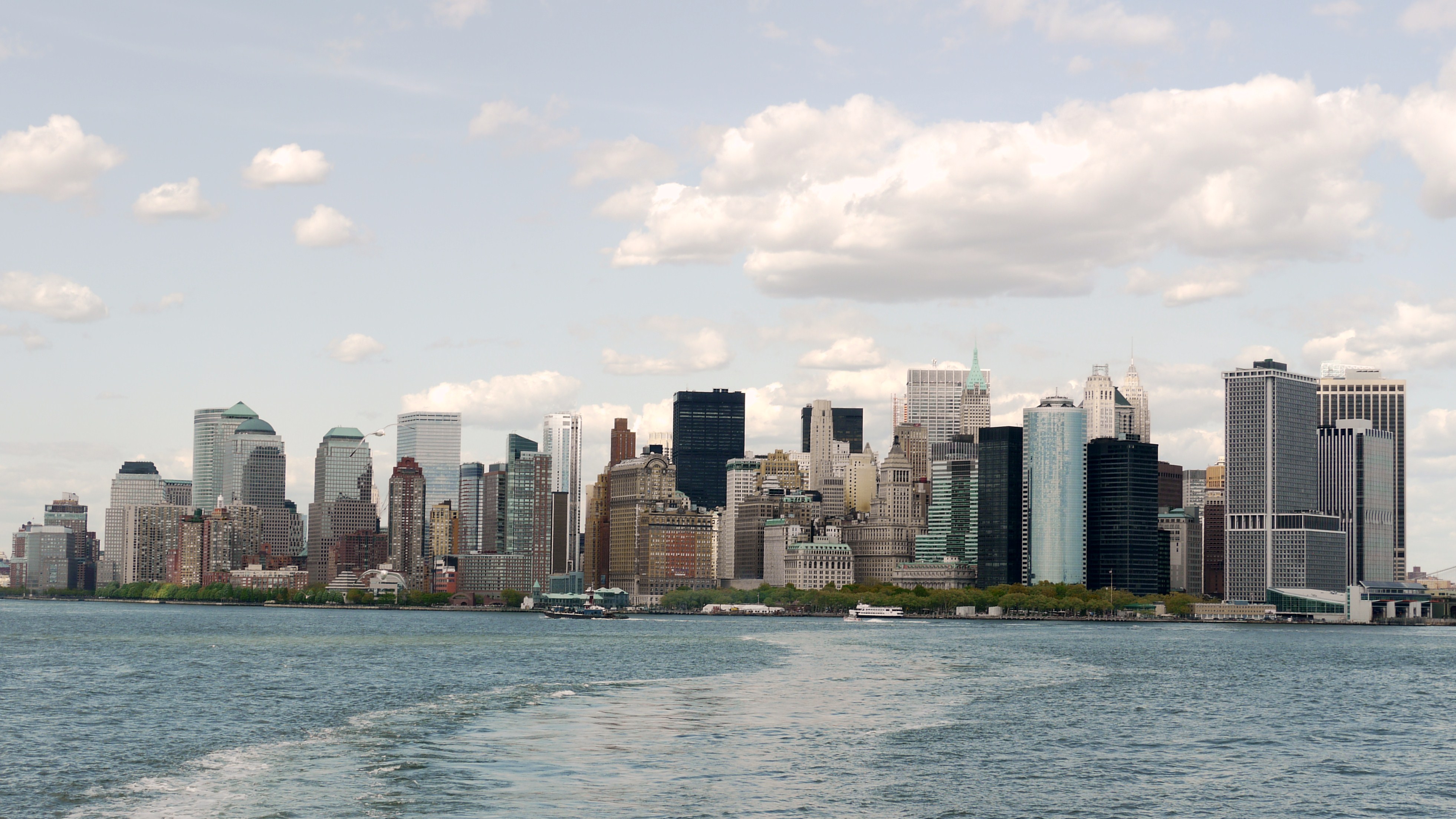
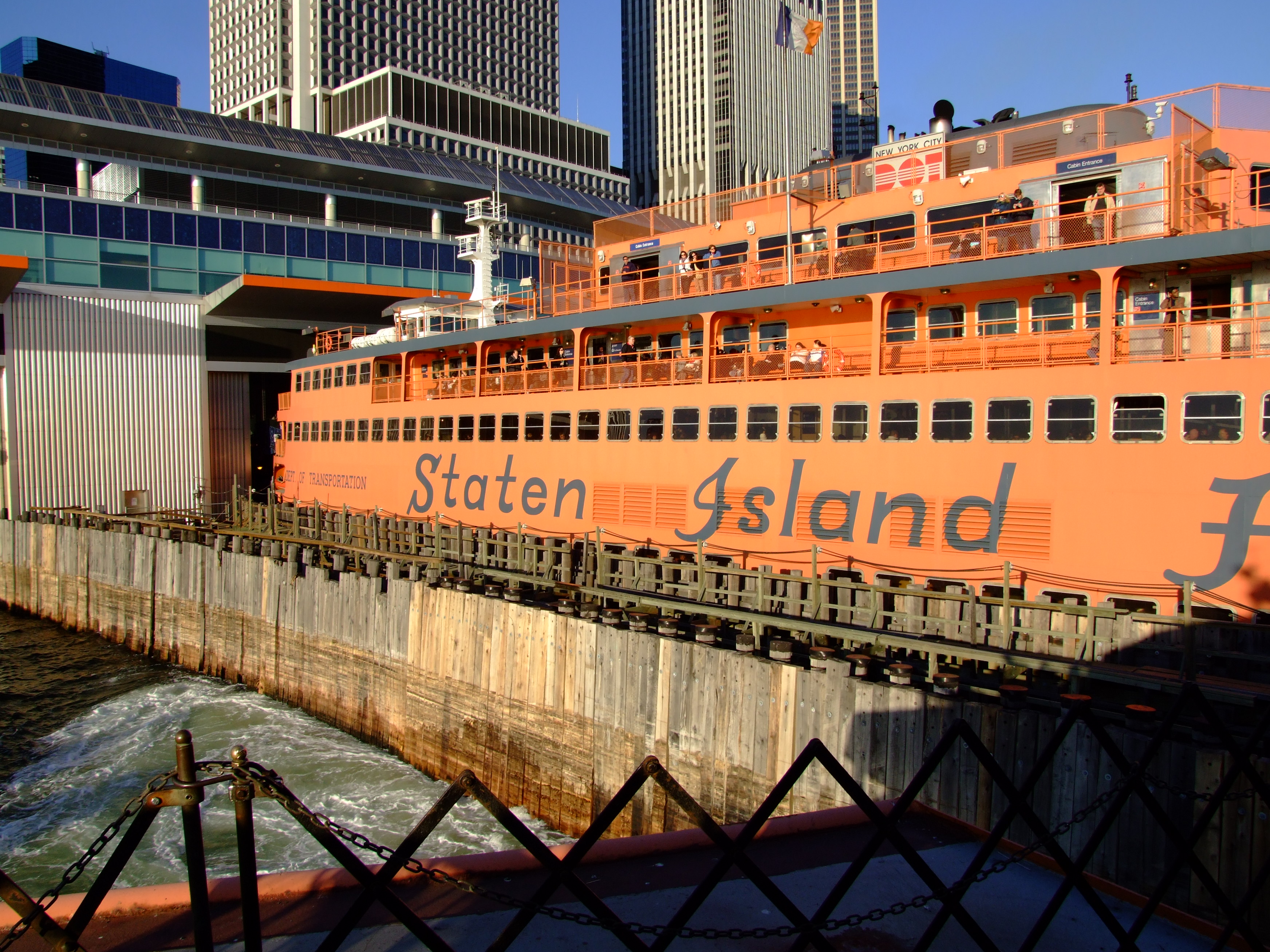
| | | | STATEN ISLAND FERRY I could have used the shuttle, but the walk was short, as you’ll see on this picture of the Battery Park area. The greenery to the left (click to enlarge) is the Esplanade in Battery Park City. To the left of the low, pyramid-shaped building is a low, nine-story, white-topped brick building, where I live in a duplex on the 6th and 7th floors above the Esplanade. The greenery on the right is Battery Park proper, followed by the new Staten Island Ferry Terminal (officially, the Whitehall [Street] Terminal), more easily seen here with a ferry pulling in. Next to the blue terminal (click), is the smaller Governor’s Island Ferry Terminal, in green. This shows a ferry loading in one of the slips. Unfortunately, the subway below still uses the old term “South Ferry”, which almost every one misunderstands. You name ferry terminals after destinations (call it the SI Ferry on one end, but the NY Ferry on the other). There used to be a ferry terminal at the end of Atlantic Avenue in Brooklyn called South Ferry (to be discussed later), so next to Manhattan’s Battery Park the ferry building was called after its destination, South Ferry. But that’s unfortunately history, now, yet the name of the subway station perpetuates the misunderstanding. I suppose most people accept it because it’s at the southern end of Manhattan, and a ferry. Go figure. They should really rename the subway station either “Staten Island Ferry” or “Battery Park” and stop the misunderstanding. | | | | As we saw on the Ratzer map, there had been private ferries leaving from this point since the 1700’s, including a notable one operated by Cornelius Vanderbilt in the 19C, but it has been municipally operated since 1905. I remember reading once that Staten Island, realizing its distance from the center of things, only agreed to the 1898 consolidation of New York under the condition of guaranteed ferry service. Still, as mentioned earlier, both SI and the rest of the city remain well aware of both the physical and emotional distance, as evidenced by the 1993 vote in SI that passed by 65% to secede from the city. Only a negative vote by the State Assembly quashed it.
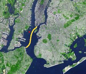
| | | | The ferry runs, like the subways, 24/7. There used to be a minimal fare, but, unlike the subways, the SI ferry is free. The eight iconically orange ferries are large and in four styles, or classes. Two classes (four ferries) have an automobile deck for 40 cars with passengers traveling on the upper lounge deck, but since Nine Eleven, no cars have been transported--to me a blessing in disguise. Depending on which of the four classes it is, a ferry has the capacity of carrying 1,280, 3,500, 4,500, or 6,000 passengers. Five ferries are in use on any one day, transporting 75,000 passengers on 104 trips. As I teenager exploring Manhattan with friends, I remember on several occasions ending a long day with a midnight “cruise” to Staten Island and back. | | | | The ferry route is 8.4 km (5.2 mi) long, takes about 25 minutes, and is centered in the Upper Bay, well to the right of Governor’s Island. The red dot on the map indicates the Statue of Liberty, shown here from the SI ferry to demonstrate how close it comes.
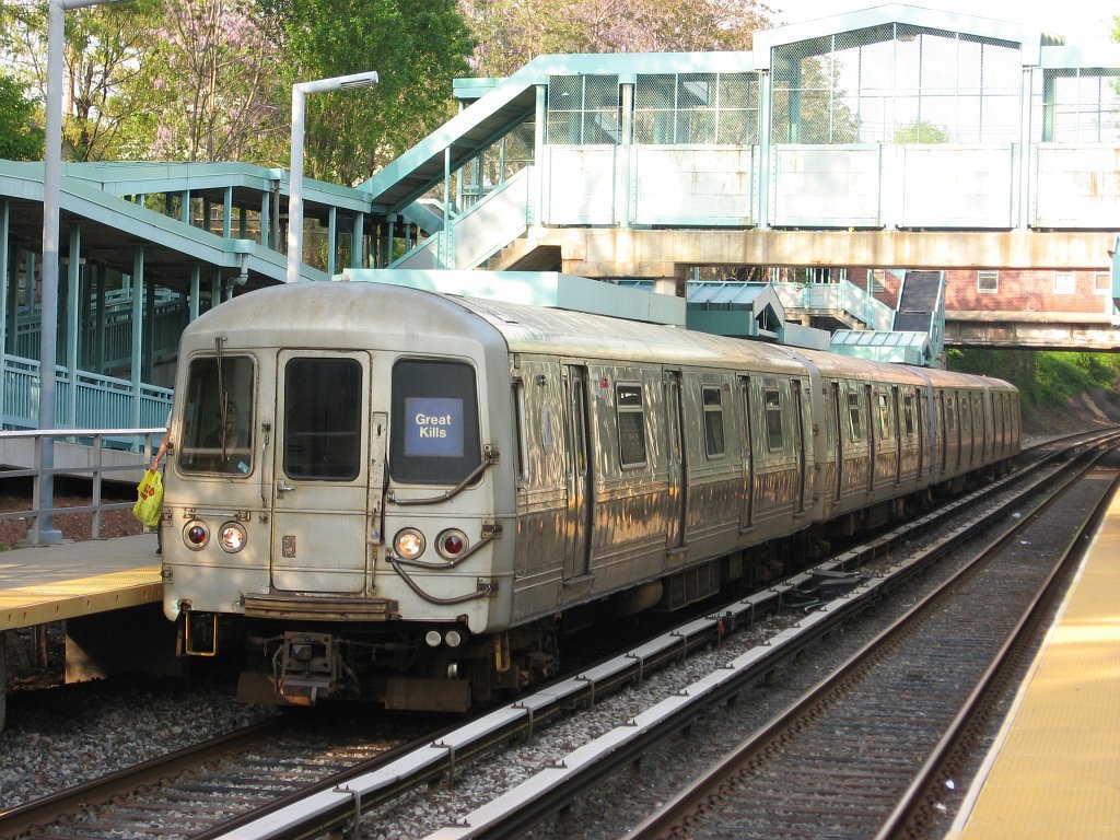
| | | | STATEN ISLAND RAILWAY The ferry terminal at Saint George, in SI, is intermodal, with numerous bus lines, but much more interestingly, the Staten Island Railway, or SIR. I’d never ridden it and was eager to see what it was like. First let’s look again at the NYC Subway map from earlier. Although the Staten Island Railway, acts de facto as a subway, runs 24/7, uses regular subway cars, and is included on subway maps, in reality it’s a railroad and subject to railroad, not subway, regulations. There were plans in 1923 to build a subway tunnel (the Staten Island Tunnel) from Brooklyn under the Narrows to SI, and it was actually started on the Brooklyn side, but then was cancelled. Recently, more talk has arisen on the subject.
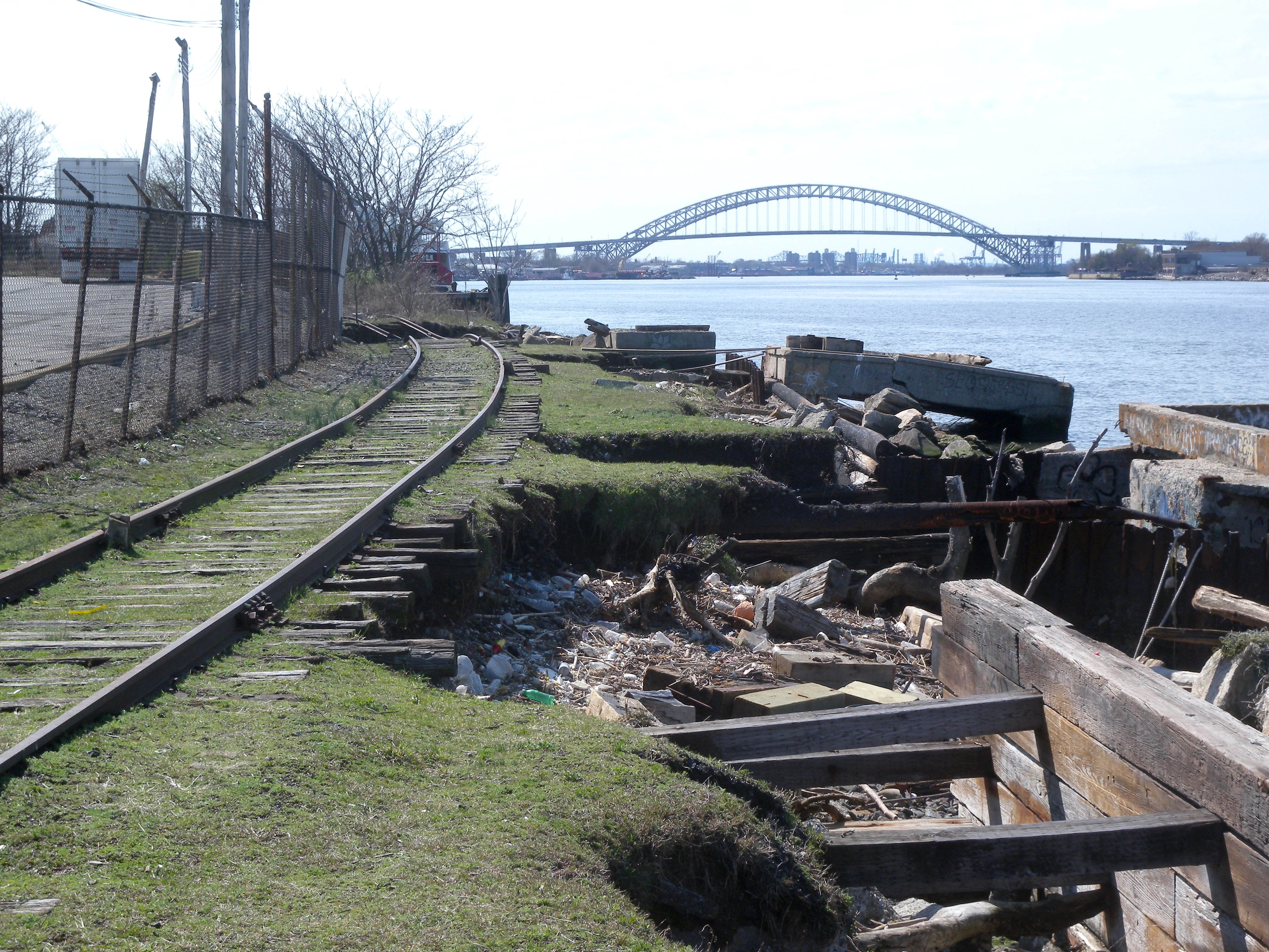
| | | | The SIR, which dates from 1860, is an elevated structure at its north end, but then it runs in an open cut, and is entirely grade separated (has no road crossings). Since the subway map distorts both the length of the ferry ride and shape of SI, we can also use this SIR map (click to enlarge). Note for later discussion the Clifton and Oakwood Heights stations, and also the first stop out from Saint George, Tompkinsville. The fare system on the SIR is odd: a flat fare is collected only at Saint George, in either direction, coming or going. Those few just using intermediate stations have a free ride. However, in 2009 it was discovered that too many people would walk, either way, between Saint George and Tompkinsville to beat the fare, so a fare is now collected in Tompkinsville as well. | | | | Compare the current map to the status of the SIR in 1952. The following year, the two other lines shown here were closed. The South Beach branch was demolished with housing since built on its right-of-way, but the North Shore branch remains intact, and is in consideration for reactivation, either for heavy rail, or light rail, which could also be extended down the West Shore of SI and/or over the Bayonne Bridge (in background) to Bayonne to connect with light rail there. (Winston Churchill had occasion to use the North Shore branch in 1943, and in 1957, Queen Elizabeth and Prince Phillip did as well, even though the route was otherwise abandoned.)
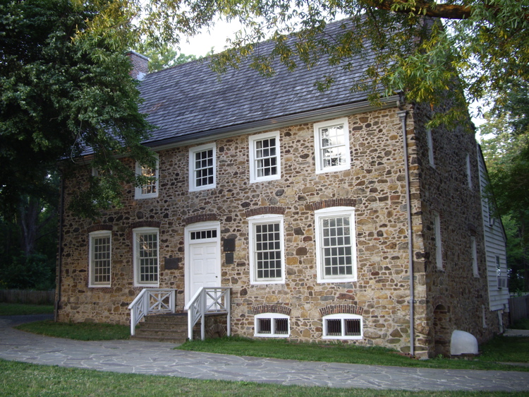
| | | | The ride from Saint George to Tottenville at the south end runs about ¾ of an hour, and is quite relaxing and pleasant. Right near the end, one goes under the Outerbridge Crossing and then arrives at Tottenville station, which, as I’d noted to myself in the past when driving, is oddly located in a residential neighborhood to the north of town, and right on Arthur Kill. There is nothing commercial at this last stop--you can’t even buy a newspaper. This seemed odd, and I also wondered about the pilings at the water’s edge that I discovered. Then it dawned on me, and later checking proved me right. The station is here because there used to be a ferry connection across Arthur Kill to Perth Amboy NJ (which is to this day on the North Jersey Coast Line). I don’t know how long the ferry lasted, but it’s shown on the 1952 map above, and also on this fabulous 1867 schedule from the Vanderbilt years. | | | | CONFERENCE HOUSE I have been for many years a member of the Historic House Trust of NYC, which owns 22 historic houses and operates 18 of them as museums, almost all of which I’ve visited. There are three on SI, and I was planning on revisiting only one on this trip, at the end of the day. | | | | Google Maps tells me that the Conference House in Tottenville, had I wanted to revisit it, lies only 17 minutes from the station (1.3 km / 0.8 mi). What it is is deceptively simple. British Captain Christopher Billopp arrived in SI in 1674 and built his manor house in 1680, the only surviving colonial manor house in NYC, now in Conference House Park on the south side of Tottenville, facing Raritan Bay.
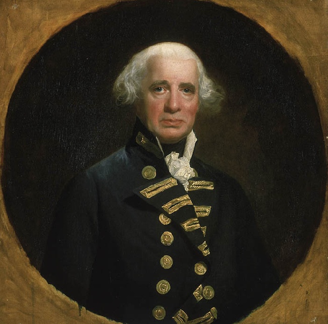
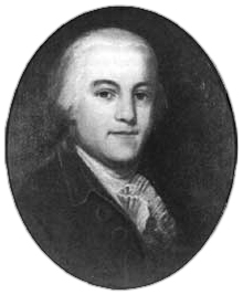
| | | | But the issue is why this manor house is known as the Conference House. It’s where the Revolutionary War could theoretically have ended (very unlikely), since that was the purpose of the Staten Island Peace Conference, in which none other than Benjamin Franklin and John Adams, with Edward Rutledge, took a day trip across Raritan Bay to Staten Island. It should be noted that there were two brothers named Howe, British Admiral Richard Howe and General William Howe, who were in charge of, respectively, the naval and land aspects of the military operation. They had some mild diplomatic powers in addition to their military roles. It was Admiral Richard Howe, who had in previous years discussed political issues with Franklin, who had suggested the meeting. Neither side had thought anything would come of the meeting, and after three hours, nothing did. But we really have to put the matter in context to our discussion of the Battle of Long Island (2011/2) in the decisive year of 1776.
| | | | [AN ASIDE ON THE REVOLUTIONARY WAR IN NEW YORK: It all started with Boston in 1775. The Americans won. New York came next, in 1776. The British won. We can’t use the phrase “battle of” for these two situations, since no actual battle took place centered in either city. Perhaps we should make it “battle for” to clarify what was going on: the Battle for Boston, and the Battle for New York.
| | | | Paul Revere had ridden on the night of April 18-19, 1775. The events at Lexington and Concord (to be discussed on my re-visit there this coming summer) took place that next day, April 19. The British were surrounded in the Siege of Boston from then, April 19, 1775 to March 17, 1776, at which point the British forces under General William Howe evacuated Boston and sailed to Halifax NS, preparing to attack New York. Washington led the entire Continental Army to New York in anticipation of a fight and concentrated them in Manhattan, later sending some to northern Brooklyn to fight the British arriving across the Narrows from SI in southern Brooklyn.
| | | | In July, Admiral Richard Howe had arrived in Staten Island and used it as a staging ground for the invasion of Brooklyn, then New York (Manhattan). Some 130-140 ships were anchored at SI, which was one of the largest armadas to set sail until WWII (the Spanish Armada of 1588 had had 151 ships). It was when they were on SI that the British had heard about the signing of the Declaration of Independence (click to enlarge). On August 22 they crossed the Narrows to Brooklyn; on August 27 was the Battle of Long Island/Brooklyn/Brooklyn Heights, the biggest of the war; Brooklyn Heights was evacuated on the night of August 29-30. At this point, Brooklyn was British and New York (Manhattan) still was under Washington. So what was the next step? | | | | In Staten Island, Admiral Howe
had taken over the Billopp House, and on September 11 (Nine Eleven!!!) he received there a delegation that he had invited of three signatories of the Declaration of Independence, Benjamin Franklin, John Adams, and Edward Rutledge (of South Carolina, at 26, the youngest signer; enjoy finding all three signatures among the 56 on the above copy). The Americans were given the option of peace in exchange of withdrawing the Declaration of Independence. This is worth pausing and reflecting on, particularly when one visits the Conference House. The Staten Island Peace Conference was, of course, doomed to failure from the start.
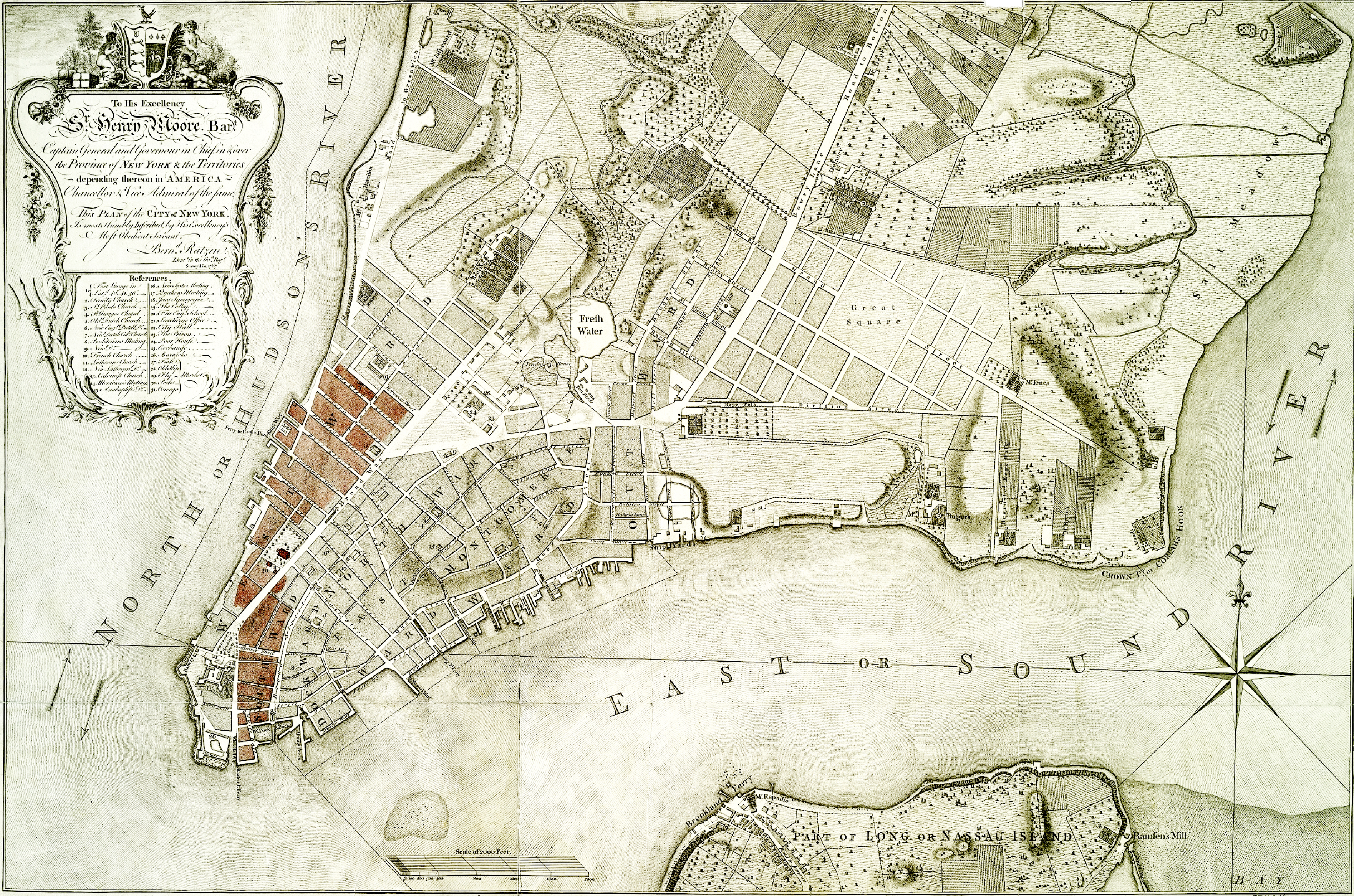
| | | | Four days later, on September 15, the British landed at Kip’s Bay in New York (Manhattan) from Brooklyn (see Ratzer map). On September 21, the Great Fire of New York of 1776 (there was another in 1835) broke out near the Battery, and spread quickly to the west side, between Broadway and the Hudson. This picture mentions, in German and in French, some 1600 buildings destroyed, including Trinity Church. The route of the fire from the Battery to the west side can be seen in contemporary markings in red made at the time on this copy of the Ratzer map. It was never proven how the fire, which destroyed between 10% and 25% of the city, started. | | | | On September 22, Nathan Hale (here, a statue in City Hall Park), who had been captured in Queens, was hanged at age 21 by the British for spying. Washington withdrew, first to Harlem Heights, then beyond, and the British took over New York and its harbor. During the occupation, abandoned homes of Revolutionaries were confiscated and assigned to British officers. There was a great influx of Loyalist refugees, resulting in overcrowding. | | | | New York was occupied for seven years, until the British finally evacuated the city on December 5, 1783. Ironically, on departing, they again used Staten Island as a staging area as they had on arrival seven years earlier.]
| | | | [A FURTHER ASIDE FOR GERMANISTS (AND OTHERS INTERESTED): Most people are aware that German was a widely used language in America, particularly in Pennsylvania, at the time of the Revolution. The English-language text of the Declaration of Independence was published for distribution to both the delegates and the colonies in general by one John Dunlap of Philadelphia on the night of July 4, 1776, and these copies are known as the Dunlap broadsides. However, as reported in German Wikipedia, a German-language newspaper called the Pennsylvanischer Staatsbote (“Pennsylvania State Courier”) in Philadelphia reported on July 5 the vote to accept the document, and was therefore the first newspaper anywhere to do so. The first newspaper to publish the complete English text was the Pennsylvania Evening Post on July 6, while the Pennsylvanischer Staatsbote was the first to publish a German translation of the complete text in its next edition on July 9.
| | | | This contemporary 1776 American German-language copy (click to enlarge), also provided by German Wikipedia, is apparently not from that newspaper, since the bottom line translates: Philadelphia: Printed at Steiner and Cist, on Second Street.
| | | | The statement on individual human rights appearing in the second sentence is surely the best-known, so we present both versions below, including any contemporary spelling quirks.] | | | | | | “We hold these truths to be self-evident, that all men are created equal, that they are endowed by their Creator with certain unalienable Rights, that among these are Life, Liberty and the pursuit of Happiness.” | „Wir halten diese Wahrheiten für ausgemacht, daß alle Menschen gleich erschaffen worden, daß sie von ihrem Schöpfer mit gewissen unveräußerlichen Rechten begabt worden, worunter sind Leben, Freyheit und das Bestreben nach Glückseligkeit.” |
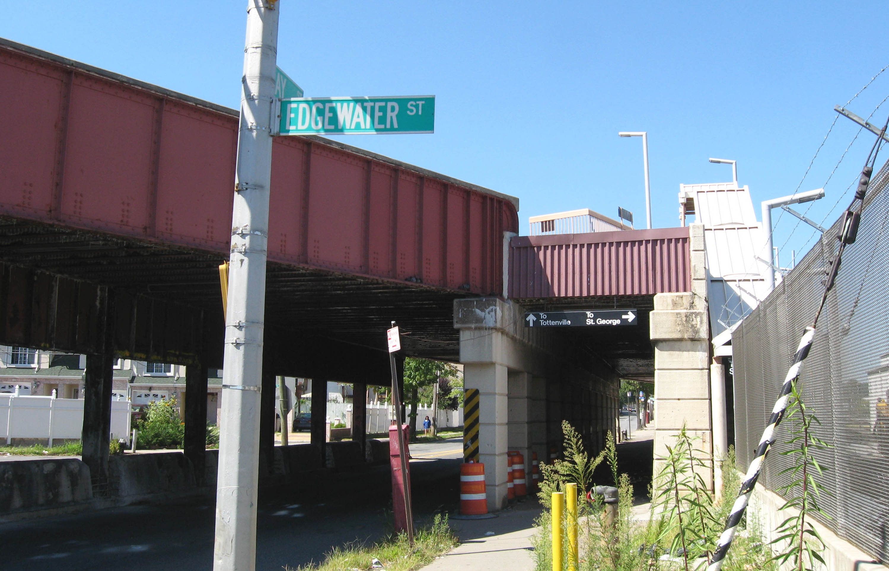
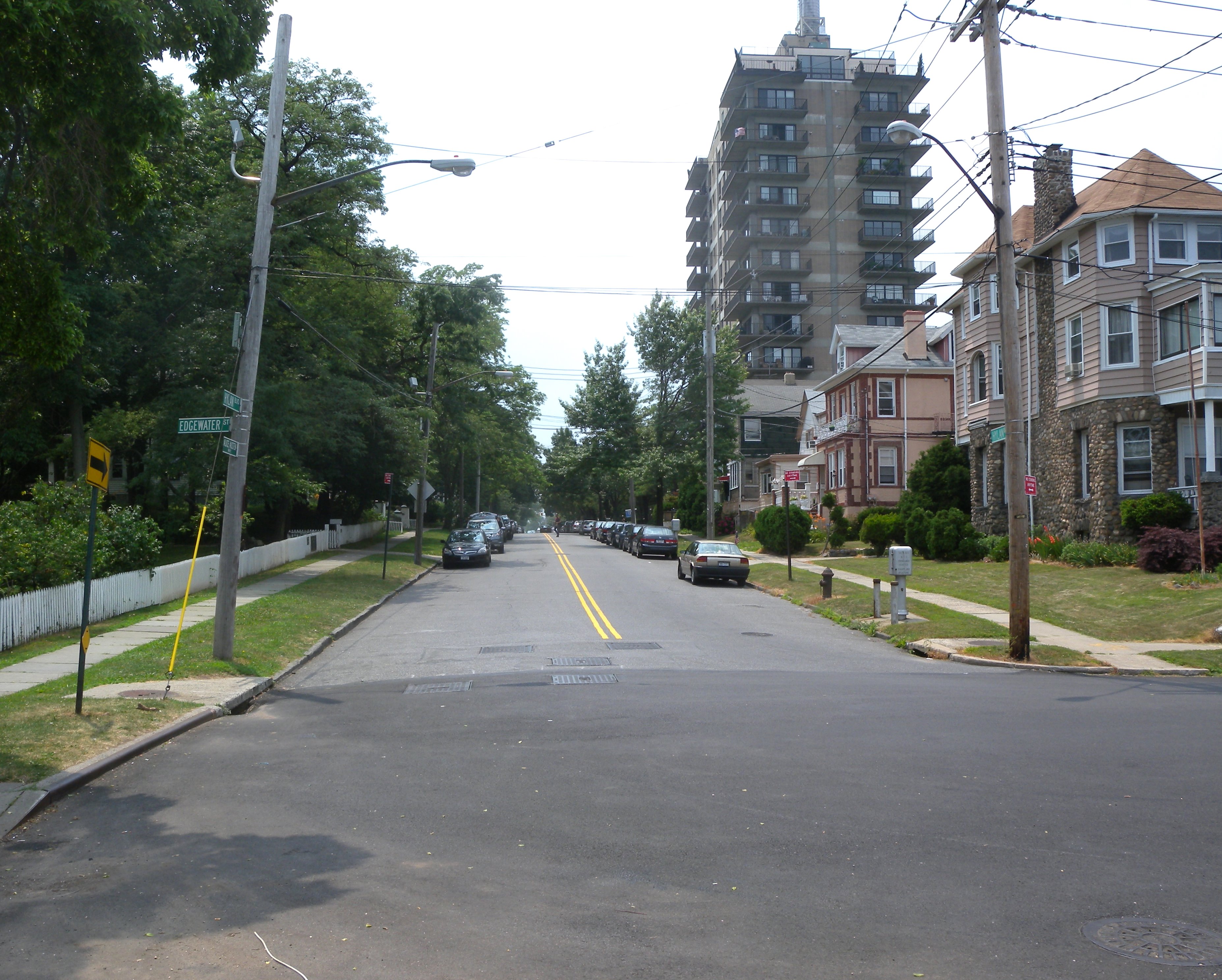
| | | | HISTORIC RICHMOND TOWN Returning north, the SIR stopped at Oakwood Heights Station, to which I could have revisited New York’s only living history village, a 22-minute walk away (1.8 km / 1.1 mi). Historic Richmond Town is an open-air live museum, also under the aegis of the Historic House Trust, located a the former county seat and commercial center of Richmond in the center of the island. It contains 30 historic buildings, many in situ, and others relocated from around SI, dating from the 17C to the 20C. 15 furnished, restored buildings may be visited, including exhibitions of crafts. The oldest exhibit, dated pre-1696, and also the oldest standing schoolhouse in the US, is the Voorlezer’s House. In Dutch times, a voorlezer was an assistant to a pastor who could hold services when necessary, run a school, or read scripture to others. This last activity gives rise to his title, since voorlezer, which literally is “fore-read-er”, means “one who reads aloud [beFORE others]”. | | | | ALICE AUSTEN HOUSE My last stop of the day did involve a revisiting of a Historic House Trust property. I got off the SIR three stops before the Saint George end at the elevated Clifton Station, which is almost on the water and has views of the Narrows and Brooklyn. The station also services the adjacent Rosebank neighborhood (including the private Giuseppe Garibaldi Museum, where he lived in exile in the early 1850’s) where there is located the 1690 Alice Austen house, a 12-minute walk down Edgewater Street (1.0 km / 0.6 mi). The walk ends at Hylan Boulevard in a quiet residential neighborhood (click to enlarge) that cannot more directly on the water. In this picture, one’s back is to the Narrows, as Edgewater arrives at Hylan. Notice that Hylan on the signpost has the secondary name of Alice Austen Way, since the house is in the trees to the left. The building on the right is an interesting-looking B&B, with water views. Oddly, Hylan Boulevard, a major SI thoroughfare, has a 17C house at either of its peaceful ends: the Austen House here is at #2 Hylan on the Narrows in Rosebank, and the Conference House is at the exact opposite end in Tottenville on Raritan Bay. | | | | The Alice Austen House was her home for most of her life. It was built between 1690 and 1750 as a one-room Dutch Colonial cottage, remodeled and expanded several times, especially in 1844 when Alice’s grandfather bought and remodeled it, naming it Clear Comfort. Its front yard has spectacular, in-your-face views of the Narrows, Brooklyn opposite, the Verrazano-Narrows Bridge on the right, and, across the Upper Bay, the skyline of Lower Manhattan. Clear Comfort was added to the National Register of Historic Places (NRHP) in 1970; it became a New York City Landmark in 1971 (lest we forget: after the destruction of Penn Station), and was purchased by NYC in 1975. Only about 3% of locations on the NRHP are promoted by the US government to the level of National Historic Landmark (NHL), and the Alice Austen House became an NHL in 1993. It is designated in 2002 as one of the “Historic Artists’ Homes and Studios” by the National Trust for Historic Preservation. In other words, this is a Special Place. There is also a 1986 SI ferry, that I’ve ridden on in the past, called the MV Alice Austen.
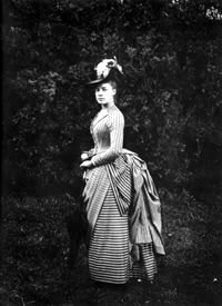
| | | | A historic house is all well and good but it begs the question: who was Alice Austen? | | | | Alice Austen’s field of expertise was photography, unusual for a Victorian woman (she lived from 1866 to 1952). Her heyday was in the years around the turn of the 20C. She was self-taught, and carried around the burdensome glass plates needed in those days. I’ve seen her photographs in SI and at an exhibit in Manhattan, and aside from the fact that she was excellent in composing her pictures, there is the secondary benefit that her work is a record of life in those years, from a scruffy newsboy on a Manhattan street corner to Victorian ladies in long dresses playing tennis on SI. This is a well-known photo of Alice in June 1888 at age 22, although taken by another photographer. | | | | She grew up in an extended family living in Clear Comfort, and became interested in photography when an uncle, also living at Clear Comfort, brought home a camera in around 1876. Another uncle in residence was a chemistry professor who showed her how to develop prints, and the two uncles converted a closet into a darkroom for her. The earliest surviving photo by her is dated 1884, and over the next 40 years she produced some 9,000 photographs. | | | | It is perhaps infinitesmally easier today for gay men and women to choose to live either openly or remain in the closet (or maybe not--think Brokeback Mountain). But being gay in Alice’s era wasn’t even discussed in polite society--just remained a quiet side of life. In 1899 Alice met Gertrude Amelia Tate (1871–1962) of Brooklyn. She became Alice's life-long companion. Gertrude moved in with Alice at Clear Comfort in 1917, and they lived together openly, but quietly. | | | | There are a number of Alice’s pictures I saw on exhibit that are gay-themed, such as of Alice with two female friends playing dress-up, which consisted of dressing as men. It’s kind of cute, with straw hats and fake moustaches--Victorian women’s outfits replaced by Victorian men’s outfits. At the time, it would have been the sort of thing that people considered as tomfoolery, some young women on a lark. Today we’d probably understand it more as an attempt at self-expression through cross-dressing. | | | | Alice lived off the income inherited from her grandfather, but it was all lost in the crash in 1929, and at 63 she had no income. She tried running a tearoom with Gertrude on the grounds of Clear Comfort, but it didn’t bring in enough funds. She then started selling off possessions, including Clear Comfort’s silver, art work, and furniture. She had owned the house outright, but mortgaged it, then lost title in 1945, and had to move. She sold her remaining possessions to a second-hand dealer for $600, who began emptying the house, but then she panicked at the thought of her glass-plate negatives. She called a friend at the SI Historical Society, who had been trying for years to get her to donate her photographic plates. He rushed over with another friend and rescued the plates from destruction, bringing them for storage to the Richmondtown Restoration (!!!). Alice then moved to a small apartment, then a nursing home, and finally, in 1950, to the SI poorhouse. | | | | That same year, a publisher wanted to do a project on American women, and the SI Historical Society suggested someone review the 3,500 remaining uncatalogued glass plates of the 9,000 she’d made in her lifetime. Some of her photos were used in a book, and others became part of an eight-page story in Life magazine. Some of her travel photos became a six-page spread in Holiday magazine. In this manner, $4,000 was raised, and Alice’s 1/3 of the proceeds were enough to move her back to a private nursing home. On October 9,, 1951 Alice was the guest of honor in an exhibition of her photographs at Richmondtown Restoration celebrating Alice Austen Day. The SI Historical Society continued supporting Alice in the nursing home for the next eight months until her death in 1952, with the Society also arranging for her funeral. A SI public school is named in her honor. | | | | When Gertrude died a decade later in 1962, Gertrude’s family refused to honor the women’s request that they be buried together. And even though they had lived together quite openly, the board of the Austen House continues to refuse to allow scholars to use the photographs to study their sexuality, essentially de facto forcing them into the closet posthumously. | | | | I would like to present some of Alice’s pictures, but they are not accessible to me. Instead, I’m providing two links to others who have reported on Alice, but who DO have a selection of her pictures, as well as views from the porch and front yard of Clear Comfort. This one from the Forgotten New York blog seems to have gotten similar information from Wikipedia as I did. Another selection I found on Live Journal, which includes a number of gay-themed pictures, including the dress-up one.
| | | | I ended my day in SI sitting on the circular wooden bench surrounding the big tree on the hill on Clear Comfort’s front lawn. In the past I’d brought the NYT Sunday Crossword here to do while admiring the view, but this time, the view alone was more than enough.
| | | |
| |
|
|
|

