|
Reflections 2019
Series 1
January 4
Ohio River I: Lake Shore Ltd/Texas Eagle - Paducah - Louisville
| | We finally leave the France trip of September 2017 and move to the two trips of 2018, one in the early summer and the other in the late summer. In a way, they're connected. I had gone on the Kawartha Voyageur (KV) on the Rideau Canal in 2014. They offered two cruises elsewhere in Ontario that I was interested in, but the KV has only one single cabin, and I was on the waitlist. I reported that I was in the Aéro in Passy when word came through by email from Canada that I'd gotten the single room for two adjoining cruises, so I tend to relate the Ontario trip to Paris. However the only configuration of getting the single cabin back-to-back was for a two-week rail 'n' sail trip starting 28 August. | | | | I then wanted a spring trip, and I found something that was easy to plan, given how busy I was with my backlog on writing about France, so I chose an Ohio River cruise and built a rail 'n' sail trip around that. However, the only departure that fit my needs was a two-week trip ending on 28 June, meaning there would be only two months to the day between the two trips. I'd have preferred a wider spread, but I figured, so be it. | | | | All in all, though, I rushed the June plans through and should have once again been more diligent on my due diligence. While I enjoyed the river trip adequately, it proved to be a comedy of errors, one thing after another. I haven't counted them, so I won't number them, but you'll scratch your head as you see the problems come up in sequence, both with Amtrak and with American Cruise Lines. Murphy's Law applies to this trip—my favorite iteration of it is: Anything that can go wrong, will go wrong. And it did. | | | | | | I had to check to see how Murphy's Law is quoted in other languages:
DEUTSCH: Murphys Gesetz: Alles, was schiefgehen kann, wird auch schiefgehen.
ESPAÑOL: Ley de Murphy: Si algo malo puede pasar, pasará.
ITALIANO: Legge di Murphy: Se qualcosa può andar male, andrà male.Loi de Murphy: Tout ce qui peut mal tourner tournera mal.
РУССКИЙ: Закóн Мéрфи: Всё, что может пойти не так, пойдёт не так.
(RUSSKIY: Zakón Mérfi: Fsyo, shto mózhet poití nye tak, poidyót nye tak.)
|
| | | | I understand there's also a Smith's Law that says that Murphy was an optimist. | | | | The trip was easy to plan:
I'd take the Lake Shore Ltd overnight from New York to Chicago, changing for a day's run on the Texas Eagle from Chicago to Saint Louis. The overnight in a Saint Louis hotel was included in the cruise fare.
The cruise would leave from Saint Louis, go down the Mississippi to the Ohio, and run the whole length of the Ohio to Pittsburgh. I'd need to book a night in a Pittsburgh hotel.
From Pittsburgh I'd take a day's run on the Pennsylvanian to New York.
| | | | Everyone likes a freebie, and in recent years I've managed to figure out how to get a free hotel on points for a few days, a free short train ride, a free day's car rental, and I've mentioned them casually in passing. It keeps expenses down, and it's a lot of fun to figure out and to execute. The best I'd done was in 2009 when I flew to Japan and back from Taiwan free on points. But I did equally as well using points on this trip, too. | | | | Speaking with some members of the Travelers Century Club at a pub party, I learned a bit more. The trick this time was to get an Amtrak credit card, which alone would get me a slew of points. Cards require you to put a largish amount on them in the first three months to trigger those points. Easy, since I had to pay for the cruise, anyway. I charged the cruise fare on three cards, including the Amtrak card, triggering point payments an financial benefits on each. | | | | ►I ended up with free rail on Amtrak points. Those points covered a roomette from New York to Chicago, and I had enough points to upgrade to day use of a roomette from Chicago to Saint Louis. From Pittsburgh to New York, I went business class. And I still had points left over.
►The Pittsburgh hotel was free on Starwood points, which I've been using for years.
►Therefore, I only paid for the cruise. AMC waived port charges and discounted the fare, so all in all I ended up paying 73% of the cruise price, including the Saint Louis hotel.
Obviously, I'm quite pleased with my success in all this financial maneuvering.
| | | | | | A well-known judge in American jurisprudence was Judge Learned Hand. He was usually referred to in that unusual way, though his full name was Billings Learned Hand, "Learned" being his mother's surname and "Hand" his father's. I always thought of him having being on the Supreme Court, but that turns out not to have been so. He was on a US District Court and later on a US Court of Appeals. He has the distinction of having been quoted by legal scholars and by the US Supreme Court more often than any other lower-court judge. I remember Learned Hand's name best for his famous 1947 dictum that "there is nothing sinister in so arranging one's affairs as to keep taxes as low as possible".
At this point I wish to paraphrase Judge Learned Hand by saying "there is nothing sinister in so arranging one's travel payments as to keep travel expenses as low as possible". Amen.
|
| | | | Day 1: F 15 June: Lake Shore Limited So what could possibly go wrong with this well-constructed house of cards? Well, let's see. It's a long list. We'll start with two announcements by Amtrak made a few months earlier, one about a route change and one about food service. | | | | Route Change We'll discuss the food when we get to it at dinner tonight. We'll start with the route change. It all starts with the former Hudson River Railroad (HRRR) that originally ran up the west side of Manhattan and beyond up the Hudson Valley. In 1864, Cornelius Vanderbilt obtained control of the HRRR and in 1871, moved most, eventually all, passenger operations to the East Side, operating out of Grand Central Station (actually, Terminal, abbreviated GCT). The HRRR today appears as the Hudson Line, along with the Harlem Line and New Haven Line of Metro North. The Manhattan section of the old HRRR was acquired by Amtrak. | | | | Now follow all that on this map of the Metro North system that we saw last on 2018/2 (Map by The Port of Authority [sic]). Click to see the three routes in color running north from GCT. Note that routes out of Penn Station are primarily east to Boston and west to New Jersey and beyond. But also note the black line running from Penn up the West Side of Manhattan, formerly part of the HRRR, now known as Amtrak's Empire Connection up the Hudson Valley and beyond to Chicago and to Canada. | | | | This is what the Amtrak announcement was about that came out in the spring. Work had to be done on the Empire Connection within Manhattan, and particularly on the Spuyten Duyvil swing bridge at its northern end that connects this route to the mainland. (I understand the swing bridge was lifted away and brought to New Jersey to be upgraded.) For that reason, all routes north up the Hudson Valley out of Penn would, for the course of the summer 2018, leave instead from GCT. That means I had a change of plans outbound. Inbound, I'd be returning from Pennsylvania, so that train would go to Penn Station as always. | | | | Sounds simple enough, but there was an extra complication for the Lake Shore Limited (Map author unknown). It has two eastern sections, each with coaches and sleeping cars, one out of Boston and one out of New York. They merge in Albany-Rensselear, then continue through central NYS, roughly following the same route as the Erie Canal, then along the south lake shore of Lake Erie and on to Chicago. | | | | | | Note on historical railroading: our NYC-Chicago route is the so-called "water level route", meaning it avoided mountains. It was the main route of the New York Central, and of its elite premier express train, the 20th Century Limited, whose route we'll be duplicating all the way to Chicago. Look again at the above map, and it might strike you that a route through Pennsylvania would be more direct. Well, that was largely the reason for being for the Pennsylvania Railroad (PRR), which, however, had its main line through the mountains of southern Pennsylvania. It therefore connected Chicago to NYC via Philadelphia. Its elite premier express train was the Broadway Limited, not named that for the street in Manhattan as you might think, but for the "broad way" of the PRR four-track right-of-way along the majority of its route.
It's worth noting that an extra historical plus about the rail part of this trip is that, just like we're now duplicating all of the route of the 20th Century Limited, when we return from Pittsburgh via Philadelphia to NYC, we'll also be duplicating the eastern half of the route of the Broadway Limited, together two of the most famous US express trains ever.
http://www.nychicagorr.org/NY_Chgo_Railroald_old_map.jpg
We can best illustrate these two routes by showing an even more direct route that was never built, the Chicago-New York Electric Air Line Railroad (CNY), whose proposed route is above in red. The green line to the north is our current route on the Lake Shore Limited, and of the former 20th Century Limited. The green line to the south is the route of the former Broadway Limited and, east of Pittsburgh, our return route on the Pennsylvanian. The CNY would have run between the two as a high-speed electric "air line" rail road. Its length would have been 1,210 km (750 mi), which would have been 240 km (150 mi) less than either of the other routes. It was the most optimistic of several such proposals, all of which ended in failure.
The use of the term "air line" for a railroad is interesting. The term obviously was used prior to aviation, and referred to a railroad whose route was relatively flat and straight, choosing a shorter route over an easier one, going, as it were, "through the air". Today, in place of the term, now fallen into disuse, there are other terms implying straightness, such as a "bee line", or even "as the crow flies". But in their heyday, these railroads were often referred to simply a "air lines", and the term was quite common. I was surprised to find on Wikipedia a list of 56 railroads, all of them now lost to mergers, that used the term in their name. The only one I've ever heard of among these is the Seaboard Air Line Railroad, which existed from 1900 to 1967 when, after a merger, it became the Seaboard Coast Line Railroad. This 1902 ad for it excellently illustrates the whole "air line" theme of straightness.
|
| | | | But added to the announcement that I'd be leaving from GCT was the complication that, for the summer of 2018 only, the Lake Shore would leave exclusively from Boston! There would be no section out of NYC to meet it in Albany. Historically speaking this was significant. It would be the first time in a century and a half that NYC and Chicago were not directly connected by rail, a startling revelation. Fortunately that construction is over and all connections are back to normal. | | | | I was told I'd be reticketed on a regular Empire Service coach train to Albany to join the Lake Shore there. This also involved a refund of Amtrak points, as I wouldn't have my roomette for that section. They also booked me (and others) on an early-afternoon train which allowed for a layover in Albany of 2h24. Trains to Albany are frequent, and I'd have planned one a bit later to cut down on the layover, but I suppose they wanted to err on the side of caution. An additional irksome detail was that I'd be deprived of using the Acela Lounge at Penn, always nice for a quiet, complimentary coffee and pastry. But so be it. | | | | Departure I've said before I don't enjoy taking taxis, which would also hold for pickup services. I trust my own sense of direction and driving skills, and otherwise use public transportation. I remember, after having checked out a map in advance, having to give the Montréal taxi driver directions in his own city, and also the driver leaving from the Wayside Inn. Usually, I only took taxis to, say, Penn Station when traveling with Beverly and her wheelchair. | | | | But this summer I decided differently. One subway gets me to Penn, but I'd have to change to the GCT Shuttle to connect to GCT, and so I decided to treat myself. Just days before the start of the trip, at the very last minute, I found a limo service, GroundLink Town Car, which had a reasonable rate, including a first-time discount. I would go in style. | | | | | | While this town car driver did a perfect job, which encouraged me to do it again two months later, the second driver got me to the wrong destination, and so I had to direct him where GCT was. When will I ever learn? More about that when we talk about that trip. |
| | | | I had the town car pick me up at 12:15, and he took me on a very clever route around Manhattan (Map by Nick Roux). Click at the bottom to find my location north of South Cove at South End Avenue and West Thames Street. He whisked me along West Street, under Battery Park through the tunnel, and up FDR drive all the way to 42nd Street. He made a left turn there, and brought me directly to the front of GCT on 42nd (where the subway lines meet).
http://kipsbaytower.com/images/600_midtown-new-map.jpg
| | | | This detailed map shows the arrival better: off the Drive at the UN, and down 42nd to GCT at Park Avenue. We were even correctly on the north side of the street. This driver did a good job. (The one in August was less skilled.) I had allowed some time before the train left at 2:15, and then we were off. I must say it was a bit unusual going long distance out of GCT nowadays, where once it was the absolute norm. | | | | Look once more at this same Metro North map. I was used to Metro North trains making all the commuter stops, but for Amtrak trains out of Penn, the first stop is Yonkers, and it was the same leaving GCT. Follow how we zipped through Harlem/125th Street, crossed the Harlem River to the Bronx, skipped the Yankees, and other places we discussed recently, such as Marble Hill and Spuyten Duyvil. As we reached the Hudson, I could see where the bridge was being worked on, but we went on to skip Riverdale, leave NYC, and stop in Yonkers. We stopped at Croton-Harmon and Poughkeepsie on this map, then at two more stops before reaching Albany-Rensselaer after about 2h30. | | | | Albany-Rensselaer Station We only recently discussed this station when going to Montréal on the Adirondack (2017/4), including the fact that there's no station in downtown Albany on the west bank, but instead this one in Rensselaer on the east bank of the Hudson. We also said that trains connecting to NYC have to be electric, but aren't beyond Albany, so we convert here to a diesel engine. But with our couple of hours' layover, we'll have time to visit the station beyond the platform for the first time ever, something I've wanted to do for some time. | | | | This picture from a nearby viaduct shows the view of the station from the northwest, which places the Hudson and Albany to our right. It's a handsome station, even from here in the back, with stairs, escalators, and elevators leading to the overpass to the station proper. This is a platform-level view of an unidentified Amtrak Empire Service train arriving from GCT during renewal work (Last Two Photos by Benjamin Turon), while this is a view from the overpass of an arriving northbound Empire Service train #235 in April 2018, two months before my June trip. It was the train that arrived about an hour later than my #255 that I'd considered taking. Click to see the entrance to the escalator, the top of which is also visible to the left in this next picture inside the overpass (Last Two Photos by Pi.1415926535). Here the station proper is behind us. | | | | We enter the airy, spacious main hall of the station from the overpass, here looking south to the main entrance on the left. Down near the entrance, we turn and look back (Last Two Photos by Benjamin Turon). | | | | We step out through the main entrance and look back from the parking lot to see the handsome main façade (Photo by UpstateNYer), then move closer to inspect the front entrance and clock tower. The architecture seems to expertly combine the modern and the traditional. From the left side of the station, we can get a good view of the Albany skyline across the Hudson (click), with two Amtrak trains in the station (Last Two Photos by Benjamin Turon). We then settle down in the main hall to write on the laptop while waiting for our train, and enjoy through the window a spectacularly framed view of Albany's Corning Tower (Photo by ronmcc). Click for detail. | | | | | | The Corning Tower is a 1966 state office building that's part of the Empire State Plaza. It was named for Erastus Corning 2nd, who was mayor of Albany for over 40 years in the mid-20C. The 44-story building is 180 m (589 ft) tall and is the tallest skyscraper in NYS outside of NYC. |
| | | | Lake Shore Limited The Boston section of the Lake Shore finally arrives and we find our Viewliner roomette. The Viewliner is a single-level car type used by Amtrak in routes within and connecting with the US Northeast. It's single-level due to clearance issues because of low overpasses and tunnels. Elsewhere the double-level Superliner car type is used, such as on the Texas Eagle tomorrow.
| | | | This is the Lake Shore at Albany-Rensselaer (Photo by Steve Wilson). Depending on your sense of direction, you may be able to tell from the looks of the station that this Lake Shore is going in the opposite direction from us, from Chicago to NYC. On the other hand, shown here just leaving Boston in the background, this is our Boston section of the Lake Shore that we're boarding here in Albany (Photo by Pi.1415926535). The sleeping car is in the foreground; the large windows in the foreground are for the bedrooms, which are large and have all facilities, including their own makeshift shower. The two-level windows are on the roomettes, so that both the upper and lower bunks have a window view at night. Roomettes have a toilet and sink, but roomette users have to use the shower down the hall. With Beverly, we always took a bedroom, even though roomettes can sleep two. As a solo traveler, I like the compact coziness of a roomette, similar to my likes at the Aéro in Passy and on the Luciole.
| | | | It occurs to me that not everyone is familiar with sleepers, or even with Amtrak, so here's a bit about the roomettes (Photo by Walter). The bed you see is just the lower; the upper hasn't been let down. This lower bed closes in the morning to two seats facing each other with a little table in between, just fine for the laptop (the table here is in vertical position behind the sign). The brown seat lifts to reveal the toilet. The brown surface on the wall lowers to reveal a sink. This view shows the top of one of the seats in daytime configuration, with a pillow (Photo by Peter Van den Bossche). The upper bunk is again not let down. The privacy curtain to the hallway has been pulled closed. Click to inspect the folding down sink. Finally, we have the sink in open position (Photo by LHOON). When lifted and closed, the washbasin drains through those five holes.
| | | | If you have further interest in this subject, you can take a look at this YouTube video of a tour of a Viewliner roomette (8:19). He is on the Lake Shore, but going eastbound from Rochester to NYC, and does a rather decent job, should you be interested in additional details. | | | | Food Service The route change was a bother, but not all that bad, and we made the best of it. The food service issue, though can only be described as horrendous. Still, I found counterbalance to it the next day, so in both cases, we made lemonade out of lemons.
| | | | People used to take the train because it was "the only way to go", and that is to be understood two ways. Dining was a fundamental experience, so let's start out with a bit of nostalgia.
http://www.iridetheharlemline.com/wp-includes/images/upload_images/marmenu3.jpg
| | | | This is a menu (click) from the New York Central RR days. I wish it were dated, but we can assume it was from the first half of the 20C. Based on the prices, which to our eyes, are amusing, but it wouldn't surprise me if it were as late as the 1940s. It doesn't specifically say it was the menu for the 20th Century Limited, the precursor of the Lake Shore Limited, but the reference in the center to the "20th Century Salad Bowl" would indicate it probably was. Most important, look at the variety of the offerings. The À la Carte ones on the left are to me surpassed by the Prix Fixe ones on the right, here called "Selective Meals". The most expensive item, an entire Prime Rib dinner, including the courses above and below, came to $1.60. But again, the point is not the prices, which today would be considerably different, but the astonishing variety available on a moving train. | | | | Today train travel is not the necessity it once was. But while some take the train for fear of flying, I'm sure most take it because they enjoy the experience: no rushing, watch the scenery, get things done, meet people, especially in the dining car, and enjoy outstanding meals offered by Amtrak. | | | | There are two kinds of food service. On day trains, which have no sleepers, there's a more modest café car to purchase food in. An attendant has a variety of carry-out style foods, including sandwiches, pizza, snacks, and beverages including liquor, wine and beer. The items are prepackaged, but on request, the attendant will heat them in a microwave, including paninis and other sandwiches.
http://trainweb.org/carl/AmericaByAmtrak/EmpireBuilder/IMG_5197.JPG
| | | | On longer-distance trains with sleepers, there's a full-service dining car, which is a real pleasure, though not of the standards of the 20th Century Limited. Above is a standard Amtrak full-service menu, though the prices are a little out of date. All meals are fully complimentary to sleeping-car passengers, purchasable by coach passengers. Note the full hot breakfasts available, the lighter lunches, and the substantial dinner entrees. You can't miss the item in the box, the Amtrak signature steak, with vegetables and potato. I always choose the baked potato, with sour cream. | | | | But Amtrak decided to make changes, replacing traditional hot meals with cold meals. It's started with two trains between NYC and Chicago, the Capitol Limited via Washington and Pittsburgh and (lucky me!) the Lake Shore Limited via Albany. The changes took place as of 1 June 2018, with my departure (lucky me again!) being 15 June. I got hit with both barrels. | | | | The Rail Passengers Association (RPA), formerly the National Association of Railroad Passengers (NARP), of which I'm a member, announced that it's against this move "which will degrade the passenger experience and, we believe, has the potential to harm ridership." I put it more bluntly: Amtrak is shooting itself in the foot. Seriously downgrading the dining experience is bad all around, but I cannot see going totally "cold". I read online that, even if you want to fire your onboard chefs and waitstaff (which they did for these trains), there are prepackaged meals available commercially that can be heated onboard. Even in the café cars then can microwave your choices. I knew well in advance what my dinner and breakfast choices would be, so I headed to the dining car with trepidation. | | | | The only positive thing I can say is that the dining car had been stylishly upgraded. But looking down the car, where you'd normally see a corridor to the right and a galley to the left, with chefs cooking away, to the left of the corridor was a long room with above-counter refrigerator doors running its length. It looked like a morgue, as seen on TV police-procedural dramas. | | | | The new mantra is that you don't have to wait for a certain seating. You can come anytime you wish to pick up your boxed meal. You can eat in the "lounge", the new euphemism for the dining car, or bring it back to your room. The "lounge" is just for sleeping-car passengers. I don't know where coach passengers eat—maybe a café car. You were not greeted, but seated yourself. There were only a couple of tables occupied, so you wouldn't be meeting new people. | | | | Trains Magazine online made these points, slightly edited: "The car's interior revealed not linen and silverware, or even paper tablecloths and plastic utensils, but bare tables festooned with green cloth bags. Most restaurants--even cafeterias--have someone who greets and seats patrons. Not so on the Lake Shore; the car's only Amtrak representative is an 'employee in charge'." The article also pointed out "[t]he large amount of packaging spread out on the table", and that the tons lf landfill trash produced this way are not as eco-friendly as dishes washed, dried, and reused hundreds of times. | | | | I kept the menu that had been handed out in the rooms. This is a lightly edited list of the four meals available for both lunch, which thankfully didn't involve me, and dinner:
Antipasto Plate: cold cuts, cheeses, olives, bread sticks
Chicken Caesar Salad: chicken breast, greens; Caesar dressing
Chilled Grilled Beef Tenderloin Salad: beef bits, carrots, artichokes, grape tomatoes, all over an "arcadian lettuce mix"; mustard dressing
Vegan Wrap: eggplant, onion, zucchini, squash, etc; kettle chips
| | | | There was also a children's plate. Everything came with a "salted caramel cheese cake". Included were free non-alcoholic beverages. As for wine, beer, or spirits, the "first one is on us". I chose what seemed to be the least of four evils, the Beef Salad.
https://goo.gl/images/ASZyPu
https://goo.gl/images/sw9RGi
| | | | Again, these are Google images, not Bing, so disregard the visual litter on the right. The first picture shows a semi-deserted "lounge" with uncovered tables and two people crowded together with more "box" in sight than food. There's no room for others at the table. The second picture shows my choice, the Chilled Grilled Beef Tenderloin Salad. My first impression was that there was more writing praising how wonderfully recyclable everything was rather than telling about the food. I'm a great recycler, down to toothpicks, but in this case, putting recycling before food quality is a reversal of priorities. | | | | Everything was plastic. The main bowl was black plastic (recyclable! recyclable!) and the salad was a gross disappointment. There were a few lumps of cold beef on the top, and raw carrots, tomatoes, etc. The amount of salad dressing was inadequate. After eating the top layer, underneath was a deep bowl full of dry "grass clippings", right off the power mower. Even Trains Magazine had commented: "The meat . . . was dwarfed by lots of lettuce and a few vegetables." The rest of the items were similarly disappointing. There's no way any rational human being would go into a restaurant and actually order this stuff. I remember sitting at the table when I was done and saying to myself—there was no one else to talk to—that this is without a doubt by far the worst meal anyone ever served me in my entire life. It was worse than the worst airline food you've ever had. The grass clippings would work better in a compost pile. I also remember thinking that, though I've gone by train to Chicago many times, if this is going to be the food service of the future, I'd rather fly. | | | | Then insult was added to injury. Though the meals are included, Amtrak needs to keep a tally, so on any Amtrak overnight train, one is handed a statement to sign, just to maintain proper paperwork. When the "employee in charge" handed me my statement, I could not believe my eyes. What I'd been given was listed as having a price of $46! Would anyone ever pay $46 for any salad, anywhere, even a good one? Murphy's Law continued in full swing. | | | | Day 2: Sa 16 June: Texas Eagle I had the usual pleasant evening in my roomette, and in the morning, I headed down to the shower (not many passengers are used to using it, and it's always available), then dressed and headed to breakfast, with trepidation. I had a longing for Amtrak French toast with a side of freshly fried bacon or sausage, but I knew I wouldn't get that. The sole morning offering listed on the menu is an "Amtrak Breakfast Bistro Box". I'll elaborate on the contents from various descriptions I'd found in advance:
vanilla Greek yogurt parfait topped with organic granola
a generous serving of fresh seasonal sliced fruit
banana-pecan bread
a blueberry muffin
a Kashi honey almond flax chewy granola bar
a Kind-brand dark chocolate nut and sea-salt bar
https://www.travelersunited.org/wp-content/uploads/2018/07/RR_Meals-BerforeAfter.jpg
| | | | This is a before-and-after view of the "new" cold breakfast on the Capitol Limited and us. Juice came with it, and the coffee was the only warm item on the table. Now for a cold meal, it wasn't anywhere near as bad as dinner last night. The problem here was overkill, leading to a lot of waste. You can see the yogurt on the lower left, entombed in plastic. I started there, and it was OK. Then I attacked the fresh fruit above it, in a long platter (everything recyclable!). There were about a dozen half-rounds, a third each of honeydew, cantaloupe, and pineapple. I had one or two of each, they were good, and I was full. I had to throw away the rest of this perfectly good food, since far too much was offered. I see why it's called a "generous serving." I'd NEVER have taken that much off a buffet. I had the banana-pecan bread with my coffee, and that was it, yet the box was barely less than half full. The blueberry muffin was ultra-giant. I wasn't going to throw that away, so I took it with me along with the two bars, which I managed to consume during the day. What overkill. What waste. And when I was asked to sign my statement, I was amazed to see a price of $40 (dinner's had been $46). I've had very nice breakfast buffets in hotels, with wide variety, hot-and-cold, and they range in price from as little as $15 to the upper $20s. Who would ever pay $40 for a cold breakfast? Is there any doubt that Amtrak is shooting itself in the foot? | | | | I rarely write letters of complaint, but friend Dave, who recently retired as an Amtrak official, gave me a name to write to in customer service, which I did, getting no reply. The story would end here, except I did more research for this posting, and found some updated information, from both a newspaper article and from Amtrak. The article said that on these two trains choices would "include a hot entrée in addition to chilled meals, starting this week", and the article was dated 12 July 2018. This means that just four weeks after I was given my grass clippings, I could have gotten short ribs. Lucky me, a third time. I found this updated menu online:
https://www.amtrak.com/content/dam/projects/dotcom/english/public/documents/menus/routes/Lake-Shore-Limited-Sleeping-Car-Menu-0518.pdf
| | | | Notice that the former overkill breakfast is now down to four items, without the banana bread and Kind chocolate bar. Of the four lunch-and-dinner entrées, three are still there, but my "Chilled Grilled Beef Tenderloin Salad"--the grass clippings--is now touted as a hot meal, a Beef Short Rib, with polenta and vegetables in a sauce. I'm very suspicious of this hot meal, since it's still served with that "arcadian lettuce mix", or, grass clippings. I do not have confidence in this change. I will quote Amtrak directly: "This contemporary style of service has been well received by customers, with meals of their choice and at times they choose. These customers also enjoy having exclusive use of the dining cars." I challenge every bit of that statement. | | | | Chicago's Metropolitan Lounge The Lake Shore got into Chicago in the late morning, and I was eager to see the new iteration of its lounge. It would prove to be the last down side of the day, after which things would brighten considerably and lemons would turn into lemonade.
| | | | If you're interested in arrivals to and departures from the station, go to 2015/1 and search (Ctrl-F) for "Chicago's Union Station" for the connection done then between the Capitol and the Texas Eagle in Chicago. But for now, I can give a condensed version of what we need to know.
http://www.chicagounionstation.com/graphics/map_concourse.jpg
| | | | This map shows that Chicago Union Station (CHI) is on the Chicago River, in two sections and on two separate blocks between Adams and Jackson Streets. The sections are separated by Canal Street (not named here). The west section is primarily grand spectacle, being the location of the Great Hall. It's the east side that's the "business end". It has, as you see, tracks on the basement level coming in and out from both north and south. On this trip, we pull in from the south and leave that way as well. | | | | I knew that the Metropolitan Lounge I liked so much had been moved to a larger space. I will repeat here from the earlier posting the short (0:23) YouTube video of the Metropolitan Lounge as it was, starting with the refreshment center. It was cozy, and in warm earth tones, and very much like a living room. I remember a (gas) fireplace on one wall. | | | | Arriving from the south side, I was first misdirected by an Amtrak employee to what I knew was the old location, in dark blue on the map marked "under construction". On top of that, the directions to the new location were highly unclear. You can see that now, its larger space is next to the Great Hall on the same level, but the poor directions that were posted misled me to go up the escalator to Canal Street and enter the other section and go downstairs again before finding it, so when I got there, I was not in the best of moods. These three pictures show what I found:
https://cdn.vox-cdn.com/uploads/chorus_asset/file/6702543/0031_003.jpg
http://www.gpchicago.com/media/images/0031_004.max-1600x1200.jpg
https://cdn.vox-cdn.com/uploads/chorus_asset/file/6702599/0031_008.jpg
| | | | It was OK, and served the purpose, but I was not enthused. The positives are that it's twice as large, with many tables including outlets for electronics (2nd picture), which the older lounge did not have enough of, so I found it much easier to work on my writing while waiting for the Texas Eagle. Otherwise I found it much more impersonal, and its stark color scheme made it seem quite sterile and utilitarian. I felt it had no soul, and was not a welcoming place. The second picture also shows a staircase to an upper level (3rd picture), quite impractical, since most people still had plenty of hand luggage with them. Since I wanted to see the whole space, I did find an elevator hidden in a corner, but upstairs was very underused. | | | | In place of the former cozy refreshment center, there was a complimentary mini-salad bar with raw vegetables and some salad dressings. I like crudités well enough, but I felt that Big Brother was again forcing one to eat one's veggies, and I avoided it. Apparently, the veggies were done by an outside vendor and a sign now said that no outside food was allowed, contrary to the old lounge. Naturally, it was for that very reason that I took out my leftover giant blueberry muffin and two bars from breakfast and enjoyed them in silent protest. | | | | Texas Eagle After a few hours, it was finally time for the 1:45 departure of the Texas Eagle to San Antonio, though I'd be on it only to Saint Louis. While this map shows Amtrak's regional Lincoln Service within Illinois (but across the Mississippi to Saint Louis), the Texas Eagle uses exactly this same 457 km (284 mi) stretch before going on overnight to San Antonio.
| | | | The Superliner is double-decker, and the roomette is quite comfortable, but lacks not only a shower, but also a toilet, with both being nearby in the corridor. I was glad I used my points for a roomette instead of for a coach seat for my daytime run, and settled in. I'm not sure if it struck me before leaving home, or just at that point, but meals are included with a sleeper, even for a day run. I checked the menu posted in the car, and it was of course the traditional Amtrak meal. Lemons were turning into lemonade by the second.
http://www.trainsandtravel.com/wp-content/uploads/2014/11/and-2Bdinner-2B-steak-.jpg
| | | | The dining car attendant came by to get my reservation, and I took the early 5:00 seating, since I'd be getting off at Saint Louis at 7:21. I sat with three others, and we had a pleasant conversation. But the good news was even better news. The above picture shows the Amtrak Black Angus steak, with vegetables and my choice, a baked potato with sour cream. But rather than brown gravy, it came with béarnaise sauce. And better still, there was something new: you could also get the steak as a surf 'n' turf, with the inclusion of a croquette made of crab, shrimp, and scallops. And when it was time to sign the statement, the price, including a salad, dessert, and wine, all complimentary, was $39, compared to the grass clippings of last night for $46. The contrast between the two is unbelievable. | | | | Saint Louis Having just revisited Saint Louis, including having dinner with friends in 2014, this was just going to be a "quick-and-dirty" overnight in the hotel there included with the cruise. I remember the spectacular arrival across the Mississippi then with the illuminated Arch off to the right, and other structures. I wanted to show one of the guys at dinner how nice the arrival was, but it turned out to be a little less spectacular. In 2014 I crossed the river on 26 October, and the night was fully dark, showing off the illuminations. But this time it was 16 June, so not only was it still twilight, but the sun backlit the scene, making it harder to see. Still, it's a spectacular arrival coming in across the river.
http://www.stladventurepass.com/images/map-downtown-2017.png
| | | | We stop as we've said in the past, not at the spectacular, but today trainless Union Station, which has been repurposed, but at the modest Saint Louis Gateway Station at the Civic Center Transit Center (above), with an exit on 14th Street. When I took the Saint Louis Downtown Trolley the last time, it was a smaller van made to look like a trolley. This time it was a regular city bus, but still charging just $1 for seniors, and there was only one other person on board. Last time, the hotel that the American Queen included was the Hilton Ballpark, on Market facing the western side of Kiener Plaza. I'd gotten myself a room with a view of the illuminated Arch, as well as of the illuminated Old Courthouse. This time, the hotel that American Cruise Lines used was the Drury Plaza at the Arch, also on Market but facing the courthouse, with only one block between the two hotels. My room did not face the Arch this time, but had a very nice side view of the Courthouse.
https://explorestlouis.com/wp-content/uploads/2012/03/Downtown-Map_Horizontal2017.png
| | | | This map is turned around, so north is on the right (click). You can find on it both hotels, the Arch, and the Old Courthouse. That evening I emailed friends Roger, Bruce, and Pat that I'd dined with last time, saying that this time I was just passing through overnight. As Samuel Pepys used to close his diary entries, and as I've done in postings in the past: And so to bed. | | | | Rationale We now move to the "sail" part of our rail 'n' sail trip, which means we need to discuss the rationale of the entire trip. As I see it, there are three sailings of particular interest in the center of the US, that is, three venues: the Lower Mississippi, the Upper Mississippi (unless you combine them into one long trip, which can be done at certain times of the year), and the Ohio River. The Missouri is too shallow for sailings; friend Candy, who I met on the Ohio River trip, has also sailed up the Illinois River toward Chicago. (In 2015/20 we discussed the Illinois River as being a former bed of the Mississippi before it was diverted, and we ferried across the mouth of the Illinois.) Candy is also familiar with the sailings up the Tennessee and Cumberland Rivers; though I'm less interested in these, I wouldn't exclude them from consideration for the future. | | | | Without a doubt, the Lower Mississippi to my mind is the best of the big three cruises. I sailed from Memphis to New Orleans in November 2014, which is discussed in 2015/8 along with a complete discussion of steamboating in general. I find it most significant historically, and intermediate stops like Vicksburg, Natchez, and Plantation Alley can't be beat. I'd rate that sailing a 10. | | | | I sailed the Upper Mississippi from Saint Louis to Saint Paul the next year, in September-October 2015. That's discussed in 2016/4. It was also very enjoyable with intermediate stops like Mark Twain's Hannibal and Dubuque/Galena. I'd rate it a nine. Candy has taken all these trips as well, and the Upper Mississippi is her favorite. No argument there. | | | | | | I remind readers that I was at the time not ready to skip the middle Mississippi. That's why I flew, not to Saint Louis where the Upper Mississippi trip started, but all the way back to Memphis instead, rented a car, and visited the Kentucky Bend, New Madrid, Cairo, and Sainte Genevieve (2015/18), plus side trips, before arriving in Saint Louis. Filling in this gap by car was very fulfilling; I'll especially cite the thrilling visit to Cairo IL (the first syllable rhymes with Kay), on a narrow peninsula where the Ohio enters the Mississippi at a very sharp angle. It was a short but seminal visit, and turned out to be the solution to a problem that I was unwittingly going to have on the current Ohio River trip. More later. |
| | | | Given all the destinations of great interest on the Mississippi, I wonder why someone who hadn't taken any of these voyages would choose the Ohio River to start with. Pittsburgh at the upper end is very nice, and Cincinnati in the middle is great. Louisville turned out to be better than I expected. But there's not much else of interest beyond a boat ride and some scenery. I would rate a trip on the Ohio River a seven—nice enough but little that's spectacular. That begs the question, why would I bother? I can explain that precisely. For me there were two geographic reasons, and two powerful historic ones. | | | | You may recall that I supplemented the Mississippi trips on both ends. In the south, I drove down from New Orleans to the Birdfoot Delta and had met someone in advance who was kind enough to give me a ride on his boat to one of the several mouths of the Mississippi, South Pass. At the north end, I drove from Minneapolis/Saint Paul along the river to revisit its source at Lake Itasca. I wanted to do the same thing with the Ohio. | | | | In Pittsburgh, I'd visited in the past Point Park, where the Allegheny River comes in from the northeast and the Monongahela River comes in from the southeast to meet at the downtown peninsula at Point Park to form the Ohio River. I was looking forward this time to coming up the Ohio and suddenly being confronted with Pittsburgh and Point Park. This is my ►first geographic reason for this trip. | | | | | | The best US harbor to enter into is New York Harbor. I've done it from the south on a transatlantic liner, and even more spectacularly, from the north on the Erie Canal trip on 23 October 2016 (2017/8). The second most spectacular arrival was earlier that year on the East Coast trip when we pulled into Baltimore Harbor on 7 May 2016, and lecturer Harold Cones came up to the top deck and narrated what we were seeing, from Fort McHenry into the Inner Harbor. Why shouldn't the arrival up the Ohio to Pittsburgh not be similar? |
| | | | The second ►geographic reason is at the other end of the river, Cairo. I very much wanted to see the ship, having left Saint Louis, make that incredibly sharp left turn, almost a U-turn, at Cairo changing from going downstream on the Mississippi to upstream on the Ohio. I'd seen it from land. But wouldn't it be fun to also experience it from shipboard? | | | | The two historical reasons can be described concisely this way: looking at the Ohio River as an east-west connector and as a north-south divider. As an ●east-west connector it had the ability of connecting Pittsburgh via Cairo to New Orleans and the Gulf Coast internally. That not only avoided the vagaries of coastal shipping around Florida, but also allowed other intermediate cities in the heartland to join directly with the east coast. The problem was of course how to get boats to Pittsburgh from the East. That was the purpose of the B&O, the Baltimore & Ohio Canal, with "Ohio" being a reference to the river, not the state. It tried to connect Baltimore via Georgetown DC up the Potomac towards Pittsburgh. But as we discussed in 2016/13, it never got beyond Maryland, specifically Cumberland, since the era of canals was waning and the era of railroads was evolving, and railroads were canal-killers. The B&O railroad, which had been competing with the canal, won the day. The easternmost segment of the route of the B&O RR (click) can be seen as indeed duplicating the canal route, connecting Baltimore, Washington, Cumberland, and Pittsburgh, but Pittsburgh and the Ohio River was by then less of a goal than Chicago, as the railroad routes fanned out all over the region. | | | | The canal that did reach Pittsburgh—sort of—was the Pennsylvania Canal (Map by Finetooth, Ruhrfisch). I say "sort of", because the goal was to get there, by any means. As you can see much of the route was indeed canal, but also river segments were part of the canal, and out of Philadelphia, the short route of an early railroad was part of the "canal" route. By far the most fascinating is the Allegheny Portage Railroad (APRR), also part of the "canal", that physically carried canal boats over Allegheny Mountain pulled on rope (!!!) cables. This is the route of the Allegheny Portage Railroad (APRR) from where it left the main line of the canal at Hollidaysburg, went over the mountain, then descended to Johnstown and met the next segment of the canal to Pittsburgh. A reservoir on the west side retaining water to replenish the canal was the source of the damburst known as the Johnstown Flood. After two decades of existence, the canal was bought by the developing Pennsylvania Railroad, which utilized those assets it could and eliminated the rest. Keep in mind for when we get to Pittsburgh that what had been the western terminus and loading basin for the Pennsylvania Canal was replaced by Pittsburgh Penn Station (officially Union Station). But the APRR site is great fun to experience—we'll be passing NEAR this site on the Pennsylvanian back to New York. See 2006/10, Ctrl-F "Allegheny Portage Railroad" for further details. | | | | But the Ohio River also served as a ●north-south divider, particularly during the time of slavery, although I, and I'm sure many, didn't usually picture it as such. When people visualize the historic North and the historic South, the first separation that comes to mind is the Mason-Dixon Line, laid out in the 1760s to resolve a border dispute between Maryland and Pennsylvania/Delaware. They ran it up to the already determined Transpeninsular Line of 1751, which in essence, allowed the Mason-Dixon Line to reach the Atlantic. Both lines are still valid as state borders. | | | | | | We remind what was discussed in an earlier posting, that Delaware was part of Pennsylvania from 1682 to 1701 and referred to as the (three) Lower Counties of Pennsylvania. In 1701 the Lower Counties petitioned for and were granted a separate colonial legislature, though they continued to share one single governor with Pennsylvania. This situation lasted until 1776, when Delaware's assembly voted to break all ties with Pennsylvania at the same time they broke all ties with Great Britain, such a double vote being just a bit more breathtaking than just breaking from Britain. Those were heady times.
Delaware is called the First State because it famously signed the Declaration of Independence first. But ponder the fact that it had just become a totally independent from Pennsylvania with its legislature's vote on 15 June 1776, so when Delaware signed the Declaration on 4 July, it had been standing on its own two feet for just 34 days.
|
| | | | But it seems to me that the Mason-Dixon/Transpeninsular Lines, while significant, are not rock-solid when considering dividing North from South. It didn't accurately separate slave-holding states from free states, as Delaware was a slave state (as was MD), yet DE was on the "wrong" side of the line. | | | | The most cataclysmic event in US history was the Civil War, and North and South did not separate at that artificial line, anyway. They split instead along a geographic feature not too far away, the Potomac River. As in all border states, there were sympathizers in Maryland and Delaware for both sides, but the Federal government restricted both from seceding because of the location of the District of Columbia in southern Maryland. | | | | In this Civil War map (Map by Júlio Reis), border states between North and South are in light blue (from the left: DE, MD, WV, KY, MO). The northernmost Southern state to secede was Virginia, in red. While battles fought in VA such as Chancellorsville were clearly fought in the South, battles fought in MD such as Antietam/Sharpsburg (2016/13) are considered to have been fought in the North, and Lee then retreated over the Potomac back to the South. I think there's a good argument to consider the Potomac the de facto border. | | | | But what about further west? As it turns out, west of PA, the Ohio River is definitely the divider. Here we see how it separates the Northwest Territory--for our purposes, specifically Ohio, Indiana, and Illinois, on the river's north side--from WV and KY on the south side, both of which were historically part of the Colony of Virginia (Map by Kmusser). Though KY stayed in the Union, there was a failed attempt by the Confederacy to take it over for the South. | | | | While there are many conflicting considerations here—slave states, Confederate states, border states--in sum, it seems to me that the Potomac and Ohio rivers can be seen together as the historic north-south divider running across about half of the US. It's also worth noting from the last map that those two rivers were the northern boundary of the original Colony of Virginia, and that the B&O canal was trying to connect these very two rivers, which would have placed the canal right along the cultural border. | | | | The Ship (Mea Culpa) We've seen the venues; we now come to the ships available on those routes, and there are two. To my regret, I chose the wrong one. I don't know what I was thinking. Mea culpa. On the Lower and Upper Mississippi trips, I sailed on the magnificent American Queen (AQ) (Photo by Thegreenj) of the American Queen Steamship Company (AQSC). Let me talk about that ship first. | | | | In 2015/8 we first talked about steamboats in general, including why paddles, either in the rear or on the side, work to propel a steamship, based on Newton's Third Law of Motion. We illustrated the three authentic lake steamers I was so happy to travel on, the 1909 Drottningholm in Sweden, the 1901 Uri, and the 1909 Stadt Zürich, both in Switzerland.
http://www.cruisemapper.com/images/ships/1044-e6102dbc56f.gif
| | | | On that posting we introduced the AQ (above), built in 1995. She has six decks, and is as authentic a steamboat as modern conditions will allow. In that posting, we show the steam-powered pistons moving to turn the totally authentic paddlewheel, though it provides only about half the actual forward propulsion. There is secondary propulsion by underwater propellers powered by diesel-electric Z-drives (explained in that posting), which is used for maneuverability around tight areas and also in an emergency. As I said then: The AQ has 222 staterooms for 436 guests and a crew of 160. She's 127 m (418 ft) long and 27 m (89 ft) wide, and is not only the world's largest operating steamboat, she's the largest steamboat ever built. She's a member of the Historic Hotels of America, the official program of the National Trust for Historic Preservation. The diagram also points out that the AQ, like Cunard liners, serves a complimentary high tea each afternoon with finger sandwiches and pastries. | | | | She has two big, black, authentic smokestacks that can be lowered to pass under bridges. The steam also powers the steam calliope, which plays authentic music when arriving and departing ports. In addition to the main, more formal, dining room, the AQ has a casual, self-serve buffet called the Front Porch, which I preferred for all meals. The vast Mark Twain lounge is a wood-paneled beauty. The gangways affording access (Photo by Benroethig) are authentically from the bow, and are let down by cranes. I always visualize them as antennae on a beetle. | | | | There's one more thing that many would consider a triviality, but that I recognize as a quest for historic authenticity. The third deck from the bottom on the AQ is, quite curiously, called the Texas Deck. As I discovered and explained in 2015/8, since 1816, steamboats always had had two decks, but they typically started adding a third deck in the mid-19C, just around the time Texas became a state (2015/2). As an indication of the great impression that was made in those years when Texas, an independent country, was added to the main body of the US, the third deck was named, and from then on has been called, the Texas Deck! And so, the AQ has one! | | | | However, I must have been having a bad day when I chose the copy-cat, non-authentic Queen of the Mississippi (QoM) to sail up the Ohio River (even the name is wrong!). It's run by American Cruise Lines (ACL), and I'd had good experiences with them. Other than the trips I took on ACL under previous ownership, I very much enjoyed the US East Coast trip from Charleston to Baltimore (2016/18 to 2017/2) with ACL, including the excellent commentary by lecturer Harold Cones. I also think I went with ACL because the AQ didn't make the connections I wanted to. The 2018 routes are no longer listed on their website, but I think one factor may have been that in 2018 the AQ went only from Louisville to Pittsburgh, leaving out the bottom third of the Ohio River. In any case, I apparently nonchalantly chose the QoM, probably since it went all the way from Saint Louis and down a stretch of the Mississippi before turning at Cairo and running the whole length of the Ohio. Well, live and learn. | | | | I would describe the AQ as a modern successor to a genuine steamship and give it a rank of 10/10. I describe the QoM as a reasonably adequate modern riverboat, but with poor management (the captain was a non-communicative bozo and the cruise director was an inexperienced ditz; I'm not sure about home office management, but am not impressed—see below on all this). The QoM is a wannabe totally steam-free "steamship" and is a copycat of the AQ. I'd rank the QoM at 6/10, and that on a good day. I keep on wanting to call it an "old tub", but it isn't. It was launched in 2015, just three years before I sailed on it. It's reasonably good looking, but its interiors just don't have pizzaz. | | | | The Queen of the Mississippi (Photo by Benroethig) does give a splashy, good impression, with bunting around its balconies, giving a faux 19C look. But it's a much smaller ship than the AQ. Its 150 passengers are 34% as many as the AQ, its 84 staterooms are 38%, and its crew of 43 is 27%. Roughly, the QoM is one-third the size of the AQ. This would normally not be not much of a problem until you see what's lost. The above picture shows one boom holding one single "antenna" gangway—a little crowded. Click on the picture to see the close area of the bow near the gangway. But the entire QoM has only ONE elevator for five decks. This can not only be a problem, but was one on the first day (see below). The smaller size precludes something as nice as the baronial Mark Twain lounge on the AQ—there's just not enough space on the QoM, which is 93 m (305 ft) long, 16 m (53 ft) wide, and has a draft of 2.4 m (8 ft). Her speed is 22.5 km/h (14 mph).
http://americancruiselines.azureedge.net/images/default-source/deck-plans/shippage_deckplan_tab_qom.png?sfvrsn=6
| | | | Let me drop in a few positive points about the QoM before we get back to the negatives. We can do it while looking at its petite deck plan. Some ships have no single cabins at all. This one does have several. I tried to get the simpler single on the main deck, #117, but it was gone. However, there were a surprising three single cabins that had balconies (and cost a little more). They were quite roomy, and the additional surprise were that they were on the top deck, the 5th Deck, a level usually reserved for the most expensive doubles. You'll see them as 509-510-511—I had 510. All three were also just steps away from the shade Sun Deck, which was quite nice. Back on the Main Deck you see the dining room, where the food and room style were both mediocre to average, and "average" is still not a compliment. There is no alternative casual dining room, as on the AQ. | | | | On the 2nd Deck is the main lounge, called the Magnolia Lounge, also not distinguished in style, and which isn't large enough to hold everyone, something that was necessary on departure day (story follows). This is where the daily complimentary happy hour was held, just before dinner, with an open bar and hors d'oeuvres, totally copying the AQ. You also see, near the single elevator, the Ship's Office, where I had several "discussions".
http://i2.wp.com/usarivercruises.com/wp-content/uploads/2011/11/Riverboat-Sky-Lounge.jpg
| | | | Finally, on the 4th Deck, note the Sky Lounge (above), the only place on the ship whose décor I found really attractive, with its white wicker-and-cane furniture. Yet it was rarely used. Only once on the trip was there a high tea announced with finger sandwiches and pastries. I enjoyed that, though it was not very well attended—perhaps it could have been advertised more. On the AQ there was a daily high tea, very well attended.
https://www.cruiseexperts.com/news/wp-content/uploads/2014/02/queen-of-the-mississippi-riverboat-cruise.jpg
https://thewhittreport.files.wordpress.com/2012/05/qom-exterior1.jpg
| | | | The first of these pictures is from above. The roof with the six flags is the roof over the top-deck cabins, including mine. The roof then extends to cover a shaded lounging area, followed by an open one, both of which are very convenient. The second picture is probably the best one of the QoM I've found. However, it goes to show that the two black stacks are faux, though they do fold down for low bridges. There's no calliope, which added so much charm to the AQ, and the paddlewheel is driven by a hydraulic motor, powered by diesel engines, augmented by the Z-drives mentioned above. The only steam on this "steamboat" comes out of the tea kettle in the galley. | | | | | | In all honesty I have to add that, during the entire trip, I became convinced in error that the paddlewheel was so false that it wasn't attached at all to any engine, and that it just trailed behind the ship, which actually propelled itself by its Z-drives and dragged the useless paddlewheel behind as decoration. I've since learned that that isn't so, but that's how unconvincing the steam-free paddlewheel looked. |
| | | | Ohio River The last thing to discuss before our sailaway in the morning is the Ohio River itself, geographically, historically, and hydraulically speaking--and, of course, linguistically, to see where the name comes from. The source of the name is the Iroquoian language Seneca, where "Ohi:yó" means "good river", indicating that the river was named first, then the state. That would be pronounced o.hi.YO, where "-hi-" rhymes with "he". It's typical for English and other Germanic languages to move the stress away from a final syllable, and to alter something like "-hi-" to rhyme instead with the vowel in "high". Have some fun playing around with the original pronunciation.
http://theohioriver.com/wp-content/uploads/2011/02/OhioRiverBasinMap.jpg
| | | | This map shows the entire Ohio River watershed, or drainage basin. The Ohio River itself is 1,579 km (981 mi) long, and flows through, or along the border of, six states, between Cairo at its lower end and Pittsburgh at its upper end. Illinois, Indiana, and Ohio are to its north, and Kentucky and West Virginia are to its south, while Pennsylvania, at its upper end, is the only one where both shores are in the same state, and that only for a relatively short distance. On this trip, we'll step off the boat in KY, OH, and WV. I will announce here and now, early on, that the boat per se will not make it all the way to Pittsburgh, and thus not to Pennsylvania, though the passengers will. Stay tuned. | | | | You can see on the above map that the entire Ohio River watershed is much larger than the adjacent six states, partly reaching into several others. That includes NY in the north, where the Allegheny River flows down to Pittsburgh to join the Monongahela coming up due north from the south to officially form together the Ohio River. But the watershed spreads particularly widely because of the Tennessee River, the Ohio's biggest tributary, which swings down to Alabama and joins the Ohio at Paducah. The other major river in this area is the Cumberland in northern TN, which joins the Ohio slightly upstream from Paducah. We'll see the mouth of the Tennessee because I knew it was there (no thanks to ACL, which didn't point it out). I missed the mouth of the Cumberland because I was unaware of its location at the time, but have a photo. | | | | Flooding is a major problem on all the rivers discussed. We know how the Lower Mississippi famously uses levees to protect against floods (and also uses the occasional floodwall, as we saw in Vicksburg) and how the Upper Mississippi primarily uses locks and dams to form the river into a series of basins, one draining into the other. It seems the Ohio uses primarily two methods. | | | | One method is a series of floodwalls, many of which have been decorated with murals, as in Vicksburg. Paducah and Maysville come immediately to mind. The other method, like on the Upper Mississippi, is a system of locks and dams, as indicated on the blue line (click), that forms the river into series of descending pools, as indicated on the yellow graph. These pools eliminated shallow stretches that had impeded navigation. However, despite all the locks involved, I have little memory of them being pointed out from the boat. I've seen more than my share of locks, but I'm sure it would have been a new experience for many. | | | | The Ohio is a naturally shallow river that the dams altered. The original natural depth varied from about 0.9 to 6 m (3 to 20 ft). Now, from Pittsburgh down to Cincinnati, the average depth is about 5 m (15 ft). The river's deepest point is 51 m (168 ft) just downstream from Louisville, where the lower level of the former Falls of the Ohio used to be. From there, the river loses depth gradually until Cairo, where it's approximately 6 m (19 ft) deep.
https://courseware.e-education.psu.edu/courses/earth105new/graphics/L04-miss-drainage.png
| | | | We've seen the drainage area of just the Ohio River basin, but above is the bigger picture, the drainage basin of the conjoined Mississippi, Missouri, and Ohio River systems, covering all of the central US. And here we come across a conundrum. (a) The Ohio River is the largest tributary by volume of the Mississippi River and (b) a the confluence, the Ohio is considerably bigger than the Mississippi, and thus hydrologically the main stream of the entire system. Whoops. Those two statements don't jibe. The bigger river is always the main river. Anything smaller leading into it is a tributary. That means that the scientific reality is that it's the Ohio river that leads from Pittsburgh via Cairo to New Orleans, with the Mississippi being a tributary ending at Cairo. But common usage has the Mississippi flowing from Minneapolis/Saint Paul via Cairo to New Orleans, with the Ohio a tributary ending at Cairo. So what should we call the stretch of river from Cairo to New Orleans? | | | | This conundrum is a splendid example of what I've long referred to as being one of a pair of dual realities. One reality is the scientific "real reality", and the other one is the everyday inaccurate acceptance of a non-fact, a "folk reality". I've often referred to my favorite example. Looking toward the sun at the end of the day, as educated people we're aware of the "real" reality, that we are rolling backward with the earth, and the rising "belly" of the earth gradually blocks our view of the sun, and it gets dark. But that real reality stops no one from still talking about the folk reality of the "sun going down" and it being a "sunset" (also "sunrise"). We still say "look how fast the sun is sinking below the horizon", a pure folk reality, but a handy reference. | | | | We came across a geographic one of these recently about the Great Lakes. They're a chain of lakes, where each one flows into the next lower one. That means that Superior flows into . . . what? What we conventionally call Huron and Michigan are the same lake, at the same water level. This odd-shaped second lake has two lobes, each with its own name, but is actually one, Lake Michigan-Huron. That flows into Erie, then Ontario, making four Great Lakes. That's the scientific reality. But we live by the folk reality of five Great Lakes nevertheless. Don't go pontificating that there are four, because you'll be considered an uneducated doofus. | | | | And so, we have our newest dual reality. We know the real reality on that last map that the stretch south of Cairo is really the Ohio, but we continue with the folk reality that it's the Mississippi, because that's the conventional "wisdom" that's been established. | | | | The Border We can pursue here a bit more the role of the Ohio River as a north-south divider in all those years leading up to the Civil War. It was the border between the slave states to its south and the free states to its north. Enslaved Africans escaping from the south via the Underground Railroad called it the River Jordan leading to what they considered the Promised Land. More escaping enslaved Africans, estimated to be in the thousands, made their way north to freedom across the Ohio River than anywhere else across the north-south frontier. | | | | When Harriet Beecher Stowe wrote "Uncle Tom's Cabin", the bestseller that furthered the work of the abolitionists, she had her characters escape across the Ohio. In 2016/3 find (Ctrl-F) "Dred Scott" for our previous discussion of Stowe and Uncle Tom. You'll see four illustrations of Eliza and her family, including one of her escaping from Kentucky across Ohio River ice floes to Ohio, then on to Canada. | | | | The US has a history of putting borders at one bank of a river rather than down the middle, which is something I haven't found elsewhere, though it may exist. [Note that a border established centuries ago where river meets riverbank might no longer correspond exactly to today's shoreline, though it will be close.]
◊ It was once true about the Hudson River between NY and NJ, but has since been resolved. In 2016/8, find (Ctrl-F) "Ellis" to see how that border dispute affected Ellis Island and Liberty Island.
◊ In 2016/10, find (Ctrl-F) "newcastleco" to go right to the map showing the large part of the Delaware Riverthat to this day is exclusively in DE to the detriment of NJ.
◊ Also in 2016/10, find (Ctrl-F) "Curiously, the charter" to see that Maryland's charter granted the entire Potomac River to MD, so the river is entirely within MD (and DC), not VA (or WV).
◊ So now we have one more instance of this to add to our collection, and that's the Ohio River once it leaves Pennsylvania (which encompasses, as mentioned, both riverbanks). In this case, the river, from where it leaves PA and up to where it enters the Mississippi, lies entirely within WV and KY, and not in OH, IN, or IL. This has to be the most spectacular example, since very roughly, the Ohio is over twice the length of the Potomac.
| | | | While MD claimed the Potomac to the disadvantage of VA, the colonial charter for Virginia defined its territory as extending to the north shore of the Ohio. To avoid confusion, let's go back to this same map as earlier of the Colony of Virginia (Map by Karl Musser). Virginia, as we've pointed out in the past, turned out to be a "triple wide" colony running from Jamestown not far from the east coast all the way west to the Mississippi. (It also claimed the Northwest Territories, but that was settled upon statehood.) You see how VA's northwestern border at that time ran along the Ohio River, and claimed ALL of the river. | | | | In 1791 KY broke away from VA, bringing VA down to a "double-wide" status. Due to internal conflicts within VA at the start of the Civil War, West Virginia broke away and became a state in 1863, in the middle of the war. That's when VA reached the "single-wide" size it is today. However, Congress continued to recognize the Ohio River as being within KY and WV, an inheritance going back to VA's original charter. | | | | Nevertheless, it should not be a surprise that there have been jurisdictional conflicts across the Ohio River because of the location of the border, just like the conflict, eventually resolved, between NY and NJ. And of course, there was the matter of mid-19C fugitives from the South trying to reach the North via the Underground Railroad. If you go back to the imagery of Uncle Tom's Cabin, while on the ice on the Ohio River the fleeing Eliza was still in slave-holding Kentucky, and wasn't in Ohio until setting foot on the north shore, as shown in these two additional renditions:
https://nationalera.files.wordpress.com/2011/07/fig-3.jpg
https://image.pbs.org/poster_images/assets/82773.JPG.resize.710x399.jpg
| | | | Day 3: Su 17 June: Sailaway Well, we're still in Saint Louis and it's the morning of our sailaway day. We're all looking forward to a splendid start to the first "sail" part of our rail 'n' sail trip. We're optimistic that Murphy's Law will not apply, but by the time we're underway, Murphy will be spinning in his grave. I won't count the number of individual items that went wrong one after the other with our dear ACL, but you'll need more than one hand to count them. But let me say early on, that despite the numerous disturbances to my mental health, it was nevertheless an enjoyable two-week trip. But griping is fun, right? And it lets off steam, which, as we know, is otherwise nonexistent on our "steamboat", the QoM. We overlooked the food issues I had on the Luciole, and really enjoyed that trip. This trip wasn't nearly as good, but despite its issues was still quite enjoyable.
| | | | I am very comfortable traveling with very little luggage, just a mid-size roller bag with carry me for a couple of weeks or longer (I include drip-dry clothes easily rinsable in hotel sinks). When Beverly was still with us, we still just used a single, but larger, roller bag. But I've seen the load of luggage others take with them, even when they're going just solo, or as a couple. I love traveling light, but also remember advice I read years ago that one should never have more luggage than one can manage on one's own. Even if one had two roller bags, one can take care of oneself and not be dependent on others having to carry one's bags. But of course on the trains coming, and at the Saint Louis hotel, I saw people with luggage galore, looking like they took everything they owned with them. | | | | The other ship, the AQ, took care of collecting luggage in an unusual way from the hotel all had stayed at the previous night, and the copy-cat QoM did the same. One was informed the night before that when going to breakfast, one should leave hand luggage on the bed, but should leave all other luggage, not in the hall, but inside one's room door. That way, while we're at breakfast, the hotel staff will enter all the appropriate rooms to pick up the luggage and have it ready for the bus to the ship. Sounds good, right? Well, not only didn't I have to do it, I wouldn't have wanted to trust them anyway, not even the AQ, let alone the QoM. Well, nothing could have gone wrong with me (Ha!) since I outfoxed them with only one bag, but the sailaway took place with two ladies traveling together that I got to know a bit at the start of the trip, Carole Ann and Lee, having no luggage on board whatsoever. Thanks, ACL! In consolation, they were each handed free toothbrushes by Cruise Director Ditz and were told their luggage would join them at the first stop, Paducah. She told them it wasn't ACL's fault, but the hotel's, and that was true. However, the ditz didn't bother to mention that it's common practice for passengers to be asked to check that their bags have actually reached the sidewalk to be loaded onto the bus, before boarding the bus themselves. Needless to say, at the end of the trip where we'd be bused to Pittsburgh, everyone was asked to confirm their luggage had been brought to the sidewalk. | | | | After a nice, included hotel buffet breakfast, everyone gathered in the lobby (which is where I first got to know those two ladies). Now in the Memphis hotel on the Lower Mississippi trip, the bus took us easily to the nearby Beale Street Landing to board the AQ. On the Upper Mississippi trip, because of construction around the Arch, the AQ only officially left from Saint Louis. In actuality, the bus brought us across the river to Alton IL, about a half-hour away, for our departure. Now, the QoM was copying all that, and had a bus ready to take us to the river for our Saint Louis departure for the Ohio River. As it turned out, we did leave from the Arch area, but it was 3-4 blocks south from the Drury Plaza Hotel, then a couple of blocks over to the river. Still we could see the Arch from the ship. | | | | But it didn't go as smoothly as I just suggested. While we were all waiting in the air-conditioned lobby, with plenty of room to stretch our legs, the inexperienced Cruise Director Ditz had us all parade out to board the buses, ignoring the luggage on the sidewalk. However, I went up to her and asked if I could hand-load my small bag on the side of the storage area, since it had a laptop and I didn't want it damaged. She agreed. We then sat on the buses a good three-quarters of an hour while the luggage was loaded. True, the bus was also air-conditioned, but constricted. | | | | When we finally got those few blocks to the QoM I was fuming. I got off the bus and gave the ditz a piece of my mind about sitting around so long on the bus, rather than in the lobby. Then I noticed my carefully-placed rollerbag was gone. "What was that all about" I exploded to her. Finally, someone found my bag mixed in on the other side. These were the first two issues I had with the ditz. | | | | I walked down to the gangway and boarded the QoM, not in the best mood. In addition, I like to be at the head of a group, so I get the most from a guide, or find a good seat in a place we're heading. We were told to collect in the ship's lounge for refreshments while bags were loaded (on the single elevator), but because of my interaction with Madame Ditz, when I got to the lounge it was packed, with people even sitting on the arms of couches. Worse, the refreshment table was "vacuumed clean" of any tidbits. Even the water urn had been drained dry as a bone. I found the ditz again, mentioned the overcrowded lounge and lack of refreshments. A flunky then came by with a totally inadequately small tray of canapés. | | | | We finally were released from prison, and I took the elevator way up to Deck 5, although it was obvious not all luggage had been delivered yet. At least I had everything I needed and didn't need to wait for luggage. I settled in to my very nice room, and enjoyed the view from my balcony. | | | | But the Coast Guard requires a boat drill for all ships, and this is where Captain Bozo made his first misjudgment. The drill always takes place early on, but he should have waited a bit longer until all the luggage was delivered on this one-elevator tub. When the alarm went off, I grabbed my life vest and took the elevator way down to the main deck again. When it was over, and I wanted to go back to my room, the elevator was "out of service". That wasn't true, since it just meant that workers were just delivering luggage. I went to the ditz again and gave her a piece of my mind about how poorly this ship seemed to be coordinating things, since I did not relish the thought of having to climb all those steps back to Deck 5 again. It was just poor, poor planning. (Are you totaling up these problems?)
http://www.americancruiselines.com/images/default-source/maps/mississippi-river/ohioriver_stl-pitts_700x700.jpg?sfvrsn=2
| | | | But you can also add all that up to bothersome trivialities based on what seems to have been an under-experienced Cruise Director—and Captain. How about the trip itself? The above map—hold on to it--shows one of the routes—I repeat "one" of the routes—that was planned for this trip. Don't you think ACL would have gotten its act together to have a decent finalized route? And again, I'm not referring to the fact that the ship didn't make it all the way to Pittsburgh, which was not ACL's fault at all, but due to an accident of nature. But long before that end to the trip, there was no excuse for not promptly having a (1) fixed schedule and (2) plans to point out major sights along the way other than scheduled stops. | | | | The brochure map showed something similar to this itinerary, but not the same, which is not unusual. There's always the caveat that things might change. On the ACL trip from Charleston to Baltimore on the American Star (2016/18), the same caveat was given, and some departure and arrival times were changed at the last minute, but nothing monumental. They also dropped Myrtle Beach SC (no loss to my mind, it's just a resort) and added Saint Michael's MD, a wonderful historic location. As for indicating major sights, Lecturer Harold Cones was great at doing this, pointing out canals and waterways we were using and other geographic points along the way. | | | | Now as for the QoM, before leaving home, I'd paid my final bill and had gotten my documents, including a detailed route with scheduled arrival and departure times. And it was there, still at home, that the first shoe fell. I had assumed we'd arrive in Pittsburgh as we had in Baltimore, though not necessarily with narration. Instead, I found the arrival in Pittsburgh to be scheduled at 2 AM. Even if you woke up to see the arrival, there would be no illuminations and no city lights. ACL had screwed me. One of the reasons for taking the trip, having a nice arrival coming upriver to Pittsburgh was pfffft (and of course, the boat never made it, anyway). But I found a way in Pittsburgh to get a similar view to what I wanted, which satisfied me, so I feel I won anyway (more later). | | | | So I knew all that before the sailaway day. The upper end of the Ohio would not happen as I'd hoped. But now let's review to the above "supposed" route map. A second route map was issued by ACL before we left. It canceled Cape Girardeau MO, which didn't bother me, since I'd stopped there on my drive along the mid-Mississippi. Madison, which I now learn is in Indiana and has a large historic district, was canceled, so there'd be no stops in IN. Other times were shifted, but then Wheeling WV, just before Pittsburgh, was added, and I'd have been glad to see a certain historic bridge there, so apparently, no harm no foul. But the other shoe was waiting to fall.
https://www.ezilon.com/maps/images/usa/missouri-physical-map.gif
| | | | With Cape Girardeau no longer in the picture, this first day ended up being a non-stop sailing day from Saint Louis to Paducah. No problem. The above map (click) of Missouri shows our route. You may remember our stops (2015/18) in Sainte Genevieve MO, the Kaskaskia exclave of IL (not named here, but in gray), Chester IL, and Cape Girardeau MO from the earlier trip. Cairo from that trip is not named here, but you see it where the Ohio River enters. South of that you see where we visited New Madrid, opposite the Kentucky Bend (not named here) that's connected to Tennessee.
https://www.ezilon.com/maps/images/usa/illinois-physical-map.gif
| | | | But this Illinois map shows both Cairo IL on its tiny peninsula, and Paducah KY, where we're headed. I relaxed and toured the ship (the sole elevator was working again once the luggage was delivered) and spent time in my cabin. As the afternoon went by, I started to wonder about the other end of the Ohio, where it meets the Mississippi at Cairo, and that wonderful sharp left turn, a U-turn really, that we'd be making. But ACL hadn't said anything about it. Concern began to build. | | | | I took the elevator down to the office of Cruise Director Ditz and asked her at what time we'd be passing Cairo. When she had no idea, I got even more concerned. But she said she'd get on the pipe and call the Captain. When she got the word from Captain Bozo, she told me: 3 AM. Once she said that, my heart sank, and a woman nearby who overheard the conversation seemed as bothered about it as I was. ACL again was paying absolutely no attention to sights on the way to their precious scheduled stops. Even if you were to get up in the middle of the night, there'd be no illuminations or city lights. Thus ACL disrespected BOTH the geographic sights I'd wanted to see at either end of the Ohio River. They had a perfect score. | | | | | | Nota Bene: The current online listing for their Ohio River cruise still includes Cape Girardeau, so now I'm beginning to think there was something distinctively wrong just for OUR screwed-up trip, which is why they issued that modified itinerary. If they'd stopped there, might we have passed Cairo in the daytime? Who knows? They still don't go to Madison, even though that remains on their route map. Wheeling was never on any itinerary other than our "modified" one. They seemed to be making this trip up as they went along, and it really looked that way. |
| | | | That other lady who overheard the conversation, and any other aware passengers, would be cheated out a spectacular sight along the way. However, I was even more glad than ever that I'd stopped in Cairo on that mid-Mississippi drive, so I at least had a great deal of satisfaction, though seeing it from the ship would have been icing on the cake. | | | | Since we'll be entering the Ohio River during the night, let's again take a satellite look at the confluence at Cairo of the Mississippi and the Ohio. The Ohio is on the right and you immediately notice two things. First, it's considerably wider and more voluminous than the Mississippi, which is entering from the top, proving our "real" reality that it's the Ohio that makes it all the way to New Orleans. But here we'll still stick to the folk reality that it's the Mississippi down there. Second, the Ohio is much muddier than the so-called "muddy Mississippi", and, as you see from the colors, waters from the two rivers don't blend for quite a while, a phenomenon we memorably discussed on the Amazon River where the Rio Negro enters it at Manaus (2011/13). Since the Lower "Mississippi" is known for its mud, that might be a further indication that it's really the Ohio down south, but shhhhh, don't tell anyone. We also note the tiny peninsula with Cairo on it (plus a small island to the west) and can easily see that Cairo very clearly faces the Ohio, with the back of town facing the Mississippi.
http://www.paddleforthepresidency.org/files/event_pics/map_cairo.gif
http://tps.govst.edu/projects/akuzminski/images/RiverBetweenUs/Confluence.jpg
| | | | But it's south of the center of town where that park is we visited, located at precisely the confluence, where the two colors of water meet. A very memorable location and visit, shown by the star on the above map repeated from the earlier posting. The second photo shows what it looks like when you're standing at the southernmost point in Illinois, in Cairo.
http://www.capecentralhigh.com/wp-content/uploads/2015/10/Aerial-Ohio-Mississippi-Rivers-confluence-08-13-2014_8969.jpg
| | | | Though we have a very good picture of the confluence in the earlier posting, I've now found this one, which is even better. Do you visualize that the QoM made a very sharp left turn (about an eight o'clock turn to the left) or perhaps a more graceful U-turn around that point to enter the Ohio? I can't tell you 'cause I don't know. I was asleep at the time as were all the other passengers. In any case, it was thoughtless of ACL to have us miss it, but with this review and summary, I feel much better.
https://www.ezilon.com/maps/images/usa/kentucky-physical-map.gif
| | | | Day 4: M 18 June: Paducah KY So on this day we finally find ourselves at our first stop on the Ohio River, Paducah. The above map shows (click) the stretch from Cairo (unnamed) up to here, as well as part of our route beyond. You can see (barely) the Tennessee River joining the Ohio at Paducah.
| | | | The major intermediate sights on the Ohio before Pittsburgh are Louisville, and especially Cincinnati. Other stops are really "busy work" to give passengers something to do other than watching nice scenery go by. Paducah turned out to be a pleasant, but not particularly inspiring town. I often use as a rule of thumb that, if I were driving in the area, might a location attract me enough to make a detour? Well, in this particular case, I HAD been driving in the area of the Kentucky Bend and New Madrid, and I thought of making a detour to Paducah, but decided it didn't have enough to attract me. Yet it was a nice enough stop. | | | | I find it of interest that Paducah—I do like the name--was laid out in 1827 by William Clark of the Lewis and Clark Expedition, at which point it got its Native American name. While many believed it was a Chickasaw name, it's instead probable that Clark named it for the Comanches, who at the time were known as the Padoucas.
http://mw2.google.com/mw-panoramio/photos/medium/9983099.jpg
https://c2.staticflickr.com/4/3286/2785945574_980427330e_b.jpg
| | | | It was in Paducah that we saw our first floodwall on the Ohio, which are really quite common there. Also very common is the practice of decorating the walls with murals, usually depicting local history. [We saw murals on floodwalls in Vicksburg on the Mississippi. For a picture, see 2015/8, and find (Ctrl-F) "Rowe".] The first picture above shows how the sloping riverbank has been paved, along with park features, with the floodwall located at the top, up at the edge of town. This is where I can mention another positive point about ACL. As we debarked on the single antenna-like gangway, there was a golf cart waiting to take those who didn't want to drag themselves up the steep hill. The cart is apparently kept on the deck, and it exits down the gangway before the passengers do. The weather was warm, and the unexpected short, but pleasant ride uphill was welcome. The second picture shows the view out from town through the floodwall, and the murals, of which there are more than fifty in the so-called Paducah-Wall-to-Wall Project, are apparent. Looking at the river, you can judge how steep the paved riverbank must be.
https://getawaysforgrownups.com/wp-content/uploads/2014/06/AAA-112.jpg
https://www.southernkissed.com/wp-content/uploads/2017/05/Market-768x576.jpg
| | | | Standing inside the floodwall (in the background in the first picture above) and waiting for the tour bus, I got this most pleasant view of Paducah, a commercial streetscape dating from about 1883 (click for architectural detail). My research in advance also showed me something else that interested me, in the second picture, both for architecture and for historic preservation. It's the Market House Theatre where a former downtown produce market on its own city block has been recycled into a theater. It would be nice to take a look at. | | | | Then I got a taste of how ACL gives some of its tours—not well. The AQ has it all figured out. It has a bus following the ship, arriving at the next port overnight. A shuttle tour with about a half-dozen numbered stops is marked out on a map all passengers can pick up on the ship. The bus will have set up brightly-colored, large sandwich boards at each stop, which make the stops easy to find. The bus then repeats the circuit all day and passengers can get off at as many marked stops as they wish, or not at all, and just enjoy a ride of the circuit. It worked very well for the AQ all along the Mississippi. | | | | Copycat ACL handed out a marked shuttle route of Paducah with the stops only vaguely indicated. We'd be in town all day from 9:00 to 5:30, when the shuttle would be running. There was nothing at the stops to reassure passengers who got off that that's where the bus would pick them up on the next circuit, or how to be sure they'd found another scheduled stop after walking around a bit. Worse, it became clear that the bus followed only about 80% of the printed route on the map. What chaos! During my ride on the shuttle, no one dared get off, perhaps for fear of never being picked up again. There was no narration, so no one knew about the Market House Theater, though I spotted it out the window on my side as we zipped by. When we got back to the floodwall, I took another appreciative look at the commercial row, since it was the only spot in Paducah where I could stand back and admire the architecture.
[The newest online description of their stop in Paducah promises a local guide explaining the town tour. It's not clear if there would be a fee for this tour—not all are complimentary—but it looks more and more that our trip was more of a screw-up than I even thought. Where was the bus with the guide? Why was our shuttle bus giving us an unnarrated and highly perfunctory "tour"?]
http://www.mappery.com/maps/Ohio-River-and-Tennessee-River-at-Paducah-KY-Map.jpg
| | | | Let me only now show this map of the Paducah area, since it doesn't show local streets anyway. We were docked on the left, where the highway numbers merge, and which is indicated as Tennessee River Mile 0. The river was never mentioned. For those of us who knew the Tennessee River was right before us (me?) it was easy to spot the confluence (Photo by Farragutful) of the Ohio River (left) and the Tennessee River (right) in Paducah. We're looking upstream, so the water is flowing toward us. Look at the map again to note that somehow, the Tennessee has broken through the land barrier early, before Owens Island, so it seems to meet the Ohio twice! However, I didn't know at the time to also look for the confluence of the Cumberland and Ohio a bit further upstream, but this is the mouth of the Cumberland on the right, where it enters the Ohio (Photo by Chris Light). In any case, I had seen the Cumberland once when I was in Nashville. | | | | Day 5: T 19 June: Henderson KY While the boat ride was pleasant enough because of the scenery, there was little reason for us to stop in Henderson. As the KY map shows, it's opposite a larger city, Evansville IN, and seems to be part of its metropolitan area. There was one tour offered, for a fee, to a museum, but I wasn't interested. During the time we were docked in Henderson from 8:30 to 12:30, we were told we could get off, walk up the slope to its floodwall, and walk around town, but I stayed on board and found better things to do. | | | | Day 6: W 20 June: (Falls of the Ohio) - Louisville We then continued upstream toward Louisville, a ride that proved to be as enjoyable as any. But as we approached Louisville, we were not told there was something else to take note of. This was another example of ACL not taking note of geographical features, such as Cairo and the Tennessee River. We missed out on the Falls of the Ohio. | | | | I will be the first to admit that I never had known there was a waterfall impeding navigation on the Ohio River, mostly because the area's been modified. But in my preparation for the trip, I'd read about it in advance, yet didn't know where to look for it, so I didn't see it, and again will have to be satisfied with what I've read, plus online pictures. | | | | I now learn that the Falls of the Ohio never were a waterfall like Niagara, with water plunging over a cliff. They were more like a series of rapids running for some 3 km (2 mi), just downstream from Louisville, causing a drop in the river level of about 7 m (24 ft). They existed where the river eroded 386 million-year-old hard limestone rock shelves and ledges and were a dramatic obstacle to navigation. This explains the earlier point, why the river's deepest spot, 51 m (168 ft), lies just downstream from Louisville, where the lower level of the former Falls is. It also helps explain why the widest point on the Ohio River is just downstream from Louisville, where it is 1.6 km (1 mi) wide. | | | | This is an undated early map of the region. Note that it calls it the "Rapids or Falls" of the Ohio. Indiana is at the top, Kentucky at the bottom, with still tiny Louisville visible at the lower right. The large island near it (unnamed here) is Corn Island. Note for later reference "Sandy Isle" on the left, now Sand Island. Above it, you can (barely) make out Clarksville IN. It's a little hard to see here, but there were three routes early ships could try to navigate through, at least in times of high water. To the north was the Indiana Chute, then the Middle Chute, and to the south, the Kentucky Chute. It must have been quite an adventure. It brings to mind the amusement park water ride called Shoot the Chute, and it's easier to envision the real-life basis for that ride. | | | | We now get to introduce our family cast, the Clarks, as in Clarksville. We'll start with the most famous one, William Clark of the Lewis and Clark Expedition. We followed him, and them, considerably along the Mississippi, in Missouri, and earlier wrote about them in Astoria, Oregon. But you have to remember his first name to identify him properly within the family. | | | | We already mentioned that Paducah was laid out in 1827 by William Clark. We can now add that the first European settlement in the vicinity of modern-day Louisville was on Corn Island in 1778, a year short of a half-century earlier, by George Rogers Clark, who is thereby credited as the founder of Louisville. George Rogers Clark was the older brother of William Clark. You now see where Clarksville, though in Indiana, gets its name. | | | | Now follow closely, since you can't tell the players without a scorecard. It was at the Falls of the Ohio, specifically in Clarksville, in the summer of 1803 that William Clark received a letter from Meriwether Lewis inviting him to join him on the expedition to the Pacific. | | | | William Clark had five children. He named the oldest Meriwether Lewis Clark (Sr), after his friend and expedition partner. (Confusing?) This son then became "Sr" when he named HIS son Meriwether Lewis Clark Jr. This latter Clark, grandson of William, organized the Louisville Jockey Club in the 1860s which built Churchill Downs where the Kentucky Derby is run. Thus we build a huge arc between an expedition to the Pacific and a horse race in Kentucky. | | | | The Falls of the Ohio originally spanned the entire width of the Ohio River. Native Americans and early European explorers could hear the roar of the Falls more than 16 km (10 mi) away. The Falls became a natural stopping point for people traveling on the Ohio River because merchandise and goods had to be portaged around the rapids, as well as passengers. Thus Louisville to the south, and Clarksville (with Jeffersonville and New Albany) to the north owe their existence to the rapids. Two years after George Rogers Clark founded the settlement on Corn Island in 1778, the Virginia General Assembly approved in 1780 the town charter of Louisville. (Remember Kentucky was still the western third of Virginia at this time.) Louisville was named in honor of Louis XVI of France, whose soldiers were aiding Americans in the Revolutionary War. | | | | To aid navigation the very first locks on the river were built on a bypass canal completed in 1830 along the Kentucky shore leading up to Louisville on what was called the Louisville and Portland Canal, shown here in the 1850s. Louisville is in blue at the lower right near Corn Island, and you see Sand Island, as earlier. A third community, Shippingport, can also be seen, but over time, both it and Portland became part of Louisville. I understand, though, that at times of very high water, steamboats would still attempt to get through avoiding canal tolls and wait times. As always, though, you can see growing rail competition when you note at the bottom the Louisville & Portland Railroad. | | | | In later times, with the modification of the river, the extended canal and the Falls all became part of today's McAlpine Locks and Dam, which in its way maintains the original threefold nature of the flow of water: the modernized canal is on the KY side, and is the descendent of the Kentucky Chute; the Lower Gates of the dam, which include a hydroelectric plant, moderate the central flow, which had been the Middle Chute; and the Upper Gates of the dam, just upstream from the Ohio Falls (14th Street) Bridge, a railroad bridge, allows limited water flow on the IN side to a wildlife conservation area, where people go looking for fossils in the exposed limestone. This would have been the Indiana Chute. But be sure to notice the Z-shape of this dam, with the long part of it between the Lower and Upper Gates separating two of the channels. | | | | This is a view upstream at the lock entering the canal to Louisville, which would be at the far end—it's the ex-Kentucky Chute. We must have done this, but were not prewarned, or were given any explanation of what it was or where we were. Sand Island is in the foreground. On the left are the Lower Gates of the dam with the hydro plant, closing off the ex-Middle Chute; at the top is the ex-Indiana Chute, with the wildlife preservation area, exposed limestone bedrock for fossil hunting, and the Upper Gates of the dam at the bridge.
http://hoosierhistorylive.org/images/Falls-of-the-Ohio-State-Park-aerial-view.png
| | | | Now let's go to the opposite end of the Falls area. This picture is upstream from everything we've seen, looking downstream. In the foreground, the river is flowing away from us over the Upper Gates; then comes the Ohio Falls Bridge, then the ex-Indiana Chute with the exposed fossil beds in between the water flows. The long stretch of the dam is on the left. | | | | Finally we have this excellent view of this same area, but from the Indiana side, looking ACROSS the river toward Louisville (Photo by William Alden). Three parts of this section of the dam can be seen here. Farthest away are the Upper Gates. Closest we see water flowing through "castellations", which are cut-outs allowing water to flow into the conservation area all year-round for the benefit of wildlife, and not just in times of high water. In the middle is a mass of concrete, which, curiously, lies just across that very large span we've been looking at in the Ohio Falls Bridge (1870, modified since). We are looking at history here (even more than usual). Between 1914 and 1960, this dam had a so-called Navigable Pass, so when the river was high enough, that section of dam could be lowered, allowing boats to travel the historic Indiana Chute, avoiding the time and expense of using the canal. The large span in the rail bridge was part of this system, so lining the two up visually, you can imagine boats passing through this way. But when the dam was rebuilt, the Navigable Pass was permanently encased in concrete as part of the dam. Now all ships have to use the canal and locks, and that huge span in the bridge spans nothing of any importance. | | | | It's now my opinion that the whole story behind the Falls of the Ohio is one of the main features of the Ohio River. There should have been a circular tour out of Louisville to visit its various locations. But ACL said nothing about it. In fairness (I do try to be fair!), I don't think the AQ does anything about it, either. | | | | Day 7: Th 21 June: Louisville Here in Louisville we have to revisit what we said about the name Louis when in Saint Louis in 2016/3. Perhaps we can condense it here. It's a French name, pronounced LWI, in one syllable. When it entered English, that pronunciation was not normal for English, so it was modified to LU.i, in two syllables. But that has two spellings, Louie and the original French, Louis. The name in time added a so-called spelling pronunciation: since S was written, people began pronouncing it, so the version LU.is appeared. This can be spelled Lewis or, again, Louis, meaning whenever you see the original spelling Louis, there is no definite way to know how it's pronounced. We pointed out at the time that for the city of Saint Louis, the pronunciation is normally LU.is, with the S, but that in two well-known songs it becomes LU.i.
| | | | So now we're in Louisville. Any guesses? One thing is easy. In no way is the S ever pronounced. Beyond that, it depends if you're local or not. Outsiders say LU.i in the name LU.i.vil. Now hold on to your hats. Locals say LU.a in LU.a.vil, and in more rapid speech, even drop a syllable to make it LU in LU.vil. | | | | I have pondered how this could have happened and I think I've discovered the answer. I think it's part of a pattern. In these river valleys there are two other well-known place names that can show this. They end in I, which is unusual for English, and some speakers weaken that I to a schwa, which is the weakly muttered vowel at the beginning of "among" and the end of "sofa", frequently (though not always) spelled with an A. Some people from Missouri pronounce it Missoura (mi.ZUR.a). President Truman, who was from there, often said it that way. The other is Cincinnati, which some people say as Cincinnata (sin.sa.NÆ.ta). So I think what we've now discovered in Louisville is a third example of that phenomenon, where many locals change LU.i to LU.a in LU.a.vil. | | | | Louisville, at about 616,000, is the largest city in KY, twice the size of Lexington in second place. This is a good map of Louisville (Map by © Sémhur/Wikimedia Commons/CC-BY-SA-3.0, or Free Art License). Click to find that it's in French. You'll nevertheless recognize the three channels of the river behind McAlpine Dam ("barrage"), and the Falls/Rapids of the Ohio ("Chutes de l'Ohio") at the rail bridge. You see how Portland is now incorporated into the city, and how Clarksville is bounded by the other two municipalities in IN settled because of the Falls, New Albany and Jeffersonville. We are docked downtown in Waterfront Park, just upstream (east) of the Clark (!) Memorial Bridge. Move due south of the bridge and you'll come to Churchill Downs racetrack ("hippodrome"), home of the Kentucky Derby. | | | | This is a panorama of Louisville (Photo by Anindya Chakraborty). Don't click yet. Find the fifth piling from the left on the Clark Memorial Bridge. Now click on the green roof next to it. This is Joe's Crab Shack within the Waterfront Park complex. I only mention that because we were docked DIRECTLY adjacent to it with my window and balcony facing inland, and so I regularly could see the diners at dinner. Tiny memories can be lasting. There was also a billboard nearby declaring Louisville to be the home of KFC (Kentucky Fried Chicken). While I find that of interest, I'll mention again I don't eat fried chicken because of reasons mentioned in the last posting. Still, if you pan to the right just beyond the bridge to the rounded building, you'll find the KFC arena.
| | | | About a 45-minute drive southwest of Louisville is Fort Knox, the US Army Post and the site of the United States Bullion Depository. I'm sure it can't be toured, but it wasn't even mentioned. We were actually in Louisville for two half-days, since we arrived in the early afternoon on Wednesday. Three tours were offered, but I wasn't interested in the two offered Wednesday afternoon. They were both industrial tours, which I have done, and which can be interesting, but anyway, my travel diary reminds there was a rainstorm then, and neither tour was complimentary. Louisville is known for the Louisville Slugger baseball bat, and there was a tour of its museum and factory. Kentucky is also known for its bourbon, and there was a tour of the Jim Beam distillery, something similar to what I've done in the past. | | | | What did draw my interest fell today, Thursday morning, at 8:30, after which we sailed for Cincinnati at 1:00. It was a tour of the Kentucky Derby Museum & Horse Park, Churchill Downs. Now I'm not a fan of horse racing. I remember when Beverly and I were visiting her brother in Miami once and he dragged us to see the races at the former Hialeah Park racetrack. I don't gamble, and that afternoon was the longest week I ever spent. Still, the Kentucky Derby is something quite unique, and it was a wise choice to go tour it. It was one of the highlights of the trip, along with Cincinnati. | | | | | | I can mention here that I stood in front of Churchill Downs once before. The summer of 1970 was the last of three summers that Beverly and I criss-crossed the US and Canada in our VW camper. In KY we made stops in Lexington's Blue Grass region to visit a horse farm; in Frankfort, we saw the state capitol and toured the Old Granddad Distillery; in Bardstown we saw the Federal Hill farm that helped inspire "My Old Kentucky Home" (see below); near Hodgenville we saw Lincoln's log cabin birthplace. The next day, 27 June, in Louisville, we went to an art museum and also found Zachary Taylor's grave (presidential graves were one thing we "collected" in those years). I mention all this because I remember NONE OF IT beyond vaguely remembering we were in both larger cities. That's the value of travel diaries, which reminded me of all this. However, the one thing I very clearly DO remember of that day two years short of a half-century ago was that we drove up to Churchill Downs and took a look at the outside. We didn't tour it, we just wanted to have had the sense of having been there. So today's tour is, in a sense, a Wiedersehen with the past. |
| | | | Churchill Downs & the Kentucky Derby Let's first get all our Clarks in a row once again. William was the famous explorer; George Rogers, his older brother, founded Louisville; William named a son after his fellow explorer Lewis, and this son had a "junior" with the same name, so we now have Meriwether Lewis Clark Jr, grandson of William and grandnephew of George Rogers. | | | | In 1872, Meriwether Lewis Clark Jr went to England and visited Epsom where The Derby had been running every year since 1780. He then went to Paris where the French Jockey Club in 1863 had organized the Grand Prix de Paris at Longchamp, at the time, the greatest race in France. Back in Kentucky, he then organized the Louisville Jockey Club to raise funds to build a local racetrack, first called the Louisville Jockey Club racetrack, and eventually called Churchill Downs, in what was then farmland to the south of the city. The first Kentucky Derby was held on 17 May 1875 and has been normally held on the first Saturday in May ever since. The attendance at the Kentucky Derby ranks first in North America, and it's the biggest race in the world. | | | | WORD STUDY That last paragraph introduced a number of words that could benefit from a word study. Let's start ab ovo, "from the egg", or from the very beginning. | | | | DERBY: Derby is a town in the county of Derbyshire in the East Midlands of England, just west of Nottingham. In Old English, the name was Deorby and meant "deer village", composed of Old English deor "deer" plus the Scandinavian suffix -by "settlement, village", brought by Viking invaders to the north of England, where towns with this suffix were settled by Vikings first. To this day, the Swedish word by, pronounced BÜ, means "village". I found one tally saying there are 210 villages and towns in Yorkshire ending in –by, and I saw a list of 161 in Lincolnshire. These include very familiar-looking names, such as Selby, Whitby, Appleby, Willoughby, Welby, Grimsby, Corby, and many more. The suffix also grew to be part of "bylaw", originally limited to a village ordinance, but now also used for the rules of an organization. | | | | However, beyond its name, our interest in the town of Darby itself is secondary. Primary is the fact that the 12th Earl of Darby's title was based there. At one point, the Earl discussed with a friend starting a horserace, and by a flip of a coin, the race was named the Darby Stakes after him, shortened to The Darby. However, the first race, in 1780, was won by the friend. The Darby, the most important race in England, over time became so famous that its name became generic, so any horserace today can be referred to as a derby. Beyond that, the fame of the race is such that hearing the word "Derby" one surely thinks first of the race, long before picturing the town or anything else. | | | | | | We must refer again here to the bowler hat, known in the US as a derby. We discussed the topic in Bolivia in 2015/15, where we pointed out that London hatmakers named Bowler were commissioned by a certain gentleman to design this style of a hat for his gamekeepers on horseback, since these hats were less likely to be knocked off by tree branches. Yet I've never been able to discover with precision why in the US bowlers are called derbies. But I think it's not too much of a leap, since they were associated with workers on horseback, that other people would use them for riding, and perhaps for visiting a horserace. The thread of logic would be that the hat you might wear to a derby is a derby hat, shortened to a derby. That's the only connection I can speculate on as to the use of that word for the hat in the US. A parallel clothing situation is the ascot (tie) worn by gentlemen as a sort of cravat, named after the Ascot Racecourse in Ascot, southwest of Windsor Castle. (It's accurately pronounced AS.kit and does not rhyme with "cot".) |
| | | | Now before we move on, we need a big CAVEAT here. It's very probable that you've been mentally mispronouncing "Derby" throughout the above discussion. Be sure to say DAR.bi for all the uses of the word in the UK: the town, county, earl's title, and horserace. But rhyme it with "Herbie" for American uses, such as the Kentucky Derby, the hat, and American place names, including Derby Line VT, the town that straddles the Canadian border (2011/24). | | | | We're still not done here. Before 1800, "Darby" was actually a common alternative spelling of Derby UK. (Thank goodness for the logic of it, but it didn't stick.) Yet with that spelling, Darby became a frequent surname, eventually, a masculine given name, even a place name--there are a number of places in the US and elsewhere named Darby, in that spelling. | | | | Finally, I know of one parallel example. Bob Cratchit was Scrooge's clerk, pronounced "clark" in British usage but rhyming with "jerk" in American usage. Beyond that, the proper name is always written Clark, either as a given name or surname. | | | | EPSOM: But the name Derby is connected only to the Earl's title, not to the Midlands town. The horserace has been run since its very first year, 1780, in the much smaller town of Epsom, in Surrey, just southwest of London. The village of Epsom lies partially on a chalk downland named after it called Epsom Downs, which is the location of Epsom Downs Racecourse, the location for over two centuries of The Derby. As with the word "Derby", the racecourse is so famous that on hearing "Epsom Downs", one surely thinks first of the racecourse and not of the geographic feature it's located on. | | | | | | The town is also known for Epsom Salts (strictly Epsom Salt), magnesium sulfate, originally extracted from mineral waters there called Epsom water. The medicinal properties were discovered in Elizabethan times, but the mineral supply there ran out in the 19C. The name Epsom was first recorded c 973 as Ebbesham, literally "Ebbi's Ham" (or hamlet, or homestead), from the name of some forgotten Anglo-Saxon. |
| | | | DOWNS: I've had a simplistic explanation of this British word for some time, and now find something perhaps more thoughtful.
Simplistic: Since hills are referred to as uplands, a flatter area, perhaps a grassy plain, would be called a down (singular) or a downs (plural, construed as a singular). Before racecourses, horse racing would be held on such a flat, grassy plain, later to be replaced by a racecourse, which would then continue to include "downs" in its name.
Thoughtful: The preposition "down" derives from Old English ofdune, literally "off [the sand] dune", meaning in a downward direction. The noun "down(s)", from Old English dun "hill", originally referred to a rounded hill, and is related to "dune". After c1400, it evolved to a more general meaning "elevated rolling grassland". A downland is an area of open chalk hills, especially the chalk countryside of southern England (think of the white cliffs of Dover). Areas of downland, of which there are many, are often referred to as downs.
Churchill Downs just copied the British word in a fit of anglophilia.
| | | | CHURCHILL: Just as with the Churchill in Manitoba with its polar bears (2011/28), do not picture Winston being involved here. Churchill Downs was named for local landowners John and Henry Churchill, who provided some of their farmland for the racetrack.
http://s3.amazonaws.com/assets.derbyexperiences.com/assets/image/1396/large/Churchill-Downs-Facility-Map.png
| | | | TOUR Let's first take the tour and afterwards we'll go into some interesting details. On the above sketch, our bus let us off in front of Churchill Downs at the semicircular Gate 1 (Photo by Jainrajat11), where Beverly and I stopped briefly in 1970. We then gathered at the Museum, #3, where local guides each took a number of us on their tour. Heading toward the buildings, we crossed the large plaza (#10) where we found a number of statues and monuments to horses. We stopped briefly at the Jockey Club (#15), which I assume by its name is the oldest structure—notice the two iconic spires--but almost everything of interest was in the Clubhouse (#18). We took elevators up to one intermediate floor where we found the following mural, which I found quite interesting:
http://media-cdn.tripadvisor.com/media/photo-s/01/f6/28/7b/mural-of-derby-winning.jpg
https://i.pinimg.com/originals/9e/cd/1e/9ecd1e1e4497a6e2acfdb437d29e1e1a.jpg
| | | | The mural shows caricatures of all the Derby-winning jockeys from the beginning to today, meaning it needs to be updated annually. The first (awkward) picture attempts to give an idea of the length of it, while the second, much better picture shows detail.
http://moneyinc.com/wp-content/uploads/2016/05/millionaires-row-skye.jpg
https://i.pinimg.com/originals/6b/d5/23/6bd52314cebba067adee525ef2f5e66b.jpg
| | | | We then continued on the elevator to the top level to the so-called Millionaires' Row. This refers to the expensive box seats that attract the rich, the famous, and the well-connected. We stopped in the dining area for VIPs (first picture), then went outside beyond those windows to the seating area (second picture). Click to see how really spectacular the view from up there is. You can see the whole oval of the track, and when we were there, some horses were being slowly exercised around it. The horseshoe of red roses by the green-roofed tower is the Winner's Circle. | | | | We were then led back to the two-story Museum, where we still had an hour to kill. I looked around a bit, and some items were of minor interest, but as much as I enjoyed the tour—and I did--you have to be much more deeply into this to spend a lot of time in the museum. Many of us just waited on benches in the lobby until we returned to the ship. | | | | ICONS The culture of the Kentucky Derby is so ingrained that a number of iconic items and practices have developed. I knew of some, and learned of others either from the guide or from further online research.
| | | | MINT JULEP: The mint julep is a cocktail consisting of bourbon, mint (spearmint), sugar syrup, and ice, crushed or shaved (Photo by Tammy Green). Since it's bourbon-based, it's associated with the American South, and the Kentucky Derby in particular, where it's been heavily promoted since 1938. Over the two-day racing weekend of the Kentucky Derby, Churchill Downs serves almost 120,000 mint juleps, virtually all of them in specially-made Kentucky Derby collectible glasses. Some of these are high-end mugs, including this silver cup (Photo by Cocktailmarler). Using crushed ice yields the frosted surface of the cup. | | | | The phrase "mint julep" entered American English in 1787. Before that, "julep" had a venerable history, starting with Persian gulab "a sweet drink" to Arabic julab to Medieval Latin julapium to Old French (14C) julep, arriving in English in the late 14C with the meaning of "syrupy drink used to administer medicine". That sounds like how they make cough syrup today! | | | | SONG: None other than Stephen Foster, called "the father of American music" wrote "My Old Kentucky Home" in 1852, and many of his songs remain popular today, over a century and a half later. It has three verses, and a chorus sung after each verse. It's understandable that in 1928 Kentucky made it the state song, with further legislation in 1986 officially replacing the word "darkies" with "people" the three times it occurs in the song, to reflect modern sensibilities. I learned when there that the first verse and chorus are sung annually at the Kentucky Derby, accompanied by the University of Louisville Marching Band (no attribution), a tradition begun in 1921. Note the iconic Twin Spires. | | | | All that sounds nice and sweet, and we could leave it at that, but it veils the underlying story of sugar-coating the original meaning of the song. Most accept the song superficially as simply describing the beauty of Kentucky and of living there, on the basis of which it was made the state song. But the reality is that Stephen Foster was not merely praising Kentucky. He wrote the song as an anti-slavery ballad. | | | | One thing I learned on this trip is that being a slave was far worse in the southern South, known as the Deep South, where slaves were often worked to death in cotton fields or sugar plantations. Life of an enslaved person was often less severe elsewhere in the South. Foster wrote the song from the viewpoint of an enslaved narrator who was sold off from Kentucky to the Deep South and is remembering his life back in Kentucky and the relatively nice home he had there. In other words, the man is in the Hell of the Deep South and is reflecting on the fact that the Purgatory of Kentucky wasn't as bad as what he has now. This is not exactly a positive reflection on Kentucky. | | | | Foster was born in a Pittsburgh suburb, right up the Ohio River from Kentucky, and was a cousin to the family that owned Federal Hill farm in Bardstown KY, relatives that he would visit. Foster was influenced in writing the song by Harriet Beecher Stowe's novel Uncle Tom's Cabin as well as with imagery he witnessed at Federal Hill farm, today the centerpiece of the My Old Kentucky Home State Park, which we visited in 1970 (above). | | | | Stowe's novel takes place in Kentucky, where a farmer is in debt, needs to raise funds, and decides to sell to a slave trader two of his enslaved workers, Uncle Tom, a middle-aged man with a wife and children, and Harry, son of the wife's maid Eliza. | | | | Now compare that plot line with what happens in Foster's song, the original title of which actually included the words "Uncle Tom", later dropped. The first verse describes an enslaved person's description of the natural beauty and his feelings associated with the Kentucky landscape. This is the Verse 1, Lines 1-4: | | | | | | The sun shines bright in the old Kentucky home.
'Tis summer, the darkies [people] are gay,
The corn top's ripe and the meadow's in the bloom
While the birds make music all the day.
|
| | | | This shows part of the imagery Kentuckians like to remember. But now keep in mind, the enslaved narrator is black and he's talking about his enslaved peers. In the original sense, his use of the words "darkies" is understandable. In the modern modified sense, changing it to "people" has the effect of including whites with the blacks as one big happy family, and fully negates the original meaning. | | | | Verse 1, Line 7 says "By 'n by hard times comes a-knocking at the door" and acknowledges that the farm the narrator works on is in debt and that he might be sold and have to leave Kentucky. This fact is ignored in the modern interpretation. | | | | | | Weep no more my lady, oh! weep no more today!
We will sing one song for the old Kentucky home,
For the old Kentucky home far away.
|
| | | | These three lines are the chorus, repeated after each verse. The first line makes no sense in the modern interpretation. Why should a woman be weeping? In the original interpretation, it reflects on the wife or other love interest of the narrator. Either she is also sad about leaving Kentucky, or worse, the couple is being broken up. | | | | While only the first verse and chorus are usually sung at the Derby, making it easier to ignore the original meaning, the state song includes all three verses. Verse 2 has little of interest here, but Verse 3, Lines 1-2 are: "The head must bow and the back will have to bend, / Wherever the darkies [people] may go." Here the narrator outlines the hard work ahead no matter where they're headed. Verse 3, Lines 3-4 are: "A few more days and the trouble all will end, / In the field where the sugar-canes grow." He realizes they're heading for a sugar plantation, which will bring an early death. | | | | The two interpretations of this iconic song once again reflect what I call a dual reality. The original is the actual, factual reality of what Foster wrote as an anti-slavery statement. The sanitized, prettied-up interpretation is a folk reality that allows the song to fit into modern life as a paean to Kentucky | | | | HATS: I'd had no idea that it was traditional for many woman to wear big, colorful, floppy hats to the Kentucky Derby. From what I saw in the museum, if men wore hats at all, they tended to be of the kooky kind (Both photos by the Kentucky National Guard Public Affairs Office). They really seem to brighten up the track (Photo by squirrel83). When I was browsing in the gift shop, some were on sale. A woman picked one up, saw the $150 price tag, and made an appropriate comment to me.
https://usatftw.files.wordpress.com/2014/07/61465ho999_queen_elizabe.jpg?w=1200
| | | | In 2007, on a visit to the US, Queen Elizabeth II (above), a noted racing devotée, joined racegoers at Churchill Downs. One thing about this picture I find amusing. You may know that there's some outdated protocol that all women in the British royal family must, when appearing outdoors, be wearing a hat—they usually are the only women in sight doing so. Well at the Derby, her hat just happened to fit in with the Derby tradition. Yet it's small by comparison—compare her hat with the hat on the lady on the right. | | | | BUGLE CALL: Finally we come to the most spectacular of the ancillary icons at the Kentucky Derby, which is without a doubt the bugle call. It's called the Call to the Post, and occurs 5-10 minutes before the start of the race. It's played twice in succession and signals that all mounts should be at the paddock exit in order to proceed to the track and the starting gate. | | | | The official bugler of Churchill Downs and of the Kentucky Derby is Steve Buttleman (Photo by Kentucky National Guard Public Affairs Office). He tells how the gig opened up in 1995 and he auditioned with others, and was chosen, meaning he's been the bugler for 23 years, right up to the most recent Derby, the 144th Kentucky Derby on 5 May 2018. He doesn't just play for the Kentucky Derby but for every race at Churchill Downs, at all three racing meets during the year. The schedule varies between 9 and 12 races a day, four days a week at the spring (including the Derby) and September meets and five days a week during the November meet. He estimates he's played his bugle for more than 60,000 horse races. When it's time to play, he exits from that green tower to enter the Winner's Circle. Here's the Call to the Post (0:40) for the 139th Kentucky Derby five years ago, on YouTube. | | | | This is a panorama (click) of the race, stands, and twin spires (Photo by PandamicPhoto.com), while this is a smaller closer view (Photo by Kentuckytourism.com). And here is a YouTube video of the opening of the 2018 Kentucky Derby (2:19). It has the last half of the Call to the Post, the singing, the hats, and the entry of the horses and jockeys, but no mint juleps! | | | | Triple Crown I add this here because I got some interesting information from the tour guide, and I finally found out where the Preakness takes place. You may know more about this than I do, since this is not my forte, but here goes. | | | | The three most prestigious races in the US are the Kentucky Derby, the Preakness Stakes, and the Belmont Stakes. A thoroughbred winning all three is known as a Triple Crown winner. There have been thirteen Triple Crown winners since the first one in 1919. Only two are still living, the last two winners, American Pharoah [sic] (2015) and Justify (2018). | | | | The Preakness Stakes is held two weeks after the Kentucky Derby, on the third Saturday in May at the Pimlico Race Course in Baltimore. The name Pimlico dates from the 1660s when English settlers named the area after Olde Ben Pimlico's Tavern in London. Preakness was the first horse to win a race the day Pimlico opened in 1870. However, the Preakness Stakes were first run in 1873. | | | | The Belmont Stakes is held on the first or second Saturday in June at Belmont Park in Elmont NY. That puts it 2-3 weeks after the Preakness and 4-5 weeks after the Derby. It was first held in 1867 in the Bronx, at one, then another track, before moving to Elmont, on Long Island next to Queens and just beyond the NYC line. I've driven on the parkway past this track many times. August Belmont Jr was a financier who built NYC's first subway (the IRT), the Cape Cod Canal, and Belmont Park. | | | | I mention these three tracks based on a story the tour guide told, which I'll embellish with other facts. It's rather amazing that the three races were founded within eight years of each other, the Belmont Stakes in 1867, the Preakness in 1873, the Derby in 1875. It would seem that the Derby is the (slightly) least venerable. But the guide pointed out that the Derby is the oldest continuously run race in the US, since it never skipped a year's race, while the other two did. So I went to work on that. | | | | When anti-gambling legislation was passed in New York State, Belmont Racetrack was closed, and the race was cancelled in 1911 and 1912. For reasons I cannot determine, the Preakness didn't run in 1891-1892-1893. So the Derby is indeed the oldest with an unbroken record, running every consecutive year since 1875. | | | | But the guide added another interesting anecdote. He said that in 1945, the last year of WWII, with gasoline rationed and in short supply, the US government declared that any event had to be canceled that would cause drivers to drive a long distance, and so the Derby did NOT take place the first Saturday in May that year, and it was feared the record continuity would be broken. But with the war coming to an end, that ban was lifted, and so the Derby did take place after all in 1945, just late. I checked online, and it took place on 9 June 1945, the only time it wasn't run in May. | | | |
| |
|
|
|


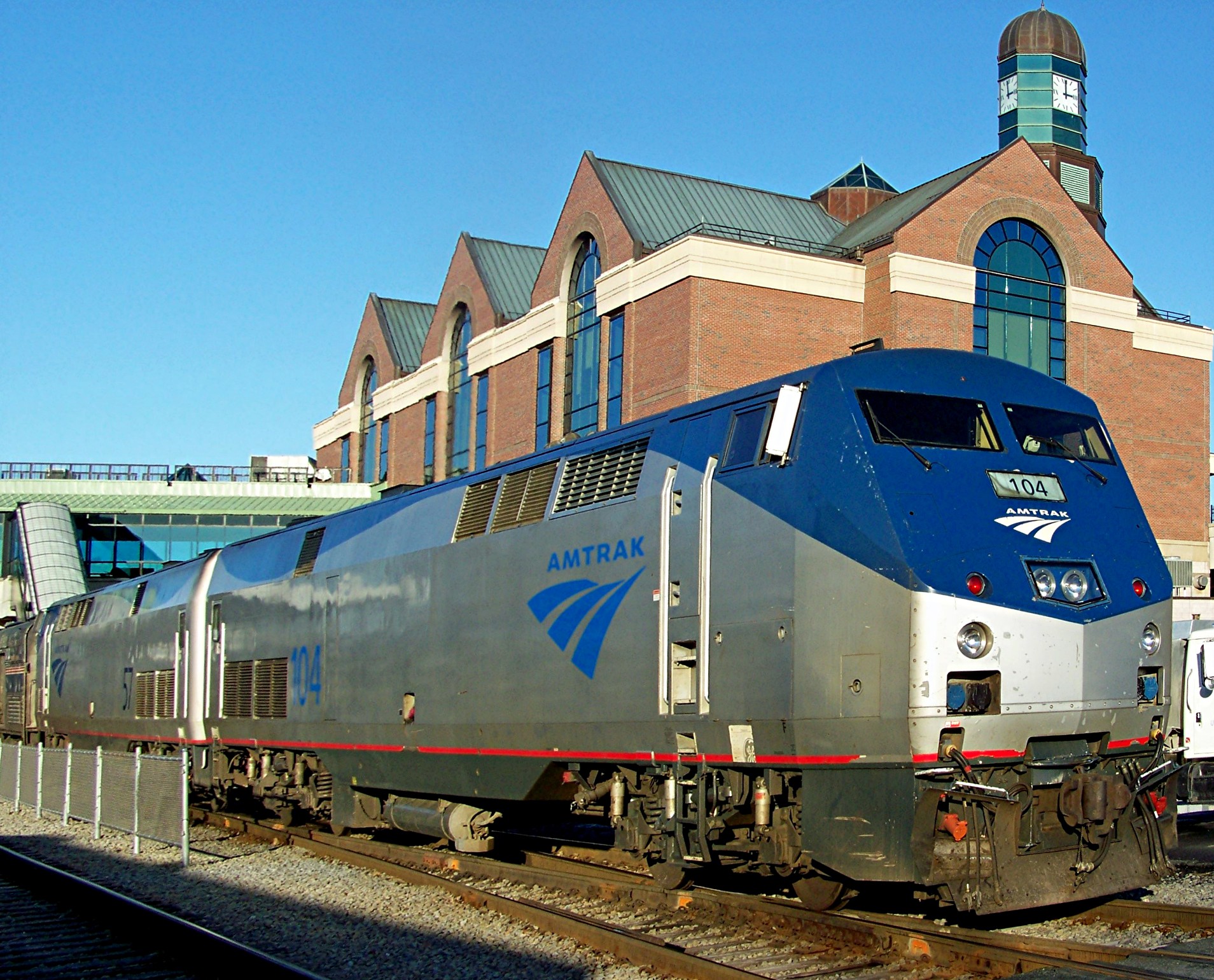
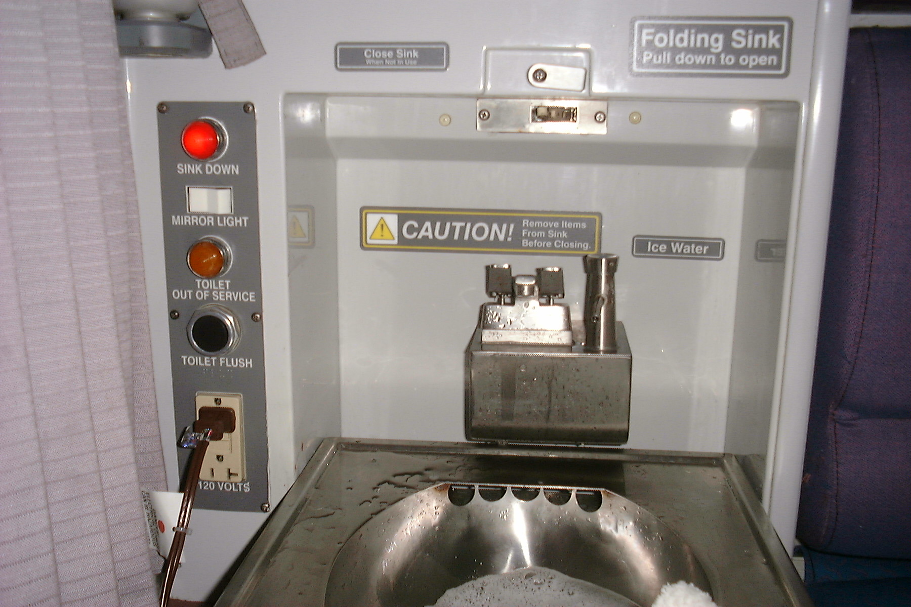
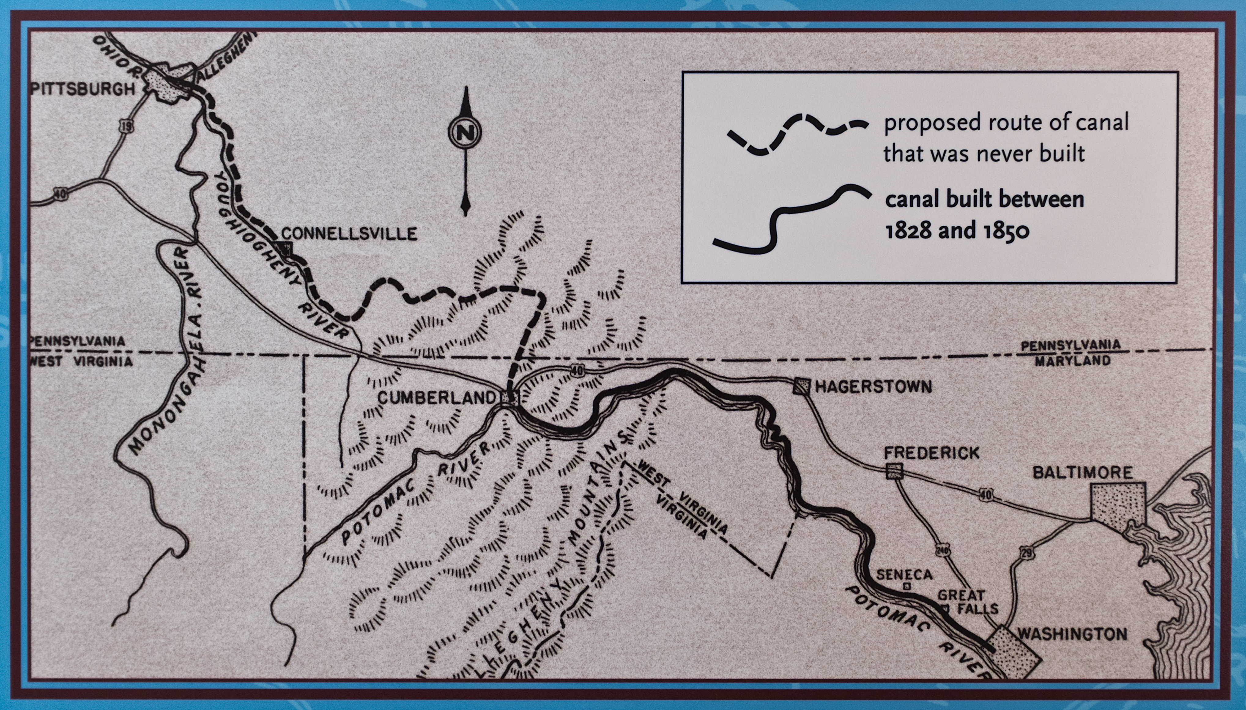
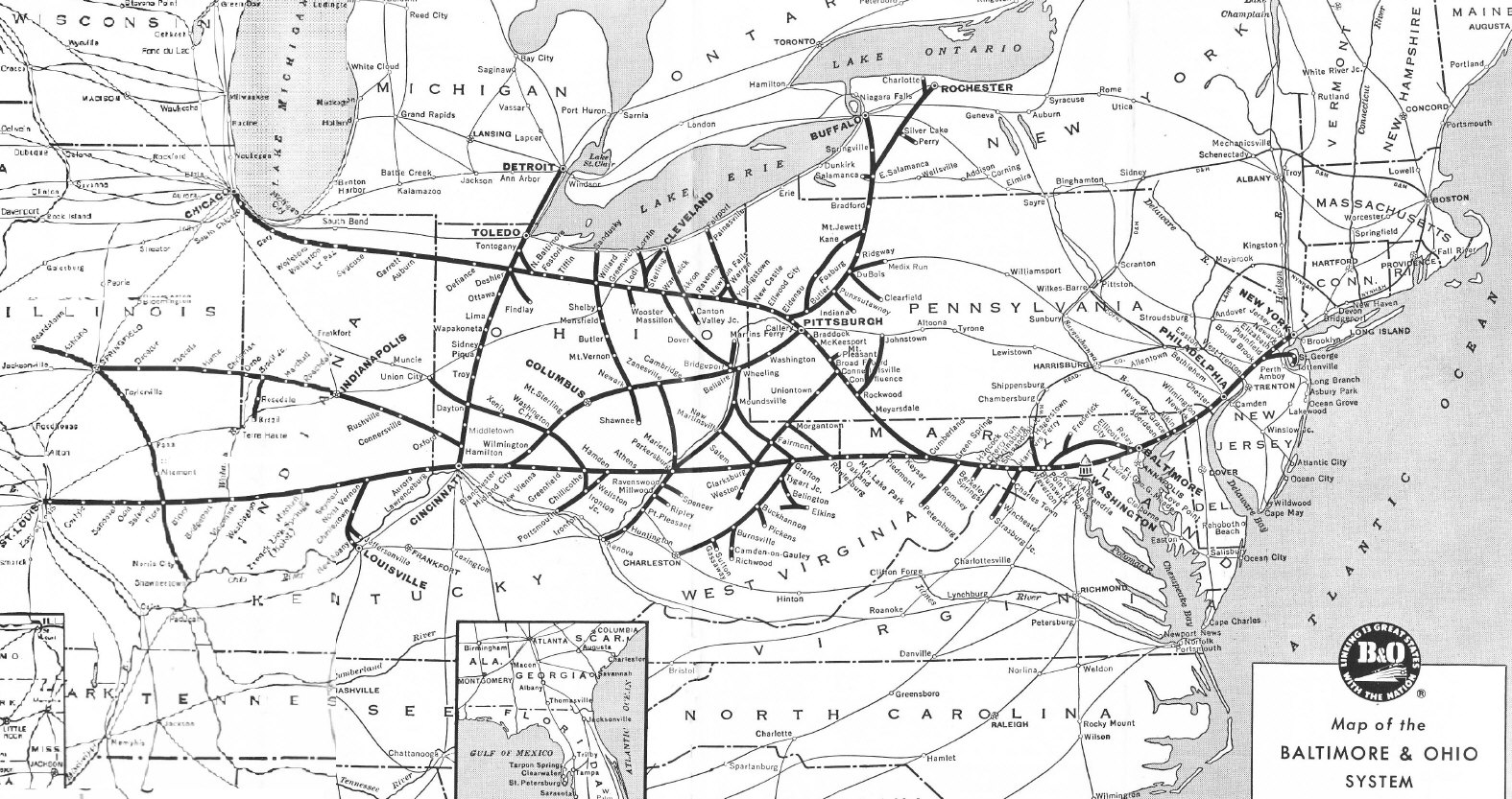
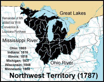
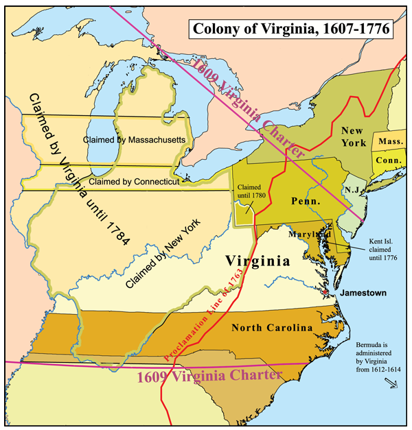
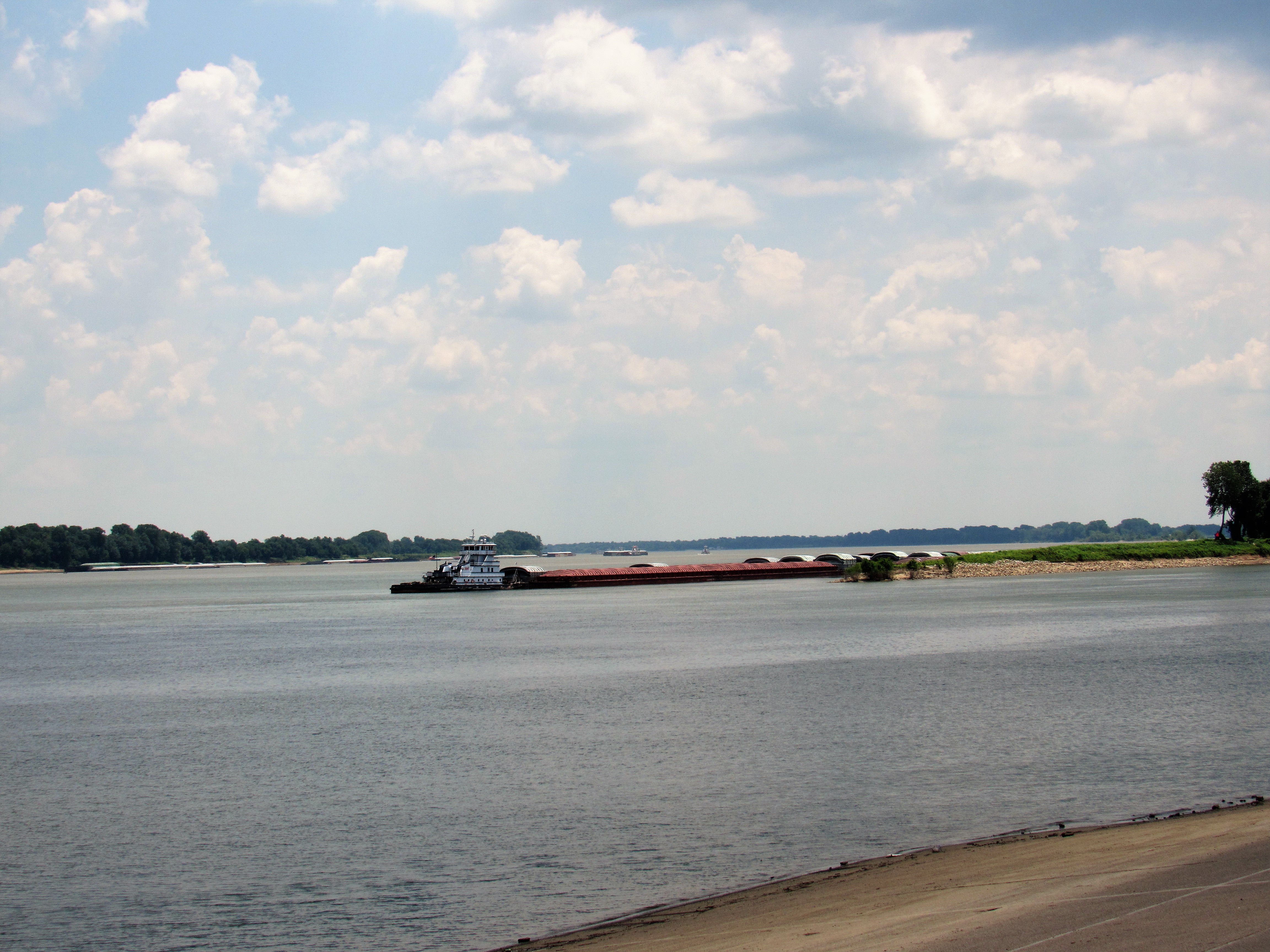
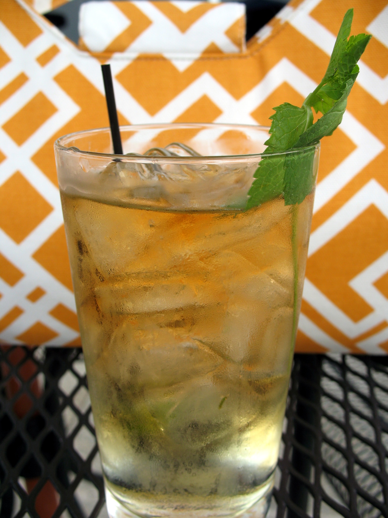