|
Reflections 2020
Series 1
January 30
Flagler & the Florida East Coast RR - Saint Augustine - Palm Beach
| | In the last posting we spoke of Henry Plant and how he opened up the west coast of Florida, notably Tampa, with his rail line and hotels, particularly the Tampa Bay Hotel. But he isn't as well known as his rival, Henry Flagler, whose name adorns streets and public buildings. Flagler's name is also more recognizable than Plant's, which can be confused for a regular word. While both Henrys did notable work, Flagler's was perhaps more spectacular as he opened up the east coast of Florida, from Jacksonville to Saint Augustine to Palm Beach. After that (in following postings), he continued to Miami, and most spectacularly, to Key West via his island-hopping (key-hopping?) Over-Sea Railroad.
http://www.orangesmile.com/common/img_city_maps/florida-map-0.jpg
http://floridahistory.org/FHIC%20RAILROADS.jpg
| | | | As before, we'll be referring regularly to our map of Florida (first link—keep it), and occasionally to our map of the Plant and Flagler routes and hotels (second link—keep it), which we'll call our Plant/Flagler map. | | | | As we tell the Flagler narrative, we'll of necessity be jumping back and forth just a bit, since some events happened simultaneously and we'll want to finish each story before starting another. We'll also be using some older names for Flagler's railroad, which are interesting in their development, tho it eventually became the Florida East Coast Railroad (FEC). The time period discussed covers three decades straddling the turn of the 20C, from 1883 to 1913, the year of Flagler's death, with updates beyond that. | | | | Cleveland Henry Morrison Flagler had two distinct careers. Those who know Florida history, especially rail and hotel history, will recognize his name in those connections, but that was his second career. Even those familiar with American industrial history might not know about his first career.
Flagler--think of a flag when saying "Flagler"; I always used to mispronounce it--was born in 1830 in Hopewell NY, in the Finger Lakes Region. At age 14, after only completing the eighth grade, he moved to Bellevue, in northern Ohio, west of Cleveland. Some years later, when in Cleveland, he became acquainted with John D Rockefeller, who worked as a commission agent with a company called Hewitt and Tuttle (remember the name "Tuttle", as it'll come up again later). Long story short, together they ended up founding Standard Oil of Ohio, which became the leader in American oil (Standard Oil = S.O. = Esso [became] Exxon [became] Exxon-Mobil). I'm sure that when most people think of Standard Oil they just remember Rockefeller, his fortune, and his dynasty, and forget his partner, Flagler.
| | | | Jacksonville In 1878, Flagler's wife, Mary, who had always struggled with health problems, became very ill. On the advice from her physician, she and Flagler visited Jacksonville for the winter. Unfortunately, Mary did not recover and died three years later. However, the visit to Jacksonville is what first got him interested in Florida. This trip, when he was 48, marked the start of the transition period between Flagler's careers. | | | | At the time, Jacksonville, tho way in northern Florida, was as much of east-coast Florida as Northerners could reach conveniently, and its tourism business did very well. Two things tended to keep travelers from going further south. First, Jacksonville was part of what I call the "Panhandle-Plus" region of northern Florida, the "civilized" area. Who would ever want to venture into Peninsular Florida to the heat, swamps, alligators, and mosquitoes of what had even been called Mosquito County? Second was a more literal blockage, the river barrier. | | | | There have been numerous river barriers to rail (and road) transportation, but we'll cite just a pair of barriers we recently discussed in 2019/8 regarding transcontinental railroads. The route discussed was purported to connect rail-to-rail coast-to-coast, but didn't so for several years after the Gold Spike. First, a bridge over the San Juaquin River in California finally brought it closer to the San Francisco Bay area. But much more importantly, the route didn't connect to eastern railroads because of the Missouri River, where for several years, whole trains had to be ferried across the river between Council Bluffs IA and Omaha NE. | | | | Many may wonder what river could block southward travel on the Florida coast. Actually, what rivers are there in Florida? We've talked about the Apalachicola (see FL map) in the Panhandle, which had divided East and West Florida; just east of that is the famous Suwannee River, which all have heard of, but which perhaps few know as a Florida river (tho it starts in Georgia), or that Stephen Foster's Swanee River is the Florida State Song. [To fit his music, Foster dropped the U (and thereby a syllable) and also one N, making it Swanee.] We've also talked about the Hillsborough River in Tampa and the Miami River in Miami. But how many know about the Saint Johns River? | | | | The Saint Johns River, which in Spanish days was the Río San Juan, is the longest river in Florida and Florida's most significant one for commercial and recreational use. To be long in a long, narrow state it itself has to run mostly north-south. On our Florida map, find Cape Canaveral along the coast and Melbourne south of it. Slightly inland is the beginning of the Saint Johns River. Follow its northward route for a total of 500 km (310 mi). Even tho we know that Florida is very flat, it still may surprise that the drop in elevation from its headwaters to its mouth is less than 9 m (30 ft), resulting, like most Florida waterways, in a very low flow rate of only 0.5 km/h (0.3 mph), causing it often to be described as "lazy". People can walk faster than this river flows, since the average person walks at 5 km/h (3.1 mph), which is about ten times faster than this river flows.
http://fcit.usf.edu/florida/maps/pages/12200/f12262/f12262.jpg
| | | | But as you reach the upper end of the river, two other peculiarities become obvious (see above link to a Duval County map, and keep it)—it becomes extremely wide—a barrier between shores. At its widest point, it's nearly 5 km (3 mi) across. Then it makes a turn to the east at Jacksonville to empty into the Atlantic. But using Google Maps distance calculator, I find that downtown Jacksonville is at a narrow point of this wide section of the river—perhaps that's why the city is located here—with a width of about a half-kilometer or a third of a mile. At the end of the 19C, this would prove to be a potential area for someone (heh-heh) to consider building a bridge. | | | | | | I have limited experience on the Saint Johns. On Voyage 17 in 1988, Beverly and I sailed on the Saint Johns from downtown Jacksonville out to the Atlantic, then up the coast to our first stop at Fernandina Beach (see 2019/18), where I first learned about the Florida Railroad. We then proceeded up the East Coast, with stops, to Charleston SC.
http://navy.memorieshop.com/Atlantic/Mayport.gif
Two years later, in 1990, we drove back to Fernandina Beach to stay in a Victorian B&B for two nights. When we left, we drove south along the coast to Saint Augustine, and thereby used the Mayport Ferry to cross the Saint Johns. The ferry (blue icon above) is located about 4 km (2.5 mi) inland from the Atlantic, and the crossing traverses about 610 m (2,000 ft). This view is from the ferry and shows the width of the Saint Johns at that point (Photo by Ebyabe).
|
| | | | Saint Augustine Five years after his introductory Jacksonville visit, in 1883 Flagler and his second wife went south of Jacksonville to the old city of Saint Augustine (see FL map), which we've discussed in the past. Despite its long history, it was at that time not yet a major tourist destination, and Flagler began to realize that Florida had the potential to attract large numbers of visitors. Finding Saint Augustine charming, he decided to begin there, but felt it had hotel and transportation facilities that were wholly inadequate. He was now 53, and was about to start his second career which, ironically, saw him becoming a hotelier first. He only got into railroads to get customers more conveniently to his three Saint Augustine hotels. Only after that did new rail and new hotels go hand-in-hand. While he remained on the board of Standard Oil, he sharply reduced his daily involvement in the corporation, and that career began to become secondary to his looming mid-life Florida adventure.
As we move along, please refer regularly to our Plant/Flagler map above, starting with his three Saint Augustine hotels. I'm also pleased to have found the below period map of Saint Augustine, undated, but probably from the turn of the 20C, since it shows his hotels already built.
https://www.visitstaugustine.com/images/sosa/st-augustine-map.gif
| | | | Ponce de Leon Hotel He first built the 540-room Ponce de Leon Hotel ("the Ponce"), which, after three years of construction, opened in 1888 and was an immediate success. On our map, the Ponce--this is its interior courtyard (Photo by TimTrick)—is the prominent structure #20 right in the center. This is a detail of the exterior (Photo by Daderot at English Wikipedia). It was designed in the Spanish Renaissance style as the first major project of the New York architecture firm of Carrère & Hastings, which would go on to gain world renown--soon after, they would design the New York Public Library in Manhattan. The hotel was the first of its kind constructed entirely of poured concrete, using the local coquina stone as aggregate. The hotel was also one of the first buildings in the country wired for electricity from the onset, with the power being supplied by DC generators installed by Flagler's friend, Thomas Edison. Interior design of the hotel—this is the lobby with a view of the hotel's rotunda and ceiling mural (Photo by Daderot at English Wikipedia)--was headed by Louis Comfort Tiffany, and it was Tiffany & Co that provided the stained glass windows in the hotel's dining room (Photo by Maksim Sundukov). Noted personalities that stayed at the hotel included Mark Twain, Somerset Maugham, and Presidents Grover Cleveland and Theodore Roosevelt.
| | | | UPDATE: The Ponce saw declining visitor numbers throughout the 1910s and 1920s. Irony of ironies: a major cause of this was the continuous extension of Flagler's railway, which allowed tourists to vacation in the warmer, tropical climates further south, such as Palm Beach and Miami. The Ponce survived in various ways as a hotel until it closed in 1967. The building and grounds are today a part of Flagler College. | | | | Alcazar Hotel The very next year, 1889, Flagler opened another hotel in St. Augustine, the Alcazar, just south across King Street from the Ponce, #21 on our map. (In Spanish, an alcázar is a fortified castle.) The Alcazar was also designed by Carrère & Hastings, and absorbed guests that the Ponce could not accommodate, thereby easing the massive demand. This is a detail of a tower (Photo by Daderot at English Wikipedia). It was to be part of a complex of three buildings of Moorish-Spanish Architecture, in his quest to create an "American Riviera" on the Florida coast. The hotel had a steam room, massage parlor, sulfur baths, gymnasium, a three-story ballroom, a bowling alley, archery ranges, and the world's largest indoor swimming pool at that time. | | | | UPDATE: After years as an elegant winter resort for wealthy patrons, it closed in 1932, during the Great Depression. After further years of idleness, it became the Lightner Museum in 1948. Curiously, the building also houses the Saint Augustine City Hall. Click on the first photo to see references to both modern uses. | | | | Cordova (Casa Monica) The Casa Monica (Photo by WhisperToMe) was built in 1888, not by Flagler, but by the man who'd first interested Flagler in building hotels in Florida. However, he immediately ran into financial difficulties, and so Flagler purchased it and reopened it as the Cordova, since, as #22 on our map, it lies across Cordova Street from the Alcazar. In 1902, a short bridge was constructed over Cordova Street to connect the second floors of the Cordova and the Alcazar, and the Cordova was again renamed, this time as the Alcazar Annex, after which, the Alcazar and Alcazar Annex were considered one hotel. | | | | UPDATE: In 1932, the building was closed along with the Alcazar. In 1945, the bridge between them was removed. In 1968 the building was renovated as a courthouse, but happily in 1999, it was purchased from the county, fully renovated and reopened in its second iteration as a hotel, and to boot, under its original pre-Flagler name of Casa Monica. It now considers itself one of the oldest hotels in the US and is a member of the "Historic Hotels of America".
It's notable that, even as the Alcazar and Cordova Hotels closed, the Ponce remained open and was one of three Flagler hotels in the state to survive the Great Depression and operate into the mid-20th Century. Still, the Ponce is now a college, the Alcazar a museum and city hall, but Flagler's Cordova—which he did not build--is back to being a historic hotel, and under its original name. So which one of this trio really came out the winner?
| | | | We're almost, but not yet quite, ready to talk about Flagler's move into railroads to supplement his hotels, but while we have the period map of Saint Augustine, let's take a look at the Depot on the left, interestingly marked #1 to indicate the status of a rail station at this period in time. Despite its importance then, my understanding is that there's no trace left of it today. If you want to go to Saint Augustine by rail, you have to take Amtrak to Palatka (see FL map) and find your way somehow from there.
https://www.floridamemory.com/fpc/general/n039684.jpg
Flagler opened this depot in March 1889. As our town map shows, the main road to the depot was Valencia Street, which was quite close to the Ponce, altho leading to its back. From what I've read, Valencia became important because Flagler asphalted it, while King Street, actually a more important street, and one leading to the front of the Ponce—and the other two hotels—remained unpaved for quite some time. Flagler was involved in making many civic improvements to the city other than his hotels.
| | | | | | Note the two rail lines connecting at the station, one coming south from Jacksonville and the other going inland across the San Sebastian River to the aforementioned Palatka. There is some confusion here as to which railroads are involved, especially since the town map is not dated. Jumping ahead in our story, we'll see later that Flagler bought up local narrow-gauge railroads for his Flagler System, converted them to standard gauge, and made them part of the Flagler system, which had a couple of names until it finally became the Florida East Coast Railroad (FEC). The railroad from Jacksonville to Saint Augustine that he bought was the Jacksonville, Saint Augustine & Halifax River Railway. He also bought the Saint Augustine & Palatka Railway, and merged them before all his acquisitions became the FEC.
Though our town map does correctly show the StA & P RR leading west, coming from Jacksonville it shows the J T & KW RR, which is the Jacksonville, Tampa & Key West RR (that last connection by water). This however became part of the Plant System's Seaboard Air Line (SAL), which (as we saw in Tampa) eventually merged with the Atlantic Coast Line (ACL) to form the Seaboard Coast Line (SCL).
http://d2ydh70d4b5xgv.cloudfront.net/images/9/8/original-1916-dated-map-of-the-atlantic-coast-line-railroad-05294b80fcee76d19a79cb69f0325a4f.jpg
This 1916 ACL map (click) shows in bold lines how the Plant System leading to Tampa grew. In light lines, it indeed shows the Jacksonville/Saint Augustine/Palatka connection as belonging to the FEC. I can only assume the town map includes an error. In any case, it serves to show just how rail served Saint Augustine.
|
| | | | It should be pointed out how Flagler's influence in the city of his first big urban hotel venture allowed it to grow. In the 1880 census, the population of Saint Augustine was 2,293, but by the end of a decade of Flagler influence, in 1890 it grew to 4,742, an increase of 106.8%. (The estimated population for 2018 was 14,576.) | | | | As much as I love history, I really hate to disparage a historical place, but it's precisely because I love history that I have to register my disappointment in Saint Augustine as it presents itself today. In 2015, Saint Augustine celebrated the 450th anniversary of its founding in 1565. However, after the 400th anniversary back in 1965, it was determined to restore part of the colonial city. A preservation board reconstructed over 36 historic buildings, which are now under the control of the University of Florida. | | | | On 15 July 1991, coming south from the Mayport Ferry, Beverly and I stopped for a half-day in Saint Augustine.
http://mrautoinc.com/oceanforestdrive/ocean-forest-drive-st-augustine-fl/st-augustine-route-map-info.jpg
This schlocky tourist map typifies what we felt the by-now touristy city looked like. Too many of the restorations in Old town were schlock, and appeared more like Disney World than Williamsburg. Fast food was being served out of historic buildings. There's a "Ripley's Believe it or Not!" Museum in an 1887 mansion. Note the alligator farm. Beverly and I avoided negativism in what she wrote in our travel diary: We stopped at the Nombre de Dios Mission commemorating the Spanish arrival in 1565 [#20 on this map]. We stopped at the Castillo de San Marcos [#17]. We walked through the reconstructed Saint George Street [center] and then to the Flagler area and stopped at the Presbyterian church [#9] with his tomb, the former Ponce de Leon Hotel (Now Flagler College) and the former Alcazar Hotel (now the City Hall and Lightner Museum). The Castillo San Marcos is a wonderful fort, I remember crossing the Bridge of Lions, and of course enjoyed the Flagler area, but we certainly avoided the wax museum. Often one has an urge to want to go back to places, but I've seen as much of Saint Augustine as I want to, a fact that I regret.
| | | | Let's mention again the thing that kept on happening as Flagler continued with his projects. As the railroad moved further and further south in the 20C into warmer weather, first Jacksonville and its area declined severely as a major Florida destination--remember how far north it is, and people were looking for a more tropical climate. Secondly, wealthy travelers—and others—also abandoned Saint Augustine, especially during the Depression, in favor of South Florida. Over time, Saint Augustine became a destination for tourist families traveling by car, a fact which speaks for itself. | | | | Naming Railroads The 19C saw the birth of railroads and their expansion. How they were named is worth bringing up here, tho these comments are in no way comprehensive. While later names signified huge systems, such as the Pennsylvania Railroad or the Southern Railroad, the earliest rail lines were starkly local, called "short lines" because they usually covered only one single, short route, and their names reflected that. If a small company were building a single short line from Dogpatch to Toonerville, they simply named it the Dogpatch & Toonerville Railroad. If they had hopes of expanding south, they may have called it the Dogpatch, Toonerville & Southern Railroad, but that showed wishful thinking, which often never came about. If they were lucky enough to actually expand the line to Podunk before going bankrupt and being swallowed up by a bigger fish, they might have extended their name to the Dogpatch, Toonerville & Podunk Railroad. | | | | | | An actual railroad that kept this sort of simple name once it became larger is the Boston & Maine Railroad. One that vastly outgrew its name, but never changed it, is the Atchison, Topeka & Santa Fe Railroad. It eventually became known simply as the Santa Fe, its original destination in the West. Few knew that it was first built to connect tiny Atchison KS with the state capital, Topeka. It's a good example of having its goal of reaching distant Santa Fe NM being met and wildly surpassed. My stop in Atchison is described in 2016/2. |
| | | | Florida Coastal Geography We first should check out some unusual geography, and the terms used for it. All along the East and Gulf Coasts of the US, from Long Island to the Mexican border, there is a series of barrier beaches on peninsulas or islands separated from the mainland by water. The water separating them from the mainland is often a lagoon or estuary, but is sometimes given unusual designations, often being called a river, even a lake. Almost all of these are part of the Intracoastal Waterway.
Look at the Florida map and follow the eastern coastline. For instance, you'll see that Saint Augustine has an estuary called the Matanzas River separating it from its barrier islands. (Matanzas are "killings" and designates where the Spanish killed a group of French Huguenots. It's the tenth-oldest surviving European place name in the US.)
There are many others, but we'll just point out several that will be coming up in our discussions. Move down to Daytona Beach to find the estuary called the Halifax River (Map by Kmusser). It was named when the British ruled Florida (1763-1784) after the same man that Halifax NS is named after. But it's not a river. (During this period, Tampa's Hillsborough River—an actual river--also got a British name, based on the Earl of Hillsborough.)
Starting near Titusville and running a long distance is the lagoon called the Indian River, but it's also not a river. Here's the Indian River adjacent to Cape Canaveral and the Kennedy Space Center. As we continue to move south, we'll come across—and will discuss at the time--the lagoon called Lake Worth (not shown) in Palm Beach and Biscayne Bay in Miami, finally a waterway with a more accurate name.
| | | | Flagler Gets into Rail It's hard to picture the concentration of effort Flagler made, just at the beginning, in the late 1880s. He had his three Saint Augustine hotels, but felt people couldn't reach them easily enough overland. While the actual Florida border is a bit further north of Jacksonville, Jacksonville itself served as a transportation border with the rest of coastal Florida. Flagler himself experienced how the trip to Saint Augustine was a three-seat connection—standard rail to Jacksonville on the north bank of the Saint John, transfer to a river steamboat ferry, then on the south bank, transfer to local rail. And he also saw that the local short line to Saint Augustine was narrow gauge, and thereby incompatible with the standard gauge on the north shore. This is how Flagler, in his second career, moved from being just a hotelier to also becoming a railroad builder. He would have to both surmount this river barrier and solve the problem of different rail gauges, not only to ease access to Saint Augustine, but also to the rest of coastal Florida.
https://texashistory.unt.edu/ark:/67531/metapth192431/m1/1/high_res/
| | | | This "main rail map" will guide us as we move south (keep it). It's actually meant to show the Plant System, which, as mentioned above, in 1900 became the Seaboard Air Line (shown in red) and in 1967, merged with another line, the Atlantic Coast Line RR, to become the Seaboard Coast Line RR. However, our interests lie in the routes in black, the ones that became Flagler's Florida East Coast Railway (FEC). | | | | | | We discussed once earlier that, before the era of aviation, any railroad that had a relatively flat, straight route might advertise that route as an air line, a phrase indicating speed that was simply synonymous with "bee line" or "as the crow flies" to emphasize shortness and directness. Obviously, that phrase has fallen into disuse, a great example of technology overtaking itself. This is a 1902 ad for the Seaboard Air Line using a plumb line to show its direct route from New York to Tampa. But look at the timetable, which brings us to several points of interest. It shows the arrival time in Saint Augustine, and not Tampa. This indicates the great importance of Saint Augustine to visitors to Florida at the turn of the 20C. But it's on the FEC route, so there might have been some accommodation there somehow. It also shows that by this time, Flagler had built his bridge at Jacksonville making thru traffic to Saint Augustine possible. |
| | | | But we're a bit ahead of ourselves, with Flagler just getting into rail. On the last day of 1885, Flagler purchased the Jacksonville, Saint Augustine & Halifax Railroad (JStA&H), the first railroad in what would eventually become his Florida rail empire. It had been built in 1881 and opened in 1883, as a narrow gauge (3 ft [914 mm]) rickety short line that ran only the 60 km (36 mi) between Jacksonville and Saint Augustine and no further. Its name was more than just wishful thinking, at both ends. It didn't leave from Jacksonville, on the north bank, but from South Jacksonville (today San Marco) on the south bank. As for the Halifax River reference, that was just more wishful thinking of the original owners to eventually extend southward from Saint Augustine. Using the Halifax River as a "destination" was also indicative of the fact that, not only weren't there any major cities to the south to name as a destination, the railroad was vaguely hedging its bets as to how far south it would ever reach (which it never did—Flagler did it). | | | | In this same time period, overlapping with his hotel construction, he also purchased several other narrow-gauge short lines like the above JStA&H. He upgraded all of them to standard gauge, both to accommodate heavier loads and more traffic, and to eventually connect to the standard rails north of Jacksonville. At any rate, the JStA&H allowed him to reach his goal of connecting from the south bank of the Saint Johns to Saint Augustine (see rail map).
STATUS: First step accomplished—Saint Augustine has a decent rail connection. Still lacking is a bridge in Jacksonville as well as rail growth further south.
http://fcit.usf.edu/florida/maps/pages/10100/f10177/f10177.jpg
Another short line he bought in this time period was the Saint Johns Railway (StJRy), whose story fooled me at first. Its route (above), between Saint Augustine and Tocoi on the Saint Johns, a fact that is unclear from its name, didn't seem to go anywhere, and I didn't understand why he bought it, since it didn't lead further south. But with more online digging, I find it to be one of his more interesting acquisitions. Searching on bing.com got me lots of illustrations.
https://fcit.usf.edu/florida/maps/pages/200/f283/f283.jpg
| | | | For the time being, we'll need this local rail map, which we'll refer to as the Tocoi map (keep it). Actually, it shows more than we need. Disregard all rail lines except the one from Jacksonville to Saint Augustine, and then the short line from Saint Augustine to Tocoi, on the east bank of the Saint Johns. Why would anyone build this odd, seemingly useless, connection? Why would Flagler buy it? | | | | Logic would seem to dictate this. Saint Augustine has access to the Atlantic, but didn't have access to the Saint Johns, so this was its inland connection. If the line had been named the *Saint Augustine & Tocoi, or the *Saint Augustine & Saint Johns—which it was not—its purpose would be much clearer. Chartered in 1858, it had the distinction of being the oldest railway that eventually would make up the FEC. Because of its age, it would have been the first connection from Saint Augustine to anywhere, so the simple name just said that it led to the Saint Johns. | | | | Tocoi was not a settlement, but a steamboat landing on the river, and the rail connection was to steamboats, not to West Tocoi (see map) on the other side--today a ghost town—even tho West Tocoi is apparently the source of the name. Here's an early view of the Saint Johns Railway:
https://www.floridamemory.com/fpc/reference/rc02501.jpg
| | | | It's so old that when it started out after 1858, it ran along its 24 km (15 mi) on wooden rails and was pulled by horses or mules. [Horse power (literally!) on railroads is not unheard of. We saw its use as of 1830 in Ellicott City near Baltimore in 2016/12 and as of 1836 in Tsarskoye Selo (now Pushkin) near Saint Petersburg in 2014/15.] The Saint Johns Railway was purchased by one of the Astors in 1876 and was rehabilitated with steel rails and steam locomotives:
https://www.floridamemory.com/fpc/reference/rc00315.jpg
| | | | Note that in this picture, it actually does say "Tocoi-St. Augustine" on the train. Below are three views of Tocoi Landing on the Saint Johns River:
https://www.floridamemory.com/fpc/reference/rc13381.jpg
https://www.floridamemory.com/fpc/reference/rc08750.jpg
https://www.floridamemory.com/fpc/reference/rc02913.jpg
| | | | The first drawing of this rail 'n' sail connection shows the steamer "Dictator" at the wharf in the background. Note the period steam engine. The second link shows a period photograph of a Saint Johns Railway train on Tocoi Wharf connecting with the steamer General Sedgwick. The third is another period photograph dated sometime between 1871 and 1880 showing the steamboats Hattie and Starlight—whose names can be read--docking at Tocoi.
An additional value of these two photos is being able to actually see what the ferry landings on both shores up in Jacksonville actually looked like before the bridge was built and the inconvenience in Jacksonville of a three-seat ride. Anyway, once Flagler bought this route in 1885 he continued its operation until 1894. I would imagine by then there were enough railways in the area to make a steamboat connection unnecessary. The rail route is gone now, and, according to Google Maps, local highway 214 now follows closely the former route of the Saint Johns Railway.
| | | | But why did Flagler buy the StJRy? To understand that, return to the Tocoi map. The StJRy had in the meantime formed the Saint Augustine and Palatka RR and constructed a line from Tocoi Junction on the StJRy west of Saint Augustine to East Palatka. Palatka itself, on the west bank of the Saint Johns, was reached about three years later with the construction of a bridge over the river. While this route took Flagler southwest and inland rather than due south along the coast, it was progress. Anyway, Palatka was a growing town that became a rail hub and attracted tourists. It's population between 1880 and 1890 jumped 88.1% from 1,616 to 3,039.
STATUS: The line has now moved south to Palatka—but inland! The Jacksonville bridge is still lacking.
| | | | What now follows is another example of how development came in fits and starts, and how starting one line might have then blossomed into that line adding a more useful one. Find on the Tacoi map where another company in 1878 chartered a (very) short line, meant for logging, from East Palatka to San Mateo, about 8 km (5 mi). When construction finally began in 1881, the line was reorganized with an expanded plan. It began laying rails running about 84 km (52 mi) to Daytona Beach on the coast (see Tocoi map, then FL map), and renamed itself the Saint Johns & Halifax River (StJ&HR), which includes a second Halifax reference. | | | | | | The earliest population figure I can find for Daytona Beach is for two decades later, in 1910, when it had 331 people. I would imagine in 1881 it had a similar total, if not far fewer. Thus it's understandable that the rail company didn't list Daytona in its name as a destination, but the Halifax River, a vaguer reference that played down any importance of tiny Daytona and allowed for the possibility of further expansion along the coast. |
| | | | In 1886, the StJ&HR reached Daytona, which was roughly the same time the StA&P reached East Palatka. Flagler lost no time in also acquiring the former and linking it to the latter, allowing him to provide thru service from (South Jacksonville and) Saint Augustine to Daytona, despite the fact that the route formed a major kink, zigzagging inland, then out again.
STATUS: We're back on the coast at Daytona, but still lack that bridge.
| | | | Flagler Builds a Bridge Since we'll now be talking about Jacksonville for a bit, refer back to the earlier map of Duval County. Jacksonville is not only the seat of Duval County, but since 1968, its borders have been contiguous with the county and the two governments have been consolidated. This fact gives Jacksonville two distinctions: it's now not only the most populous city in Florida, but also the largest city by area in the contiguous US. We mention this since we'll be naming a number of places in the area which at the time, were separate municipalities, but which are today all part of Jacksonville, such as Jacksonville Beach and Atlantic Beach. Downtown Jacksonville is that tangle of yellow and red highways exactly in the center of the map, where the river runs east-west. Tho it's far in northern Florida, it's not at the state line. Smaller Nassau County, whose seat is Fernandina Beach, is to the north, separating it from the state line.
It was actually only two years after the opening of the Ponce in 1888, that in 1890, Flagler built a railroad bridge in Jacksonville across the Saint Johns River to gain access to Saint Augustine as well as the southern part of the state. It connected the standard-gauge lines on the north shore with the south shore lines he'd upgraded to standard gauge.
http://www.jaxhistory.org/wp-content/uploads/2015/08/img068-1024x652.jpg
This link shows a colored postcard of the bridge, the first bridge of any kind ever built in Jacksonville--a road bridge wasn't built for over three more decades, in 1921. It was single-track swing bridge (Animation by Y_tambe), a bridge that has a section that opens and revolves 90° to allow ships to pass, as the postcard shows. But it's a case of progress on the one hand leading to a decline on the other. Since it was built to provide better access to South Florida, it served as the final chapter of Jacksonville's decline as a major visitor destination, a fate that also befell Saint Augustine over time.
https://www.mapsofthepast.com/mm5/graphics/00000001/FLJA0005_a.jpg
| | | | This marvelous sketch (click) is an undated birds-eye view of Jacksonville showing the first bridge to cross the Saint Johns, Flagler's 1890 single-track rail bridge. Note the busy ship traffic. The Atlantic Ocean is in the upper distance; the downtown Jacksonville waterfront is in the center. Also note the busy south shore waterfront.
https://2mv53u1cm6mneu0xp29yafi1-wpengine.netdna-ssl.com/wp-content/uploads/2019/03/1562-2.jpg
https://cdn.shopify.com/s/files/1/1650/8891/products/edd5565b-9472-41a3-a17e-1f936816fef6_1024x1024.jpg?v=1541738372
These are two details from the south shore waterfront. The first one, just downstream from the new rail bridge, shows sailing ships, steamships, and those in-between—ships using steam, but which kept their sails—just in case the steam should fail!
The other south shore detail from the right of the map shows ships transferring passengers and goods to a south-bank rail line. It's reminiscent of the period photos of Tocoi Landing, tho much busier. At the bottom right note the reporting mark J&A, indicating that this is the narrow-gauge Jacksonville & Atlantic Railroad, which we'll discuss below, so keep this detail, just for a moment. Among the ships here would be the J&A-owned ferry from Jacksonville to the J&A, which Flagler's bridge superseded, so we're seeing in this sketch both the old and new ways to cross the river. Because the J&A was built in 1895 and changed hands and was remodeled in 1899, we can now date the entire sketch to between those two dates.
| | | | UPDATE: As revolutionary as this first bridge to cross the Saint Johns was, further developments caused two deficiencies to become apparent. One was that Flagler became intent on double-tracking his line all down the coast for greater efficiency, and the bridge was single-tracked. Secondly, in 1921, a road bridge, the Acosta Bridge, was built immediately downstream of it—that location on the river must have been advantageous for bridges--and the swing bridge mechanism turning to the side became less ideal. Thus the FEC replaced the original rail bridge in 1925 with the present double-track FEC Bridge (full name: FEC Strauss Trunnion Bascule Bridge). | | | | | | A Strauss Trunnion Bascule Bridge (Animation by Mliu92) uses a counterweight—here in blue—rotated around an axle to lift a section of the bridge, here in red. The animation shows a double one, while the FEC Bridge is single, looking more like the right-hand side. |
| | | | The Acosta Bridge was itself replaced in 1990. This is a 1992 map of the second rail bridge, adjacent to the Acosta Bridge. It's this second rail bridge that's the oldest remaining bridge of any kind crossing the Saint Johns at Jacksonville.
| | | | Here we have a panoramic upstream (western) view (click) of the Acosta road bridge with the historic FEC rail bridge directly behind it (Photo by Jonathan Zander). The bulky counterweight stands out.
http://4.bp.blogspot.com/-dGEnEtxAsPI/TB6_YUqavpI/AAAAAAABFdM/sQImMezPUsE/s1600/2010062003%2BAcosta%2BBridge%2B%26%2BFEC%2BStrauss%2BTrunnion%2BBascule%2BBridge.jpg
https://i.ytimg.com/vi/mglWz1kqDeo/maxresdefault.jpg
The first view looks south over the double-track FEC Bridge with the much newer Acosta Bridge on the left. The second view shows the counterweight folding under itself as the section of the bridge is raised. This YouTube video (1:37) shows the bridge opening and this one (1:58) shows the bridge closing again. Unless you enjoy watching paint dry, I suggest you merely skim thru them to watch how the counterweight hides itself, then reappears again.
| | | | The FEC Bridge today is used for freight only, since Amtrak uses another route, which we'll see later. But curiously, passengers can cross the river at this point on rails today, but not as you think. The Jacksonville Skyway (Map by SPUI) is a people mover charging no fare, an automated monorail train that currently comprises two routes across 4 km (2.5 mi) of track, serving eight stations on both riverbanks. But its rails cross the Saint Johns River on the Acosta Bridge, along with the car traffic. The below contemporary map shows it more clearly, as well as the FEC Bridge (click).
https://s3.amazonaws.com/libapps/accounts/29963/images/Jacksonville_map3.jpg
| | | | Rail to the Atlantic If you refer back to our Plant/Flagler map you'll see another Flagler hotel in this area, the Continental. It should not really be surprising. Remember our division of Florida into three areas. Here in the north, we're still in what I called the Panhandle Plus area, the swath of North Florida from the Panhandle cutting across to the Atlantic that had been the populated area throughout the 19C. This is the part of Florida, including Saint Augustine, that Flagler had been so successful in. So why not try to add more to a surer thing here in the North before plunging any further into the underpopulated, swampy "tropical Siberia" of the Florida Panhandle, including the area that had once been called Mosquito County? | | | | We now refer back to the above second detailed map of the south shore waterfront. The Jacksonville and Atlantic Railroad (J&A) was built in 1885 as a 914 mm (3 ft) narrow-gauge line, not exactly from Jacksonville itself, but from South Jacksonville (an independent city until 1932, now the San Marco neighborhood of Jacksonville) to Pablo Beach (now Jacksonville Beach), a distance of 26.15 km (16.25 mi). The company had enlarged powers, including running boats across the Saint Johns River, as mentioned above. This is exactly what we saw on the waterfront in the detailed map. The J&A was foreclosed on in 1892, and Flagler bought it in 1899. He not only had it converted to standard gauge—1435 mm (4 ft 8.5 in)—like his other short lines, but he connected its west end away from the landing on the river to his bridge crossing, physically connecting it to the rest of the FEC. At the Atlantic end, he also extended it north along the coast to Mayport, and the line, which then reopened in 1900, was now called the Mayport Branch of the FEC. You may want to confirm this on our main rail map. | | | | While all the above, along with his Continental Hotel, seems to fit in perfectly with Flagler's general expansion plans, I've also come across an ulterior objective for Flagler's wanting to reach out to the Atlantic. Coal! Flagler needed coal to fuel his growing railway and hotels, and the Mayport Branch reached the docks at Mayport on the Saint John's, which soon also became home to the company’s coal wharf, where a large coal terminal was built.
http://fcit.usf.edu/florida/maps/pages/10600/f10670/f10670.gif
https://bestmapof.com/map/2018/04/printable-map-of-jacksonville-fl-area-printable-map-of-jacksonville-fl-area-printable-map-of-jacksonville-fl-area.jpg
| | | | The first link shows the Mayport Branch, already labeled FEC, connecting South Jacksonville to Pablo Beach (to use the old names) and then turning north to Atlantic Beach (and other beaches), ending in Mayport. Previously, Atlantic Beach and its area were among the most remote areas of the Jacksonville beaches, and now they were connected directly to Jacksonville downtown, plus areas to the north. The second link is a general map of Greater Jacksonville for better orientation. Jacksonville Beach (ex-Pablo Beach) is at the end of US 90, which roughly follows the route of the former Mayport Branch. Mayport (unnamed) is north of Atlantic Beach, at the mouth of the Saint Johns.
http://fl-genweb.org/duval/transportation/jm-p/JM&Pon1924map.jpg
| | | | A Failed Rail Line I've been learning the extent of failure in early railroad building. We've already seen how Flagler was able to buy up several short lines, most likely at fire sale prices. It's revealing to take a look at one of the Wikipedia "list articles", the List of Florida Railroads. I was blown away at the number that came and went over time. But on the above map I came across one in the Jacksonville area that caught my interest. I was looking for a map of the J&A, which is at the bottom in black, and discovered that a failed railroad was also shown. | | | | The Jacksonville, Mayport & Pablo railroad (JM&P) was a hard-luck standard-gauge railroad that barely existed for about eleven years, 1888-1899, if that. It's been described as a comedy of errors. Its original route is shown in red dots. It had begun at a large dock in the naturally deep water of the Arlington area of the south shore, and went to the Atlantic, to the Burnside Hotel that the railroad had built at Burnside Beach, then on to Mayport. | | | | The inaugural trip of the JM&P was a family picnic excursion. The train broke down on the return trip and the men had to get out and push a lone passenger coach back to the ferry landing. The JM&P never lived down the nickname it got, "Jump, Men & Push". In addition, the Burnside Hotel, also built in 1888, burned down c1889, seemingly living up to its name. | | | | At its western end, passengers were ferried to the dock from a ticket office on the edge of downtown Jacksonville by the steamer "Kate Spencer". It would seem to me that the long ferry ride was already a kiss of death. Doing poorly, the JM&P was sold in 1892 and was immediately extended west (purple dots) to a new dock in South Jacksonville. It now finally faced its ticket office downtown across the river, but still couldn't compete with the FEC's direct service via the bridge. The JM&P went into receivership in 1895 and gradually ceased operations. It's route today is largely gone, in one place replaced by a local road.
https://i.pinimg.com/originals/f9/e9/e1/f9e9e12808d144af9896c3650f788768.jpg
| | | | The Continental Hotel The hotel Flagler built, called the Continental (above), was in Atlantic Beach. It opened in 1901 and was more modest and less ornate than some of the other Flagler hotels. While the three Saint Augustine hotels were typical of the era, being urban resort hotels, the Continental was Flagler's first to be a beachside resort. The north and south wings of the hotel were four stories tall and it had a six-story tall central rotunda. It also had two of the region's first golf courses.
https://beachesmuseum.org/wp-content/uploads/2019/05/IMG_6608-800x626.jpg
| | | | Unusually, it had its own rail station, the Atlantic Beach station, on the inland side of the hotel. To confirm that, compare the smokestack on the two last photos. In 1891, Henry Plant had had a spur line serve his lush Tampa Bay Hotel, and this was the first time Flagler did something similar (but not the last).
https://i.pinimg.com/736x/a5/c3/ce/a5c3cede6ccb8b942e5487933b239748--hotel-atlantic-veranda.jpg
https://i0.wp.com/www.jaxhistory.org/wp-content/uploads/2015/10/The-Continental-Hotel-advertised-in-a-Florida-East-Coast-Railway-brochure.jpg
The first link shows a tinted postcard of the era boasting a "Veranda facing the Ocean", giving it a homey, late-Victorian look. Elsewhere it's described as a "detached porch . . . connected with the hotel by covered walks . . . [providing] a promenade a quarter mile [0.4 km] in length." The second link shows an illustration from an FEC brochure (click) that not only shows the large size of the veranda/porch, but also has several pictures promoting the hotel's "automobiling" on the beach, which was later extended to an "Automobile Speedway on the beach" 30 mi (48 km) in length, from the Saint Johns in Mayport to close to Saint Augustine. Usually one associates cars driving on beaches with Daytona, which has had racing since 1902, but it also existed in Atlantic Beach at that time.
https://www.floridamemory.com/fpc/general/n027896.jpg
| | | | Flagler sold the hotel in 1913, and the new owners renamed it the Atlantic Beach Hotel. I find the above brochure particularly interesting as illustrating the transportation of the era. It advertises the hotel as having "the most accessible beach in all the South, with direct through railroad lines" in multiple directions. This is all based on the FEC bridge. It's illustrative to think of overnight direct connections from the cities shown to Atlantic Beach, and also to realize that, at the turn of the 20C, "going to Florida" on its east coast meant going to the northern tip, not beyond Atlantic Beach or Saint Augustine. | | | | UPDATE: The Continental was a wooden structure that, not yet two decades old, burned to the ground in a spectacular fire in 1919. The FEC continued to operate the Mayport Branch for another decade, but began to lose interest for numerous reasons. There was the loss of the hotel; local roads and bridges improved and the automobile began to take over local traffic; the FEC converted all locomotives to burn oil, and the coal terminal in Mayport was no longer needed; it was the Great Depression; and of course, Flagler kept extending his railroad south into warmer regions of Florida. The Mayport Branch ceased operations in October 1932, the tracks were removed, and the branch was abandoned.
STATUS: The bridge is built; the Mayport Branch comes and goes; Flagler has otherwise acquired short lines that have brought his railroad, via the kink to Palatka, down to the Daytona area.
| | | | Ormond Hotel Check on our Plant/Flagler map that the last Flagler hotel in the northern half of Florida is the Ormond Hotel in Ormond Beach—the Florida map will show that Ormond Beach is just north of Daytona, where his most recently acquired short line in this area has brought him. He didn't build this hotel. After the Casa Monica it was the second and only other one that he bought instead of building.
https://assets.simpleviewcms.com/simpleview/image/fetch/c_fill,h_1200,q_75,w_875/http://res.cloudinary.com/simpleview/
image/upload/v1511798724/clients/daytonabeach/DB_Area_Map_ede82a67-270b-496e-b915-42b84e695130.png
| | | | This is our Ormond Beach map, showing how close it is to Daytona Beach—the two bridges indicated are just 4 mi (6.4 km) apart. The focus of our attention is the Ormond Bridge, also called the Granada Bridge, since Granada Boulevard crosses it to connect the mainland and the peninsula. | | | | And it's just that geography that's the point. As we've have learned before and will see elsewhere, a body of water, here called the Halifax "River", separates barrier islands and peninsulas from the mainland. The result is three shorelines with water views. The actual shoreline and beach is on the peninsula facing the Atlantic, but the mainland has a faux shoreline on the Halifax facing the same easterly direction, and the peninsula has an inner faux shoreline facing west toward the mainland. | | | | It was once that locals knew that the railroad from East Palatka would be arriving in 1886 that the idea of building a hotel "in the wilderness" of the peninsula developed and the Ormond opened at the start of 1888. On our map, it was located on the Halifax immediately on the north side of what is today the Ormond/Granada Bridge, which actually was built later. | | | | The very first bridge was a wooden footbridge built to the middle of the hotel on the peninsula from the mainland the next year. But Flagler had been following all this action, and sensed competition building for his Ponce in Saint Augustine. So after the hotel struggled in its remote location for two winter seasons, Flagler bought it in 1890 and by 1905 had expanded it to several times its original size by adding a north, south, and west wing, giving the Ormond a rather irregular plan. The result of the expansion can be seen in this c1905 tinted postcard. I find it curious that the hotel wasn't built on the beach but on the inner faux shoreline facing the mainland. Of course, on the narrow peninsula, the beach was not far away, and the hotel might even had distant views of it. Perhaps it was still the influence of urban resorts that led to this, since the only beach hotel Flagler built before this was the Continental at Atlantic Beach.
https://i.pinimg.com/736x/69/be/be/69bebe5d81001b7c36fdd241195a61af.jpg
| | | | As we've seen happen elsewhere, Flagler built a railroad bridge parallel to, and to the south of, the wooden bridge which allowed trains to deliver the private cars of the wealthy guests to the hotel door. Flagler later had the rail bridge modified so that wealthy patrons could drive their automobiles to the hotel (see above link). This was the ancestor to the Grenada Bridge. The wooden bridge was demolished soon afterward. The converted rail bridge showed its age by 1954 and was replaced by a bascule bridge (drawbridge), which was itself replaced in 1983 with today's high-clearance concrete-and-steel bridge, the modern Grenada Bridge. | | | | The grounds of the Ormond included a separate kitchen, power house, laundry, lumber shed, rose garden, greenhouse with garden, stables, two employee barracks, saltwater swimming pool, casino, putting green, croquet and tennis courts, stores, cinema, garage, and grandstand. The hotel was open in the winter season only, and, as the wealthy guests migrated north and south, so did the staff! The Ormond had working agreements with several posh northern hotels, and would hire and bring their entire staff south for the season. One of the better-known hotels that sent its staff to the Ormond for the winter was the Mount Washington Hotel in Breton Woods NH (2006/12). | | | | In 1914, John D Rockefeller, Flagler's partner from Standard Oil in Cleveland, arrived at the Ormond for the winter season, and rented the entire second floor of the west wing for his staff and himself, which was later known as the Rockefeller Wing. His presence was great publicity for the hotel. | | | | After four seasons at the hotel, in 1918 Rockefeller bought a nearby estate for himself called the Casements, because of its casement windows. Nearby indeed. It was directly across Granada Boulevard from the hotel and also on the Halifax (see the Ormond map and also the second hotel picture above). The Casements had been built in 1913 as a winter home for a clergyman and his wife. Rockefeller lived in the house during the winters for almost two decades, from 1918 until his death in 1937 at the age of ninety-seven. | | | | UPDATE: After WWI, patronage at the Ormond began to decline. It was the same story—patrons were lured further south by newer Flagler hotels in Palm Beach and Miami. Thus a new type of guest developed, one no longer able to afford lengthy winter getaways. The hotel expanded to year-round operation, and slowly converted to convention use. In 1949, it was sold for the first of many other uses. In 1955, the south wing was shortened to allow for widening of Granada Boulevard. Over time, much of the grounds had been sold off, including the golf course, casino, laundry, stables, garage, grandstand, employee barracks and more. Only the powerhouse and some land was left with the foreshortened hotel. In 1992, the Ormond Hotel was razed to the ground to make way for a condominium called Ormond Heritage. Like the hotel, Rockefeller's The Casements was put to several uses later on. Today it's owned by the city and is used as a cultural center and park. | | | | Reaching South Florida Ormond Beach and Daytona (Beach), on the Halifax River, are barely at the northern edge of central Florida. Of the short lines he'd consolidated and upgraded, he was using the name of the Jacksonville, Saint Augustine & Halifax Railroad, but he wanted to go further, down to the Indian River country of central Florida's coast (see Florida map). Starting in 1892, landowners south of Daytona petitioned him to extend the railroad further, and in that year, he reorganized the line as the Jacksonville, Saint Augustine & Indian River Railway, indicating his new destination. For the first time, he obtained a charter from the state authorizing him to actually build a new route instead of purchasing existing railroads and merging them into the Flagler System. As the railroad progressed southward, cities such as New Smyrna (Beach) and Titusville began to develop along the tracks.
https://www.floridamemory.com/fpc/reference/rc13032.jpg
| | | | This is an excerpt from a brochure during this period of expansion south of Daytona (click) where the line reached Rockledge FL, located between Cape Canaveral and Melbourne. Note all the potential destinations way to the bottom of the map, all small villages at best. Also note the hyperbole of the climate claim and also the continued emphasis on Saint Augustine, still Flagler's prime destination.
In 1894, Fort Pierce was reached on January 29, and West Palm Beach on March 22 (see Florida map and rail map).
In 1895, the name of the Flagler System was finally changed to the Florida East Coast Railway and incorporated. Instead of continuing with local names, he finally arrived at a more expansive name covering his larger ambitions.
https://www.floridamemory.com/fpc/reference/rc13950.jpg
| | | | Palm Beach & West Palm Beach This is an excerpt from a follow-up brochure to the previous one. The line has passed Rockledge, and made remarkable long-distance progress. It's passed West Palm Beach, and reached Lake Worth (Beach), the city just to its south, named after the Lake Worth lagoon. (You will have noticed how many cities on Florida's east coast whose names didn't at first include the word "beach" have modified their names to do so, a strong asset in Florida.)
With Palm Beach now ready to develop, the reference to Saint Augustine on the previous map is lacking here, truly a shift in Flagler's emphasis from north Florida to south Florida. But what I find truly amazing—and revealing—on this map is that it shows a stagecoach line running south beyond the rail line to the remote, underpopulated villages of Fort Lauderdale and Miami. And do keep that image properly in mind, avoiding picturing "Wild West" stagecoach images from the movies. Stagecoach lines ran everywhere back in the day. Tho bumpy and dusty, they were the bus lines of their era.
http://ontheworldmap.com/usa/city/palm-beach/large-detailed-map-of-palm-beach.jpg
| | | | It will be easiest to first become familiar with the two cities today on this excellent Palm Beach map (keep it) before we see how they at first started out. The first thing we note is the lagoon misnamed as Lake Worth, forming something we saw in Ormond Beach, the triple shoreline. The barrier beach on the Atlantic is the actual shoreline. The first faux shoreline is the westward-facing one on Lake Worth. Between the two is the Town of Palm Beach, entirely on this peninsula. The eastward-facing shoreline on Lake Worth is the edge of the City of West Palm Beach, almost always shortened to simply West Palm.
https://www.researchgate.net/profile/Ripu_Kunwar/publication/273133761/figure/fig1/AS:391819008462859@1470428339420/Map-of-Lake-Worth-Lagoon-in-Palm-Beach-County-FL.png
| | | | Lake Worth We've seen that the bodies of water on Florida's east coast that are east of the barrier beaches have inaccurate names, such as Halifax River and Indian River. Here we have a lagoon called Lake Worth, named after a general. Like the others, it runs parallel to the coast and separates the barrier beach areas from it. Lake Worth is about 34 km (21 mi) long and very roughly a mile wide (1.6 km). Before man-made alterations, it was completely a fresh-water lake, and somewhat higher than sea level. It at first seems odd, but no rivers or steams flow into the lake. All inflow is by ground seepage from the Everglades to the west. | | | | | | That statement may confuse some, since one usually pictures Everglades National Park much further south than this area—and it is. But the park covers only about 20% of the Everglades, meaning the area is larger than one may think, and most of it is not in the park. Here is a map showing the entirety of the Everglades (Map by Kmusser). Click to see that the watershed starts as far north as Kissimmee and includes all of Lake Okeechobee, and is most extensive south of it. Because of the extensive water flow, drainage canals have been built in built-up areas to contain and move it, including one flowing into the Miami River. These drainage canals can also be found on our Florida map. You can see how West Palm Beach gets its share of the flow. On the below map, compare the natural flow with the current flow, which includes the numerous drainage canals. You can also see how a restored flow would be beneficial to the park.
https://www.sciencenews.org/wp-content/uploads/2018/08/081818_everglades_water-flow-map.png
|
| | | | and made the lagoon water brackish. The Lake Worth Inlet connects the northern part of the lagoon to the ocean and is the entrance channel to the Port of Palm Beach. The South Lake Worth Inlet connects the southern part of the lagoon to the ocean. It is used primarily by recreational boaters. The Atlantic Intracoastal Waterway runs the entire length of the lagoon.
How the name Palm Beach came about seems obvious, but it's not as casual as one might imagine. The name is based on a specific event.
| | | | In 1878 (still pre-Flagler) a ship called the Providencia was sailing from Havana past this area to Cádiz, Spain. It was carrying a cargo of coconuts harvested in Trinidad & Tobago and was wrecked right offshore. The coconuts floated ashore, and, since coconuts are palm tree seeds, took root on the barrier beach forming a lush grove, growing into an array of a lot more palm trees than would naturally have been there, hence the name Palm Beach.
FUN FACT: Take a look at the Florida map and notice that, because of the graceful curve of the coastline, Palm Beach is the easternmost town in Florida.
| | | | Flagler Arrives We now have an idea of what the area looks like today, so now let's go back to 1894 when Flagler arrived. Prior to being established as a resort by Flagler, Palm Beach was sparsely populated, but that's the sort of thing we've seen again and again in Peninsular Florida, including when Plant arrived in Tampa. To put it simply, despite the scattered earlier population, Flagler founded both Palm Beach and West Palm Beach. Look back to the Plant/Flagler map to determine that Palm Beach is where Flagler built not one, but two resort hotels, the Royal Poinciana and the Breakers. Only Saint Augustine had had more than one of his hotels before, so he was apparently trying to replicate that success. | | | | The nucleus of Palm Beach was established by his two luxury resort hotels (plus his own mansion—see below). While Palm Beach out on the peninsula was known for its luxury at the time, and still is, West Palm Beach on the mainland was established as a more average place, but also as a service town for Palm Beach, and has become a major city in its own right. The 2018 estimated population for Palm Beach was 8,800, and for West Palm 111,400. So tho West Palm has 12.5 times the population, it's Palm Beach that still has the panache, just as Flagler planned.
https://cmgpbphistoricalpalmbeach.files.wordpress.com/2012/04/1907-wpb-map.jpg
| | | | Continue holding on to our modern PB map and center it on the northernmost bridge, to this day called the Flagler Bridge, but now let's go back to how things looked after Flagler arrived in 1894. I was so lucky to find this "1907 PB map" (click) showing the whole story, altho some of the writing is hard to read, even after online magnification. Again, concentrate on the Flagler Bridge, which ties everything together, in the most literal sense. | | | | Two Hotels On the older map, try to discern the dashed border going around the words "Palm Beach", including both hotels. As I understand it, Flagler bought up tracts of land "at any price" to consolidate them into this large parcel of land on the desolate barrier island. It also seems from the map that Palm Beach at first might have just consisted of his property, expanding later, but that's not certain. I'm going to call this piece of land his campus, which stretched shore-to-shore.
The same year he and the railroad arrived, 1894, he built the Royal Poinciana. Curiously, I find he built it on the west-facing Lake Worth shoreline, and not at the beach. Could the location of the west-facing Ormond Hotel have influenced his decision? The six-story, Georgian-style Royal Poinciana, shown here in 1900, was another one of the Gilded Age hotels. It was enlarged twice to handle the crowds, doubling in size each time, to the point that in its day it was the largest wooden structure in the world, with 1,700 employees and 1,100 rooms. It stretched 549 m (1,800 ft) along Lake Worth and its hallways totaled more than 5 km (3 mi) in length. Bellhops delivered messages and packages from the front desk to the guest rooms by bicycle. This is the Royal Poinciana dining room c1920.
| | | | UPDATE: The 1920s were a hard-luck time for the Royal Poinciana. In that decade, visitors began to consider Victorian hotels as relics, and attendance at the Royal Poinciana declined. Then in 1925, when the Breakers had its second fire and was rebuilt, on reopening in 1926, it had new luxuries, and attracted guests away from the Royal Poinciana. Just two years later, the Category 5 1928 Okeechobee hurricane did severe damage to the Royal Poinciana, especially to the north wing, which shifted off its foundation. Tho it was repaired, the next year brought the stock market Crash of 1929 and the following Great Depression finally did the hotel in. It was closed in 1934 and was torn down by Labor Day of 1935. | | | | Now shift back to the beginning. Just two years after the Royal Poinciana opened, to house the overflow from the Royal Poinciana, Flagler opened in 1896 what he at first called the Palm Beach Inn over on the Atlantic side of the campus. But since the hotel was on the beach—which must have been unusual at the time--his guests kept on asking for rooms "over by the breakers", the waves on the beach, and so in 1901, he renamed the Palm Beach Inn The Breakers. (The most splendid of the Newport RI mansions [2019/15], also called the Breakers, was completed slightly earlier, in 1895). | | | | The Breakers was the only other beachfront hotel he built besides the Continental up in Atlantic Beach. But wait! The Continental opened five years later in 1901, so the Palm Beach Inn/Breakers was actually Flagler's first beachfront hotel! Thus the Continental's opening was in the same year that the Breakers got its new name. This is food for thought. Was the interest of resort-goers changing at the turn of the 20C from urban hotels and those facing inland waters to beachfront hotels with ocean views? | | | | We've already mentioned that the Breakers had had a fire. Actually, the wooden building burned twice, in 1903 and 1925. It's convenient when telling the history to do as the Breakers website itself does—to use the terms Breakers I, Breakers II, and Breakers III to distinguish between the three iterations of the building. Flagler was still alive when Breakers I was replaced by Breakers II after the first fire, but not when Breakers III was built after the second fire, so today's landmarked structure is a descendant of Flagler's legacy, but he himself wasn't involved in building it. | | | | We'll also see shortly that the Miami hotel Flagler built after the Breakers is also gone today, meaning the Breakers here in Palm Beach (tho rebuilt twice) is the last surviving one of his hotels. Of all his hotels, this is the tally of what still exists today. In Saint Augustine, the former Ponce is a college and the Alcazar is a museum and city hall. Only two structures still function as hotels today. One is the Casa Monica (Cordova) in Saint Augustine. However, he bought the Casa Monica and didn't build it, and then treated it merely as an annex to his Alcazar. The other is the Breakers (III), which he certainly has to be given credit for, tho Breakers I and Breakers II that he actually had built are gone.
We have a lot more to say about the Breakers, including both fires, and will get back to it shortly.
| | | | Chariots Flagler forbade all motorized vehicles from his property, and, with one exception, most horse-drawn vehicles. To get between the two hotels and other facilities there was a Palm Trail for pedestrians and a Pine Trail for three-wheeled rickshaws, actually bicycle-like wheeled wicker chairs, powered by hotel employees. These vehicles, which also went beyond Flagler's property, were called Palm Beach Chariots, and much more offensively to modern ears, Afromobiles, since many of the employees doing the pedaling were African-Americans. I did read an article that said the offensive, racist term wasn't necessarily used at the time, but was coined decades later, yet that remains to be seen. This was turn-of-the-20C South, and was just a little over three decades after the Civil War, so such offensive terminology might have been an ongoing remnant from the past. The rickshaws lasted well into the 1950s.
https://postcardmemory.files.wordpress.com/2013/09/afromobile-403.jpg
https://postcardmemory.files.wordpress.com/2013/08/afromobile-404.jpg
| | | | These tinted postcards show the PB Chariots. The first one is labeled an Afromobile, and it does have an African-American driver, but the second one does not. Still, both links above use that very word. | | | | Whitehall The two hotels were built in 1894 and 1896, and to continue the proper timeline before further discussion of the Breakers, we have to mention at this point the mansion Flagler built. He'd lost his second wife to mental illness in 1901, married again, and built Whitehall as a wedding present to his third wife in 1902. On our 1907 map, it's just southwest of the Royal Poinciana in a square protruding into Lake Worth.
Whitehall (Photo by Ebyabe) was the Flaglers' winter home and is today the Flagler Museum and a National Historic Landmark. The 75-room 100,000 sq ft (9,290 sq m) Beaux-Arts Gilded Age mansion was built by Carrère & Hastings (the Ponce, Alcazar, New York Public Library, the Fifth Avenue Frick Mansion [Museum], etc, etc). The Flaglers used Whitehall as a winter retreat from 1902 until his death in 1913. The winter months of their presence in Palm Beach are what established the Palm Beach season for the wealthy.
| | | | As for his death, it was as spectacular as anything else he did. In May 1913, he fell down a flight of marble stairs at Whitehall and later died of his injuries at age 83. At 3 PM on the day of his funeral, May 23, every engine on the FEC stopped where it was for ten minutes as a tribute. People along the railway waited all night for the funeral train to pass en route from Palm Beach to Saint Augustine, where he was buried. | | | | Flagler's private Railcar No 91, built in 1886, is on exhibit at Whitehall. Both the interior and exterior have been restored to their 1912 appearance, which is the year he rode in that car along the just completed Over-Sea Railroad to Key West, celebrating that phenomenal engineering feat.
https://www.toysperiod.com/images/articles/luxury-trains/Henry-Flagler-Luxury-Train-Car-91-Built-in-1886.jpg
https://hedrickbrothers.com/wp-content/uploads/2015/10/Hedrick-Brothers-Construction-Flagler-Kenan-Pavilion-img-2-1024x683.jpg
When Beverly and I visited Whitehall, No 91 was exhibited outdoors, as in the first link, which is how I remember it. However, I now understand that a special pavilion has been built for it, as in the second link, made to look like a period railroad station. Of course, you can't miss the two white "chariots" in the center. Watch this YouTube video (4:04) called A History of Railcar No 91. At 1:20, you'll note that the kitchen is certainly "of its time". Note the use of the term Over-Sea (and not Overseas) in describing the route to Key West. We'll discuss that later.
In sum: the development of these three structures, the two hotels and the mansion, coupled with railroad access to them, established Palm Beach as a winter resort for the wealthy members of America's Gilded Age.
| | | | Rail Access to West Palm What we haven't discussed yet is the rail access to this area, so refer back to the 1907 PB map. Let's start with the FEC main line in West Palm Beach. Coming from the north, it cuts right thru the city. As we noticed earlier, from the time of its arrival in this area it went a bit further south, to the city of Lake Worth. Any further extension would be from there. | | | | West Palm at the time was of course quite small, and rail activity was concentrated in its northern part. There was a rather spectacular wye there leading to where a spur to Palm Beach crossed over the Flagler Bridge. The station is, oddly, located directly in the wye. It's unclear if all three arms of the wye had access to the station. The triangle of the wye is not much larger than the adjacent city blocks, so that could have been a possibility. Even with all the information on the internet, we have to grasp at the straws offered by maps like this and some photos. | | | | UPDATE: Look at our modern PB map. West of the Flagler Bridge, you can see where the upper arm of the former wye is part of Railroad Avenue North, and how Quadrille Boulevard runs on the lower arm of the former wye, all while the current rail line runs along West Railroad Avenue. Now move down Quadrille about a half-mile (0.8 km) to Evernia Street, which is the address of the current passenger station. And that needs further explanation, since the successors to the FEC line, FECI (Florida East Coast Industries) always ran the line only for freight. | | | | In 2012, FECI decided to run passenger service between Orlando via West Palm Beach to Miami. Since it has no connection between Orlando and West Palm (see FL map and rail map), new construction is planned for that stretch. Otherwise, it wanted to use its own rails for the rest. Under the name Brightline, service between West Palm and Miami began in May 2019, with a stop in Fort Lauderdale (Map by Jkan997). In January 2018, Virgin Trains USA took over Brightline, which is the only privately-owned and operated intercity passenger railroad in the US. | | | | The original Miami station had been razed and replaced with parking lots next to Government Center, so construction on a new station called MiamiCentral (one word) was begun. The name was later altered to Virgin MiamiCentral. We'll discuss this when we get there. Similar construction was necessary in Fort Lauderdale and West Palm. There are plans for intermediate stations, as well as for the extension to Orlando. | | | | | | This news came in literally at the very last moment, after the posting was done, so I'm adding it now after-the-fact. The February 2020 newsletter of the Rail Passengers Association (ex-NARP) has announced that Virgin/Brightline is planning three new intermediate stations, one in Boca Raton (between WPB & FLL), one in Aventura (between FLL & MIA) and one at PortMiami (one word). This last one, which could be ready by the end of 2020, is the most interesting to me, since I've seen the old east-west track thru Miami from Government Center to Biscayne Bay, and wonder how they'll manage to do it. I've also sailed from PortMiami on the Amazon River trip and found the port inconvenient to get to. With the route to the Orlando International Airport presently under construction, it will be the first time that an intercity rail system will connect an international airport to a cruise port. It's expected this connection will have a negative effect on the Fort Lauderdale cruise port, Port Everglades, and give a further boost to Virgin Voyages, among others sailing out of Miami. |
| | | | Tho the modern West Palm station has nothing to do with Flagler, it's part of his heritage, so we'll illustrate it here. This is a view looking south of the West Palm Beach Virgin Trains USA station and this is a view looking north (Both Photos by Phillip Pessar). The station, completed in 2017, is a Modern style structure and I understand those V-shaped columns supporting the upper concourse are illuminated. The Fort Lauderdale and Miami stations are very similar in design. Since the Miami station is elevated, I was wondering about the other two, but research shows they are both ground-level. The West Palm station is directly on the west side of Quadrille Boulevard (see modern PB map). | | | | | | We'll speak shortly about another railroad, Tri-Rail, which is planning a new route, the Green Line, from Miami to West Palm. Its station is planned to be co-located with this station, and a sketch shows it to the east of the Virgin line. It's unclear to me if it'll be using that other track outside, and whether it'll impinge on Quadrille Boulevard. |
| | | | Two Corridors We need to extend this West Palm update to explain a surprising development. We're used to the Plant System being on the west coast of Florida and the Flagler System on the east coast. But as we said above, the Plant System in 1900 became the Seaboard Air Line (SAL), which is shown on our main rail map in red, with the FEC in black. We now have to update that map with our little surprise.
In 1927, the SAL opened two expansions to the south, one on each coast. The west coast extension extended the tracks south to Fort Meyers and Naples (see FL map). But as the Florida land boom of the 1920s fizzled out, the route lost money, and the tracks were removed in 1952.
The expansion on the east coast was far more successful and exists to this day. The route ran north of Lake Okeechobee to West Palm Beach and down to Miami (and later, to Homestead). This of course paralleled the FEC, often just a short distance further inland, sometimes a bit more.
Take a look at this map, updated to 1936 (click) of the SAL in Florida with its extensions, the doomed one to Fort Meyers and Naples in the west, and the one to our area of study on the east. In 1988, the Florida Department of Transportation purchased the line from West Palm to Miami International Airport from SAL's corporate successor thru various mergers, CSX Transportation. This route is today the state-owned South Florida Rail Corridor, just a short distance away from the still privately-owned Florida East Coast Rail Corridor, used for passengers by Virgin Trains USA (Brightline).
| | | | Now go back to the modern PB map, to the Virgin station on Evernia at Quadrille. Let's walk together about four blocks to the west and what do we see on South Tamarind just north of Evernia? Another rail line and station? This is the former SAL line, today's South Florida Rail Corridor, just steps away from the FEC Corridor. We have the Plant and Flagler heritage this close together, tho neither ever saw these stations. | | | | This is the station used by Amtrak's Silver Star, which we'll ride on on this trip, and Silver Meteor. It's also used by Tri-Rail, which we'll explain momentarily. As we walk up Tamarind from Evernia, this is the view looking north that we see of the Amtrak/Tri-Rail station, built in 1925 (Photo by Donald Albury), and this is the view looking south (Photo by Jhw57). However, this station is still considered to be more out-of-the-way and less walkable than the other station, which is considered more "downtown", which is why Tri-Rail is planning to serve that as well. | | | | Tri-Rail Tri-Rail is a commuter rail line linking West Palm, Fort Lauderdale, and Miami. If this sounds familiar, it indicates how completely the revival of rail is taking place in southeast Florida, with enough passengers to occupy two duplicating systems. The prefix refers to the three counties served by the railroad.
http://www.mobilemaplets.com/thumbnails/4152_thumbnail-1024.jpg
| | | | Tri-Rail occupies, with Amtrak, the South Florida Rail Corridor, and at present, serves many more stops than the Virgin route does, which considers itself an express route (tho it, too, may add more stops). Tri-Rail has 18 stations and connects directly to Amtrak at many of them. The line has no turn-around point (wye) so all trains face south at all times, with the locomotives always at the south end. For this reason, a cab is also located in the north end of the northernmost car from which the train can also be driven. Therefore, Tri-Rail trains travel north in reverse and south forwards.
While Tri-Rail's northern end is the City of West Palm Beach, it has one station in the northern part of town, at Mangonia Park.
| | | | | | Our PB map goes to 19th Street. The Mangonia Park station is at 45th Street, making Mangonia Park part of Uptown West Palm. It was established in 1947 with a request to the state for a charter as Magnolia Park. Since there already was a Magnolia Park in Florida, the state granted the charter, but took the liberty of modifying the name to Mangonia Park. |
| | | | The southern end of the Tri-Rail route is not downtown Miami, tho that is planned--it presently goes to Miami International Airport. However, there's a Tri-Rail & Metrorail Transfer Station (see map), where you can change trains to go to downtown Miami on Metrorail (shown in gray) for ten stops to the Government Center Station adjacent to the Virgin MiamiCentral station. Miami's current Amtrak station is just 3-4 blocks from this transfer station, so it's just a bit more awkward to make the transfer from Amtrak, which is what we'll be doing.
Tri-Rail is planning an expansion, so that it will not only use the present South Florida Corridor, but also the FEC corridor, as does Virgin. Various routes have been suggested, and nothing is yet final.
http://4.bp.blogspot.com/-gWLOrRchEZA/U1WbnLX-FvI/AAAAAAABaDo/AxAi5ELzbyQ/s1600/1534945_621960064540708_5352338228490712415_o.jpg
| | | | This sketch is dated 2013, so it can't be considered definitive, but can give an idea of plans to use both corridors. The present route would be divided (click) into the blue and red lines. The red line would then have a crossover to the FEC Corridor and would go south to the downtown Government Center station (with many new stops that Virgin does not serve, being an express route). There would also be a green line, called the Coastal Link connecting to the north—its potential downtown West Palm station we discussed earlier. The name of this link shows it’s the more easterly and convenient route. Not shown here, but mentioned on the upper left is an orange line that would have another cutover after West Palm and connect up to Jupiter instead. For the future, there's talk of even going up to Jacksonville. | | | | Moultrie Cutoff The Moultrie Cutoff was built in the 1920s, and at first I didn't connect it with anything else, but now I think I see why it was done. Remember the pre-aviation, outdated concept of an air-line railroad, one with a very straight route that makes a bee line, as tho flying thru the air, to reach its destination with the utmost speed. I now believe it was the arrival in the West-Palm/Miami corridor of the Seaboard Air-Line that made the FEC people rethink the historical fact that, because of how early short lines were bought up, there was a kink in the FEC route running over to East Palatka and Palatka. Let's take another look at that map we used earlier that shows the kink.
https://fcit.usf.edu/florida/maps/pages/200/f283/f283.jpg
The kink certainly slowed down speed to southern Florida, and now the FEC now had an "air-line" competitor right next to it. I believe that's why they built the Moultrie Cutoff in 1925 that straightened out the kink.
The San Sebastian river forms the western side of Saint Augustine. At a point barely 0.8 km (0.5 mi) west of the river they began the Moultrie Cutoff at a spot called Moultrie Junction, named after a nearby town (see map). The cutoff ran south almost straight as an arrow to the town of Bunnell (see map), which is immediately west of Palm Coast (see FL map), where it rejoined the route.
https://streamlinermemories.files.wordpress.com/2016/03/fec4.jpg
| | | | You'll recall that in this period, the FEC Bridge in Jacksonville was rebuilt in its present form, one reason being because Flagler wanted to double-track the route down to Miami for greater speed. As this map shows, the double tracking all the way to Miami (but not beyond) included the Moultrie Cutoff, avoiding the single-tracked kink to East Palatka. Since then, the lines in the kink have been abandoned, and to some extent, had their rails removed. As with every rail removal, this is unfortunate, especially since today, Palatka is the Amtrak stop closest to Saint Augustine, so those arriving by train have to scramble to get to Saint Augustine. On the other hand, if Tri-Rail does ever make it to Jacksonville, all the coastal towns, including Saint Augustine, will have rail service again. Florida's rail progress is remarkable. | | | | Rail Access to Palm Beach Back once again to the early days. Back in the day, it was the height of elegance and convenience for rail service to go right to a hotel. We saw that with Plant in Tampa, and with Flagler in Atlantic Beach and Ormond Beach. And with two hotels in elegant Palm Beach, there's no doubt that he built rail access across Lake Worth. | | | | The spur line, called the Palm Beach Branch, had trains crossing over on a wooden trestle, which also included a pedestrian walkway. Thus hotel guests could arrive conveniently at the entrance to the Royal Poinciana, and the wealthy could even have their private railway cars bring them to the hotel. Flagler surely used it for No 91 to bring him to Whitehall. | | | | Refer again to the 1907 map. There are two black rectangles on the route north of the hotel. Online magnification allowed me to see that the right one is labeled "Passenger Depot", with "Ticket Office" above that.
https://vanderbiltfamily.files.wordpress.com/2012/01/hotelguests.jpg
| | | | A bit of online searching allowed me to find this great picture taken in front of the Royal Poinciana on 14 March 1896 of a group of guests. Included among others are four Vanderbilts, a Livingston, a Winthrop, a Wadsworth, and a Whitney. But more important for our purposes is the FEC train which they felt important enough to include in their group portrait. | | | | But continuing to use the map for clues, it's odd that tracks are shown running between the hotels, because I have no indication that the trains went further than that depot. What vehicle on tracks could have shuttled arriving and departing guests to and from the Breakers? Take a look:
http://www.chazzcreations.com/yahoo_site_admin/assets/images/Breakers_Hotel.318202816_std.jpg
https://cmgpbphistoricalpalmbeach.files.wordpress.com/2010/01/muletrain.jpg
| | | | Horsecars! Tho actually they seem to be mulecars. This was the exception to Flagler not allowing horse-drawn vehicles on his campus in Palm Beach. I think it's priceless that the first picture shows a wagon that actually says "Florida East Coast" on it. And remember, horsecars on tracks were common in big cities before streetcars took over, and in the countryside, for example, horse-drawn trains originally went to Tocoi (above).
http://www.chazzcreations.com/yahoo_site_admin/assets/images/Breakers_Hotel_prior_was_The_Palm_Beach_Inn.318224148_std.jpg
https://www.shorpy.com/files/images/SHORPY-4a08774a.preview.jpg
| | | | We now can move over to see more about the Breakers. The first link shows the Palm Beach Inn before the name change--note the tracks in front of it. The second link is c1901, just about the time of the name change to the Breakers (I). Again we have the horsecar on its tracks. Note the boardwalk-sidewalks with cutouts for the palm trees. | | | | The rail spur, the Palm Beach Branch, was removed in 1902 at the insistence of Flagler’s wife, Mary, who complained about the noise and smoke coming from trains affecting them at their nearby mansion, Whitehall. (I'm SO surprised Flagler agreed to that.) The trestle became a toll bridge, which was replaced by the Flagler Memorial Bridge in 1938, which lasted until 2017 when a new drawbridge with the same name replaced it. | | | | UPDATE ON THE BREAKERS: Take one last look at the 1907 map. You'll see next to the Breakers a pier. I couldn’t make out the first word, then it struck me that it might say "coal pier". I would never have considered that except that up in Mayport, Flagler built an entire coal facility to run his trains and hotels. | | | | This is the flip side of the last picture, a 1901 post card of the ocean side of Breakers I seen from the pier. And here we have the first fire, Breakers I aflame , again from the pier. Here's a closer view, showing crowds watching from the beach. The wooden Breakers I burned in June 1903 as workers were enlarging the wooden building for the fourth time in less than a decade, and was promptly rebuilt under Flagler's direction, opening in February 1904, in time for the very next winter season.
https://2mv53u1cm6mneu0xp29yafi1-wpengine.netdna-ssl.com/wp-content/uploads/2019/03/2758.jpg
| | | | We can insert here a 1915 bird's-eye view (click) showing a lot of green space. At the bottom, the eye finds the pier first, then Breakers II, then, near the bridge, the Royal Poinciana, which does seem quite large. I cannot explain why a steam engine would be pulling a train across the bridge at this late date. Note also how the wetlands to the west are rightly referred to as the Everglades, even tho most people today associate that word just with the national park.
http://fpc.dos.state.fl.us/postcard/PC07838.jpg
| | | | Again seen from the beach in this undated postcard, based on the Colonial-style shape, it has to be Breakers II. Rooms started at $4 a night, including three meals a day, but that was a period when a working man may have made about $5 a week. In 2018, rooms in Breakers III started at $1,050 per night. As with its predecessor, The Breakers II guest register had famous names of the early-20C US: various Rockefellers, Vanderbilts, and Astors; the tycoons Andrew Carnegie and JP Morgan; the publisher William Randolph Hearst; the five-and-dime kings WT Grant and JC Penney, and many more.
http://www.chazzcreations.com/yahoo_site_admin/assets/images/The_Breakers_Palm_Beach_FIRE.318182512_std.jpg
But this, too, didn't last. In March 1925 came the second fire, and Breakers II burned to the ground. Compare the burning south wing in this link with the postcard above. But this time it was known exactly how the fire started. It all had to do with fashion, specifically a favorite hairstyle of the 1920s.
This model's hair is an illustration of a Marcel wave, attributed to a hair stylist named François Marcel. Marcel waves were deep waves made in short hair by a heated curling iron. Marcelled hair was a very popular style for women's hair in the 1920s, often in conjunction with a bob cut.
The mayor of Chicago and his wife were guests at the hotel for the season and had attended the Saint Patrick's Day Ball the night before. It's believed that his wife left her brand new, electric Marcel curling iron turned on when she left her room, where the fire was proven to have started, causing the end of Breakers II.
| | | | Flagler had died in 1913, so it was the Flagler heirs that hired an architectural firm to build the 550-room replacement, Breakers III. This time it was finally decided to abandon wooden construction for fireproof concrete. The hotel reopened at the end of 1926 to considerable acclaim. This is a 1927 view of the main (west) façade of Breakers III, complete with a period car. Note the two very distinctive towers of the façade, which was modeled after the 1544 Villa Medici in Rome (Photo by MM in it.wiki), so its style is Italian Renaissance. | | | | As this aerial view shows, Breakers III is far grander than its predecessors (Photo by Rich Andrews) and has an impressive, broad allée leading up to its entrance (click). Today's hotel and grounds occupy 57 hectares (140 acres) beside the Atlantic, and it has been listed on the National Register of Historic Places. When Beverly and I were there, we just drove up that allée (click) to see the façade (Photo by Nick22aku at English Wikipedia).
https://upload.wikimedia.org/wikipedia/commons/6/6b/West_Palm_Beach_Aerial_November_2014_photo_D_Ramey_Logan.jpg
https://upload.wikimedia.org/wikipedia/commons/5/55/Palm_Beach_proper_Florida_photo_by_D_Ramey_Logan.jpg
| | | | We have two aerial views of the area. The first looks west with emphasis on West Palm Beach. The newest iteration of the Flagler Bridge is open, and the site of the Royal Poinciana is now covered with other structures. The second looks east to Palm Beach (click). Beyond the Flagler Bridge and golf courses, the Breakers with its two towers stands out at the Atlantic. | | | | Mar-a-Lago On our modern PB map, there are three bridges. Scroll down to the third one and on the Palm Beach side, you'll see Mar-a-Lago. It's a resort and national historic landmark built from 1924 to 1927 by cereal-company heiress and socialite Marjorie Merriweather Post. The 126-room, 5,810 sq m (62,500 sq ft) mansion contains the Mar-a-Lago Club, a members-only club with guest rooms, a spa, and other hotel-style amenities. Just like Flagler's hotel campus, the Post property extended the entire width of Palm Beach, from the Atlantic across to Lake Worth (tho a public highway crosses it). She wanted the name to indicate that the property went Sea-to-Lake, but decided to do it in Spanish instead, hence Mar-a-Lago. The property is now owned and used by the present occupant of the White House. | | | | Worth Avenue We'll be leaving Palm Beach after visiting a favorite spot, Worth Avenue. Beverly and I visited Palm Beach twice. In both cases, we'd driven down from Tampa to southern Miami to visit her brother and each time took a day trip up to Palm Beach. There's actually a minimum to see—drive up to the Breakers, past Mar-a-Lago, not much more. But then there's the chance to walk down Worth Avenue and find a spot for dinner. | | | | The original Palm Beach shopping area had been in the fashionable area north of the Biltmore, but after 1918, rising rents caused merchants to move south and congregate on what became Worth Avenue. Starting in the 1920s, it became known for its high-quality merchandise and became an upscale shopping and dining district. Today, it's one of the pre-eminent pricey shopping streets in the world. I've walked along a number of such streets—Fifth Avenue, Rodeo Drive (just window-shopping, I assure you)—and just walking along Worth Avenue lets one enjoy an elegance and style to beat most if not all others. Reflecting the lifestyle of wealthy Palm Beach market, the street has approximately 250 high-end shops, boutiques, restaurants, and art galleries, that include Giorgio Armani, Neiman Marcus, Cartier, Louis Vuitton, Tiffany & Co, Tourneau, Hermès, Ralph Lauren, Gucci, Chanel, Brooks Brothers, Salvatore Ferragamo, Valentino, and many more. | | | | On our modern PB map, scroll down to the middle bridge and then five blocks south and you'll see Worth Avenue running shore-to-shore. It's one-way west, so Peruvian Avenue carries traffic back east. But as the map indicates, the heart of it runs for about the block and a half, east from Cocoanut Row to and past Hibiscus for about another half-block, and also flowing a bit north and south. These north-south extensions are another factor that makes Worth Avenue different from other shopping streets. They're a number of small, architecturally significant pedestrian walkways called "vias" leading to small courtyards. They're located on either side of Worth, and here the shopping and dining continues. | | | | This is a wide-angle panorama looking west down Worth Avenue (click) to the right (Photo by Volkan Yuksel). It shows the palm-lined petite nature of the street, showing why it's one-way.
There are eight vias. In Italian, a via is a street, usually much larger than just an alleyway, albeit an elegant one. On the north side of Worth, nearest Cocoanut Row is Via Parigi (= "Paris"), and nearby is Via Mizner, arguably the best known of the vias. It's named after an influential Palm Beach architect and the only via listed on the National Register of Historic Places. Typical of all the vias, Via Mizner is entered thru a paved, floral walkway (Photo by CZmarlin) leading to a shaded courtyard with a fountain (Photo by CZmarlin).
| | | | Continuing east on the same block are Via Roma, Via Demario, and Via Bice. East of Hibiscus is Via Encantada, an amusingly curious mix of Italian and Spanish—the Italian word for "enchanted" is incantata. On the south side, between Golfview Road and Hibiscus are Via Mario, then Via Amore (Photo by CZmarlin). | | | | Let's take a stroll down Worth Avenue itself. On the north side, just east of Cocoanut Row, is Il Papiro (= "papyrus") (Photo by Elisa.rolle). It's a high-end stationery store selling fine writing papers. Click to see that it's adjacent to Via Parigi; it's also near Via Mizner. A few steps away we have an arcade, right at (click) Via Mizner (Photo by Christopher Ziemnowicz [CC BY 4.0]). | | | | On reaching Hibiscus, we see Tiffany & Co (click) on the northeast corner (Photo by CZmarlin), here viewed from the south side of Worth. The northeast corner is occupied by the Chanel Boutique--here's its entry (Photo by Christopher Ziemnowicz [CC BY 4.0]). Right outside Chanel, looking east down Worth, we find parked a (very red) Ferrari (Photo by CZmarlin). After all, this IS Palm Beach. Click to inspect it and to see the Tiffany store. | | | | Apparently when the very rich from Palm Beach find the need to pick up a fresh cup of diamonds, they might drive their (very purple) Bentley over to Worth (Photo by User:MVASCO). Some, however, don't need the double blast of a bright color along with their exotic car and may bring a more sedate cobalt-blue Bentley instead. One resident prefers a lighter blue on his Rolls-Royce, which—I am informed—is a Phantom Drophead Coupé (Last Two Photos by CZmartin).
In the next posting, we'll discuss Miami's downtown, and the circumstances under which Flagler's FEC reached it. Notable names will include Julia Tuttle, and the Brickells (William & Mary), particularly Mary.
| | | |
| |
|
|
|


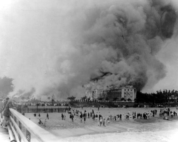
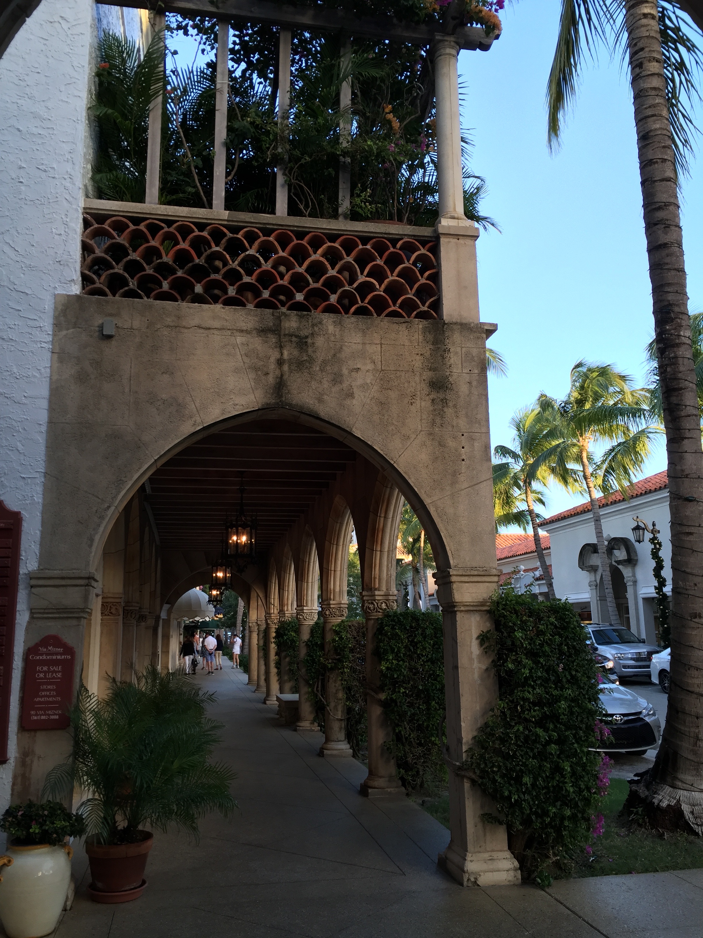