|
Reflections 2024
Series 1
January 15
SE Florida II: Tampa Wye - Miami Downtown, The 2019 Visit
| | Overview I expect this narrative to fall into this pattern: the last posting covered the history of Miami, and this follows up with my most recent visit, the first one specifically to downtown Miami, in November 2019. Expected to follow will be the history of Flagler's railroad (the FEC) beyond Miami to the Keys and Key West, succeeded by my most recent drive there, the fifth, and the first one solo. The third segment will be about Miami Beach (which is not Miami!), where Flagler never set foot--again, both its background, and then my visit, which features its fabulous Art Deco Historic District. I'm glad to see that, at the time, I assembled notes, pictures, and maps, so that now I do not have to primarily rely on memory.
Planning was a bit more complex, but I've always felt planning can be the best part of the trip, the part where initial learning takes place. The canceled trip was simple, just round-trip on an Amtrak sleeper on points, New York to Fort Lauderdale, then the ship. Changing was more fun. First a quick call to Amtrak got the travel date moved more conveniently, and extended the trip so it went down to Miami, all still free on points. As I learned much more about the three segments of the trip, I found three hotels to stay in, each one of which fit my wishes and likes precisely. Then it was just the car rental. I still do not know why some people take pre-planned tours and don't have the fun—and education—of planning it themselves.
The November 2019 visit ran for 14 nights, from the 1st to the 14th, returning on the 15th. Below is the narrative for the first section of the trip, to Downtown Miami.
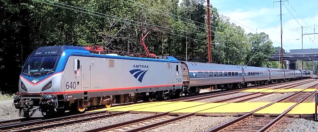
| | | | Day 1, F, Nov 1: Silver Star (1st Day) For the years we went regularly to Florida when we had our condo north of Tampa, we've driven (oy!), flown (fast, but jarringly abrupt), taken our car on the Auto Train between Virginia and Florida (convenient, restful), and taken the regular train, the Silver Star. This time, going to Miami, it was the a sleeping car roomette on the Silver Star again, by way of Tampa. After I stopped at the Club Acela lounge at Penn Station, the train left NYC at 11:02 AM. This is the 2,449 km (1,522 mi) route (click) of the Silver Star (Map by jkan997). Because the Silver Meteor has a similar, but staggered route and schedule, both routes are collectively known as the Silver Service.
https://upload.wikimedia.org/wikipedia/commons/8/80/Amtrak_Silver_Service.png
This is a copy of the SAME route map for those who wish to keep it in a separate tab for reference while reading.
In the midsection of the route, the Silver Star takes the western route via Raleigh to Savannah (Photo © by James G Howes, 2019).
Once in Florida, after Kissimmee (ki.SI.mi), it adds that side round trip to Tampa, stopping in Lakeland to discharge passengers going, and then a second time in Lakeland coming back to receive passengers, before continuing to Winter Haven.
The Silver Meteor, which I've also ridden, takes the eastern route via Charleston to Savannah. It only has a bus connection to Tampa (out of Orlando).
http://fcit.usf.edu/florida/maps/1900/photos/M012000.jpg
It would seem that the Amtrak route follows the above route in northern Florida of the former Atlantic Coast Line--compare stops like Jacksonville, Palatka, Winter Park, Orlando, Kissimmee, Lakeland, Tampa. Unfortunately all other passenger service has been lost, notably the branch to Clearwater and Saint Petersburg.
| | | | Day 2, Sa, Nov 2: Silver Star (2nd Day) In 2019/18, we discussed Tampa, Henry Plant, the Tampa Bay Hotel and more. One of the things we mentioned is the Tampa Wye, saying we'll talk more about it when we actually use it. Now is that time. Since it's been half a decade since that posting, I'll repeat the following now, explaining what a wye is for those who don't know, or don't remember. | | | | | | Anyone who's driven a car knows what a three-point turn is. If you want to reverse direction and can't make a U-turn, you pull forward into a driveway, then back out into the opposite lane, before continuing on your way in the new direction.
https://fthmb.tqn.com/KOrRMIaZeaSfebHa2mx8-8YH1OI=/960x0/filters:no_upscale():max_bytes(150000):strip_icc()/wye-584f908a3df78c491ec10dcb-5967ce1c5f9b582c35648160.jpg
Where rail lines meet, tracks would be laid out in a triangle as above called a wye in North America and a triangular junction in British usage. "Wye" sounds like "Y" and is merely a respelling of the name of the letter because of the Y-shape of the intersection. There's a railroad switch (set of points) at each corner connecting to each incoming line.
The primary use of any wye is to merge one line into a central point of another, much as a T intersection does on a road. But any wye can also be used to reverse direction, by pulling in forward onto an arm off the main line, then running backward back out to the main line via the other arm. In some cases, a "turning wye" might be purpose-built, not leading anywhere at the third point, but just to turn trains around.
|
| | | | Let's start the story here:
https://photos5.appleinsider.com/gallery/23890-30706-171205-Tampa-xl.jpg
Sad to say, rail service in Tampa is vastly simpler than it once was. You see in blue the route of the Silver Star to Tampa Union Station. The only other semblance of rail is a recent development shown in red, the new light rail line running downtown from the Ybor City neighborhood on the right. ("Ybor" rhymes with "we boar[d the train]". When Beverly and I were active in Tampa in the early 1990s, we were members of a society that successfully promoted development of that rail line, and I've ridden it end to end.
As with most modern maps, this one is more interested in showing highways than rail, but we can say the following about the blue rail route--it replaces what would have been 6th Avenue east-west. The streets go north-south, and the Tampa Wye replaces what would have been 37th Street, which you have to picture on this map, which shows 34th and 39th. Keeping that image in mind, compare this map:
http://fcit.usf.edu/florida/maps/pages/2000/f2029/f2029.gif
You can also see Union Station, and the major street in Ybor City, 7th Avenue, with the rail route one block south on 6th. On the right, you can see the Tampa Wye and its extension running north where 37th Street would be. Below we can compare today with the past.
https://live.staticflickr.com/8110/8590698284_ccc5937757.jpg
https://live.staticflickr.com/7072/7305439200_65ce600d0a_b.jpg
The first link shows a map of Tampa Bay rail routes still in use. In red is Amtrak's route for the Silver Star, coming from the north via Orlando and Lakeland to Tampa, then heading south via Lakeland and Winter Haven to Miami. The red tracks are shared by Amtrak and CSX, the freight railroad formed in 1980 by mergers that included the Seaboard Coast Line. The black lines are exclusive to CSX, including, sadly, the former line to Saint Petersburg.
I'll also mention the former Tampa Northern Railway, which went due north via Lutz (rhymes with "loots") to Brooksville, which hopes of reaching Atlanta, which never happened. I mention this for personal reasons. We lived in the Paradise Lakes resort which had a Lutz Post Office address, and regularly saw and drove over those disused tracks on the east side of the resort.
But now look at the very tiny, bent route not going very far northeast out of Tampa. That's the source of the Tampa Wye. More below.
The second link shows a rail map of the Tampa Bay area from a happier time, 1912, with much more rail opportunity and more neighborhoods served by rail. We see that the surviving line in red, which then was part of the Seaboard Air Line Railroad, not only went to Union Station, it also had a branch that served the local port area, and an extension down the peninsula to Port Tampa, which served Henry Plant's shipping lines to Key West, Havana, and beyond. Also in red, we see the full service to Tarpon Springs, Clearwater, and Saint Petersburg.
The purple line shows clearly how the Tampa Northern railroad going to Brooksville connected with the main line and even went beyond to serve the harbor. In blue is the Tampa & Gulf Coast railroad serving Tarpon Springs with a branch to Port Richey. It used the Tampa Northern tracks to reach Tampa, and both lines connected to Union Station along the main Seaboard Air Line route. SAL eventually absorbed both these small lines into its system.
http://fcit.usf.edu/florida/maps/pages/12000/f12002/f12002.jpg
But now we come to a very helpful rail map, one of all Hillsborough County. You'll recognize many routes we've already discussed: the main line Amtrak uses—the ONLY passenger service left--comes from Lakeland via Plant City; the line to Saint Petersburg is misleading when it shows Amtrak service—what is meant is an Amtrak bus connection out of Tampa Union Station (TUS). We again see the former Tampa Northern passing thru Lutz into Pasco County—this is where we lived, just over the border into Pasco, but nevertheless were served by the Lutz PO and therefore had a Lutz address.
But finally we have a complete representation of that bent route we saw, which was the Tampa and Thonotosassa Railroad.
| | | | | | When living in the region, I loved the weird name Thonotosassa, and was sure it had to be of Greek origin. I was quite wrong. It comes from two local Muscogee words, ronoto "flint" and sasv "some", meaning the location was a source of some valuable flint. |
| | | | In 1893 the Tampa and Thonotassa railroad opened a 21 km (13 mi) route between those two communities, beginning at a junction with Plant's main line in Tampa and including a station in Thonotosassa. But in 1901 the Plant System bought out the railroad, then sold it in 1902 to the Atlantic Coast Line Railroad, which in turn, extended the route to the northeast in the 1920s. By 1969, the line no longer had passenger trains and only one daily thru freight train, so it was declared redundant and most of it was abandoned. A bit remains at its far northern end, and most of the tracks in the southern end are gone, including the station in Thonotosassa. However, the southernmost section in Tampa remains under the name Neve Spur, as does the junction with the main line, the Tampa Wye, officially called the Neve Wye. Check that last map again to confirm this unusual story.
This explains why Tampa's wye appears purpose-built—but is not--because it doesn't go anywhere, or at least not much further north than its triangle.
| | | | | | I have found it infuriating about that technical name for the Tampa Wye. I've spent a lot of time online trying to find its origin, and the name Neve is not explained anywhere I could find. I also had no idea how to pronounce it, until I came across a video where Neve was pronounced to rhyme with the name "Evie". I find this situation irritating, and will ignore that word and continue calling it the Tampa Wye. |
| | | | While I was riding the Silver Start this trip, I was in constant email contact with friend Dave Irish, who was then still a Manager at Amtrak, and he followed my progress, sort of as a virtual traveling companion. As we neared Tampa, I mentioned the wye, and how I'd gone to see it by car when we were still active in the Tampa area. Here is my email description of the experience to Dave as it happened. | | | | | | As we speak, it's 12:50, and we just made a right turn (north) into the wye in the Ybor City neighborhood of Tampa.
It's a couple of minutes later, and we just started backing out of the wye.
We're backing out over 6th Avenue (7th Avenue to the north is the main drag) and traffic is lined up waiting for us (most likely, cursing us).
We're pulling back onto the single-track main line, and my window is such that I can look up the track to where we just came from.
We're now backing in to TUS.
|
| | | | This is my preferred YouTube video (of several) of the Tampa Wye (4:13). Maddeningly, the Tampa Wye is referred to as the Neve Wye in all of them, and even after my digging, I cannot figure out why, and neither can Dave.
At 0:45, you can see that the track it's pulling north on is quite distinct from the track it will be leaving on, on the right.
At 2:00, the train stops, and you can see the conductor in the end car, who will be giving signals to the train driver (US: "engineer"). Thus the conductor will be the eyes and ears of the operation and will be "driving" the train remotely, from the rear. The actual train driver, now really in the rear, might as well have a paper bag over his head during this operation.
At 3:55, you can see that the train is backing out over the tracks on the right to reverse its direction, having arrived on those tracks on the left.
Later on, Dave told me about his experience with the Tampa Wye while working for Amtrak.
| | | | | | My story about the wye at Ybor City: Well, when our training group was immersed in conductor classes at the Wilmington, DE training center, I was traveling to Miami on business. We had to teach trainees how to read signals and call them out to the engineer, as well as pass hand signals in case of radio failure. That wye leading to the Tampa station presented the longest backup move on the system and I was bound and determined to experience it. Most Amtrak managers traveled to Florida on the "Meteor" but I wanted to travel the "Star" for (1) the backup move and (2) a different route (inland) from what I normally traveled. . . . I positioned myself on the rear end of the train observing the whole show with the conductor and trainmaster. It was pretty impressive since the conductor had to regularly call out track conditions to the engineer and keep a hand on the backup hose in case he had to "dump the air" (put the train into emergency braking mode). A radio failure could precipitate this or a sudden, unexpected obstruction like an auto at a grade crossing. The crew was very professional and conducted the whole move just like the textbook (and I told them so). I only wish all of our trainees could experience this kind of operation in training. Trust me, controlling a 500 ft backup move in Penn Coach Yard in Philadelphia pales in comparison. |
| | | | Using the Google Map Distance Tool, I find that the distance from the northern point of the wye triangle to Union Station to be 2.22 mi (3.57 km), which indeed is considerably more than the 500 ft (152 m) Dave mentioned in the Penn Coach Yard in Philadelphia. Just imagine driving your car backwards for that distance—and this is a long train!
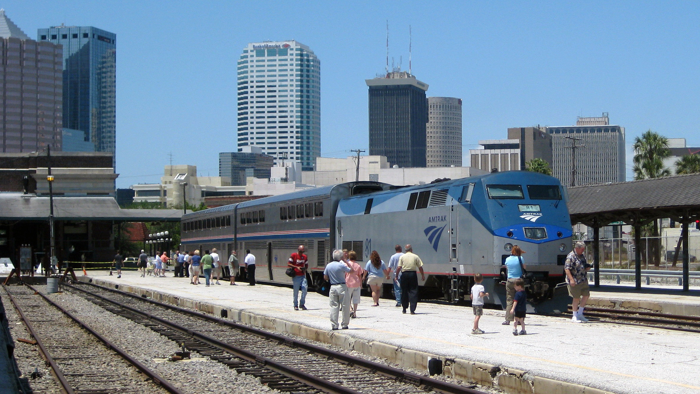
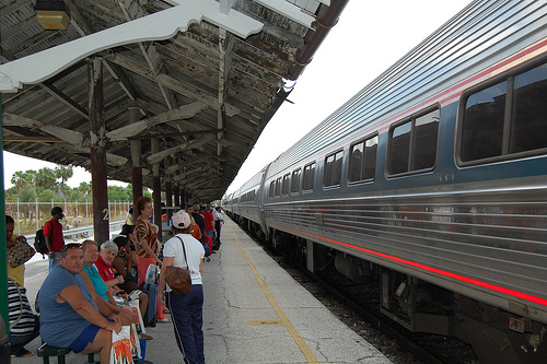
Finally, let's get to Union Station, where this train is located (Photo by TampAGS). It's not a train normally found here, but is Superliner equipment, normally seen in the West, brought here specially for display at festivities for National Train Day 2009. Still the train has its back to the station building and to downtown Tampa and had to have already been turned around in the wye, and is now pointing away from the station and ready to leave eastbound, inland. This, however, shows passengers waiting to board the Silver Star (Photo by Jmcquigg). The station is behind us, and the train is pointing east, ready to travel inland.
As we continue beyond Tampa, to plunge again momentarily back into the past, pre-CSX (also pre-Amtrak), this is the map of the Seaboard Air Line within Florida in 1936 (click) showing the extension of its routes into South Florida built in the 1920s, where Plant's west coast service suddenly swung across Florida to rival Flagler's east coast rail route, the FEC. If you compare the Silver Star route with this one, after we do our doubling back to Lakeland, we seem to pick up this route at about Winter Haven, and stop at Sebring, Okeechobee, and West Palm Beach, finding ourselves parallel to, and slightly west of the FEC route to Miami, both of which are still in use today (the older map shows service on both continuing beyond Miami to Homestead, which is no longer the case).
| | | | | | As to the name of the Seaboard Air Line railroad, we must repeat something we discussed in the past, because it's so much fun, showing how language changes with technology.
Back in the 19C and early 20C, people did not travel in the sky—the very thought would have been absurd. It was only when air travel became a fact that the word "airline"—no space--referred to planes in the sky. However, many railroads used the term "air line"--with a space, also spelled "air-line" with a hyphen--to indicate speed and a direct route—Wikipedia lists over 50. The term could also be used for a regular straight road, such as an "air-line road".
We'll also repeat this period advertisement for the Seaboard Air Line Railway from 1902—note her dress—where she shows that the SAL route is "straight as a plumb line" from the north to Florida. If you know your railroads, also note the dig,< that Flagler's FEC running down the east coast of Florida is "not as direct", and this includes travel to Key West and Havana.
While that usage died with the arrival of the air age, we continue to have a similar expression today, "bee line", as in "he made a bee line for the free buffet" indicating a straight and quick route.
|
| | | | We continued to Miami and its remote terminus. We were due in at 5:58 PM but were about an hour late. I'd checked in advance that sunset that day in Miami was at 6:39, meaning it was still twilight when we arrived, as I was concerned about arriving in darkness. You'll see why.
Amtrak's Miami station is not in Miami proper, tho it is within Miami-Dade county, but does that really count? Its address is 8303 NW 37th Avenue. When it says NW, you'd better believe it. Measuring from what we can call "point zero", the main intersection in Downtown Miami from which street numbering emanates—my hotel was a few blocks from there—the address tells you that the station is 37 avenues to the west and 83 streets to the north. You can't get much further into the boondocks.
| | | | | | For non-US readers: "boondocks", I word I like, is a US term meaning "backwoods", "remote area". I now learn it's a US term with good reason, since it developed during the US occupation of the Philippines in the early 20C, reinforced during WWII. I find it comes from Tagalog bundok, "mountain", tho US usage construes it as a plural, just as "backwoods" is construed as a plural. |
| | | | This next map can show how far into the boondocks the station is located:
https://miamigeographic.files.wordpress.com/2014/05/metrorailcities_mg2.jpg?w=768&h=1024
Everything shown here is within Miami-Dade county, with the Metrorail system superimposed. Toward the top, note the stations called Hialeah (in the City of Hialeah), Tri-Rail, and Northside (in the unincorporated district of Northside, specifically the area called West Little River). The Tri-Rail (and therefore also Amtrak) route coming in from the north divides Hialeah from West Little River, but the Amtrak station--in West Little River--is four blocks north and one block east of the Tri-Rail/Metrorail transfer station and is confusingly NOT made to coincide with it. But this will be our route to Government Center in Downtown Miami. Is that far enough in the boondocks for you?
It will be clearer if we look at this schematic map we've seen before of the Miami rail system (Map by FrickFrack). The ex-FEC route is in yellow on the right, used by Brightline to go directly to the new Miami Central station adjoining Government Center. The ex-SAL route is in pink on the left, used by Tri-Rail to zig over to Miami Central. The gray dot is the Amtrak Miami station, on the same ex-SAL route, but tantalizingly north of the Tri-Rail transfer station. There has been talk of Amtrak continuing on to Miami Central, but that wasn't the case in 2019, and to my knowledge, still hasn't happened.
So simply put, southbound arrivals on Tri-Rail can transfer directly to Metrorail, but when I arrive southbound on Amtrak on the same track, because of the separate station, I have to hoof it for several blocks, taking 10 minutes (1 km, a half mile), to do the same. Does that make sense? Welcome to Florida.
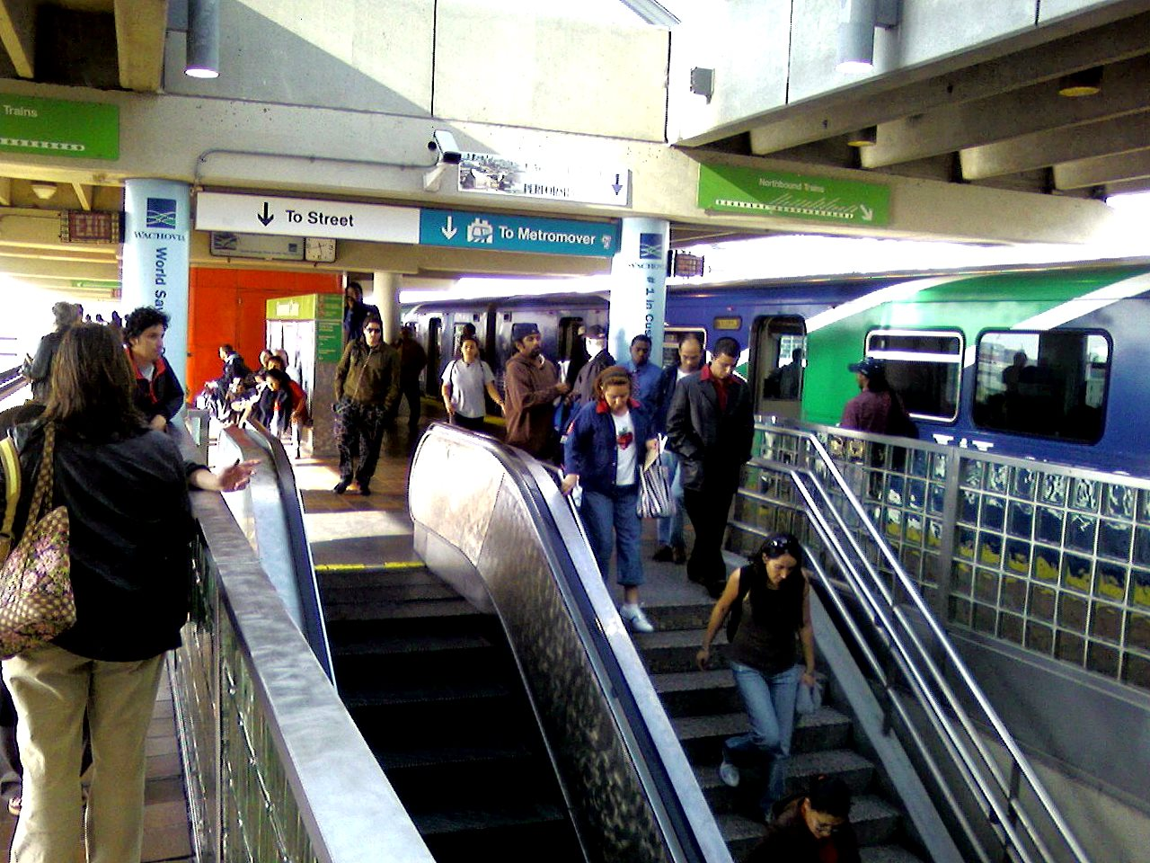
So we arrive at the Amtrak station in the boondocks in the twilight hours (Photo by Phillip Pessar), and passengers make their local connections. I however, turn to the right down that slope with my wheeled bag to walk south on 37th Avenue for four blocks from 83rd Street to the Metrorail elevated structure on 79th. To my amazement, no other passengers join me. To boot, I encounter absolutely no one else in these local streets filled with closed auto repair shops and the like. I'm glad it's still twilight, tho still a bit creepy. Reaching the el structure, I turn west for a long block underneath it, and tantalizingly, walk over the Tri-Rail grade crossing to reach the transfer station.
This is a view of the transfer station showing mostly the Tri-Rail part (Photo by Phillip Pessar). The Metrorail el structure (in black) is mostly hidden behind the tree on the left. The white structure is an overpass for Tri-Rail passengers to cross the tracks, which contrasts with the grade crossing underneath the el structure I was forced to use.
This view to the south from the white overpass makes things clearer (Photo by Joedamadman). The Metrorail el structure is in the distance, and you can see (click) two white trucks at the grade crossing I had to use to reach the dual station on the right. This major transfer point is one of the busiest stations on the line for Tri-Rail, tho oddly it's one of the lowest in ridership for Metrorail. In retrospect, I suppose I could have taken Tri-Rail to Miami Central—you see a train—but I chose to use Metrorail. I entered the dual station and bought three tickets from the machine, then I took the elevator up to the Metrorail platform.
The three tickets involve the pre-planning I like to do. One was for Metrorail now. But two weeks hence, I'd be going home from Miami Beach, which has no rail service. So the second ticket was for a city bus I'd checked out that would take me to Government Center in Miami, where I'd use the third ticket for Metrorail back here, followed again by that walk up to Amtrak was in the late morning, and less irksome.
This is a Metrorail train on the elevated part of the transfer station (Photo by FrickFrack). It was then ten stops on Metrorail to Government Center (Map by Howchou), where the transfer to the free Metromover was a simple delight--just going downstairs--especially compared to the previous "Amtrak hike" (Photo by FrickFrack).
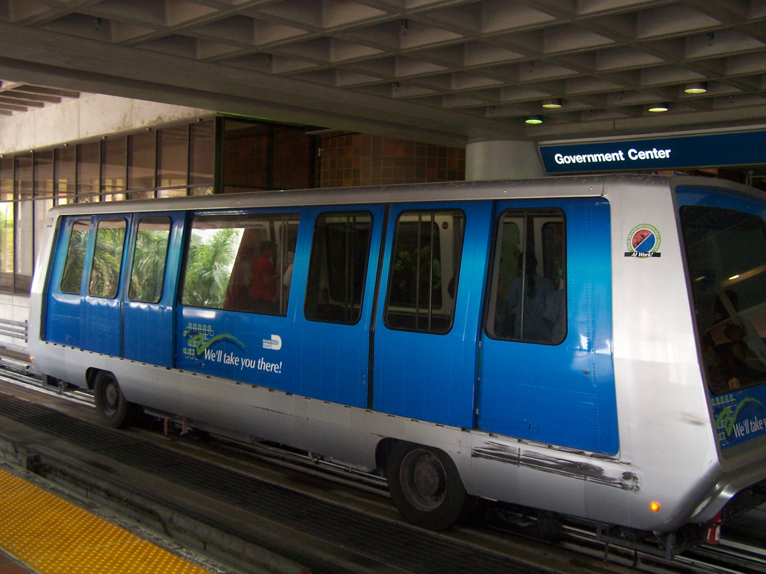
This is one of the frequently arriving Metromover cars in the lower level of the Government Center station—note the rubber tires (Photo by Miami92). Since trips are short, the cars consist of mostly standing room, with minimal seating (Photo by Ed Webster). However, those wide window sills trimmed with metal bars do tend to be used as what I like to call short-term butt-resters.
If Amtrak had come downtown, I would have had a two-seat rail trip, but as it was, it became a three-seater (with no seat here!), plus that walk. So at the end of a long rail day, I got to know the Metromover, as seen in this detail of the previous map, updated (Map by Howchou). The central section consists of a very irregular oval around Downtown, with three routes connecting eight stops. The light blue route runs clockwise, and just stays Downtown. The other two routes I like to think of as "lollipop routes", which circle downtown, but also have a long "stem" away from the center. The gold route runs counterclockwise, but includes a run south to Brickell. The dark blue route also runs counterclockwise, but includes a run to the north. Since I knew my stop was the Knight Center, it was obvious that I'd take the dark blue route for two stops to conclude a long rail travel day—actually two days.
| | | | The Hotel When I chose the Courtyard by Marriott, I also had an option to get a hotel in Brickell, but I definitely wanted to be downtown. I also knew in advance that this hotel had easy rail access. It was a very nice, mid-range hotel, but I only realized the totality of its advantages once I got there.
https://miami-history.com/wp-content/uploads/2019/10/Miami-StreetMap-Pre1920.jpg
LOCATION: First, we've already talked about its incredible location, but incredible only to those who know the history, since it's a HIC LOCUS EST ("this is the spot") moment--but with absolutely nothing to see. You have to KNOW where you are. On this old map we've seen before, find SE 2nd Street cornering on what would be SE 2nd Avenue ("2nd & 2nd") and you'll find that the hotel is located on the northeast edge of Julia Tuttle's former property, with my window facing east to some non-descript building, but which had been the location of the Royal Palm Hotel with the former hotel park to its north. If you're looking for the (invisible) history of Miami, this is the place to be.
DOUBLE FREEBIES: My two nights would have been free on points, but it was better than that. 2019 was the first time I got a Free Night Certificate from Marriott, issued on renewal of the AmEx credit card. I used that for the first night, so I didn't even use up points, making it a double freebie; I did use points for the free second night.
The only other time I was able to use a certificate as part of an actual trip was in 2022 in Buffalo, also with the second night on points. I didn't want to waste the certificates in 2020, 2021, and 2023 but had no trips on which to use them, so each time I used them instead to cross the Hudson for a free single night in three different fun locations in New Jersey.
RAIL TO HOTEL ROOM DOOR: It's an exaggeration to say that it turned out that I had rail to my hotel room door--but not much of one.
https://live.digitalphotoacademy.com/wp-content/uploads/2014/06/bayfront-park-miami-map.png
At the bottom of this map, find the Courtyard by Marriott at 2nd & 2nd. It fills in the eastern part of a city block. The western part is occupied by the Miami Tower. Now the Knight Center is a convention center to the south of those yellow roads, which is the I-95 feeder we'll use in two days, but to my surprise, the Knight Center Metromover Station wasn't across the highway but adjacent to the Miami Tower on the same block as the hotel!
| | | | | | The Miami Tower is a 47-story skyscraper that happens to contain the offices of a law firm my Board of Directors of Eden Bay used to use, so I've driven here from Tampa in the past, not realizing now that the hotel was next to this same building! |
| | | | This is the Miami Tower. Click to see the Metromover entering the station WITHIN that low building joined at the hip to the Miami Tower (Photo by Averette). Where the train exits can be seen (click) the pink sloped-roof back of the Marriott Courtyard, on that end of the block. Again, the I-95 feeder we'll be using to go to the Keys is in the foreground.
The station leads to the lobby of the Miami Tower, which exits directly onto SE 2nd Street, where a right turn and a few steps takes you to the north entrance of the hotel.
| | | | | | This hotel/rail connection is just as good as the one we had some years ago in London. We'd arrived by ship at Southampton and took a train into Victoria Station. I'd earlier found a historic hotel physically joined to the station where we spent the night. The next morning we just walked back into the station to take the Orient Express to Venice. This Miami rail/hotel connection was just as convenient. |
| | | | I also have the view from the other side.
http://d643vpbj5tmkd.cloudfront.net/imageRepo/1/0/29/961/433/miadt_phototour36_P.jpg
This is the Courtyard by Marriott as seen from 2nd & 2nd. The walk from the lobby was on SE 2nd Street on the right, to a side entrance to the hotel. An elevated Metromover train is on the left.
I settled in, and had dinner at the hotel. It was the weekend that daylight savings time ended, so we gained an hour, and it was a good time to get an extra hour of rest.
| | | | Day 3, Su, Nov 3: Downtown Miami On previous trips, I at most drove thru downtown and never paid much attention to it, including the Miami River. But this time was the first that I actually stayed overnight downtown and wanted to see what I could find out. I spent one day walking around the area, and was surprised at my conclusions. Granted, it happened to be a Sunday, which is not a good time to judge a place, and Sunday morning might have been a particularly unfortunate point in time, but that's the way it worked out. Let's use this excellent Moon map to guide the day, as well as our departure the next morning.
https://i.pinimg.com/originals/91/ac/e2/91ace2c3429ed92c23b9a7b6a489d2f8.jpg
First orient yourself based on the Knight Center Metromover station in the Miami Tower in gray, with the hotel to its left at 2nd & 2nd. The four city blocks over to Miami Avenue and down to the river are the remnants of Julia Tuttle's land, with the sad little Fort Dallas Park the only historic highlight. The site of the Royal Palm Hotel would be roughly the four city blocks to the east. You see how the actual Knight Center is across the access ramps to I-95 that we'll be driving on tomorrow morning.
I'd like to start with the decisions I've come to about Downtown. I had pictured a lively, modern center city filling the area surrounded roughly circled by the Metromover, and that was not the case. I found four areas I'd like to mention to describe my opinion of Downtown Miami today.
MODERN CENTER I found that the vibrant, modern center city I expected does exist, but in limited form as the petite neighborhood I just described in the southeast corner of downtown. It abuts Brickell, which is significant, since it reflects Brickell, and is a carry-over from Brickell, the true modern downtown of Miami. Let's draw its borders as Miami Avenue to Biscayne Boulevard, from the river north to maybe SE 1st Street.
RAIL CENTER Over on the west side is the Government Center station, as well as Miami Central (not shown). This had been the site of Flagler's station and rail route as well as of the original Court House and City Hall (the present City Hall is in Coconut Grove). I got a feel for this neighborhood when arriving last night, and when I came in on the city bus from Miami Beach on departure, but it was lively both times, with people scurrying about.
BISCAYNE BOULEVARD On the east side, the Biscayne Boulevard area seemed to be a rather lively recreational area, with several points worth visiting. While there is considerable commerce on the western side of the boulevard itself, it doesn't really scream "downtown".
THE SLEEPY 1920s Now look at everything else in between these areas. This was the heart of Miami in its heyday in the 1920s, and has not changed significantly since then. Just for that reason, it reflects nicely the period vernacular architecture of that period, but does not reflect exceptional modern urban growth or health. It contrasts sharply from the other areas described, especially from the "modern center".
| | | | Visiting Downtown Miami I got an early start on what would prove to be a very hot day. Before I started my tour, I wanted to check something out that was on the route anyway. I went west a half-block to Miami Avenue, then north a half block (follow on the map). Under the el structure, there was a curious gated passageway with businesses leading to an inner courtyard. I'd checked before I sought out an address I'd found online before leaving home to find an interesting restaurant for this evening, and finally found the Meraki Greek Bistro in this courtyard, with umbrellaed tables. It was of course closed on a Sunday morning, but the door was open and I went in to check it out. It was empty, except for two men sitting at the bar, who turned out to be apparent owners. They were very friendly, and I told them I planned on coming in for dinner that evening. I'm so glad I did this, because that dinner—and evening--turned out to be the most memorable of the entire two-week trip.
POINT ZERO I then zigged over to Miami Avenue and up to Flagler Street, to see my first point of interest, the intersection from which all streets and avenues are numbered, which we can call point zero. But apparently even Miamians pay no attention to this point. Again, it's a matter of having an interest in this sort of thing as I approached another HIC LOCUS EST, with absolutely nothing to see other than four nondescript buildings on each of the four corners. But this is the intersection that defines the four quadrants of the Miami street grid: everything is either north or south of Flagler Street, and either east of west of Miami Avenue (which, in my not-too-humble opinion, should have been named for Tuttle).
The building on the SE corner is the first one in the SE quadrant, probably the smallest quadrant, leading up to, and being hemmed in by, Biscayne Bay, but also running down thru Brickell and beyond. This quadrant includes all of my "Modern Center".
The building on the NE corner leads into the NE quadrant, also up to the Bay but running north, very likely the second largest.
The NW corner leads you-know-where, and runs way up into the boondocks, up to and beyond the distant Amtrak station. We can mention now that, when the grid was laid out, not everyone accepted it. In this quadrant was notably the city of Hialeah, which kept to this day its own numbered grid. For example, last night when I walked under the el structure to the transfer station, along Miami's NW 79th Street, once I walked over the Tri-Rail tracks I was instead for a few steps on Hialeah's E 25th Street, which is the address of the ticket booth. In the N-S direction, while I had walked down Miami's NW 37th Avenue, the next avenue west would have been Hialeah's E 11th Avenue. Crazy? Again, welcome to Miami.
The SW corner leads into what is surely the largest quadrant in Miami, SW, which runs perhaps "to the moon". We'll see this tomorrow driving down to the Keys. At Homestead, Miami's SW street numbers just break into the low 300s, but then surprise! Homestead has its own numbered grid, and then Florida City even has its own as well. Just south of that, I do see a SW 352nd Street, would seem to be the end of it. But in the marshlands below that on the way to the Keys, occasional odd side roads, some semi-abandoned, have higher numbers still. I've found a SW 360th Street, and the southernmost one I've found on a map is SW 424th Street. It's not exactly the moon, but perhaps that's next.
https://maps.lib.utexas.edu/maps/historical/miami_fl_1919.jpg
Back in Downtown Miami, there's good reason that this intersection doesn't appear special, since it was never purpose-built to be such a point zero, but was an afterthought. As the above map we've seen before will remind you, in the first street grid of earliest Miami, Flagler Street was originally simply 12th Street among other numbered streets, and Miami Avenue had been Avenue D among other lettered avenues. This map dates from 1919, and the current grid was conceived in 1920 and implemented in 1921, so we've just had its centennial. The present Miami street grid is called the Chaille Plan, named for the city councilman who implemented it, Josiah Chaille. The name seems to be of French origin, but I'm advised it's been anglicized so that Chaille rhymes with the second part of "shilly-shally".
Given the hindsight of a century, we can see that point zero was placed way off the mark. Since both SE and NE are so insignificant, given that, if you'd still want to measure from Downtown, it would have been better to have had Biscayne Boulevard as a starting point, with no east area at all, everything lying to the west, but with Flagler Street still dividing everything into simply a NW or SW, and nothing more. But surely in 1920, this point did seem to be in the center of things, and no one could have imagined so much expansion westward, particularly southwestward.
I continued north on Miami Avenue and found very few people on this Sunday morning, a number of which were homeless and sitting on steps. The outlook was dated, often drab. There was little there that was really compelling a visitor to enjoy Old Miami, other than an interest in the architecture of the period. Fortunately, I'd checked, and had notes from, Michelin Florida, which advised me to look for the Weddell Building and the Chaille Block, both located on Miami Avenue. And so I did. Neither was given any stars, so nothing here is earth-shaking, but I did enjoy the experience. This early 20C style was called a new subtropical style, and involved "vernacular storefront architecture with verandas covering sidewalks". "Vernacular architecture" is defined as "relating to the common building style of a period or place". Sounds good to me.
WADDELL BUILDING Only a half-block up from point zero I found the Waddell Building, dating from 1912, and given its history, its location makes great sense. Once the new "point zero" was established, this block of "Avenue D" just north of "12th Street" was heavily influenced by an early pioneer in that decade, E A Waddell. Many of the original buildings are now gone, but the one named after Waddell is still there.
https://farm8.staticflickr.com/7283/16395994110_7d3ac56243_z.jpg
https://c1.staticflickr.com/9/8675/16070645130_23f7645974_b.jpg
https://miami-history.com/wp-content/uploads/2015/01/2015-0111-WaddellBuilding-04.jpg
The first picture was taken at the new point zero in 1929. On seeing this picture, I immediately recognized the location because that double-arched structure, the Waddell Building, is still there, and I saw it on my walk. The second picture is contemporary as you approach it, but note the downmarket stores below. The third picture looks back at it.
The building represents a style very prevalent in the early part of the 20C, which offered both a storefront ground level and a second story featuring a balcony, for either hotel or apartment dwellings. The style is called Vernacular Commercial and was appropriate for the time because it combined both retail and residential opportunities in a growing urban area. But also keep in mind this was pre-air-conditioning. The balcony offered a place for upstairs residents to seek out cool air—unusually, even it is roofed-over--and the structure also protected sidewalk strollers from the weather. This is one of Downtown's last surviving examples of this style.
CHAILLE BLOCK Now walk with me in the heat, sitting down occasionally, for four blocks north, to the east side of the avenue between NE 4th & 5th Streets to a row of low buildings called the Chaille Block—we now know whence that name came—and you needn't shilly-shally in pronouncing it. These buildings vary in dates between 1914 and 1919. This is the Chaille Block looking north from NE 4th (Photo by Phillip Pessar). These stuccoed concrete buildings do indeed fill the entire city block up to NE 5th, where we can see the Metromover structure, which we'll be using in a moment. The block consists of five buildings; we see three standing out, one in salmon, one in teal, and the far one in cream. They are all considered as one unit on the National Register of Historic Places.
On this first salmon building we recognize the arcade with the shop front level having a covered sidewalk, also the covered balcony, then, uniquely, a second, roofless balcony. The crest of the building (click) says "Dade Apartments". The teal one does have a canopy over the sidewalk, but has no balconies.
The Chaille Block is the only intact downtown commercial streetscape dating from the 1910s and is a unique, remnant of the history of Miami's commercial development.
| | | | | | However, the looming gray hulk behind this streetscape visually spoils the image somewhat, and it gets worse when one discovers that it's the FDC Miami, a Federal Detention Center—a jail for the Federal courts. Worse still, the visible front portions of the Chaille Block buildings have been incorporated into its design. But presumably, that's the cost of preserving them. |
| | | | When walking up to NE 5th to get the Metromover, we get this view back:
https://www.theworldorbust.com/wp-content/uploads/2012/01/IMG_2338-1024x768.jpg
It shows that the cream building is most similar to the Waddell, since above the storefront level covering the sidewalk is a single, covered balcony. Click to see that this one is actually labeled in its crest "Chaille Building 1914". It's a magnificent streetscape, and more people should come and see it.
Our map shows us that just turning the corner, in one block we reach the College North Metromover station. We're only going one stop—out of the loop—to the Freedom Tower, which is walkable, but 1) it's fun to ride the Metromover, and is free, 2) every station has an elevator up from street level, and 3) it's hellishly hot, and the cars are air-conditioned. So up we go.
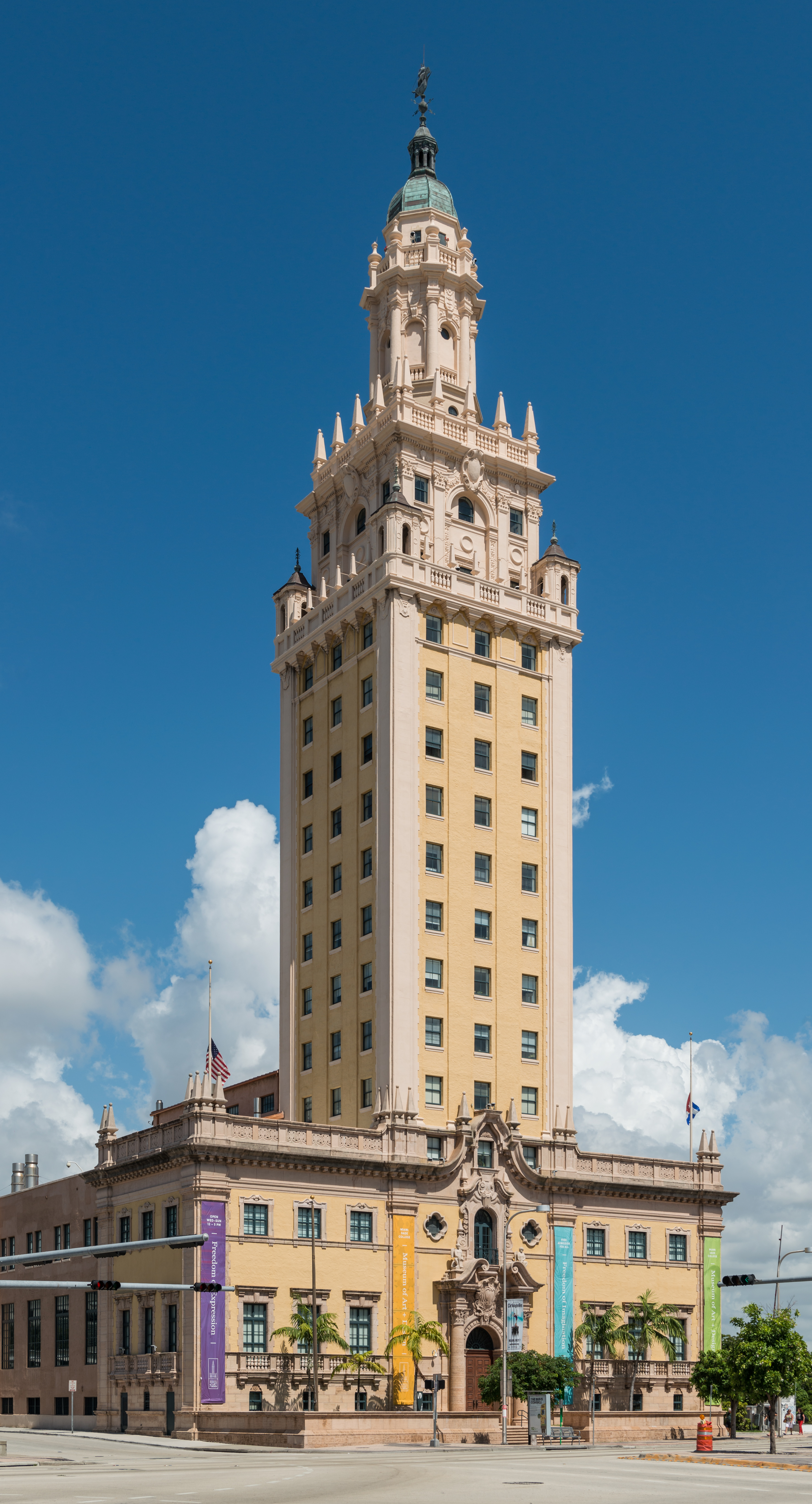
FREEDOM TOWER The building now bearing this name was completed in 1925 (our historical era for the day thus far!) as both headquarters and printing facility for a now defunct newspaper, the Miami News, which was a evening competitor for most of the 20C of the morning Miami Herald, which famously still exists. Look back at our map and you'll see the rail line in black that passes to the north of the building. This is the line we'd discussed as a potential route for a boat-train in the Port of Miami, but nothing has come of that. However, back in the day, trains would deliver large rolls of newsprint directly to this building to print the newspaper, since it was actually printed on-site.
| | | | | | Curiosity always gets me to delve into more research. What was the background of the Miami News? When I looked it up, I was shocked to find out where it came from: it was founded in 1896 as the Metropolis. Does that name ring a bell? Or more so, the date? While the history article didn't mention it, The Metropolis was the name of the newspaper founded by Henry Flagler when he arrived in Miami that year. We said this in the last posting: To further develop the area beyond building the station and hotel, Flagler dredged a channel, built streets, instituted the first water and power systems, and financed the town's first newspaper, the Metropolis. It was an unusual name for a place that still had so few inhabitants.
In 1923, a new owner took it over, and renamed it the Miami Daily News-Metropolis; in 1925 it was shortened to the Miami Daily News, and in 1957, shortened further to The Miami News. But losing money, despite having won five Pulitzer Prizes on various subjects, the paper ceased publication in 1988, despite its long history going back to Flagler.
|
| | | | In any case, with its 1925 name shortening to the Miami Daily News, the paper had a new, handsome building erected for itself, and what was then called the Miami News Tower was dedicated that same year. However, with the further shortening of the name in 1957 to The Miami News, the paper vacated the building to locate to a new facility on the Miami River. A few years later, with refugees fleeing Fidel Castro's Cuba during the 1960s, the federal government used the building to process, document, and provide medical and dental services for the newcomers. This was the point where the building was renamed the Freedom Tower (Torre de la Libertad). Today the building is part of Miami Dade College and is used as a contemporary art museum with and central office for different disciplines in the arts.
I find the building now called the Freedom Tower to be spectacular, here seen in a view from the southeast (Photo by DXR). Above a 3-story base rises a 12-story tower. It's on the National Register of Historic Places and is a National Historic Landmark.
Architecturally, it's an example of the Mediterranean Revival style and includes design elements, notably the cupola, borrowed from the 16C Giralda in Seville (Photo by Quoique). As you know, La Giralda is the bell tower of the Seville Cathedral, a UNESCO World Heritage Site. Under the Moors, it had been a minaret to a mosque, the minaret being completed in 1198. When the Catholics converted the mosque into a cathedral, they made the minaret into a bell tower and added a Renaissance-style belfry to the top between 1558 and 1568. Thus La Giralda as we see it today is considered a 16C structure. It's not the same as the Freedom Tower, which nevertheless does pay homage to it in style.
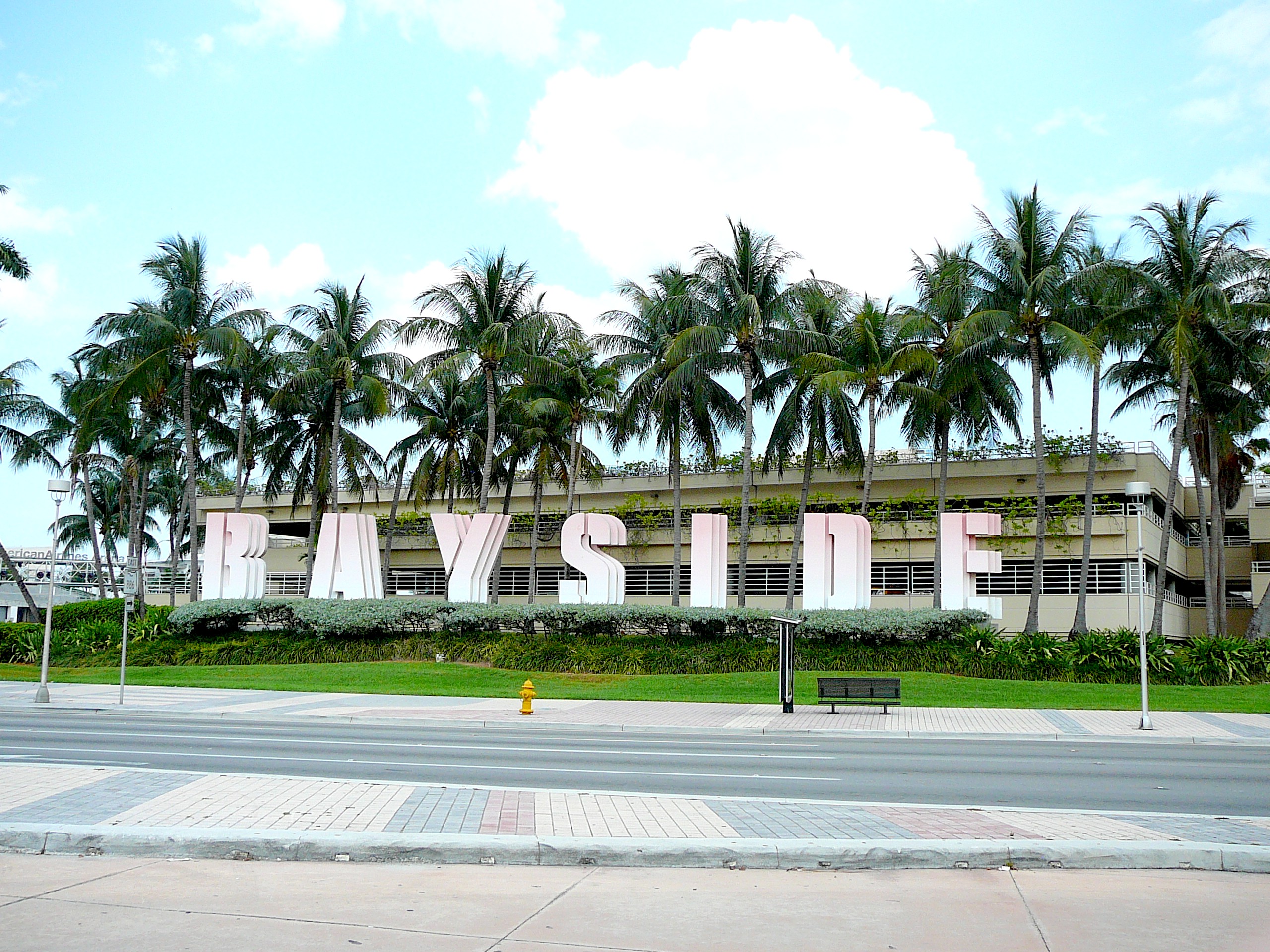
Arriving at Biscayne Boulevard, the scene became more lively, with more people about. I crossed over diagonally to the Bayside Marketplace to get a better view of the Tower from a distance. I note on the map now that nearby was the American Airlines Arena, which I only mention for those who pay attention to sports venues, which I do not. I also note that the year of the visit, 2019, was the last year it had that name, which has changed a number of times since. Those interested in organized sports will know—and care—a lot more about it than I do.
BAYSIDE MARKETPLACE Nor am I an avid shopper, and rarely buy things when traveling, but I did visit (quickly) the Bayside Marketplace--to great disappointment (Photo by Marc Averette). I was hoping for a bit of air conditioning, but the two-story building is open air. I didn't want to shop, and didn't need more hot air, especially indoors. It does have live music, restaurants, bars, and family events. In addition to 140 shops, there are over 50 carts and kiosks in and around the building, as below.
http://www.baysidemarketplace.com/images/gallery/2018/Bayside-Marketplace-21.jpg
To my great shock, I find that the Greater Miami Convention & Visitor's Bureau calls it the number one most-visited attraction in Miami. (!!!!!) Forget upscale, even mid-market. It's all a down-market venue and of no interest to me. And without air conditioning!
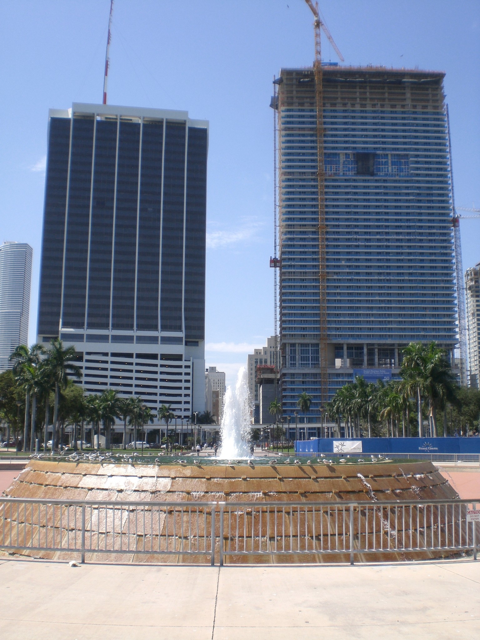
BAYFRONT PARK As we walk south on Biscayne Boulevard we reach the large Bayfront Park. Until 1924 (our era again!), the waters of the bay ran along the edge of Biscayne Boulevard, facing the hotels and businesses on the west side of the street. The city was booming, its population soaring, and it was decided a roomy public park on the bay would be ideal.
Hindsight again: the park is roomy and fine, but the low population of Downtown today isn't what seems to support it—people come in from other neighborhoods and beyond.
https://miamigrid.files.wordpress.com/2019/06/bayfront-park.png?w=779
This aerial view shows the boulevard and the extent of the landfill area added since 1924, exactly a century ago. Freedom Tower is in gold at upper left (click) alongside the causeway below the arena with the rail tracks and road that lead out to the Port of Miami; Bayside Marketplace is the set of large buildings south of the causeway next to the Miami Marina; south of the amphitheater is the park proper, with the spectacular round main fountain in orange. The bottom of the park (see map) is Chopin Plaza. Follow it west under the Bayfront Park Metromover station and you'll again be on "my" SE 2nd Street; go west two blocks to find the 2nd & 2nd intersection and the hotel (not named).
Below is another aerial view of the park, but at an angle, from the Freedom Tower to the "orange" fountain. It also shows how built-up Biscayne Boulevard has become.
https://img2.10bestmedia.com/Images/Photos/298797/295746-236296846432033-460336117-n_54_990x660.jpg
I am going to assume that on a "normal" Sunday, Bayfront Park might be reasonably busy. But as it turned out, this was not a normal Sunday, and the park was teeming with people. I soon found out why. Most people seemed to be carrying a special map of some sort—it seems some organization had sponsored a scavenger hunt in the park for the day. Thus, people were running about playing the game, and the park was quite lively. In addition, there was music; at least one bandstand, and elsewhere, a choir was performing. Being in the park was even more pleasant than normal.
Look at the "orange" fountain in the last photo. I made my way there and sat down near the Bay to catch the breeze, all while enjoying the fountain (Photo by Averette at English Wikipedia), also looking west beyond it at two buildings on the west side of Biscayne Boulevard—click to see the Metromover in the foreground.
I had one more thing to see before I left the park, something I'd only recently found out even existed. Just south of the fountain I found it without even having to ask—it was the statue we discussed in the last posting of Julia Tuttle (Photo by Alexf). The only other reference to her in Downtown Miami—no city street is named for her--is the Julia Tuttle Causeway across Biscayne Bay to Miami Beach, which leaves Miami on NE 36th to NE 39th Streets, which is hardly in the center of Downtown.
Anyway, the bronze statue dates from 2010 and shows her in the typical turn of the 20C style. She is holding oranges in one hand and a bough in the other, for those who want to give credence to the fairy tale. But what's so unusual about the statue is that Miami and southeastern Florida are pictorialized on her skirt. Walking around the statue, one sees Native Americans, an alligator, a train, shaking hands, an egret, a spoonbill, the Royal Palm Hotel, more. It's a rather nice way to represent history, and I'm glad I found the statue.
Afterward I checked out my car rental nearby for tomorrow morning, then took the Metromover from the Bayfront Park station to the Riverwalk station. But it's not what you think. Look again at the map (Map by Howchou). While it seems to be just two stops away, I had to take the gold line counterclockwise around the entire loop to reach Riverwalk, on the way to Brickell. But it's just seven stops, and didn't take long.
MIAMI RIVER & RIVERWALK The Riverwalk station, very modern in style, is well located—compare this view with the Miami map (Photo by Averette). It's very close to the hotel (that's SE 3rd Street in the lower right). We see (the pitiful remains of) Fort Dallas Park, heavily fenced in and inaccessible. Barely visible thru the trees is the Riverwalk itself along the Miami River, and Brickell is on the other side.
We've talked enough about Fort Dallas Park, but will just add this picture of one of the buildings, the Palm Cottage (Photo by Ebyabe). As we said earlier, it's one of the houses Flagler built for his workers, moved here. It's notably in Flagler Yellow, as were many of his buildings, including the Royal Palm Hotel. It's the last known building in Miami directly associated with Flagler. Built c1897, it was one of at least 30 rental houses Flagler built for workers building the hotel. It's on the National Register of Historic Places. However, it looks nicer than it is. It needs restoration, and to my knowledge, is still not open to the public.
Our Miami map shows only regular city streets, so it's hard to tell where the Miami Riverwalk is as the footpath runs quietly, primarily along the north bank of the calm Miami River. At least for now, the Riverwalk starts under the I-95 overpass (see map) and passes under the SW 2nd Avenue Bridge, Metrorail, the South Miami Avenue Bridge, the Metromover (which we'll use again in a moment), and finally the 1915 Brickell Avenue Bridge we've mentioned before, connecting SE 2nd Avenue with Brickell Avenue on the other side. Given the heat, I only walked downstream a bit and back, but did see (click) the Brickell Avenue drawbridge open, tho it's closed in this view (Both Photos by Marc Averette). Click to see, appearing stark black, the bronze column with the Tequesta Native American family at the top on the southeast corner of the bridge. I was pleased to see on my side a well-attended outdoor café with umbrella tables on a large terrace on the Riverwalk.
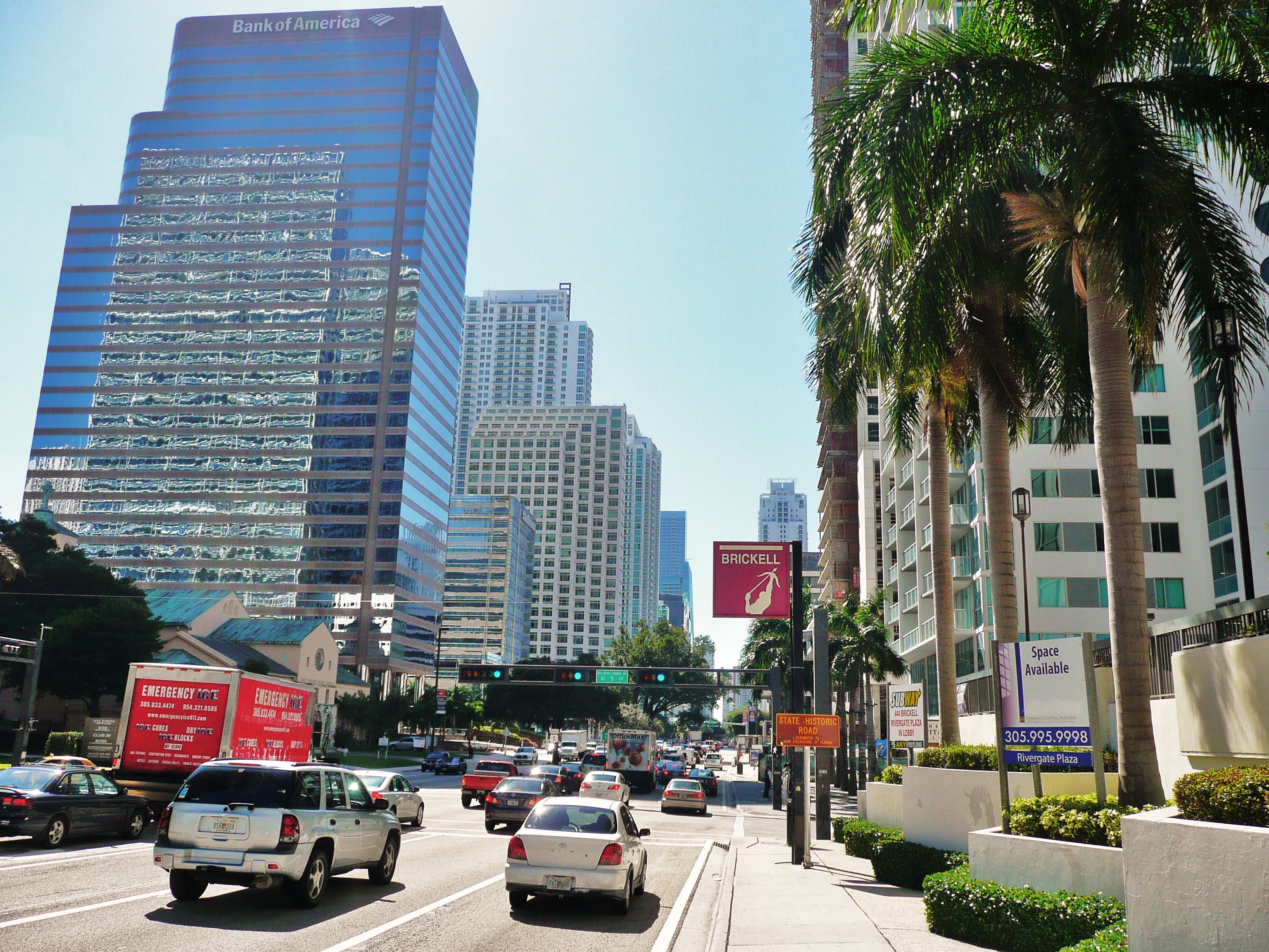
BRICKELL Back on the Metromover, I rode south to the end of the line in Brickell, where there are five stops. I'll reprint the map again, because names here are significant (Map by Howchou). After three numbered streets, we have a joint stop at the Metrorail Brickell station, its first stop south of Government Center (Photo by FrickFrack). This view looks south on the Metrorail Brickell platform with a train in the station; on the left, our southbound Metromover comes around the corner to stop at its corresponding Brickell transfer station in the distance.
Since the Metromover station has the same Brickell name as the Metrorail station, it can't be used again for the last stop, and that is called, significantly, Financial District. This name makes it perfectly clear that we aren't in the traditional Downtown anymore. We're in the de facto, modern downtown, the business center of Miami, Brickell. This isn't yesterday's Kansas anymore, Dorothy, we've reached today's Big Time, and the name of this station points that out clearly.
This is the exit from the Financial District station, unfortunately shown at night (Photo by B137). We're looking west from Brickell Avenue, and that's SW 14th Street straight ahead (barely making it to the edge of the Miami map). We're seeing the structure for the escalator and stairs--the elevator is further back.
This view looks south on Brickell Avenue at SE 5th Street--click to read the green sign (Photo by Marc Averette). This is about where the Brickell Trading Post had been at the end of the 19C. The Metromover stop we just saw is ahead at SE 14th Street. You can see how urbanized Brickell is—it's among the fastest-growing areas of Miami-Dade County.
https://u.realgeeks.media/miamirealestatebuys/Interactive_map_Brickell.png
I'm repeating this map of Brickell we've used before, both for better orientation, and to show something else of importance. I've found Downtown had more traditional architecture, with some more modern architecture on Biscayne Boulevard and in the southeastern "modern center". But for interesting modern architecture, Brickell is the place to be. On this map, move south on Brickell Avenue to where SW 20th Road would meet it. I didn't see the following point of interest during this trip, but rather on an earlier trip with Beverly when we drove around this area by car to see a "hole in the wall".
This is the Atlantis Condominium at 2025 Brickell Avenue (Photo by Averette at English Wikipedia). It's a landmark 20-story luxury 96-unit condominium building completed in 1982, and has become an icon to the Miami skyline. Click to see the iconic sight that makes it so unique, the 5-story Palm Court cut out of the center of the building as a "hole in the wall". It features a red spiral staircase, a hot tub, and a palm tree. I'd imagine it might get a bit breezy there at times, and might not appeal to the acrophobic!
Two more comments on the subject: my great-niece Kari is a lawyer, who told me she recently was in Miami on business. I asked where she stayed, and she said right downtown. But further discussion showed she stayed in Brickell, the modern "apparent downtown". She may or may not have actually stepped foot into Downtown itself.
The other point is the name of my hotel, which also says a great deal. The full name was the Courtyard by Marriott Downtown/Brickell. Since it was physically located Downtown, it said so. But it was also very eager to point out that it was in the part of Downtown very close to Brickell, a point that may have gained it some customers. I feel the hotel's name reflects the current neighborhood situation in the center of Miami.
It was mid-afternoon and time to call it a day after enduring all the heat and humidity. In the air-conditioned hotel room, I took a second shower of the day, rested, then wrote online and researched my online notes for a couple of hours. By about sixish, it was time to go to dinner, which had been planned long in advance. The dinner, and whole evening, proved to be the most pleasant of the whole two-week trip.
| | | | Meraki Greek Bistro Stepping out of the hotel, I found the day's humidity had developed into a mild drizzle, so I trotted the short distance to the corner and up SE 1st Avenue to #142, passing under the sleek Metromover structure and down into that gated passageway. There were other businesses in the passageway and ensuing plaza, but then there was the Meraki Greek Bistro. (I can't get a good feel about the meaning of the word μεράκι, which is translated as "passion; also hospitality; also taste".)
https://merakidowntown.com/wp-content/uploads/2019/10/merakidowntown1.jpg
https://merakidowntown.com/wp-content/uploads/2019/09/slider2.jpg
While there was seating outside the restaurant in the plaza (first link), based on the humidity alone, I wanted indoor air conditioning, and anyway, this area was moist from the drizzle, so I went inside (second link) and found a small table near the entrance.
Usually one uses "cozy" to describe a warm scene around a fire, but this scene was cozy for the opposite reason. It was cozy as being a nicely cool refuge from the humidity and drizzle, especially down that passage and into the plaza, and I felt myself very much at home. While the food was excellent, it was the atmosphere and people that made the place so memorable.
That feeling was heightened immediately. While I was reading the menu, one of those two owners from that morning came over to welcome me, and enthusiastically shake my hand. The waitress was also super friendly. We got to chatting, and I felt she might be Greek. No, she explained, but she was indeed from the Orthodox East—she was Russian from Magnitogorsk in Siberia—and if there's anything I like, it's ethnicity.
The dish I probably most frequently order in a Greek restaurant is μουσακάς moussaka. For those who don't know what that is, I'll explain what I know, plus what I just researched online. One hears two pronunciations. My preferred one has always been mu.sa.KA, tho many people say mu.SA.ka. On that basis, I just looked it up. It's borrowed from Greek μουσακάς / mousakás, and that accent mark works like in Spanish, meaning that that's the syllable that's stressed, so I'm pleased with my choice of pronunciation.
It had in turn been borrowed from Ottoman Turkish, which had borrowed it from Arabic. That all seems logical to me, tho I'm surprised that the word was first attested to in English way back in 1862, in the form mùzàkkà. That might have been for a variation of some sort, since the modern Greek version was created by the French-trained Greek chef Nikolaos Tselementes in the 1920s. I'm pleased to have found out so much more about something I've enjoyed for years.
His recipe is what I've been used to: there are three layers that are each cooked separately, then combined for the final baking. 1) The bottom layer consists of sliced eggplant sautéed in olive oil; 2) the middle layer is ground lamb cooked with chopped or puréed tomatoes, onion, garlic, cinnamon, allspice, black pepper; 3) the top layer is perhaps the most usual and distinctive, a layer of béchamel sauce, whose surface gets browned in the final baking
| | | | | | Béchamel (bé.sha.MEL) sauce is one of the "mother sauces" of French cuisine and apparently reflects Tselementes's French training in designing an otherwise quintessentially Greek dish. Béchamel is made from a white roux of equal parts of butter and flour, plus milk and some nutmeg. |
| | | | In my opinion it's the spices that give the dish its special flavor, especially the cinnamon, but also the allspice and nutmeg. I just checked Beverly's recipe card for moussaka—she learned from a friend to make it a bit differently, but you can't go wrong with this dish.
Usually made in a rectangular casserole pan, as lasagna is, Moussaka is then cut into squares for serving—check out the three layers (Photo by Key West Wedding Photography). But to my delight, at Meraki is was prepared differently, and this preparation is what remains with me as the nicest way I've had Moussaka.
It was prepared, then served, in an individual brown ceramic crock, the kind you usually get French onion soup in. But instead, here it was Moussaka in a crock like this (Photo by Björn Larsson, www.bjornlarsson.se). The only difference was that my crock also had a brown ceramic lid to keep it warm. It was very elegant, and a different experience, eating downward into my moussaka!
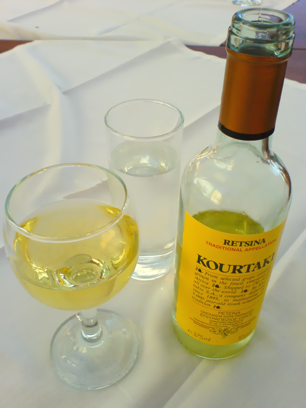
You may be familiar with ρετσίνα / retsina, which I ordered with dinner (Photo by Nsaa). It's a Greek white wine that's been resinated, or exposed to pine resin, giving it a unique flavor. It's been made for the last two millennia, and is said to have originated from the practice of sealing wine vessels, particularly amphorae, with pine resin to better keep oxygen from spoiling the wine. A side effect was that the resin aroma also infused the wine. It's no longer necessary to seal bottles that way, but the flavor itself became popular enough so that the resin aroma is added today, just for the taste.
I always end a Greek meal with μπακλαβάς / baklava, the layered pastry dessert made of filo (phyllo) pastry sheets filled with chopped nuts, and sweetened with honey (Photo by Robert Kindermann). Look at the Greek spelling, and the accent mark tells us it's end-stressed (ba.kla.VA). However, I see online that Merriam-Webster says it's BA.kla.va, and the Oxford Dictionaries want ba.KLA.va. But I always say, go with the original, as the other pronunciations are clearly anglicizations.
| | | | | | Fun with Greek: I'm sure we all know the Greek letter Beta: uppercase Β, lowercase β, which of course corresponds to Latin B/b, and is even part of the word "alphabet". But just as ancient Latin is different from today's Italian, Ancient Greek is just as different from Modern Greek, even tho they're both called "Greek"—don't be misled.
One of the changes is that, over time, the B-sound disappeared from Greek and developed into a V-sound. (This even influenced Russian, where the Cyrillic letter B also represents V.) So today, in Modern Greek, the letter B/β represents V/v, and even the name "beta" is pronounced "vita". Do not be taken aback by these examples: Berlin is Βερολίνο, that is, Verolíno; Bern is Βέρνη, or Vérni; and Boston is Βοστώνη, or Vostóni. (I know your jaw has dropped to your chest, so compose yourself so we can continue.)
Now I'm no expert on this, but in recent centuries the B-sound has reappeared in Modern Greek, perhaps just from borrowings from other languages—I cannot be too or sure. But how to write it? The letter B is already taken for V. The answer for this and other situations is to use a digraph.
Look again at the word μπακλαβάς, which comes from Turkish, which does have a B. That Greek spelling is mpaklavás. Late in the word, we see the letter beta/vita (β) being used for the (v), which we expect. But for the B at the beginning we have the digraph MP. In other words, symbolically, the voice of the M influences the voiceless P to be voiced to represent its voiced counterpart B, hence, "baklavás", the Greek version of baklava.
For an English word with B that's sometimes used in Greek, here's the word μπαρ / mpar. You can go here if you have an urge for some retsina.
There are other situations with similar digraphs, but it's too much to go into here.
|
| | | | Along with baklava, I always have Turkish coffee. It was called that in Greece for a long time, since that's where it came from, but as politics entered more and more into the discussion, it's changed, so now it's called ελληνικός καφές / ellinikós kafés or Greek Coffee. It's made by roasting finely ground, quality coffee beans, which are unfiltered, so that the coffee grounds are left in the demitasse cup when served. This means first that you get only half as much coffee as it appears, since the coffee grounds sediment fills the lower half of the cup. It also means that you can literally stand your tiny spoon up vertically in the grounds at the bottom of the cup. I don't sweeten my coffee, but Greek/Turkish coffee always comes sweetened, and I always ask for medium sweetness (Photo by Vadim Indeikin). It's very, very good. As good as espresso is, I think this is better. It's like sipping brown nectar.
It was a wonderful meal in a wonderful atmosphere. To my surprise, I now find that Meraki not only has a branch in Coconut Grove, but is also planning a branch in NYC, specifically in Williamsburg, in Brooklyn. I've gotten myself onto their mailing list.
In the morning we drive to the Keys and Key West.
| | | |
| |
|
|
|

