|
Reflections 2017
Series 12
July 27
Peru III: Machu Pikchu
| | Nota Bene: I don't like to dwell on this subject but I will do so fleetingly once more. I was doing post-trip research on Machu Pikchu for this posting and learned about the dangerous mountain paths that some people climb, and also about the horrendous flooding often caused by El Niño that wipe out local infrastructure, including the rail line. But I was startled when I then came across this statement: Authorities have struggled to maintain tourist safety. Tourist deaths have been linked to altitude sickness, floods, and hiking accidents. Hiking and flooding I can understand, but altitude sickness? That just slows you down, and for some people (not me) causes headaches, right? Well, it gets scarier, and it's probably just as well that I didn't know the following before I went. I now find out that every year, people die of altitude sickness traveling above 2500 m (8000 ft) due to what is known as HAPE and HACE. HAPE is high altitude pulmonary edema, or excess fluid in the lungs, and HACE is high altitude cerebral edema, or fluid on the brain. It cannot be predicted who is subject to either, and either one can be fatal within hours. I'm sure it's a very small percentage of cases that reach that point—I think I saw the figure 1% somewhere--but all of this trip except the very beginning and end in Lima was at higher altitudes than the above cutoff, and I know I'm susceptible. I'm glad I've now conquered my last figurative Everest. | | | | | | I wasn't planning on mentioning this until one of the last postings, but it's appropriate now, so I'll bring it up here. I momentarily blacked out and fainted on the street in La Paz, fortunately in the company of others. La Paz is high, but not the highest altitude of the trip. It happened so fast, that after "seeing" an instantaneous black flash, I remember being fully aware of physically falling to the ground. I stood up right away, and a doctor I saw later in the hotel said I was fine. But high-altitude sickness is serious business. Details later. |
| | | | The Magnificent Challenge This title may seem like an oxymoron, but I have wonderful news and I have news that, for me at least, takes a bit of the edge off the wonderful news. Call it challenging news. The wonderful news first. | | | | There are worldwide icons that even people who don't travel will have heard of, the Taj Mahal, the Kremlin, the Colosseum. To this group definitely belongs Machu Pikchu. It's the most familiar icon of Inca civilization. It's one of the most important archaeological sites in South America. It's one of the most visited attractions in Latin America. It's the most visited attraction in Peru. | | | | To that I'll add my two favorite aspects of it, in order of preference. (a) The historic site has a very spectacular mountain setting, as good as I've seen anywhere, maybe better, though uniquely special in its own way. (b) The historic site includes a complex of exceedingly fine Inca architecture and masonry, as good as anything in Cusco—and we haven't even seen Saqsaywaman yet!—although more extensive. | | | | The challenging aspect of the wonderful news is that (1) it's not the easiest place to reach, or once there, to visit, and that (2) it's becoming a victim of its own success.
As to point (1), it's the perfect example of a location about which people can joke that "you can't get there from here". I'll just use the New World examples cited earlier. A bus tour out of Mérida brings you easily to the Mayan sites of Chichén Itzá or to Uxmal—or you can rent a car. A bus tour—or car rental—can bring you from Mexico City to the Aztec site at Teotihuacán and its pyramids. But even for someone already in Cusco, getting to Machu Pikchu is not so easy. No road will bring you to the area, so forget driving or a bus tour all the way. You can hike for days. You can take a train, which is the only transportation that goes even near there, to Aguas Calientes, followed by a bus up the mountain. The entrance fees are surprising, and getting higher. Visiting time at the site is limited, and is becoming even more restricted.
| | | | | | I'm very good a planning trips, but it was a thorough hassle to decide if I should spend a night at the historic site, spend a night in Aguas Calientes down below, or do the whole thing as a day trip out of Cusco, which was my decision. So you CAN get there from Cusco, it just isn't so easy, requiring extra planning, extra time, more money than you'd expect, even for backpackers, and a lot of extra effort. I know of a number of people reading this who've been there, and who may or not agree. Of course, all the effort is absolutely worth it—see points (a) and (b) above—but when I got back to Cusco after the Machu Pikchu Experience, I mentally checked it off my bucket list—done!--and got back to appreciating the Cusco Experience. |
| | | | As to point (2), we can start with the fact that UNESCO, which made Machu Pikchu a World Heritage Site in 1983, in 2016 added it as well to its list of endangered sites. A spokesman stated that "Being placed on the list means there has been such a degradation of the site that the very qualities which make it a world heritage site are being damaged, perhaps irrevocably." It was also pointed out that "the authorities . . . must take rigorous emergency measures to counter the growing disorganization of Aguas Calientes", as its ongoing overexpansion of tourist facilities needed to be held better in check. | | | | So not everything is as ideal as people might think, people who wear rose-colored glasses when contemplating famous places. Online I've found hikers saying other local trails are better than the Inca Trail, and some even bad-mouth Machu Pikchu itself, pointing out that, while it remains an archaeological wonder, it's being overwhelmed because of its popularity. I found a website called smartertravel.com where a certain Josh Roberts makes these comments: | | | | | | "On the one hand, how can you go to Peru and NOT see Machu Picchu? On the other, is there anywhere in South America that’s more famous [and] more photographed . . . ? Part of me felt like I’d already experienced Machu Picchu before even setting foot in Peru." But then the realities he found caused him to lament: "The first bus to Machu Picchu leaves Peru’s party-all-night tourist town, Aguas Calientes, at six in the morning. The line to be on it forms sometime after midnight, and by the time the sun pokes over the Andes, [Machu Pikchu] . . . looks less like one of the great wonders of the ancient world and more like a modern day Disney theme park. Don’t get me wrong. It’s hardly Machu Picchu’s fault that you’d barely raise an eyebrow if someone emblazoned the words “Welcome to Incaland” on a sign above the ticket gate. . . . From a distance, it looks just like the postcards. But up close? Elbow-to-elbow tourists. A relentless parade of buses. A five-star hotel and a dozen different Wi-Fi signals. It even has its own app. The disappointing truth is that while Machu Picchu is undoubtedly an awesome archaeological spectacle, it’s also everything you secretly fear it might be: crowded, noisy, underwhelming. A tourist trap."
Let me say right off that I do NOT agree with him. Not only did my all-inclusive train trip have the bus tickets included—and priority boarding—friend Joe who stayed in Aguas Calientes said his hotel did the same thing. It remains a marvelous destination that should not be missed. But there are points in Roberts' argument that are very valid, notably the relentless parade of buses and the crowds. On approaching the historic site it's not like you're nearing remote Chichén Itzá or Uxmal or Teotihuacán's pyramids, but frankly does feel more for a moment like you're entering Disneyland or Disney World. Everyone, past visitors and others, needs to take off those rose-colored glasses as to what Machu Pikchu is all about. Once your mindset is in a practical mode, then go and enjoy yourself.
|
| | | | There was a great number of misconceptions I had. Some were cleared up in pre-trip research, plus being there, but my favorite research is post-trip, because I know what I still don't understand and usually dig up the answer after the fact. | | | | The grossest misconception I had got cleared up pre-trip. We know the Spanish never found Machu Pikchu, so they couldn't plunder it, because it was "high in the mountains". True, you can't see it from below. But visitors are usually surprised to find out that, counterintuitively, Machu Pikchu is LOWER than Cusco. Cusco is at 3,402 m (11,160 ft). You go over a ridge and down across hilly countryside to Machu Pikchu, where the historic site is at 2,430 m (7,970 ft). That's 972 m (3,190 ft) lower than Cusco—though still high. Altitude is always a factor here. | | | | Something else that irritates me is over-romanticizing the site. Especially considering what we've been saying, scratch from your memory the phrase "lost city of the Incas", which is romantic hype—and that's the polite word. The only thing that's true in that phrase is "Incas". It was never totally lost—locals were aware of it—and it's not a city, but a fortified royal estate. You go there for the beauty of the site, the architecture, and the history that has been pieced together. Leave your romance novel in your suitcase, or better still, at home. | | | | Another misconception I had, even when I was there, is that all the structures you see are original. I, like apparently everyone else was duly amazed that so many walls had withstood not only time, but the encroaching jungle. After the fact, I realize what nonsense that is. What Bingham found upon clearing away the jungle was a shambles of scattered rock up above a river valley. Over the last century, archaeologists and other scientists have supervised a restoration, and a reconstruction where necessary. I can just imagine how those angled rocks could be reassembled into a wall, like a jigsaw puzzle. I've seen various percentages, one being that 20% of the construction is original and 80% either restored or reconstructed. When we see pictures later of rows of roofless buildings, one gets the impression that by adding a roof and utilities, you could move in tomorrow, so thoroughly have they been restored. Still, when I was there, no one seemed to assume anything other than we were seeing original structures. | | | | | | I find absolutely nothing wrong with restorations or even reconstructions. I've learned this from decades of travel, coming across numerous buildings and sites that were either destroyed in wars—Peterhof Palace near St Petersburg is one of many--or purposely removed at an earlier date—Ford's Theater in Washington. These and many others are back today, and are total reconstructions, meticulously done. I also remember the first time I went to Versailles Palace and noticed the large tablet thanking the Rockefeller Foundation for the large post-WWII grant to restore the Château, which France at the time was unable to do. The fact is that most centuries-old buildings are, because of aging and repair, at least partial reconstructions and/or restorations, and there's no reason whatsoever to discount Machu Pikchu for being one.
There is also no doubt in my mind about who are these sites for, any more than who a funeral is for. We think a funeral is for the deceased, but it's really just the opposite, for the comfort and benefit of the survivors. Who are these historic sites meant for? The tsars? Louis XIV? The Incas? All the places travelers visit are for them, the travelers, and the site should be made presentable for the instruction and enjoyment of these visitors into the future.
|
| | | | Orientation for the Historic Site I have some marvelous online panoramas among the pictures of the site, but I will admit straightaway that, even after being there, I was confused as to which views faced which direction, and what was what. It was very hard to follow. Therefore we're going to start all this in a rather unique way, and for the moment, without yet seeing those spectacular panoramic views. If your knowledge is so good of the area that you don't get confused, then skip the next part, but it's what I used so I could remember myself what is located where. I suggest we all try the following. | | | | We start with language. The Quechua word pikchu, which does refer to a mountain, actually is very specific. It refers specifically to a "broad-based mountain ending in a sharp peak". Perhaps if you think of a cone, you'll get the idea. But I have another thought. Take a look at Pão de Açúcar / Sugarloaf Mountain (Photo by Lmsteixeira) in Rio de Janeiro. You see the broad base, steep sides, and sharp peak? This mountain in Brazil nevertheless strongly resembles a pikchu in the area we're studying. I think because of the pointiness of its shape, we can best translate the word as "peak", as long as we keep in mind it's this squat type of peak.
| | | | Our little exercise by which you'll never forget what is where at the historic site, whether you've been there or not, involves making a fist with your right hand and holding it vertically in front of you. Now raise your pinky and thumb straight up, making sure to leave the three knuckles in between forming a sharp ridge, not a flat area. Voilà. You've just constructed your own historic site. (Pictures will come later. This part is all hands-on. Literally.) | | | | Your pinky is at the northern end of the complex, and represents arguably the prettiest of the pikchu in the area. It's called Wayna Pikchu, or "young peak". It's often hispanicized as Huayna Picchu, but we don't do that here—we go for Quechua authenticity. The Incas built a trail up its side and temples and terraces on top, at 2,693 m (8,835 ft), which is 260 m (850 ft) higher than the historic site. Another thing that makes it easily recognizable is that, in front of it and to its left, it has a "baby brother" pikchu called Uña Pikchu, which you'll see later in the pictures. | | | | The next point is something that I'm sure many people do not realize. The name Machu Pikchu refers to two different things! It's an actual pikchu and also the historic complex named after the pikchu. If you ever wondered by the historic complex was referred to as a peak, that's the reason. Back to your fist. Your thumb is the actual peak named Machu Pikchu, hispanicized to Machu Picchu. It means "young peak". | | | | The three pointed knuckles between the two pikchu represent a saddle. A saddle is not just any mountain ridge, but specifically one that connects two peaks, which is exactly what we have here. It's actually an odd name, since such a ridge actually resembles a horse's back onto which you'd lay a saddle, but let's not split hairs. In may ways, a saddle resembles a hammock between two trees. It's on top of this saddle that the Incas built their complex, which they named after the pikchu to its south. But obviously, the complex is not a pikchu! So did the Spanish never find the complex because it's on top of a mountain? Well, sort of, but it's not on top of any pikchu in the area. I will try to differentiate between Machu Pikchu (peak) and Machu Pikchu (site) as I just have. | | | | | | We just jumped to Brazil, so let's now jump to Switzerland. There has to be many saddles connecting peaks around the world, but the Jungfraujoch is a very notable saddle in the Alps. It's the completely glaciated ridge that connects the two four-thousander peaks (in meters)
Jungfrau and Mönch, at an elevation of 3,466 m (11,371 ft). While Joch is German for "yoke", as in what connects two oxen, in Swiss and Austro-Bavarian German it's used for a saddle as we've described. The famous train that takes you up a tunnel here (2008/15) goes to the Jungfraujoch, not to the Jungfrau itself.
|
| | | | Back to our fist. Down at about the level of your wrist, the Urubamba River surrounds the entire complex like a horseshoe on the three sides away from your chest. Again, you can picture how someone down on the river level would not see the complex up on the saddle, just as you can't see it today. With water on three sides, we now come to how the Incas accessed the site. It was not from the water. As we know Inca trails covered much of the empire, and we've discussed that a local remnant is located here. Picture a trail coming from your chest area, running north to the right side of your thumb. This is how the Incas reached the complex, at this high land level ending at something called the Inti Punku. Original Inca access had nothing to do with the river below. | | | | Quechua vocabulary quiz: What could the Inti Punku be? We've studied both words.
We know from the Qurikancha that Inti was the sun god, so we can say the word means "sun". We know our hotel Rumi Punku means "stone door", so a punku is a door. Therefore, the main entrance to the complex—by land, of course—was through the Inti Punku or Sun Gate, which would have been heavily guarded against attack. The Inca trail ends, therefore, at the Inti Punku on the right side of your thumb, with a view around Machu Pikchu (peak) to Machu Pikchu (site). Because of this arrival sequence, it seems to me, that the site is named after the pikchu where people arrived, not after Wayna Pikchu (your pinky) across the way.
| | | | While some hardy people do hike the Inca Trail, this is not how most people arrive at the complex today. On your fist, look at the back of your hand and picture a road with multiple zig-zags coming from the river down in the valley up to the saddle. When you get off the train, you take a bus up this road. I'm sure no one realizes—I certainly didn't when I was there—that you're entering the complex up top from the side, not from the main entrance. This is historically what enemies might try to do who wanted to attack, yet avoid the soldiers at the Inti Punku! But of course, nobody tells you this! So much is available only through digging on the internet after the fact, or through logical speculation. | | | | Still holding off on pictures and maps, since we want a good mental image in advance to apply to those visual images, let's discuss what Machu Pikchu (site) was. There is a lot of hypothesizing about that, with some people thinking it was a city. But, as we mentioned in regard to the Inca statue in Cusco, most archaeologists think it was a fortified royal estate to be used as a retreat for the ninth Sapa Inka (Supreme Ruler), Pachakutiq, who transformed Cusco into the Incan Empire. This idea is supported by the presence of elite residences in the northeast sector of the site. But isolated far out from Cusco, the capital, it needed to be protected from enemies, so it was built in the form of a citadel, or high fortress. Usually, a citadel protects a city, like Saqsaywaman did for Cusco, but this citadel was, by definition, self-contained. | | | | As to that self-containment, don't be misled by phrases we'll see about the site, such as agricultural sector, industrial sector, urban sector. Any large estate anywhere has to be self-sufficient in growing food, in building and repairing things, having a place where the people live. That doesn't make an estate a city.
https://briangadea.files.wordpress.com/2015/01/machu-picchu-01.jpg
| | | | The estate was populated by the ruling Inca and several hundred servants. It had a water supply from springs that couldn't be easily blocked. Review the above diagram which gives useful information. But reports conflict. It says Machu Pikchu could support 650 people at once. Another report was even more optimistic, saying there's enough land here to grow food for about four times the population, while another one still was more pessimistic, saying the site's agricultural potential would not have been sufficient to support residents, even on a seasonal basis, so it's difficult to know what to believe. | | | | As for llamas being used to transport supplies, I've found an interesting comment about the wheel. The Incas never used it in any practical manner. Apparently the principle of the wheel was known to them, since wheels have been found on toys, but the wheel was not used in their engineering. The explanation of their not utilizing it can be explained by (1) the lack of strong draft animals—llamas cannot do what, for instance, horses can, which were introduced by the Spanish; (2) the steep terrain, and (3) the dense vegetation of the region, all of which may have simply rendered the wheel impractical. | | | | Let me draw other parallels to Europe. The French kings wanted a royal retreat and built Versailles southwest of Paris. The Russian tsars built Peterhof and Tsarskoye Selo southwest of Saint Petersburg (2014/15). Add to that Berlin/Sanssouci, Vienna/Schönbrunn, London/Windsor. To that we can now add Cusco/Machu Pikchu (site). | | | | But we have to be careful not to let the tail wag the dog. The palace and gardens at Versailles should not be missed, but Versailles shouldn't be visited at the expense of skipping or downgrading Paris. Similarly, Machu Pikchu (site) should not be missed, but not at the expense of Cusco. | | | | The Incas built the estate around 1450, but abandoned it in 1572 as a belated result of the Spanish Conquest. That means that this complex of exceedingly fine architecture and masonry was constructed, inhabited, and abandoned all in just over a century. The reason for the abandonment remains unclear. One thought is that most of its inhabitants died from smallpox introduced by travelers even before the Spanish conquistadors arrived in the area. In any case, over the centuries, the surrounding jungle overgrew the site, and few outside the immediate area knew of its existence. Then in 1911 American historian and explorer Hiram Bingham travelled the region and was shown to Machu Pikchu (site) by a local farmer. Bingham brought the site to international attention and organized another expedition in 1912 to undertake major clearing and excavation. He returned in 1914 and 1915 to continue with excavation. | | | | Visitors & Fees We are purposely telling this story in bits and pieces, in the hope that in the end, all will fall into place. We remain for the moment without pictures or maps. We have some history, and find ourselves holding the historic site in the palm (fist?) of our hand, as it were. Let's fill in some of the statistics that add to the challenge of a visit.
| | | | Machu Pikchu (site) is a victim of its own success. Unless you go early or late in the day, which can be difficult, it will tend to be crowded. The number of annual visitors surpassed one million in 2012, and later topped off at nearly 1.2 million. While the Peruvian government and UNESCO have now agreed to a daily limit of 2,500 visitors, since 2011, the average daily number of visitors has far exceeded that figure, and is presently about double that figure, 5,000 a day during the May-to-October high season. Something has long needed to be done. | | | | I was there in late May this year, among the last few weeks under the old rules. They were rather strict, since anyone staying overnight locally wanting to visit the site the next day had to purchase another admission. But at least if you got there early, you could stay the whole day. Starting in July this year, it's even stricter. Visitors can visit in the morning, or otherwise in the afternoon. If they want both, they now have to buy separate tickets, as though it were a new day. The hope is to limit visitors to 3,600 from 6 AM to noon and 2,700 more during the afternoon. | | | | Some may have romantic images of visitors wandering about the ruins by themselves. That has indeed been possible up to now. But with the new rules, all visitors will be required to use a guide-led tour, which will add to expenses. While I fully understand that measures had to be taken to prevent the site from being overwhelmed, all these rules and fees have added to the "challenge"—indeed hassle—of visiting up to now, and will intensify in the future. | | | | I will explain later that I took the train tour, which was a package including all entrance and transportation fees, and the guide on the train continued as a site guide, so I had no separate guide fee, bus fee or entrance fee. Therefore, after the fact, I tried to research what the various entrance fees are that were included in my package. Below are the numbers I found for on-the-spot purchase at the last minute. That's a bit chancy, since tickets could sell out, but I also find that online purchases or purchases through a travel agency are marked up about 40% above the below figures. | | | | Entry to the site is US$50. Coming back the next morning after overnighting locally means you pay it again, but with the new rules, coming back in the afternoon after a morning visit would also involve another fee.
| | | | Many people like to climb Wayna Pikchu (your pinky), incredibly steep that that is. They pay US$60 for both entry to the site, and a ticket to climb Wayna Pikchu. The number who can do this is limited to 400 people daily, restricted to two morning time slots. 7-8 and 10-11. When you see pictures of how steep it is, seemingly vertical, you'll wonder why people want to do this. Here is the description of what is involved: A steep and, at times, exposed pathway leads to the summit. Some portions are slippery and steel cables provide some support during the one-hour climb. The ascent is more challenging between November and April because the path up the mountain becomes slippery in the rainy season. Better conditions for climbing can be expected during the dry season, which runs from May to September. I'm sure you get great views from there, but this is not for me. On the other hand, in fairness, friend Joe climbed it in the past and told me it wasn't that bad. | | | | Some people buy a ticket for US$56 which gives entry to both the Machu Pikchu site and Machu Pikchu peak (your thumb). It's described this way: The Machu Picchu Mountain provides a great alternative if the tickets for Huayna Picchu have been sold out. The climb is a little longer but less steep and less crowded. From Machu Picchu Mountain you will have amazing views of the site and will also give you the chance to see the Sun Gate, where the Inca Trail actually enters the site. I'm still not interested, but this does have the advantage of meeting up with the end of the Inca Trail at the Sun Gate without actually hiking the Trail, which is intriguing. | | | | Now let's fill in a little more information to fall into place when we look at the maps. The only entry to the area is by train. You arrive at the town of Aguas Calientes (more later) down in the valley next to the Urubamba River, but still have that long, zig-zag road (up the back of your hand) to the site. Let me copy the official explanation: From Aguas Calientes there are two options to climb to Machu Picchu, on foot or by bus. If you want to walk up this 6 km road, it will take no more than 1 hour. You can also take one of the 20 buses that travel the winding road that depart every 15 minutes. The first one leaves at 5:30, while the last one returns at 17:30. I've checked, and the round-trip bus fare is US$24. I'd say you have to be a real hiker to walk up the mountain, and I seriously question that one hour duration, since the bus ride itself takes 20-25 minutes. Maybe 1.5 hours is more probable to hike it. | | | | Finally, let me expand on what I said earlier about options to visit Machu Pikchu (site). You can stay overnight up top at the Belmond Sanctuary Lodge, which is very expensive, despite not looking nearly as luxurious as other Belmond properties, at least from the outside. But staying overnight might imply you want to visit the site again the next day, which is another admission fee. | | | | You can stay down below in Aguas Calientes. Joe, with Lars, did this, and found some nice, satisfactory accommodations. However, this might also imply you want a second visit the next day—or maybe not--which would involve another entrance fee AND another bus fee. As it turns out, they stayed two nights and visited the site 2-3 times, including climbing Wayna Pikchu, but that would be way beyond the range of my interests. | | | | The third possibility is to do it as a day trip out of Cusco, either on the regular train or on the pricey, but all-inclusive—and luxurious--Belmond Hiram Bingham, as I did. But the regular train doesn't have any package plan, so you'd be running around buying bus tickets and entrance tickets, reducing the time available for your day trip, so a day trip on the regular train would be a poor solution. I would say that staying overnight down below in Aguas Calientes, but going up top only once, might be my second-choice solution. You can see how visiting Machu Pikchu, magnificent as it is, is challenging. It's much easier to take the RER C suburban train out of Paris to Versailles and walk five minutes to the Château. | | | | Urubamba Valley It's time to bring regional maps into play, but we'll start with looking at our Peru map from earlier postings again:
http://www.lib.utexas.edu/maps/americas/peru_physio-2006.jpg
| | | | I want to do this because another thought has just struck me. We said earlier how it was odd that this whole trip between Lima and La Paz runs NW-SE. Then when we had our first visit to Cusco, we noted that the entire downtown layout also ran NW-SE between Saqsaywaman and the Qurikancha. Now click on this map again to see that travel between Cusco and Machu Pikchu (ruin) also is NW-SE. Isn't this odd? | | | | While we're here, find the Urubamba River that starts south of Cusco (where it can also be called the Vilcamayo or Vilcanota), passes Machu Pikchu, then changes its name once again to the Ucayali before entering the Amazon. It's odd to picture that a huge part of Peru, on the Pacific, sends waters down to the Atlantic, via the Amazon.
http://www.cusco-peru.de/indigo-uru/graphics-all/lc60/p04m.jpg
| | | | I've come across a great number of maps of the area between Cusco and Machu Pikchu (site) that confused me, even after I'd been there. But I like this one, which will be our "Brown Map". Its great advantage is being simplified, but we'll also have a more detailed one later. One problem is that the Urubamba Valley is also called the Sacred Valley (of the Incas). That's a frequently heard, but non-specific, somewhat romantic, historical name that I'm sure is promulgated by tourist authorities. Aside from it being a somewhat flighty name, it's also usually misused. | | | | I always thought incorrectly, even while I was there, as I'm sure many visitors do, that everything on our Brown Map was the "Sacred Valley", including that whole area south of the river where the train starts out (dotted line). This is untrue. The Urubamba Valley (this famous central part) runs about 100 km (62 mi) from Pisaq to Machu Pikchu, and I now find confirmation that, by definition, it's only about 1 km (0.62 mi) wide. Even the Belmond train claims its whole route is in the "Sacred Valley", though it admits it only reaches the Urubamba later on. This is nonsense, promulgated so as not to confuse unwary tourists, and people lap it up. It should say it runs through the mountains until finally reaching the Urubamba ("Sacred") Valley. In other words "Sacred Valley" is misleading, and I want to avoid it. I set my own parameters. I use the Quechua spelling of Machu Pikchu because it's clearer, and, in this case, will also emphasize the geographic name, Urubamba Valley. I will downplay the more romantic—and touristy—name "Sacred Valley" and only refer to it that way when necessary. | | | | Let's clarify our plans. Today we go to Machu Pikchu by train. Tomorrow we go to the Urubamba (Sacred) Valley by car. The next day we leave Cusco and take the other train to Puno. Based on what I'd read, I'd decided I wanted to see Pisaq and Ollantaytambo on the drive tomorrow, thinking I'd picked out a couple of more interesting places at random, only now realizing that those were ideal Valley choices, since the rest of the map isn't the "Sacred Valley" anyway. | | | | | | I haven't found any religious reason that you'd expect for the Urubamba Valley being called the "Sacred Valley". But I do think it a bit humorous what attracted the Incas to climb out of the Cusco Valley and over the ridge down into the Urubamba Valley to settle it. The lower altitude! Remember we saw that sketch of what grows at what altitudes in the Andes, and in Cusco, the Incas couldn't grow everything they needed. The Urubamba Valley was not only close by, but was at a considerably lower elevation and warmer than any other nearby area. This permitted the cultivation of maize/corn, a prestige crop for the Incas, which in turn was used to make chicha, a corn beer they drank in large quantities at ceremonies and festivals, and which is still the case. You'll recall that, in the painting of the Last Supper, we said that the glasses were meant to contain chicha, and we'll come across it one more time shortly. |
| | | | Now that we're traveling outside of Cusco proper, let's look closely at the map. The Urubamba comes in from the south and crosses the famous section of its Valley on the way to the Amazon. Following the upper river, we see the black dotted line of the other train, the standard-gauge Belmond Andean Explorer, going down SE to Puno. The map also shows the ruins at Raqch'i where we'll stop at that time. | | | | But everything else lies NW, so let's concentrate there, noting three routes. (1) The dotted line on this side shows the narrow-gauge Belmond Hiram Bingham--and local trains--going to Machu Pikchu. Note for later the location of the station at Poroy (po.ROI). Nothing in the beginning of the train ride is in the "Sacred Valley", although that isn't the impression you'll be given. The rail route then crosses the Urubamba at Ollantaytambo, and stays in its Valley all the way to Aguas Calientes, below Machu Pikchu. (Freights can go slightly further to a hydroelectric plant at Hidroeléctrica Station, but beyond that, the rail line is washed out.) Note the Nevado Veronica, one of the highest mountains in the area. | | | | Disregard the red lines, which are local dirt roads. Note (2) the black loop north of Cusco. Tomorrow, after stopping within Cusco at Saqsaywaman, we'll drive this loop to Pisaq, have lunch in Urubamba, then go to Ollantaytambo, returning down the balance of the loop. But note that the road ENDS in Ollantaytambo. Those going to Aguas Calientes who don't take the train in the first place have to get on the train here. Note how well it works out that, in our two days out of Cusco, we'll end up seeing every bit of the Urubamba Valley, though in sections. I hadn't realized in advance it would work out so well. This shows how dumb luck is always a factor in the most precise of plans. | | | | We will not leave out the route for hardy souls, the hikers. While originally the extensive Inca Trail, our route (3), came all the way from Cusco, if not beyond, today it's quite a bit shorter (see red dotted line). Hikers have to take the local train to the modern trailhead at Kilometer 82 of the rail line out of Cusco (yellow symbol on the map), and after four days of hiking will then enter the site through its original gate. | | | | It should be noted that all three ways of reaching Machu Pikchu (site) in one way or the other involve the railroad. We, as mentioned, will not be using the road route (2) to go there, but we will be using it tomorrow to visit the Urubamba Valley, and will discuss it then. But before we get to our rail route (1), for the sake of completion we really should talk about the Inca Trail, route (3), though not from personal experience. | | | | The Inca Trail to Machu Pikchu I am not a hiker. I'm what I call an urban walker, and can spend hours walking about an interesting city. Walks in the woods other than a tiny nature trail in a national park do not interest me, so a four-day hike on the Inca Trail is a non-starter. Then there's the altitude. Most of the Inca Trail goes way up into the mountains, and is higher, not only than Machu Pikchu (site), but higher than Cusco. No thanks. But that's not the worst of it. Far worse is taking your life in your hands by walking for four days along a narrow trail eked out of a mountain slope with horrendous drops on your side into an abyss below. Let's take a look.
http://cdn.activeadventures.com/images/Peru/Classic_Inca_Trail/Inca-trail-to-machu-picchu-Active.jpg
| | | | This map is turned around. As you compare it to the Brown Map, note that north is in the five o'clock position, putting Cusco to the left, with the Urubamba also coming from there, picking up local streams on the way. The train comes along the river to Aguas Calientes, but, as mentioned earlier, the route does continue a bit further. Your fist will guide you to recognizing Wayna Pikchu, your pinky, to the north, and Machu Pikchu (peak), your thumb to the south, with the zig-zag road leading up top. | | | | The train leaves you off at Km 82. (I don't know why Km 88 is mentioned here.) While all other visitors arrive at river level, you want to do it like the ancient Incas did, arriving from the mountains, so you hike up along the valley of a stream to Wayllabamba. Your route will eventually bring you (around the right side of your thumb) to the Inti Punku, where your first view will be of the modern zig-zag road. I assume there's a fee station up there, where you visit the site, then take the zig-zag road down to get the train. Since you're a hardy soul, I assume you skip the bus and walk downhill. | | | | My research tells me that overuse of the trail, and littering (!!), has forced the Ministry of Culture of Peru to place restrictions on its use: (1) only 500 hikers a day may use the trail; (2) a hiking permit is required; and (3) no one can hike alone, but must have a guide. The last requirement alters that total of 500 hikers, since actually it consists of 200 hikers plus 300 guides/porters. There are tour companies that will organize all this--note the name Active Adventures on the link to the above map.
https://s-media-cache-ak0.pinimg.com/736x/ec/24/da/ec24dae1afdfedcab6e0c55446b52e30--trail-maps-inca.jpg
| | | | This graph also interests me. Note again how Wayllabamba is where the going gets really tough, involving two mountain passes. The name of the first pass is not comforting. The guide on the train, who also was the guide at the site, said he's hiked the Inca Trail four times, and pointed out that the second day was hardest, corroborated by this graph. I'd assumed at the time that, as a local, he did it for fun, but now I see he could have done it professionally. | | | | I'm going to leave the actual trail pictures I've found for last. First let's look at the view hikers see early on Day 4. This dark, and somewhat unattractive picture (far better ones will follow) does show the first, pre-sunrise view around Machu Pikchu (peak) towards Machu Pikchu (site), though at this angle, most of the site is not visible, just the zig-zag road (on the back of your hand) down to the Urubamba. While we'll see later that Wayna Pikchu is a beautiful mountain, from this unusual angle she's a frump who hasn't fully woken up yet. I'm almost positive that you're getting a preview of the precipitous Inca Trail in the left foreground (click). Apparently just a bit further on we see the hikers who've reached the Inti Punku (Both photos by Colegota) and who are waiting for the sunrise before descending to the site. That would mean they've already passed through the Sun Gate, with the trail to the right and Machu Pikchu (site) to the left. The altitude of the Inti Punku is 2,745 m (9,006 ft). The difference between here and the site is 290 m (951 ft). Remember that also applies to those already on the site who wish to climb Machu Pikchu (peak) to see the Inti Punku.
https://www.keadventure.com/media/image-cache/f60e4e31-e721-4e64-9adf-9d758a59866f/1920-750-1-1702-1571/1484835851-1484835844-1448980473-hiking-the-inca-trail.jpg
https://i.ytimg.com/vi/oRkhJdLB5PM/maxresdefault.jpg
https://www.rei.com/adventures/assets/adventures/images/trip/gallery/latinamerica/inc_02
| | | | Let's start out with these three views of the Inca Trail. I've stood at cliff edges and other precipices, although I prefer to stand back a few steps. I cannot imagine walking along with a cliff edge constantly along your side. Try two more.
https://www.realworldholidays.co.uk/blog/wp-content/uploads/2014/06/inca-trail-group.jpg
http://tourist2townie.com/wp-content/uploads/MachuPicchu-IncaTrailHigh.jpg
Those steps in the last picture look rather uneven. Some might like trying this, but I'll take the train, thank you.
| | | | The Santa Ana Let's take another quick look at the rail lines of Peru (Map by jkan997). We've discussed the ones in the Lima area, but regular (non-excursion) passengers are accommodated only out of Cusco. We've talked about the line to Puno and how it started as wanting to reach La Paz across Lake Titicaca. We'll ride that route in two days.
| | | | Instead we're looking at the much shorter route from Cusco—more or less—to Aguas Calientes—more or less. Both routes are run by PeruRail, which is a joint venture owned 50/50 by the family of a Peruvian entrepreneur and Belmond Ltd. This explains why each route includes a Belmond luxury train. | | | | This shorter route is the Ferrocarril Santa Ana / Santa Ana Railroad. The Santa Ana is narrow gauge, which is traditionally better for mountainous routes, allowing for sharper curves. Curiously, it started out at REALLY narrow gauge, 762 mm (2.5 ft), though later altered to the present 914 mm (3 ft). | | | | The Santa Ana was authorized in 1907, a bit surprising, since Hiram Bingham didn't rediscover Machu Pikchu until 1911. But that's better explained when, after the first section opened in the early 1920s, it was extended to Aguas Calientes in 1928, with the historic site then more likely being a factor. This length comes to 113 km (70 mi). The Santa Ana passed to government control in 1931—my speculation, because of the Great Depression. It was later extended in stages into the jungle, reaching Quillabamba in 1978 (see Peru map). But landslides, attributed to El Niño, caused the route to be abandoned in 1998 beyond the hydroelectric plant at Hidroeléctrica, just beyond Aguas Calientes. This is why I said it goes, more or less, to Aguas Calientes. There's also a good reason why I said the train, more or less, leaves Cusco—because it doesn't really leave Cusco. This needs explanation. | | | | In 2015/15 we were in Ecuador and took the Tren Crucero up to Quito. One of the more interesting things we did involved the two famous switchbacks up the steep mountain known as the Nariz del Diablo/Devil's Nose. Highway switchbacks are simple, involving going back and forth up or down a mountain around hairpin curves, just like on the back of your hand to reach the historic site. Trains also benefit from switchbacks, but they can't do hairpin curves. Instead they climb up one slope, pull up to a dead end, and stop. A worker then flips the switch to change tracks, and the train then climbs backwards up the next segment. Further up it does the same thing, but then reverses direction. Rail switchbacks always come in even numbers, otherwise the train will end up facing the wrong direction. In Ecuador, we all were made aware of the switchbacks as a central part of the trip, and moved to the appropriate end of the train to watch. | | | | When the Santa Ana line was built, its trains left from the San Pedro Station on the west side of downtown. Then the only way for its trains to rise out of the Cusco Valley was to go back and forth up a slope using a series of six (six!!) switchbacks to the top of and over the ridge. Locals have always called this section by the delightful name of El Zig-Zag. After that, the route used some horseshoe bends to descend on the other side, arriving at the station of Poroy, which we pointed out on the map. From there on, things went normally. | | | | But when I started investigating this trip, I found out that's no longer the case. Apparently San Pedro Station just sells tickets, but is otherwise disused. All of El Zig-Zag and the horseshoe curves on the far side are out of use. Poroy Station is the de facto start of the line, and you have to make your own way there to catch a train. I heard the Belmond Hiram Bingham was the first to do this, and now all the trains do it. Poroy is about a half-hour's car ride from the center of Cusco. | | | | I've found it odd. You'd think that that El Zig-Zag could at least be used for excursion trips, if not for a fun section of all trips. I've looked and looked to find out more about it, and finally just found some results. The below information supersedes that was said about Cusco in 2015/15.
http://www.avoe05.dsl.pipex.com/pe_rly7.gif
| | | | Above is a handmade sketch of rail routes in the area. Look to the lower left for El Zig-Zag. Though it climbs up a western slope, it's shown turned around here, so try and orient yourself. At the bottom are the two Cusco stations, and it finally shows that link between them that showed on the Cusco map, but which I didn't understand. Wanchaq Station to Juliaca and Puno was built first, so the connecting track, shown here as being dual gauge, starts with Km 0 for the Santa Ana line. The first two switchbacks are on this connecting segment. San Pedro traffic then, used to join the line at this point, but only traversed the four higher switchbacks. A series of horseshoe bends then raises the line further, reaching the summit at a place called El Arco at 3,600 m (11,811 ft). Additional horseshoe bends on the other side lower the line down to Poroy. [Note: Google Maps and the ITM map we'll see later do not show those first two original switchbacks on the connecting track, so it's possible they've been somehow eliminated, just leaving the four out of San Pedro.]
http://2.bp.blogspot.com/-0IYU6QGnilI/UXb_y5OOozI/AAAAAAAABI4/ogriMFOZyx4/s1600/Cuzco-Santa+Ana+zigzag.jpg
| | | | I've finally found this period picture—obviously period, since it's a steam engine belching smoke—of a train rising up El Zig-Zag and approaching a switchback, which it will back out of up to the next one. I found a Spanish-language blog online discussing this, and the only reason people seem to give is the difficulty of traversing it, particularly since it's single track and trains can't meet. But that's a weak argument, since the whole Santa Ana line is single track, and passing sidings take care of two-way traffic. But that's the way it is. | | | | Santa Ana Altitude Statistics The Santa Ana is one of the highest railroads in the world—I have it as #8 on my list, and, after we ride to Puno, it's the fifth highest I've been on. But how do we measure its highest point to see where it fits in on the list? I've assembled these statistics, finally being able to complete them having learned about El Arco from the above sketch:
[Cusco 3,402 m (11,160 ft)]
[El Arco 3,600 m (11,811 ft)]
Poroy 3,570 m (11,710 ft)
Aguas Calientes 2,040 m (6,690 ft)
Machu Pikchu (site) 2,430 m (7,970 ft), or 390 m (1,280 ft) higher than Aguas Calientes
| | | | It's easy to see that Cusco is higher than Machu Pikchu (site), and that early trains rose from town over El Arco to descend on the other side. But if the line no longer functions within Cusco and over El Arco, I don't see that that’s a valid measurement any longer, so those figures are in brackets. If everyone gets on the train at Poroy, that's obviously the high point of the Santa Ana, and is what goes into my summary chart. I'm also pleased with the last two lines of information, and finally know how much higher the historic site is from the Urubamba Valley around it, which is also the height the half-hour bus ride takes you. | | | | Belmond Hiram Bingham Full disclosure: while I've been interested in the Incas and Machu Pikchu since at least 1967 when we visited the other two pre-Columbian cultures, ever since I learned maybe a decade or two ago about the Hiram Bingham, launched in 1999, now the Belmond Hiram Bingham, getting to Machu Pikchu by means of this train was twinned with it on my bucket list. I've been involved for many years with the Society of International Railway Travelers (SIRT), which is under the supervision of Eleanor Hardy. It was through her that I first learned of both the trains out of Cusco, adding them years ago to my bucket list. The main thing she and I disagreed with was the degree of ultra-luxury Eleanor likes. Her version of this trip was to stay in the very expensive Belmond Monasterio in Cusco, take the pricey Belmond Hiram Bingham, and then stay in the very expensive Belmond Sanctuary Lodge at the historic site. Her website also suggested adding on the Puno train, but she had no interest in helping me include Bolivia, or stay in more reasonable hotels in Peru. If I remember correctly, her total fee—without Bolivia—would have approached double what I'm paying on my present trip, which suits my needs completely. That's why I turned to Jim at Amazon Adventures to connect me with a local Peruvian and a local Bolivian tour operator. But the point of this explanation is that, in my mind, Machu Pikchu and the Belmond Hiram Bingham are one single thought, held together with superglue. All the necessary background now being in place, we are finally ready to start our narrative and get on the train. | | | | Day 4: Machu Pikchu It's roughly a 13-hour trip, 12 hours scheduled by Belmond plus half-hour at each end to get to Poroy and back. Erick showed up with a driver at the Rumi Punku after breakfast and we drove up to and over the ridge surrounding Cusco and came down on the other side, soon arriving at Poroy. I was well aware we were missing out on El Zig-Zag, but that's the way things are. Poroy was slightly scruffy, but the station was well maintained, though the ample waiting room was empty. Everyone was out on the platform, as the first picture below shows, and Erick was with me as I checked in. He then told me he'd see me again that night.
http://www.ski-epic.com/2011_machu_picchu_peru_and_cusco_peru/p44s_hiram_bingham_train_to_machu_picchu.jpg
http://www.unnamedproject.com/CMS/wp-content/uploads/The-Belmond-Hiram-Bingham-B.jpg
| | | | The second picture is a detail of the waiting Belmond Hiram Bingham itself, featuring its gleaming blue and gold livery.
https://media-cdn.tripadvisor.com/media/photo-s/02/c7/55/aa/hiram-bingham-train.jpg
http://www.irtsociety.com/wp-content/uploads/2015/10/HB-service.jpg
| | | | We'd been informed there would be two things waiting for us on arrival, one was refreshments, mentioning mimosas (orange juice and sparking wine) and the other was a quinoa punch. The first is meant to convey la-di-da high class for the tourist trade, and I can take that in stride (see both pictures above). I thought I saw a bowl of the second over on the side, being ignored, perhaps as being too ethnic for the tourist trade. For the moment, I took a mimosa. I'd solve the other matter later. (Note on the second link that you're accessing a picture from Eleanor Hardy's website, the Society of International Railway Travelers, or SIRT.)
https://static1.squarespace.com/static/56898b0abfe8732981034e9a/574ceff32eeb81625a0036fd/574cf02af85082d3b6c91d61/1464660405733/DSC_0218.jpg
http://www.viaja-peru.com/images/photos/hiram-bingham2.jpg
| | | | The second thing promised was folk musicians and dancers, as in the first picture. I'm of two minds there. It's extremely touristy to combine this with a train trip. I don't expect to find a troupe of Americans doing a square dance on the platform at Penn Station when I'm boarding a train. But it WAS extremely colorful, particularly those outfits, so I enjoyed watching it while I sipped my mimosa. | | | | Then they had to go and ruin it. It was touristy, though enjoyable, until each dancer went into the crowd and dragged a passenger over to dance with them (second picture). I don't think that's funny, or cute, especially if I feel I'm watching authentic folk dancing being debased, so I promptly finished my mimosa and boarded the train. I have my standards, and they're very strict.
http://ic.pics.livejournal.com/marina_callas/76770134/69872/69872_1000.jpg
| | | | Just as with the Tren Crucero in Ecuador, there is no coach seating on this train. Instead your permanent seat is at a table in a dining car. The above picture shows it perfectly, and you can even still see the folk dancers on the platform. There were tables for four or two, with many empty seats. I had a table like the one on the right, all to myself. Once I was seated, I checked out the train, as I always do. There was another empty dining car in front of us with a galley for food preparation either in the front of that car or in its own car up behind the diesel engine. I asked the headwaiter about the empty diner, and was told the train can seat up to 84 passengers, 42 per dining car. However, today only 24 were going outbound, but 52 coming back inbound (I love digging up info like this). It was only during this conversation that I finally realized the true nature of this train, that it actually does function just like on a regular train. I was used to something like the Tren Crucero, where it was a single group of passengers, and where everyone who boarded in Guayaquil got off in Quito. This train, though, is just a more elegant version of the other daily trains on the route. While I at first thought everyone was a day tripper like me, I found that some were, but some were overnighting, either in Aguas Calientes or up above, and that considerably more were returning who were already there. I found that heartening, since this was a "real train", albeit elegant, which by definition made it less touristy, despite the glitz. We left right on time at 9:05.
https://4.bp.blogspot.com/-r9EdpeP6Wk4/V5AqGGwCW2I/AAAAAAAABRs/3MF_-VLtNeUIZA0Hd5f4FcIR5C-oRpFcgCLcB/s1600/descarga%2B%25281%2529.jpg
| | | | As I was speaking to the headwaiter, I brought up the fact that I'd heard about and seen a bowl of ponche de quinua / quinoa punch on the platform, was interested in it, but hadn't been offered any. No problem, and in a few moments he came back with a glass of it, as above. It's served warm, and online recipes I find for it vary, but center around boiling together quinoa flour, regular flour, cloves, cinnamon, vanilla, milk, and sugar. I'm glad I finally got some, and as for those who didn't seek it out, I'm afraid it was their loss.
http://www.lastfrontiers.com/imagestore/peru/PE1105SM292_hiram_bingham.jpg
http://st.stranamam.ru/data/cache/2016apr/02/05/19186839_90011thumb650.jpg
| | | | Finishing that, I wanted to check out the car behind where I was sitting. Belmond described it as two cars, a bar car, and observation car, but that isn't the way I saw it, which was one single car, a very nice one. The first picture shows the lounge and bar area in the "bar car". While all drinks are all-inclusive—and they were pushing Pisco Sours--I don't see the morning as a time for alcohol, although I later did ask for a Pisco Sour—what else—served at my table. You see the open wood-and-glass partition 2/3 of the way into the background—this is the basis for Belmond calling the observation lounge with its open observation deck beyond (second picture) a separate "car". (Actually, they call it an observatory car and observatory balcony, but I suspect those "not-quite-English" terms are the result of being translated from Spanish.) It's all very nice and well done.
https://belmondcdn.azureedge.net/hb-x/250x250/hb_250x250_exterior_observation_car01.jpg
http://www.sergireboredo.com/rpv/peruorientexpress/peruorientexpress500/007-BJ5484-photos-of-peru-fotos-de-peruanos-sergio-reboredo-orient-express-vagon-mirador-oriente-express-musicos-bailarines-peruanos-trajes-tipicos-hiram-bingham-entre-cuzco-y-machu-picchu.jpg
| | | | It's fun to step outside on the deck for a while (first picture), though that gets "old" faster than you'd think. When you turn back into the observation lounge, looking through to the bar (second picture), you find the musicians who play for most of the outbound trip. | | | | On my way back to my seat, a couple in the bar lounge waved me over to join them. I don't know why, maybe because I was a solo traveler. They were Maureen and Bing (as she put it, like "Bing Crosby"). They were ethnic Chinese, originally from Singapore, now living in Brisbane, which made them Singaporean-Australians. Maureen used a wheelchair because of a leg problem. As she put it, she was disabled since age seven. It was nice having a chat, and I told her about how nice it was she got to travel, but also for how many years I pushed Beverly around on trips in her wheelchair. I'd be bumping into them again. | | | | At one point in the middle of the trip, the train stopped. OK. Then it moved backwards. Switchbacks! If we'd been warned, I'd have run to take a closer look, especially since we'd avoided the Cusco switchbacks, and since on the Tren Crucero they'd made such an interesting issue from it, but we reversed shortly afterward and continued on our way. Later research does mention that there is a pair of switchbacks less then halfway outbound, and I've found the below picture showing one of them. See if you can tell what's happening:
https://i.ytimg.com/vi/4opfRVnw4Xo/maxresdefault.jpg
| | | | Based on the windows, it was taken from one of the regular trains. This is obviously the back of an observation car, so we must have just pulled in, and are about to back out, once the worker finishes changing the switch. The lower track is on the right, and the higher one is on the left, but we can't tell if this is an inbound or outbound train going up or down, nor if this is the first or second switchback of the pair. | | | | I think the train guide's name was Carlos. He'd also be showing us around at the historic site. During lunch, he talked about local matters, quinoa for one, the many types of maize/corn, but also pointed out that there are numerous varieties of potato in Peru (more about that in the next posting in Pisaq). He talked about the Inca Trail, how he'd done it four times, and how the second day was the hardest. | | | | The fixed lunch was excellent: smoked trout over creamy avocado with a corn tamal; Peruvian sauteed beef with papas andinas [Andean potatoes, appropriately], and corn cheesecake with elderberry sauce. | | | | | | Vocabulary comment: in the original Spanish, the food item is a tamal (ta.MAL), plural tamales. A mistake was made when the name entered English, where "tamales" was presumed to have a singular as "tamale" (three syllables). It's just as unusual a historic development as if "señores" were given a singular of "*señore". But though based on an error, "tamale" is the English word, and there's nothing "wrong" about it. Just don't go around thinking the Spanish are making a mistake. |
| | | | Now that we're out of Cusco, we can present the more detailed map of this area. In the posting of 2016/8, I praised the series of maps put out by International Travel Maps (ITM), located near Vancouver BC. Their regional and country maps are on a par, or even a bit better, than Michelin maps, although Michelin makes dynamite city maps. The reason the subject came up in that posting is that I explained how I got it more rapidly via Point Roberts, that functional exclave of the US functionally enclaved within Canada. The map in question is called Cuzco [sic] and Peru South, and I took it with me on this trip. I was then surprised to find the Cusco area maps online (not southern Peru on the reverse side), and we'll be using it now.
http://www.itmb.ca/shop/images/samples/Cuzco_Front.jpg
| | | | Click on the lower left of the ITM Map, the inset of Cusco, to inspect the best map of the switchbacks of El Zig-Zag I've seen. As with Google Maps, it doesn't show those first two switchbacks on the connecting track, so, as mentioned earlier, they may have been eliminated. But the four switchbacks out of San Pedro are very clear. | | | | On the main part of the map, find Poroy, and follow our rail route (dashed line) as it goes ever lower into valleys shown by green areas, then swings north to the Urubamba ("Sacred") Valley. This belies Belmond's advertising that the whole trip is in the Sacred Valley, though that's what the tourist authorities call this whole area, anyway. You can't win. | | | | Shortly after we reach the river, we're in Ollantaytambo and get a better feeling for the narrowness and depth of the spectacular Urubamba Valley (Photo by David Stanley). But it was only when I found this picture post-trip and saw that it was also labeled as showing the Nevado Veronica that I realized that no one mentioned on the train we should be on the lookout for snow-covered mountains (but maybe it was cloudy). | | | | I now find that the Nevado Veronica, which, at 5,893 m (19,334 ft) is one of the highest peaks in the Valley, shows on both maps. Locate it on the ITM Map, and also the three nevados to its left. But while I could understand that word, I'd never seen it before, so follow this line of thought. | | | | In Spanish, nieve is "snow" and nevado/nevada literally "snowed", is "snow-covered". Spain, Mexico, and the US all have mountain ranges called the Sierra Nevada, or "snow-covered mountain range". The one in California and Nevada gives its name to the state of Nevada, despite that state's image of arid desert areas. But this is for me a "new" use for the word. This mountain's name doesn't use montaña, the regular word for "mountain" (think of Montana), but calls it the Nevado Veronica. Now seeing these four mountains in a row called nevados, we see that the word can be used specifically for a snow-covered mountain. | | | | The ITM Map continues to show the Valley get greener, so we're descending, and after a few bends in the river, we arrive at Aguas Calientes. | | | | It's a quintessential rail town. Other than hiking, the train is the only way to get here, and it developed because of the rail line being the closest settlement to the historic site. The name means literally "Hot Waters", but put in better English, it's "Hot Springs", because there are some of those at the north end of town, but friends say they're nothing special. Tourist officials push the name Machupicchu (one word) for the town, also Machupicchu Pueblo [Village], but that confuses matters even more and in multiple ways. As mentioned earlier, the historical site is about 6 km (3.7 mi) away or about a 1.5 hours walk, most of it uphill 390 m (1,280 ft). | | | | Aguas Calientes was settled by a few farm families in 1901, then was transformed into a busy railway worker's camp during the construction of the railroad in the late 1920s. It was the central hub for worker lodging and their equipment until the railway was completed in 1931. Today it's a tourist town. If we use the 3-2-1 star system, I might give it a minus 1. My guess, if you do stay overnight here, but don't repeat going up top on the second day, there's really quite little to do here. But I wouldn't fully discount it.
http://www.buscuscoollanta.com/images/assets/plano-de-machu-picchu-pueblo.jpg
| | | | Let's see where we are (click). This is really the most useful map of many online, though it makes the place look a little more charming than reality. I must say I actually saw very little of the town, since I went directly between the train and bus each way with no local sightseeing, so I'll learn from these pictures as much as anyone. | | | | Let's start with the river (Photo by Elemaki, José Porras), which is labeled here with the alternate name. This appears to be a downstream view, west of town, but you already note the typical rising mist and the spiky hills, the pikchu, that typify the area. Actually the river's name changes to the Urubamba upstream from here, on the bottom right, where our train from "Cusco" / Poroy comes in. | | | | The following pictures show the regular PeruRail trains, not ours: this would seem to be a siding (Photo by Diego Delso, delso.photo, License CC-BY-SA), since the line is single-track (Photo by Bgabel); here's a close-up view (Photo by James Preston) at what is apparently the same street crossing. Do note the extensive street activity on all these pictures. | | | | The map shows the station (Photo by Hugh Llewelyn), but also shows the tracks continuing downstream to Hidroeléctrica. As I review the map, I see I now know a lot more about its layout than when I was there. The Aguas Calientes River divides the town, with the hot springs to the north. Counterintuitively, the bus and train routes are not adjacent, which surprised me. The bus leaves from across the local river, perhaps to avoid having to have a vehicular bridge built on this river, since those shown are all pedestrian bridges. The bus route is in brown, but highly stylized at the bottom, since the river crossing and zig-zag are actually downstream from town. This means that all the streets you see, on both sides, are pedestrian streets. I've read that the Avenida Inca Pachekutiq (Quechua spelling) is the main and only thoroughfare connecting the hot springs with the main square. Although I didn't get to see it, I understand the local statue of Pachekutiq (Photo by D. Gordon E. Robertson) is just east of the Main Square. This would correspond to the one we saw in Cusco in the last posting of the mid-15C Sapa Inka who transformed Cusco into the Inca Empire and for whom Machu Pikchu was built as an estate-citadel. | | | | I'll be quoting Belmond's announced schedule of the day to show how the day trip plays out. The outbound train trip was on schedule from 9:05-12:24. The bus trip was included for the day-trippers, and scheduled for 12:45-13:10. If you're staying overnight in town, you have time to figure out the layout of where to go, but when I got off the train, just as Erick had told me, another rep from Coltur walked me—slowly, remember--though that extensive indoor tourist trap euphemistically called a handicraft market and across that southernmost pedestrian bridge to the bus stop right near it (picture below). The train guide Carlos arrived shortly thereafter, with others, including Maureen and Bing, and perhaps he would have brought me over to our three buses if the rep hadn't. But when a personalized touch is included, I'm fine with that.
http://boletomachupicchu.com/gutblt/wp-content/images/bus-a-machu-picchu.jpg
http://www.peru-explorer.com/machu_picchu/images/maps_machu_picchu_2.JPG
| | | | We are now ready to compare our right fist with a map layout of the area, and the practice we've been having will be helpful when we start seeing the pictures. This map has north at the top, so everything should now make sense. Start with that large upper loop of the Urubamba the surrounds your wrist. In it is Wayna Pikchu, your pinky (alternate spelling on the map, including "C°", the abbreviation for cerro,"hill", which I would call a somewhat inaccurate word. Below that is Machu Pikchu (site), on your three knuckles, and then Machu Pikchu (peak), your thumb. The Inca Trail comes up from the bottom, passing the Inti Punku with its view of the zig-zag road we're about to take on the bus—you can see its distance accurately here out of Aguas Calientes. From the right, follow the rail route along the Urubamba and across the map. I've just confirmed from Google Maps that the hydroelectric plant at the Hidroeléctrica rail station is located quite a bit closer than I expected, just where that dotted line crosses the river and then ends to the west of Machu Pikchu (peak). This puts this bit of today surprisingly close to our bit of yesterday. | | | | I'm very pleased with this map (Map by Pablopablo) I found only in Spanish (but not English) Wikipedia. It actually is the very best summary of how the area looks: locate pinky, knuckles, thumb. But we add three things here. Find (1) Putukusi, (2) Puente Ruinas, and (3) Carretera Hiram Bingham. | | | | | | (1) In a concave bend between two convex bends in the river is Putukusi Mountain, comparable in height to pinky and thumb, but the odd man out among them. As I look at it, it certainly has the form of a pikchu, but that word isn't included in its name, as with the other two. Online you read about people wondering why everyone is in a hurry to climb the other two when there are no fees or permits needed for Putukusi and it offers outstanding views across to the historic site, from which it's also visible.
http://portal.andina.com.pe/EDPfotografia3/Thumbnail/2016/10/27/000383621W.jpg
(2) Puente ruinas is the "ruins bridge" over the Urubamba offering access to the historic site, as in the above picture. Apparently the bridge on the right is some old bridge, now just used for pedestrians. We crossed the Urubamba on the left, being greeted by the welcoming sign (click) as we entered the historic site from way below. I've read that this is a Bailey bridge, a prefabricated wood and steel bridge that's easily assembled. I've also read that there is talk of replacing it.
(3) Carretera Hiram Bingham is Hiram Bingham Highway, our zig-zag road, but calling it a carretera / highway is generous. Oddly shaped as it is, it's just a road.
https://uwoinperu.files.wordpress.com/2012/01/screen-shot-2012-01-30-at-2-56-54-pm.png
http://insider.si.edu/wordpress/wp-content/uploads/2015/05/Inka-5.jpg
https://s-media-cache-ak0.pinimg.com/originals/01/17/19/011719c69a7426a591d9e80b5ecd334d.jpg
This map shows the best detail, including Putukusi (not named) from whose base we cross the bridge. The road brings us up to the Belmond Sanctuary Lodge via switchbacks. This is the easiest place to count how many—I get 13. While rail switchbacks need to be even in number so the train can continue forward, road switchbacks don't have that restriction. The second item shows a typical switchback. The road is paved, but dusty, and buses meeting buses do, happily, slow down. I do like the final picture (click), which is quite spectacular. But do realize again that we're "breaking in" to the property from the side, as enemies of the Incas would have had to have done.
https://media-cdn.tripadvisor.com/media/photo-s/0a/b9/91/0c/front-of-hotel-to-the.jpg
|
| | | | Once up top, the first impression I had was the most negative one of the entire day, though, happily, it soon dissipated. The bus pulled up to a busy parking lot (above, though it looks much calmer than I experienced), filled with puddles from an earlier drizzle to be dodged. Buses were coming and going everywhere, and people walking to and from the buses, the hotel, and the site. The impression I had was of chaos, although things did settle down. I could see what Josh Roberts above meant. To the left was the dowdy façade of the Belmont Sanctuary Lodge, which does not give a classy impression from outside. Ahead were ticket booths and restrooms (an essential stop, because there are no facilities in the restoration). To the right was shrubbery separating chaos from the site. My nickname for this place is "Chaos Plaza". | | | | Our three buses let us off in front of the hotel, but people went in every direction, adding to the chaos. Finally, I found Carlos, the train guide who was the guide here as well, and he had two other people. To my great surprise, Carlos would be taking only the three of us, a fortyish couple from Atlanta, Jackson and Michelle, and me. Actually, that was a relief, since I'd be moving slowly and was wary of slowing down too big a group. And off we went into Machu Pikchu for our included tour of 2 to 2 ½ hours, which worked out to just about two hours, which I found fully satisfactory. | | | | The Location I said earlier I was impressed most by (1) the location and (2) the architecture, and I feel the following distance views that I mentioned earlier are the best way to view the location. Needless to say, I did NOT climb up to see all these views personally. From all our right-hand fist practice, much that we see should seem familiar.
| | | | We'll call this panorama Distance View 1 (Photo by Martin St-Amant - Wikipedia - CC-BY-SA-3.0). It's probably the most iconic you can get. From what we've said, you should expect that to be—and it is--Wayna Pikchu (your pinky), since the smaller pikchu, Uña Pikchu, is to its left and forward, and so we're looking north. The little guy is also climbable; its small size is indicated by the fact that uña is "fingernail". Although this view is from the south, we're not quite far back enough yet to be standing on Machu Pikchu (peak), though it would be close behind us. What we're seeing above all those fascinating terraces on the right is what is known as the Guardhouse (talk about reconstruction of buildings!), which commands this view. Click to inspect it, and the terraces, which show visitors wandering about. I wonder if that will now be possible without a guide. This distance view clearly defines the agricultural sector here up on these terraces as opposed to the urban sector at their foot. Inspect the Urubamba Valley on the left, and the graceful pikchu shape of Wayna Pikchu, and ponder with me why anyone not a professional mountain climber would try to climb it. Finally peek into Machu Pikchu (site) and start to realize how very reconstructed these buildings are. The easiest thing to spot is the large, grassy, Central Plaza dividing the sections of the site, which contains about 200 buildings. Move back up towards the Guardhouse and identify that dark green dome peeking at us from the east side of the site. | | | | Panorama Distance View 2 (Photo by McKay Savage) is indeed taken from much further up Machu Pikchu (peak) than the Guardhouse and gives a very different view, showing all of Putukusi, only whose dome appeared in the previous view. We see the Urubamba three times as it cuts an S around Putukusi, then Wayna Pikchu. Machu Pikchu (site) looks even more split in two (click) by the Central Plaza, as the historic site straddles the saddle between the peaks. | | | | We now move closer in for Distance View 3 (Photo by icelight). Wayna Pikchu looks perhaps prettiest here, next to Uña Pikchu in front of it. The thing that should surprise most in this picture is the degree of restoration and reconstruction. Add roofs and utilities to those row houses, and you could move in tomorrow. This is not how Hiram Bingham found them, and I suspect most visitors don't realize this. I didn't at the time, either. | | | | As we come to Distance View 4 (Photo by Martin St-Amant - Wikipedia - CC-BY-SA-3.0), we spot an immediate difference, but our pinky-thumb imagery will help us see that we're now turned around, looking south. If that doesn't do it, then the zig-zag road up the back of our hand should do the trick, telling us this is the east slope. Final proof is that Uña Pikchu is right in front of us, since this is taken from the top of Wayna Pikchu, and for the first time EVER, we see the actual Machu Pikchu, and of course I'm referring to the peak, not the site named after it. Actually, for a pikchu, it's less graceful than the others, including Putukusi, on the left. If you click on Machu Pikchu (peak), you will actually see the Inca Trail arriving on its eastern side. We might also be seeing the Inti Punku, but I'm not sure. Follow it into the area of the agricultural terraces, and you'll find the Guardhouse we saw earlier. Now you can judge from which angles those first views to the north were taken. Note the steep slope on the west flank, and then work your way to the Urubamba. That bridge isn't in the right place to be the one we crossed earlier. It seems to be the rail bridge that brings the line to the south bank to the hydroelectric plant, as the map had indicated. These panoramic distance views show everything! | | | | We have two additional views that are downward, both on the east side. The first shows the incredibly steep terraces (Photo by Håkan Svensson [Xauxa]) near the edge of the historic site, where the vertical drop plunges down to the Urubamba. While some terraces were used for planting, as farmland to grow crops, all of them helped prevent erosion, and also landslides, and I'm sure they still do. The other view once again shows the zig-zag road (Photo by Dr. Eugen Lehle), but also the Puente ruinas / Ruins Bridge that we just rode across. | | | | Changes Over Time The 1911 expedition that made the rediscovery had been under the auspices of Yale University, where Hiram Bingham was a lecturer, later professor, and the National Geographic Society. Work on clearing away the jungle had begun then, and when Bingham came back in 1912, it was completed and he took this mid-distance view of Wayna Pikchu, Uña Pikchu, and the north side of the original ruins. The picture was published in National Geographic in April 1913, and that issue was devoted entirely to Machu Pikchu, giving it significant publicity, a point to be considered, given its renown and popularity today. Look carefully—the Central Plaza can be discerned, and some walls seem to exist at this point, but the place is understandably a total shambles, obviously before any restoration or reconstruction work had begun. Note the three-walled structure on the lower left, today called the Sacristy on the Sacred Plaza, and, behind it, the steps going up the hill called the Inti Watana.
https://i2.wp.com/howtoperu.com/wp-content/uploads/2016/02/machu_picchu_restored.jpg?resize=700%2C469
| | | | On a website called howtoperu.com I found several comparison pictures. The above mid-distance view was taken in 2015, 103 years after Bingham's original. It's an attempt to photograph from the same location and angle, and it matches up rather well. The restoration, and especially the reconstruction, overwhelm as compared to what Bingham found. The Central Plaza is lovely, the Sacred Plaza is beautiful and filled with visitors (remember this view for later), the terraces continue to work against erosion and landslides, but now have manicured lawns, the hill up to the Inti Watana seems perfect, and the triangular stone roof supports just seem to be lacking their thatched roofs. The envisioned reconstruction as to what it all once looked like seems perfect for today's beholder, which is who it's meant for, since those original Incas are long since gone.
http://classconnection.s3.amazonaws.com/527/flashcards/4190527/jpg/picture21-142F36A3C5E286EB362.jpg
https://i0.wp.com/howtoperu.com/wp-content/uploads/2016/02/machu_picchu_before_excavation.jpg?resize=700%2C525
https://i2.wp.com/howtoperu.com/wp-content/uploads/2016/02/machu_picchu_now_after_excavation.jpg?resize=700%2C503
| | | | These three views all go together. At the top here is an artist's rendition (click) of what a central detail of the site might have looked like. The entrance down at this level (NOT the Inti Punku) is on the left; we see those thatched roofs everywhere; in the back, #4 is the Sacred Plaza and behind it, #5 is the Inti Watana on its hill; the Central Plaza divides the sections. On the lower right, find a rounded building with a conical roof, #9—this is the Temple of the Sun. | | | | The second and third pictures are from howtoperu.com again. The first of their pair is a Bingham photo, probably from the Geographic, of this section just as he found it, mostly covered in jungle shrubbery, including the Inti Watana hill in the background. But clearly protruding from the foliage is the three-walled Sacristy on the Sacred Plaza, and, on the lower right, the rounded, roofless remnant of the Temple of the Sun. The second of this pair was taken, again in 2015, at exactly the same spot as the previous one. The Inti Watana is manicured to perfection. In front of it are the three walls of the Sacristy on the Sacred Plaza, and in the right front is the remnant of the Temple of the Sun. All the people climbing the numerous original stone staircases show how hilly the site remains—one (reconstructed) row of houses is higher than the next. | | | | I continue to be of two minds of this. What the archaeologists and curators have done is magnificent to show how it was. But still, it's not what Bingham found. I might be more satisfied if reconstructions were clearly marked as such, but they are not. Signs saying so would not intrude on the experience, but, sadly from the economic point of view, they might cut down on tourist appeal and potential. | | | | Walking the Historic Site Carlos led Jackson, Michelle, and me onto the historic site. I continued to move slower than the others, but Carlos kept his narrative going and things worked quite well, although either Carlos or Jackson would lend me a hand, literally, when we had to climb an area where the stone steps were quite irregular. At the stops, I was able to catch my breath. I had a small parcel, and Michelle asked to carry it so I could get the occasional handhold up the stairs. The feeling of being an invalid was dissipated by a surprise encounter. When our path crossed a stone staircase we came across Maureen and Bing coming up the steps, and her wheelchair was surrounded by a few brawny guys who were carrying it and her up the steps. We joked how well they were getting her all around the site.
| | | | I thought I'd reviewed maps of the site and what the main structures were so I'd be informed in advance, as I like to be, but I'll admit, I had the impression we were just walking up and down, back and forth, at random. Carlos was describing everything we saw, and in retrospect, I confused the important with the less important, the chaff with the grain, getting lost in the details. Only now, after the fact, can I see the Big Picture of just what we did, and everything becomes clearer: we walked more or less in a clockwise loop around the site in just about two hours. Reviewing the major stops, it's now so clear to me, I feel I could lead my own tour, which I shall do, albeit this virtual one.
http://leegilchrist.net/images/Peru/Machu%20Picchu/Machu%20Picchu%20map%202.jpg
| | | | We're going to use both this map and pictures for our virtual walk. That's because all those 200 buildings can be confusing, when you're there or afterward, but these should help. On both map and pictures, north will be at the top to make it easier. On the map, the two divisions of the site should become clear right away. All those terraces at the bottom constitute the farmland, that is, the agricultural sector, as opposed to the urban sector, where the buildings are. | | | | Now look at the urban sector. The large Central Plaza divides the urban area into an upper-class upper town on the left (west), with the temples for religious and ceremonial purposes, and a working-class residential lower town on the right (east) with the work areas and warehouses. | | | | The ticket gate is at the bottom of the map, and we first walk across the agricultural terraces. Over our left shoulder is the Guardhouse (here called "Hut of the Caretaker"), which we saw in Distance View 1 (Photo by Martin St-Amant - Wikipedia - CC-BY-SA-3.0), which we are repeating here. Click to compare the rounded terraces and Guardhouse, and the urban area in the distance, with the map.
https://upload.wikimedia.org/wikipedia/commons/1/13/Before_Machu_Picchu.jpg
| | | | Above is the direct link to Distance View 3 that we saw earlier. Copy and paste it in another window as we use it for the bulk of our ongoing walk. Click on the lower left and you'll see the original main entrance to the city (not the Inti Punku up on the mountain). | | | | The first building we should pay attention to is the Temple of the Sun, that round, tapering tower base we saw before. Because of its shape it's also called the Watchtower. Actually, the structure today is shaped like a fishhook, which you can tell both on the picture and map, as well as here (Photo by Fabricio Guzmán). You can't enter it, and we saw it only from above, as in the picture. From this area above it you can see that window on the far side, which is perfectly aligned for the winter solstice in June, when the sun illuminates the stone in the center of the temple. As spectacular as this is, your eye can't miss Putukusi across the Urubamba Valley, another spectacular example of nature equaling—if not trumping—human accomplishment.
| | | | While we did not go down to the low side of the structure, the exquisite stonework (Photo by pululante) stands out in this view (click). | | | | Our map shows the nearby staircase rising further up to the left, which can be discerned on the main photo as well. It could very well be these these stone stairs (Photo by Colegota), which I remember quite well, not only because climbing was difficult in the high altitude, but because there were no railings on either side, and either Carlos or Jackson had to help steady me as we climbed. It's no fun appearing the invalid in a group. | | | | On our map, let's walk up to the open area known as the Sacred Plaza, which on the far side has the remnant of the sacred temple with its Sacristy and on the right the remnant of the Temple of the Three Windows, plus other buildings. Now move to our large picture and again find this large open plaza, the three walls of the Sacristy that we saw on earlier pictures, and on the right, the three walls of the Temple. Finally, identify these places on this detail of the Sacred Plaza, a center for Inca religious observances. Now keep your eye on the Sacristy and compare it with this detail of the Sacristy (Both photos by Colegota) of the Principal Temple on the Sacred Plaza. Its remaining three high walls show the usual masterful stonework, with the trapezoidal niches we've been seeing since the Qurikancha. But the surprise is what is very unusual: an Inca wall actually damaged by an earthquake. You'll remember that these three walls were visible above the jungle foliage in Bingham's 1912 photo. Before we leave, notice for later the height of the Inti Watana behind the Sacristy and the steps up to the top.
| | | | We pivot to the right, step within this other set of three walls, and find it's obvious how the Temple of the Three Windows (plus niches) got its name (Photo by McKay Savage). Although we don't climb down to look at the opposite, outside view (Photo by Pavel Špindler), we can see it here. | | | | Inside again, we can inspect this masonry detail (Photo by Colegota) while seeing a restored house almost in move-in condition! If you check out the detail of the stones carefully, you can tell on this nicely sunlit view (Photo by ESMERALDA118) which window we were looking through--the third one, to the right. This view shows exceptionally well that each window is an extraordinarily cut trapezoid with precision-made lintels above. The far wall also has some interesting stones, and notice the tiered, or stepped stone to the right. Here's a better view of it in situ; it's called a chakana (Photo by pululante). | | | | I did not see this stone or learn about it at the time, but post-trip research has brought up some interesting information. The problem is, it would seem some of it is true, some contemporary fantasy. We have to again separate the grain from the chaff. Let's tell the whole story, then comment on the potential "fake news" parts of it. | | | | Apparently only the upper half of the chakana is present. This is a complete chakana (Illustration by Huhsunqu), also called an Inca Cross. It's a stepped cross made up of a cross with equal arms, plus a superimposed square, resulting in a figure with twelve points. This tiered or stepped cross is claimed to be a traditional Inca symbol representing the three levels of existence. The bottom step represents the underworld, or death. Its symbol is a snake. The middle step represents the present human world. It's symbol is the jaguar. The upper step represents the celestial area of the gods. Its symbol is the condor. The chakana I also a solar calendar, each of the twelve points representing a month, a zodiac constellation, and a festival, with the four cardinal points marking the solstices and equinoxes. Furthermore, the chakana also represents Cusco, the center of the four-part Inca empire, and the constellation of the Southern Cross. | | | | It's an extremely compelling story and you just want it to be true. But it would seem that it's just too compelling, too good, too perfect to be true, and has caused a lot of controversy. Apparently the chakana interpretation is an "invented tradition" of the late 20C and early 21C. It has become part of the New Age belief system, and of the Peruvian tourist-oriented economy. A 2003 book has been identified as the source of the myth, and it isn't supported by mainstream scientific, scholastic, or archaeological sources. Nor do they support the word "chakana" to describe the design, which is derived from chaka "bridge" to imply a crossing over. | | | | Well, what DOES seem to be factual? The twelve-cornered design apparently does appear in pre-Columbian Inca or pre-Inca artifacts such as textiles and ceramics from several cultures, including the Tiwanaku (ruins in Bolivia near La Paz). But there's no significance connected with the design, and no guide to interpretation. For that reason, some locals regard imposing this "invented tradition" on the Incas as being cultural appropriation. | | | | But I think the stone figure we've looked as is fascinating no matter what it's called or what its uses may be. As this picture shows (Photo by McKay Savage), when the sun hits it right, it casts a shadow that completes the missing lower half of the cross. For a culture that considered the sun a deity, what affirmation they must have felt here in their temple by having their sun deity assert its presence by joining them in completing this symbol, by taking their half and adding its own. | | | | On the map we move behind the Sacristy to the hill with the Inti Watana (Huatana). You needn't check the big photo because we have a detail here of the area (Photo by Jorge Manriquez P.), which clearly shows (click) how close it, the Sacristy, and Three Windows are. A slightly higher view shows the top better as well as the stairs (Photo by Colegota). But this was the one location that was a temporary parting of the ways. At this altitude I had no intention of going up those stairs, and Carlos didn't even suggest it. As I looked up and got a view of the top, he told me how to walk around the hill to meet them when they came down the other side, which was fine with me.
| | | | The actual Inti Watana (Photo by Jordan Klein) up top that I didn't see close up is this ritualistically carved rock, possibly a type of sundial. (Notice the typical river mists and at least one pikchu in the valley.) Its odd shapes, including the slightly inclined plane and the upright stone column tilting 13° to the north, defy interpretation. It's aligned with the sun's position during the winter solstice, and the Inca believed the stone held the sun in its place during the course of the year. At noon on the equinoxes the sun is almost above the column and casts no shadow at all. On June 21, the column casts its longest shadow on its southern side, and on December 21, it casts a much shorter one on its northern side. I tried to look up watana and it seems to mean "rope; mooring", signifying how the structure "moored the sun in place". My translation of Inti Watana would be "Mooring Place of the Sun". | | | | But even more interesting than its looks is the fact that this one still exists at all. There had been many Inti Watana across the Inca Empire, but in the late 16C, Spanish officials and clergy destroyed every one they could find as pagan. This was part the ongoing presumption not only that the religion of the Spaniards was better than the religion of the Incas, but it was also a political liability with officials back in Spain if they allowed the religious significance of the Inti Watana to remain. Thus the overwhelming significance of this one at Machu Pikchu is that Bingham found this Inti Watana fully intact in 1911. This was proof that the Spanish had not found it, and therefore had not found Machu Pikchu. The stone survived in perfect condition until 2001, when, while filming a beer commercial (!!!), the film crew illegally snuck in a huge crane to the site, which fell over and chipped the top section. O tempora! O mores! | | | | On our map, we continue to walk around the Central Plaza to the Sacred Rock, which was probably a communal area for meetings and performances. To its left is the path—and ticket booth—for climbers of Wayna Picchu. From there we swing back through the residential and "industrial" district of the Lower Town, which is really far less interesting than the Upper. Now trace this route on our large photo to get an idea of what it looks like. | | | | There are two more things we saw in passing that I'd like to mention. We entered this partially restored, two-story residential building (Photo by Martin St-Amant - Wikipedia - CC-BY-SA-3.0), with the typical trapezoidal windows, and Carlos explained its use, including the upper floor. I asked him where the staircase leading upstairs would have been, and he said it was a good question and that he was glad I did. There was no staircase. All these buildings are on slopes, and the road behind a building is higher than the one in front. From the lower road you enter downstairs, and from the higher road behind you, you enter upstairs. Clever. | | | | The other point was the reconstructed thatched roofs on some of the buildings, as in this picture (Photo by Mathias Ripp). They imitate the thatched roofs resting on bamboo poles that the Incas used. Where did they get the bamboo up here in the mountains? They imported it from the tropical Amazon area! How the bamboo poles were affixed to the stone buildings was just as interesting. Look at the protruding stone prongs (Photo by McKay Savage) on that peaked roof at the top. The bamboo poles would rest on, and be lashed to the prongs, and would in turn support others and the thatch. | | | | Two hours worked well for our tour, and at the end, as we were back crossing the agricultural terraces, Jackson and Maureen said they'd rather skip tea time and climb the terraces up to the Guardhouse to get that view, so we said goodbye and Carlos and I went back to dodging buses as we crossed "Chaos Plaza" to the hotel, where afternoon tea was scheduled for 16:00-16:45.
http://statics.loff.it/wp-content/uploads/2013/08/53.jpg
https://i2.wp.com/www.annees-de-pelerinage.com/wp-content/uploads/2015/07/Restaurant-machu-picchu-belmond-sanctuary-lodge.jpg?resize=640%2C421
| | | | The first picture shows Belmond Sanctuary Lodge at a quieter time without the bus chaos in front of it. It's quite adequate, but plain downstairs, where the small lobby is on the right and the tea room is behind those windows and columns to the left. I've heard the rest of the hotel in the back is a more upscale, but it can't be on a par with other Belmond hotels. Why is this one considered five-star? Location, location, location. It's the only accommodation at the historic site. The second picture shows the tea room and its windows, with the buffet off to the right. Pleasant, but not posh. I ordered green tea and went to the buffet to get some canapés very similar to these (Photo by Gandydancer). It was really overkill that Belmond added tea time at all to its train program, since we'd been eating all day and still had dinner awaiting us on the train. But I have a habit of going ahead and eating good food that's presented to me, so I dug in. It was a nice enough resting period. | | | | I had wondered from early on how a hotel, particularly a luxury chain, got to own a hotel at a World Heritage Site, but the answer I found makes a lot of sense, and goes right back to the days of Hiram Bingham. The site of this hotel was used as a place for the archaeologists and researchers to stay from 1911 to 1946. It included storage rooms where tools needed for work on the site could be kept and a small building where guards could stay. The property eventually went to a local hotel chain that replaced the building with a hotel, then it changed hands several times, eventually becoming the property of the regional government of Cusco. In 1981, Peru declared the area surrounding Machu Picchu a "Historic Sanctuary", which explains the current name of the hotel. The government passed the property to Orient-Express Hotels Ltd, now Belmond, in 1999 along with the Hotel Monasterio. Of course, Bingham's work site could also have eventually been returned to its natural state, but so be it. | | | | I met Carlos and the others for the scheduled 16:45-17:10 bus ride back down to Aguas Calientes as twilight started to roll in. Remember, late May here is like late November in the Northern Hemisphere, and the days grow quite short. With perfect timing, the young man from Coltur met the bus and walked me over the bridge and through the craft market back to the station to sit in the waiting room, even as the others, including Carlos, found their own way. | | | | The return trip was scheduled for 17:50-21:16, and as usual, was on time. The mood was muted, since everyone, day trippers and those who'd stayed overnight, was at the end of a long day. Most stayed in their dining car seat and the lounge was quiet, although I wanted to check something. They had never explained their statement that the observation deck, now in front of us, would be closed on the return trip "for operational reasons", and I was curious what these reasons were. One thing that made the deck useless was the darkness, but the primary reason was really quite smile-worthy. There's no room in Aguas Calientes for the train to reverse direction for the return trip, and so we went home backwards, as it were, with the diesel engine attached to the back of the train instead—now the front--right at the observation deck. And diesel fumes are less than compelling! | | | | Dinner was very enjoyable, despite all the eating during the day. The three courses were quinoa tabbouleh, a wonderful use of quinoa; leek and cream potato soup; and grilled trout over mashed pumpkin. It was a bit startling to be offered trout in South America, as a lunch appetizer earlier, now for dinner, and again on the train a few days later, since it's such a Northern Hemisphere fish, but it was explained that Canadian trout were introduced to Peru some time ago, and trout have become a major Peruvian product. Between courses, I found myself leaning my head to the side against the wall and dozing off. At the end, I just didn't have any room for the two pieces of chocolate served as a lagniappe, which I still regret! | | | | Andean Darkness There were very, very dark skies most of the time on this trip, and I got to thinking about the moon. I know that at home, I'll notice a nice full moon out my window, and waxing or waning crescent (sickle) moons. But it's less obvious when there's no moon (a "new" moon), when the sun is illuminating its far side, and the Earth faces the unilluminated side. This is not only because it's hard to notice a negative, but also due to so much ambient, man-made light in urban areas so that moonlight might not be missed.
| | | | But this is the remote Andes. I've since checked, and the period of time in Cusco was indeed early in the week of the New Moon, which fell on Thursday 25 May. It was less noticeable in Lima, though at dinner last night in Cusco, it did seem unusually dark up above, despite the street lights. But on both this train and the other, overnight one we'll take in a few days, we're crossing the rural, high-altitude Andean countryside, with virtually no ambient light, and the total blackness outside the train windows was palpable, even if you cupped your hands around your face—nothing. Other than at the stop at Ollantaytambo the eerie blackness continued until we arrived back at Poroy, when it was a relief to see the station lights. I now understand more than ever why they build observatories on the tops of mountains, where there's minimal to no ambient light intruding on the view of the skies. The thinner air at high altitudes is surely another positive factor in viewing the skies. But on both trains, rolling through the deserted Andean countryside, it was so very black outside that it was outright scary. | | | | We pulled into Poroy at just about the scheduled 21:16, and Erick and the driver were waiting for me—actually it seemed most passengers were being met by someone to get back to Cusco. Including both half-hour car rides, it would be a 13-hour trip. We drove up over the crest, then down into the Cusco Valley, and this was the only time I got to see Cusco illuminated at night. I was very impressed when we passed the Plaza Regocijo (Photo by Markuswp5), which, unlike the Plaza de Armas, was a park with beautifully illuminated trees. I asked Erick its name, so I could come back during the day. Then, just a couple of blocks beyond, we drove along the far side of the Plaza de Armas (Photo by Martin St-Amant-Wikipedia-CC-BY-SA-3.0), in front of the Jesuit Church. And a couple of blocks further still, we were back on Choqechaka and at the Rumi Punku. | | | |
| |
|
|
|


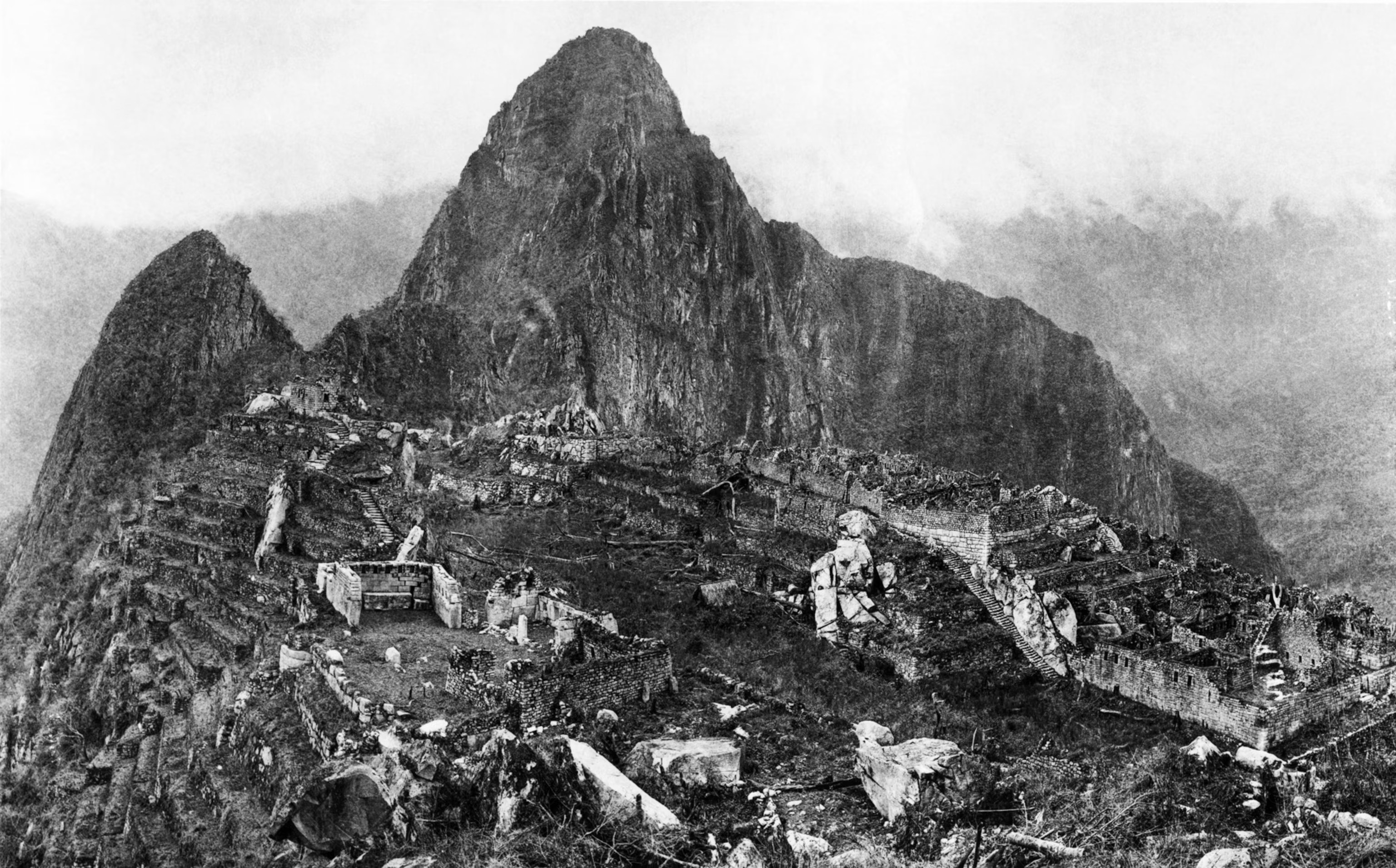
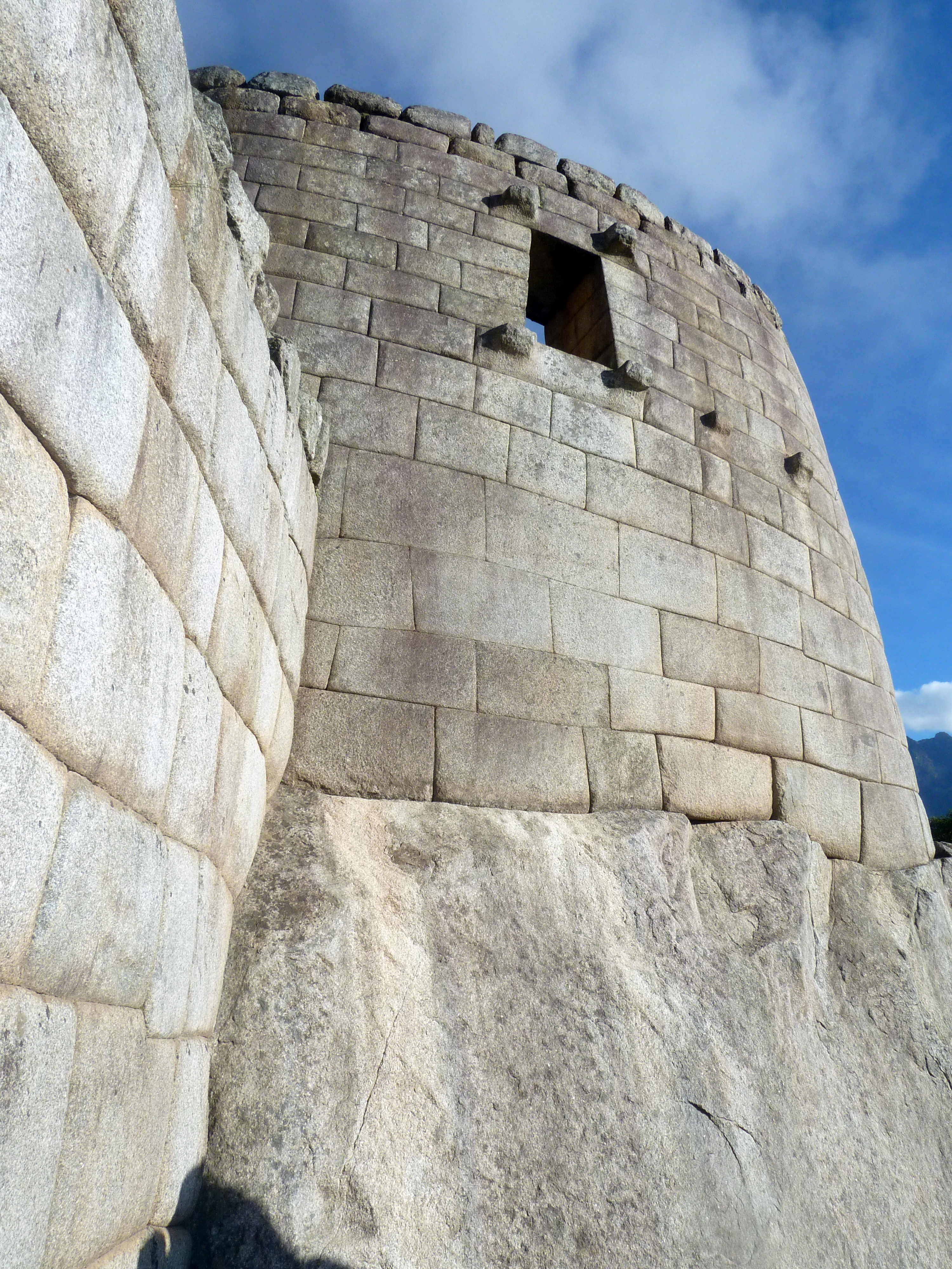
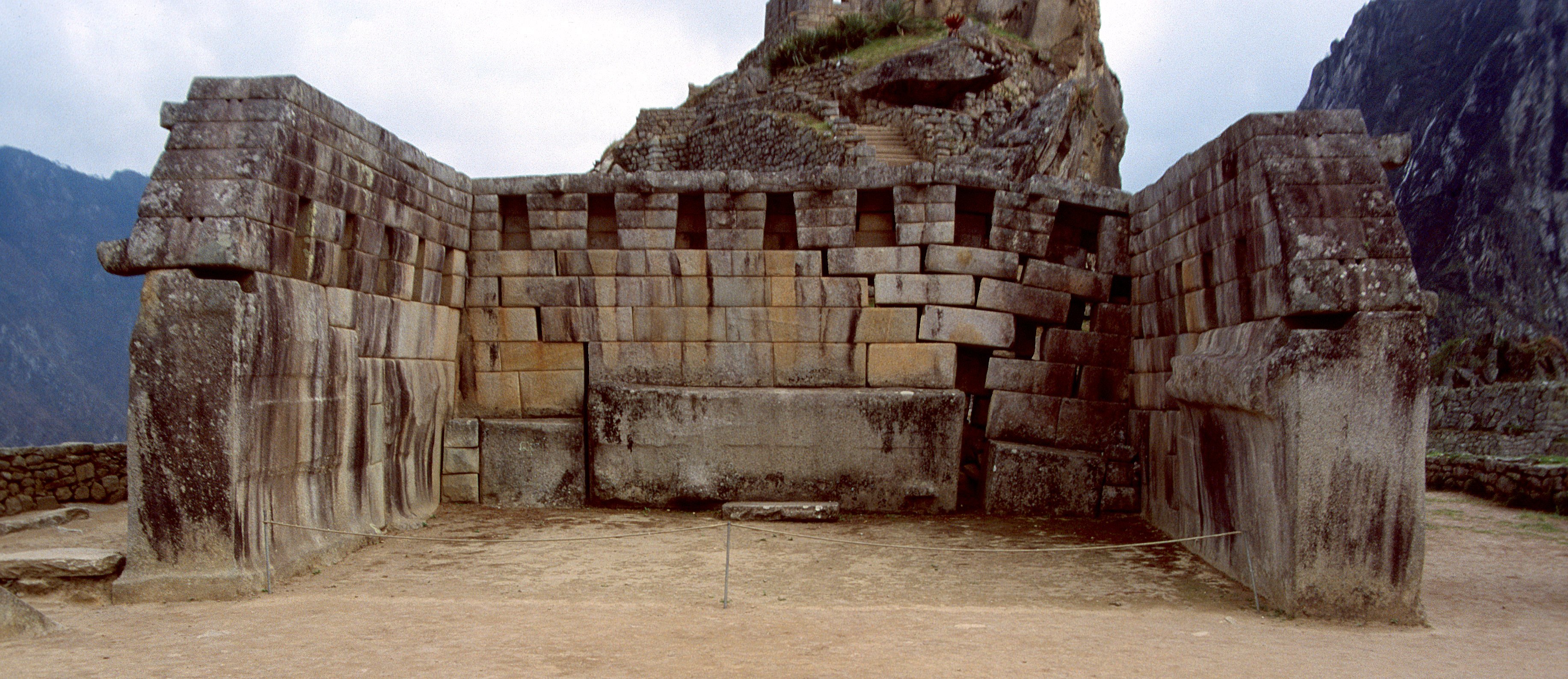
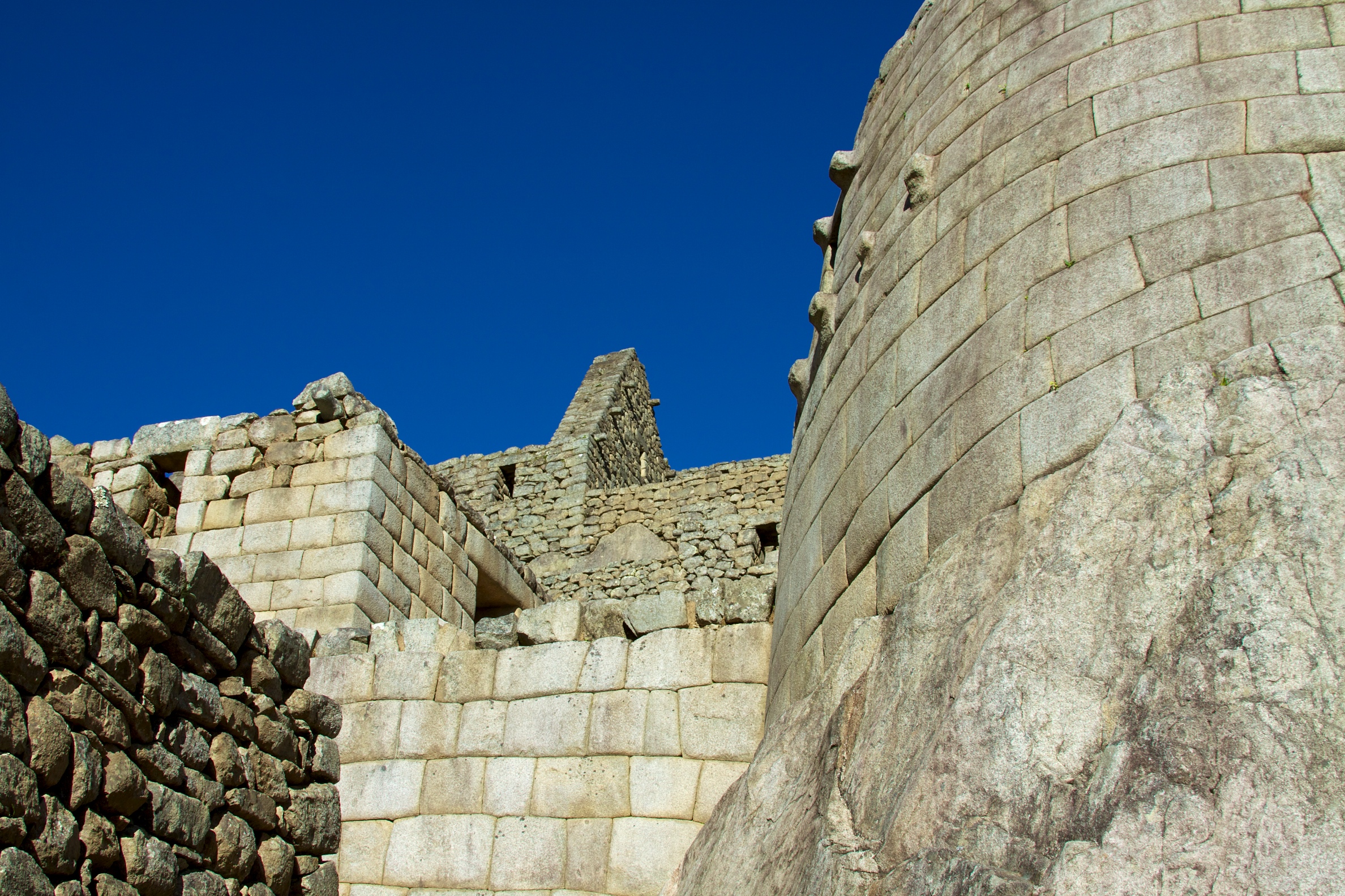