|
Reflections 2017
Series 13
August 5
Peru IV: Cusco II: Saqsaywaman - Urubamba Valley – Cusco III
| | Day 5: Cusco II: Saqsaywaman; Urubamba Valley The day after the train trip to Machu Pikchu was a Sunday, and I'd scheduled a visit this day to those places you need a car for. That would primarily be the Urubamba Valley ("Sacred Valley"), but before that, a part of Cusco that could be walkable, but inadvisedly so, the cliffs of Saqsaywaman.
https://belmondcdn.azureedge.net/ocus/1366x955/ocus_1366x955_destination_cuzco04.jpg
| | | | Here's the center of Cusco with the Plaza de Armas. (The tree-covered Plaza Regojico with its fountain that we saw illuminated at night coming home last night from Machu Pikchu is just one block away at the lower left.) The Jesuit Church is on the lower right, and the Cathedral on the far side. Two blocks uphill behind the cathedral and one block left is the Hotel Rumi Punku. Estimate where that is, and you'll see that the imposing citadel of Saqsaywaman on top of the hill at the left is really quite near. So near, and yet so far.
http://4.bp.blogspot.com/-1JSXL3DZ5iU/TdG-EQWepCI/AAAAAAAAIcA/MXeX5vO5AGw/s1600/cuscopuma.jpg
http://images.travelpod.com/cache/accom_maps/Hostel-Jacaranda-Inn-Cusco.gif
| | | | Here's a similar view from higher up that shows the difference in altitude spectacularly, and a map (click) that shows streets better. Oddly, I found an online map that actually shows where the Rumi Punku is on Choqechaka. Google Maps says to simply take Choquechaka and zig-zag your way up, walking for 27 minutes over 1.4 km. But there was also something I'd never seen on Google Maps before, a line graph indicating that you start at 3426 m and end at 3590 m, having climbed 165 m (541 ft). (The official altitude of Cusco is 3402 m, but the hotel is already partially uphill from the Plaza de Armas, apparently by 24 meters/yards.) | | | | It's easy to see how walking a few zigs and zags will get you there. But at this altitude? And there's another problem. The Frommer guide warns against isolating yourself up top here, especially early and late in the day when fewer people are there, since muggings have occurred. For this reason, I scheduled this Cusco stop instead as the first stop on the car trip out to the Urubamba Valley. | | | | I was surprised to see that it was Boris who showed up with the driver, the same guide from the first day. Erick also showed up at the hotel again for a few moments to make sure everything went smoothly, then off we went. Follow on the map how the car route went. We swung south around the Plaza de Armas, then north up Saphi (remember that name), with a sharp right on that white road, Don Bosco (unnamed). It led around the hill and then to the west parking lot. We walked along the walls (in black) and then Boris phoned the driver and he picked up at the east parking lot to reduce walking, I'm so glad to say. From there it was north to the Valley, so they planned it quite cleverly. | | | | Saqsaywaman Saqsaywaman, like Machu Pikchu, was a citadel, but also described as a ceremonial citadel, since religious and political events took place there as well. But while Machu Pikchu protected a royal estate, Saqsaywaman was meant to protect the capital city of Cusco. It didn't start being an Inca structure. Sections were first built by the Kilke culture about 1100, which had already been there for two centuries. The Incas expanded it starting in the 13C. We saw this before when the Aztecs took over Teotihuacán from the Teotihuacano culture.
http://fthmb.tqn.com/08FzmTY7RkQzAY6YNN6A8yOJC2s=/640x0/filters:no_upscale()/about/Sacsayhuaman_mapa_-56a2a5713df78cf7727860a6.gif
http://www.qosqo.com/maps/saqsa-plan.gif
| | | | I'd had an excellent online map that showed everything I wanted to show, but it has disappeared, so we'll use the first of these two maps as an introduction. The essence of Saqsaywaman starts with its large central plaza area, capable of holding thousands of people for celebrations—still used today—which highlights the quintessential sight, the adjacent three massive terrace stone walls. The first map, in Spanish, is the only one that shows the plaza, between a little hill to the north, and the bulk of the citadel to the south, whose three walls are highlighted in red. But let's concentrate on the second map, which I find better. | | | | | | When there I saw the stone gate on the east side (Photo by Martin St-Amant-Wikipedia-CC-BY-SA-3.0), but only seeing these two maps do I know that they actually do call it the Rumi Punku, exactly the same name as on our hotel. I find that both comforting and affirmative, for having chosen a hotel with such a historic style of entryway. Of course, since we realize that punku in Quechua already means gate, adding puerta on the Spanish map or "gate" on the English map to the name is actually redundant, but let's keep that our little secret. |
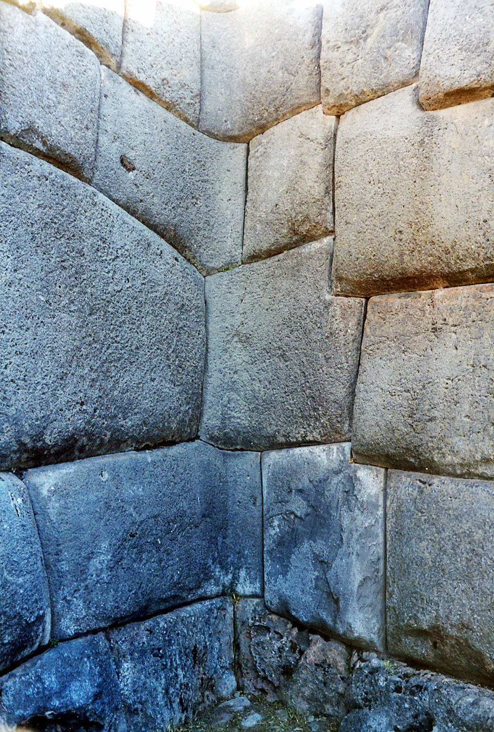
| | | | I hope you are pleasantly confused, just as I was at the time, that things seem backwards, but when you think about it, it makes perfect sense. In both maps, Cusco is to the south, and the walls face away from town, perhaps counterintuitively. But there are cliffs on the three sides facing town. Where else would you put up a triple wall but on the landward side, the side that could be attacked? Notice how nicely all three walls are zig-zagged, the better to hold off an enemy during an attack. | | | | It's time we took a look at the spectacular main feature, and panoramic views are the best. As usual, I can't decide between two, so I'll show both, each having its good side. Saqsaywaman 1 (Panorama by Darkmagic) is not only brighter (click), but makes it clear that, despite what the maps show, there's little to see beyond the three walls, so had no reason to be tempted to climb, since I was already walking slowly. It's particularly good in showing how small the people look next to those massive stones in the lowest wall. You can also see how the Cusco Valley in the distance has this ridge running around it. And I like Saqsaywaman 2 (Photo by Martin St-Amant-Wikipedia-CC-BY-SA-3.0), although a bit darker, because it concentrates on nothing other than the three terraced walls. | | | | I am fully taken with Saqsaywaman. It's been described as the greatest (and nearest) of ruins, and I think its spectacular scale makes it the most interesting ruin in Cusco, to say nothing of the fact that nothing was built on top of it, as happened in town. While Machu Pikchu has a more spectacular setting, as for architecture, I saw nothing in Machu Pikchu that beats this. The numbers I've seen are that perhaps what you see is about 30% that remains of the original structure, and that covers only about a quarter of the original area. The structure is so reduced because the Spaniards stole the more manageable blocks for houses in Cusco--remember that most of the stones in Cusco Cathedral came from Saqsaywaman. One can only imagine what the site would look like if the Spanish hadn't been so destructive. | | | | Let's walk up to the wall and look along the length of its 22 zigzags (Photo by Bcasterline). You can see how hard they make it to attack. And this work is referred to as "large-stone polygonal masonry", a phrase that I think sums it up nicely. The stones used in the construction of these terraces are among the largest used in any building in pre-Columbian America. The work is so typically fine that they display a precision of fitting that is unmatched in the Americas. The longest of the three walls is about 400 m (1,312 ft). They are about 6 m (20 ft) tall. The largest blocks vary from 128 to 200 tons (141 to 220 US tons). | | | | As we know, the precision of the work, the rounded corners of the rocks, the variety of their interlocking shapes, and the walls leaning inward, all combined to help the structure survive earthquakes. This last picture shows not only rounded stones, but also stones cut in an amazing inside angle in one of the zig-zags (All three photos by Håkan Svensson [Xauxa]). | | | | Saqsaywaman was the site of one of the bloodiest of battles two years after the Spanish conquest. During an anti-Spanish revolt in 1536, the Incas took back Saqsaywaman and nearly defeated the Spanish in a siege of Cusco. Francisco Pizarro had three brothers with him in Peru, Gonzalo, Hernando, and Juan. Juan Pizarro and his forces stormed Saqsaywaman in a horrific battle with thousands of deaths, including that of Juan Pizarro. | | | | A lengthy name like Saqsaywaman begs to be translated, and that's hard to do. The only sure thing is that waman is "falcon", since it represented a falcon that guarded Cusco. I've seen various interpretations of the first part, but I can live with the one that says that saqsay is "to satiate yourself, to eat your fill", so that Saqsaywaman would be "[Place Where] the Falcon Eats its Fill".
http://www.itmb.ca/shop/images/samples/Cuzco_Front.jpg
| | | | Urubamba Valley We now leave the Cusco area to visit the Urubamba Valley. Above is once again our ITM map of the area. We had seen on an earlier map how what we're doing is almost a circular loop drive plus an extension, and you can follow the main road in red, every bit of which we would end up traversing to visit the places I wanted to see, up to the road's end in Ollantaytambo. And of course, we saw the section of the Valley west of Ollantaytambo yesterday on the train. | | | | Let's start by understanding the big picture of the rivers so we can see that the river running through the Valley we'll be visiting today--as well as below Machu Pikchu--is part of the headwaters of the Amazon—just keep that in mind. Follow on this relief map (Map by Roar Johansen) to see how this happens. We'll concentrate on the two rivers near Cusco, as they change names and come together. | | | | The Apurímac (a.pu.RI.mak), which rises in southwestern Peru less than 160 km (99 mi) from the Pacific, is considered the source of the Amazon. It flows northwest passing south of Cusco, joins the Mantaro to become the Ene, and takes on the Perené (unnamed on the map) to become the Tambo. | | | | Meanwhile, off the map on the lower right, La Raya pass (which we'll visit later, on the next train), is the source of another river, called the Willkanuta (hispanicized as Vilcanota). It then changes its name to the Urubamba and passes Cusco to the north (barely visible on the map—look closely), flowing down the Urubamba Valley and past Machu Pikchu. It then becomes much more visible on the map, and where it joins the Apurímac is where the joint name Ucayali appears. So both our rivers are of similar length, but the Apurímac must be a bit longer to be considered the source of the Amazon. | | | | On this map (Map by Kmusser) you can see both the Apurímac and the (unnamed) Urubamba on either side of Cusco, forming the Ucayali, and can see how the Ucayali is the main headstream of the Amazon. And now we can segue to where we mentioned this on the Amazon trip (2011/13): 100 km before (south of) Iquitos, the Ucayali joins the Marañón, and here the river is for the first time actually called the Amazonas. It keeps this name as it passes Iquitos and for the rest of its time in Peru and Columbia. | | | | That's the background, and now on our ITM map, follow the route in red (paved) from Cusco toward our first stop in Pisaq. The Valley connections were not far apart, but I checked with Google Maps and it says this stretch takes just 45 minutes, so we're not speaking of vast distances here at all. Find on the map the village of Taray as we reach the Urubamba Valley. This is Taray in the foreground (Photo by Charles Gadbois) as we arrive in this beautiful Valley; Pisaq would be a bit to the right. Click to find the Urubamba flowing downstream. The Valley is just as nice here as when we saw it from the train near the Nevado Victoria. The entire Valley is far, far more beautiful than I'd ever expected, which was a marvelous revelation. | | | | The color changes on the map show we've been descending, and will continue to do so. In numbers we get this: Cusco 3,402 m (11,160 ft); Pisaq 2,972 m (9,751 ft); Ollantaytambo 2,792 m (9,160 ft). Remember that the lower altitude of the Valley has always allowed it to be a major center of Incan agricultural production, hence the nickname "sacred". They have traditionally grown the staples of white corn and potatoes. The Valley is still traditional, in customs and speech, and is largely Quechua-speaking, so in addition to the beauty, we get ethnic and cultural history. This is a win-win excursion. | | | | Pisaq There are several reasons for going to Pisaq, hispanicized as Písac. I went there for potatoes. Well, OK, for more than that, clarified below. One major reason to go is for the Inca ruins there. I knew they existed. I didn't mention them. Boris didn't mention them either as we arrived in and visited the town, and that was just fine with me. I suppose the prime reason we each silently agreed to keep our mouths shut is that, as I understand, the Pisaq ruins are spread out on top of a mountain ridge. I had no intention of doing any degree of mountain walking, and certainly not climbing, in this altitude. But the second reason is also all-powerful—repetition. A traveler shouldn't fall in the trap of having to see every tree in the forest, every lake in Minnesota, every beach on the Mediterranean, every Colonial church ever built in Peru, or every Inca ruin. We'd seen Cusco, Machu Pikchu, and had just left Saqsaywaman, each of which had at least one special thing to make it stand out from others. Ruins elsewhere could be skipped, especially hard-to-access ones. As a concession, I offer here an overview of the Inca ruins at Pisaq (Photo by Kevstan). It does seem like visiting them would be formidable, but the picture does offer a nice view of the Urubamba Valley (click). On the other hand, it's hard NOT to get a nice view of the Urubamba Valley anywhere along its length.
| | | | The Frommer guide says the Pisaq crafts market is among the best, particularly on Sunday, and a major reason for visiting. I'd heard that Pisaq was an attractive town and had the typical narrow Inca streets, only a few of which remain in Cusco, so the market plus the streets, was a draw, and I had planned this for a Sunday. We found plenty of typical narrow streets (Photo by Frans-Banja Mulder) like this, with the typical drain down the center, and craft shops along the way. Some streets on the other hand had many market stalls (Photo by TonjeGram), with fabrics, crafts, and trinkets. But I very rarely buy things in places like this, so we just browsed up and down some streets.
https://moon.com/wp-content/uploads/2013/05/02_02_Pisac.jpg
| | | | As our ITM map shows, the road from Cusco needs to make two huge switchbacks in order to lower it down into the Valley, where we cross the Urubamba into town. Above is a map of Pisaq, showing our entry, and how few streets there are in this small town, but typical for an Inca town, all forming a parallel and perpendicular grid of narrow streets. After seeing the crafts, we headed for Plaza Constitución, where, on Sundays only, there was a farmers' market. The visit here would replace the Cusco market I skipped on that walking tour and was a very fulfilling experience culturally.
http://4.bp.blogspot.com/-B2yrbpeLx6s/U3j9Gkp-q2I/AAAAAAAAf-I/vL6B99PdjsM/s1600/Sacred+Valye05_Pisac+Market16.JPG
https://oneworldofcolor.files.wordpress.com/2013/06/1285-pisac-peru.jpg
| | | | Visiting the Pisaq farmers' market (Photo by TonjeGram) was a much more authentic cultural experience than visiting the tourist-oriented Pisaq craft stalls. In these three pictures, just look at the people—the outfits the locals were wearing, and particularly those hats on the women! I love that look!
http://l7.alamy.com/zooms/7f603f1da36547419cddaf67cbae9e90/sacks-of-beans-for-sale-on-a-peruvian-market-c57mty.jpg
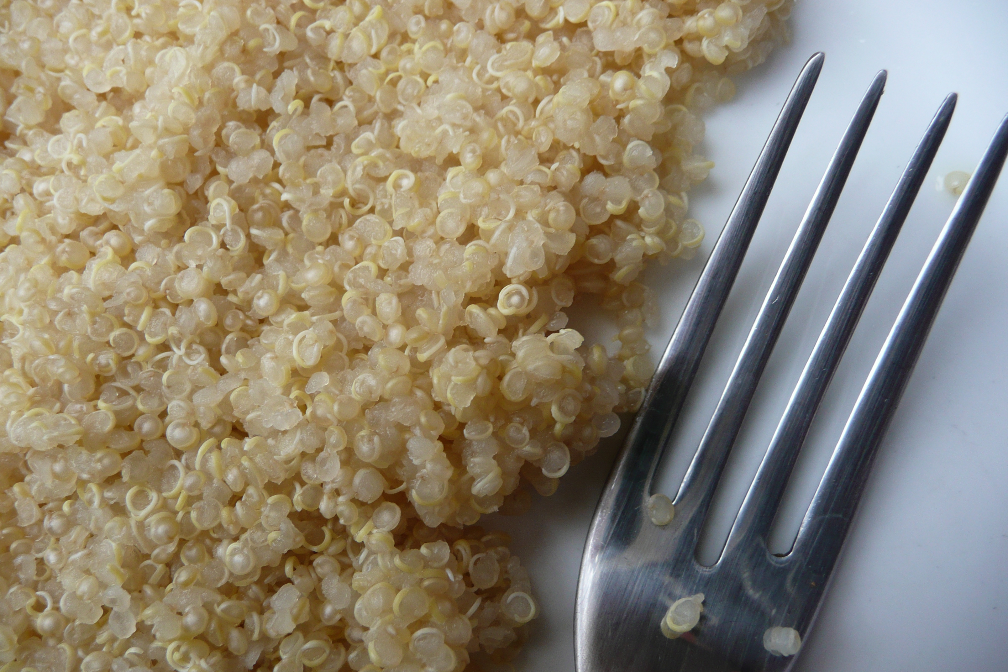
| | | | I wanted to see lima beans, named after Lima, while I was in Peru. I asked Boris to find me some, and a woman had a burlap bag full. It was similar to those in the right foreground of the above picture of many kinds of beans taken in a Peruvian market, but the only beans this woman was selling were lima beans. | | | | I'd learned so much about quinoa in Ecuador (2015/15), when the indigenous woman showed us a field of it, and we found some in the market. It comes in many colors, the most common being white, red, and black. This is a
Peruvian quinoa field (Photo by Maurice Chédel) at 3,800 m (c 12,500 ft) west of Cusco, and this is cooked white quinoa (Photo by Vi..Cult...).
| | | | We should not forget that the reason Incas of old came down from high Cusco to settle the Urubamba Valley, located at a more reasonable altitude for agriculture, is maize/corn, an essential crop. Yesterday on the train, Carlos pointed out how Peruvian corn is unusual in having very large kernels. He had on hand one way they're served, as loose, toasted, salted kernels, similar to corn nuts and sometimes given away to restaurant patrons upon being seated, just as elsewhere, free peanuts might be presented to a patron in a bar. I'm told that the taste and appearance are somewhat similar to hominy, as discussed with grits in Charleston 2016/17. (Photo by Nsaum75 at English Wikipedia; for size comparison, a Mexican peso and US quarter are shown; the latter is 24.26 mm [0.94 in] in size.)
| | | | International varieties of maize/corn originated in Central America. What we have here is called Peruvian corn, and the local name is choclo, derived from a Quechua word. It's a large-kernel variety of field corn (Photo by HugoMon), not to be confused with sweet corn. Field corn is normally not used for human consumption without commercial pre-processing, as described. As compared to the sweet taste of sweet corn, the kernels of choclo (Photo by David Adam Kess) are not only larger, but chewier, with a starchy, hefty texture. We found choclo in the Pisaq market. It comes not only in the yellow and white shown, but in many varieties and in many colors (Photo by Jenny Mealing).
http://www.maschevere.com/wp-content/uploads/2014/12/cosas-curiosas-peru-7.jpg
http://stories.coop/wp-content/uploads/sites/stories.coop/files/stories/written/2012/03/27/491/017-1024x768.jpg
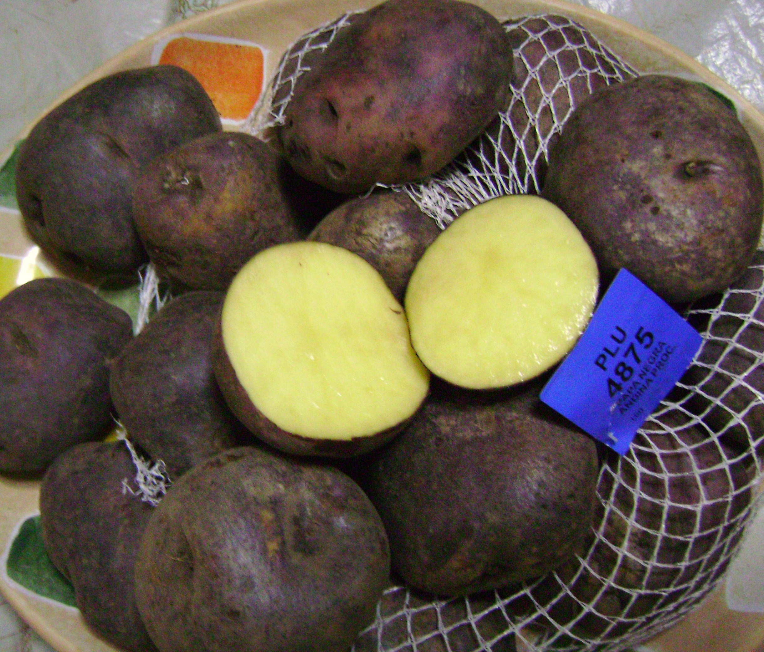
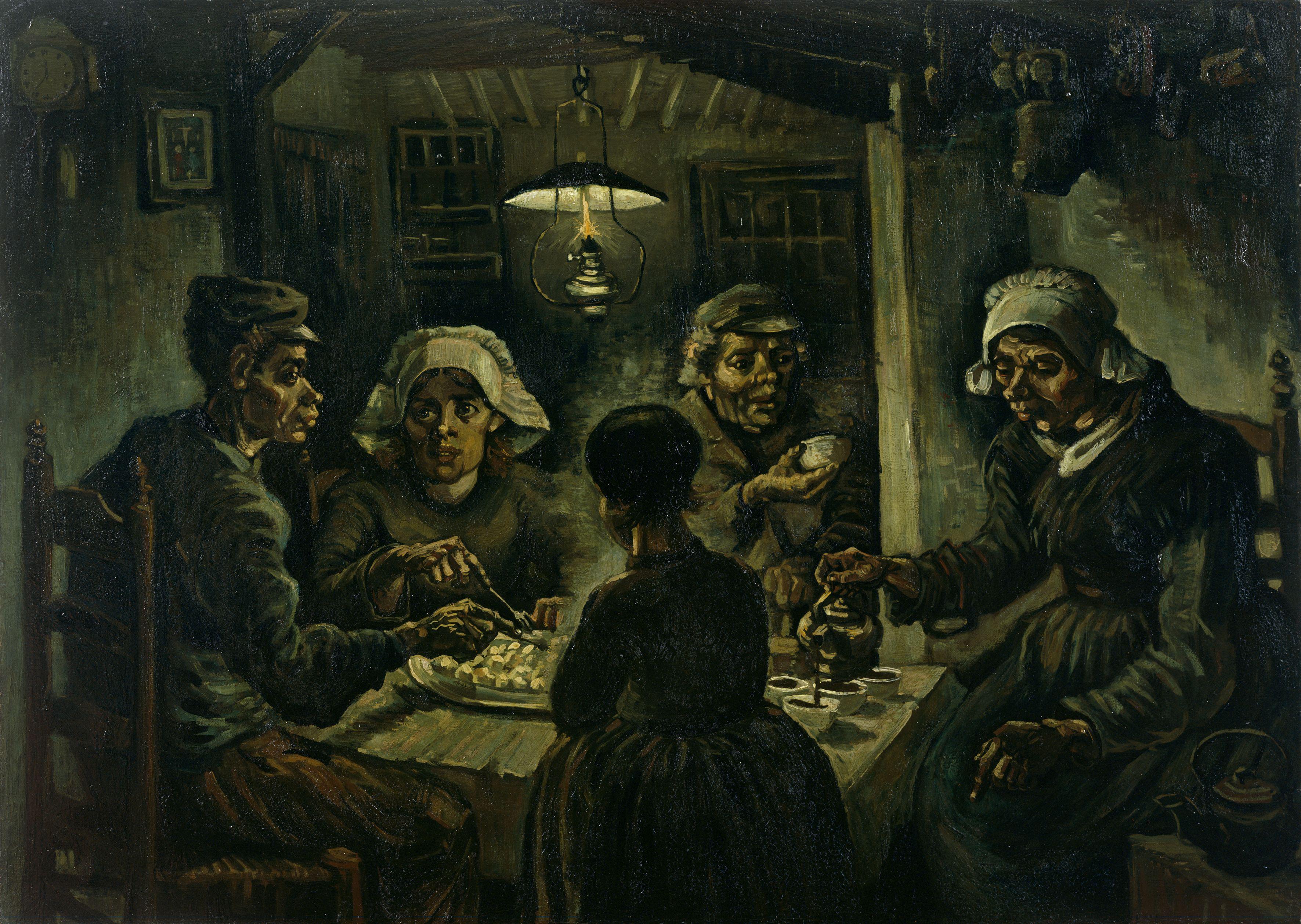
| | | | And then we found my potatoes! Plenty of them! And what potatoes! There were more and of greater varieties than I could have hoped for—just look at the multiple colors above. Of course these pictures mix different ones together for the sake of illustration—the vendors actually had the different kinds neatly separated in different piles, as in any market. And you cannot tell a book by its cover. This variety, known as the Andean black potato, is yellowish inside (Photo by Dtarazona), while this purple-blue variety is purple-blue inside (Photo by Stephen Lea). This explains why there's such a thing as blue potato chips (Photo by BBCLCD). | | | | Peru is the country with the greatest diversity of potatoes in the world. It has eight cultivated native species, with thousands of varieties. While one quote ventures 3,800 in total, there is in Lima the Centro Internacional de la Papa / International Potato Center, which has 2,500 potato varieties registered that are native to the Peruvian Andean region, and continues to register more. Potatoes here differ in size, shape, color, skin, pulp, texture, and taste—and therefore, use. Needless to say, Peruvian shoppers have to know their potatoes. | | | | There is good reason for this. The potato was originally domesticated around the shores of Lake Titicaca. Genetic testing of the varieties proved that single origin, where they were domesticated about 7,000 to 10,000 years ago. Yet it took millennia of selective breeding, since wild potatoes have a bitter taste and contain small amounts of toxins. Early cultures had to work at finding the right ones for cultivation that were tastier and less toxic. It's believed sailors returning from Peru brought potatoes back with them to Spain and England in c 1570, though it took a good century until this botanical novelty was accepted. But how completely it was accepted and became part of international cuisines and cultures, even history, is truly amazing—just think for starters about diverse things such as the Irish Potato famine and French fries. Rembrandt painted several pictures involving potatoes specifically, by far the most famous being De Aardappeleters / The Potato Eaters in 1885. | | | | Names for Potatoes The name of the Rembrandt painting brings us into the world of words, specifically names for the potato. While some European languages have unique names for them, there are, across a variety of languages, three different naming patterns. What's odder still, the patterns jump willy-nilly between the three subfamilies of our Indo-European languages, Latinate, Germanic, and Slavic languages.
| | | | (SWEET) POTATO: Let's start with words that resemble "potato", and here I found a surprise as to potatoes and sweet potatoes. Based on the similarity of these two English names, which doesn't necessarily happen in other languages, logic would say that we learned first of the potato, and then afterward of the non-related sweet potato, which would seem to explain the imitative name of the latter in English. It's not so. | | | | The two vegetables were spread by the Spanish, who came across the sweet potato first, in Haiti in 1526, where the indigenous Taino name was batata. They imported it to Spain, where it was cultivated by the mid-1500s, and where the word was eventually altered to patata. By the 1590s, the Spanish then also discovered the potato that had been cultivated in Peru for so long. As is still the case today between the English names "potatoes" and "sweet potatoes", the Spanish didn't see a difference, and called the potato patata as well. In modern times, this has come full circle, and there's no longer this duplication, since in Spanish today, a sweet potato is a camote, and a potato is a patata. It's just ironic that the latter word originally referred to the former vegetable. | | | | Well, almost. There's another word for potato in Spanish, papa, which is Quechua for "tuber", reflecting the origin of the potato. Papa is used extensively, if not universally, in South America, and patata in Spain.
Well, almost. Papa is also used in Spain, but some people consider it less elegant.
Well, almost. The ONLY way to say "French fries" in Spanish anywhere is papas fritas "fried potatoes". Clear?
| | | | The sweet potato reached Virginia by 1648. While the first potatoes to arrive in North America were sent to Jamestown, the first ones actually grown in North America were planted in New Hampshire in 1719. As to names, while Spanish cleared up the confusion of calling the two vegetables by the same name (above), that never happened in English, beyond adding the word "sweet" to the name of one of them. | | | | Other languages that follow the "potato" pattern are: Italian patata; Portuguese batata; Norwegian potet; Swedish potatis; Greek πατάτα / patata. Notice how this is a mix-and-match blend of Latinate and Germanic languages, plus Greek. Remember pi (π), and you can read the Greek word directly. I always wondered if the Swedish word, not a plural, was influenced by the English plural "potatoes". But that's just conjecture. | | | | People kid in English about "names that end in vowels" as being of Italian (or Spanish) origin, since few English words end in clear vowel sounds. Therefore, I find it odd that when English adopted patata, it ended up turning the last sound into a clearly enunciated O. Then that extended further. The tomato also originated in the Central Andes (!!), but was cultivated by both the Incas and Aztecs, and so it was the Nahuatl (Aztec) name tomatl, with that familiar TL at the end, that altered to Spanish, tomate (to.MA.té), and spread in that form to many languages. It entered English as such c 1600, but by 1753, most likely under the influence of "potato", "tomate" in English grew an O as well, and became "tomato", and so we have, quite unusually, these two words in O—and they rhyme. Well, almost. Since English tends to abhor a clearly pronounced O at the end of words, the frequent pronunciation mumbles it, resulting in the pronunciations "potata" and "tomata". Talk about coming full circle. | | | | APPLE: When the potato spread across Europe, the Spanish name did not necessarily follow it and other imagery evolved. Apparently one was that its shape reminded people of an apple, but since it grew underground, it was called the equivalent in the local language of "earth apple". This most notably happened in French, where pomme "apple", developed into pomme de terre "earth apple". But this can get shortened, most notably in pommes frites "French fries", which refers to fried potatoes, but looks like it means fried apples. But context saves the day, and everyone understands. | | | | We now get back to Rembrandt's painting of De Aardappeleters. Take away de "the" and eters "eaters" and you're left with aardappel, which is "earth apple". If you don't recognize aard immediately, then reflect on the aardvark, an Afrikaans Dutch word literally meaning "earth pig", since it burrows underground. And while the standard German word is something else (below), German dialects do use Erdapfel for "potato", very close to the Dutch. We again see the same structure in both Latinate French and two Germanic languages. | | | | TRUFFLE: This one bowled me over, as I never knew before how the truffle influenced the third type of imagery. But we'll only understand how if we understand dissimilation. | | | | Assimilation is easy to understand—two sounds become more alike. Add the prefix "in-" to "pose" and you do not get "*inpose", but "impose", with one sound adjusting to another by becoming more similar to it. This happens all the time, which is why "football" is so commonly pronounced as "foopball"—"baskepball", too. | | | | Dissimilation is a little harder to see, but it involves two nearby sounds becoming different from each other. The Latin word for "poison", venenum (think "venom"), became in Italian veleno, whereby the N~N becomes—dissimilates to--L~N. Latin peregrinus with R~R becomes French pélérin and English "pilgrim", both with L~R. English "February", with R~R, when pronounced that way, is often considered a stilted, if not a downright snobbish pronunciation, and most often is pronounced instead as "Febyuary" with Y~R. In each of these cases, the first sound becomes something different from what had started out as its twin. | | | | So now apparently in some languages the image of a truffle growing underground, like a potato does, influenced the naming of the potato. The Italian word for "truffle", presently tartufo, once had a dialectical form tartufola. This was adapted into German to describe the potato in the form tartoffel. Then dissimilation occurred within the German word with the T~T altering to K~T, and so the German word became Kartoffel, as it remains today. It's interesting to compare Kartoffel with Trüffel, the German word for "truffle". | | | | This word appears not only in (Germanic) Danish kartoffel, but (Latinate) Romanian cartof and (Slavic) Russian картофель / kartofel', borrowed, like so many Russian words, directly from German. However, that form is the formal way to say it, as it most often appears in the diminutive form картошка / kartoshka. | | | | So the tuber that started as tasteless and toxic on the shores of Lake Titicaca spread around the world causing comparisons with sweet potatoes, apples, and truffles. And without that tuber, no would be able to ask today "You want fries with that?" | | | | Wayra Restaurant, Urubamba When traveling, I usually have a large breakfast and dinner, and do not have lunch, but when I was making plans for today months ago, Coltur said they had a nice stop, that included a horse show. That jolted me to remembering how much I enjoyed stopping for lunch at La Danesa (2015/15) on the Tren Crucero trip in Ecuador, as well as other very special places where lunch was included, so I agreed, which was a good idea. It was only about 55 minutes from Pisaq to the restaurant in Urubamba (see map), and it was along this stretch that we passed several roadside grilling stands offering the previously discussed roasted guinea pig (cuy), with guys brandishing long skewers with you-know-what on the end, looking like they'd just picked up some road kill.
| | | | On the far side of Urubamba we came across a large walled-in complex. At the gates, a worker slid them open so we could drive through. We were at a combination horse ranch, Hotel Sol y Luna ("Sun and Moon"), and Wayra Restaurant. The restaurant name is Quechua--what else?—for "wind". Boris and I walked through gardens and past some active horse paddocks on the way to the hotel-and-restaurant building.
http://1.bp.blogspot.com/_rRS_pP7rEsA/TKlgB_RF98I/AAAAAAAAABg/w6RZiVVqmc8/s1600/999321_112345_ZOOM_PRODUCTO.jpg
| | | | Beyond the hotel lobby was the ample restaurant. Part of it was this glassed-in terrace, but to its right was the open terrace with large white umbrellas over the tables (picture later). Boris and I were the first to arrive, and sat at a table right at the edge of the lawn where the horse show would take place. Shortly afterward, we heard a rustling at the table to my left. It was Maureen and Bing from the train yesterday. She had just climbed from her wheelchair to her seat as I went over and said hello. | | | | The meal was mostly served family style, with occasional items served individually. There were breads, salads, including a quinoa salad, some meats, veggies, desserts. While the meals on Belmond trains were of an international high-style, the meal at Wayra was more ethnic, and very Peruvian. Some things stand out in my memory, and since I like to get rid of negatives first to clear the deck, I'll mention the below item (all pictures are actually from Wayra).
https://richedwardsimagery.files.wordpress.com/2016/01/grilled-beef-hears-tasty-for-our-family-style-bbq-luncheon-on-the-terrace-at-wayra-ranch-urubamba-province-sacred-valley-of-the-incas-peru.jpg?w=584
| | | | We were served four skewers each in individual plates. I spied the meat suspiciously. I turned to Boris and he volunteered "grilled beef hearts". I grimaced, and gave him my four, which he was happy to get.
https://richedwardsimagery.files.wordpress.com/2016/01/home-made-empanadas-for-our-family-style-bbq-luncheon-on-the-terrace-at-wayra-ranch-urubamba-province-sacred-valley-of-the-incas-peru.jpg?w=584
https://media-cdn.tripadvisor.com/media/photo-s/0f/48/ae/fd/salsas.jpg
| | | | That matter now out of the way, we can say that the meal actually started with a selection of meat and cheese empanadas, as in the first picture. We were given a long dish with three traditional sauces, as in the second picture, and I tried and liked them all on the empanadas, as well as on other items during the meal.
https://richedwardsimagery.files.wordpress.com/2016/01/a-mix-of-colorful-local-peruvian-potatoes-for-our-family-style-bbq-luncheon-on-the-terrace-at-wayra-ranch-urubamba-province-sacred-valley-of-the-incas-peru.jpg?w=584
| | | | I then felt that I really lucked out. After having just seen them in Pisaq, we were served a large bowl with five varieties of Peruvian Andean potatoes. My day was made, and the humble boiled potatoes were also excellent when enlivened by the three sauces. But, while Boris commented on the sauces, no one really explained what they were, so that meant more post-trip research. I have discovered the names and ingredients of two of them. T
http://www.cuzcoeats.com/wp-content/uploads/2012/11/DSC_0196_02.jpg
| | | | One sauce, I have now found out, was uchikuta, hispanicised as "uchicuta", a name that translates from Quechua as simply "ground hot pepper", but that's misleading, since it's much more. I now understand that this spicy sauce is very popular in Peru, and everyone wants it served to them. There are various recipes online, but the ingredients tend to include some or most of the following, all combined in a blender: garlic, coriander, tarragon, cilantro, parsley, oregano, peanuts, onion, feta, olive oil. Included in this mix as well are three Peruvian specialties: rocoto peppers (Photo by Sebastian Aguilar [DrCooling]); wakatay (hispanicized as huacatay, or Peruvian black mint; and cancha corn, which are Peruvian corn nuts.
https://nativocrafts.com/wp-content/uploads/2015/08/ocopa4.jpg
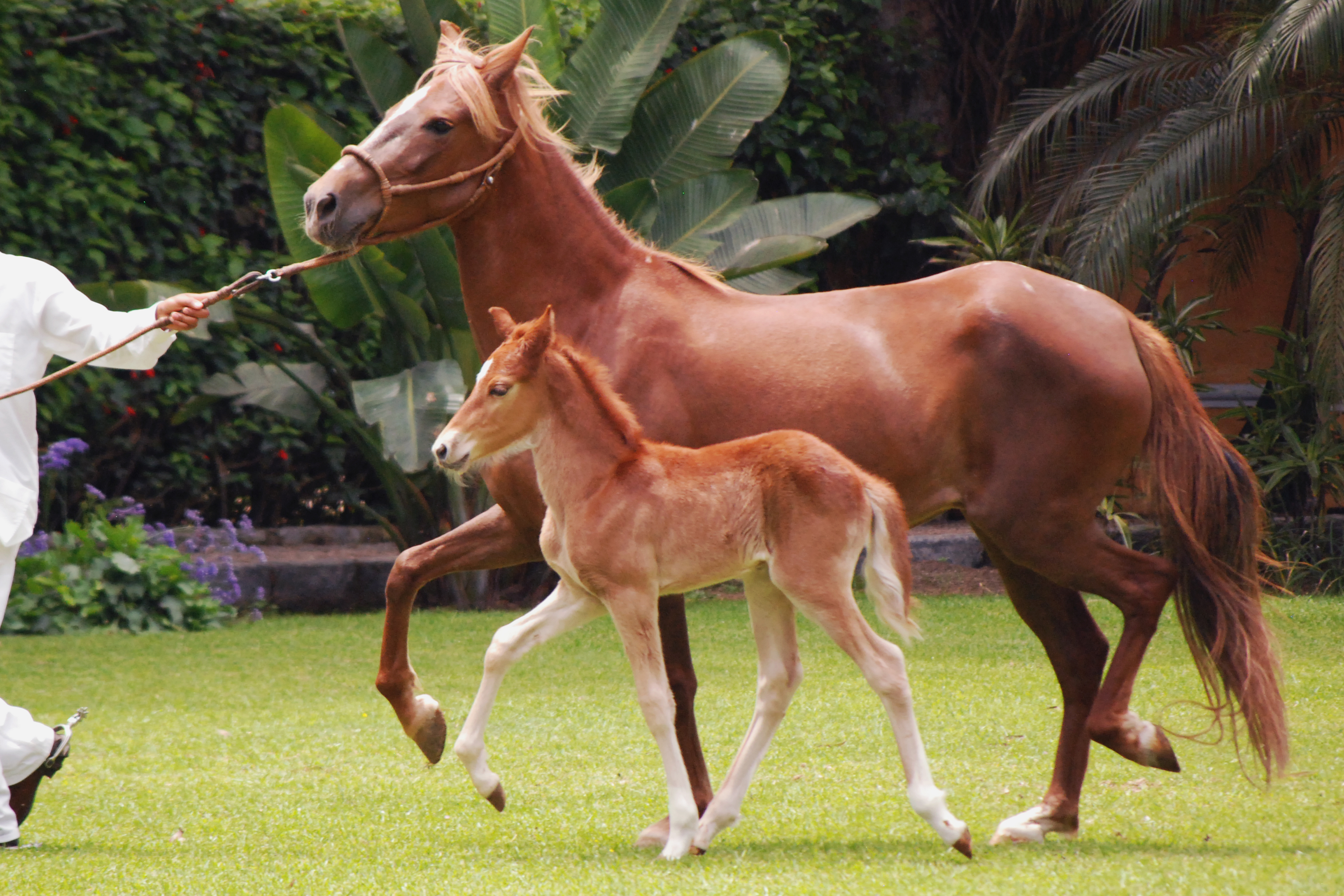
| | | | The other sauce I identified is ocopa, which seems to include, among other things, onion, garlic, wakatay, chili paste, evaporated milk, unsalted peanuts, feta. It's so good with potatoes that that's just how the above picture shows it. | | | | Spanish Horses I know little about horses, other than the fact that the Spanish brought them to America. I've ridden a horse just once, in the Dominican Republic. Our small group was out in the blazing hot sun for an hour and a half, and I remember not having control of the horse. Beverly's horse and mine just followed the group. But I know those horses were Paso Fino ("fine step") horses, which I now find were imported to the Caribbean from Spain. I read that they are "a naturally gaited light horse breed . . . prized for their smooth, natural, four-beat, lateral ambling gait." I understand only some of that sentence.
| | | | On the other hand, the Peruvians have been breeding their own strain of Spanish horse for centuries called the Paso ("step") or Peruvian Paso. It's distinguished by a "natural, four-beat, lateral gait". Because both names share a word, and since how the horses move seems to be a distinguishing characteristic, everyone, including me, apparently assumes a close relationship and common breed, but we are apparently all wrong. While both breeds share ancestors in Spain, and have some similarities, they were developed independently. So much for that. | | | | The Peruvian paso is protected by the Peruvian government, and has been declared a Cultural Heritage of the Nation by the National Institute of Culture. The breed has a side walk called a paso llano that is characteristic. I scoured the internet to find out about that last word, then saw I'd already had in my notes that it's short for paso Castellano or "Castilian step". Apparently, instead of a trot, the Peruvian Paso perform an ambling, four-beat gait between the walk and the canter. The paso llano is a lateral gait in that it has four equal beats and is performed laterally, that is, in the leg sequence left hind, left fore, right hind, right fore. This gait doesn't yield the vertical bounce that a trot does and is easier on the rider. It's also very stable, since the horse always has two, and sometimes three, hooves on the ground at once. That the gait is natural is shown by how this foal is walking (Photo by Harvey Barrison; uploaded by Kersti Nebelsiek).
http://www.gaytravelherald.com/wp-content/uploads/2013/03/gay-travel-herald-wayra-ranch-sacred-valley-peru-paso-horse-riders-andes.jpg
http://images2.mygola.com/wayra-ranch_9422338_l.jpg
https://www.bestofperutravel.com/wp-content/uploads/2013/01/Wayra-Restaurant-Urubamba-8.jpg
| | | | The Horse Show About midway through lunch, the horse show began, and ran for 20-25 minutes, with music on the PA system.. There were four costumed riders circling the lawn and doing ride-bys, as in these three pictures. The first picture also shows the spectacular Urubamba Valley visible from our seats. The third picture also shows where we sat. The hotel lobby is to the left back; that glassed-in patio we saw earlier projects on the right, and the outdoor terrace where we were sitting is under those white umbrellas. Boris and I were at the table to the left of the horse, and Maureen and Bing at the next one.
http://scontent-sjc2-1.cdninstagram.com/t51.2885-15/s750x750/sh0.08/e35/c101.0.878.878/18879687_1855648991350932_8584800839065927680_n.jpg?ig_cache_key=MTUzMTcwNzQ5OTAwNzAyMjQxOA%3D%3D.2.c
http://www.coolperu.com/travel/images/wayrarestaurant_2.jpg
| | | | But it wasn't only horsemen. There were also four dancers that appeared (1st photo), who sometimes interacted with the horsemen (2nd photo). Finally, we have three short YouTube videos. Watch what you like. The first one (1:28) shows the horse show, with music, though a bit from afar. The second one (2;05) shows a dancer with a mounted horseman performing right in front of our umbrellaed tables. The third one (1:58) is mostly about the Hotel Sol y Luna. I suggest you watch only the first 35 seconds, showing a little of the horse show, but then arriving at the walled compound and entering the gate, and the gardens. It's really quite nice having entertainment during lunch.
| | | | We were then off to our final stop of the day, Ollantaytambo, 30 minutes away. But in between, we continued to have more of the Urubamba Valley (Photo by McKay Savage)—click for details. I continue to be amazed that I, along with most others, thought that the entire area on the ITM map down to Poroy is somehow the "sacred valley", while in reality, it's just this beautiful narrow stretch of steep-sided river valley. | | | | Ollantaytambo Talk about long names! I understand even the locals shorten it to Ollanta (o.YAN.ta). On that basis, I long thought that that famous ship in Lake Titicaca, the Ollanta, that's just been restored, was named after this village. Now I can tell it's not. Instead, they're both named after an Inca general named Ollantay. "Tambo" is the hispanicized version of Quechua tampu, which apparently refers to a place offering travelers food and lodging. Could we say Ollantaytambo is the equivalent of Ollantayville? Maybe not.
| | | | I'm sure you've noticed the 900-pound gorilla in the room. It's Y-shaped. Why does that Y at the end of the general's name come and go? I haven't been able to figure it out. Maybe we should write his name as Ollanta[y]. His name descends in oral tradition, but was also written as a drama, Y-less, in the mid-18C by Antonio Valdez, a priest in Urubamba. | | | | At the time of the Inca Empire, Ollantaytambo was the royal estate of the Sapa Inca Pachakutiq, who conquered the region and in the late 1400s built the village and the ceremonial center, which is now part of the ruins people come to see. His name should sound familiar, since we've seen two statues of him, and he was the Sapa Inca who Machu Pikchu was also built for as a royal estate, further down the Urubamba.
http://www.frommers.com/images/destinations/maps/jpg-2006/2877_ollantaytambodining.jpg
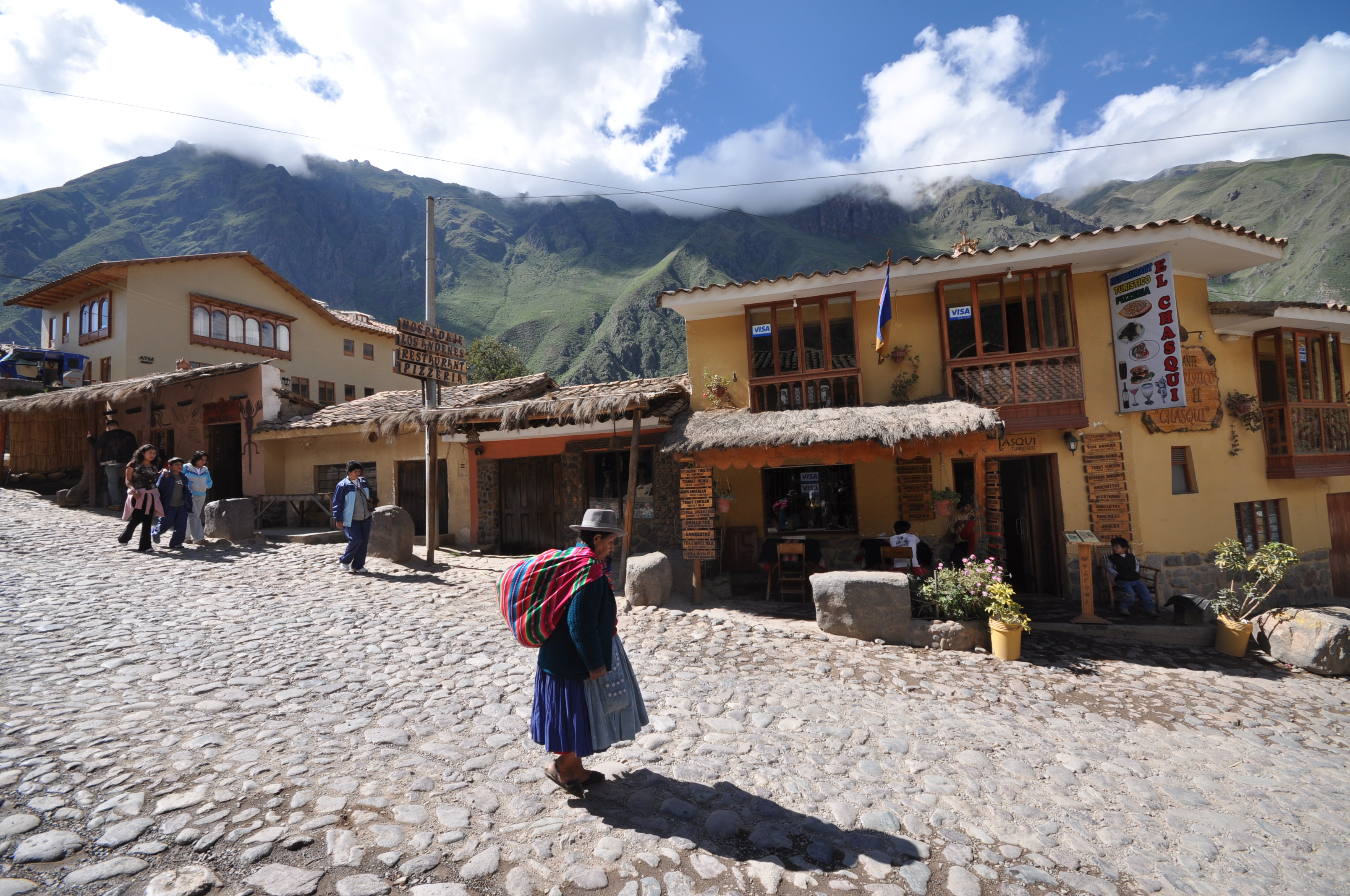
| | | | We'll use this map from the Frommer guide. I found the village much more compelling than the ruins, and now see the Frommer guide agrees, giving the village three stars and the ruins two. It's also listed among Frommer's "Best Villages" for South America. The attraction is that the town is the finest example still remaining of the Incas' talent for urban planning and has the only remaining perfect grid of narrow Inca streets (not widened, like many of Cusco's). It's the only Inca village where many residents still live in the centuries-old Inca buildings and it therefore has some of the oldest continuously occupied dwellings in South America. It has a solid indigenous air with many people in native dress (Photo by Jorge Láscar), and some cobblestone streets. | | | | We came in from Urubamba, and as the map shows, the road from there leads right to the humble Plaza de Armas, where the driver let us out. Frommer had reported that the finest streets of what it called this "stone village" were right behind the plaza, particularly the Calle del Medio, and that's exactly where Boris led me, not walking too far, just one block to the first intersection, then left one block to where we could see the local stream, the Patacancha, and the ruins in the distance across the way.
http://images.eldiario.es/canariasahora/Ollantaytambo-Sagrado-Cusco-VIAJAR-AHORA_EDIIMA20140831_0307_13.jpg
http://tours.cuscopunku.com/uploads/3/6/1/3/3613052/3697032_orig.jpg
| | | | Now let's try to follow that walk down narrow streets, with online pictures of similar streets in town. The first one shows the stone walls and cobblestones, plus that drainage channel down the center. The second one shows two things of interest, a rumi punku / stone door, as in our hotel's name, and to the side, one of the canals still carrying water down from mountains. Next is a typical Inca rumi punku (Photo by Stevage) in Ollantaytambo, part of a house still used by people with kids playing outside. The town just reflects the old way of life.
https://cdn.viajala.com/img/blog/5-sitios-arqueologicos-en-peru/ollantaytambo.jpg
https://laviebyc.files.wordpress.com/2015/01/image81.jpg
| | | | These two views resemble the intersection we came to where we turned. The first one in particular cries out to me that this is a "stone town". It's obvious the Incas built towns for pedestrians, and one can understand that the Spanish arriving in Cusco were frustrated with the narrowness, and rebuilt streets so their horses pulling wagons could get through. And so one comes to Ollantaytambo to get an idea of the original look of the Inca streets. | | | | The ITM map makes it clear how Ollantaytambo is really a child of the Patacancha Valley, and abuts the Urubamba only because the Patacancha does. Keeping that in mind, take a look at this overview of Ollantaytambo. (Photo by Gonzolito) It's taken from one side of the Patacancha Valley (where there are granary ruins we'll soon see) and shows on the right the other side of the same valley with the large ruins of the temple-fortress. Yet the view down the Urubamba is particularly attractive. Remember that the train yesterday joined the Urubamba here, and our train ride went down the valley you're looking at. Also keep in mind that the paved road we arrived here on, ends here. | | | | Now go back to that picture again click so you see the Plaza de Armas and estimate our two block walk to the Patacancha, which has those trees growing next to it. When we reached those trees, it was approximately on this street (Photo by Bgabel). The Patacancha's trees are to the right, but there's also a beautiful view of the Urubamba Valley. A rumi punku exits over another little canal via a stepping stone over to the cobblestones. When we turn to the right and look over the trees, this is the panoramic view across the way of the ruins of the temple-fortress that Boris later led us to—click for details (Photo by Martin St-Amant-Wikipedia-CC-BY-SA-3.0). Both sides of the narrow gorge here are lined with agricultural terraces as we'd seen at Machu Pikchu which had been used to maximize available farmland. | | | | Retracing our steps to the Plaza, lo and behold, we bump into Maureen and Bing for the third and final time. Then our car takes us across the Patacancha (see town map) to a large open area near the ruins (Photo by Jorge Láscar). It's full of tour buses and numerous vendor stands, in front of the wall that serves as an entrance to the site. Boris shows our tickets that he's had with him, and we're in. We're now at the foot of the massive ruin of the temple-fortress (Photo by Bcasterline) with its agricultural terraces up the hillside. | | | | There was not even a discussion about climbing the 200 very steep steps to an esplanade at the top with additional ruins, since it was so obviously out of the question for me. Yet I could see everything I needed to see from here at the bottom and was completely satisfied. All in all, this was nice, but the "stone town" was better. In any case, we can all admire this view from above (Photo by Ivan Mlinaric). It sweeps from this ruin past the entrance plaza (click) across to the village and Plaza de Armas. But then focus on the other side of the gorge, from which we had an earlier view, and click to find three rows of yellowish structures. These are the ruins of mountain granaries (Photo by Stevage) on the hillside over the town. Amazing as it may seem, reportedly, grain was poured into the uphill section, then removed from the downhill side. | | | | It was about 1h40 back to Cusco since (see ITM map) we had to backtrack to Urubamba before completing the loop on the paved road. The road rose in switchbacks to get us out of the Valley. While it didn't strike me at the time, we must have gone through Poroy once again on the way back. The late afternoon and evening were for writing and relaxing at the hotel. | | | | Day 6: Cusco III: A Solo Walk The next day, the last day in Cusco, was a quiet Monday, and I had planned it as both a rest day and a "solo" day. After breakfast it was just writing in the room and relaxing. But in the afternoon I felt I could manage a solo walk for a couple of hours, despite the high altitude. After all, I'd chosen the Rumi Punku because of its central location and I hadn't shown myself around yet. As a matter of fact, this day was the only solo walking tour of the entire two-week trip. Considering I usually go on my own—just recently, in Charleston, Baltimore, Troy—it was due time I do it here. I had in mind a hotel and a museum, plus serendipity here in the center. But the serendipity led to post-trip research, and through dumb luck I ended doing just the right thing, without knowing it in advance. We'll use our Beige map again:
https://4.bp.blogspot.com/-rXYR_xHoYIM/VsMTrFIllQI/AAAAAAAAJo4/TT-HKT69VXo/s1600/cusco-city-map.gif
| | | | Let's go together down Choqechaka, despite the mild drizzle, from the Rumi Punku (#136) to Hatun Rumiyuq (-oc on the map) and turn right. This is the block where we pass on our left, the Stone of Twelve Angles (2017/15). One more block with the Cathedral to our right and we come out into the Plaza de Armas, and to our left is another building that we discussed, one that had a columned arcade with a covered walkway called the Portal de Carrizos, which I found out were reeds. We then continue straight ahead to the next corner of the Plaza, where the map shows, right on the corner at #46, a Hostal (Hotel) Plaza de Armas. This is our first planned destination today. It's based on the fact that, when planning this trip, this had been my second choice as a hotel. I was and remain delighted with the Rumi Punku, but wanted to see this one as well, since it boasted a roof terrace right here on the Plaza. And you cannot argue with its prime location. | | | | I was really quite amused when I found this picture online showing the Portal del Comercio (Photo by Joelzanabria). In style and naming, it's like many of these around the Plaza, including the Plaza de Carrizos. When in 2017/15 we were discussing the statue in the square, we saw additional arcades in the background, but with blue balconies—and here they are. Click to inspect under the arcade that this is indeed the Portal del Comercio, and then move to see within it that the whole corner building is the Hotel Plaza de Armas! What a hoot! [Also note the sign again that we saw on the previous picture of a Portal, directing traffic on the Plaza Haukaypata. It's the Inca name of the square—see below.] | | | | I walked into the Hotel mostly because I wanted to see it, but also to warm up a bit and get out of that misty drizzle. The traditional building from the Colonial period was totally modernized inside. Across the empty lobby, a woman at a desk asked in Spanish if she could help me. I answered in Spanish that I was just looking around, but then added a twist. I admitted that I already had a hotel, but wanted to see this one para la próxima vez / for next time—just a little white lie. She pointed to the elevator and told me to look around. I took it to the top floor, the fourth, where there was a flight of stairs to the roof terrace.
https://www.bestofperutravel.com/wp-content/uploads/2013/08/Hotel-Plaza-De-Armas-Cusco-5.jpg
| | | | The terrace was all I'd expected, and more. It had a direct view of the Cathedral, and to its left, of all the other arcades around the Plaza de Armas. What a nice spot. I absorbed the view, but kept in mind that late May means the southern winter is around the corner, and it was too chilly to spend too much time up here. But it was really nice to see it. | | | | In the two days I was with Boris, he had with him in advance all the entry tickets. One multiple-location ticket included a certain museum, and he gave me that mostly-used ticket with the museum still unpunched and suggested I might enjoy it. So it was the second goal of the day, and really close by. I continued down Mantas (see map), and in the next block there was a tiny rectangular park (not shown) facing La Merced Church, called the Plazoleta de la Merced (also Plazoleta Espinar). It was worth sitting down on a bench to view the passers-by and the church across the street (more later). | | | | A right turn down Heladeros to the corner and there was the Museo de Historia Regional / Regional History Museum. But also to my surprise was that it was exactly catty-corner from the Plaza Regocijo, that treed park we had the nighttime picture of earlier. What luck.
http://www.charliequispe.org/Museos/MuseoHistoricoRegional01.jpg
http://mw2.google.com/mw-panoramio/photos/medium/42531515.jpg
| | | | When I got to the museum (above, both outside, and in the courtyard), it struck me it had to be a recycled Colonial building, and inside I asked someone in Spanish, and it was. But no one told me anything else. It was only in post-trip research in a Spanish source that I found out it was the Colonial mansion of a famous Cusco author and chronicler, Garcilaso de la Vega. The building dates from the end of the 16C to the beginning of the 17C, and he lived there until 1560 when he returned definitively to Spain (it's so unusual to see such early dates in the New World). After the earthquakes of 1650, 1950, and 1986, he building needed restoration. I continued to wonder why an important mansion was on a back street like this, but I figured it out later. | | | | The exhibits were adequate, and included some art work, furniture, costumes, a display of the local varieties of potatoes, an exhibit on Pisco brandy and the Pisco Sour. Still, I was impressed more by the historic building.
http://www.euroradialyouth2016.com/travelogue/wp-content/uploads/2011/04/Plaza-Regocijo-Happy-Park-Cusco-Peru.jpg
Let's cross over catty-corner (see map) to visit the park in the Plaza Regocijo and its old trees and fountain (above), as well as the arcades around it. We'll have to check out that unusual name later. You can't help but to continue down that interesting, narrow, one-block street called Calle del Medio / Middle Street:
http://assets2.mi-web.org/entradas/0007/3736/2009_Cuzco2_001_Calle_del_Medio.jpg?1329651246
https://media-cdn.tripadvisor.com/media/photo-s/04/7b/7b/e9/calle-del-medio.jpg
In the first picture you can see more arcades at the far end on the Plaza de Armas and then you realize it's Middle Street because it separates the Portal del Comercio on the right, where the hotel is, from the Portal Espinar on the left, seen in the second picture at the exit to the street, facing the Plaza de Armas.
| | | | On the far side of the Plaza we see a street off to the left called Calle Suecia / Sweden Street, a name that seems highly unlikely. And I've since found out that therein lies a tale. Going back to Colonial days, not only would women in farmers' markets on the Plaza use this street as a dump, the many visitors arriving on horses or mules, or even leading llamas, would use this street to leave their animals, adding to the—shall we say—insalubrious atmosphere. For these reasons, the street acquired the name Calle Sucia, literally "Dirty Street", or "Filthy Street". Over time "Sucia" changed to "Suecia", with no connection whatsoever to Sweden. | | | | Don't jump to conclusions. There could be two explanations, one casual, one deliberate. The casual one involves folk etymology. Once the street got cleaned up, later generations of locals might have thought they must have heard wrong: the name of a street couldn't possibly be Sucia/Dirty. We must have actually been hearing Suecia/Sweden. Or, it could have been a deliberate change, with locals invoking the squeaky-clean imagery of Sweden to alter the name. Probably, though, it was a little of both. | | | | We then cut up the steps going up the hill (puff, puff) on Tucuman on the other side of the Cathedral, across Nazarenas with the two Belmond hotels, down past the seven stone snakes on Siete Culebras and back to the hotel. | | | | Since on the two away days the major meal was included, after eating across the street from the hotel that first night, this fourth night was only the second meal in Cusco proper. Coming back, I noticed that bistro was closed on Monday, so further down the street I found a very similar one called Las Ñustas. Few words in Spanish start with an Ñ, so I looked up the word. A ñusta was the Quechua name for an Inca princess. Peru is one of the countries where the Fiesta of the Pachamama is celebrated. The Pachamama/Mother Earth is the goddess that represents the Earth. In the modern fiesta, the oldest woman in town is chosen to represent the Pachamama and a virginal teenage girl represents the ñusta, symbolizing the earth that has not yet been fertilized and planted. Stop smirking. | | | | It was a similar evening as that first night, chilly, and, despite the street lights, the sky continued to present that ominous Andean blackness during the New Moon. The bistro was also similar, small, and again with one of those tall propane space heaters, the height of a person, that looked like an art work. Their Visa machine was also out (?) but they took US dollars, so I was glad I had small bills, not requiring change. The meal was good, but worth mentioning is only the Sopa Inka (in that spelling) with quinua (in that spelling), greens, and chicken. To attempt to illustrate it, I'll use the same picture of quinoa soup (Photo by ProjectManhattan) I used in 2017/11 for the quinoa soup that first night . | | | | Inca History at the Plaza de Armas We've talked about the Qurikancha at one end of town and Saqsaywaman at the other. But it was in the middle that Cusco started, at an earlier incarnation of the Plaza de Armas. This I only found out fully in post-trip research, and in doing so, I found that the solo tour we just did above, by pure dumb luck, covered everything I would have done if I'd known this history in advance. | | | | I suppose it all started in 2017/11: Cusco I with this map I'd found, where I said: At the time of the Inca Empire (Map by Scarton), Cusco looked like this. It really tells everything by showing the location of the original settlement between Saqsaywaman and the Qurikancha (not shown, but at the bottom of the gold area). But while I'd heard that the current Plaza de Armas had been larger in Inca times, this was the only indication I had just how, and that it had been almost twice the size. I still don't fully understand the green area; pure conjecture would be that it was an early suburb. But look at those streams! They seemed to define the historic area, with one cutting through the large plaza (with bridges?). And the other? Why does it look suspiciously as the route of "my" street, Calle Choqechaka? Was the street originally a stream? Seeing something like this rendition begs for the discovery of more. | | | | Let's start with the Sapa Inka, hispanicized as Sapa Inca. The title is Quechua for "the only Inka", which means the Spanish got it wrong. Hearing his title, the Spanish started calling all of his followers Incas, and so that became the name of the ethnic and linguistic group. To try to illustrate how much of a mistake that was—though we're stuck with it—it's as though all the Tibetan Buddhists that follow the Dalai Lama were also called Dalai Lamas, or that all Roman Catholics were called Popes. Anyway, the Sapa Inka ruled the Kingdom of Cusco and later the Inca Empire, known as the Tawantinsuyu. The position was hereditary, with son succeeding father. The Sapa Inka was considered a god. | | | | The first Sapa Inka and founder of the Inca civilization in Cusco, possibly in the early 13C, was Manqu Qhapaq, hispanicized as Manco Cápac. We first came across his name as being the name of the train ferry on Lake Titicaca. After the death of his father, his wanderings led his nomadic tribe to the Cusco Valley, where they defeated three small tribes and then, considering a swampy area they found between two small streams a place safe from attack, they settled around it, and it's now the Plaza de Armas. This could explain the name of the Portal de Carrizos (Reeds). Other tribes remaining in the valley regarded them as invaders, and so Manqu Qhapaq/Manco Cápac, and later his son and successor Sinchi Ruq'a /Sinchi Roca, would often have to defend against these other tribes what is now referred to as the Kingdom of Cusco, but which was actually the City-State of Cusco. Sinchi Ruq'a/Sinchi Roca built terraces and imported enormous quantities of soil in order to dry out the swamp and improve the fertility of the valley. Later still, the swamp-cum-plaza was totally dried out by covering the area with sand brought up from the coast. | | | | Independent Sapa Inka During Inca independence, there were 13 Sapa Inka. The names of the below eight have appeared, or will appear, in this posting:
1st Manqu Qhapaq/Manco Cápac ("the royal founder"), c 1200-1230 CE, founder of Cusco, considered to be the son of the sun god Inti.
2nd Sinchi Ruq'a/Sinchi Roca ("valorous, generous Inka"), c 1230-1260 CE, his son.
6th Inka Roq'a/Inca Roca ("magnanimous Inka"), c 1350-1380; his former palace includes the 12-sided stone—unless it was Sinchi Ruq'a's Palace (see upcoming illustration).
8th Wiraqucha/Viracocha ([name of a god]), c 1410–1438; his original name was Hatun Tupaq Inca, but, after seeing visions of the god, was instead named after him.
9th Pachakutiq/-cutec, -cuti ("he who overturns space and time"), 1438-1471, extended the Kingdom of Cusco into the Inca Empire; Machu Pikchu was probably his estate; we saw his statue in Cusco and the one in Aguas Calientes.
10th Tupaq Inka Yupanki/ Túpac Inca Yupanqui ("noble Inca accountant"), 1471–1493; the son eventually chosen to be Pachakutiq's successor because his elder brother, Amaru Yupanqui, was not a warrior.
11th Wayna Qhapaq/Huayna Cápac, ("young mighty one"), 1493–1527; the Inca empire reached the height of its size and power under his rule.
13th Ataw Wallpa/Atahualpa ("happiness fowl" [a totemic bird]), 1532-1533, killed by the Spaniards on the 26 July of his short reign.
| | | | Puppet Sapa Inka After the conquest, six additional Sapa Inka, the 14th to the 19th, were installed as puppets to convince the people they were still self-ruled. We'll mention just one:
19th Tupaq Amaru/Túpac Amaru ("decorated serpent"), 1571-1572; last Sapa Inka, also killed by the Spanish.
| | | | | | NB: The American rapper who renamed himself Tupac Shakur, actually formulated it as Tupac Amaru Shakur. While Shakur is apparently a male name in Arabic meaning "very grateful", the bulk of his complete adopted name is Quechua, consisting of the hispanicized version of the name of the last Sapa Inka. |
| | | | Back to the Plaza de Armas. That it once was larger, about twice its present size, is almost an understatement. The entire plaza was originally surrounded by palaces and was the center of political and religious life. It was used for fiestas, fairs, and victory celebrations. I'm so pleased to have found this map of the original square (Map by Scarton) that explains perfectly just what happened. But since some might want to follow along in a separate window, here's the link to the SAME map:
https://upload.wikimedia.org/wikipedia/commons/f/f5/PlazaArmasCusco1.JPG
| | | | | | Only one word needs to be explained, since it will mislead non-speakers of Spanish. The adjective referring to the Cathedral and Plaza de Armas, actual, means "present", or "present-day". Its noun form, actualidad, which seems to mean "actuality", should also be translated with a noun, so let's say the inset is listing the "present-day [sites]". |
| | | | We see again what we'd noticed on the earlier map, that that stream cut it the square in two. We can now add that each section of the square had its own name. We twice saw the name of the present Plaza de Armas when we saw pictures of the Portals. While those signs showed the hispanicized version, Huacaypata, we will, as usual, stick with the original Quechua version, Waqaypata. The section of the original square on the other side of the stream, as this last map shows, was largely decimated with constructions in the Colonial period. It was called the Kusipata, hispanicized as Cusipata. On a building near the museum facing the Plaza Regocijo I did see a sign saying Plaza Kusipata, so the historic names are being revived in Cusco today. | | | | There were two names because each section of the original large plaza had its own use. "Waqaypata", oddly enough, refers to crying or weeping, so it can be translated as "Lamentation Sector". The explanation of that seems to be that the meditation ceremonies conducted there by Inca nobles would regularly end dolefully. But then after the major ceremonies, the people would concentrate on the other sector of the plaza to celebrate, eat, and drink. Thus Kusipata translates as "Rejoicing Sector". I had always understood that "happiness" in Spanish was alegría, and it is, but at this point, I learned the word regocijo--look at it carefully to see the resemblance to "rejoicing"—and so the modern name of the Plaza Regocijo is simply a translation of Kusipata, which more fully explains that sign I saw there saying Plaza Kusipata. | | | | But it all changed when the Spanish arrived. First they occupied all the Inca palaces around the square. Then, as we know, they cut those buildings down to their foundations and built Colonial mansions, churches, and other buildings in their place. After that, in 1542, authorization was given to totally alter the Kusipata. I've wondered why this was done. It's only speculation, but it seems possible to me that serious-minded Catholic priests and other Spanish officials were not happy about the Kusipata being—how shall I put it—too secular. While that seems to make some sense, it's only speculation. | | | | The map shows that space was allowed for the modern Plaza Regocijo, #1, next to which a building taking a complete block was put up called the Hotel Cusco, #5, set back a bit from the edge of the former square. I have not been able to find out any information about this rather large building, but it doesn't seem to be any sort of a hotel today. The balance of the Kusipata was split into two blocks with the arcades designed to enhance the developing Plaza de Armas, the Portal Espinar, #2, and the Portal Comercio, #4, at the east end of which is today the Hotel Plaza de Armas. It's apparently for access between the two large blocks of Portales that the Calle del Medio was now put in between them. | | | | As mentioned earlier, three years later, in 1545, the beach sand that had been used on the surface of the square, sand the Incas considered sacred, was taken up to be used in the mortar for the Cathedral. We can speculate again on two reasons for this, other than that the Spanish needed some sand! It could have been to denigrate the Inca culture and beliefs to show Spanish power, but also could have been an attempt to transfer beliefs, to convince the Incas that their sacred sand had become part of a building sacred to the Spanish, and which now should also be sacred to the Incas. | | | | We'll discuss the two streams that defined the original center of Cusco in a moment, but for now, we'll just identify the Saphi (hispanicized as Saphy). As our map shows, the buildings were not set back from the Saphi, but laid out above it, so that the Saphi was covered, routed through a tunnel, and used as a sewer. The buildings were placed awkwardly, so that, while the stream runs straight underground, street traffic has instead a zig-zag to reach Avenida El Sol (not named) at the lower right.
https://moon.com/wp-content/uploads/2013/05/04_02_Plaza_de_Armas.jpg
| | | | So what does that end us up with? We've discovered the entire original Inca square, and realize that three parts of it actually still exist, clearly shown on this modern map, the Plaza de Armas, the Plaza Regocijo, and the Plazoleta de la Merced/Espinar, which, again, is that tiny rectangle across from the La Merced church. Which gives me to continue to be amazed that, by just wanting to see that hotel and museum, I made the entire circuit of these historic places without realizing until after the fact, even including resting in the small park. | | | | The other thing that I find so odd. Two buildings that used to have extensive views are now blocked in. I wondered why the Museo Histórico Regional in the Colonial mansion was on some back street, but it wasn't originally. It was on one edge of the Kusipata and would have had a view clear across to the area of the Cathedral. And moreso, it explains the situation of the three churches. From the beginning, I thought it odd that while both the Cathedral and the Jesuit Church ("Iglesia de la Compañía") continue to have expansive views across the Plaza de Armas, La Merced is blocked in on a side street instead of having a view across the Kusipata/Plaza Regocijo. Although the present church dates from 1650, the original one was built in 1539, three years before the Kusipata was changed in 1542. We can now speculate that that small Plazoleta across from it, the remnant of the original plaza, must have been put there as some sort of minor compensation to the church for losing its view.
http://farm4.static.flickr.com/3630/3659934581_6297f5d5c1_o.jpg
| | | | Inca Palaces We've talked about the Inca palaces that pre-dated the Colonial buildings, and this map (click) gives us a better idea of what was where. It indicates again where those two rivers were located, and describes the Kusipata as the "celebratory side" and the Wakaypata as the "ceremonial side", which is a good way to put it.
| | | | We see how the Cathedral partially took the place of the Kiswar Kancha, the Temple of Wiraqucha/Viracocha, the 8th Sapa Inka.
We know about the statue of Pachacutiq/Pachacútec (9th) in the Plaza today, and see on the left where his palace, the Qasana, bordered it.
Find the Jesuit Church on the Plaza; this was the Palace of Wayna Qhapaq/Huayna Cápac (11th), called the Amaru Kancha, and it bordered on the left that Calle Loreto we walked along the first day. This palace was allotted to Hernando Pizarro, then passed down through others and finally to the Jesuits, which explains the location of the Jesuit church.
| | | | We then come to the area of a bit of confusion. On the upper side of the Plaza, find the Palace of Inka Roq'a/Inca Roca (6th), Qoraqora.
Then find what is labeled here, probably correctly, the Palace of Sinchi Ruq'a/Sinchi Roca (2nd), Hatun Rumiyuq, also the name of the adjoining street, because it's one of the walls of this palace that contains the 12-angled stone. Hatun Rumiyuq means "the one with the big stone", and the reference is not only to the street, but to the palace it's named after, now just a foundation.
| | | | Now the confusion is this. The palace with the stone is usually identified as being that of Inca Roca, who ruled c 1350-1380, but there's also the other building on the Plaza that seems to be his. The alternate thinking, and it's the one indicated on the map, is that this palace was the one of Sinchi Roca a century to century-and-a-half earlier, c 1230-1260. This is a difference between the 2nd and 6th Sapa Inka. | | | | We then come to a family matter. Next door is Hatun Kancha, listed as the Palace of Inka Yupanqui. As far as I can tell, that should read Amaru Yupanqui, the elder brother that never became a Sapa Inka.
Now move down to the Pukamarka, the Palace of Tupaq Inka Yupanki/ Túpac Inca Yupanqui (10th). This is his brother that DID take over the job. He apparently built this larger palace to reflect on himself, and also to show his superiority over his older brother Amaru. But he didn't build his palace in the main square. I'd say because there wasn't any room, but what I read is that, while showing up his older brother, he wanted to be respectful of his grandfather Wiraqucha/Viracocha and his father Pachakutiq/Pachacútec. So much for dysfunctional families.
| | | | Accessing the Provinces It's very interesting how the Inca Empire abutted Cusco. First let's look at the time before the Empire. You see in red the Kingdom of Cusco in 1438 (No attribution). Note the other ethnic groups, particularly in violet the Aymara Kingdoms, as the Aymara still form a major population around Lake Titicaca and in Bolivia. It was then, in 1438, that Pachakutiq began Inca expansion. The area he conquered was about the size of the Thirteen Colonies at the outbreak of the American Revolution in 1776. The kingdom then became an empire, a federated system with the Sapa Inca leading a central government and four leaders in charge of four provincial governments. | | | | A province was called a suyu. The Quechua word for "four" is tawa and the suffix -ntin creates a group, so a tawantin is sort of like a group of four, or a quartet. Thus the Quechua name for the Empire was the Tawantin Suyu. Have fun deciding on a good literal translation. The Quartet of Provinces? The Four Provinces? The (Four) United Provinces? Once united, this is what the Tawantin Suyu looked like (Map by EuroHistoryTeacher, cropped by Kintetsubuffalo).
| | | | The names of the four suyu were purely directional. Chinchaysuyu was North Province, and the most populous. Antisuyu was East Province, and perhaps you remember that the word anti gave its name to the Andes. Qullasuyu, South Province, was the largest in area, and Kuntisuyu, West Province, was the smallest. The map shows that Lake Titicaca was shared by two suyu, but much more interesting is the point where the four colors, that is, the four suyu, merge. Although not named on the map, this is Cusco. While I doubt there are few countries with as few as four provinces, I'm sure there's no country where all the provinces physically abut the capital city. This has to be unique.
http://www.cuscoweb.com/english/images/image03.jpg
| | | | This last map will show us two things. First is the accessibility of Cusco, since each province bordered it. The official roads to the provinces are bordered in red. On the lower right is the road to Qullasuyu and Lake Titicaca, the only road leaving a bit further away from the Wakaypata/Kusipata. The other three leave from three ends of the double plaza. You'd have to pass the 12-angled stone to take the road to Antisuyu and the Andes; pass one end of the Kusipata for the road to Kuntisuyu and the sea; and pass the other end of the Kusipata for the road to Chinchaysuyu—and Machu Pikchu. | | | | Streams The second thing this map shows us are the two streams. We know part of the Saphi got buried. I now believe both are completely buried underground, though conceivably could still be flowing. Compare this map with our Beige Map to see that the Saphi flowed/flows under the street named Saphi whose last block seems to have been renamed Platero, then under those buildings, then continued/continues down the Avenida El Sol, this while street traffic above has to perform that zig-zag to do the same. But the big find is that the name of the other stream is the Tulumayu, and that I found information that I was completely right--it has now been covered over by my street, Choqechaka. But it's a bit more of a revelation that Choqechaka then actually changes its name downstream to Avenida Tullomayo (hispanicized spelling). | | | | Overview I continue to be amazed at the good photographs I find online. This last one shows, as much as is possible, an overview (Photo by Martin St-Amant-Wikipedia-CC-BY-SA-3.0), not just of the Plaza de Armas, but of the entire modern iteration of the Wataypata/Kusipata complex. If you want to study it closely, here's the link to the SAME photo:
https://upload.wikimedia.org/wikipedia/commons/2/20/Cuzco_D%C3%A9cembre_2007_-_Panorama_1.jpg
| | | | After you appreciate the panorama, click to examine closely just where we've been. At the left are the towers of the Cathedral. Next we see the Portal de Carrizos, where that Starbucks was located. The Jesuit Church follows, but don't forget Calle Loreto between them, with Inca walls on both sides. As soon as you see the blue balconies, you're at the Hotel Plaza de Armas. But don't turn here, continue straight down that street until you see how the blocked-in La Merced seems so out of place as compared to the two other churches—also picture that Plazoleta facing it. You can tell the Plazoleta has to be there, since that massive white building is set back. This building is that Hotel Cusco, which today must have some other purpose. To its right you see the museum in its Colonial mansion, catty-corner to the trees in the park in Plaza Regocijo. Follow the tree line up the Calle del Medio, whose exit you can see on the Plaza de Armas, separating the Portal del Comercio on the left from the Portal Espinar on the right. We can now enjoy the Plaza de Armas again, although in this picture, the statue of Pachakutiq had not yet been erected. | | | |
| |
|
|
|

