|
Reflections 2017
Series 4
March 10
Montréal-NYC Rail & Sail II: The Adirondack to Montréal; An Innocent Abroad
| | Day 1: The Adirondack I've ridden a number of times on Amtrak's Adirondack between New York and Montréal, in both directions. I know the route well, but this time I understood just what I was doing so much better, since I'd researched it as being the rail part of our MTL-NYC Rail 'n' Sail (R&S). While it's obviously named after the Adirondack mountains, I didn't realize that Adirondack Park actually extended to much of the shore of Lake Champlain, meaning that the train actually ran THROUGH the park. I'd driven into the central part of the park in the past, but didn't realized that I'd been in the park more times than I thought. This is the route of the Adirondack (no attribution) for those who just want a quick glance, but since this time we're going to be discussing this area a lot more, for those interested in keeping the same map handy in another window for reference, here's the direct link:
https://upload.wikimedia.org/wikipedia/commons/e/e9/Amtrak_Adirondack.png
| | | | Though high-speed rail has been discussed in New York State for years, with a potential connection between NYC and MTL taking as little as three hours, nothing has come of it, and we still have to use the older heritage route scheduled for just under 11 hours (actually 10h56). Actually, it could take at least a couple of hours less than that, but sufficient "fat" is built into the schedule for the inevitable delays, not the least of which is crossing the international border. The train leaves NYP (New York's Penn Station) at 8:15 and is due in to MTL's Gare Centrale/Central Station at 19:11 (7:11 PM). It's a long day, but there's a lot to see and experience en route. | | | | We arrive early at NYP. This is both to get on line for a good seat, but also to register at the customs desk to pick up luggage tags to cross the border. Since this time we have no pass for the Club Acela lounge, we pick up a muffin and coffee and use the regular, very busy lounge. But you want to line up early for a good seat, and a long line started forming near the escalator going down to the track. Than, as luck might have it, I noticed this back-packing young woman behind me. Small talk became conversation, and as it turned out, although I didn't know it yet, we would end up being traveling companions all the way to Montréal. It's nice having someone to talk to en route. | | | | She was Victoria, and managed a wine bar in Oakland CA. She was new to this route, probably to the whole Northeast, and after Montréal, planned on making her way to Maine, then down the New England coast by train back to New York, with stops on the way. Going down the escalator to the train we got separated, but, since passengers crossing the border were concentrated in the same car, easily came back together. The car was not crowded. I, as always, took at window seat on the left that I knew would face the Hudson; Victoria took the corresponding window seat across the way, and we each had a double seat to ourselves. | | | | The route up the Hudson Valley was familiar, with nice river views as ever, and anyway, at the end of the trip, I'd again be seeing from the boat in the middle of the river the George Washington Bridge, the Tappan Zee Bridge, the Walkway over the Hudson in Poughkeepsie (2011/8)—see map--and more. Still, I pointed out a few sights to Victoria, and in about 2 ½ hours we pulled into Albany-Rensselaer, on the east bank of the Hudson, opposite Albany, the capital of New York State.
https://upload.wikimedia.org/wikipedia/commons/6/60/RensselaerRailStation.JPG
https://c1.staticflickr.com/9/8116/8627978095_097fe4db9f_b.jpg
| | | | The first picture shows the façade of the Albany-Rensselaer Station. It faces east, away from Albany and is located in Rensselaer NY. (Rensselaer is an almost-rhyme with "musketeer".) Visible on the left (click) are some high rises in Albany across the Hudson. I've never seen this façade in person, as I've always been on a train at one of the platforms on the reverse of the building, as shown in the second picture. This view looks south in the direction of NYC. | | | | | | Curiously, the capital of New York no longer has a downtown rail station. There had been a very popular one downtown, Albany Union Station at Broadway and Steuben Street, built in 1899-1900, but it now houses bank offices. In 1900, it received 96 trains per day, which rose to 121 during WWII, serving New York Central and the Delaware & Hudson. It remained the Capital District's main station until December 1968, when the decline of rail service in general, plus the ease of not having to send trains downtown instead of around Albany's north side (as they now go, as will we), caused the present station to be opened in Rensselaer, whose current building opened in 2002. I recently read that someone has suggested building a gondola cable car from Albany-Rensselaer across the Hudson, not to downtown (a sign of the times) but beyond it to the complex of state office buildings a bit further. But that will probably never get off the ground (pun intended). |
| | | | Since Albany-Rensselaer is a hub, it's where we change engines. Trains entering Manhattan have to be electric powered, and the route between there and Albany is also electrified, but not beyond, so we have to change to a diesel engine, and the reverse happens southbound. For that reason, we have a scheduled layover here from 10:50 to 11:10, another factor that lengthens the trip. This shows an engine change (Photo by Bublegun). Click to see the couplings involved. During the layover we lose power, and also air-conditioning or heating, although backup train power keeps your laptop running. Still, it was a good time to step out on the platform, as seen on the earlier picture, which Victoria and I did, and I explained about Albany and where it was located from our standpoint. | | | | I pointed out that, in the United States, many state capitol buildings follow the lead of the Capitol in Washington and are Classical Revival in style, often of white marble, and with columns. But New York went in a different direction, since the New York State Capitol Building (Photo by Kurtman518), whose main façade we see here (click), eminently reflects the Victorian period. It's Romanesque Revival and Neo-Renaissance in style, and was the most expensive government building of its time when it was competed in 1899.
http://www.satellite-sightseer.com/id/1778/United_States/New_York/Albany/New_York_State_Capitol
| | | | This is a satellite view looking straight down at the Capitol. Click on the + just once, and as the view closes in, all buildings change to an isometric projection for easier inspection. Drag the view towards the upper right and newer buildings appear, since, in more recent times, the Empire State Plaza—we just spotted its highrises in the earlier picture--was built to extend the Capitol's footprint southwards.
https://upload.wikimedia.org/wikipedia/commons/6/66/Albany_Panorama.jpg
| | | | This is a beautiful panorama of Albany across the river, roughly what one would see, as I estimate it, from a certain rail facility slightly north of the station. Move to the left an click. First we see a major downtown road crossing, combined with a spaghetti of interchanges, a sign of our times. As some of the highrises from Empire State Plaza continue to appear in the background, we come to a small riverside amphitheater with a footbridge behind it. Across that bridge is Broadway, and one block to the right would be the former Albany Union Station, but I don't believe we can see it. What we can see a bit to the right are two towers of the State Capitol Building, one here under construction. At the very right end of the view, the black bridge is the rail bridge that well be crossing in a moment to the northern part of Albany on the way to Schenectady (ska.NEK.ta.di). | | | | In conjunction with this panorama, I've found a very revealing aerial view of Albany (Photo by Karthikc123). You see the Hudson going north, so this view is to the northeast. Click on the State Capitol Building in the center, and you will see the highrises of the Empire State Plaza south of it. I have no comment (!) on how their styles blend together, or on how well the Plaza does or does not fit in to the urban fabric.
| | | | Across the Hudson is Rensselaer NY. I would love to be able to say that that complex surrounded by tracks you see (click) is Albany-Rensselaer Station, but it's not, it's that other rail facility just mentioned. The station is located down the tracks a bit a bit further to the right and just off the picture, about where the freeway at the bottom crosses that bridge to reach the east bank. But on this side, across from that facility is the just-mentioned amphitheater and footbridge over another freeway (plus some remaining rail freight tracks in the center). When we leave the station in a moment, we'll pass that facility and cross the black rail bridge. | | | | | | There will be three rail 'n' sail crossovers on this trip, which is quite unique. Since today is the only rail day, we will initiate the rail segment of these crossovers three times. The train crossing on the bridge above the Hudson now will pair with the boat sailing along the Hudson under this very same bridge 10 days hence. |
| | | | Passing Albany, we're going to get a glimpse of the upper part of the Capitol Building, similar to what we saw in the panorama. But here, just as we reach the west shore at the area of that red sign, we'll be at the southern end of Erie Boulevard, the replacement of the Old Erie Canal. What goes around, comes around.
http://www.satellite-sightseer.com/id/2156/United_States/New_York/Albany/Crazy_highway_ramps
| | | | Now our lengthy pause at the station is over, so let's actually do it, using this satellite view. It's positioned on that highway bridge with the spaghetti interchange, but drag the image to the left and you'll find the Albany-Rensselaer Station. Click the – once to rise up, then drag the image to the bottom as our train takes off. Right after we pass that other rail facility we cross the river (careful, don't miss that black bridge!). Change to Map and you'll find we immediately pass Erie Boulevard, so we know we're in historic canal territory. | | | | | | Do realize that we're using Google Earth now for these views from above. If you saw the recent Oscar-nominated film "Lion" with Dev Patel and Nicole Kidman, you'll recall all the searching for Saroo's home village in India by using the very same techniques we're using right now. |
| | | | Look back at our rail map to see that all trains out of Albany-Renssalaer first move northwest of Albany to stop at Schnectady before continuing either north, as we'll be doing, or west. We won't cross back to the east bank until Fort Edward. We can also use this satellite map to reach Schnectady. First rise up about four levels and drag the image so that we approach the northwest. When you've found Schnectady, move closer again. | | | | You should now have found the blue icon for the Schenectady Amtrak Station (Photo by Daniel Case), whose platforms we see here. Then flip back to Satellite. You will find where the rail line crosses the Mohawk River, which here contains the Erie Canal. Going in closer, the image will flip back to an isometric projection, making it look very real. On the train, I kept watch and was more than delighted to actually spot the Mohawk from the train. This is the second of today's rail 'n' sail crossovers, as the boat will cross under this rail bridge nine days hence. What a great concurrence of rail 'n' sail! | | | | NYS Canal System: Champlain Canal Because the train has moved inland a bit, we do end up missing seeing several things of interest. We don't see the end of the Mohawk River or the Mohawk Falls in Cohoes at all. For now, we don't see the end of the (Newer) Erie Canal in Waterford, but we will, of course, later, on the boat. We also miss seeing the southernmost part of the Champlain Canal.
http://www.canals.ny.gov/maps/img/speedlimits/map7.gif
| | | | This canal map will give us a unified overview of the whole canal. Disregard the color coding, which indicates canal speed limits. Starting at the bottom, we see Albany and the end of the NEC down to Lock E2, plus the Federal Lock on the Hudson (often called lock E1), located in Troy NY, which we'll visit toward the end of the trip. We can trace our rail trip from Albany to Schenectady, where we crossed the Mohawk. Noting that we're a bit west of the Hudson, our next rail stop will be in Saratoga Springs NY. The below picture actually does show the northbound Adirondack at that very station:
https://upload.wikimedia.org/wikipedia/commons/a/a2/Amtrak_GE_Genesis_P42_166_at_Saratoga_Springs.jpg
| | | | Continue on the canal map to where the train will cross the Hudson again at Fort Edward, where the train will join the Champlain Canal to its end in Whitehall NY. But with our knowledge gained earlier, we can obtain additional information from this map. The black lines at the bottom would be the route of the Old Erie Canal, connecting down to Albany. The dotted lines up along the Champlain Canal would indicate the Old Champlain Canal, starting on the west bank, then crossing over to the east bank. I understand this route is being made into a hiking trail. The black line west of Fort Edward would seem to indicate the old canal had a spur to service Glens Falls NY. | | | | Over a route of 97 km (60 mi) there are eleven locks, C1 to C12, with no lock C10. Opened in 1823, the original canal was built simultaneously with the OEC, which is why it seems logical to consider it a side canal of that main canal. It was an immediate financial success, an carried quite a bit of commercial traffic until the 1970s, but, like the Erie, today is used for recreation. | | | | But let's try to figure out what the new canal is like located in the Hudson. While the old canal intersected with the OEC on the west bank, the new one, being located out in the river, doesn't begin until about 4.8 km (3 mi) north of the Troy Federal Lock. However, Lock C1 is also located on the west side of the Hudson, I assume largely because the old canal had been there.
http://www.canals.ny.gov/navinfo/charts/14786c01r.png
| | | | I've found the set of navigational charts for the canal online. I won't use them all, but seeing some will be fun. The one above shows the stretch in question. Click to review it. Note how the navigational channel in white squeezes over to the left for C1 at the dam. You will also see railroad tracks of the former D&H on the shore, a reflection of when everyone had rail service an Amtrak didn't have to zip over to Schenectady before going north.
http://www.canals.ny.gov/navinfo/charts/14786c05l.png
http://www.canals.ny.gov/navinfo/charts/14786c05r.png
| | | | I want to jump upstream to two navigational charts, so let the canal map also guide you where we are. The first chart shows Lock C5, which is just east of Saratoga Springs, where our train just stopped. Click to see how some river rapids are a problem, an so the canal becomes a ditch on the west bank to avoid them, just as we saw at the Chain of Rocks area in St Louis. Now this is speculation, but do you think we're seeing a bit of the original canal there south of the lock, and that the newer canal took over (and expanded) the bed of the original canal? The second chart is the next one upstream, including Lock C6. Another ditch canal is involved, but for the first time, the canal moves to the east bank, although it then rejoins the river.
http://www.canals.ny.gov/navinfo/charts/14786c06r.png
| | | | We now come to a decisive change, and everything we need is shown on this navigational chart for Fort Edward NY. Start following the canal at the bottom moving north, and you'll see that our train from Saratoga Springs rejoins the Hudson, where everything veers northeast. You'll see that the early Hudson enters from the northwest, and neither the canal, nor the railroad that follows it, is interested in that direction. At Lock C7, the canal permanently leaves the Hudson for its own ditch. Our train stops at the station ("depot"), then continues relatively close to the canal from here on in.
http://www.canals.ny.gov/navinfo/charts/14786c10.png
| | | | The canal then reaches the end of its route in Whitehall NY. And the Adirondack makes a stop here as well. Find the station, and you'll see tracks continuing north, but also turning east to Vermont. This is where two Amtrak routes separate. In 2011/23, on the Vermont trip, we talked about taking Amtrak's Ethan Allen Express to Rutland VT in order to visit Middlebury and beyond. Note this Amtrak map:
https://www.amtrak.com/servlet/BlobServer?blobcol=urldata&blobtable=MungoBlobs&blobkey=id&blobwhere=1249240040152&blobheader=image%2Fgif
| | | | The routes of the Ethan Allen and the Adirondack are identical up until Whitehall, when the former then turns east for the short distance to Rutland. This map also shows the different rail companies whose tracks Amtrak has to use, and, up to now, we used the same ones. | | | | That's rail out of Whitehall, now sail. Back to the Whitehall map. Lake George is to the west, and the town of Poultney VT, is to the east, though, not named here. But the Poultney River coming out of VT is clearly indicated, and it's important. First, it forms the jagged NY/VT border at this point, and you can see VT across the river. But just as the canal enters the river and ends, we find that, what looks like a continuation north of the river is actually considered the incredibly narrow southern end of Lake Champlain, and so Whitehall is considered the southernmost village on Lake Champlain, despite the amazingly narrow access. So our train continues along the canal to its end at the Poultney River, then actually starts traveling along the west bank of the Lake, from here to Canada, facing VT all the way, but closest to VT at this point. This area seems to be known as the Narrows of Lake Champlain, a term I never heard before, but apparently quite appropriate.
http://www.worldlakes.org/uploads/LCBasinMap.gif
http://www.canals.ny.gov/navinfo/charts/14784w.png
| | | | Once the canal leaves the Hudson at Fort Edward, where water flows south via the River, it moves between watersheds until Whitehall, where water flows north via the Lake. The first, blue map above (click) shows the watershed of Lake Champlain. At the bottom, note the NY/VT line, and how the Poultney River forms that S-curve at the border. Most interestingly, note how very thin Lake Champlain is for so very long. Its uppermost end reaches somewhat into Québec. Then, you might find the last of the navigational charts (click) of interest. It repeats Whitehall, but then shows the river-like narrow Lake in detail for quite some distance. The satellite image of this area on the interactive map might also interest you. | | | | As for visualizing the complete trip by water from NYC to the St Lawrence, you need this map including the Richelieu River in Québec as part of the complete Champlain-Richelieu Watershed (Map by Kmusser). | | | | The Adirondacks & Adirondack Park As I said earlier, although I once drove into the Airondacks (Photo by R khot) to experience some favorite locations in the Park (click), I'd never realized that the Park's borders extended as far east as Lake Champlain, making the name of our train along the lake route just that more meaningful. Actually, this NY State Park's boundaries do tend to cover the whole mountain range, forming a roughly circular dome, about 260 km (160 mi) in diameter.
http://www.dec.ny.gov/docs/lands_forests_pdf/adkmap.pdf
| | | | This map of the Adirondacks and Adirondack Park will at first seem overwhelmingly complex, but keep following these steps and we can easily follow our train route and find out more about the Park. Move down to the lower right corner first, and then press the plus sign at the top so that it registers about 100% or so. Wait moment until the map refocuses and the circle at the upper left stops turning. You will see where we just left Saratoga Springs. Follow the train tracks to Fort Edward, then Whitehall, where you can't miss the S-curve of the Poultney River forming the state line. Move up to Fort Ticonderoga, discussed in 2011/16. From there, scan due west to Raquette Lake (both the actual lake, and the town), then move slightly south to Great Camp Sagamore. | | | | The late 19C was a time when the wealthy were particularly active in building great houses, as we'll see, in the Hudson Valley, in the Thousand Islands, and perhaps surprisingly, in the Adirondacks. While the constructions in the Adirondacks, known as the Great Camps, were meant as summer homes to enjoy the wilderness, you may rest assured that all the conveniences of home—and then some—were brought along. These were grandiose family compounds of cabins where the wealthy could host or attend parties, and relax. But they also brought civilization with them, such as a movie theater or bowling alley included within a "camp". It was a wilderness, since the Adirondack region was one o the last areas in the northeastern US to be explored. The camps started out simply, just as tents, sometimes on hotel land for guests who wanted more of an outdoor experience. Then the movement mushroomed, to tent platforms, lean-tos, then compounds of rustic cabins, but becoming ever more elaborate. | | | | The Adirondacks are large, and the only great camp Beverly and I visited there on a day trip was Great Camp Sagamore, on the advice of the Michelin Green Guide. It was built between 1895 and 1897, then purchased by Alfred Gwynne Vanderbilt. He expanded and improved it, adding flush toilets, sewers, hot and cold running water, a generating plant, outdoor bowling alley, tennis court, croquet lawn, a huge reservoir, and a working farm. It has dozens of outbuildings, over 20 fireplaces, and sleeping quarters for 100 guests. | | | | However, Vanderbilt died on the Lusitania in 1915. Sagamore was made a National Historic Landmark, and is now run by a private institute. It still offers accommodations in season, but it also offers guided tours, which we had the pleasure of experiencing. Michelin describes Sagamore in its heyday as a self-contained rustic village for the nouveaux-riches and a wilderness playground. | | | | This is one of the buildings of Great Camp Sagamore (Photo by Mwanner). Click to inspect it, noting the Adirondack chairs. Generally associated with the great camps is the rugged style called Adirondack Architecture. Native materials were used both inside and outside to give a rustic, primitive appearance. Logs were used either whole or split, to show the natural bark, or otherwise peeled. They were also notched, log-cabin style. Burls, roots, and twigs were common in the style. Native granite fieldstone—we do remember that Canadian Shield granite here—was used for massive fireplaces and chimneys. But there was also logic in using these local materials. Not only did they promote a natural appearance, but their use also avoided the expense of bringing in conventional building materials to these very remote locations. | | | | This local style was influenced by the British Arts and Crafts Movement and the American Craftsman style. But it's also obvious that this architecture drew heavily on Swiss chalet design, including gables, bay windows, large roof overhangs, and huge fieldstone chimneys. All this together yielded a whole new esthetic. Below are two examples of interior style:
http://www.holeinthedonut.com/wp-content/uploads/2011/08/Great-Camp-Sagamore-Lodge-Common-Room.jpg
http://www.americanroads.net/PartOf84seatDiningRoom.jpg
| | | | Sagamore is the only camp we visited. The following two are located further north in the Park, in the area of Saranac Lake. This is a 1916, black-and-white view of a building at Echo Camp in the town of Upper Saranac Lake. The notched-log "log-cabin" lock is particularly obvious. But probably the top-notch example (pun intended) of both this style of life and of architecture is Great Camp Topridge, built for Marjorie Merriweather Post atop a ridge, as the name says. It was the largest of the Adirondack Great Camps, an possibly the most elaborate. We'll just take a peek at her original boathouse (Photo by Mwanner). The natural tree trunks are striking, but also note the twig-and-branch style in the rafters. Post considered Topridge a rustic retreat, yet there were 68 buildings, including a fully staffed main lodge and private guest cabins, each cabin with its own butler. At first, it could only be reached by private yacht, otherwise a float plane. Later, a driveway was added running up to the bottom of the ridge, at which point a funicular brought you up its side to the main building. Topridge is still privately owned. | | | | Scan straight back east right to Fort Ticonderoga, then follow our route north to Westport, both here and also on the rail map. Just to measure our progress—we arrive at Westport at about 2 PM. There are two reasons to mention Westport. One is the attractive Westport Station (Photo by Mwanner), the ex-Delaware & Hudson Railroad Depot built in 1876. Click to inspect the architectural detail. In 1974, the D&H sold the depot to the town of Westport for $1, and it's since been restored. As for an interesting bit of recycling, it's now the home of the Depot Theater, a summer theater. | | | | But it's particularly interesting that Westport, located within Adirondack Park, is the birthplace of the Adirondack chair (Photo by Greg Hume), a few of which we just saw at Camp Sagamore. Although I'm sure many are familiar with it, as it's also found in other US locations in addition to being ubiquitous in the Northeast US, let's define it anyway. It's a simple wooden chair, tilted severely backwards, and usually used outdoors. It has a rigidly straight back and seat, wide armrests, and actually only two legs, up in the front, as the seat is sharply angled so that it replaces what would have been rear legs. | | | | It's a quintessentially iconic chair in this entire region, but it has a bit of a checkered history. It was a vacationer in Westport, one Thomas Lee, who designed the first Adirondack chair in 1903, calling it the "Westport plank chair". To get it built, he went to a carpenter friend in Westport, Harry Bunnell, who needed winter income anyway. Fortunately for Bunnell, and unfortunately for Lee, Bunnell saw the commercial potential of the chair for Westport summer visitors, and, apparently without asking Lee's permission, filed for and received a US patent for the chair in 1905. I'd be interested in knowing Lee's reaction to this, but can only use my imagination. Bunnell manufactured these chairs out of hemlock for the next 20 years, painted green or brown, each signed by him. Since then, others have built the chair, and have modified it, also using cedar or synthetic materials. Here are some do-it-yourself instructions:
http://www.startwoodworking.com/sites/default/files/uploads/taunton/images/adirondack%20plan%203.JPG
| | | | Follow the road west from Westport to find Lake Placid, site of the 1932 and 1980 Winter Olympics. A bit further west is Saranac Lake, beyond which are the two locations mentioned earlier, including Great Camp Topridge (not shown, probably as it's private). | | | | Champlain Valley North of Westport, Lake Champlain begins to widen, and Port Kent (compare this map with the rail map) will be our last stop in the Park. The Adirondack only stops here when the ferry between here and Burlington VT across the lake is in operation, from May to October. Because the Port Kent Station is seasonal (Photo by Daniel Case), it's just an open-platform shelter, but look (click) at the view of the lake, Vermont, and the silhouette of the Green Mountains! Here's the view down to the ferry area (Photo by Robert Mortell).
http://www.lesleydixon.com/files/2813/6802/4948/vermont-5-mount-champlain-valley-from-mount-philo.jpg
http://www.decorlove.com/ideas/photos/pi1/8/view-of-lake-champlain-from-grounds-of-inn-at-shelburne-farms-vermont-adirondack-chairs.jpg
| | | | For the sake of balance, and to continue to appreciate the Champlain Valley, we have above two views in the opposite direction, both from locations facing the Westport/Port Kent area. The first shows the Adirondacks, Lake Champlain, and its Valley from Mount Philo in VT. Then, as seen from Shelbourne VT, what is more idyllic than four Adirondack chairs overlooking the Adirondacks and Lake Champlain? | | | | As the train continued along here, I crossed the aisle and pointed the area out to Victoria. I made sure she realized that, although she'd be shortly traveling through five of the six New England states, right now she was getting a perfect view of the sixth one, Vermont, a fact she seemed to enjoy hearing.
http://media.worldbookonline.com/image/upload/f_jpg,c_scale/content/lr012284.jpg
| | | | Move up on both maps to our next stop, Plattsburgh, and we have now left the Park. In 2017/1 we said that in the War of 1812, the US won two back-to-back battles, the Battle of Plattsburgh (Battle of Lake Champlain) on 6-11 September 1814, and the Battle of Baltimore on 12-15 September 1814. We said that Baltimore was remembered because of Francis Scott Key, but who remembers Plattsburgh? Well, here we are now to see in the above map how the British came south from what is now Canada, and we once again see that what goes around, comes around.
http://static.panoramio.com/photos/original/97527186.jpg
| | | | We finally leave the Park map, but the rail map shows us we're at the last stop in the US at Rouses Point at 4:05. We discussed the town on the visit in 2011, including visiting the handsome, but horrifically dilapidated rail station (2011/24), where I said: It’s a sleek new platform, but the nearby traditional station building is abandoned. Well, I'm pleased to inform that I've now read that the total restoration of the station was completed in 2014 by the local historical society. As we stopped there I commented on it to Victoria, as we viewed the upgraded building from the train. It's then a short hop over the international border, where we stop at Lacolle QC (see rail map) for the border check, which can be prompt, or take longer (same thing southbound on the US side, too). It wasn't too bad, and then it's a pretty straight shoot of about an hour for a final stop, in St Lambert, opposite Montréal; then we cross the St Lawrence into Montréal's Gare Centrale. | | | | A Dissociation in Montréal I want to use this short interlude on the train before St Lambert to tell a story that I do not fully understand. In planning the current trip, I find I've dissociated my very first, somewhat unusual, trip to Montréal, and indeed to Canada, from all later trips to Montréal, until this one. I've been aware for a half-century (well, 49 years) of that first trip, very vividly in my mind, and knew it was to a special area of Montréal, yet I never related to it on later trips. Dissociation is a state in which something becomes separated and functions independently, so regarding Montréal, I think that's what this is, dissociating special-area Montréal from real Montréal. I also think I can explain how that must have happened, and I know just why it all became resolved on this trip, making that first trip reconnect with all the others. We will discuss below this special-area Montréal at length, since this trip involves a return to it. As we get there, I invite you to join this sleuthing experience.
| | | | We had gone to the New York World's Fair in 1964, twice, by subway. I know we got interested in Montréal's Expo 67, which was Canada's main celebration for its Centennial 1867-1967. Reading about it now, I see that it's considered the most successful World's Fair of the 20C, with 62 countries participating and the most attendees to that date. I see it also set a World's Fair single-day attendance rate on its third day, with 569,500. | | | | I clearly remember the ride there, and being at the fair. I do not remember how we set the trip up, where we stayed, or the return trip. To check just when we went, I consulted one of our 19 travel diaries, having found that the fair ran from late April to late October that year. I knew it wasn't during the summer, because in July and August 1967, we spent six weeks in Mexico studying advanced Spanish and traveling, then two weeks in Minnesota with Beverly's family. So I looked for an entry for Montréal. And, to my amazement, there was none. | | | | Knowing something happened, yet not being able to place it properly, deepened the mystery. Why was this the only trip not in any travel diary? I can only speculate. A fair is a "show". We never wrote up the New York World's Fair visits, just as you wouldn’t write up a visit to the theater, or the circus. Maybe that was our reasoning in not writing it up—it was entertainment, not travel. I think. | | | | And still, although we had traveled internationally, and although Beverly had been to Canada earlier, and had even sailed to Europe from Montréal before we were married, I was my first time there. Anyway, more speculation. I'm sure we didn't go in the spring at the end of the school year in May and June, so it must have been in the fall, September or October. It couldn't have been September, since we must have still been getting settled then with new classes in the new school year. My best guess is that we used Columbus Day in October. I just checked, and it was later, in 1970, that Columbus Day was fixed on the second Monday in October. Before that it had been on the traditional October 12. Finding a 1967 calendar online, I find that was a Thursday, so that must be it. It must have been a four-day weekend that year, Thursday through Sunday, the 12-15. Seeing now that the closing date was October 29, we were really cutting it close. | | | | The memory I do have is that we did get a package trip, very unusual for us. This is why I don't remember finding transportation or a hotel, or even where the hotel was, because we didn't plan it ourselves. I'd been vaguely under the impression that it was a package emanating out of Montréal somehow, but I was recently enlightened by friend Jonathan. He's considering a bus tour next winter from his home in Eastern Pennsylvania to the Québec Winter Carnival, and is relishing not having to drive, especially in winter weather. That lit the light bulb. We must have found some local tour operator in New York that put the package together. Another problem solved. | | | | I said I remembered the trip going, but not returning. I know I've railed against buses, politely described as "motor coaches". Well, this was a bus trip, and an overnight one! We did this because it was just a long weekend away from work, and we didn't want to waste two days on travel. But this was back when buses rarely had toilets, so there were periodic "rest stops" for people to run inside somewhere to relieve themselves. And there was also a "dinner stop", where people ran inside somewhere and grabbed a sandwich to eat on the bus. Bus trips are one thing, but overnight bus trips quite another. | | | | Not only do I not remember the hotel, I don't remember being IN Montréal at all, just at the fairgrounds, which were on two islands and a peninsula in the St Lawrence. Reflecting back, this is probably why I never associated this fair trip with later visits within the city, when we drove around the suburbs and to the top of Mount Royal, and visited both the downtown area around Central Station and my favorite, the old part town, Vieux Montréal/Old Montréal. The fairgrounds bordering the city stuck in my mind as one place, and Montréal as another, one dissociated from the other. | | | | Expo 67 After all this sleuthing—and I think we've figured it out correctly—what is it that I do remember other than the trip north? Well, the site of the fair itself. It's probably the fact that it was located in the middle of the St Lawrence and near, yet separated from what I now see to be both downtown Montréal and Vieux Montréal, that I've for years visualized them as a world apart, brought together only during the current trip. Here's a map of the Expo 67 site (Map by Thomas Römer/OpenStreetMap data). For those who wish to inspect it more closely in another window, here's a direct link to the same map:
https://upload.wikimedia.org/wikipedia/commons/7/72/Montr%C3%A9al_Expo_67_Site_Map.png
| | | | I'll mention both what I remember and what I've since learned about the area, both out of general interest and because we'll be sailing along the St Lawrence in this area. First we have the three Expo venues in the river, but note at the lower left that the St Lawrence, curiously, runs DUE NORTH here adjacent to downtown, shown in gray at the top. The two islands are Île Ste-Hélène & Île Notre-Dame, both of which lie in alignment with the downstream flow, left to right. Note the lock of the St Lawrence Seaway (first lock going upstream) along the St Lambert shore in gray. | | | | The third venue site was the Cité du Havre, a Montréal neighborhood only as old as Expo 67. It includes a long, narrow peninsula, Jetée Mackay/Mackay Pier, which I now learn is man-made, and had been built from 1891 to 1898. Its existence makes perfect sense, since it's meant to protect the piers of the Port of Montreal (in gray) from downstream currents and winter and spring ice. I have also now learned that only Île Ste-Hélène is genuine. Île Notre-Dame is artificial, as is much of Cité du Havre, both having been built from landfill resulting in building the Montréal Métro. Also note Pont Victoria/Victoria Bridge and its location, as our train will be arriving across it shortly. The present shall reflect the past. | | | | Most of the structures here are gone. I only really remember two of them well, and both still exist. One is the Geodesic Dome on Île Ste Hélène, very famous in its day, and known here as the Biosphere. The other I knew would still exist because it was a permanent structure, the unusual modular housing complex, Habitat 67 in the Cité du Havre. We'll discuss both more later. Otherwise, today, both islands are used as parkland and for recreational use, with the Cité du Havre an expandable residential neighborhood that includes some light industry. | | | | I had totally forgotten about the Expo Express, that 5.7 km (3.5 mi) transit system connecting all three venues with five stations. I read now that the trains carried 1,000 passengers each, running every five minutes. But I also find that the city took it over the year after the fair, ran it summers only on a shortened route for five years, then withdrew the service after the 1972 season. It's gone now. | | | | Look at the dotted line on the map. I was unaware of it in 1967, but have now checked it out. Realizing that so much landfill from métro construction contributed to the fair's site, these dots show a spur line of the Montréal Métro that had been recently inaugurated. Watch this gif of the evolution of the Montréal Metro (Map by STM/Calvin411) from 1966 to 2007. You'll note that in 1966 two lines were initiated, but in 1967, the fair year, the short yellow line was added to also serve the fair. This is our dotted line on the fair map. It connects at Berri, and so involves only two additional stations. The first one was originally called, logically, Île-Ste-Hélène, but was later renamed for Jean Drapeau, who was the mayor of Montréal who is given credit for the Metro and for Expo 67. Completing the yellow line, the only one to cross under the St Lawrence, is the station in Longeuil, the next town north of St Lambert. There are plans to extend this stub line in both directions.
| | | | The last point we have as we tie the past to the present is the name of the Cité du Havre, where—surprise—we'll be spending one night tonight, plus most of tomorrow. In 1967, I was blissfully unaware of the uniqueness of this name, taking it rightly to refer to "Harbor City", a razzle-dazzle promotional type name surely formulated by the advertising industry. But now we know more. We've discussed (2016/11) that (Le) Havre is a word of Dutch origin, also used in names in Newfoundland and Maryland, but otherwise used just poetically, or perhaps figuratively; normally you refer to Le Port de Montréal. We now see another example of its figurative use in this case. | | | | But at the time I didn't know that much about cité as used in French, so let's clarify that now. The normal word for "city" is ville, so you talk about La Ville de Montréal. On the other hand, cité is comes up in various "elevated" meanings, so talking about the Cité du Vatican is not unusual. But most appropriate for this use, it's used for a "city" that's not really a city, so that a university campus is a cité universitaire. This then falls into commercial use, similar to the English use of Radio City in New York (now known best as the site of Radio City Music Hall), Television City in Hollywood, and Battery Park City, where I live in Manhattan. Therefore, appreciate the commercial advantage of referring to the site of your world's fair as Harbor City styled as La Cité du Havre. | | | | We are finally ready to tie together the old with the new on the current trip. What caused it? As I said, only two bookings were necessary, and I already had my cabin from Blount Small Ship Adventures. But companies tend to be chintzy with giving out information in advance of sailing. I was not only curious about the starting and end points, I needed to know if I'd have enough time, arriving by train that evening, to get to the boat, or if I'd have to come a day earlier and book a hotel room. Though it was like pulling teeth to get advance information, I was pleased to find out that the final two-night stop, in Manhattan, would be at the Chelsea Piers. I couldn't find out which of the four piers it would be (it turned out to be the southernmost), but that was good news. But more importantly, where in Montréal would I be able to board the ship? She had to go look it up (?) and came back with the cryptic answer Bickerdike Basin. (In their favor, closer to sailing more precise info was sent.) | | | | If this had been years ago, her cryptic answer would have been useless, but this is the internet era, and I was more than delighted when Google Maps identified le Bassin Bickerdike as not only being in Cité du Havre, but right adjacent to Jetée Mackay/Mackay Pier and therefore adjacent to, of all things, Habitat 67. It was discovering that fact that immediately brought home my dissociation and totally dissolved it. It's as though there were a wide tear in some upholstery and we were sewing to repair it, and the needle and thread were drawing the two locations back into one single, unified one in my mind.
http://www.satellite-sightseer.com/id/3836/Canada/Quebec/Montreal/Habitat_67
| | | | This satellite view shows it all, just as I discovered it after hearing from Blount. This view starts out too close, so rise up three clicks and you'll see it all. That's the Victoria Bridge we'll cross in a moment right to left, and the two islands are at the top. Again, at this point, the St Lawrence flows due north for a short distance. Old Montréal is at the left, with the few piers of the Old Port. Now that you're oriented, come back down to the Jetée Mackay. You'll see the churning waters of the river to the right, and the calm waters of Bassin Bickerdike to the left. At about the churning waters, come in until the isometric projection appears. | | | | You are looking at the unusual shape of Habitat 67. It's on an upper level, along with a street and park to its left. To the left is the actual pier, at a lower level, as the shadows indicate. Where you see boats docked is where our boat will be. When we arrive here this evening—it only just struck me—it will not only tie together the port and city of Montréal in my mind, it will also be an anniversary. Years ago, according to the above calculations we just figured out, we would have arrived at the fair, after the overnight bus trip, on 12 October 1967. By absolute coincidence, the rail day on this present trip was 12 October 2016, so the evening arrival at the boat, located at the former fairgrounds, comes to 49 years TO THE DAY later.
http://img.src.ca/2014/06/12/352x198/140612_4t4v7_rci-parc_6.jpg
| | | | Our Arrival The Adirondack crossed the border roughly an hour ago, and we now come, on the outskirts of Montréal, to the only stop in Canada, Saint Lambert. On the above map, which unfortunately is quite small yet shows just what we need, the St Lambert rail station is the small blue icon below the name. Note that right offshore, and under the bridge we're crossing, is the St-Lambert lock, the St Lawrence Seaway lock that's furthest downstream and essential for traffic passing Montréal. This is the third and final rail 'n' sail crossover of this trip. When we sail through the lock and under this bridge four days hence, it'll be the first crossover completion.
| | | | We recognize the two islands and Jetée Mackay in the Cité du Havre as they all point downstream, which again, is northwards at this point. We also mentioned earlier the Pont Victoria/Victoria Bridge (Photo by Emdx) that we're on at the moment. On this panorama taken from two kilometers upstream, click to follow our train route as we first cross over the St Lambert Lock on the left of the picture, hidden behind the trees, but recognizable by the two raised bridge structures. (Why there are two shows the uniqueness of the Victoria Bridge, but we'll explain that when we go through the lock.) Just beyond the midpoint of the panorama you'll see a surprise, a pearl-gray round structure in the background. You're looking at the geodesic dome from Expo 67, now called the Biosphere. | | | | | | In the hustle and bustle of getting ready to leave the train, one point evaded me. I think Victoria would have been pleased if I'd thought to tell her we were entering Montréal on the Victoria Bridge. |
| | | | The Victoria Bridge opened in 1859, is about 3 km (1.9 mi) long, and has 24 ice-breaking piers. It was the first bridge to span the St Lawrence, and carries our rails in the center and roadways on both sides, servicing Route 112 (in green). The reason it's located in this wide spot in the river is because the water is particularly shallow here. By now it's at the darker end of twilight, and we can't see anything of significance down on Cité du Havre. Reaching the Montréal side, we cross under Autoroute 10 (in blue; see below), and then the bridge's rail and road traffic splits. The road goes west and ends, while we go southwest, but then make a large loop northwest and enter downtown very close to Autoroute 10, which also ends by our side, as Boulevard Robert-Bourassa, bordering Central Station, which is the blue icon above the letter L. | | | | We arrive at the scheduled time of 7:11 PM, but remember, that schedule has a lot of fat in it to allow for delays, at the border or otherwise. We are now pressed for time. I'd decided I wouldn't have to spend a night in a hotel in Montréal when they said you could come in the evening on this, embarcation day, and there'd still be dinner available. | | | | I'd earlier carefully checked out the boat's location, and knew precisely how to get there. Cité du Havre being out in "Siberia", walking or taking the Métro was out of the question. I do not like taking taxis, as I've said in the past, primarily because I'm an admitted control freak, and taking a taxi is putting my fate in the hands of another, who I don't necessarily trust. If I'd magically had a car, I could have easily driven there directly from the station, but that is fantasy. (I could also say that most passengers were unaware of just where this "Siberia" was in advance.) | | | | It was quite simple. In case I had to give instructions to the taxi driver—which I fully expected—I took notes in French. From the station I needed to go down Boulevard Robert-Bourassa to where it becomes Autoroute 10, up on a viaduct, then take the second exit, Sortie 2. Continuing on the service road, I had to go au deuxième feu, to the second light, then turn left under the viaduct. A bit of zigzagging and we should be OK. | | | | I highly dislike using US currency in other countries, even in Canada, where it isn't that rare to do, but it's a matter of principle for me. So I went to where I knew there was an ATM in the station and, not needing much, withdrew C$20. (Due to the favorable exchange rate, I was later billed only US$17.04, and my bank reimburses any ATM charges.) | | | | I found the taxi stand and set out on my short adventure. A few people were waiting, and when I reached the dispatcher I told him I wanted to go to the Cité du Havre, which drew a blank. I was not surprised. He said tell the driver. I did, and he seemed to know where I meant. I sat up front, and as ever, felt obligated to speak French, despite the quirkiness of the Québec accent. It turned out the driver was from Haiti, and didn't use the Québec accent, so we chatted on the subject of Haitian Creole. | | | | He went down Bourassa. OK. He took the Autoroute. OK. He took exit 2. Great. We stopped at the second light, but he didn't put on his left turn signal. Not good. That's why I should be driving. À gauche! Ici! got him to make the turn, we went under the viaduct, and zigzagged onto and along the Jetée Mackay up to a boat. It wasn't ours, but our sister ship, the Grande Caribe, our twin. I was surprised it was there, but our ship, the Grande Mariner, was right in front of it. I still don't like taking taxis, am uncomfortable doing so, and this short (mis)adventure continued to prove my point.
http://ou-trouver-a-montreal.ca/wp-content/uploads/2014/02/Plan-DCGMTL-2014.jpg
| | | | This little map will show just where we ended up. At the bottom, the Jetée Mackay points north, to the upper right. The unnamed gray mass on it is Habitat 67 on Avenue Pierre-Dupuy, both on an upper level (click). The actual jetée/pier is, as we noticed earlier, about one story lower beside a stone wall. Bassin Bickerdike is the water next to the pier, and we were docked where the bassin gets a bit wider. I was surprised to find that the piers of the Old Port of Montréal were quite as close as they were. Rue de la Commune is in Old Montréal. So near, and yet so far. | | | | The boat is petite, yet looked smaller still next to the stone wall, with the upper part of Habitat just visible if you craned your neck. Those that didn't know Habitat was there—my guess, just about everyone on board—wouldn't think twice about it. The deckhand keeping watch at the small gangway told me where to sign in. I then dropped off my bag in my cabin and headed for the dining room, expecting to be the only late arrival there. To my surprise, the regular dinner hour was still going on, so when I was seated at the last place in a table for eight, everyone else was just having dessert as I ordered my meal. In this way, socialization started immediately, as I answered questions about my arrival. There was some incredulity when they heard I'd just arrived by train, but one gets used to people not knowing what they're missing. | | | | I was alone at the table finishing my own dessert when someone sat down to my right with a greeting that was something like "I thought you'd be coming to the boat!" He introduced himself as Will Van Dorp, who'd be the ship's lecturer this trip. As soon as he said it, I recognized him from the picture Blount had sent around in their mailing, which included his Van Dyke beard. Yes, he's a Van Dorp with a Van Dyke, a fact alone which has to indicated he's an interesting person. He said he remembered me from the train, which means Will and I were probably the only two people on the Adirondack coming to the boat. He particularly remembered me from when Victoria and I stepped out onto the platform at Albany-Rensselaer. I tried to pry out of him just what it was that made him remember me, but he remained the diplomat. Was it because I was pontificating about Albany across the river? In any case, it was probably my stop at the ATM that allowed him to get to the ship just before me. | | | | Actually, I also remembered him from the train. Over all those hours, whenever you walk down the aisle to the café or rest room, you notice things. There was the large woman sleeping across two seats, people playing games or using laptops, and, as I walked toward the back of the car, a gentleman with a Van Dyke sitting at the window to my left, facing Vermont. As soon as he sat down at my table, I remembered having seen him on the train. | | | | And from the flyer we'd gotten, I remember his last name even better than his first, since I learned the Dutch word dorp, meaning village, or town, in elementary school when we were learning about NYC and its Dutch heritage, including the Staten Island neighborhood of New Dorp, which I presume was originally Nieuw Dorp. When I started learning German and came across its corresponding word, Dorf, as in Düsseldorf, remembering it was a no-brainer. | | | | We tended to do a lot together for the whole trip. Maybe it was because both Will and I are interested more than average in the deeper background of travel and ships, but the lectures he gave were interesting, and well-attended. I've already quoted some things he said, such as about the Erie Canal. His deepest interest is in workboats, and his illustrated lecture one evening on that subject piqued my interest in it quite a bit. His website is: https://tugster.wordpress.com/ | | | | Grande Mariner Afterward, despite the dark night, I took a look at the ship inside and out, as well as the surroundings, but in the daylight the next morning I could see more. Little things about language that are "off" do irritate me, and I don't care for the pretentious spelling of that name. The first word being spelled with an –E at the end, useless in English, reeked of flash. It would logically in English be "Grand Mariner", which would please me quite a bit more. On the other hand, if you're grasping for French, a "mariner" is a marin, so in French it would be "Grand Marin", which still doesn't need that –E. Well, not that's off my chest.
| | | | Blount Small Ship Adventures (originally American Canadian Caribbean Line) was founded in 1966 by Luther Blount to "go where the big ships cannot." His three daughters now run the line. They build their own ships in their home port of Warren, Rhode Island. Both its ships are low-key, small and homey, the opposite of the lush 'n' plush I grow increasingly tired of. Montréal/New York is Blount's bread-and-butter route. | | | | Breakfast includes small items from a buffet, then home-style platters served to the table, such as French toast or eggs. Lunch—I love this—is soup 'n' sandwich. A huge tureen of soup appears communally in the center of the table, plus a salad, and a platter of every-varying sandwiches. Dinner is served by waitstaff, based on the choices you filled out on the card at breakfast. Wine and beer are complimentary at lunch and dinner, but otherwise, there's no bar. Those interested—not I—participate on a bring-your-own-bottle basis, with storage in the lounge, where complimentary mixes are available.
http://i1.wp.com/usarivercruises.com/wp-content/uploads/2010/12/Grande-Mariner-Deck-Plan-2016.jpg
| | | | This is the Grande Mariner deck plan, which couldn't be simpler. Above this there is an outdoor Upper Deck (the "roof", as I like to call it), which we'll see shortly in the photographs. What's called here the Lower Deck is for crew, with a couple of passenger cabins. In practice, there are just two decks of consequence, and no one uses their official names—it's usually a matter of going "upstairs" or "downstairs", otherwise "to the Lounge" or "to the Dining Room".
https://www.premierrivercruises.com/assets/images/CLs/blt/grande-mariner/gm-lounge01-540.jpg
| | | | The rather comfortable Lounge is upstairs, on the deck that also has a promenade around its entire circumference. This view is looking aft, toward the entrance. On the map, that square area in front of the lounge is to accommodate the pilot house when it's lowered from the deck above so we can fit under low bridges on the canals. Don't forget that the Erie Canal song is officially called "Low Bridge, Everybody Down" (2017/3), and that still applies on both canals we'll be transiting. Actually, once the pilot house is lowered (and stays lowered for the entire transit of both canals), the upper deck is closed off and the stairway to it sealed, so no one has to duck at a low bridge, or even could if they wanted to. External viewing is done from the promenade on the lounge deck.
http://8795-presscdn-0-90.pagely.netdna-cdn.com/wp-content/uploads/2016/05/Grande-Mariner-Chair-Lift.jpg
http://www.wanderlustwonder.com/wp-content/uploads/2014/06/Grande-Caribe-Dining-Room.jpg
| | | | The staircase between the two principal decks has an automated chair lift for those who need it. Otherwise, downstairs is the location of the dining room. This picture is of the Grande Caribe, our twin sister ship. And, as it turns out, my small cabin 10B, way up front, which includes the foremost porthole starboard. By pure coincidence, Will was next door to me. | | | | Small as my cabin was, I like compact spaces, and was perfectly happy. On trains, I'm used to the roomette with an upper and lower berth, sink and toilet, with shower down the hall. Beverly and I used to take a room on Amtrak, which is larger, and whose private toilet, in a "phone booth" cleverly converts to a shower space with a hand-held showerhead. | | | | However, the cabin I had on the ship would be crowded for two people, and in that case, I would have asked for a free upgrade, since there was plenty of space. To find that fact out, I of course always have to inquire to get the details I want. On this trip there were 51 passengers with space for 83, which is only 61% capacity.
http://www.greatlakescruising.com/bssa/cabins/GM_10AB.png
https://www.blountsmallshipadventures.com/_resources/common/userfiles/image/cat2cabin.jpg
| | | | The sketch shows the closet and desk on the right, and bathroom on the left. The area between the toilet and sink converts into a shower, with a surrounding curtain and hand-held showerhead. The sketch is accurate, but misleading as to the beds. They are bunk beds, but not one above the other. The upper one is much further from the door, since it's located on the severe slope of the hull. The photo, on the other hand, is also not quite of this cabin. The upper bed in mine had the porthole next to it, but the room was narrower and there was no ladder. I always slept on the lower, quite comfortable bed. Only on the second night did I try the upper, but it was too awkward to get up in the middle of the night and to have to stretch to be able to step onto the lower bed. If we had been two people, I definitely would have asked for a free upgrade, but the lower bed was just fine for me.
http://erieshipnews.com/images/Erie09/061909/Mariner/100_5813.JPG
http://travelpost.noble-caledonia.co.uk/wp-content/gallery/grande-marnier-exterior/grandemariner1.jpg
| | | | The first view looks downward. Click to see the windows in the dining room (forward) and some cabins (aft). Of the three portholes, the furthest forward is mine. You'll note the slope in the hull at this point. Above the old name of the company is the promenade, with the lounge up front. You might be able to judge next to the staircase where the space is that the pilot house sinks down into. Up top, behind the pilot house, is the terrace area. All this disappears (manually) when we're on the canals. The second view looks upward from the porthole level. | | | | The Grande Mariner was commissioned in 1998 and refurbished in 2010. Its length is 56m (184 ft), its beam (width) is 12 m (40 ft) and its draft is only a very canal-worthy 2 m (6.5 ft).
http://www.boatnerd.com/news/newsthumbs/images-07-2/G-Mariner-02-df.jpg
http://images.cruisemates.com/cruise-ships/1/5/4/6/056_26_grand_caribe_coming_through.jpg
| | | | I like to call these the "headless" views, first as seen from below with the retractable pilot house lowered one deck, and everything else up top gone or flattened down. The second view is from above in a canal lock (it's the Grande Caribe, but the same). You see how the blue awning has been flattened down, and this is an excellent view of the pilot house having been moved down one deck. | | | | There was an additional point that wasn't explained, and I don't know if anyone else asked. Maybe they weren't interested. But it struck me odd that the ship should be docked here in "Siberia" instead of in a more convenient location. I did feel it was an adventure to be back on the "fair grounds", but it didn't seem normal that we were here. So I asked, and I found the answer of great interest. | | | | Lying alongside Montréal's Old Town is Montréal's Vieux Port/Old Port, which was active as early as 1611, when French fur traders used it as a trading post. Today it's a recreational and historical area redeveloped in the 1990s and maintained by Parks Canada, since in 1976, actual port activities had been moved downstream to the much larger present Port of Montréal. This map shows both Vieux Montréal and the Vieux Port (Map by Jean Gagnon) (click). When we visit these streets in a moment, we'll have to take the long way 'round from the Cité du Havre (Habitat 67 is marked here, though Bassin Bickerdike/Bickerdike Basin is not). Blount normally docks its ships in the Bassin Alexandra/Alexandra Basin on the south side of Quai Alexandra/Alexandra Dock, and will again in the future. However, at present, Quai Alexandra is under construction, being remodeled as a Passenger Cruise Terminal, so Blount ships, and others, have been exiled for the construction period to "Siberia". This information gave even deeper meaning to "so near, and yet so far!" Look how well-positioned that would have been, and will be! It would be as ideal as where we docked in Baltimore. (Before leaving this map, note where the Canal Lachine/Lachine Canal enters the Vieux Port at the bottom.) | | | | 55th Voyage When we sail, it will be my 55th voyage. The posting for 2013/7 lists the Fifty Voyages I'd taken by ship between 1957 and 2012. I've since updated it at the end (take a look) to include the four subsequent voyages on the Rideau Canal, Lower Mississippi, Upper Mississippi, and US East Coast. To those 54 I've now added the 55th entry, a copy of which is below: | | | | | | 55. 2016
Grande Mariner – Blount Small Ship Adventures
Montréal-NYC Rail 'n' Sail (QC-NY) - 3rd Canal Cruise (Oswego/Erie) & 5th River Cruise (St Lawrence/Hudson)
Montréal to New York City
(see 2017/4)
|
| | | | The Geography of Montréal Before we get off the boat to look around the adjacent areas, we have to take note of the unusual geography of Montréal.
http://static1.bigstockphoto.com/thumbs/0/9/3/large1500/3907946.jpg
| | | | Click on this area map as needed. Let's start with what we know. The St Lawrence River, that defines the area, enters from the bottom in its normal northeast direction. But then it wends its way so that between St Lambert and Old Montreal, it flows, unusually, due north for a while. Pont Victoria and the islands are easily found. | | | | We know that the Rideau Canal connects the St Lawrence at Kingston to Ottawa on the Ottawa River, which then flows to Montréal. That was the bypass that the canal was built to create. But we see here that the Ottawa River doesn't join with the St Lawrence in a simple way, but has four connections. First, it continues in its northeast direction, but then splits into two smaller channels, with two different names, subject to some rapids. These channels form, aside from Île Bizard, the large Île Jésus/Jesus Island, containing the city of Laval--which is Montréal's largest suburb--and the even larger Île de Montréal/Montréal Island. Only at the downstream end of Montréal Island (top of map) does the Ottawa River join the St Lawrence. | | | | But there are two early connections. Just before Montréal Island, the Ottawa has two channels around the Île Perrot to connect with the St Lawrence as well. While that would seem to simplify navigation, the St Lawrence a bit further downstream then contains the Lachine Rapids (not named here) which historically have thoroughly hampered navigation. Thus, Montréal, its island, and neighboring islands have traditionally joined with the local waterways to constitute a major blockage to navigation. What do we learn from this unique geography? That it's not odd at all, actually to be expected, that Old Montreal is located toward the downstream end of the island, which is also downstream from the Lachine Rapids. That's the only way early settlers could be expected to arrive from, and depart to, Québec and France. I have to admit I never realized that about Montréal's location before on numerous trips. It's only because we're doing this by boat that it all becomes clear. | | | | Lachine, Lachine Rapids, Lachine Canal I'd heard of all three of the places in this heading, but never knew before in what sequence they were named. Now I know I have them in the right order, as shown. | | | | Look a bit upstream on Montréal island from Old Montréal and you'll find Lachine, formerly a separate municipality, but since 2002, part of Montréal (see below). Let's start with how it got its name. Chine, which sounds like the English word "sheen" is China in French. It's also common to use the definite article with major place names, as in Vive la France, so "China" could also be La Chine. And in this particular locality, it eventually became written as one word, Lachine. | | | | But why that name here? It's always fascinating how Europeans were historically trying to find the route to China, with the Americas being an impediment, starting with Columbus. Even John Smith and Christopher Newport sailed beyond Jamestown up the James River, vainly hoping for a passage to China. But when it comes to Lachine, there are two versions of the story, one more fun, the other more historically accurate. | | | | What I'd heard is that "some explorer" who either already lived in Lachine, or who settled there after the story ended, was convinced he could reach China by sailing up the St Lawrence. At that point, I wondered if he and his men got as far as the Thousand Islands, or Lake Ontario, which they might have considered to be the Pacific, before returning back and giving up. The story goes that he and his men were mocked when they returned to the area without having reached China, were derisively called Chinois [shi.NWA] ("Chinese"), and where they settled on the upstream end of the island—logically, having returned from upstream, was called China, or La Chine/Lachine. | | | | It's a fun story, and some of it might be slightly true, but it's apparently highly disputed. So I looked up to find out who this person was. To my surprise, it turned out to be Robert Cavelier de la Salle, usually referred to in history books as the explorer La Salle, who explored the Great Lakes and Mississippi Valley to the Gulf of Mexico and claimed the Mississippi Basin for France, which eventually became the Louisiana Purchase. True, he was looking for a passage to Asia, but he nevertheless did pretty well for himself. "Some explorer", indeed. | | | | La Salle was born in Rouen, France, and arrived on Montréal island in 1666, since it was the French settlement located furthest inland. He was granted a manorial estate on land on the upstream end of Montréal island, which became known as Lachine. He set up a village and fur trading post and acted as middleman between the Senecas and Mohawks, who brought in furs, and merchants who brought them back to Europe. The natives told him of a great river, the Ohio, which intrigued him, and he thought again about a passage to China. He sold his interests in Lachine to finance the venture. | | | | These are the estimated routes of the three expeditions (Map by Charles Edward) that La Salle undertook working out of Montréal island, presumably Lachine. They were in 1669, 1670, and 1673. La Salle was killed in Texas in 1687. | | | | | | This is a memorial plaque (no attribution) to La Salle at his birthplace in Rouen. It reads: "The Saint-Herbland parish was the site of the house where Robert Cavalier de la Salle was born on 22 November 1643. Killed in Taxes the 19 March 1687, he founded, near Montréal on the Saint Lawrence River, the city of Lachine. He went down the Mississippi River, [a] peaceful explorer and conqueror. He gave Louisiana to France." [Language point: note on the plaque the article in both "la Louisiane" and "la France".] |
| | | | But the connection with the naming of Lachine remains unclear. It was named in 1667, before any of the expeditions. Some sources say the name referred to La Salle's desire before ever leaving on any expedition of finding a route to China. That sounds reasonable, and would disprove the mockery story above. In any case, when the local Catholic parish was founded in 1676, the third oldest on the island, it was called the Saints-Anges Gardiens de Lachine, or Holy Guardian Angles of Lachine, adopting the local name. | | | | Since Montréal island with its adjacent river rapids blocks commerce up and down the St Lawrence, the upstream location of Lachine is significant. Since its founding, voyageurs would leave here going inland and return here, transporting goods in their canoes over great distances across North America. On the downstream side, Old Montréal was the connection to ships accessing points downstream and beyond, so both localities were natural transfer points in the two directions for goods, both furs leaving the colony and trade goods arriving. Between the communities, the merchandise could be portaged—carted--over a 14.5 km (9 mi) road. A stone warehouse was built in Lachine in 1803, used until 1859. | | | | Well, the elephant in the room is the Lachine Rapids, just downstream from Lachine and named for it, since Lachine was the last point accessible by boats coming downstream. The Lachine Rapids (Photo by Colocho) are about 4.8 km (3 mi) in length. This is an older map, from 1856, but it does show the location of the rapids, near a small island just before the river widens to an "elbow" in the water:
https://s3.amazonaws.com/gs-geo-images/19f10c75-adc3-472c-8bf7-49f2b4d9ee93_l.jpg
| | | | Compare that location on the old map to the Montréal map, which also shows that little island. But then also locate on the old map the 19C solution to the problem, that black line crossing the "elbow" on the island, and also follow it on the Montréal map, since it still exists. You've just found the Lachine Canal, which, as you can see, is a "ditch" canal. | | | | The Lachine Canal was built to avoid the rapids in 1825, right in the time period of the Erie, Oswego, Champlain, Welland, and other canals. It made Montréal into a major port. Its 14.5 km (9 mi) route makes perfect sense, connecting the downstream shipping facilities at Old Montréal (we saw it on that map) with the upstream and inland canoe and similar facilities at Lachine. And what else would you call a waterway that was the practical extension of the Saint Lawrence up to Lachine and beyond but the Lachine Canal? It roughly replaced the portage road between the two communities and allowed for the closing of that stone warehouse some years later.
http://www.pc.gc.ca/~/media/lhn-nhs/qc/canallachine/a-b/2009carte-map1178x738.ashx
| | | | This is the best map of the Lachine Canal I could find. On the upper right, note the name Ville-Marie, which we'll explain shortly. I was also curious about that Canal de l'Aqueduc/Aqueduct Canal. It turns out it's not exactly a canal, but an open-air aqueduct dating from 1853 and drawing water from the St Lawrence, still serving part of the drinking water needs of Montréal. | | | | But rail still fought water, and, as the railroads developed, the fact of the matter was that it was usually more convenient to ship by rail to Montréal for transfer to ships, so the blockage caused by Montréal island not only made Montréal into a major port, it also made it into a rail hub. The canal continued to operate successfully until about 1950, and turned out to be a victim of its own success. It was surrounded by the industry it helped develop, which didn't allow its expansion as ships became larger. It had become obsolete, and closed in 1970, but was named the Lachine Canal National Historic Site of Canada. The closing, though, led to the devastation of the neighborhoods lining the canal. | | | | I've only seen the Lachine Canal when we passed over it in a commercial neighborhood when visiting Old Montréal, but this is a more idyllic canal view further along the way (Photo by Tango7174). And down at the Lachine end, this is the canal next to that stone warehouse (Photo by Adqproductions), which is today a NHS of its own.
| | | | Of course, the reason it was possible to close the canal was because the expansion that was needed appeared in the form of the St Lawrence Seaway, which opened in 1959. On the Montréal map, you'll see that the Seaway, as is now common, appears IN the river. Sort of. At least it's not a ditch. It's a dedicated channel, not in Montréal itself, but on the St Lambert side of the river. You see how, going upstream, as we will be doing in a couple of days, you enter that dedicated channel at the St-Lambert lock, stay in that channel through the Côte Ste-Catherine Lock, then rejoin the open river, having passed the Lachine Rapids. Then there are two more locks right away, off the map, on the shore south of Île Perrot. Thus the Seaway constitutes the 20C passage of the unique geography of Montréal, as opposed to the Lachine Canal constituting the 19C passage, and the overland portage before that.
http://www.satellite-sightseer.com/id/5569/Canada/Quebec/Montreal/Lachine_Rapids
| | | | One last look at this area, this time a satellite view. It's preset at the Lachine Rapids, around that little island. Two clicks upward will show you the Seaway, the Aqueduct Canal, and the Lachine Canal. One or two more will show you the whole island, and others. You can identify Old Montréal because it's at the northern end of the Lachine Canal. And due west of that is the green circle of Mount Royal. | | | | Mountain, Island, City There are a couple of naming oddities to discuss. As with the Lachine situation, I didn't know which came first in the naming of the city, but I know now that this title has the names in correct order. The three-peaked, but small mountain just west of downtown and of Old Montréal was named first as Mont Royal (rwa.YAL)/Mount Royal. The island was named after that, and the city took the name of the island, in that order.
| | | | But I hope you see the next elephant in the room. The names are not alike. If the mountain is named normally for modern French, why are the island and city different? The explanation given is that, in Middle French, "royal" was réal (ré.AL), and the mountain was originally named mont Réal. That's in conformity with Italian reale [ré.A.lé] and Spanish and Portuguese real [ré.AL], as in the name of the famous Spanish soccer club, Real Madrid (the "Madrid Royals"). While the island and city retained that form, the name of the mountain was upgraded when the word changed in French. There is an argument against that Middle French explanation, and that is that Cartier's 1535 diary entry refers to le mont Royal. But I see no problem with that, as apparently the word was in transition at that point, and Cartier was apparently using the newer version. | | | | Remember that the island is what blocks river navigation, and so pre-settlement, it was what was in the minds of the French colonists when sailing up the Saint Lawrence. And there's additional proof that it was the island that came second. When the settlement was founded, just as the mountain had been given a royal name, the settlement was given a religious one, Ville-Marie. To get the feeling for that name, consider it to be something like "Maryville". Then, by the 17C, people sailing to the island for purposes of porterage had to stop first in the settlement, so going to "Montréal" shifted meaning to also include the settlement, and then that name took over for the settlement as well. Today, the arondissement/borough that includes Old Montréal and Downtown is called Ville-Marie, and the highway flanking Old Montréal on the inland side is the Autoroute Ville-Marie, actually named not after the old settlement but after the arondissement. | | | | Founding Montréal Since we've already talked about the 17C founding of Lachine, and also mentioned Ville-Marie, we should say a few words about the 17C founding of Old Montréal at the opposite end of the island. I will freely admit that, despite my superficial familiarity with several pleasant locations around Old Montréal, I never knew until now the details of just where it was founded. Let's go back to the same map of the Old Port & Old Montréal (Map by Jean Gagnon) we used before to find a place new to me. | | | | The sites I'd been familiar with, all of which we'll visit shortly, are toward the top of the map. But because I wanted to visit Quai Alexandra, I discovered by pure chance an area nearby. Find a very broad street pointing north called Place d'Youville (Photo by Jeangagnon). As you see, it's wide enough to have a linear park down the center, and there's a good reason when you see a park in an old part of town, where there's usually more crowding. The street is so wide because it originally was the bed of a small river, called the Petite Rivière St-Pierre, or Little St Peter River. You'll also note that, where this street and ex-river joins the river road, Rue de la Commune, the intersection is called Place Royale. This is where it all started, where two waterways came together. You'll also note that the Youville/Commune merger at a sharp angle forms a point of land. This is called Pointe-à-Callière, an important name I've never seen translated or explained. It translates as Callière Point, since Louis-Hector de Callière, governor of New France from 1698 to 1703, had his mansion built on the point. | | | | We've located the special historic area, but we're getting way ahead of ourselves. Where two waterways meet would have attracted French settlers, but even before that, it would have attracted Amerindians, and the junction was indeed used as a Wyandot (Huron) campsite. Samuel de Champlain, as you'll recall, founded Québec in 1608, building his Habitation (Fort) near the river in the Lower Town (2013/5). But he was intent on expanding New France, and in 1611, he traveled upstream to Montréal Island to set up a fur-trading post (thus we know the island had been named before the city). To do so, he went to where the waterways met, and where Hurons were already meeting, and gave the place the rather unusual name of Place Royale. Speculation: since Mont Royale was nearby, this was Place Royale. (?) However, this was a commercial venture, and not a settlement. Champlain returned once, in 1613. | | | | It wasn't until 1641 that Paul Chomeday de Maisonneuve (a name that translates as Newhouse) left France with a group of colonists for Québec, and continued upstream the following year, arriving here on the island on 17 May 1642. They settled on the same spot where Champlain had stayed, and founded Ville-Marie with Maisonneuve as its first governor. "Ville-Marie" appeared on all official town documents until 1705, when "Montréal" appeared for the first time. It's really understandable. The island was the obstruction in the river, and people talked about going there, and beyond. Ville-Marie at first was just the local settlement where they landed, and began to take on the name of the island. | | | | The new arrivals built Fort Ville-Marie on the distinctive piece of land now known as Pointe-à-Callière, easily discerned on this excerpt from a 1645 map, as is the St Pierre that defines it. The Point, river, and fort are particularly clear in 1749 map, which also shows streets indicating how the town's growth moved in the downstream direction to the north. | | | | Although this hand-drawn 1672 map of those streets to the north looks a little primitive, it was drawn by an official with the help of a surveyor. The Point barely appears at the lower left, but Rue de la Commune is already the river road (today some parkland separates it a bit from the St Lawrence). The major inland street here is Rue St-Paul, and uphill is Rue Notre-Dame (old spelling: Nostre). If you compare this to our map of Old Montréal, you'll find the street grid today is very similar.
| | | | We have one last view to show the big picture. This is Ville-Marie/Montréal in 1725. Click to inspect the detail. You should be able to find the Point, St-Pierre, the Fort. Rue de la Commune isn't strongly indicated here—perhaps the city wall blocked it to some extent in this period--but you can tell where Rue St-Paul will get you crosstown near the river, and Rue Notre-Dame will do the same further up the riverbank. | | | | | | The first wooden stockade fence around the town was erected between 1687 and 1689. Louis XIV gave his consent to build a stone fortification in 1712, and his chief engineer built a wall between 1717 and 1738 running about 3.5 km (2 mi). The fortifications were gradually dismantled between 1804 and 1817, with only minor foundations remaining today. |
| | | | The Fort housed up to 50 early colonists. From 1642 to 1676 it was the location of annual fur-trading meets, as Amerindians came to trade furs for French goods. By 1685, Ville-Marie had a population of about 500 colonists, mostly living in modest wooden houses. The fort was demolished in 1688, and Callière built his residence there in 1695. In 2007, an archeological dig uncovered the remains of Ville-Marie under a warehouse, and today, a history museum is located at this historic intersection. | | | | The Island & The City On earlier visits, I never knew quite what was Montréal and what wasn't. Just where were the modern city limits? I had the feeling that maybe they were the same as the island, but I wasn't sure. Well! Now I know. From my point of view, I have some good news, then some bad news, then a modification of the bad news.
| | | | We first saw this sort of thing when we discussed Quebec City in 2013/5, where a number of municipalities merged with Québec, but a few later demerged. That's what happened in Montréal as well, but much more spectacularly. This is what the Island of Montréal, including Île Bizard and some tiny islands, looked like politically up to 2001 (Map Source: en:Image:Montreal2001.png). It's like a bit of Swiss cheese.
| | | | Realizing that those two red islands are adjacent to Old Montréal and Downtown, we can see that the historic core of the city is at a point with about 1/3 of the island to the north and 2/3 to the south. Much of the southern part of the island consisted of separate municipalities—note Lachine--but others were partially or totally enclaved within Montréal. The island included 27 independent municipalities, and Montréal's area covered about 37% of the island. | | | | This was the point where the provincial government decided on numerous expansions of urban areas within the province, feeling that larger municipalities were more efficient. At this point, using the clever rhyming slogan Une île, une ville (One island, one city), Montréal was expanded to the entire island, including Île Bizard and the tiny islands. The situation was particularly complex here because a number of municipalities were predominantly English-speaking and they were afraid of losing language rights, despite claims by the Montréal mayor that they would be respected. | | | | Thus, this is how the Unified City of Montréal looked from 2002 to 2005 (Map Source: en:Image:Montreal2002.png). This is what I consider the good news. Montréal here encompassed 100% of the island, and has roughly tripled in area. The expanded city now has 27 arondissements/boroughs (Map by Montrealais), including Lachine and Ville-Marie.
| | | | But then the provincial government changed, and the new administration tried to roll back the clock. They had a referendum and set up a structure where former municipalities could demerge from Montréal, and some, not all, municipalities took advantage of this. That's what I consider the bad news. This is what Montréal and the island has looked like from 2006 to today (Map by Hardouin). There are now 15 independent municipalities, meaning that 27 went down to 1, then up to 15. Comparing Montréal itself, it's now covers 73% of the island, about doubled from its original size. In other words, it went from 37% to 100 % to 73%. You'll note that Lachine stayed part of the city, as did most of the west shore, including Île Bizard. It's the southwestern part of the island that uniformly demerged, plus a number of Swiss-cheese enclaves. | | | | Adjoining its 14 neighbors, the diminished Montréal now contains 19 arondissements/boroughs (Map by Montrealais). The actual Mont Royal/Mount Royal is located within the city, especially now that Ville-Marie is joined by boroughs to its west within the city limits. But oddly, there's a separate enclaved municipality called Mont-Royal, which actually lies west of the mountain, and is apparently only named after it. | | | | But I said there's a modification of the bad news. Although the government that set up the demergers seemed to promise full independence for those municipalities who wanted it again, that wasn't quite true, as they did not regain all their previous powers. A new urban agglomeration of Montréal was created at that point, constituting the whole island. As in other areas, a région administrative governs the island agglomeration. As the name says, it's administrative, not political. The municipalities that demerged were given back specific powers, largely of a minor nature, such as animal control, garbage pickup, local street maintenance, and some cultural facilities. The major powers, such as police, fire, and main roads, and the majority of taxes, remained in the hands of the urban agglomeration. All across the province, it's still the central city that has the biggest say, because its larger population gives it a larger voting weight. So the demerged municipalities still share these major municipal services with Montréal—administratively, not politically—and in the agglomeration council, they have only 13% of the votes, to Montréal's 87%. So to that extent, efficiency wins out. | | | | Day 2: Old Montréal/Old Port & Expo 67 We now have considerable background about Montréal—I know more than I ever did before—and we're ready to continue the narrative to see what there is to see. Our Day 2 was the first full day of the cruise, and it was altered, considerably for the better. We'd been scheduled to sail at 1 PM on this day. I had no intention, or need, to take any tour they might have been offering during the morning, so my plan was to walk around Cité du Havre and revisit the remaining Expo 67 sites. But it was announced the previous evening that we wouldn't leave until 7 PM. As usual, passengers were treated like children with no explanation. I knew that if we weren't on the river that afternoon, we'd have to do it at night, which was odd, since we were to do overnights normally in ports. It wasn't any big deal, though, and the sweet point was, though, that I found out what caused this beneficial delay (see below). | | | | So it would be a Montréal day after all. They announced a free, all-day shuttle between the dock and the center of Old Montréal, so I decided that would be the morning activity, and after lunch I'd visit the Expo sites, followed by some relaxation time. As it turned out, riding the shuttle was as much fun as both visits. | | | | I decided to take one of the first shuttle departures after breakfast. The bus was petite, and couldn't have seated more than about 15. About a half-dozen passengers were already in the back, and I sat down on the aisle, behind the driver. By pleasant happenstance, Will sat down across the aisle from me, and we had a lengthy conversation across the aisle going in to town. I'm rather sure everyone in the back was enjoying themselves listening in.
http://www.vieux.montreal.qc.ca/images/pdf/loc_1a.pdf
| | | | This contemporary map shows the whole area well. North (downstream) is to the upper right; you recognize our islands and Cité du Havre; you see how the Lachine Canal reaches Old Montréal and the Old Port; how close Mount Royal is to downtown; how the Autoroute Ville-Marie, #720, passes Old Montréal mostly underground in a tunnel. Even on this large-scale map, you can see in Old Montréal Rue de la Commune, Rue St-Paul, Rue Notre-Dame, all now familiar territory. | | | | Will and I were talking backgrounds, and one of the most interesting things Will told me was that years ago he'd been in the Peace Corps in what had been the Congo, but was at that time Zaïre, and is now the Democratic Republic of the Congo (DRC). When I mentioned my interest in language, he told me he'd learned something interesting while there. He started to tell me that the local word for "peanut" was . . . And I interrupted him: nguba! I was then able to tell him that I'd just been writing about Gullah in South Carolina (2016/17), and I'd come across the same fact. In other words, he'd encountered the word on one side of the Atlantic, and I'd encountered it on the other. But it IS a small world. Actually, smaller still, since Will wrote me some time after the trip that he'd since been in South Carolina, where he visited a Gullah Museum. | | | | The local language Will was familiar with, and in which he heard the word, was Lingala (dark green: Lingala native speakers, light green: Lingala sometimes used). My source for the word had said it was from Mbundu, which is spoken in neighboring Angola. I think it's reasonable that the word has some universality in Central Africa.
https://phorcys-static.ewg.org/Kwikeesystems/1415225660_78538/028000081409_CL___JPEG_3.JPG
| | | | I've stated that nguba is the source word for American English "goober", a dialect word for peanut. It's only recently occurred to me that the word is used extensively for commercial chocolate-covered peanuts, which is a product very commonly sold at concession stands in movie theaters. | | | | Will had told me he spoke Dutch, learned at home from his Dutch-American parents, and has used it when visiting relatives in the Netherlands. But he also mentioned that the Peace Corps had given him a crash course in French, commonly used in Zaïre/DRC. Then—I do not remember who started it—the conversation slipped into French for a while. The reason I can't remember who started it, because it was a perfectly natural thing to do, since we were pointing out street names outside in French. | | | | It was the Québec peculiarity I've brought up in the past. When the Anglo overlay was removed from Québec Province and regulations required signage in French, apparently only the framework needed to be in French. Look again at the above contemporary map. When Victoria Bridge became Pont Victoria, Bridge Street became Rue Bridge, since "Bridge", like "Victoria", was considered a proper name. In other words, it did NOT become Rue du Pont. | | | | It was when the shuttle bus turned on to Rue Mill (see map) that I continued to comment in French that that's what Mill Street had become, and not Rue du Moulin, for the above reason. Once we moved into French names, and to French in general, the bus driver in front of me joined in to add his two cents about the street names—and by now the whole bus was listening. The driver did compliment both of us on our French, which was very nice to hear, but I suspect few if any of the passengers understood the compliment, since he said in French, and English speakers are notoriously monolingual, more's the pity.
http://www.vieux.montreal.qc.ca/images/pdf/loc_3a.pdf
| | | | Old Montréal/Old Port We have the excellent above map for Old Montréal and the Old Port. Either leave it at its present size of give 3-4 clicks to enlarge it a bit. You can see that on the shuttle, we crossed the Lachine Canal coming and going, which is all I've ever seen of it. You can see how considerable parkland has been added along Rue de la Commune, setting it off a bit nowadays from the water. Parks Canada manages this area. We were let off on Rue de la Commune near Place Jacques-Cartier. This square, also with parkland, had to my mind always been the center of things, although now I was learning in addition about just where Ville-Marie had actually been located. Fortunately, this contemporary map shows just where the walls were located; where the dashed line becomes solid shows where remaining foundations are. The walls also show how pedestrian-sized traditional towns were, built for people, with traffic being secondary.
| | | | I've found a beautiful online picture that gives a good introduction to the atmosphere here. We're looking up the shoreline slope of Place Jacques-Cartier (Photo by Jeangagnon), but fortunately it's taken from the water's edge of the Old Port, so that we see the width of the parkland, and are also looking across Rue de la Commune. Click to see the steepness of this slope, unusual for a square, and to see the Nelson Column at the top (a remnant of the years when British culture overlay the French), as well as much of Montréal's Hôtel de Ville/City Hall to its right. Now compare that view with this 1901 colorized picture postcard taken from a bit closer and showing a more traditional atmosphere (click), and finally, Place Jacques-Cartier today (Photo by Jeangagnon). Click again for detail.
| | | | Will and I started out walking uphill to the top for a better view of City Hall off to the side (Photo by Jeangagnon). Click for details, and to see the balcony in the center, the site of a famous event, as I pointed out to Will.
| | | | | | I was aware of the event at the time, but over the years have not associated it with Expo 67, because it happened in July that year, and I visited Expo in October. Charles de Gaulle was visiting Canada, and Expo, in 1967. He gave a speech to a large crowd from that balcony on City Hall, which included three phrases: Vive Montréal! Vive le Québec!--which were to be expected--but then he added: Vive le Québec libre!, ("Long live free Québec!")which was not expected, especially with his strong emphasis on libre, which was followed by loud applause. It was a phrase used by Québeckers who favored Québec sovereignty, and it was understood that he was adding his support. It created an international incident, with Prime Minister Pearson saying that "Canadians do not need to be liberated". In France it was recognized as a breach of protocol, although many might have been sympathetic to the idea. The event is still considered a turning point in Anglo and "Franco" relationships in Canada, and can certainly be thought of as a basis for later language changes—such as Mill Street to Rue Mill. French was later given equal status with English across Canada, and is the only official language of Québec Province. It also makes you think twice about that Nelson column, and whether it still belongs where it is. |
| | | | At this point, Will wanted to walk further inland, so we parted ways. I wanted to (re)visit the main streets of Old Montréal, so I continued down Rue Notre-Dame, created in 1672, as far as the Place d'Armes (see map). Such a square is common in French colonial cities—there's also one in Québec, just as Spanish colonial cities have their Plaza de Armas. The phrase is hard to translate, and "Arms Square" doesn't cut it. But it was where arms were kept for colonial militias to drill with, and the closest translation might be "Parade Ground", but that loses most of the flavor. Today, these areas are always parks. | | | | As you enter the Place d'Armes (Photo by Tony Hisgett), you find a pleasant, park with trees and benches, musicians, and people relaxing. Click to inspect the statue of Maisonneuve. Turning, you look back toward where we just came in (Photo by Jeangagnon), then move to get a better look at the Gothic Revival Basilique Notre-Dame/Notre Dame Basilica across the way (Photo by Jeangagnon). We continue down that street beyond the statue.
| | | | This turns out to be Rue Saint-Sulpice (see map), and we now move somewhat downhill and shortly find the intersection of Rue Saint-Paul (Photo by Dickbauch). A narrower main street, it has a lot of atmosphere. Since I didn't know just where on the street this picture had been taken, I looked up the location of that Le Keg restaurant on the left, and Google Maps showed me that's Rue St-Jean-Baptiste entering on the left. Going even further north (downstream) on St-Paul we have this view with Québec flags and an interesting silver dome (Photo by Shizhao) in the distance capping the view (see below). | | | | Note on the map that we're near the water again, and a short distance to our right brings us to Place Royale, and, as we now know, we are now in the historic area of Ville-Marie, which is mostly underground, but with buildings of different eras above ground. Find Place d'Youville (the former riverbed) running into Place Royale; note the older building at one end and the very modern building now located on the Pointe-à-Callière. | | | | Now let's take a look. This is Place Royale (Photo by Jeangagnon), where Montréal started—it's Montréal's equivalent of Plymouth Rock. To the left, Rue de la Commune runs along the water. This is that modern building we saw on the map, it's the architectural museum pointing at us, in charge of the area here above and below ground, and occupying the Pointe-à-Callière—which means that we're looking straight ahead down the Place d'Youville (click). At one time its stream would have been flowing toward us. The period building on the right is the 1836 Ancienne-Douane/Old Customs House (Photo by Jeangagnon), seen here at a better angle. | | | | As the map shows, we just need to turn around here to see Quai Alexandra, where we would have docked. While I walked over to see it at ground level, this view shows Quai Alexandra (Photo by Jeangagnon) from the lookout on top of the museum. It didn't look quite like this, since it's presently totally under construction for a major upgrade into a proper cruise passenger terminal, and so no ships were docked there. Blount ships used to dock—and will again in the future—on the right-hand side. But look straight ahead and you'll see (click), across the way not only the Cité du Havre where the Grande Mariner was docked at the time, but also Habitat 67. Again: so near and yet so far. | | | | Continuing to pivot in place, this is a beautifully composed online view of the period architecture (Photo by Coquinar) looking from Place Royale up Rue de la Commune all the way to that silver dome. Look at the sidewalk. As the streets merge, this is the very point of Pointe-à-Callière. | | | | The map shows that we've executed a comfortable circle around Old Montréal, but we're not quite done. As we walk back down along Rue de la Commune, actually in the park and along the piers (Photo by Jeangagnon), we pass Will waiting at our shuttle stop, but there's one more thing worth seeing—click to see that silver tower and its magnificent building. It's the former Marché Bonsecours/Bonsecours Market (Photo by Denis-Carl Robidoux), so big that only this darkish aerial view gets it all in. This view shows the riverfront façade with the name in English (click). For over a century it was the main public market in Montréal. Named for an adjacent chapel, it opened in 1847. It closed in 1963, and as one hears so often, was slated for demolition. (!!!) Instead, today it's a multi-purpose facility. It includes, on lower and upper floors, a mall with craft boutiques, cafés, and restaurants, also banquet rooms for rent, and some municipal office space. This is a nice view of the main entrance, facing inland(Photo by Jean Gagnon), with the name in French—click for details.
http://www.satellite-sightseer.com/id/6642/Canada/Quebec/Montreal/Montreal_City_Hall_Hotel_de_ville
| | | | I got back to the shuttle stop just as it was leaving, so Will and I continued our chat. While we're on our way back to the boat for lunch, take a look of this satellite view of Old Montréal. It's set to start on the Hôtel-de-Ville, down close in isometric mode. I think you'll enjoy it better staying in isometric mode, with will remain one click higher and one click lower. You should now know your way around. Try going one click higher, then down Place Jacques-Cartier to the Market, then down to Place Royale and Pointe-à-Callière, all of which show up particularly well. | | | | Expo 67 Consult once again that contemporary regional map we saw a moment ago. It's the only one that shows the Expo 67 area covered by the original Expo map. On Cité du Havre, Avenue Pierre-Dupuy is the street Habitat 67 is on, but it runs on the upper level—our boat is docked on a parallel road below it and closer to the water. After lunch, I saw I couldn't get up to Habitat, even though I could see the top of it above me. I first tried walking out to the end, but it didn't connect, and there was construction there, anyway. So I decided I had no choice but to take a long walk south to where the roads connected, then take a long walk back, to end up right above where I'd just been. I started walking, and after just a few steps, a very odd thing happened. A car going in my direction stopped and asked if I wanted a ride. He was Anglo, so French wasn't an issue. I thanked him, and joined him. He probably thought I wanted to go into town, but I told him about Expo years ago, and so he drove to the end, then came back and dropped me off in front of Habitat. It was very nice of him, but that's not the best part. He told me he was the Harbormaster for the Port of Montréal! | | | | | | I only remember actually hitchhiking once. Beverly and I had taken a public bus out of Juneau, Alaska, to the Mendenhall Glacier in the suburbs. We got tired waiting for the return bus, so we started to hitchhike, and were soon picked up by a pleasant lady and driven back to our hotel. But it turned out the driver was the wife of the Mayor of Juneau! |
| | | | Talking to the Harbormaster is how I found out about our delay. He was here because he'd just driven our captain to the boat. So that's why we didn't leave earlier! But why wasn't that explained on the ship? Anyway, once the Harbormaster left, I first continued walking past Habitat to the tip of Cité du Havre, and stopped at the beginning of the Pont de la Concorde/Concord Bridge (see map). I didn't have to go any further, because I had an outstanding view from here. | | | | Straight ahead, over the bridge and on Île Sainte-Hélène was what is today called the Biosphère (Photo by Eberhard von Nellenburg)--that's what it's used as--but what I remember as the Geodesic Dome. One had appeared as a pavilion at the New York World's Fair in 1964 and is now used as an aviary by the Queens Zoo.
http://img.timeinc.net/time/magazine/archive/covers/1964/1101640110_400.jpg
| | | | But the name Buckminster Fuller was in the papers in the 1960s, and I distinctly remember him being on the cover of Time Magazine. I now find he did not invent it. The first one was built as a planetarium at the Zeiss optical factory in Jena, Germany, in 1926. But decades later, it was Fuller who named this style of dome "geodesic", got a US patent for it in 1954, and popularized it in the US. He did not build the one in New York, but his fame extended even further when he built the one in Montréal as part of the American Pavilion. It's 76 m (250 ft) in diameter and 62 m (200 ft) high. While it survived the fair, in 1976, during renovations, a fire burned away the dome's transparent acrylic bubble, but the steel truss structure remained. In 1990 it became an environmental museum about the Great Lakes and St Lawrence, the Biosphere.
http://www.satellite-sightseer.com/id/3837/Canada/Quebec/Montreal/Montreal_Biosphere
| | | | This satellite view is focused on the Biosphere in isometric projection, so go in or out as you wish. Actually, we'll be seeing it again in a few days from the other side when the boat passes this way. Anyway, still standing at the beginning of the bridge, I turned to the right, and, over the main channel of the St Lawrence, had a spectacular view of the Victoria Bridge we crossed last night, this time from downstream. I then walked back to where I'd been dropped off in front of Habitat. I knew it had been built as a permanent structure, so fully expected it to be here. | | | | It's a housing complex designed by Israeli-Canadian architect Moshe Safdie, originally conceived as his master's thesis at McGill University, but then built as a pavilion at Expo 67. It's an architectural icon and landmark and, as we've noted, very easily recognizable. As I understand it, it's based on a modular, pod construction. This is a closer view of Habitat 67 (Photo by Jeangagnon) from the lookout atop the Pointe-à-Callière Museum, again with the Quai Alexandra in the foreground. Now review the lower dock area. Our boat was docked in about the area of those black tires (click). The wall was high, but the upper part of Habitat could still be spotted. You see the construction blocking the left way out, so my route had to be to the right, then back on Avenue Pierre-Dupuy, seen above. Note the modules, and how one's terrace might be a neighbor's roof. I just checked, and it seems to be a co-op, and I find it's considered to be 12 stories tall. I've seen floor plans online, and don't understand them, though pictures of interiors seem roomy and really quite spectacular. I found one unit for sale for C$1,000,000. Interested? Take another look (Photo by Vassgergely at English Wikipedia). Maybe a detail (click)? (Photo by Concierge.2C)
| | | | Personally, I accept it as a sculpture, though oversized—a small version would look good on a table. I respect it as architecture, but do not love it. How do guests and deliverymen find your apartment? Most apartments have 1-2 exterior walls, but how do you justify—and insulate--this many exterior walls in the Canadian winter climate? Made of concrete, it's brutalist in style. Perhaps if it were painted something other than gray . . . | | | | Walking back the long way, I pondered the Harbormaster's pointing out that 2017 marks the 50th anniversary of Expo 67, just as it marks the sesquicentennial (150 years) of Canadian Confederation in 1867. At the end of the long walk near the boat, a Québecois security guard stopped me and wanted to see une pièce d'identité. I had a little fun and overloaded him with my passport, driver's license, and a credit card that has my picture on it, and so we chatted a bit in French. | | | | I spent the rest of the afternoon taking it easy, and we sailed for Québec City in the dark during dinnertime. Actually, it was a very traditional route, considering that, before any canals, Montréal had been the upstream "end of the line".
http://www.satellite-sightseer.com/id/3836/Canada/Quebec/Montreal/Habitat_67
| | | | This is the same satellite view as before, focused on Habitat. Get closer to the isometric view, and then go higher up, to review the area for the last time until we return in three days to use the Seaway's St Lambert Lock. | | | | Guest Essayist: An Innocent Abroad We've been lately including a few add-ons to the postings, such as 2016/14's "Magpies" and 2016/15's "Boards & Ships". We've also had over time the odd guest essayist, most obviously when friend Carter Brey discussed his trip to North Korea in 2008/5 but also when friend Jonathan Bolton helped personalize Barcelona for us describing his student time there in 2016/3. | | | | We're doing it again. Will Van Dorp's discussion of his Peace Corps time in Africa got me intrigued, but later on, when he told another story, either at table after dinner or in the lounge, I knew I didn't want to see that story go undocumented. When I asked him in January to write it up, he agreed, but was delayed in doing so. He later explained he had a paid writing assignment to complete first. I then told him, as he well knew, the only pay involved here is a smile: :-)
http://www.tenbunderen.be/basankusu10.jpg
| | | | The narrative goes back in time, almost as far as my Expo visit in 1967, since he told me he was in Zaïre/DRC from 1973 to 1975. The above map shows roughly where he was, in Equateur Province, in the Basankusu District, in the village of Bokakata. Besides French, spoken in government offices and in secondary schools because of the Belgian colonial heritage, the local languages were Lingala, used as a lingua franca across the tribal divide, and Lomongo (the dominant people are the Mongo), both Bantu languages. | | | | A caveat: this is a creepy-crawly story. You might want to turn on all the lights in the room, especially in dark corners. And if that involves using a pull-chain, do look twice. | | | | Will and I discussed potential titles for the piece. For reasons explained below, I suggested it be called An Innocent Abroad. Here's Will Van Dorp. | | | | | | I am three times the age I was back in 1973. And I’m at least three times more cautious now, which probably also means one-third as likely to experience the thrills of life, including brushes with death, the kind of encroaching of danger that makes events in youth so formative.
I was in the Congo, then called Zaïre, recently arrived as a Peace Corps volunteer, subjects to be taught as needed at a boarding high school for boys. This school, alongside a tributary of the Congo River, 4° above the Equator, had opened in this sparsely populated area of the rain forest in 1905, then staffed by Dutch priests, whose collateral goal was to monitor cruelty and abuse of natives by Belgian colonials. The school was hard to staff, since the number of priests and brothers has declined in an increasingly secular world, and upwardly mobile Zaïrians head for the city, not for a forest clearing school in places like Bokakata. It was not unattractive: all buildings were made with local brick, topped with corrugated metal sheets. Royal palms lined some pathways, and the grounds were mainly bare red soil, and what patches of grass existed were kept short by hand-swung long machetes, so that any snakes could be seen.
The school had electricity from dusk until about 9 pm. It was the only generator within 20 miles, at another boarding school farther upriver. A one-cylinder diesel spun a generator for the tiny electrical grid at Bokakata. A Scottish brother named John maintained it. The headmaster priest Leon usually turned the generator on and off. He was nearly 60 then, and his bed was behind his school office.
Between his residence and mine was a pit toilet, quite basic below the ground I was told, in spite of its appearance, a one-story brick structure with a commode and two urinals. Ceiling sheets had gaps where light bulbs hung down.
One night I’d left the common building where our small community socialized after dinner at around 8:50 because I wanted to get to the urinal before Leon killed the lights.
As I stood there using the urinal, for no apparent reason, I chanced to look up at the light. I noticed there was a one-inch diameter cord coiled not far from the bulb. It seemed thicker than it needed to be, and I could not recall having seen it before. True, Brother John the electrician had been at Bokakata the day before, but still, it seemed new. And then just a second before Leon extinguished the light, the green wire undulated, shifted itself.
I froze.
I knew Leon would walk past soon because he generally stopped at the urinal on his way home, and Leon always carried a flashlight. It seemed that hours passed before he walked the 100 or so feet between the generator and me. When I could hear his footsteps on the path just around the corner, I called out, "Leon, shine your flashlight onto the ceiling above me. I think there’s a snake there."
Maybe it was the tension in my voice that conveyed alarm, but Leon was immediately serious. "OK, walk backward." I stepped away from the urinal as he kept the snake illuminated.
"Hold the light," he said, handing the flashlight to me as he turned to restart the generator and call Camille. Camille was a Congolese priest, his house beside mine.
Moments later, Camille came. "He’s a bad one," he said after a few seconds. "Let me call some students." Camille was the diocese’s success story, a local boy with many talents who chose to become a priest in the order. Within five minutes, Camille returned with a dozen students from the dorm. They carried lanterns, machetes, and long poles. Camille had the lanterns placed all around the toilet, to flood the area with light.
With machete at the ready, a student advanced on the snake, still coiled around the bulb. It was a difficult place to strike at the snake, and the student hit but did kill the snake, which immediately moved out of sight atop the ceiling.
A half minute later, the snake was dropping to the grass outside from a gap between the roof and the ceiling. The students with long poles began striking it as it made its way toward the lanterns. The poles managed to break the snake’s back in first one, then many places. Camille then asked for a machete and beheaded it with a single whack, then lifted the head away from the body on the side of the machete blade.
A student dispatched to the school had returned with a bottle a formaldehyde from the science lab. The head plopped into the clear liquid for all to see in safety.
|
| | | | What a story. When you heard that the snake was green and thought the worst, you were right. It was a green mamba (Photo by H. Krisp), described as "dangerously venomous". Further research shows that they're in the same family as cobras, with adult males averaging around 1.8 m (5.9 ft) in total length, while females average 2.0 m (6.6 ft). They are also described as being nervous—a word I don't like in reference to snakes, especially highly toxic ones—alert, extremely agile, and excellent climbers. | | | | They are also arboreal (Photo by deror avi), in other words, tree-dwelling, which just seems unfair. Walking along, looking at the ground ahead of you is normal, but not above. (I won't even comment on water snakes.) They are described as shy, elusive, and rarely seen, usually attributed to their green color, and so they blend in with leaves in their arboreal lifestyle, and are thereby well camouflaged. They are also diurnal, or active during the day. So why was Will so "lucky" to meet one? They apparently are also known to leave their trees and enter houses, and may even shelter under the roof. While they normally sleep at night coiled up in a tree, Will found one, resting instead under a roof. But it makes a great story. | | | | Will suggested a title making use of the dual meaning of "green" in English; it was something like "Green Newbie, Green Mamba". Not bad, but my objection was that that title gives away the end of the story. I preferred to channel Mark Twain and his travel book "The Innocents Abroad" and call the piece "An Innocent Abroad", which I feel it certainly describes. | | | | I will say right off I have had NO similar experiences with wildlife whatsoever, thank goodness. But I will make reference to three incidents that come to mind.
(1) Most recently in 2015/6, having just driven from Texas to Mississippi, I arrived on the outskirts of Natchez and in a park took a secluded loop trail to see an Indian Mound. About 1/3 around on the dirt path with grass and fallen leaves on both sides, I came across a large sign: CAUTION: VENOMOUS SNAKES IN AREA. And I was wearing sandals and short pants. I was far enough along that I completed the trail, but did check under my rental car in the parking lot before getting in. But NOTHING HAPPENED.
(2) Before that, in Redwood National Park in California (2008/19) there was an hour's loop trail through the redwoods. But at the head of the trail was a warning that this was bear and mountain lion country, that one should best walk in groups (there were few others), and should make noises along the way to announce one's presence. But NOTHING HAPPENED.
(3) Finally, in Nova Scotia (2014/19) on the Cabot Trail, I parked at a short trail in the woods that would take maybe ten minutes, to see the Lone Shieling, a stone cabin. But at the head of that trail was a sign warning about coyotes: don't run, don't throw rocks, but find a walking stick for protection. More alarming, previous visitors had left two sticks, longer than I am tall, leaning against the sign. In this case, caution won out, I passed on taking the walk, and drove off. Fortunately, I did see the stone cabin a couple of moments later down the road from the car. But NOTHING HAPPENED.
So Will's story apparently fills a wildlife gap here!
| | | |
| |
|
|
|


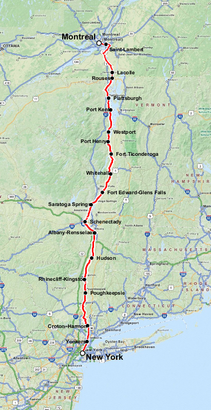
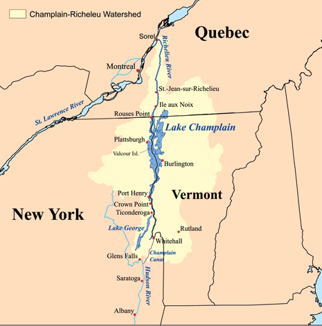
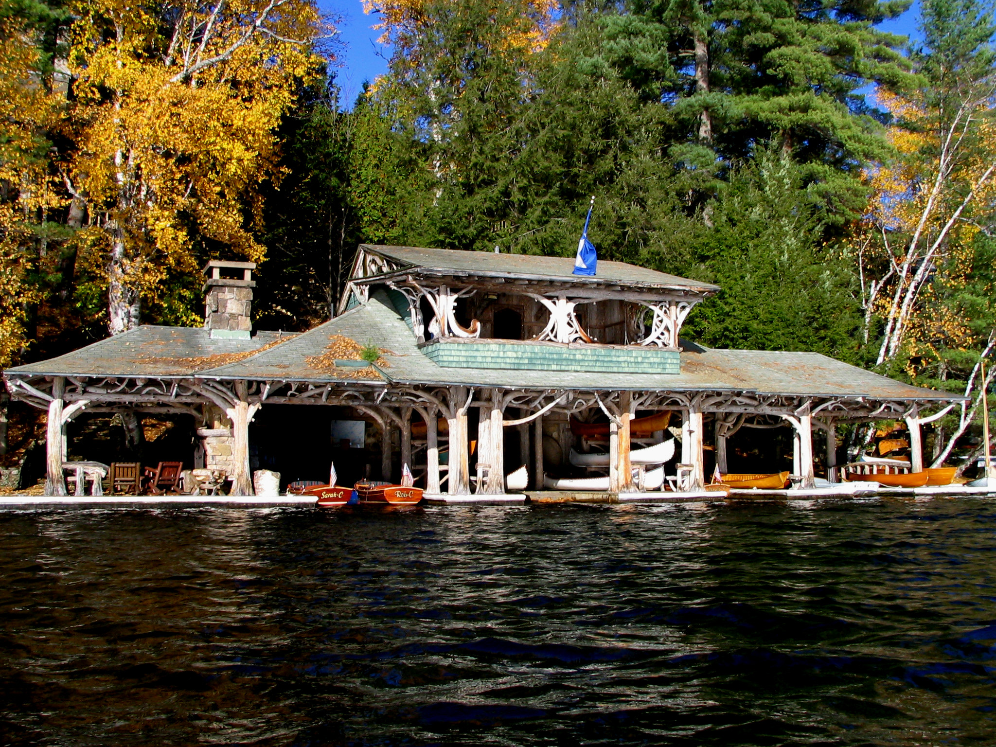
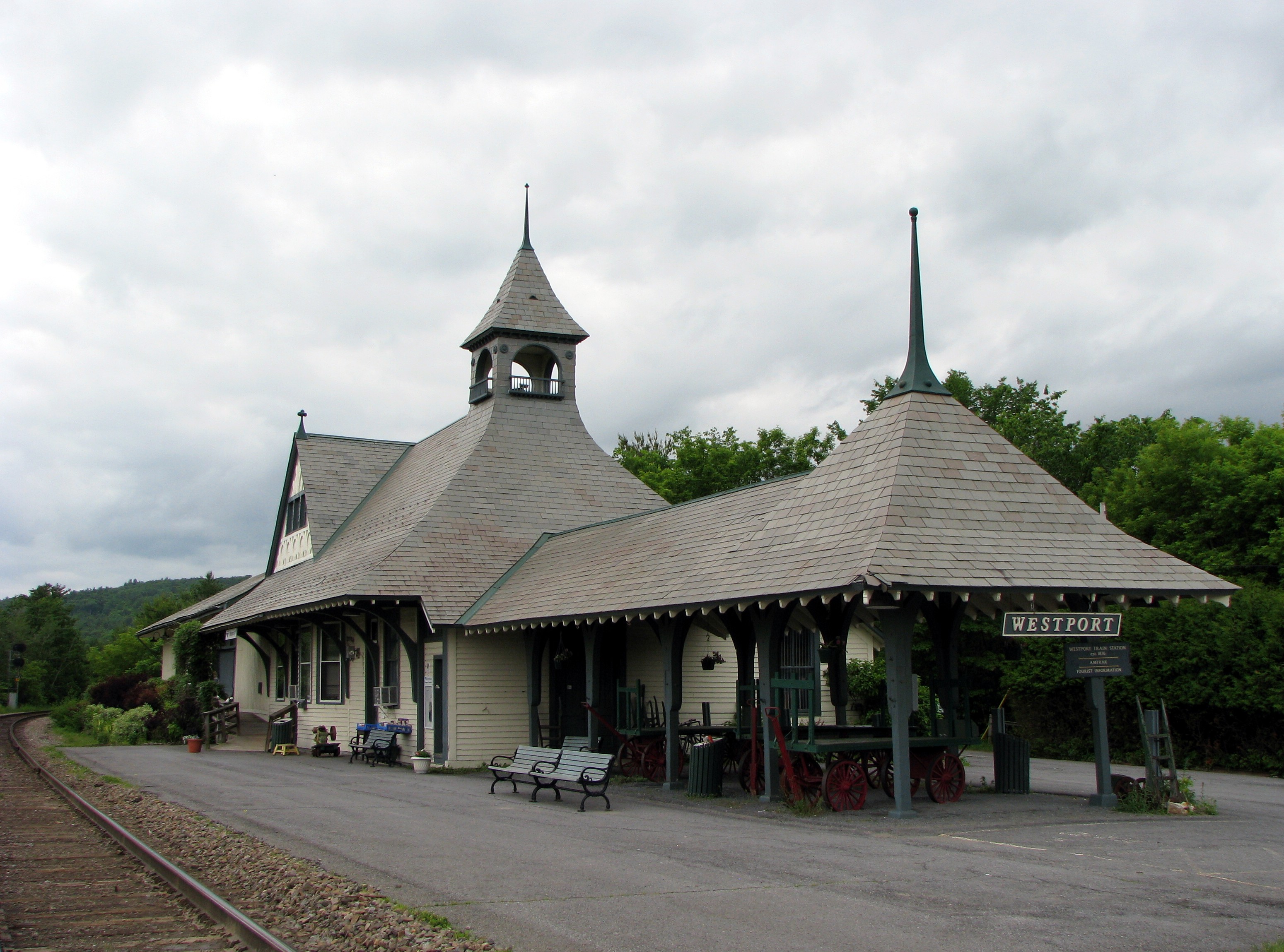
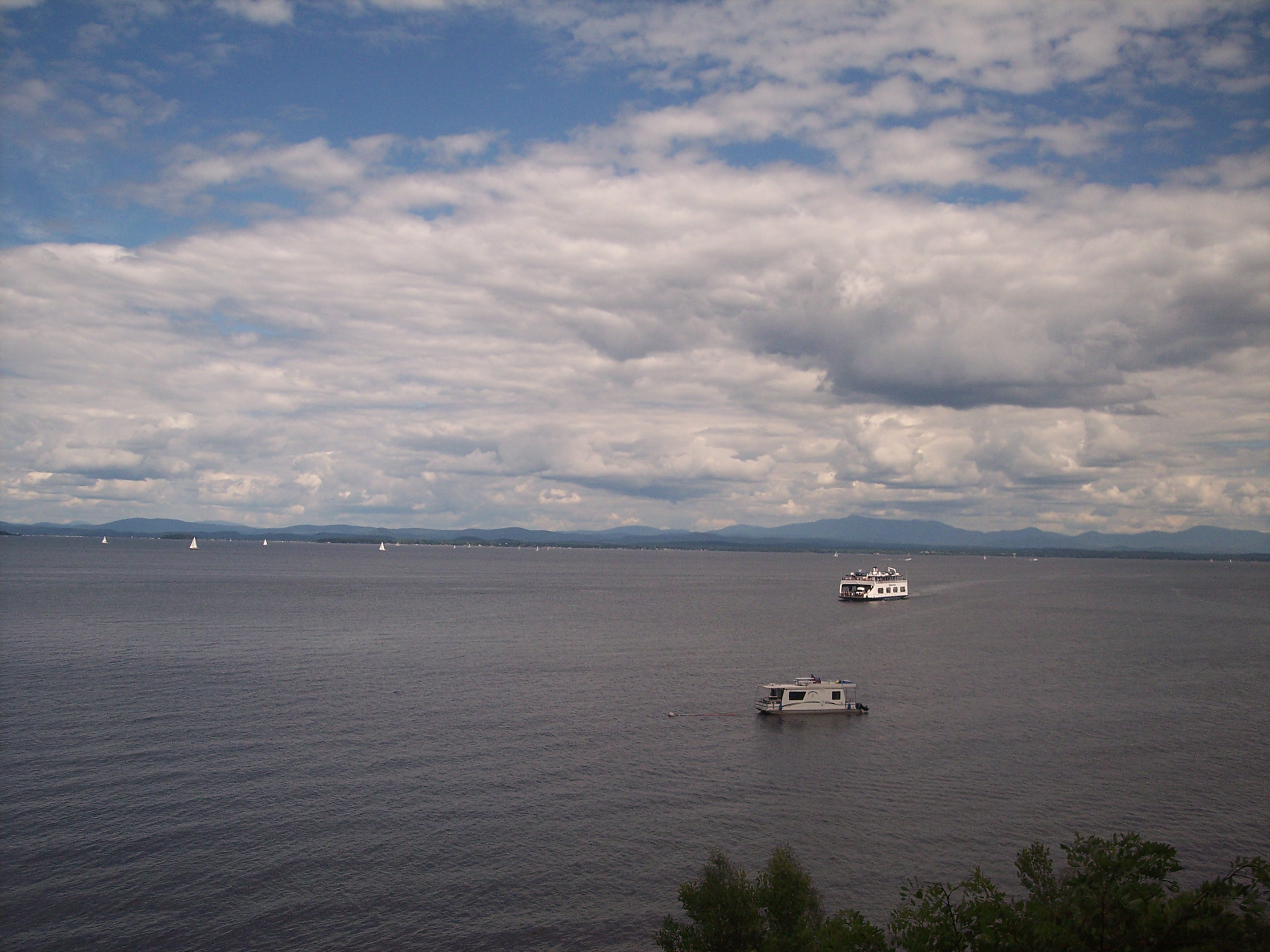
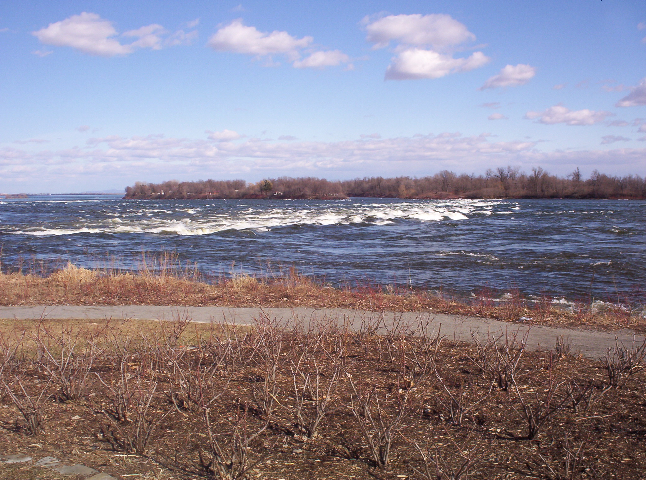
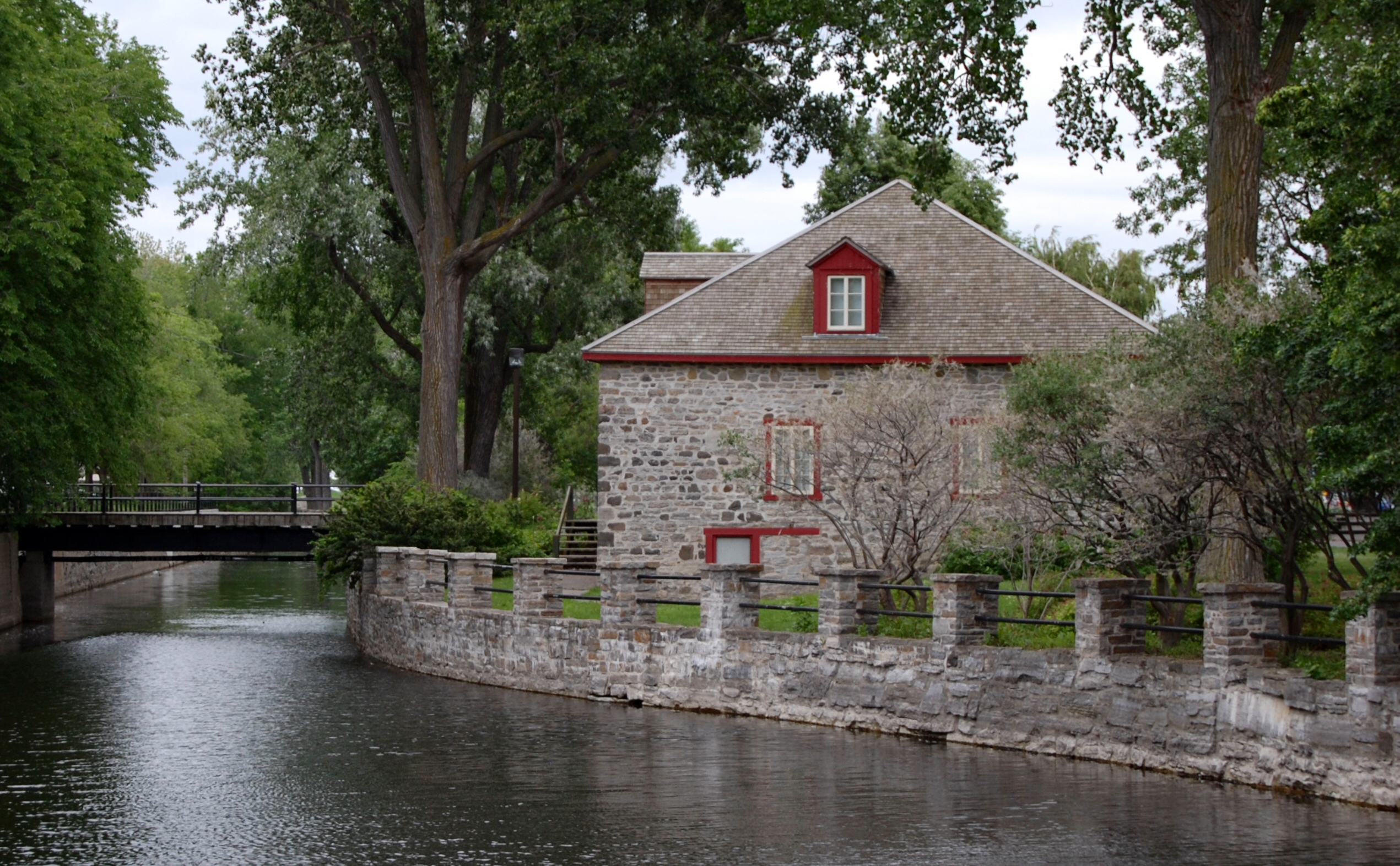
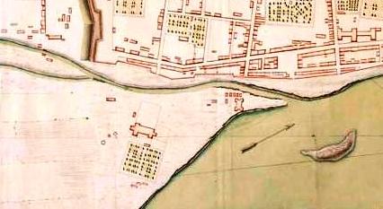
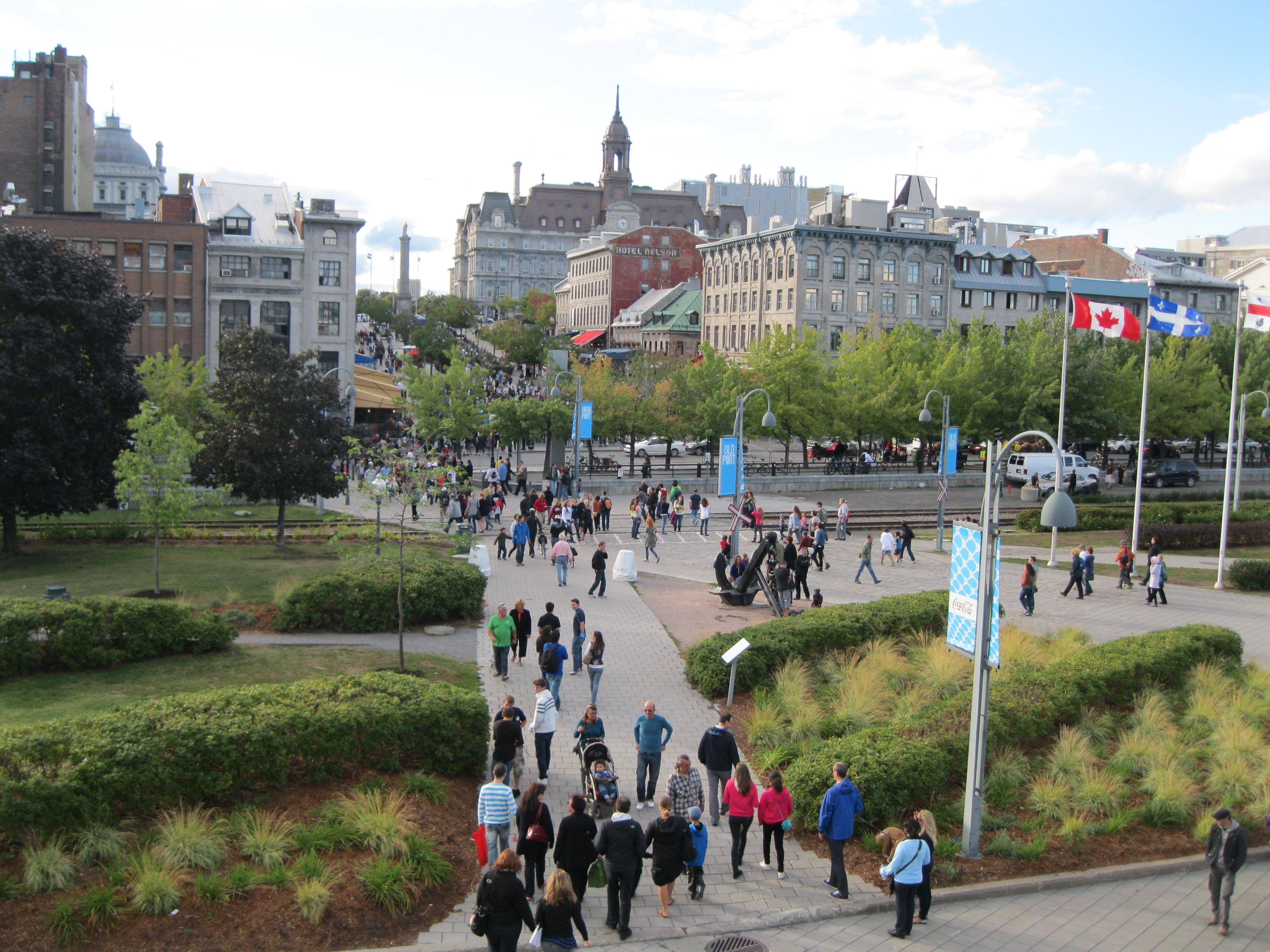
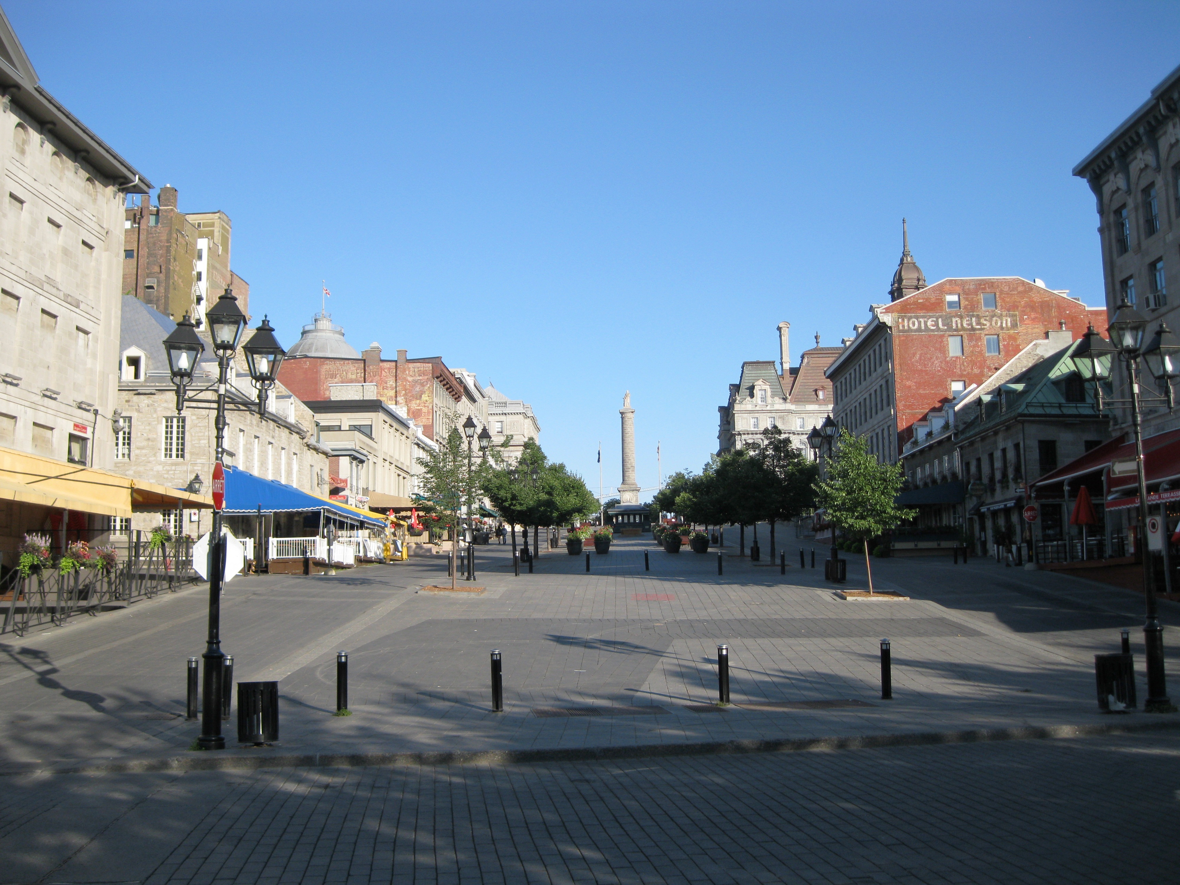
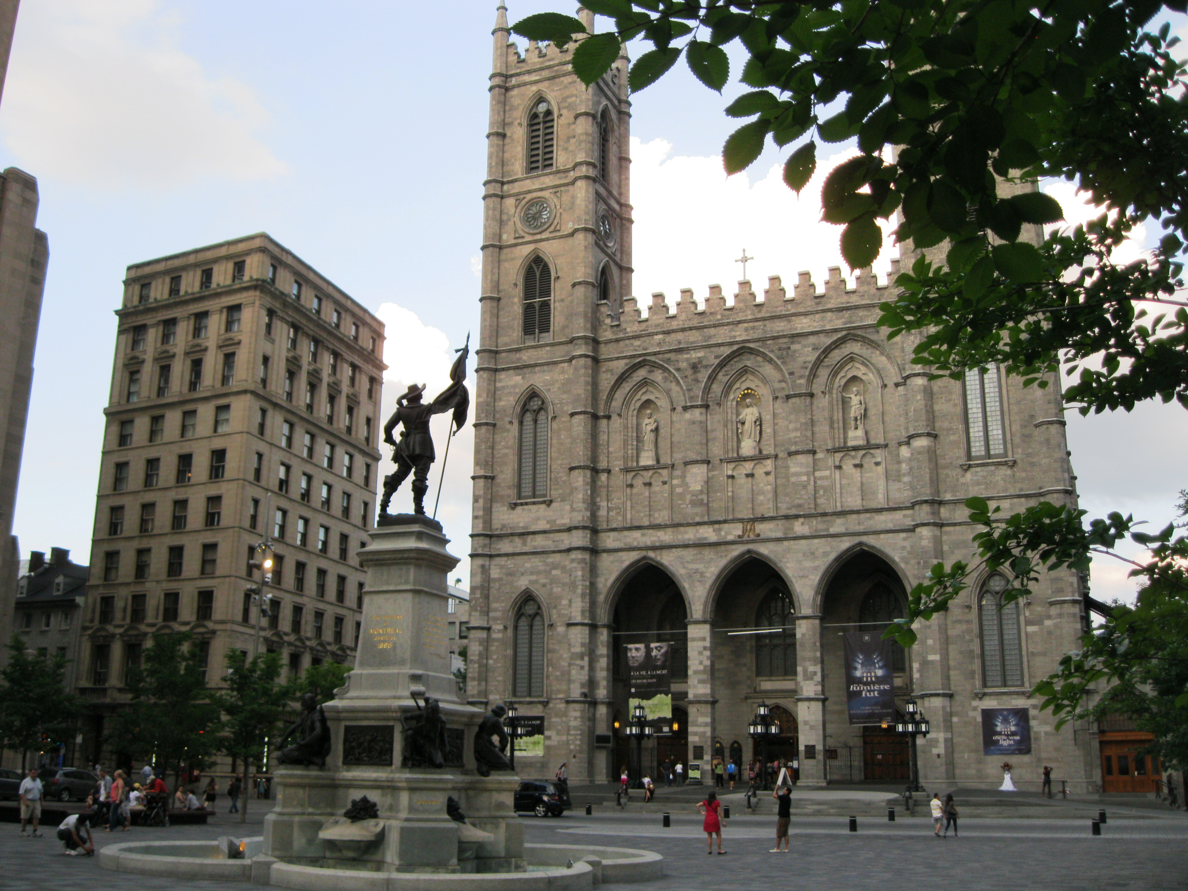
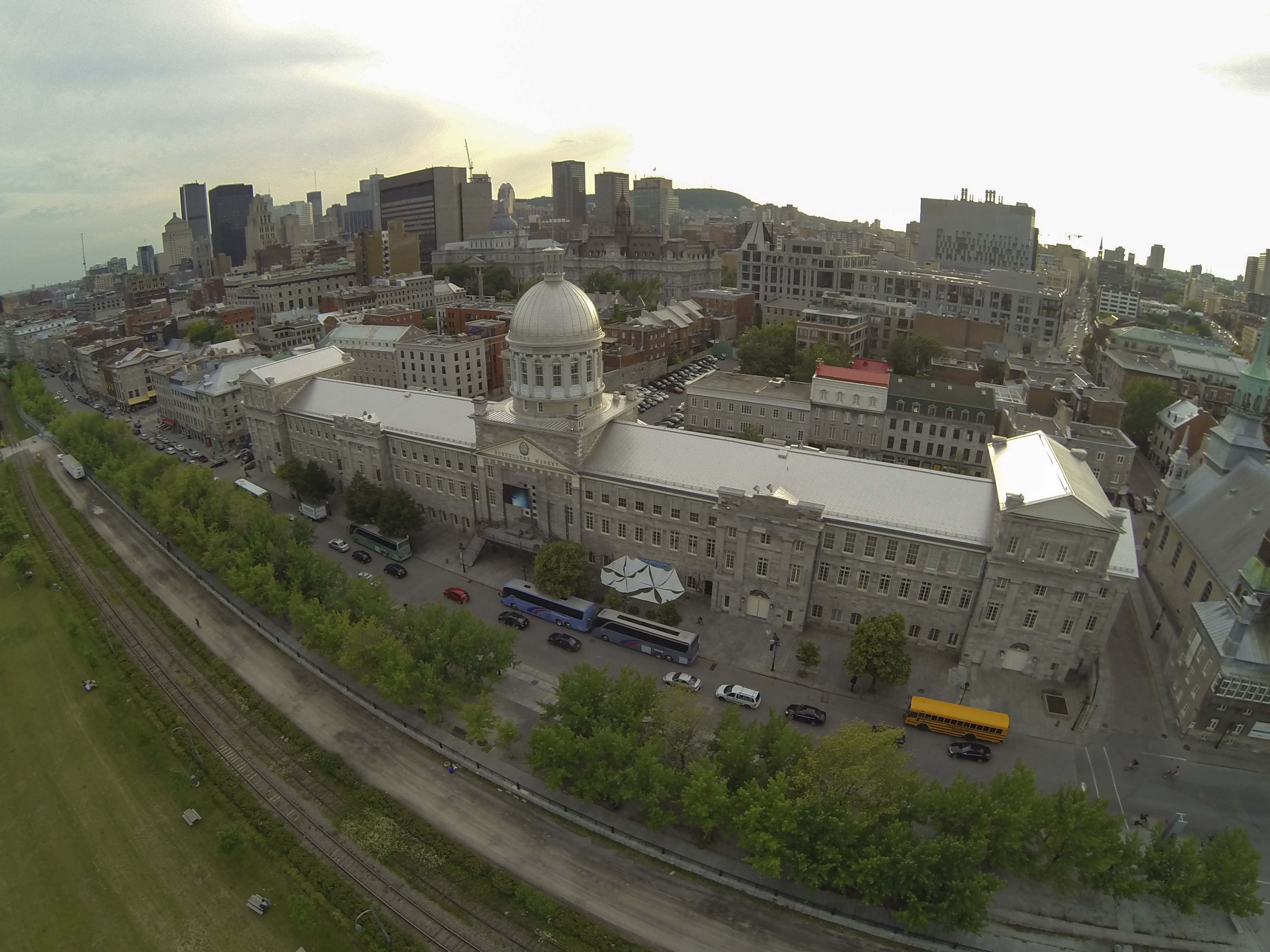
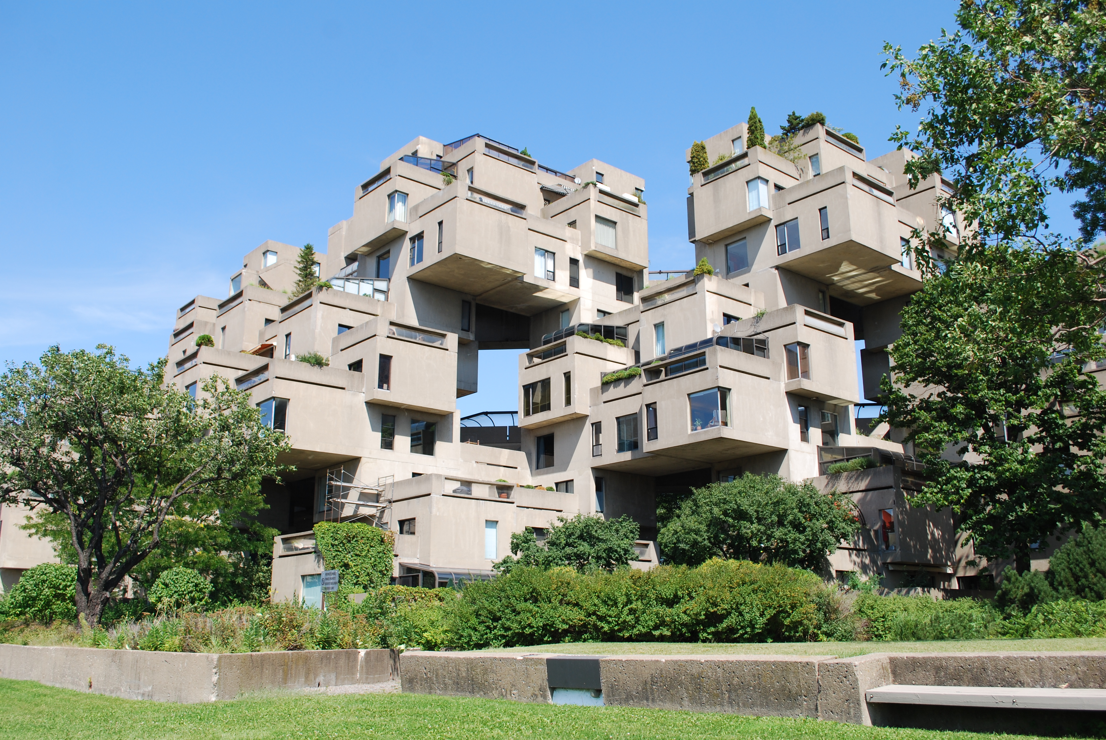