|
Reflections 2024
Series 4
April 22
SE Florida V: Disaster: Financial Ruin & Hurricane -The "Overseas" Highway
| | To the question about the two routes to Key West, rail and road, "What could possibly go wrong? the answer is "everything". Total disaster, or the wet bottom of the shopping bag giving way with groceries pouring out all over the street.
You may already know about the horrible 1935 hurricane that killed the railroad that had opened in 1912, plus so many people, including veterans, with destruction everywhere. But terrible things don't happen in a vacuum. As we said in the last posting, the railroad had survived three hurricanes during the seven-year construction period, one each in 1906, 1909, and 1910, which threatened to halt the project, even when the one in 1906 killed 135 of Flagler's workers. But the project continued, because other events, presumably Flagler's deep pockets, kept things going.
If a cabin burns in the woods and kills someone, that's tragic. But if the woods are tinder-dry and burn down as well, that compounds the tragedy. Yet if the woods are wet, the fire is contained to the cabin.
A perfect example occurred right in this very time period. In 2020/11 we discussed "Sarajevo 1914" and the tragic assassination of Franz Ferdinand. But other assassinations have occurred in history that have not led to World Wars. Europe at the time was wound tight in two alliances, which led to the woods burning along with the cabin. Under different circumstances, the assassination might have had different results, such as a localized war between Austria-Hungary and Serbia and not a World War.
So what was the environment surrounding the horrible 1935 hurricane that made things so different? A horrible economic situation that led to financial ruin. Bad on top of bad yields total disaster.
| | | | Financial Ruin It all started with the economic prosperity of the Roaring Twenties. After the World War, normalcy returned and public interest was deflected toward Florida. Swamp land had been drained in the Everglades, rail lines continued to penetrate (FEC among others!) and highways were expanded (SR 4A among others!). This growing prosperity resulted in the Florida Land Boom of the mid-1920s, which was Florida's first real estate bubble. This pioneering era of Florida land speculation lasted from 1924 to 1926 and attracted investors from all over the nation. The following is a preview in 1922, a few years before the speculative rush reached its peak, showing a billboard promoting the sale of lots from a company centered on Miami's Flagler Street. It shows the promotion of Florida as both a paradise for residents and a cash engine for potential investors. Investors who'd never been to Florida bought land they hadn't ever even seen. The population of cities such as Miami and Saint Petersburg grew ten times in less than two decades because of the money being pumped in from outside for home construction and hotel development.
An interesting development was based on the years of the World War, when the rich were cut off from sailing to Europe to spend the season on the French Riviera. This increased the appeal of those parts of the US with a warm Mediterranean climate, including Florida. The euphoria of investors and travelers was coupled with a lack of knowledge about storm frequency and intensity, to say nothing of the poor building standards used by boom developers.
In 1924, Florida amended its constitution to prohibit taxes on income and inheritance—it has no state income tax to this day. This was just one more incentive for wealthy investors and entrepreneurs to be interested in the state. All this set the conditions for Florida's first real estate bubble.
By January 1925, there was a lot of negative press that investor-speculators were reading about investing in Florida. Forbes magazine warned that Florida land prices were not based on actual land value, but on the expectation of finding a buyer to flip the property to at a huge profit, and buyers were becoming increasingly non-existent. Since land values were inflated, banks were issuing ill-advised loans. The Internal Revenue Service began to consider the Florida real estate boom as a giant sham operation.
The 1926 Miami hurricane—the one that took out the Royal Palm Hotel--ended the boom, destroying with it any remaining public enthusiasm for Florida vacation properties and real estate development. Two years later, the 1928 Okeechobee hurricane provided the final coffin nail to the boom.
1926 can be considered the year of the Florida Land Bust.
| | | | | | The 1928 Okeechobee hurricane was one of the deadliest hurricanes in the recorded history of the North Atlantic basin, and the fourth deadliest hurricane in the US, were it killed an estimated 2,500 people, mostly in central Florida, particularly around Lake Okeechobee. On 13 September, the storm strengthened into a Category 5 hurricane (the worst) and peaked with sustained winds of 160 mph (260 km/h). It made landfall near West Palm Beach, but the effects were most severe inland, around Lake Okeechobee. The storm surge caused water to pour out of the southern edge of the lake, flooding hundreds of square miles to depths as great as 20 feet (6.1 m). On the north side of the lake in Okeechobee City, lakeside homes were destroyed by the storm surge, and others were severely damaged or demolished by winds of at least 90 mph (140 km/h).
This map shows the approximate area of the flooding, south and north. (NB: The Palm Beach County label is misplaced. The area north of Canal Point has been in Martin County since 1925.)
|
| | | | The collapse of the Florida Land Boom was one event that led to the Great Depression in 1929. It also could be said that the Great Depression started three years early for Floridians, who had already become accustomed to economic hardship.
While land values had dropped nearly to the vanishing point, the property was still subject to property tax assessments far in excess of its current value. Many property owners simply abandoned the property and did not pay the taxes. While deposits in Florida banks had increased steadily between 1922 and 1925, after that they started to decline, and by 1926 smaller banks began to fail because of so many defaults on loans as well as withdrawals by depositors.
As for Key West and the Keys specifically, things were not better. Actually, they might have been worse. The charm of the distance of Key West from the mainland—way out to sea--now worked against it. It was just too far away. And, despite the two routes available to reach it, it was losing business.
During its 23 years of operation of the single-track Over-Sea Railroad, 1912-1935, the anticipated growth of cargo via Key West to the Panama Canal didn't materialize. Freight traffic in general was disappointing. Local Key West freight consisted of coal, fruit, and building materials. Trains of tank cars brought potable water to Key West from the mainland.
On 1 September 1931, less than two years into the Depression, the FEC was forced to default on the interest payments to its mortgage bond. It thus becomes a ward of the Federal Bankruptcy Court, but continued limited service.
As to the incomplete highway, in 1933, in order to complete SR 4A by replacing the ferries with bridges, the Florida Legislature created the Overseas Road and Toll Bridge District—note the word "toll". They were seeking federal funding, tho funding was scarce in the midst of the Great Depression. Funding would eventually come thru the Federal Emergency Relief Administration (FERA), part of Roosevelt's New Deal. This is the government relief program that brought to the Keys to work on bridges and roads hundreds of World War veterans—and also Spanish-American War veterans from 1898--seeking early payment of wartime pensions. In 1934, FERA opened labor camps for the vets to do construction work.
In 1934, by 1 July, well over a year before the hurricane, most businesses in Key West were closed because of the Depression. About half the Key West citizens were on relief, today usually called welfare. On 2 July both Key West and Monroe County declared bankruptcy (!) and asked the state to take over their responsibilities.
| | | | | | The New York Times reported on 5 July: Key West . . . asked Governor Dave Sholtz to take charge of its affairs because it has been placed in a "state of emergency" by a series of economic set-backs. Monroe County, in which the island city is situated, followed suit. [Both entities] submitted resolutions declaring an emergency existed and surrendering all their legal powers to the Governor [who] called on [FERA] to "accept the responsibility" . . . in the situation. . . . "About half of the population" [the resolutions said] "is on the Federal rolls, and the normal assistance given to the people under the present system is inadequate and affords very little relief." |
| | | | Thus, Key West, Monroe County, and the FEC railroad were all bankrupt at least a year before the hurricane, and the local people were impoverished. This is the financial ruin that the hurricane compounded the following year. | | | | The 1935 Labor Day Hurricane You'll recall that passengers on the Over-Sea Railroad reported that from their seats they would see tall ocean waves on both sides of their train as it crossed the longer bridges, just like as if they were at sea. Now look at that asset as being a liability. The low-lying Keys were—and are--super vulnerable to stormy sea action, where friendly seas suddenly become the enemy.
On 2-3 September 1935 a disastrous category 5 hurricane (the worst) devastated the Keys and, along with general destruction, chaos, and death, washed away miles of railroad embankment. In some places the storm carried the tracks a great distance from the roadbed.
While today hurricanes are given names, back in the day they were identified by dates and ad hoc names, such as the 1926 Miami Hurricane or the 1928 Okeechobee Hurricane, both mentioned above. Since 2 September in 1935 was Labor Day in the US, this killer storm is known as the 1935 Labor Day Hurricane.
Modern forecasters have radar, TV, satellites, but back in the day they relied rather vaguely on barometers, telegraph cables, and reports from ships at sea. It was rather hit-or-miss. The 1935 Labor Day hurricane (you see how it passed right across the Keys) was the most intense Atlantic hurricane to make landfall on record, in terms of both air pressure and wind speed. It intensified rapidly, and, moving at a speed of 10 mph (16 km/h), made landfall in the Keys on the evening of 2 September. The storm had an eye 9–10 miles (14–16 km) across. As the eye passed over the area, it brought with it a massive storm surge, which carved new channels between the Keys to connect Florida Bay with the ocean before the waters receded. Still, rescue efforts were also prevented into Tuesday because of ongoing gale-force winds and high seas.
The Upper Keys especially suffered catastrophic damage. Winds were estimated to have gusted to 200 mph (320 km/h), raising a storm surge of about 18 to 20 feet (5.5 to 6.1 m) above sea level that washed over the low-lying islands. Winds and the surge destroyed almost all the structures between Tavernier on Key Largo and Marathon in the Middle Keys. Islamorada was totally obliterated. Continue to keep in mind that this hurricane was the most intense storm ever known to make landfall in the Western Hemisphere, having the lowest sea level pressure ever officially recorded on land.
The Labor Day Hurricane was one of only four hurricanes to make landfall at Category 5 strength on the US coast since reliable weather records began in about 1850. The three other storms were Hurricane Camille in 1969, Hurricane Andrew in 1992, and Hurricane Michael in 2018.
Click over the Keys on this tracking map marked at six-hour intervals and follow the colors on the below key (Map by Sanoxel).
Dark blue: tropical depression; Light blue: tropical storm
Yellow: Category 1 Hurricane; Gold Category 2; Orange Category 3
Red: Category 4 (209-251 km/h, 130-156 mph)
Purple: Category 5 (≥ 252 km/h, ≥157 mph)
Thus the highest category, with the worst destructive power, occurred directly over the Keys.
Three ships ran aground in the Keys during the storm, tho without fatalities.
The force of the hurricane lifted the Danish motor ship Leise Maersk over Alligator Reef southeast of Upper Matecumbe Key and grounded her nearly 4 miles (6 km) away near that key.
The American tanker Pueblo lost control and was pushed around the storm's center, ending up in Molasses Reef southeast of Key Largo nearly eight hours later.
The passenger steamship Dixie ran aground on French Reef southeast of Key Largo.
This is a typical flattened building after the hurricane, location unknown. The hurricane left a path of near-total destruction in the Upper Keys, centered on what is today the village of Islamorada. This is a destroyed church and cemetery in Islamorada (Photo by Florida Keys--Public Libraries). The eye of the storm passed a few miles to the southwest creating a calm of about 40 minutes' duration over Lower Matecumbe and 55 minutes (9:20–10:15 PM) over Long Key. This is the platform of Long Key station still showing the devastation five months after the storm, in February 1936.
A civilian was running the camps for veterans. Ironically, the camps had run out of money and were scheduled to close in two weeks. Since earlier weather bulletins had called for the storm to pass to the south, over Cuba, he'd made no plans to evacuate the vets. But a plunging barometer and new warnings at 1:30 pm got him to call for an evacuation train from Miami, also called a rescue train or relief train, to pick up whatever survivors it could. The train got underway at 4:25 pm, but was delayed at Windley Key. When it reached Upper Matecumbe, a huge tsunami hit the train about 50 feet (15 m) from Islamorada station and knocked all eleven cars off the track, leaving just the locomotive and tender standing.
This resulted in one of the more visually spectacular scenes that is used to illustrate the Labor Day Hurricane, right in the heart of Islamorada. Here we see all eleven cars washed off the tracks, tho the locomotive and tender remain upright on the rails. Amazingly, everyone on the train survived. Several months later, the locomotive and tender were sent back to Miami by barge.
https://keysweekly.com/wp-content/uploads/2021/09/Upper-Matecumbe-train.jpg
This second photo of the same event shows more details. Both photos show SR 4A, parallel to and not far from the rail route.
https://i.ytimg.com/vi/e496Cy4Wprs/maxresdefault.jpg
https://keyslifemagazine.com/wp-content/uploads/2021/12/1935-Long-Key-which-suffered-through-the-eye-of-the-storm-but-nobody-died.-Source-Jerry-Wilkinson.jpg
The first picture here shows "rail 'n' sail" destruction at an unidentified location, but the second link indicates that it shows Long Key, meaning that's the Long Key Viaduct on the upper right.
Back on Lower Matecumbe Key is where the easternmost ferry slip was, also shown here.
Here's a video (1:51) of a Miami meteorologist in 2017 reflecting on the Labor Day Hurricane of 1935. We also have one (4:34) where two survivors relate their experiences.
The links—rail, road, and ferry boats—that chained the Keys together and with the mainland were all broken.
| | | | Deaths The list of Florida hurricanes shows about 500 tropical or subtropical cyclones affecting the state. In total, all hurricanes hitting the region have resulted in over 10,000 deaths, most of which occurred prior to the start of hurricane hunter flights in 1943, which are aircrews that fly into tropical cyclones to gather weather data. These are some notable death tolls for early 20C hurricanes in Florida: 1906: 240; 1926 (Miami): 372; 1928 (Okeechobee): 2500+; 1935 (Labor Day): 409.
But there was one unique situation in the Labor Day hurricane, and that was all the veterans that had been brought to the Keys to work. Total deaths, locals and vets, were in the hundreds, yet the Okeechobee total is close to five times greater. But there was great public sadness, and probably guilt of some sort, since the vets were there only temporarily, following the Bonus Army controversy. Also, the vets had survived the World War, but had succumbed to a twist of nature. The camp payrolls for August 30 listed 695 veterans in the three camps.
At veterans' Camp #3 on Lower Matecumbe near the ferry the surge arrived near the end of the calm as the eye passed, with the wind close behind. While some bridges and railway embankments were washed away, nearly every structure was demolished—you'll remember the simple wooden cabins at the camp, and the myriad tents! The camps simply washed away as sustained winds of 185 mph (300 km/h) hammered the flimsy tents. Afterward, vets told about lashing themselves to trees or hanging on to railway tracks. Others sought cover in the very trenches where they'd been quarrying rock for the bridge they were building. But when the storm surge filled the trenches, they drowned. Such ironies abounded.
The landscape turned gruesome. Bodies were tangled in mangroves. Some bodies washed clear across Florida Bay to Cape Sable, including a mother and child, holding on to each other.
A Coast Guard cutter retrieved 75 bodies from the water and stashed them on its top deck. Its crew later reported they heard sharks banging against the cutter's hull, attracted by the bodies.
Sand mixed with the rain and wind, scouring the landscape and the people. The faces of some of the dead were simply sanded away.
It was natural for people to keep their backs to the rain and wind, but that resulted in the backs of their ears having scabs on them where the skin was peeled off by the sandy rain.
Bodies were scattered everywhere in the Keys—these are five hurricane victims towed on an improvised skid behind a car--and their rapid decomposition created horrible conditions.
WARNING: this next photo, set between water and railroad tracks, is gruesome, with outstretched arms. Some may want to skip it.
https://www.floridamemory.com/fpc/general/n041527.jpg
Health officials demanded that no bodies be moved and that they be buried or cremated in place. This was reluctantly agreed to with the understanding that those buried would be later disinterred, with locals being reburied appropriately and with veterans either being shipped home or to a national cemetery, notably Arlington National Cemetery, since all soldiers and veterans (other than those dishonorably discharged) are entitled to be buried in a national cemetery with full military honors.
The cremations began on Saturday, September 7, when 38 bodies were burned together at the collection point on Plantation Key beside Snake Creek, the channel between Plantation and Windley Keys in Islamorada. During the week that followed, 136 bodies were cremated on Upper Matecumbe Key at 12 different locations. On Lower Matecumbe Key 82 were cremated at 20 locations. This continued on other Keys, and on into November.
But before the embargo on shipping bodies was declared, 123 bodies had already been brought to Woodlawn Park Cemetery west of downtown Miami (SW 32nd Avenue & SW 8th Street [= Tamiami Trail & Calle Ocho]). A temporary morgue was set up there under tents that was staffed by fingerprint experts and eight volunteer undertakers with the intent of identifying and preparing the bodies. But then the embargo was declared, and 116 bodies were immediately buried at Woodlawn in a mass grave in a plot that FERA purchased. Five others had individual headstones. The Veterans Administration coordinated the ceremony with full military honors the next day, 8 September.
On 19 November, FERA reported that as of that date, the total dead was 423: 259 veterans and 164 civilians. By 1 March 1936 that total was updated by 62 more bodies, bringing the total to 485: 257 veterans and 228 civilians. Note that that's more vets than local civilians. There was not only a problem of identification, especially of bodies found months after the fact, and also whether to just include vets on the camp payrolls or to include civilians who were also veterans.
You may be aware that Ernest Hemingway was a resident of Key West, and his home may even today be visited. After surviving the hurricane at home, three days later Hemingway visited the site of the vets' camps by boat. He found bodies floating in the ferry slip at Lower Matecumbe. When he arrived at Camp 5, he found that, out of 187, only 8 had survived. He said he saw more dead in one place there since he was at a major World War battle site in June of 1918. He wrote a critical article about the experience called "Who Killed the Vets?" He said "Ignorance has never been accepted as an excuse for murder or for manslaughter". He wondered why no one could explain why American soldiers on American soil were left waiting for a rescue that never occurred. He implied that FERA workers were too unfamiliar with Florida hurricanes, resulting in a lack of concern for the welfare of all involved.
Outrage quickly spread across the country, since, beyond local deaths, the vets' deaths were a national humiliation. Soldiers having come back from war were sent to mosquito-infested islands under substandard living conditions during hurricane season to work for the government, only to be abandoned once the inevitable storm arrived.
On 1 November the same year, the American Legion completed its own report, having discovered three I's: "Inefficiency, Indifference, and Ignorance." There was Inefficiency in establishing the camps, Indifference to the safety of the men, and Ignorance of the danger of hurricanes.
| | | | The Aftermath Given the extensive damage and destruction to its infrastructure, the already distressed and bankrupt FEC railroad was financially unable to reconstruct the rail line between Homestead and Key West. Over 64 km (40 mi) of track were washed away by the hurricane, 3 km (2 mi) of which ended up washing ashore on the mainland at Cape Sable. (How ironic—Flagler had originally wanted tracks at Cape Sable!) For the first time since 1912, Key West was inaccessible by direct land route from the mainland. The storm thus ended the 23-year run of the Over-Sea Railroad (1912-1935).
In September after the storm, the US Interstate Commerce Commission approved the application from the FEC to abandon the Key West Extension entirely. Earlier, in 1933, the Florida state legislature had created the Overseas Road and Toll Bridge District to seek federal funding to extend and connect the roadways by building bridges to eliminate the two ferries. That explains the bridge the veterans were brought in to help build, which barely got started. If more time had gone by and those ferries had been replaced by bridges, the rail route and bridges might not have been lost.
Given the financial ruin of the FEC, at a date I have not been able to pin down, the FEC sold the roadbed and remaining bridges to the Overseas Road and Toll Bridge District, acting an arm of the State of Florida, for $640,000. This is equivalent to about $14.5 million in 2024. As of 1912, it had cost $49 million to build, so its "fire sale" price was about 30% of its cost. Florida also cancelled $160,000 in back taxes. The federal government, thru the Works Progress Administration (WPA) advanced $360,000 to the Road and Toll Road District to pay for the purchase. This would allow the quick completion of the Overseas Highway, giving the WPA a small success in wake of its scandalous handling of the hurricane. There was a lot of attempted "face saving" here, in a way, scandalous on its own.
The State of Florida then rebuilt the bridges, notably the larger ones, which had survived major damage anyway, into road bridges (see below) and eventually also incorporated much of the balance of the rail right-of-way into what had been SR-4A. This is the equivalent of a house burning down and a neighbor buying up the ruined property at fire sale prices to extend his own property, taking advantage of the first owner's misfortune. The new highway did not only usurp infrastructure, it stole the railroad's name and mangled it, since the sensibly named Over-Sea Railroad became the Overseas Highway (which is located, after all, in Florida, and not anywhere overseas). What for years had been a dual rail-and-road route--albeit with two road ferries--now became just a road route, and the highway now became the sole overland route connecting Key West with the mainland.
If the already started bridges to replace the ferries had been completed, it's reasonable to believe that the road might have stayed with its own infrastructure and would not have picked over the bones of its senior neighbor. Tho inoperable, the rail infrastructure could have remained for some possible future redevelopment.
I found online somewhere this comprehensive statement, commenting on "the extraordinary construction and spectacular demise of the Key West Railroad, one of the greatest engineering feats ever undertaken, [which was] destroyed in one fell swoop by the strongest storm ever to hit US shores." And I agree with another statement I found, that there is no question that, if the line were still active today, it would be an incredible tourist attraction drawing thousands annually.
Events happened in this order: The US Public Works Administration offered to lend the Overseas Road and Toll Bridge District $3.6 million to acquire 45 miles of right-of-way and other properties of the FEC between Lower Matecumbe and Big Pine Key stations to convert the route into an automobile highway. That is to say, the highway people just coveted those big rail bridges where the road had had to use ferries. In May 1936, in Washington, The Public Works Administration approved a $3.6 million loan to the Overseas Road and Toll Bridge District to do this, and by October that year bids went out for construction. Thus the original plans to complete the highway with its own bridges were abandoned, and the roadway would be taking over the rail bridges, which were in good condition but had to be retrofitted for automobile use (more later).
In May 1937, a federal judge authorized the Receivers of the FEC Railway to sell the Trumbo Point terminal in Key West to the highest bidder. It went for $146,000, the equivalent of $3,146,300 today. Trumbo Point today is one of several bases comprising the Key West Naval Air Station. It's inaccessible to civilians without US Navy clearance. Trumbo Point is primarily used for military housing, and also contains a restaurant, bar & lounge, vacation rental villas for active and retired military personnel, a pool, and water park.
In March 1938, the Overseas Highway was opened, thus re-establishing a direct land route between the mainland and Key West to replace the railroad. US 1, which comes down the East Coast from Maine, was then extended beyond Miami to Key West.
The trio of prime crossings that were taken over for the highway have since been replaced: east to west, the Long Key Viaduct, the Seven Mile Bridge, and the Bahia Honda Bridge. They were all listed on the National Register of Historic Places in 1979. They remain in use as fishing piers and pedestrian paths. Thus the highway usurped them, then years later, spit them out again.
| | | | Pros and Cons It's probably unfair to judge today decisions made under the circumstances of the 1930s, given the economy during the Great Depression, the ruinous Labor Day hurricane, the debacle of the veterans' plight, plus local deaths, and the destruction of much rail infrastructure. Still, it was a very poor decision, very much "in-the-moment" without thinking about the future.
On the one hand, the Key West extension was already in decline when the hurricane struck. Traffic in 1934, the previous year, was some 25% of what it had been in peak (and prosperous) years of operation in the 1920s, and the possibility remained that it could have been abandoned at a later date.
In addition, in 1936 after the storm, both the Key West City Council and the Key West Chamber of Commerce passed similar resolutions calling for the abandonment of the Key West Extension and "to proceed without delay" to supply the Florida Keys and Key West with satisfactory and adequate transportation via an overseas highway. That's understandable given the circumstances, and the growing notion that automobiles would take over the world, killing off rail anyway.
On the other hand, consider this: The dismantlement of the rail line meant the effective end of Key West as major deepwater commercial harbor, since motor transport lacked the economies of scale that rail transport possessed when it comes to connecting to inland industries and markets in an economically viable way.
The dismantlement was also politically expedient, as mentioned above, rather than thinking the matter thru soberly about national infrastructure. Both WWII and the Cuban Missile crisis demonstrated the strategic importance of Key West and the military value of the Key West Extension, which was gone when it was needed the most. In 1942 both American coastal and long-distance shipping traffic were sorely affected by German U-boats in the Florida Straits. Only four U-boats were able to harass coastal tankers, which threatened to bring American war mobilization on the eastern seaboard to a halt. It was difficult to supply the Key West Naval Station using coastal vessels, and motor transport on the Overseas Highway was not as fast and efficient as what a rail line could have done.
When it was no longer economically viable to trade with Cuba thru Key West in the late '30s, the FEC moved its rail ferries to Fort Lauderdale to connect with Havana from there, at roughly triple the distance. Then when WWII started, those ferries were used for US Navy service for transport overseas. After the war, the rail ferries resumed their service. Southbound freight to Cuba consisted mainly of manufactured products and northern fruits such as apples, pears, and grapes, also meat and eggs. Northbound freight from Cuba consisted mainly of tobacco, pineapples, tomatoes, and refined sugar.
This continued until the Castro era in Cuba in 1959. When the Cuban Missile Crisis came in 1962, Key West defenses had to be reinforced. The US Army then sent its radar equipment and air defense missiles by special trains southward, but only to Florida City, at which point they had to be off-loaded to be moved by motor convoy to Key West, which obviously complicated and slowed the movement.
All in all, removing the railroad was a bad idea. From a personal point, I've now driven the Keys to Key West five times. It's a nice, tho lengthy drive. But still, I'd rather have done it by a nice, relaxing train, leisurely looking out Over [the] Sea.
| | | | The Post-Hurricane "Overseas" Highway
¶ All the times I drove the Keys to Key West, I thought I knew its history. Only now, four-and-a-half years after the last time, have I learned how remiss I was. It was NOT a matter of train gone, new road replaces it. Only now do I know that there was a road alongside much of the rail route from early on, so that the highway today is actually a replacement of SR-4A. Or, it can be looked at as an upgrade of the original road.
I continue to think, despite the circumstances of the time, that it was with unprecedented lack of foresight that a premier rail route was allowed to die, with a road being allowed to consume its bones. This is especially so since it was a bad idea to try to convert those bridges, especially the three big ones, from rail to road, because the highway thus achieved was a bad one. I know that for a fact since I drove it round trip four times in the 1990s. Only on the current trip in November 2019, was it completely smooth sailing end to end, and that was because by then, they'd finally gotten rid of the highway-on-rail-bridges idea and all of it moved back to a dedicated route for automobiles. By then, the ex-rail bridges used for autos were cast aside as antiques, tho at least commemorated as landmarks. Thus those rail bridges were only pressed into automobile service from 1938 until about 1982 or a little later, just over four decades, then rejected.
The main problem was that the rail line was single-tracked, in other words, relatively narrow. Also, train routes don't need shoulders on the sides, as highways do.
https://live.staticflickr.com/4121/4888973016_4c7b7162bc_b.jpg
This is the Bahia Honda bridge when it still had tracks. Keep in mind that the trains ran one-way, with sidings for when two trains were to meet. One train would pull into a siding and wait a moment until the opposite train passed. I also recall that both day trains, one in each direction, were scheduled to meet at 3 PM at the Marathon station, which would also allow for passing each other. On the other hand, a highway carries traffic in both directions at the same time, and is at very least twice as wide, even if you don't allow for shoulders. So those converting the bridges felt it was simpler to frankenstein a solution, as on the unidentified bridge below.
https://bylandersea.com/wp-content/uploads/2010/02/wideningbridge2.jpg
First, the tracks were ripped up. Then a 6.7 m (22 ft) sheet of steel was laid down, and paved. The dismantled train tracks were repurposed, painted white, and used as guardrails on either side of the highway. I'm all for recycling, but that was a practical, yet shameful use of the rails. All rail bridges on the route, including the Seven Mile Bridge, were eventually widened to become highway bridges. The project was completed in three years and in 1938, the (new) "Overseas" Highway opened.
On my first four round-trips in the 1990s, I had to drive across these frankensteined bridges, and it was a horror because of the lack of space. On these bridges, one found that the bridge structure was a hair's breadth way from the car on the passenger side, with a constant danger of side-swiping. It was worse on the driver's side, with traffic moving in the opposite direction nerve-wrackingly close, with side-swiping being an even greater danger. It was a normal urge to slow down, but even below the speed limit, the speed of the traffic in the opposite direction, when added to yours, doubled the difference. Those bridges were "white-knuckle" crossings. You just hoped that you wouldn't meet a wide truck coming at you in the opposite direction. And I wasn't the only one who felt this way. I found this quote online: "I remember my first road trip to Key West in 1960. When we got to the Keys highway, my Mother nearly succumbed from white-knuckled fear. Trucks passing in the opposite direction took more than their half of the road."
And of course, your rear-view mirror stuck out toward these cars moving in the other direction! I just read that the highway was nicknamed the "Highway of Mirrors" because of all the side mirrors that were knocked off, littering the roadway with pieces of mirror.
I was only totally comfortable with the highway on the most recent 2019 trip because all the converted bridges had been retired, and all the highway had finally become a normal road, purpose-built for cars, with plenty of width, including shoulders.
I've found an interesting map showing how the highway swallowed up the rail route, and it was most definitely NOT all at once
| | | | | | As you know, I offer photo and map links to websites, including those on Bing. For those I find on Wikipedia, I can usually imbed them right into the text, as long as I give proper credit. Most of these come from Wikimedia. However, this map does not. It only appears on a Wikipedia page, but it's worth showing. Thus, when you use the below link, there will be a momentary blink showing the Wikipedia page before he map appears as a secondary step. When returning, you may (or may not) need to be sure you go back two steps. |
| | | | This is the map that uses two colors to show all the routes between the mainland and Key West:
https://en.wikipedia.org/wiki/Overseas_Highway#/map/1
Blue shows the rail route converted to the highway, while red shows the new "Overseas" Highway following the original highway route, SR-4A. This is a great shock to me. All five times I drove this route round-trip, I assumed every bit was the former rail route. How wrong I was.
(1) Start in the middle with the large blue section. When the "Overseas" Highway opened in 1938, it was only in the Middle Keys that it ran along the old rail route, which shows that the highway people coveted those rail bridges where they themselves hadn't built any highway bridges yet. This is roughly in the area of the two ferries, plus the road stretch connecting them in Marathon. The original highway segments (SR-4A) were still in use for the new highway in the Upper and Lower Keys.
(2) Now inspect the red area to the right, up to where it touches blue again. At least early on, the old highway roadbed prevailed. However, we did learn earlier from that man in Tavernier that eventually, the highway was widened, by using what had been the rail route for the southbound lane(s) and the former SR-4A route for the northbound lanes. This was then all consolidated as a continuation onto the Keys of US 1.
(3) The blue area near the mainland is, as we discussed earlier, where the road took over the rail causeway from the mainland to Key Largo to connect with the main highway. The remaining red route crossing Card Sound on a toll bridge, which had always been part of SR-4A, became a local County Road (CR), that only serves the north end of Key Largo, designated CR-905 and CR 905A. The Card Sound Bridge is fortunately the only toll facility in the Keys, happily off the beaten path.
(4) Perhaps the most interesting of these areas is the last part close to Key West. Here in the Lower Keys, we see in red the No Name Key SR-4A route at the former ferry dock. It ran parallel to the rail route for a while, but then swung way to the south to reach Key West on its own.
Apparently, in the beginning, the road kept to this old route, and it was WWII that made the difference. As the war started, the US Navy wanted improvements to the highway to improve their access from the Naval Air Station on Boca Chica Key (close to Key West) to the mainland for national security purposes. They found that the old 1920s highway route in this area was less than ideal, since it was a winding road with rickety wooden bridges. Thus the Lower Keys part of the highway was fully moved to the old rail route, which the state already owned and which was a more direct route with smoother curves that would allow for higher speeds.
| | | | | | This is further proof that letting the railroad, with its many advantages, die was a terrible idea. Another thought occurs to me, but it's pure speculation. During WWII and the Cuban Missile Crisis, how did the military convoys that were necessary (because the railroad was gone) get across those "white-knuckle" bridges? When a convoy came thru, there's no way it could have met oncoming traffic. Did they have to temporarily stop civilian traffic to let the convoy thru? What a terrible idea to convert the bridges and not build new ones right away—which, of course, they eventually did do. |
| | | | Tolls While the highway today is famously toll-free end-to-end, I was surprised to find that that wasn't always the case. For close to two decades, from the point the "new" road was opened in 1937 until 1954, at least the western half of the highway was a toll road.
https://live.staticflickr.com/5768/23964023862_342dc47b3b_z.jpg
https://www.keywestislandnews.com/wp-content/uploads/2020/09/Overseas-HighwayToll-Booth.jpg
There were two toll booths. The first link shows the one on Big Pine Key, which would have collected one-way tolls eastbound, and the second link probably shows the one on Lower Matecumbe Key, which would have collected westbound tolls. Both pictures also show the dated, almost abandoned, nature of the road back in the day. The toll was quite high, $1.00 per car and driver, which is equivalent to $17.37 today, and 25 cents ($4.34 today) for any additional passenger.
https://www.floridamemory.com/fpc/reference/rc07101.jpg
This link shows the toll booths being removed in 1954; the road still looks rather barren. "Freeway" evidently refers to the fact that the tolls are gone, since only later did the word become synonymous with a controlled-access highway, which this wasn't and still isn't.
| | | | Driving the Keys Since rail is sadly no longer an option to travel the Keys to Key West, let's see how people get there.
AIR: Other than long-distance flights to Key West, there is local puddle-jumper air service from Miami, Fort Lauderdale, and Tampa. But then you don't get to see the Keys.
https://www.keywestexpress.net/hs-fs/hubfs/Florida-Map-Home-Page-1.png?width=1087&name=Florida-Map-Home-Page-1.png
BOAT: There is a pricey catamaran passenger ferry from Fort Meyers Beach to Key West (all-year) and another from Marco Island (winter season), each taking about 3h30. Cruise ships do stop, but rarely. But all that also goes directly to Key West and skips the Keys.
BUS: There are inexpensive bus services between Miami and Key West. The fastest bus makes five stops en route, so one can also stop off, or just enjoy seeing the Keys. But it IS a bus.
CAR: So what do you suppose is the favorite way to get to the Keys and Key West? By car, of course, either your own or a rental out of Miami. Do note that a hearty 82% of all visitor arrivals in Key West are by car. So when you're walking down Duval Street, aside from the few locals you might see, of the visitors, four out of five arrived by, and will leave by, car. Add the bus passengers to this total and you'll get an idea of the business a rail service could have provided if it had been repaired. Still, all five of my trips on the Keys to Key West were by car.
| | | | The Trips I drove to Key West in 1991, 1994, 1996, 1998, and then on the current trip in 2019. That I know the dates shows the value of keeping travel diaries.
Reviewing the dates now, I'm amazed to see there were only 2-3 years between all those early trips. In my mind, our visits were much more spread out over time. I was also surprised to see that it had been over two decades (21 years) since I'd been there, since it had seemed "like yesterday".
All four of those earlier trips were of extra-long distance, starting in Tampa, driving the Tamiami Trail north of Everglades Park, then, east of it, either down Krome Avenue to Homestead and beyond, or stopping in Miami's southern suburbs on the way to visit Beverly's brother and his family. This current 2019 trip is the first one starting in Downtown Miami.
All had been in my own car. This was my first rental car to the Keys, and my one and only solo trip to Key West.
Two of the trips were with family, either mine or Beverly's. This has happened at other times in the past, but which is VERY rare. Beverly and I usually traveled alone, and now I'm a solo traveler.
Let me be specific. In 1991 we were at our place in Tampa and decided on this trip, just the two of us.
In 1994, Beverly's mother in Minneapolis was visiting Beverly's brother Phil south of Miami, and the four of us went to Key West.
In 1996, it was just Beverly and me again.
In 1998, my sister Pat and John were visiting the Tampa Bay area. The four of us took the trip, stopping briefly at Phil's, which is the only time my sister ever met Beverly's brother.
And in 2019, it was my solo trip.
| | | | Day 4: Mon, Nov 4: Drive Keys I'll remind again that this 14-night 2019 trip was in three parts. The first was the stay in Downtown Miami, ending in that very pleasant evening at that Greek restaurant, which was probably the high point of the two weeks. The middle part was the drive to the Keys from Downtown, but returning the car to Miami Beach, making both pick-up and drop-off of the car walkable. The third part was in Art Deco Miami Beach.
It is therefore ironic that the low point of the two weeks was today, the morning after the high point. Normally, I wouldn't talk about minor irritations, but this story is worth telling.
I usually rent from Enterprise, since they can do a complimentary pick-up or drop-off, which I've used many times. I've also used other companies. But I found that Sixt was convenient at both ends. I'd never used them before, and was intrigued that it was a German company, so I'd booked it in advance, along with everything else.
I'll start with a caveat. The day before, I stopped in to Sixt to confirm my booking, and the young man was charming. When I returned the car in Miami Beach, both gentlemen that I worked with were very helpful. So the following low point of the trip is nothing against Sixt.
Sixt is a car rental company with about 2,000 locations in more than 100 countries. It was founded in 1912 in Bavaria in the southwestern suburbs of Munich by Martin Sixt, and is still largely owned by the Sixt family. I'd never done business with Sixt before, and was eager to try.
It was a short walk with my wheeled bag at 9:00 in the morning from the hotel, and I eagerly arrived at the Sixt office to be confronted by this harridan behind the counter (Image by DannyHennesy). If she wasn't actually a witch, what she was at least rhymes with it. For reasons I do not know, she did not seem to like me, and was dripping with ATTITUDE. After some preliminary shuffling of papers, it came down to two things she wanted to sell me. And I wasn't buying.
At Enterprise and other companies, they know that I don't buy extra rental insurance, since I'm covered. But the harridan asked me if I wanted insurance, and was not pleased when I refused it. She then condescendingly instructed me, as tho taking to a doofus, why rental insurance is important. I should have cut her off at that point, but I did tell her that my homeowner's insurance has a rider on it that covers car rentals. She was not pleased at losing what was becoming a battle, so she asked "What insurance company?" It was absolutely none of her business, but I was trying to take the high road, so I told her. That led her to ask "What's the policy number?" At this point I exploded. I told her I don't carry that information with me; when I need it I phone my agent.
She shifted to her second ploy, involving tolls. It's a fact that Florida has no state income tax, dating from the years of the Florida Land Boom in the 1920s, when the state was trying to attract investors. However, to make up for that, Florida has more toll road mileage than any other state in the US. The Florida Turnpike is a toll road, as is Alligator Alley, the Sawgrass Expressway, and more. Driving around Florida, I've used those roads when I wanted to, and paid the tolls. I once used the very boring Alligator Alley with its toll in place of the Tamiami Trail, for instance. I know my way around. I knew there was a toll road down to Homestead, but that wasn't the route I'd planned.
I suppose car rental places have trouble with renters who skip tolls, and the company getting the bill when cameras photograph the license plates. So she wanted to sell me a daily plan that covered tolls. She paternalistically told me I could skip any tolls I wanted (like a criminal) and this plan would cover me (and them). But I told her my planned route for the next few days didn't involve any tolls, and I didn't want this add-on, either. She was even less pleased, but then waddled into the next room to get my keys.
The car in the next-door garage was perfect, and as I drove off, tho I had to cool off. This was not the way to start off a pleasant drive to a favorite destination. But the Wicked Witch of the West comes only at the beginning of the story, doesn't it? (This is Margaret Hamilton in the 1939 film.) It was now time to pursue the Yellow Brick Road all the way to Oz, at the far end of the last distant island.
I drove over to the "Downtown Distributor" (Photo by Marc Averette) behind my hotel that got me to that bit of elevated I-95 in the distance to US1, in this area also called the (South) Dixie Highway, a road I knew that would get me where I wanted to go.
| | | | Dixie Highway In the past we've talked about some early US highways that dated before the standardized numbering of US Routes in 1927, and the old Dixie Highway is another one of them. It was first planned in 1914 as an "auto trail", then built and expanded from 1915 to 1929, to connect the Midwest with the South, hence the name. Follow the duplicate routings from where it started opposite Canada down to Miami, and you'll see it covered a narrow band of Midwest states, and a narrow band of Southern states. Since very little road paving was available in those years, what resulted was more a network of connected paved roads, more than one single highway. But then in 1927, when the US Routes took over, the Dixie Highway Association was disbanded and the highway was taken over by the federal government as part of the US Route system then being established, with some portions becoming state roads. It's not unusual today for a newer road to take the brunt of the traffic, with the former Dixie Highway becoming a local street.
There are remnants of the name all along its former route, most notably on Florida's east coast, where it's a major local street in many towns and cities. Notably US-1 is named (South) Dixie Highway from Miami running south. For much of the route they're the same, but then there's a split and "Old Dixie Highway" then runs parallel to US-1, about a block away, eventually disappearing in Homestead.
The New York Times reported on 20 January 2020, that, with the ongoing removal of Confederate monuments, there is a movement to change the name of Dixie Highway. In 2015, Riviera Beach, just north of West Palm Beach, changed the name of Old Dixie Highway to President Barack Obama Highway.
Miami-Dade commissioners unanimously approved renaming the county's Old Dixie Highway and West Dixie Highway as Harriet Tubman Highway. However South Dixie Highway/US-1, which is surely better known, couldn't be changed by the county, since the state of Florida had to agree to the change, and apparently that hasn't happened.
I absolutely agree to removing Confederate statues and names, including from military facilities. But in this case, I wonder. The word "Dixie" just refers to the South, and is not specifically a Confederate name (tho it was used during those years). I think it's a cultural loss to lose the word. But I can see, and accept, that people now see it as a negative word, and that that's the way things are going.
| | | | South to Homestead The start of the trip is the mainland stretch, which I'm happy to do this time, since, coming from Downtown Miami, it follows very closely where the railroad ran, more so than when I'd come down from Tampa. I'm also quite familiar with the Dixie Highway, having used it extensively when visiting Beverly's brother and his family in the southern suburbs.
https://ontheworldmap.com/usa/city/miami/miami-metrorail-map.jpg
To the south of Downtown, click to see the (South) Dixie Highway/US-1 closely hugging the Metrorail route. Metrorail here follows the route of the Over-Sea rail route, so I couldn't be closer in an attempt to duplicate the rail route as much as possible. Metrorail ends at Dadeland South, where a transfer is possible to the South Dade Transitway, a busway opened in 1997 and completed in 2007 to SW 344th Street in Florida City. It's parallel to US1/ S Dixie Highway/US-1, and also runs along the abandoned FEC rail line.
https://www.miamiherald.com/latest-news/801ceg/picture104555206/binary/09-28-Metrorail.jpg
This map is hypothetical, but serves as a guide. Metrorail is in black, and in red is a suggestion to convert the busway to an extension of Metrorail, again to SW 344th Street. In any case, this map shows pretty much my highway and imaginary rail route to Homestead and Florida City.
http://ontheworldmap.com/usa/city/miami/miami-dade-highway-map.jpg
However, let's use this more exact map. In Downtown at the top (also in the bottom inset map showing the Downtown Distributor), you can see where I moved from a bit of I-95 to Dixie Highway and proceeded southwest. The route is standard suburban road, and on a Monday morning moved along nicely. (Returning was a holiday weekend, and traffic was slower, but I still wanted to follow the rail route.)
The entire trip took place in Miami's SW quadrant, by far the largest, and, since Dixie Highway predates the Miami grid and maintains "a mind of its own", as a solo driver, it was fun to be able to measure my progress by the cross streets (running east-west), especially at major intersections. For example, crossing SW 104th Street, then later SW 168th Street showed my progress southward. However, crossing north-south avenues, such as SW 92nd Avenue, then SW 102nd Avenue showed my slight westward progress, which was irrelevant.
When I passed Eureka Drive, which is also SW 184th Street, I was in familiar territory, since Beverly's late brother Phil used to live on SW 176th Street, and his two sons lived nearby. I'm still in occasional touch with my nephew-in-law Dan Johnson.
This neighborhood is also the center of the former community of Perrine, which we'll refer to later.
https://static.wixstatic.com/media/5865e4_24858338111b228179984b5ca5d1058c.jpg_srz_940_380_85_22_0.50_1.20_0.00_jpg_srz
This view generally describes the area. Dixie Highway/US-1 is in the center, and on the left is the busway known as the South Dade Transitway, the ex-rail route, so I was right close to the historic route.
Move down to Homestead and Florida City. To the right is the Homestead Extension of the Florida Turnpike (HEFT), also a toll road, and not historic and not necessary for my needs.
To the left is SR 997, or Krome Avenue, arriving in the area. Trace it back up to the Tamiami Trail coming from Tampa, which was our direct route to the Keys when we didn't stop to visit the Miami relatives.
All these roads merge, via Homestead, in the center of tiny Florida City, and we see where the busway ends at SW 344th Street. The numbers get VERY high in the southwest quadrant. We also see where SR 9336 leads off into the main entrance to Everglades National Park. While our road continues due south to central Key Largo, Card Sound Road takes off to the toll bridge to northern Key Largo.
Note SW 360th Street at the bottom. While a few odd streets and back roads have some higher numbers, crossing this street on Dixie Highway is de facto leaving the urbanized area on the mainland for an area of open grasslands.
| | | | | | This is a map of the City of Homestead.
https://www.cityofhomestead.com/ImageRepository/Document?documentID=1449
We've talked about how, when Miami's street grid was laid out, Homestead kept its local street numbers and Florida City also kept its own, which were different still. I always have to smile in this area to see SW changing to SE, to NW, and what have you. On the upper right of this map, find where one block uses Miami's SW 307th Street designation, which is flanked by blocks of the same street using Homestead's NE 12th Street designation!
It gets better. On the lower right, find SW 328th Street, the Miami designation. Move right and it becomes Homestead's SW 8th Street. And just below it is Florida City's NW 15th Street! How does mail get delivered? How do people find addresses?
|
| | | | The open grasslands to the south of Florida City toward Key Largo look a lot like this for about 32 km (20 mi):
https://live.staticflickr.com/119/251613762_b0e71d9458_b.jpg
It's just the road crossing a sea of green, much of it sawgrass:
https://wildsouthflorida.com/images2020/sawgrass.1.jpeg
Sawgrass is a genus of large sedges, plants characterized by long, narrow, grass-like leaves having sharp, often serrated (sawtooth-like) edges between one and three meters/yards tall. It can produce tall shoots with dense canopies. I've driven in the area of Everglades Park where the sawgrass is taller than the car, giving the impression that the sawgrass knows the road you're on is invading its territory. There's even a toll road named after it: the Sawgrass Expressway acts as a bypass around Fort Lauderdale.
https://itchyadventures.wordpress.com/wp-content/uploads/2013/08/florida-keys-map.gif
We'll be using this map, so hold on to it.
Then it's onto a causeway across the water to Key Largo and a right turn southwestward. The 182 km (113 mi) of roadway from Key Largo to Key West incorporates 42 bridges from key to key. Confusingly, not enough keys have signs with their names. It's likelier that town names will be listed, even tho a town often comprises several keys. The road varies between four-lane and two-lane, and sometimes the two lanes are separated a block apart.
On the map find Plantation Key abutting Windley Key. This is the drawbridge between them over the lengthy inlet called Snake Creek. It shows how narrow many of the crossings between keys are. This is Plantation Key as seen from the drawbridge, where this view looks back east, whence we came. The scenery is typical (Both Photos by JKBrooks85).
https://www.cuddlynest.com/blog/wp-content/uploads/2023/02/best-florida-keys-islands-marathon-key.jpg
The link says that this aerial view is showing unspecified keys around Marathon. The road is ample, and in many places covers both the ex-railroad bed and ex-SR 4A. As mentioned, on the water crossings there are no signs naming the numerous keys traversed—you just know you're in the City of Marathon. Water views are frequent, as are urbanized areas, with occasional green areas. That's apparently the Florida Strait to the left, and the shallow Florida Bay to the right.
But these are generalizations about the route. Let's point out some specifics.
| | | | Key Lime Pie I'm sure there are those who wonder why this subject suddenly pops up, which is exactly why it's here, where it belongs. It represents the fact that I find a problem can occur in English generally with three-word names.
It started with me as a kid when I first heard of the Empire State Building. My impression was that it was a government building (which it is not—it's always been privately owned). It was obvious to me! It was a State Building, therefore run by the government, which, for some reason, got the commercial name Empire. I was perceiving the three-word name as Empire+State Building, and only later did I realize it was meant to be Empire State+Building.
I continue to believe I'm not the only one who has made this mistake. I also believe most people don't think about the fact that this highly iconic symbol of New York CITY is actually named after New York STATE, known as the Empire State.
It's exactly the same thing with the three-word name Key Lime Pie. Up until our first trip to the Keys in July 1991, I thought it was Key+Lime Pie. Not that I'd given it much thought, but wasn't it a lime pie? Maybe it had Key attached to it because it was important, like a Key Speech. Of course that's illogical, but who ever heard of a key lime? So what else could it be?
It was early on that trip that Beverly and I made a stop early in the Keys. Maybe it was in Key Largo, I don't know. We stopped at some gift shop and saw a postcard, which I still have in Beverly's recipe file, showing a Key Lime Pie and giving the recipe. It says it makes "An authentic Key Lime Pie with native key limes. Note the creamy yellow inside. [It has] a just-right tart taste." It combined eggs, sweetened condensed milk, and 1/3 cup of Key Lime juice. Most ingredients went into the base; some egg whites also went into the base, the rest were used to make the meringue. It suggested using a standard pie shell. Beverly had typed in on the card two variations she found: to use a graham-cracker crust (super!); try whipped cream as a topping.
Obviously from that point on, I checked out what it was all about. It turns out that the limes we usually see are called Persian limes. In fact, we hardly consume them, since they're usually merely a garnish on a cocktail. Also limes and lemons are a dual concept in our culture that we often think of as one. We talk about lemon-lime soda, while we never mix limes with, say, grapefruits.
Key limes do get their name from the Florida Keys, tho, despite the name, they are not native there. These are key limes on a tree (Photo by Wtstoffs at en.wikipedia). But here's a surprise. They're green because they're . . . green. That is, unripe. When ripe, a key lime is yellow! (Photo by Averette at English Wikipedia). So the recipe is accurate. Authentic Key Lime Pie should be yellow. If you've had one that's green, someone is tricking you, because it's counterintuitive that a lime should be yellow, and they feel your sensibilities must be placated.
Here are the details: The Key lime is a citrus with a spherical fruit, 2.5–5 cm (1–2 in) in diameter. It's usually picked while it is still green but it becomes yellow when ripe. It is smaller and seedier, with a higher acidity, a stronger aroma, and a thinner rind, than that of the Persian lime. The Key lime is valued for its unique aromatic flavor compared with other limes.
http://2.bp.blogspot.com/-tCPvURCyivU/VczpPeYcraI/AAAAAAAAGAc/80YAuOhTBuI/s1600/keylime.jpg
https://www.sugarhero.com/wp-content/uploads/2023/05/key-limes-6-text-768x512.jpg
Note the size difference as well. And here's a very nice picture of a slice of Key lime pie (Photo by Derickbaumgartner). This baker seems to agree with Beverly that a Graham cracker crust is superior, as is a whipped-cream topping. And it's properly yellow. I have to wonder about that garnish, tho. Perhaps those are skin slices from an unripe Key lime. But perhaps the chef used a Persian lime, just to give the diner a "green" feeling.
I've always been a Key Lime Pie addict. I'll order one anytime it's on the dessert menu, but I'm not convinced I always get the genuine thing, as I would in the Keys. Maybe a chef uses Persian lime juice? They wouldn't dare use lemon juice, would they? No one gets presented with a certificate of authenticity!
I've always ordered Key Lime Pie in the Keys. You couldn't avoid it if you wanted to! On the current 2019 trip, I spent four nights in the Keys (all in Key West) and had Key Lime Pie for dessert every single evening, enjoying slight differences restaurant to restaurant.
But there's one last surprise. We've seen pictures of the urbanization of the Keys. Today there is little to no commercial Key lime production on the Keys or even in Florida, although it remains a popular home landscape fruit tree in people's gardens. Key limes today are grown in warm subtropical and tropical regions of the world (see below).
FURTHER INVESTIGATION: We saw the Key lime described as being "native" to the Florida Keys. True, they're associated with the Keys, but it's illogical to think they have to be native there. In any case, they're not. They've just become extremely associated with the Keys, even more remarkable today, since they're not grown there commercially. More online digging revealed more facts.
The Key Lime as we know it is technically referred to as the Mexican lime. But it goes further than that. It's actually native to South Asia (India, Indo-China, Indonesia) (Map by carol). The assumption is that it was brought to the Middle East by Arabs and then taken by Crusaders to Mediterranean Europe. It was then probably introduced to Mexico and the Caribbean by Spain, where it quickly became naturalized, hence the name "Mexican lime".
We now refer back to our mentioning, on our drive to Homestead, of the former community of Perrine and see how it got its name.
In 1827, Dr Henry Perrine was appointed US Consul in Campeche, in Mexico's Yucatan, where he served for ten years. Soon after he got there, the US Treasury Department asked all Consuls to find useful plants that could be introduced to the US. Perrine was the only US Consul to respond to the Treasury Department's request. He sent seeds and plants to people he corresponded with in the southern US. He'd become convinced that the southern tip of Florida was the only place in the US with climate conditions suitable for the introduction of tropical plants.
In late 1838 he took up residence with his family on Indian Key (see map, now uninhabited) between Islamorada and Lower Matecumbe. While residing there, he planted limes and started a tropical plant nursery over on Lower Matecumbe. This is how Perrine introduced the Mexican (Key) lime to the US.
The next year, Congress gave him a land grant to recognize his service and to support his plans to introduce new plants. This eventually became the community of Perrine we passed thru on the mainland. However, because of the ongoing Second Seminole war, the Keys were considered safer than the mainland, so the family stayed on Indian Key. But it wasn't safer there. In 1840, Seminoles attacked Indian Key and killed several people, including Perrine, tho his family escaped.
In 1839, cultivation of limes in southern Florida was reported to be increasing, and by 1883, they were being grown commercially on a small scale in central Florida. When pineapple culture was abandoned on the Florida Keys because of soil depletion and the 1906 hurricane, people began planting limes as a substitute crop in the Keys.
In 1953, a company in Rock Harbor on Key Largo, was the chief producer of limes. In the 1950s, the Upper Florida Keys Chamber of Commerce launched an educational campaign to arouse interest and encourage residents to plant the lime and nurseries to propagate the tree for sale. I have no idea when the "Mexican" lime—from Asia!!--started to be known as the "Key" lime, tho it would seem that the 1950s would be a reasonable guess. However, since the 1926 Miami hurricane, which took out the Royal Palm Hotel, Key limes have NOT been grown commercially in the US, but are all imported.
The "Mexican lime" is still cultivated commercially in Mexico, India, Egypt, Ghana, and in the Caribbean: in Dominica, Jamaica, Grenada, Trinidad and Tobago, Guyana, the Dominican Republic, and Montserrat.
| | | | | | As you know, since the 18C, British sailors were given limes (easier to preserve than other citrus fruits) to prevent scurvy, (vitamin C deficiency). Dominica might have been an original source.
Since the 19C, Dominica was the original exporter to the UK makers of Rose's Lime Juice. The most popular drink today using it is the gin or vodka gimlet.
|
| | | | That's it for Key limes, but what about the pie? To my great surprise, I find the stimulus for making the pie was not the limes but the sweetened condensed milk! It apparently started in 1931 when Borden, the producer of condensed milk, published a promotional brochure for a Magic Lemon [sic] Cream Pie, which used condensed milk, lemon juice and rind, and egg yolks. Apparently, users altered the recipe with local ingredients. In 1933, a Miami newspaper article spoke of a "Tropical Lime Chiffon Pie". In 1935, an "icebox lime pie", was mentioned as a specialty of the Florida Keys. In 1940, a recipe was published for what was actually first called Key Lime Pie, and we just read about the promotions in the 1950s for the dessert.
It worked. In 2006, the Florida legislature designated Key Lime Pie "the official Florida state pie".
| | | | Hotel en route? It had occurred to me when planning this trip at home that this might be a time to break up the long drive by making an overnight stop in the Keys going, and again somewhere else coming back, but after careful review, I decided against that, wanting to spend all my overnights on this segment of the trip in Key West. I'm sure many readers would have decided to make a stop, so do let me explain my two reasons.
As I've explained in the past, I find a clear difference between travelers and vacationers. A traveler is more serious about the destination as an educational goal, a vacationer mostly wants to relax. The reasoning is opposite. A traveler is primarily drawn by distant places and times (geography and history), while a vacationer wants to get away from home for a change of scene—"vacating" home, office, school. I'm a traveler, and bristle when someone says that I'm going "on vacation again" after all the research and work I've put in to planning what I might consider an "academic" trip, as opposed to someone who simply books a seaside hotel and sits on the beach reading a book. A traveler is a "visitor", and, even if on a guided tour, is not a "tourist", which to me is a pejorative word.
Neither a traveler nor a vacationer is better, they're just based on different points of view. And one can mix 'n' match. The vacationer can leave the beach for a bit to visit historic districts and houses; the traveler can stop for a time at a beach or pool. And I've done just that over time. In Europe, Beverly and I have stopped for a couple of days at the beach in Sylt on the North Sea in Germany, and at two beaches on the island of Ibiza in Spain. We've also spent a few days poolside at a resort in Andalusia, Spain. Our vacation condo we had north of Tampa had access to pools and hot tubs; related to that was the resort in the Dominican Republic, which added a beach to the pools and hot tubs. Elsewhere, we spent pool time in Key West, lakeside time in a resort in NE Connecticut, and on day trips to Gunnison Beach at Sandy Hook, New Jersey. I've also taken short solo trips to swim at Cherry Grove in Fire Island and in Provincetown, Massachusetts. I say this to emphasize that, while I'm primarily a traveler, I also do some "vacationing" as well.
But now I come to the second reason I mentioned above: every single one of the destinations mentioned above in Europe and the US is either clothing-optional or decidedly clothing-free. I no longer can abide wearing a swimsuit at a beach or a pool, anymore than I'd wear one in a bathtub or shower.
Our first experience was in the summer of 1961, when Beverly and I took the six-week German School course at Middlebury before spending the year in Germany, and a bunch of students and (European) professors said they were going zum Steinbruch (to the quarry) to go swimming. We went along to an abandoned, water-filled granite quarry south of Middlebury well attended by locals and used as an "ol' swimming hole" several times that summer for refreshing, clothing-free swims, and it was the start of a habit. We learned more than just languages at Middlebury!
Back to the Keys. When I researched what there was to see on the Keys, I found nothing that interested me enough to spend the night—everything could be stopped at en route. I was amused when I found that some hotels advertised how "close" they were to the Veterans Memorial, which was the best sight they could come up with to brag about. Otherwise they advertised fishing, which does not interest me, and swimming pools or perhaps beaches. But none of them were clothing optional, a feature I did have waiting for me in Key West, so no en route overnight stops were made.
| | | | Hurricane Monument I'm a person who stops to read every historic marker and the inscription on every statue, so I do not know why, on the four visits in the '90s, we never stopped at the Hurricane Memorial. I'm not sure I even knew just where it was. Also, it faces south, so a driver passes it over his shoulder, and coming home, one is always in a rush. In any case, I did make it a point to stop there in 2019. | | | | | | I first want to mention the other monument, whose existence I didn't even know about until recent research, and which I therefore never have seen. It's the one used as an emergency burial ground at the time at Woodlawn Park Cemetery in Miami. The Veterans Administration again chose not to obey Roosevelt's order to rebury the unclaimed bodies at Arlington National Cemetery.
https://live.staticflickr.com/524/18571190752_802045cd5e_b.jpg
Today, this granite marker, which does seem quite handsome, that went up in 1936 or 1937, is the only official sign of vets who are buried in Woodlawn’s northeast corner. Flat headstones, probably placed by families, identify five soldiers. Two bodies were exhumed and buried elsewhere. Both monuments are without any names, and no individual names are marked.
The address indicates that the cemetery is on the south side of the Tamiami Trail, which at that point is SW 8th Street (Calle Ocho) out at SW 32nd Avenue, so I've surely had occasion to drive by it many times, but was unaware of the monument.
|
| | | | But on the current trip I finally wanted to stop at the principal memorial, called officially the Florida Keys Memorial, but known commonly as the Hurricane Monument. We saw maps earlier showing just where it's located, but this one serves our purposes better now:
https://tzmedia.b-cdn.net/media/images/static-maps/us/24_9171_-80_636.jpg
We're in the center of Islamorada, on Upper Matecumbe Key. The former rail route is now the "Overseas" Highway. We'd seen that, for this stretch, SR 4A became separated from the rail route by the width of a city block, but then rejoined it here at Johnston Road for a distance. The former highway, now just a city street, is now known as "Old Highway" or more officially as Old State Highway 4A. It's at this triangular intersection that the memorial was built, and I wondered why.
As I just found out from an online posting by Jerry Wilkinson, the late Keys historian we've discussed before, the fact that the memorial ended up at this site was also hurricane-related. To paraphrase Jerry:
The hurricane had destroyed a school on the beach, and a landowner in town exchanged his town land for the beach land. The school board, now the owner of town property, worked in tandem with the Works Progress Administration (WPA) and rebuilt the school in town, which was to also serve as a hurricane shelter. That school is now the library across from the memorial on the north side (see book symbol on map). The land was too large for just school use, so the part south of the railroad right-of-way became the site for the memorial, which runs one block up from Johnston, as the library property does. Since the memorial was built on school property, it is, interestingly and unusually, still owned by the Monroe County School Board.
Two years after the hurricane, the memorial was dedicated on 14 Nov 1937, with several hundred people attending.
I'm usually very good at preparing myself to understand what I'm about to visit, but fortunately, I always have a catch-all follow-up by doing post-research such as this. However, the current research is four years and five months after the November 2019 visit, since I'm so far behind in postings.
Only now do I understand how inadequately I was prepared to visit this monument. This goes along with not knowing about SH 4A, nor that the vets had been brought there for bridge-building and not railroad work as I'd thought. But I also need to point out the lack of adequate historic markers at the memorial. There were two: one I apparently missed, and the other told little. For instance at the time of my visit, I thought it was just a memorial and didn't realize it was actually a gravesite! And only now is it fully clear why the stonework is--to be charitable--cheap-looking. But with the new facts, I see that the stonework is totally appropriate.
On approaching the memorial, I found the location was hardly marked, perhaps not at all, which might explain why we never noticed it on earlier trips. I drove to the left around it into the side street. I now know I turned on Johnston to get to Old Highway, where there was parking on the far side of the monument. This is the small plaza that I circled around (Photo by Bcrford). On the platform in the back is the 5.5 m (18 ft) obelisk (click). I was parked in the parking area back where you see the car. There was absolutely no one else at the memorial for the perhaps 20 minutes I was there. You see the small dark plaque on the obelisk (Photo by Ebyabe). But all it says is what I knew, that it's dedicated to the locals and the vets. It says nothing about burials.
Only now, all these years later, do I see (on the first picture) the poorly-placed green plaque at a distance facing Johnston and facing away from the memorial proper.
https://floridakeystreasures.com/wp-content/uploads/2017/05/Heritage_Monument_Trail_plaque_Florida_Keys_Memorial.jpg
As I read this now, I see the only reference to the physical destruction, including that of the railway. I knew about the vets, but hadn't learned yet they were working on the highway, not the railroad. And only here does it say there are actual burials here. I did not see this plaque far away from the monument and facing away from it.
I spent my visit appreciating the obelisk and its beautiful ceramic plaque (Photo by Bcrford). Click to inspect closely the rough, pockmarked stone that the entire monument and plaza are made of. The first impression is that it's inadequate for a memorial. But now I learn that these are coral slabs from the Keys referred to as "keystone", which makes its selection much more appropriate. And it was quarried from either the Windley Key Quarry or Key Largo Quarry, and Windley is where the vets themselves were quarrying stone for their bridge, and where some died. That makes the choice of stone super appropriate. Why does no historic marker explain this?
While we're here, concentrate on what is for me the most interesting sight, the ceramic white tile illustration. This is 1937, and things don't get any more Art Deco than this! (It's a preview of the Art Deco we'll be seeing in South Beach, part of Miami Beach.) It's totally stylized, and shows the wind and waves of the hurricane. The palm fronds are horizontal from the wind, and the super-stylized waves are flooding the trees. It's a spectacular work.
But if I tell you we're looking north, does something bother your sense of direction as it does me? We know the hurricane arrived from the Atlantic via the Florida Strait and blew north toward quiet Florida Bay. Thus the storm is shown arriving backwards! Things should be blowing right-to-left.
But a more apparent quirk is noticeable. This plaque depicts just the weather situation, it makes no reference to people, either vets or locals. (Compare it to the Miami monument.) As we know, this memorial is totally anonymous. No name is mentioned. But it is odd that no person is even depicted.
I vaguely remember seeing in front of the obelisk this map of the Keys in ceramic tile (Photo by Ebyabe). Click to confirm that, while appropriate, it's not particularly impressive. I now understand it shows the Keys from Key Largo to Marathon and is 6.7 m (22 ft) long. I didn't pay much attention to it.
But nowhere nearby does it say the map covers a crypt! (That green plaque does, but it's completely across the plaza.) The crypt holds victims' ashes from the makeshift funeral pyres, commingled with skeletal bones. Altho the exact number is not known, it is estimated that the cremated remains of some 190 storm victims lie there. Other estimates say 300.
As to the question of anonymity, identification is not a requirement for the civilian dead, but a memorial with identifying information is a statutory entitlement for the veterans. About 170 were cremated or never identified, but the Veterans Administration has chosen not to memorialize them, despite current Federal law and President Roosevelt's order that there be provided a burial with full military honors for every veteran not claimed by his family.
The Hurricane Memorial was added to the US National Register of Historic Places in 1995. Local residents hold ceremonies at the monument every year both on Memorial Day in May and on the Monday holiday of Labor Day in September to honor the veterans and the civilians who died in the hurricane.
But for (ahem!) visitors, an improved set of historic markers would vastly improve a visit to the memorial.
| | | | The Three Bridges I was aware of the fame of the Seven Mile Bridge (old and new) on every trip, but am now aware that there are actually three historic rail bridges from the Over-Sea Railroad that stand out in importance for their length and renown. Consult the above map of the Keys to review the locations.
HistoricBridges.org has a Bridge Browser that summarizes and rates 7,703 historic bridges, primarily in North America. It points out the background of the three below and that they today are just used for pedestrian walkways. It also mentions that, for all three (plus others), William J Krome (of the Cape Sable expedition) was one of the engineers.
The Bridge Browser rates bridges, and some reach only mediocre numbers. However, all three here are highly regarded, both nationally, and locally, where their ratings are usually slightly higher.
LONG KEY VIADUCT: Long Key to Conch Key; national 8, local 8
11,975 ft (= 2.27 mi) (3,650 m); 180 spans, main span 50 ft (15 m)
SEVEN MILE BRIDGE: Knight's Key (Marathon) to Little Duck Key; national 8, local 9
35,720 ft (= 6.77 mi) (10,887.5 m); 335 spans, main span 80 ft (24 m)
BAHIA HONDA BRIDGE: Bahia Honda Key to Spanish Harbor; national 9, local 10
5,056 ft (= 0.96 mi) (1,541 m); single span, 248 ft (75.6 m)
The further west you go, it seems the higher the rating. Seven Mile Bridge might be the most famous, but the Bahia Honda Bridge shortly after it westbound does seem to be the winner in the Keys.
The duplication of bridges, side-by-side, can be startling. This is the Long Key Viaduct on the left, now used for pedestrians and cyclists, looking east back to Miami, with the modern (1982) highway bridge on the right (Photo by Shanbin Zhao). This is an aerial view looking west (Photo by Tinsley Advertising; byways.org). It shows that the old bridge crossed, and accessed, Pigeon Key, once a work camp for the railroad, today used for recreation, but the new bridge does not. You'll notice (click) the contemporary penchant for removing sections of historic bridges so they can't be used long-distance. It may be for safety, but I really don't understand defacing a historic structure.
Near the center of the new bridge (click), it rises in an arc to provide 65-foot (20 m)-high clearance for boat passage. The remainder of the bridge is considerably closer to the water surface—in fact a causeway. Next is a view of the new Long Key Bridge looking back east (Photo by Mirsal Ennaime). You see Pigeon Key on the left, and it's obvious that the bridge is plenty wide, with break-down lanes in case of emergency—no white-knuckle driving here. It's built from precast, prestressed concrete sections, comprising 440 spans. The new bridges carry the Florida Keys aqueduct, supplying water to points west, as well as fiber optic cables, providing telecommunications to and from the Lower Keys.
Further along we reach the new (1982) Seven Mile Bridge (Photo by Summ), now a modern causeway that also has a section that rises high to let ships pass under. This section of the causeway can be considered an actual bridge, as it provides a 20 m (65 ft) clearance below. It ranks as the longest segmental bridge in the world, with 288 sections that are 41 m (135 ft) long. It provides expansive views of the open ocean as it runs alongside Flagler's concrete and steel marvel, the original Seven Mile Bridge (Photo by Lightenoughtotravel at en.wikipedia).
https://kajabi-storefronts-production.kajabi-cdn.com/kajabi-storefronts-production/themes/3519565/settings_images/8VnsUk91QdeBxdEyLf4f_LittleDuckKeyFishingBridgeMap.jpg
I didn't stop at the other historic bridges, but at the western end of the Seven Mile Bridge I saw an easy opportunity to pull off on a wayside that I now see was on Little Duck Key. Click to see the new bridge and the "Overseas Heritage Trail" on the old bridge, but with the willfully missing link, which makes me wonder how it's a trail offering any distance. Maybe it's only for fishing. Anyway, from the wayside I entered just a bit of the old roadway just to see its narrowness.
A short distance further is the Bahia Honda Bridge, both old and new, for which I have a series of pictures. Here it is as a one-track rail bridge c1920. Next we have a postcard from the period when it was converted to highway use. Then we have a modern view from Bahia Honda State Park (see map), showing the removed section (Photo by Mwanner at the English-language Wikipedia). And finally, an aerial view showing both old and new (Photo by Pilotlight11).
| | | | Key Deer For many of us, the image of a deer is the white-tailed deer of the Americas, also called the Virginia deer, the most widely distributed deer type in its family, which includes elk, moose, reindeer/caribou, and more. This would be a typical male, and this is a typical female (Photo by James St John). The only live experience I have with these deer is when we built our house in Purchase NY with a large lawn, and once in a while at dusk a deer would come walking across the lawn right by our windows. It's amazing that there would be deer in central Westchester County.
While we know deer are relatively large animals, there are numerous subspecies, and a charming one lives on the Florida Keys and nowhere else, known as the Key Deer. The unique feature of these deer is their small stature. They're tiny, the size of a mid-size to large dog and are the smallest sub-species of deer.
Early Key deer migrated to the Florida Keys from the mainland over a land bridge during the Wisconsin glaciation, the most recent glacial period, that occurred 20,000 years ago. They are found only on the eastern part of the Lower Keys in the National Key Deer Refuge, primarily on Big Pine Key, but reportedly as far east as Bahia Honda Key and as far west as Sugarloaf Key (see map), tho not in my experience. To my surprise, I find that Key deer are known to easily swim between the islands.
The deer are a reddish-brown to grey-brown in color. Antlers are grown by males and shed between February and March, then regrown by June. Longevity is up to 9 years for males and 7 years for females. Living close to humans, they have little of the natural fear of humans shown by most of their larger mainland relatives. This is an example of the phenomenon called island tameness, which is losing fear due to close proximity.
https://www.floridarambler.com/wp-content/uploads/No-Name-deer-1080x876.jpg
I found this online picture (note that it's from No Name Key) and present it for two reasons. It shows that the deer's height falls just above being knee-high on people, and it also shows how close to people the seemingly fearless tame deer can be found, tho not by me, as all my many sightings have been from a car.
Recent estimates put the Key deer population between 700 and 800, putting it on the list of endangered species. Road kills from drivers on US 1 are a major threat, averaging between 125 and 150 kills per year, 70% of the annual mortality. As Key deer are endangered, many precautions have been taken to preserve as much Key deer habitat as possible.
https://as1.ftcdn.net/v2/jpg/04/76/51/28/1000_F_476512831_J77A1cXDKP73zlbMwUXZfcfQPlmV7elq.jpg
https://www.terragalleria.com/images/us-se/usfl4018.jpeg
Signs are prominently placed along US 1 to inform drivers that they are entering Key deer habitat, and warning them that feeding Key deer is prohibited. Deer mortality is also listed. Along the stretch of US 1 in Big Pine Key, the daytime speed limit of 45 mph (72 km/h) is "strictly enforced", and, since Key deer are most active at night, the nighttime speed limit is 35 mph (56 km/h). About 2 mi (3 km) of US 1 on the eastern end of Big Pine Key are elevated and fenced off to allow Key deer to pass under the road.
https://ontheworldmap.com/usa/island/big-pine-key/detailed-map-of-big-pine-key.jpg
Of the five times I've taken this drive, we've stopped every single time on Big Pine Key to see the deer, as it's a major highlight of the trip. Big Pine Key is also the second largest key, after Key Largo. On this map you can see that it's an easy turnoff to the appropriately named Key Deer Boulevard, and, adding maybe 10 minutes to the trip, it was easy to spot deer on lawns and sidewalks, such as this male in someone's driveway (Photo by Oydman), or this female elsewhere (Photo by Joseph C Boone).
Then came this 2019 solo trip. I pulled off and started looking. No deer. I was glad this didn't happen the two times we had family guests in the car. I kept driving up Key Deer Boulevard and actually eventually came to the end of it. I still wonder why this large diagonal boulevard even exists on the island counter to the island's grid, wondering if it ever led to something. I turned around and continued what would prove to be a major fun adventure, tho a blundering one, only partially suspecting at the time how historic this side trip was becoming. I've since learned that my blundering route is actually recommended for deer sightings.
Backtracking south, I found myself at Watson Boulevard, which seemed to lead to another built-up area, so I turned left. There were small signs on lampposts telling me "Watch out for deer!" Tho I knew "watch out" meant to "be careful" of them, the signs seemed to be taunting me, because it could also mean to "look for" them, which I was doing!!
I kept on going to the point where I found I was leaving Big Pine Key and entering the oddly named No Name Key. I now realize this was the only time I was on a key that was off the main highway. I've learned this key is particularly sparsely populated, with only 43 residences, and it did seem more open and wilder, so I continued ahead, not realizing until recently that I'd stumbled across a piece of the original SR 4A.
https://www.yellowmaps.com/usgs/topomaps/drg24/30p/P24081F3.jpg
I like this map because it shows No Name Key very well and also how close Bahia Honda Key is (click) with its old and new bridges (the new one still being built).
https://www.aaroads.com/fl/keys/watson_blvd_eb_app_end.jpg
https://www.aaroads.com/fl/keys/watson_blvd_eb_end_01.jpg
The first link shows how quickly Watson Boulevard was coming to an end. Its east end is very remote and woodsy, with few to no houses. The yellow sign on the right says that the road ends in 1,000 feet (305 m). But no deer. The last block also had a warning that it was one lane only, but I kept going.
The second link shows how I reached the boulders blocking the east end of Watson Boulevard. I suspected at the time this might have been where some ferry might have once docked, so I wasn't entirely clueless, but only later did I learn about the ferry system on SR 4A. I was eager to find some deer and get to Key West, otherwise I might have parked and walked around the boulders to see if I could see the water or a dock—I'm sure something of interest might have been just beyond. Still, I'd discovered history, and only now am fully aware of what I'd stumbled across, as shown in this historical map.
http://3.bp.blogspot.com/-ybaJ8TftK2Y/UHDeaaFh45I/AAAAAAAAAJU/PNRs5Vf-QKc/s1600/bigpine2.jpg
But still no deer. Since I had to back up that last block of the one-way road, I turned around in the car to look out the back window. And there it was, watching behind the car. Success. I backed up and made a wye turn to continue my drive west, and it immediately happened again, a second success. These two online photos are genuinely from No Name Key (Both Photos by Marc Averette).
It was then back to Big Pine Key and down to the main highway. While previous deer stops had just taken a few minutes, this one easily added an hour or more to the drive. But finally finding both deer plus stumbling across the history made it fully worth it.
| | | | | | I'd still rather have taken a train to Key West, all five times, more readily enjoying ocean views all the way. So as to not have missed the deer, there always could have been the possibility of arriving by train, renting a car around town (a good idea in any case) and taking a side excursion by car back to Big Pine Key for the deer sightings. |
| | | | Stock Island Check our map to confirm that Stock Island is the last stop before Key West Island, tho the center of Key West proper is on the far western side of its island. Stock Island is separated from Key West Island by Cow Key Channel, which is only about 225 ft (69 m) wide. (Cow Key is that unnamed oval to the south.) The entire part of Stock Island north of US 1 in gray is actually part of the City of Key West, while the southern part in yellow is an unincorporated area. As mentioned earlier, Stock Island was supposedly named for herds of livestock formerly kept there. Alternatively, some local historians suggest that it may be named for an early settler. But I'd say that that little island being called Cow Key enforces the first theory.
You'll notice that, crossing the bridge, our "yellow brick road to Oz" cannot go straight. We have to turn either south or north on Roosevelt Boulevard, which is a tale in itself, to be explained in the next posting dealing with Key West proper.
| | | |
| |
|
|
|


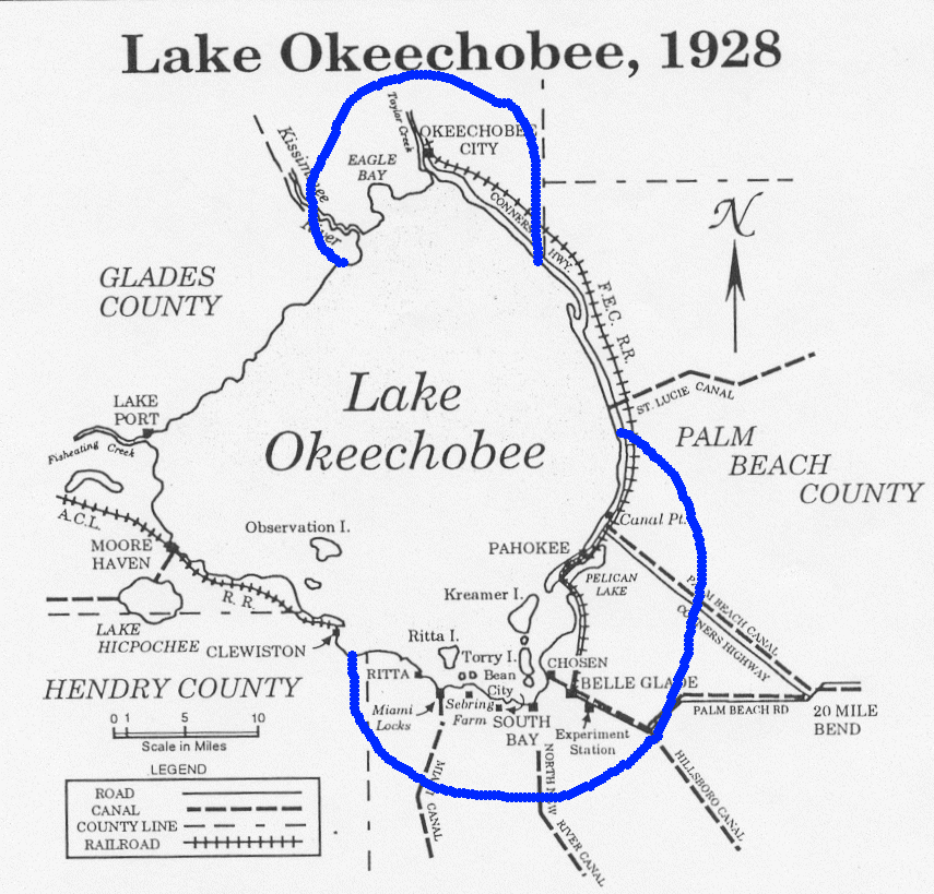
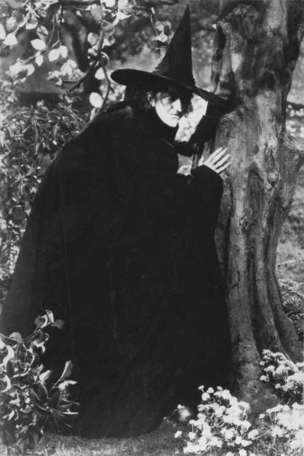
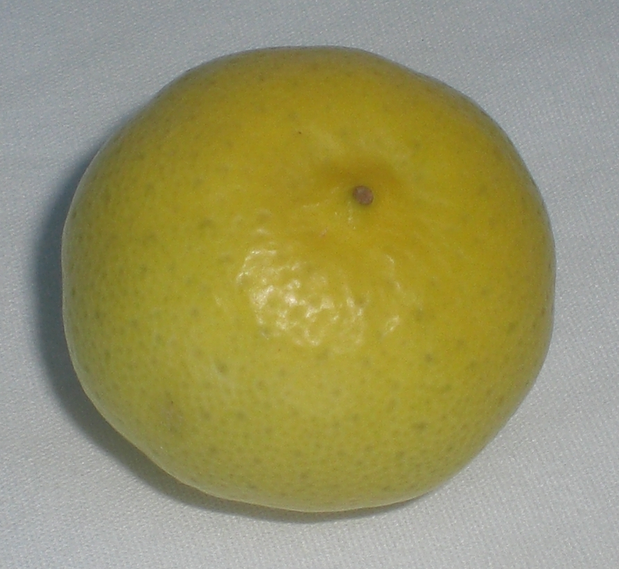
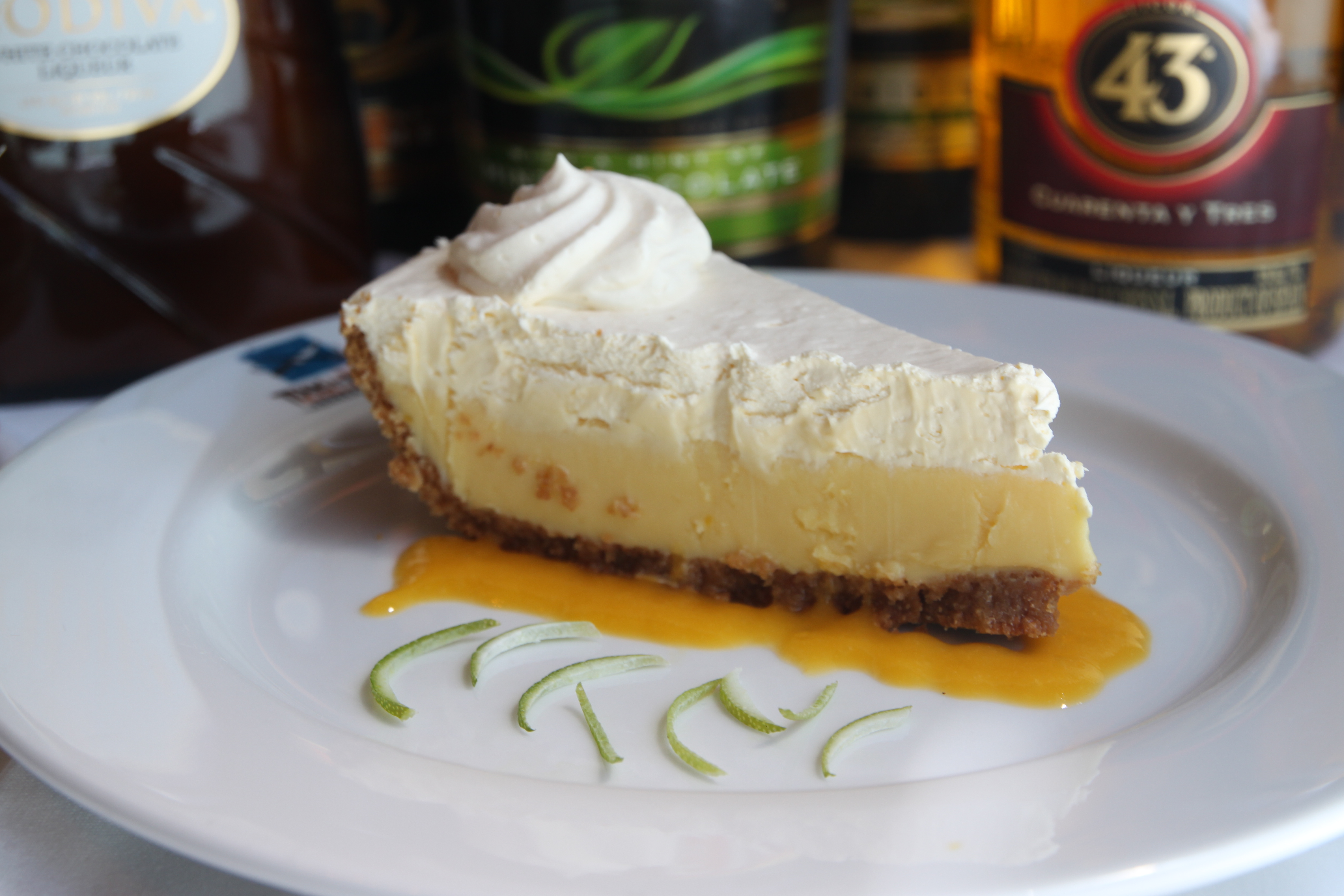
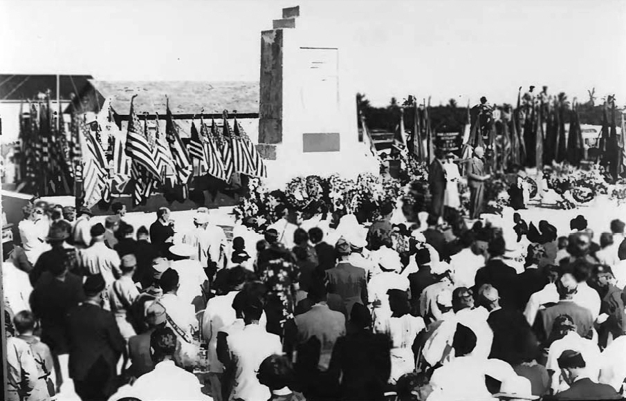
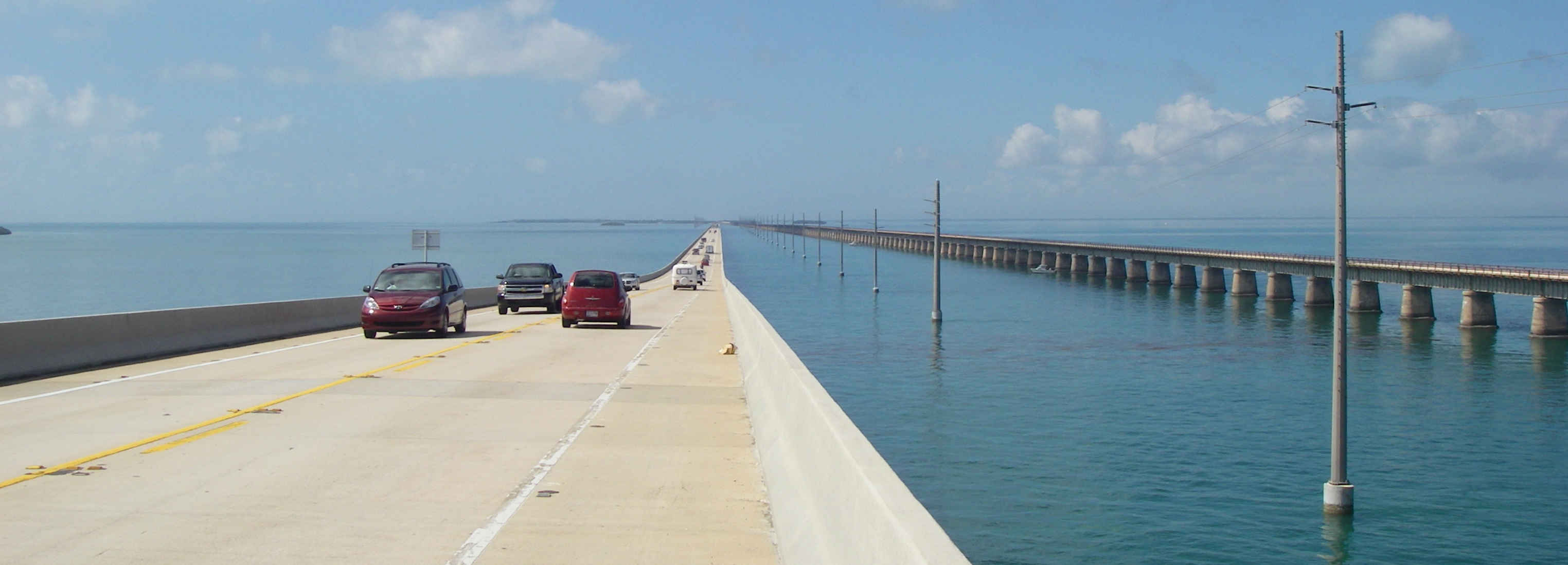