|
Reflections 2017
Series 6
May 1
Montréal-NYC R&S IV: Oswego - Oswego Canal - Erie Canal
| | Although it's always been tempting to call this the Erie Canal trip, since that was the original basis around which it was planned, actually, little time was spent there. It's great to visit the canals and watch the lockage and the scenery go by, and, while you'd think that canals are a slow way to travel, it seemed to take no time at all.
https://www.blountsmallshipadventures.com/_resources/common/userfiles/image/Maps/Larger%20Cruise%20Maps/Locks,%20Legends%20&%20Canals%202018.JPG
| | | | Here's the route map. You see what Trois Rivières is called by steadfast anglo-monolinguals, know why we had to stop in Ogdensburg, what's on Dark Island, and why we skipped Clayton. There's no stop in Fonda, and there's no lock there. Instead we stop two locks beyond it to the east, in Amsterdam NY. Otherwise the route ahead on the map is accurate. | | | | I see this two-week trip in four segments. (1) The one rail day ended in Montréal; (2) six St Lawrence days ended in Oswego; (3) three canal days will end in Troy; (4) four Hudson days will end in NYC. The third segment, roughly between Oswego and Troy, is even smaller when you consider that the first canal day starts at noon after time spent in Oswego, and on the third canal day we leave the canal going into the Hudson just after midday, spending time in Troy. That means that our time on the two canals covers ½ + 1 + ½ days. It's great fun, but of the three segments on the boat, the canal time between Oswego and Troy is the shortest. | | | | Day 7 (later): Oswego After resting during the slightly bumpy crossing of Lake Ontario, I came up on deck just as we were passing the breakwater in Oswego in the mid-afternoon and entering the Oswego River. The following view looks north into Lake Ontario, where we just came from, from Oswego Harbor (Photo by Dirk Ingo Franke). Click to see both sides of the breakwater protecting the harbor, river, and town. This view on the west bank (we docked on the east bank) shows grain silos, while the other side shows coal being stored at the Port of Oswego Authority facility, with a quick preview of Fort Ontario just before the tree. This industry that grew from canal commerce remains, though the Oswego Canal, like the Erie Canal, is today just used for recreational purposes. Actually, these Blount boats coming through could be virtually the only commercial traffic the canal has. This mid-afternoon arrival allowed me more time here to do what I wanted to do. We'd been scheduled to arrive during dinner when it was dark, and would only have a half-day the next morning. Now we had two half-days.
| | | | I found Oswego a simple town, like Ogdensburg. Michelin discusses it, but gives it no stars, and I regret that I won't be able to give it any, either. But I liked both towns and retain pleasant memories of each. I've now been doing so much post-trip Oswego rail and other research that it's growing on me. As to my now lengthened visiting time, I decided to see the well-known rails-to-trails bridge this afternoon and Fort Ontario in the morning before we leave, allowing for two easy visits in town followed by the canal adventure. | | | | In short, Oswego was a frontier settlement established by the British as a trading post in 1722, fortified with a log palisade. The first fortification on the site of what is now Fort Ontario was built by the British in 1755, but has been modified since. Oswego was laid out in 1797, it became an American naval base in the War of 1812, and the Oswego Canal, a branch of the Erie Canal, reached the area in 1829. The first of three rail lines arrived in 1848. First came the canals, then about two decades later, rails—that's just about right. So, based on our order of visiting them, we'll discuss the rails-to-trails bridge first, then Fort Ontario, then the Oswego Canal.
http://images.travelpod.com/cache/accom_maps/Econo_Lodge_Inn_And_Suites_Riverfront-Oswego.gif
| | | | This map was extremely helpful at the time, and will also be so now. While it doesn't show the breakwater, we see how the Oswego River so evenly divides Oswego down the center, with almost all streets including a W or an E in their name. We dock on the east side of the river, just north of E Cayuga Street, probably directly across from where the previous harbor view was taken. You can easily find Fort Ontario on the Lake, right above the port facility. | | | | Now locate a Z in the river, formed by three bridges. Bridge Street is the main street in town, and you see the Bridge Street Bridge. Two blocks south is the Utica Street Bridge, and on a most graceful diagonal is the former rail bridge in between, here in dashes, completing our Z. Now find the dashes on E Schuyler Street entering from the left bending down to Bridge Street. They then go through a two-block tunnel (not named) to E 1st Street, then over the bridge, to where they abut the road bridge. While the dashes stop on the map, the original tracks did go down W Utica Street until off the map. The route from W 1st Street going east over the former rail bridge and tunnel has been recycled as a rail trail. More later.
https://www.oswegony.org/cmsimages/Bridge%20St.%20Bridge.jpg
| | | | Now look at this amazingly complete picture. The panoramic angle distorts the Bridge Street Bridge, which is really straight as an arrow, so, once you suppress a giggle, look at what a great picture it is (click). We've just pulled in from the lake past the breakwater. You see the silos, the approximate spot from where the previous picture was taken, the coal, and maybe the fort. The first, pumpkin-colored building beyond the bridge is the Quality Inn with E 1st Street to its right. To its left is E Cayuga Street, then comes a brick building, the Best Western Hotel, next to which the Grande Mariner very conveniently docked. | | | | But don't leave this picture before checking out the lock. The Bridge Street Bridge is the first of many "low" bridges over the next two canals—you remember the song—that we have to fit under, so the pilot house is going to have to be lowered. You're looking at lock O8—that's not a zero but an O for Oswego—the lock furthest downstream on the Oswego Canal. You can see how it hugs the shoreline, so it's not an onshore ditch canal. But is it part of the river? Were we going to call it a maritime voie or lane? There are no easy answers. | | | | The recycled rail bridge and two-block tunnel are today the principal parts of the Oswego Rail Trail, the best name in my opinion, although you also find Harbor Rail Trail, River Walk, and the inaccurate O&W Railroad Promenade and Bikeway. That last name includes an error, as another railroad actually built the bridge and tunnel, the RW&O. North of the bridge and tunnel you can walk or bike the whole dashed-line route on the map. | | | | I have to start by telling about my earlier confusion. I knew only about the bridge in advance, and was looking forward to it. I found out about the tunnel when I got to the bridge. I'd heard a former station used to be located at the north end of the tunnel, but wasn't sure if that was right, since it wasn't marked when I got there. Afterwards, I heard there was a different station recycled as a supermarket on the west shore. I did see it a half-block away from the far end of the bridge, but wasn't aware until long afterward that that's the only remaining station building of three. In addition, there's that business of the bridge and tunnel being attributed to the wrong railroad, the O&W. I'd written down some on-site notes explaining some things, but couldn't understand the problem, including the wrong-railroad business, until well after the fact. What a mess! What magnificent confusion! I know that's an oxymoron, but that's how I felt until I was doing post-trip research, and over days of exhilarating online searching, I finally figured out everything I wanted to know. For me, that hunt was worth the prize of finally untangling that mess, and I learned a lot. | | | | Rails in Oswego While discussing the impact of rails in Oswego, it's also worthwhile to use this opportunity to (1) show how railroads grew in bits and pieces during their heyday, and (2) demonstrate the huge amount of rail infrastructure we've lost over time.
| | | | Oswego was apparently more of a commercial prize than I'd realized, being a port on Lake Ontario as well as an exit for commerce on the Erie Canal via the Oswego canal. As was typical of the day, passenger rail followed hand-in-hand with the commerce. This led to four railroads converging on Oswego within what I calculate as a compact quarter-century, between 1848 and 1873, then a merger between two of them resulting in three railroads in town with three stations. The Oswego Canal opened in 1828, but I have no population statistics for that period. Yet by 1850, two years after the first railroad arrived, the population was 12,205; by 1860 it was up a whopping 37.8% to 16,816, and by 1870 up a huge 24.3% to 20,910. Subsequent decades show fluctuations merely in the low single digits, both up and down. The estimate for 2015 is -2.0% to 17,787. It's evident that the period when the railroads arrived saw a population expansion like no other.
http://www.mapsofthepast.com/mm5/graphics/00000001/magic/NYOS0005A.jpg
| | | | Historic maps have a lot to tell us. While I also found some good railroad maps, it was only when I searched online for Oswego maps that I found this map of Oswego County dated 1866 that starts to tell the rail story, since here we see the first two railroads having arrived (click), one on each side of town, but not connecting, since they are separated by the river. The boldfaced year in each entry below indicates either the year the railroad was founded with Oswego at one end, or, if founded elsewhere, the year it eventually reached Oswego. | | | | First RR: O&S > DL&W The first railroad to reach Oswego was the Oswego and Syracuse, which began operations in 1848, and ran just between those two cities. I cannot find any official recording mark for it, so I'll make an obvious one up: O&S. To continue, we need this 1922 map of the Delaware, Lackawanna and Western, officially the DL&W. It was incorporated in 1853, and as you can see on the map, its main line ran between Buffalo and Hoboken NJ (for NYC). It decided to develop a branch to Lake Ontario, so in 1869, the DL&W bought (reading northwards on the map) what had been the Syracuse & Binghamton, and leased the Oswego & Syracuse, in order to give it access to the port of Oswego and Lake Ontario. Thus the O&S became the northern end of the branch that gave it access to NYC, Buffalo, and more. In addition to freight tracks reaching the grain silos on the west shore in Oswego, as the county map shows, passenger trains proceeded east along West Utica Street to the station near the corner of West 1st and Utica Streets. Later a station for another railroad would be directly opposite it on the north side of the street. Passenger service lasted at the DL&W/O&S station until 1949.
https://sites.google.com/site/savethewebsterdepot/_/rsrc/1416928287147/the-railroad/rwo_map_1886.jpg
| | | | Second RR: RW&O > NYC Our second railroad is the Rome, Watertown and Ogdensburg, the RW&O. As the name indicates, it had early on nothing to do with Oswego. The above RW&O map shows its size in boldface in 1886, and is a good indicator of how railroads grew back in the day, so follow each step on the map. It had begun in 1842 as the Watertown & Rome—its crescent route is easy to find. At this time, the Potsdam & Watertown was also formed (Potsdam is near Massina), and in 1861 they merged as the RW&O. A branch line from DeKalb Junction to Ogdensburg was later built, finally giving sense to the name RW&O. Completing the route, the Potsdam RR opened in 1856 only as far as Norwood Junction, and the Norwood & Montréal RR reached Massena in 1886. All of these companies became part of RW&O. The RW&O eventually became a subsidiary of the New York Central in 1891 and merged with it in 1913, being referred to then as the NYC/RW&O. | | | | | | This is a good point to take note of all the rail connections to the Saint Lawrence and the Thousand Islands, including to Cape Vincent, Clayton, both with water connections to Kingston ON, Alexandria Bay, and Ogdensburg. We can see how the resorts there thrived and how George Pullman arrived in his private rail car. It's all gone now. You couldn't make these connections today if your life depended on it. |
| | | | So what about Oswego? In 1864 the RW&O constructed a branch from Richland Junction near Pulaski to Oswego (see map, and then refer back to the Oswego County map). The line from Watertown entered Oswego from the northeast—so much is clear. But then I have to disagree with my online sources, which say at this time, it ran parallel with the O&W up to the O&W station. This is impossible, as the O&W wasn't founded until five years later, at which time this did come true. This has to be speculation on my part, but in our time frame, the RW&O must have come down E Schuyler Street all by itself (see Oswego city map), then turned south and ended at what was later to be the O&W station on Bridge Street at E 3rd. This is clearly what the county map shows—no O&W yet. Remember, the county map is dated 1866, two years after the RW&O arrived, and three years BEFORE the O&W did. You see the basis for early confusion on my part? | | | | Third RR: O&W This railroad had its origins in the New York & Oswego Midland RR, dating from 1868, which at least mentioned Oswego in its name, although it didn't yet reach New York. In 1880, the O&W inherited that main line with branches, became successor to it, and extended it, most significantly in 1890 when it reached the anthracite coal fields in Scranton PA, coal that eventually reached its way to Oswego, as we've observed. The full name of this third railroad in Oswego was the New York, Ontario and Western, or NYO&W, but everyone shortened that to just the O&W.
http://www.kinglyheirs.com/RailSiteLinksFiles/owmap.jpg
http://www.nyow.org/OW_map.jpg
| | | | This first map of the O&W is pleasingly simple, showing the main line from Oswego to Weehawken NJ (for NYC), the branch to Scranton, and the branch to Kingston NY, where our boat is going to stop. I include the second, undated, O&W map because it's more detailed. The full name of the O&W does reference New York at one end, but instead of Oswego it mentions Lake Ontario. The word "Western" was apparently just wishful thinking. As for its connections, look at Oswego. This map must date to after when the RW&O became part of the New York Central, but it says you can continue on the NYC to Watertown and beyond. As we know, you'd change at E Bridge Street. Let's see how that would work.
http://owrhs.com/Articles/Oswego/oswegomap.jpg
| | | | Careful, this map is turned sideways, with north on the right. Click to follow the O&W tracks coming north from the lower left, then joining the RW&O tracks coming in from Watertown and running parallel with them into town. Where they (used to) meet at E Schuyler and E 12th Streets is where the rail trail starts today. Notice how both railroads had freight spurs to go along Lake Ontario to the coal depot. At about E 6th Street there's a spur that first serves Fort Ontario, but which then also goes down to the coal depot. But our interest is the turnoff at E 3rd Street, ending (in the beginning) at a stub end at Bridge Street, where, on the northwest corner is (was—it's gone) what is always described as the O&W Station. I know that, once the tunnel across Bridge Street was built, RW&O trains stopped here as well as across the river, so I cannot imagine that they didn't also stop here before the O&W arrived five years after it had. I have no proof, but it's only logical. | | | | Those are the three railroads. We still have great things ahead after one more arrived, but was promptly swallowed up. The same year the O&W arrived on the east side, 1868, a railroad was chartered to serve the west side. It was the interestingly named Lake Ontario Shore RR (LOS), which literally ran more or less all along the south shore of Lake Ontario between Oswego and what was then interestingly called Suspension Bridge (over the Niagara River, to Canada), in the area of Niagara Falls NY. Work started in 1871 southwest of Oswego, and tracks reached Oswego in 1873, down W Utica Street to a point on the north side, opposite the DL&W/O&S station on the south side, with the tracks in Utica Street. | | | | Thus the stage was set. Two routes on the west side. Two routes on the east side. In 1875, just two years after the LOS arrived, the RW&O absorbed it. Go back to the RW&O map dated 1886 and confirm that the heavy black line leading from Oswego to Niagara Falls is labeled RW&O. So within Oswego there was now a shift in the players. There was the DL&W/O&S in the west, and the O&S in the east. But the RW&O was now on BOTH sides of town, each of its two routes coming to a dead end. What followed was inevitable. If the RW&O wanted through service from the Thousand Islands via Oswego to Niagara Falls, it had to connect its two assets. This is proof positive that the O&W had nothing to do with crossing the river, it was all the RW&O.
https://s-media-cache-ak0.pinimg.com/originals/fb/f4/10/fbf410e9d7d05f3f03f59e1943ed4410.jpg
| | | | This undated map is a little dark, so someone has marked the rail lines in red. In addition to the spur line to Lake Ontario on the east side, we also see one on the west side. The red lines don't conform to the name of the map, but they do help us see ALL the lines. On the east side, we see again the RW&O coming in from the north, joining the O&W line from the south, and both going down E 3rd past a black mark for the rail yard, to the black mark at Bridge Street for the so-called O&W station. On the west side, we don't see the two lines merging, but both then arrive down W Utica Street to the black mark for the twin stations on W 1st. Now we can see clearly why the RW&O wanted to connect the dots. Remember that the courthouse tunnel dates from 1876, the year after the LOS was absorbed, so the RW&O extended its route on E 3rd across Bridge Street and into the courthouse tunnel, and it emerged at E 1st, crossed both it and the new bridge it had built, and arrived at W Utica and W 1st Streets to its other station. It seems to me that the resulting rail pattern in Oswego resembled the Greek letter pi (π), with a line down each side of the river and the new connection across the river completing the shape of the letter. I understand that early rail schedules suggest the RW&O trains (and the New York Central's, once it absorbed the RW&O) stopped here and at their own station on the west side of the river, making Oswego a rare two-stop town. | | | | Thus the rail bridge crossed the river in town before either of the road bridges were ever built. The fact that the stations were on Bridge and Utica streets is also the explanation why the rail bridge forms the crossbar in the Z between them. It all makes so much sense when you know the background, especially since ALL these tracks are gone, as are the railroads we've named, and as are two stations, with the third now being a supermarket. How are you supposed to tell what it's all about unless you look it up? | | | | The Great Demise All passenger rail is gone here, and many freight routes have been abandoned as well. The O&W lasted until 1957, when it was liquidated in bankruptcy. The O&W holds the distinction of being the first notable US railroad to be abandoned in its entirety, not just having branches abandoned. Improved highways ended the O&W's passenger service to the resort areas of the lower Catskill Mountains (the "Borscht Belt"), combined with the lightly populated portions of upstate New York that it served. The last passenger train ran in 1953.
| | | | The DL&W (including the O&S) and the NYC (including the RW&O) later became Conrail, and in the 1999 breakup of Conrail, the line was assigned to CSX Transportation. Today, trains no longer cross between the east side and west side through the courthouse tunnel and the long bridge, so the top of the π, so vital in unifying Oswego rail services back in the day, is gone. Use of the tunnel for railroad purposes was discontinued in 1976, exactly a century after it opened in 1876. It had deteriorated by the 1990s, but was restored and incorporated into the Oswego Rail Trail, which was constructed in 2000-2001. | | | | The "legs" of the π leading into Oswego are still used for freight. CSX freight trains in Syracuse use the old DL&W line on the west bank to reach the west side of Oswego harbor, and they use the old O&W line on the east bank to reach east side industries. The line from Oswego to Watertown is abandoned. Founded in 1979, the Ontario Midland RR (OMID) runs part of the old RW&O line west of Oswego. It was created to save all of it from Oswego to Niagara Falls, but ultimately only gained operation from Hannibal just SW of Oswego to Webster, just east of Rochester, about 80 km (50 mi), perhaps a third of the distance it wanted to save, and then, just for freight. In a town that used to have three rail stations and three railroad lines, Google maps suggests, for potential rail travelers in Oswego, including students at SUNY Oswego, the bus service running SE along the river to the Amtrak station in Syracuse, a ride that takes 1h45 and makes 129 stops. | | | | We said we'd show how railroads in the 19C grew in bits and pieces, and we did that. Now we need to record the loss of rail infrastructure across North America and elsewhere, using New York State as an example.
http://www.american-rails.com/images/NYOWMap.jpg
| | | | This map, which probably dates from the last quarter of the 19C, purports to be of the O&W in boldface, but oddly includes non-O&W connections out of Oswego. Disregard all that, and just consider the extended rail infrastructure (click) within New York, neighboring states, and Ontario Province. (This map doesn't reach the Thousand Islands, but we saw those connections earlier.) Start by considering the ship routes across Lake Ontario that connected to the rail lines. Consider the possibility then of circling the lake by rail or by a rail 'n' sail combo. East of Utica, consider that the Erie Canal and Mohawk River had rail routes on both sides, including the West Shore RR. When we reach the Hudson, we'll stop in Troy, which no longer has rail service. While the East Shore still has passenger rail service today—we were there on the Adirondack—the West Shore has only freight service, given the demise of the West Shore RR and the O&W. We'll also stop in rail-less Kingston, and, just south of Cornwall, rail-less West Point. In between those two you see what is today the Walkway Over the Hudson at Poughkeepsie, but which then was a vital link from nearby coastal cities directly to Boston, avoiding New York, which at this time required ferry service across the Hudson. | | | | Try this little exercise. In 2016/4, we told how Mark Twain moved to a large mansion in Hartford CT in his later years, but made regular summer visits to his wife's family in Elmira NY. Many of his most famous works were written in these cities, and the family is even buried in Elmira. I've visited both, but I had to do so by car. When Twain and his family went between them, it was long before the auto period, but I doubt they went that long a distance by carriage, or even stagecoach. I'm going out on a limb here and suggest they may well have done so by train. Use this map and, though it requires several changes of train, put together a hypothetical (and possibly real) Mark Twain route between Hartford and Elmira. I can estimate it with three routes and two changes of train, routes that include the O&W and what is now the Walkway Over the Hudson. Do not even think of trying this nowadays.
https://www.dot.ny.gov/divisions/operating/opdm/passenger-rail/passenger-rail-repository/2016%20NYS%20Rail%20Map.pdf
| | | | Finally, this is a sad map showing New York State rail in 2016. Zoom in on the pink inset map at the upper left. It shows the plus sign of today's intercity passenger rail (excluding suburban commuter rail). We see the New York-Albany-Montreal route we took, and also the Boston-Albany-Buffalo-Chicago route, and that's it. Move right and see what remains in the Thousand Islands area, then how in Oswego, the "legs" of the π are still there for freight, but the top is gone. We also see how, west of Oswego, just a section of the former LOS remains. There are just too many "abandoned/service discontinued" lines in gray. Go down the Hudson, and you will see red lines on both sides, but the west shore has no passenger service. Only in NYC and suburbs does the extensive commuter rail picture improve the scene. | | | | Our Rail Walk Let's get back to the narrative, for which you should go back to the Oswego town map, albeit now with vastly improved insights, much more than I had when I walked this route alone. | | | | | | Although I'm sure these pictures are copyrighted so I can't link to them in the posting without special permission and have to have you link to them yourself, I want to say that I really did appreciate the vast amount of information and pictures from these two websites. One is http://abandonedrails.com/ and the other is http://kodtrak.railfan.net/ You'll see within the links which pictures came from each. |
| | | | From the boat docked at E Cayuga, it's just steps to East 1st, and it's only 2 ½ blocks down to the dotted line on the map crossing our path, which is where we'll start.
http://www.visitoswegony.com/files/fun/large/6ed4fab9abe62fe3d96bd606e6045afc.jpg
https://3.bp.blogspot.com/-FiWBwnVCicg/VsjWVYXIZfI/AAAAAAAAImI/301dUFSZFrM/s1600/DSCN1414b.JPG
| | | | When we turn to face the river, we find we're at a tiny park, which serves as an exhibition area at the bridgehead. It's a good four times larger than this first picture shows, with several panels on rail history. In fairness, this is where I learned that the wrong railroad was given credit in the name, and it did explain the background, but it was still confusing at the time. In the back is where you step up to the eastern bridge entrance, which is also in the second picture surrounded by trees on the riverbank. Unfortunately, half the walkway is blocked by a huge silver-colored pipe that crosses the river here, visible next to the person on the bridge (click).
http://picture.abandonedrails.com/xycwq4h7.jpg
http://picture.abandonedrails.com/624wl88s.jpg
| | | | These two pictures were taken of the ex-rail bridge from the Utica Street bridge just to its south. The first looks toward the right bank and shows the bridge emerging from the riverbank trees. Lock O8 is on the right, and through the bridge structure (click) you can see its downstream gate. The second view looks toward the left bank. The small building with the brown triangular roof at the extreme left of the picture (click) is a half-block west of the end of the walkway on the north side of Utica Street at W 1st. It looked as nondescript at the time as it does here, and was unmarked, so I saw it from the side but didn't know at the time it was the only remaining rail station in Oswego, originally belonging to the NYC/RW&O.
http://kodtrak.railfan.net/Graphics/oswego/nycoswego05.jpg
http://kodtrak.railfan.net/Graphics/oswego/nycoswego07.jpg
| | | | I had so much trouble finding these pictures, that I refuse to choose between them as the best view of the NYC/RW&O station, even they show the same thing. Note the shape of the roof, the Oswego sign on the right of the second picture, and that the tracks serving the station are in the middle of Utica Street.
http://kodtrak.railfan.net/Graphics/oswego/dlwoswego08.jpg
http://picture.abandonedrails.com/myb3tg9u.jpg
| | | | You have got to love the first picture, of the two stations on Utica Street in better times. The view is toward the southwest—look at those period cars! Under the flag is the DL&W/O&S station, on the south side of Utica street with a train arriving in front of it. On the north side of Utica Street, in front of us, is the NYC/RW&O station, seen from the rear. | | | | You have to hate the second picture, the opposite view, looking toward the northeast. Yes, it's the same NYC/RW&O station building, no longer in better times. It's the roof, of course, that will allow you to identify it, but it's today Paul's Big M Food Depot. I refuse to call this a properly recycled building. The train-plus-platform mural painted down the side of the building is an attempt to set a mood, but I fail to see it as successful. All in all, I'm glad I only saw this building from a half-block away, and only its east side, at that, not this.
http://picture.abandonedrails.com/as2na31w.jpg
http://kodtrak.railfan.net/Graphics/oswego/dlwoswego09.jpg
| | | | So let's pivot where we are and return over the bridge. This is the western bridge entrance, and it shows much more clearly (click) that huge silver pipe, now on our right. Otherwise, the park atmosphere has been done very well. The second, undated picture was taken when rail ruled and the rail bridge crossed the river with no road bridges in sight. The Bridge Street Bridge doesn't exist yet, and I assume neither did the Utica Street Bridge. Therefore, the rail crossing was the first, and preempted any road crossings. Put another way, the diagonal crossbar of our Z came first, before its top and bottom.
https://farm4.staticflickr.com/3133/2838248523_6dec75bd9a_b.jpg
http://kodtrak.railfan.net/Graphics/oswego/owoswego47.jpg
| | | | Having reached the tiny park again, we cross E 1st Street (see city map) and find ourselves at the western portal of the two-block tunnel, beautifully restored, inside and out, but, like the bridge, it's trackless, and paved instead. Obvious only at this portal is the Great Error, indicating in stone (!!!) that this is the O&W, not the RW&O tunnel. But there's something else about this picture—we see the courthouse at the left. This leads us to realize how low the hill—or perhaps ridge--is that the tunnel goes through and wonder why a simple cut through, with stone retaining walls, wasn't decided on. Well, a tunnel's more fun, even without the trains in it. | | | | I hope you appreciate the second picture, of the eastern portal of the tunnel. I don't know if it was a postcard, or a painting, but someone loved this view to immortalize it with something more than a photograph. The view is from the middle of E Bridge Street looking south, and the courthouse looks perfect. Again, the shallowness of the tunnel is noteworthy. Of course, the tracks are gone now, but we can explain something about them. The O&W station is behind us, across Bridge Street, so the O&W ended (or began) here. You can see the switch that O&W engines used as a crossover so they could run around their trains via the NYC/RW&O track.
https://c1.staticflickr.com/4/3220/2839085656_a48b84038b_b.jpg
https://farm2.staticflickr.com/1570/26558119486_db2f8ed6cd_b.jpg
| | | | Now we have two modern pictures of the eastern portal and its area. The first shows that there are actual retaining walls here and we can spy the courthouse. The second is close to Bridge Street at a leafless time, but with park benches; similar to the period picture, it shows the courthouse.
http://kodtrak.railfan.net/Graphics/oswego/owoswego22.jpg
http://kodtrak.railfan.net/Graphics/oswego/owoswego23.jpg
| | | | As we turn around at Bridge Street and look up the stub end of E 3rd, we have to go back in time again. These two pictures were by far the most difficult to find online, since the building is totally gone now, so do appreciate them. This is the O&W station on the northwest corner of E 3rd and Bridge, looking at its right corner. Actually, it looks quite a bit like a regular office building of the period, except for the train platform on this side. The tree above the arch obscures the name, but the second picture shows the view of its left corner at the arch, and the name is fully visible. Note the other charming period buildings on Bridge Street.
http://kodtrak.railfan.net/Graphics/oswego/owoswego03.jpg
http://kodtrak.railfan.net/Graphics/oswego/owoswego25.jpg
| | | | We have here an undated, but period postcard looking west along Bridge Street. Cayuga Street is to the right, where our boat would be located. On the left we see part of the rail bridge, and can judge the tunnel exit across from the O&W station, which, in this tiny view, seems to have been modified. But if we put ourselves back at the tunnel exit, we're shocked to see this 1950s view of where the station had been. This is again the stub end of E 3rd Street. What a mess, this post-industrial decrepitude. This is the early 1950s, as the parked cars show. Taking the place of the station is Loblaw's grocery store, which has reportedly been there "for several years" at this point. | | | | But though the station is gone, I have good news. The intersection is totally spiffed up today, with trees lining both streets. Where the station used to be on the northwest corner there's today an attractive Thrifty Shopper Mart that includes a Little Caesar's Pizzeria. How contemporary can you get? Across E 3rd, on the northeast corner, is a small business with a large parking lot facing Bridge Street, a sign of the times. We'll discuss that business shortly. | | | | You can confirm on the city map that it's just steps back to the boat, but also to a surprise. I knew they were going to lower the pilot house, but it was a bigger deal than I'd thought. I'd only experienced two other similar procedures. On the American Queen (2013/7, Voyage 52, 2014, moreso Voyage 52, 2015), it was a larger-scale matter of big river—big bridges, but occasionally things needed lowering to fit under a bridge, particularly on the Upper Mississippi. It was simple. We had two tall, black smokestacks—just decorative—and on the pressing of a button, they would both lower forward together to rest in U-shaped cradles. Another button had the pilot house accordion in on itself downward, and we passed under a low bridge. Everything being hydraulic, it was all raised again quickly right after passing the bridge. | | | | On a smaller scale there was the Kawartha Voyageur on the Rideau Canal just before that (2013/7, Voyage 51, 2014). The canal had lots of low bridges, but again, it was all hydraulic. On the top deck, the metal sunshade would just fold down low, and the pilot house would collapse on itself halfway, but the captain would open the sunroof and his head and shoulders would stick out of the collapsed pilot house, which was actually quite amusing. | | | | When it was announced early on that in Oswego, the pilot house on the Grande Mariner would be lowered, to be reraised in Troy, I assumed there were numerous low bridges on the canals, but wondered why the pilot house would be kept down throughout. When I got back to the boat, I saw a number of passengers sitting around on a fence watching the lowering procedure, which was all manual! So THAT's why they only did it once! When I got there, the metal sunshade had already been lowered by hand, and the crew was up front, surrounded by ropes everywhere, just having completed manually lowering the pilot house from that top deck (the "roof"), to the deck below. It fit in on that deck in the bow, just in front of the lounge, with access through a door in the front of the lounge. It was clever, but it seemed overly complex. Still, it was finally done. | | | | Day 8: Oswego, Oswego Canal, Oneida Lake We didn't sail till noon, and there was offered, for $35, a walking tour of Oswego from 9:30 to 11:00. I can't imagine where it would have gone other than my couple of nearby destinations, but it was most likely offered for the mapless, and therefore, the clueless. Anyone arriving in a new place not previously having checked it out as to a map and sights to see is either condemned to walk around aimlessly or to pay someone for a tour, walking or otherwise. They will be shown what the tour guide wants them to see, not necessarily what they might themselves have chosen if they hadn't committed themselves so steadfastly to cluelessness. | | | | Well I had my map, and this morning's plan is simple, just to visit nearby Fort Ontario. The town map will show it's quite walkable, but a free shuttle was being offered, so after breakfast, I decided to try it out. I'd then walk back to the ship. Simple, no? | | | | But I have to rail a bit more about how some people travel. I always use a medium sized roller bag for 2-4 weeks of travel, for clothes, paperwork, laptop. I pack a minimal amount of clothes that include drip-dry tees, easily rinsed out in a hotel sink to dry overnight. Only if I'm in a hotel for more than one night do items like socks get washed out, which need two nights' drying time. It's all quite simple. | | | | I have never understood why someone would need to use a hotel's laundry service, and worse, a ship's laundry service. But at any rate, the question on this trip was moot, since the ship didn't have a laundry service. Instead, they announced in advance that, in each port, they can tell "launderers"—my word--where to find a local laundromat. My eyes rolled when I first read that. | | | | In addition, there were the boozers. Wine and beer were complimentary at lunch and dinner, which is "boozer" enough for me, but passengers were told they could bring their own spirits—BYOB--to be left in the lounge to be used with complimentary mixers. That's OK, though not for me. What did confuse me, though, was how some would run out of their supply for cocktails. These boozers would also be told where to find a local liquor store in local ports. | | | | So I was fully aware that the shuttle bus would include both launderers and boozers, along with those that wanted to see the fort. But I almost burst out laughing when I found our first stop. We went down Bridge Street and pulled into the northeast corner of E 1st to the parking lot of the Colonial Laundromat. Behind us was the tunnel, to our left was the Thrifty Shopper Mart on the site of the O&W station. The intersection I had come to see the day before for its historic value was now being visited by the launderers to clean their dirty socks!
http://media.syracuse.com/news/photo/2016/05/05/072701-oswego-1-dljpg-04577fe730a51e2f.jpg
http://visitoswegocounty.com/wp-content/uploads/Aerialphotofort.jpg
| | | | I assume the driver later found a destination for the boozers, but next came Fort Ontario, reached right up the next block, E 4th Street (see map). The first aerial photo above is "upside down", that is, it looks south, up the river. I'm sure by now you recognize (click) our silos, three bridges, and coal storage facility. You can visually follow Bridge Street to E 4th, right up to the fort. The antecedents of Fort Ontario State Historic Site date from 1755, but it's restored to 1867-1872. You can see its five bastions surrounding a few simple buildings in the center. | | | | But I like the second picture better. The van drove us right up to the lake overlook at the top of the picture. We were about 6-8, and enjoyed the view from here of the lake we'd crossed the day before. But that soon got old, and I started walking back own the road through the large park area to the fort. I walked around to the front to inspect the walls, but this late in the season, the fort was closed. Still, I was quite satisfied. It was quite a simple fort, and this year alone we visited Forts Moultrie and Sumter in SC and Fort McHenry in MD. | | | | I didn't see anyone else come over to the fort, nor did I notice the van leave. For all I know, the group could still be standing at the overlook. Leaving the grounds of the fort, it was easy to pick up the rail trail coming down Schuyler Street back the couple of blocks to Cayuga and the boat. | | | | Safe Haven at Fort Ontario There's a bit of mid-20C history connected with Fort Ontario that you'd hardly expect, but it involves good news then followed by bad news. Fortunately, in the end, the good news takes over again. | | | | The good news: during WWII, Fort Ontario was the only location in the US to house Jewish refugees fleeing the Holocaust. But the bad news taints the good news. | | | | The bad news: during WWII, Fort Ontario was the ONLY location in the US to house Jewish refugees fleeing the Holocaust. This duplexity is demonstrated by the Latin term, res ipsa loquitur, "the thing speaks for itself". Furthermore, a fundamental reason for the fact that no others were established is shown by the difficulty in establishing the Fort Ontario Emergency Refugee Shelter, also known as "Safe Haven" in the first place: antisemitism. Here's the framework of what came to pass, blending the good and bad sides of the news. | | | | We start with the background of President Franklin Roosevelt's infamous decision to agree to place many Japanese citizens, and worse, many Japanese-American citizens, into internment camps from December 1942 to 1945, following the attacks on Pearl Harbor. But FDR was also responsible for opening a different kind of camp in Oswego in spite of the strong anti-immigration sentiment in Congress at the time. There were fears that some refugees were Communists, or German sympathizers. (!!) FDR went against the will of Congress by opening Fort Ontario to Jewish refugees. But the refugees were deliberately chosen so that some were non-Jewish, in order to allay antisemitic fears. | | | | Oswego was chosen because FDR, a native New Yorker and former NY governor, previously had campaigned in Oswego. He liked it up on Lake Ontario and he thought small-town America would be a good place for the refugees to reside in. On 20 September 1945, Eleanor Roosevelt visited the camp (below).
https://www.iloveny.com/wp-content/uploads/2009/08/visitor4_150.jpg
| | | | A big concern with the establishment of the camp was the issue of immigration, an issue reflected in today's news. However, Roosevelt had to make it very clear that immigration laws were not going to be ignored. The refugees would merely be residing in the US, not citizens of the US. They would have no visa status. Roosevelt also had to assure Congress that the Army would not permit any refugee escapes. (!!!) Initially, plans were made to install spotlights along the existing 6 ft (2 m) chain-link fence, as well as having 150 armed guards around the camp perimeter. Neither of these things were implemented, thank goodness, although the chain-link fence was topped with barbed wire. Because of their immigration status as “guests” with no official status, the refugees would not be able to work, and they would not be allowed to travel beyond Oswego. They were also told they would be returned to their homelands after the war, and would have no rights as regards entering the US. | | | | | | There is a wealth of photos available on this subject, and it was slow going choosing a few examples. I cannot link directly to any of them—you'll have to do it yourself--because either they're copyrighted or of unknown copyright status. A large number of them were taken by the well-known German-born American photographer and photojournalist Alfred Eisenstaedt, who achieved prominence as a staff photographer of Life Magazine. Life featured more than 90 of his pictures on its covers and published over 2,500 photo stories of his. Few will fail to recognize what is arguably his most famous photograph:
https://upload.wikimedia.org/wikipedia/en/9/95/Legendary_kiss_V%E2%80%93J_day_in_Times_Square_Alfred_Eisenstaedt.jpg
Celebrating Victory over Japan (V-J), it's called V-J Day in Times Square, and shows an exuberant American sailor kissing a nurse in a dancelike dip, published in Life in 1945.
Life was preparing a story on the Oswego refugees for its 21 August 1944 edition, and sent Eisenstaedt to photograph them, which is one reason for the plethora of photographic material. He found many were hesitant to be photographed because of their appearance—refugees are real people, after all. They were concerned about ragged clothing and wanted at least a chance to clean up. Apparently the Army had taken their clothes and had disinfected them, causing burns, holes, and discoloration. Any photos that follow that I could identify as Eisenstaedt's are so indicated.
|
| | | | A total of 982 Jewish refugees arrived at the camp in August 1944. They were brought from Italy, which by then had fallen to the Allies, but came from many other parts of Europe, particularly Germany, Austria, Czechoslovakia, Poland, and Yugoslavia. Upon arriving at Fort Ontario, many were surprised, scared, and angered to see that the fort was surrounded by barbed-wire-topped fences. Nearly 100 of the refugees had been imprisoned in Buchenwald or Dachau, and they feared this could be another concentration camp. It was only after explanations from staff at the fort that the refugees began to accept the fence.
https://static1.squarespace.com/static/57cf18ae6b8f5ba693497e1a/t/5896952a29687ff9f4c52c0b/1486263614351/
https://1.bp.blogspot.com/-uK8CQ9aZquY/WFAk4KGSoaI/AAAAAAACe4I/8lyE51UcFzYoWQxIQAXqQvzYMMFDYDkxQCLcB/s640/wwii-refugees-9.jpg
| | | | The first picture was taken on 4 August 1944 on arrival in Hoboken NJ. The second, by Eisenstaedt, shows the train having arrived, along with the barbed-wire-topped chain link fences. We can speculate that they arrived either completely or partially on the O&W, since we know that that's what skirted Fort Ontario. Perhaps Eisenstaedt arrived that way as well.
https://2.bp.blogspot.com/-6XV7DnCxz_U/WFAk2lZ9xwI/AAAAAAACe30/Zjet21s90JwzAfHH87Fjc5zMtZhDihlMACLcB/s1600/wwii-refugees-4.jpg
https://s-media-cache-ak0.pinimg.com/736x/12/f8/fc/12f8fcfd572adf467d6f2fda1ddc8739.jpg
| | | | Refugees are shown tending to want to carry their own luggage (Eisenstaedt). Boys from Oswego had been hired to help, but many refugees clung to their possessions, the few remaining ones they had. I had wondered when I was there where at the fort they were housed, but the second picture shows they were given army barracks in which to live, which I now assume is where the large green park area is today. The picture shows the same view of Lake Ontario we had.
https://1.bp.blogspot.com/-0zrRaOI4NsI/WFAk1MPsAsI/AAAAAAACe3Y/GjkQ1LlbuSor0g5IiNuapOJY6sLJf3svACLcB/s640/wwii-refugees-13.jpg
| | | | An Eisenstaedt photo shows refugees entering their temporary home in an Army barracks. However, there was a lack of freedom in the camp. For the first month, the refugees were not allowed to leave. Even relatives who had traveled to Oswego were not allowed to enter the camp, and they had to visit with their refugee relatives through the chain-link fence. Some local citizens visited the camp to welcome the newcomers, passing sweets and gifts through the fence (below).
http://mediad.publicbroadcasting.net/p/wrvo/files/styles/medium/public/201512/fence_refugees_and_oswegonians.jpg
| | | | The 982 individuals arrived in what were called 496 "units", that is, either family groups or unaccompanied persons. Many had been refugees for 7-8 years, and almost all had endured considerable suffering. Still, while in the camp, many complained about the loss of freedoms they continued to encounter there, such as confiscations by customs, censorship of their mail, and their restriction to the camp. But after the first month, the quarantine was lifted. Residents of the camp received six-hour passes to go to Oswego—and we know how short that walk is. Thousands of visitors also poured into the camp. | | | | The refugees resided in the camp for the 18-month period from August 1944 to February 1946. That latter date was a full nine months after V-E (Victory in Europe) Day on 8 May 1945 and even after V-J (Victory over Japan) Day, later that summer. The reason the refugees were kept in internment was because of disagreements concerning whether or not to allow them to stay and become US citizens. But this is where the news turns good again. Due to political pressure, those that wanted to were allowed to stay and become citizens. Some chose to return to Europe, perhaps to find family members, or perhaps hoping that their homes and businesses still remained as they had left them. But most wanted to stay, rather than returning to a country where they believed they had no future. 60% of them had active immigration cases pending and were granted permanent or temporary status, sometimes ending up in the homes of family or friends.
https://3.bp.blogspot.com/-WB7X9-fvBHY/WFAk3n3Di1I/AAAAAAACe4E/tNM0WfmMKaIAfU_wMbp7qcp0DyuMZMfxgCLcB/s640/wwii-refugees-7.jpg
| | | | We are currently in another era of refugees. This set of Eisenstaedt photos shows that these randomly selected individuals who happen to have refugee status are regular people, trying to get on with their lives. That's also shown in the below picture showing refugees having dressed up in costumes, a tradition when celebrating Purim. Wait until you burst out laughing (guaranteed!) before continuing reading.
http://idamclient.ushmm.org/IMAGES/(S(g2kafp55ji0lrav3nkenqh45))/RetrieveAsset.aspx?instance=IDAM_USHMM&id=1127046&page=0&size=1&width=800&height=800&qfactor=2&type=asset
| | | | If you're now reading this, you've found the refugee with a sense of humor who's dressed up as Adolf Hitler visiting a Purim celebration. Finally, below are two pictures showing an attempt to reach some form of normalcy at the camp.
http://scoutingmagazine.org/issues/0410/art/ww-01.jpg
http://scoutingmagazine.org/issues/0410/art/ww-00.jpg
| | | | Among all the photos I came across was this one of 11-year-old Walter Greenberg in his Boy Scout uniform, which seemed to be a story that wanted to be told. Greenberg was a native of Italy whose family had been fleeing the Nazis for much of his short life. Boy Scout Troop 28 in Oswego in 1944-1946, with 28 members, all Holocaust survivors, came into being largely due to the efforts of Scoutmaster Harold D Clark, in the middle row, third from the right. Walter Greenberg is in the front row, second from left. There was also a Girl Scout troop and a Cub Scout pack for the younger boys. As an adult, Greenberg became a filmmaker, and he's had a traveling exhibit of the Oswego project. | | | | NYS Canal System: Oswego Canal It's noon and time to sail off from Oswego. We'll see all of the Oswego Canal—and River--today, and then some. To re-orient ourselves, let's look again at this map that emphasizes the Oswego River and its drainage basin (Map by Karl Musser). Then let's look at the ups-and-downs of the trip:
http://www.canals.ny.gov/navinfo/charts/mileage.jpg
| | | | This is a profile sketch (click) of the entire NYS canal system showing (in red) the change in elevation at each of the locks (numbered in black). Start on the left at Lake Erie (blue numbers are height in feet above mean sea level) and note how the Western Erie Canal drops in height consistently all the way past where the Cayuga-Seneca Canal joins it to the point where we on the Oswego Canal join. We will be rising considerably on the Oswego from the height of modern Lake Ontario to the height of ancient Glacial Lake Iroquois as represented by Lake Oneida. | | | | Once we join that tail end of the Western Erie Canal will it do its only rise, at Lock 23, to access Lake Oneida. Sylvan Beach is the start of the Eastern Erie Canal, which we'll transit in its entirety. We'll have to rise twice more, and then every following lock will have us descend to the left of the Hudson River. Note specifically the plunge taken at the end in the flight of locks 6-5-4-3-2, followed by a turn south through the Federal Lock in the Hudson, informally known as Lock 1. At the bottom, note the possibility of going north on the Hudson up the Champlain Canal, which has its own rise, then fall, into Lake Champlain.
http://www.geoffschultz.org/2008_Sailing/Photos/NY_Ilian_Oswego/images/20080715_081228.jpg
| | | | Let's also use this sketch for some specific detail on the Oswego River and Oswego Canal. Leaving Lake Oneida is the Oneida River. Leaving the Finger Lakes is the Seneca River. They merge to form the Oswego River, hence the name Three Rivers. The Oswego River is channelized (or "canalized") for part of its length as the Oswego Canal, so again, like in the St Lawrence, you're sometimes in a canal section and sometimes in an open river. The canal was completed in 1827 and opened in 1828, two years after the completion of the original Erie Canal. In 1917, the Oswego was deepened and refurbished along with the entire system. | | | | As the sketch shows, the Oswego has seven locks, numbered south to north (opposite our travel direction) numbered O1 to O8--lock O4 has been eliminated—and again, that's an O, not a zero in the names. There had apparently once been a series of steep rapids in the city of Oswego, so there is a flurry of three locks at the lower end, O8 and O7 being particularly close to each other, then O6. The canal is 38.1 km (23.7 mi) in length, with a change in elevation of 36 m (118 ft). Do keep in mind that that's roughly the height of water lost when Glacial Lake Iroquois flooded away, leaving Lake Ontario "at the bottom of the bathtub". | | | | We also need to get reoriented with two maps we've seen before. First is the "brochure map":
https://www.nps.gov/erie/planyourvisit/upload/ERCA_brochure_large_2007.pdf
| | | | Again, scroll down to the second page, click on "Automatic Zoom" and set the page size to taste--I like 200%--and wait for the page to focus. This map is the better of the two for a general overview, and very few locks are shown here. Remember that our time on these canals will be just two days, broken down over three days in the pattern ½, 1, ½. Today's half-day will involve a route through, among other locations (see map), Fulton and Phoenix, then the tangle of waterways called Three Rivers, on our way to cross Oneida Lake, to spend the night in Sylvan Beach. If you feel that that's a lot of canal distance to cross in only a half-day, then you need to adjust your image of canal travel—it's less pokey than you might have thought.
http://www.canals.ny.gov/maps/
| | | | Our NYS interactive canal map ("Interactive Map") as you recall is much better for lock detail and satellite images. Under "Satellite", make sure "Labels" is checked. Get centered on our area and hit the plus sign three times to start out. You'll now have the Oswego-to-Sylvan Beach segment we're doing today. Click on any red lock symbol for info. | | | | So here we go. On the interactive map, zoom in to Oswego. The first thing we see is the trio of close-by locks. But first, let's say good-bye to the town. The second bridge in is, as we know, Utica Street. Center on that, and click on "Satellite", then zoom in, crazy-close. At W 1st and Utica, you'll see Paul's Big M market, formerly the NYC/RW&O Station. Across the street was the DL&W Station. Let's "walk" over the former rail bridge across the river to the tiny park, where the black roof protects the historical display area in the park. We cross E 1st Street, then enter the tunnel, and shortly afterward, exit it. Crossing Bridge Street, we see the Thrifty Shopper where the O&W Station used to be, and, if you're close enough, you can wash your socks at the red-roofed Colonial Laundromat. | | | | Zoom out a couple of clicks to more easily follow the trail to Schuyler Street, then pass the point where the tracks probably let the refugees off. Take a close-in look at the fort and at the viewpoint on Lake Ontario. Rising up, you can inspect the breakwater. Now come upstream to where our boat has just left its moorage north of Cayuga Street as we sail under the Bridge Street Bridge. If you're close enough, you can see both sets of gates to lock O8.
http://static.panoramio.com/photos/original/5216372.jpg
| | | | And this is the view from the Bridge Street Bridge looking south, in our direction of travel, showing both gates. It's also very clear that the canal on the left, even though it's within the riverbed, is totally separate from the river on the right. Click to see the former rail bridge with the Utica Street bridge discernable behind it. Zoom up, and come back in right after to see Lock O7. Keep on going and you see where the canal reblends into the river. | | | | I would say that this afternoon on the Oswego Canal was the most pleasant of the entire trip. Aside from the weather and scenery being perfect, it just seemed that, when arriving at a lock in a town, the lock was more intimately bound into the community as an integral part of it. On the St Lawrence, the locks were huge, and I described them as being of "papa bear" size. These locks were "mama bear" size, if not giving the impression of being even more petite.
https://farm4.staticflickr.com/3221/2735418346_4bc04b0567_b.jpg
| | | | Work your way up to Fulton NY, where there are again two locks, O3 and O2, and look around the town and both locks. They look pretty much alike, so the above picture of O3 can give an idea of both. The river is on the left, and, beyond the dam in the foreground, we can see the water flowing downstream, so we're looking behind us, to the north. The water in the corresponding satellite image is flowing more intensely, and looks more like a waterfall; you also see both gates of the lock here, while the photo only shows the upstream one. But look how integral to the town the lock is, with a principal street lying just steps away from it. It was not unusual to have kids standing with their bikes watching us lock through, quite differently from the Seaway. Now click to inspect the lock more closely. I found it quite attractive, all along this and the Erie Canal, that all lock devices were in the colors of the State of New York, blue and gold, and the lock number was always prominently displayed. | | | | Finally, on this canal, move up to Phoenix and lock O1. Again, the lock is similar to Fulton, but there's an interesting difference here. On the satellite image, move in to inspect Lock Island Park. Lock Island was created when the canal and lock were cut into the east bank of the river forming the island. But note how the Culvert Street Bridge is located directly behind the downstream end of the lock, right behind the downstream gate. Then also note how Bridge Street has no bridge, but looks as though one might have crossed right over the business part of the lock itself! This required more online research.
https://c1.staticflickr.com/4/3403/3471630031_c5ef8651bf_b.jpg
| | | | This picture I found shows a close-up of Phoenix Lock O1, again showing New York State's blue-and-gold livery on its accoutrements. But we're looking downstream, and sure enough, we see in yellow the Culvert Street Bridge right at street level and not too far above the water level (the lock chamber is full, but according to an earlier chart, this lock has a lift of only 10.2 ft [3.1 m], so that would appear to be the meager clearance of the bridge over the water downstream). As it turns out, this is a bascule bridge, built in 1990, which lifts up on one side similar to a castle drawbridge over a moat. More technically, I find it's called a rolling lift bridge (Animation by Y_tambe), a term I really like because of its descriptiveness, which simply means its lifts its span by rolling back on curved tracks resembling rocking-chair rockers.
http://www.dalrymplecompanies.com/images/projects/LocksPhoenix1.jpg
| | | | In this picture, apparently construction is going on in both the river an on Lock Island Park, explaining its temporary barrenness here. But it shows the yellow Culvert Street Bridge rocked back in open position. It's very difficult to see, but it's possible we're looking at the now disused remnant of the Bridge Street Bridge, built in 1912, crossing over the center of the lock. | | | | On the satellite map, rise up quite a bit and move a very little bit south, until you're in the Three Rivers area. You can see where the Seneca River comes in from the south, and the Oneida River (both named) comes in from the east. This three-way junction, considered the start of the Oswego River, is where we turn east onto the Oneida River on our way to Lake Oneida. | | | | But you can also tell on the satellite map that the Three Rivers junction lies between Erie Canal Locks E24 at Baldwinsville and E23 at Brewerton, putting us on the eastern end of the Western Erie Canal. We're headed toward the latter lock, but I have good pictures of the former lock as being typical of the area. First zoom in crazy-close to Lock 24 so that you can clearly see both gates pointing left, upstream. Then locate the green structure to the left of the left gate. Now look at this picture. This is a tour boat in Lock 24 at Baldwinsville (Photo by Mccallusa). It must be headed west, since we see that green structure again. It took a LOT of searching until I learned that that is a guard gate, and, while the name seems indicative of what it is, it took a lot more searching until I saw plainly what a guard gate does. There are a number of these along the canal, and I'm not sure I saw them, and if I did, only now do I understand that they're for emergencies. They usually remain in open position, but if sudden floodwaters should come surging down the river, a guard gate protects both the canal and its lock, and of course, the local town. This is a short (0:36) YouTube video of a guard gate being lowered.
http://static.panoramio.com/photos/large/26005497.jpg
http://mediad.publicbroadcasting.net/p/innovationtrail/files/styles/x_large/public/201405/CanalSyracuse2.jpg
| | | | This first view looks west toward the guard gate in Lock 24 with a small boat in the lock chamber. In the second view, the Tugboat Syracuse, part of the canal fleet, pulls in from the west. NYS livery is obvious in both pictures, particularly in the tugboat. Lock 24 is unique in that it was the first lock opened in the modern canal, in 1910, the rest of it taking another eight years. | | | | We rise up on the satellite view and again seek out our actual route, where we're arriving at Lock 23. We can tell from the straight line that it's on an artificial cut, what I like to call a ditch. I understand it's the busiest lock on the entire canal system because of its prime location near Three Rivers, gaining traffic from Oneida Lake and points east, the Finger Lakes and points west, and Lake Ontario and beyond. | | | | We now enter Oneida Lake, and only those of us aware of geologic history realize we've moved up from low-level Lake Ontario and have achieved the height of the remnant of Glacial Lake Iroquois. This is a view from the southwest shore of Lake Oneida (Photo by Joegrimes). It's the largest lake entirely within NYS. We cross its entire length of 34 km (21 mi)—its width is 8 km (5 mi)--and arrive after dark in Sylvan Beach at its eastern end after dinner at about 8 PM. | | | | This is a good point to discuss depths and clearances. Sylvan Beach is considered the division between the Western Erie Canal (WEC), which we've just been on, and the Eastern Erie Canal (EEC). The WEC has a depth of 3.7 m (12 ft) but the EEC is a little deeper at 4.3 m (14 ft). Lake Oneida, between them, is a relatively shallow 6.7 m (22 ft), yet deeper than either part of the canal. As for bridge clearance, the WEC has 4.7 m (15.5 ft), but the EEC has more of an allowance, at 6.4 m (21 ft). | | | | Day 9: Erie Canal to Amsterdam We're finally at our middle canal day, the full day on the Erie Canal. In doing so, we'll traverse a dozen locks, from Lock 22 in New London NY, just east of Lake Oneida, to Lock 11 in Amsterdam NY, where we'll spend the night. We'll be quite selective in our discussions, just picking out a few locations of particular interest.
| | | | We leave Sylvan Beach at 6 AM, now traveling on the Eastern Erie Canal. If you recall from our profile sketch, this is the only point where we go uphill. While Oneida Lake is at an altitude of 112.8 m (370.1 ft), Locks 22 & 21 raise us up to the highest stretch of the EEC, 128.1 m (420.4 ft), the stretch through Rome NY up to Lock 20, after which all locks will lower us down to the Hudson, which will then bring us down to sea level in NYC. As we cross over this "hump", we move from the Great Lakes watershed (Lake Ontario, Oswego River, Lake Oneida) to the Hudson River watershed (Mohawk and Hudson Rivers). | | | | This is a short (0:53), good YouTube time-lapse video of a boat going through Lock 21. Unfortunately, it's going downward, so it's a westbound trip, the opposite of what we're doing, but it illustrates well how a lock works. At 0:17 the boat enters the already-filled chamber. Note how the gates at this end have temporarily retracted into the side walls. The water is then let out of the chamber through hidden pipes, bringing the boat down to the lower level. The far gates open, and off it goes into the lower canal level. When we go through in the opposite direction, though, we're raised up instead. | | | | Go back to the Brochure Map and note again how, in green, the Old Erie Canal State Historic Park—part of the original, abandoned canal route--comes up from Syracuse along Hwy 46 to Fort Stanwix National Monument. Then on the interactive map, rise up a click or so from Lock 21 and watch Hwy 46 cross the modern canal. The old canal has been following this road, and you can find where they fork, with 46 crossing the modern canal and the old canal following a local road up to where it crosses the modern canal and can be followed into Rome to Fort Stanwix. | | | | On the Brochure Map, you can see the dashed line indicating where the Old Canal emerges from the green line and continues quite some distance eastward along the modern canal. Meanwhile, the Mohawk River has come down from north of Rome and continues along with us past Lock 20. Compare this with the satellite view of the interactive map from Rome to Lock 20. You can also spot the main east-west rail route we've discussed (Chicago-Buffalo-Albany-Boston), and just east of Lock 20, the New York State Thruway, I-90, joins us. You'll now see that, to paraphrase Jimmy Durante only slightly, "everybody's getting into the act" in this key transportation corridor. | | | | | | I need an aside here to try to understand people and their choices, particularly some travelers. On the Brochure Map, locate Lock 20, where we are now. Then, well south of the canal, locate Cooperstown NY, site of the National Baseball Hall of Fame & Museum. Then locate Amsterdam, where we dock tonight.
It's no secret that I'm not a sports fan, and we'll leave it at that. However, I do take a mild interest in the history of baseball as an American cultural phenomenon that has spread to some other countries. To wit, when Ken Burns aired his nine-part documentary Baseball in 1994, I watched all 18.5 hours of it with the greatest interest, even though I've never seen a baseball game—or any other sporting event—either in person or on TV. While in St Louis I wanted a room overlooking the Arch and not the Busch stadium, in Baltimore I was glad my room overlooked Camden Yards. That was partially because the view also included Camden Station, but I was also attracted by the free-standing bronze statues in the small park at the edge of the stadium. The standout is the 1996 statue of the Baltimore native, born just steps away, Babe Ruth (Photo by Edbrown05). I looked at the six other bronze statues adjacent, but paid them little attention. For the sake of completeness, I just looked up why they were there. It turns out they're the six players who've gone to the Baseball Hall of Fame—in Cooperstown!—as Orioles. I will warily admit to recognizing two of the names, Jim Palmer and Cal Ripken Jr. So whatever interest I may show in the culture of sports is complicated.
But to the point, for which I'll compare the stop at Singer Castle with the present situation using a hypothetical. If, like Singer Castle, Cooperstown and its Baseball Hall of Fame were (1) located directly on the trip route; (2) admission to it were included in the cruise fare; and by far, most importantly, (3) the boat waited at the dock during your visit, I would have participated. But instead, Cooperstown is (1) a one-hour's bus ride from Lock 20 and another hour to Amsterdam; (2) the tour fare would be $79; and most incredibly, (3) the boat would continue to Amsterdam. In other words, participants would miss almost all the full-day on the Erie Canal. Wasn't the Erie Canal a principal reason for taking the entire boat trip?
I couldn't believe the listing of what was called a "Between Locks" tour, but, sure enough, they filled a bus. It was scheduled for eight hours, more or less a full day, including a boxed lunch, but that remained unclear, since I remember them leaving after lunch on the boat. Subtract two hours for the long bus rides, and not much time is left. They promise you 38,000 artifacts on three floors, which is daunting to the greatest fan, but then say they're stopping in one of two other museums as well! It would seem that even the most steadfast baseball fan would see through this plan; my philosophy is that if you can't do it right, don't do it at all. On their return, I spoke to some of the participants, and I didn't get a happy vibe. And they missed most of the Erie Canal! I still do not understand why anyone would subject themselves to this chaotic interruption to the trip.
|
| | | | The Wise Ones who stayed and enjoyed the canal cruise proceeded with the rest of the day's laid-back itinerary, all downhill starting with 20. Of all the remaining locks between 20 and 11, I recall two standing out, 19 and 17, and those are the ones we'll discuss. | | | | On the satellite map, follow this bundle of transportation routes to Lock 19, at Frankfort NY, and zoom in. Aside from the lock being located just a stone's throw from the Thruway, you'll clearly see that the main rail line crosses the canal at a scissor-like angle just downstream of it.
https://imgsrv.marinas.com/v1/image/fetch/h_300,q_auto:eco,x_progressive/https://images.marinas.com/high_res_id/30055
https://imgsrv.marinas.com/v1/image/fetch/h_300,q_auto:eco,x_progressive/https://images.marinas.com/high_res_id/30057
| | | | You can see the lock in the first of these detailed pictures as it lies upstream from the railroad crossing. Do not be misled in thinking that gates are missing—the upstream gates on the left are in open position and set back into the side walls of the chamber. The second picture is turned a bit, but all gates are visible.
http://www.tug44.org/erie.canal/lock-19/images/lock19-3.jpg
http://www.tug44.org/erie.canal/lock-19/images/lock19-2.jpg
| | | | The first picture shows a boat in the lock in our direction. You can see the nearby gates having opened into the chamber wall. I clearly remember the uniqueness of this lock, with the rail bridge, steep sides, and narrow channel making it a tight squeeze. On these canals, we have no access to the closed upper "roof" deck, but you can't help thinking that the original name of the Erie Canal Song is "Low Bridge, Everybody Down". The second picture shows the view looking back, once we've exited the chamber and cleared the rail bridge. Every Lake Shore Limited (NY-Chicago) and Maple Leaf (NY-Toronto) I ever took must have crossed over Lock 19 without my ever having realized it. | | | | Leaving this area on the satellite map, notice how the Thruway, rail line, canal, and the still-tiny Mohawk River are all visible. Continue until you find Lock 17 in Little Falls. Here you cannot miss the rail line, as the satellite view has captured the image of a humongously long freight train on it. You also see Hwy 169 downstream a bit. Our other map points out a unique fact of Lock 17, that it has the highest single lift in the system. It lifts boats--or lowers them, as in our direction--an astounding 12.3 m (40.5 ft), with this single lock replacing four locks on the Old Canal, which were in exactly the same location. The reason why four locks had been needed, and why this replacement lock has to have so high a lift, is explained by the name of the town here, where there had been "little falls" and rapids in the Mohawk River.
https://media-cdn.tripadvisor.com/media/photo-s/06/85/0e/f3/the-overlook-mansion.jpg
| | | | This is a view to the west of the Grande Caribe, the identical sister ship of the Grande Mariner, passing Lock 17 eastbound, as we are doing. The chamber is still relatively full, so the boat is waiting to continue towards us. Notice the flat top, since the metal sunshade had been collapsed in Oswego, just as the pilot house had been lowered up front. Do understand that those three windows in the front are on the pilot house, which now has its back to, and entrance from, the lounge. It will be raised up to the top deck again in Troy. Under these circumstances, these boats look like they're sporting a crew cut.
http://www.tug44.org/erie.canal/lock-17/images/lock17-2.jpg
| | | | Lock 17 is also unique because it doesn't have a traditional downstream pair of gates. Instead, its very deep chamber has a concrete arch supporting a guillotine-style gate, or a curtain gate, which works just like a theater curtain, and is unique in the entire system. This is an inside view looking east, with the water drained and the black gate (beyond) raised. You are looking at the white counterweight in the down position. The white support for the Hwy 169 bridge ahead is visible through the opening. It IS a little weird sailing under this gate.
http://www.tug44.org/erie.canal/lock-17/images/lock17-1.jpg
http://c8.alamy.com/comp/ABYKPP/erie-canal-lock-17-little-falls-new-york-herkimer-county-highest-lift-ABYKPP.jpg
| | | | These two show the view back. The first view shows the black gate closed (while we had still been in there) and the white counterweight raised high. The second view, apparently from the highway bridge, shows the curtain gate open once we've left. The satellite view also, looked at very closely, clearly shows the curtain gate. | | | | It appears from the satellite view that, after Lock 17, the canal frequently joins the now-larger Mohawk River, except for bits and pieces of ditch canal areas, including around the locks. The Brochure Map reminds us that, after Fonda, we'll come across the Schoharie Crossing State Historic Site (sko.HA.ri), with the Schoharie Aqueduct. On the satellite map, come in close at Lock 12. Opposite you'll see the different color water of Schoharie Creek entering the Mohawk. Going in crazy-close will show you a bit of the Schoharie Water Bridge crossing the creek, and the trees lined up to the south of it indicate the route of the Original Erie Canal. By 8 PM we tie up in Amsterdam near Lock 11, and the weary baseball fanatics rejoin us, having missed the bulk of the Erie Canal. | | | | Day 10: Erie Canal to Troy (early): Starting our last half-day on the Erie Canal, we leave Amsterdam's Lock 11 at 7 AM. For an overview, the Brochure Map points out Schenectady, Rexford (on a hairpin bend), and Waterford, and today, those will be the places on the canal we'll discuss. | | | | On the satellite map, either move down to, or jump to, Lock 8 near Schenectady. Go in crazy-close, then let's sail downstream passing several islands named after New York Native American tribes. The last island is the Isle of the Cayugas (unnamed) and has the Western Gateway Bridge crossing it. Right after that, at Front Street Park, is a rail bridge, the one we crossed coming north on the Adirondack nine days ago. We have now completed our second rail 'n' sail crossover, after St Lambert. If you move south a little bit into the city, you'll see the blue icon for Schenectady Station, where we stopped then. | | | | Rise up several clicks and continue downstream until you come to that hairpin bend with Rexford on the north shore. A contemporary bridge carries Hwy 146 over the river from there to the curiously named village on the south shore, Aqueduct, which gives us a clue to what used to be there. Go in crazy-close to the modern bridge until the view changes to an isometric projection. Immediately downstream from the modern bridge you'll see the historic remains of the former Rexford Aqueduct on both sides. This is the water bridge that brought the Original Canal across the Mohawk to Rexford. But that needs clarification. The very original one in 1824 was enlarged in the 19C upgrade in 1842, which is what we're seeing. Of the original 14 arches, the satellite view shows the one remaining arch on the north side and two arches on the south side. Watching the shoreline carefully from the boat, we really do get to see the double arches (Photo by Howard C. Ohlhous) by peeking under the more modern highway bridge. | | | | Move along past Lock 7 and we find we're approaching the Hudson and are near the end of the canal. As you'll recall, we now come to a parting of the ways. Find the one more extremely sharp hairpin curve in the river with US 9 crossing it. Right after this, the canal takes off at about the four o'clock position. Let's first follow the river, which continues in the five o'clock position. Get in quite close on the now very wide river until you reach the Cohoes Falls in Cohoes. I'm not totally sure of this, but I believe the original canal continued this way along the south bank on its way to Albany, and it's possible you can discern that. You then reach that group of islands around which the river has to wend its way south and north before actually entering the Hudson. | | | | Now backtrack to the point where the modern Erie Canal takes off to reach Waterford instead. Pull up enough so that you can see the last five locks more or less clustered together, Locks 6-5-4-3-2, known as the Waterford Flight of locks. While it was enjoyable to experience, it was a little disappointing. But first let's look at the background of this concept.
https://www.dfly.no/wp-content/uploads/2016/05/kanalbatarna12.jpg
| | | | In 2006 I was in Sweden and cruised on the historic Göta Canal (2006/8). One of the highlights are the Berg Locks, also known as Bergs slusstrappa, literally Berg's lock staircase, but better phrased as Berg's Flight of Locks. As the picture shows, there are seven locks lined up back to back, which is quite impressive to traverse. | | | | My next experience was in 2014 in Ottawa (2014/16), where, with great difficulty, I worked it out to traverse the Rideau Canal's famous Ottawa Flight of Locks. You can look down the length of all eight locks from the city street above them, which adjoins Parliament, to get this view (Photo by Bobak Ha'Eri) right down to the Ottawa River. After a short sail on the river, we then went back to ascend the Ottawa Locks (Photo by Philipp Hienstorfer)—click for detail. This was a fabulous down-and-up trip—actually to nowhere. | | | | So I had great expectations for the Waterford Flight of Locks, even though there were only five. The good news is that they're a major feat of engineering, overcoming a difference of 51.5 m (169 ft) over a distance of 3.2 km (2 mi) and avoiding Cohoes Falls. But the disappointing news is, while relatively close to each other--check them out on the satellite map--from one you hardly get to see the next one, and absolutely nowhere to get to look down at the Hudson River from up above. It was no different than going through other locks, just one after the other. Nice enough, but not like the two earlier experiences.
http://www.buckettripper.com/wp-content/uploads/2012/09/Blount-4.jpg
http://www.nycanals.com/w/images/e/ee/Lock_E-4.JPG
| | | | The first picture actually shows the Grande Mariner exiting Lock 5 on the Waterford Flight. The second one shows Lock 4, with Lock 5 in the background. However, at no point did I have a distinct feeling of seeing two locks at once. Here, there were no spectacular views, you could not see the Hudson until you were on it, and you barely could see the next lock in the flight.
http://www.canals.ny.gov/navinfo/charts/14786c01l.png
| | | | This map (click) gives us another view of where we are. Check out Cohoes Falls and the islands. You'll now see the Troy Federal Dam & Lock in the Hudson, which we'll reach shortly, often referred to informally as Lock 1, though it's not part of the Erie Canal. In Waterford, we see Locks 3 and 2. Between them I believe is the original route of the Champaign Canal, cutting across this area on its way to join the Original Erie on their way to Albany. But concentrate on Waterford and the white area indicating the deeper channels. Those who leave have the option of taking a left turn and going up the Hudson to the modern Champaign Canal, though we go south. For the moment, concentrate on Lock 2 with a bridge crossing the canal immediately, followed by a larger bridge further along.
https://i.ytimg.com/vi/kbe8qLxY-E0/maxresdefault.jpg
| | | | We have some views taken from a drone. First is this still picture taken over the final lock, Lock 2, looking east toward the Hudson. The lighter bridge is 4th Street, the darker is 2nd Street, and that's the still rather narrow Hudson right beyond that. Cohoes and its falls would be to the south, somewhere beyond the treed area to the right. Then we have two very short YouTube drone videos. First is one taken over Lock 2 (0:50) It follows the water in the canal flowing downstream toward the Hudson and then, at about 0:42, suddenly "looks up" toward the Hudson, but it's not as good as the flight where the still picture was taken. I like the second video more. The drone revolves to achieve a circular view over Waterford (0:30). It starts out with the best view of the Hudson beyond the 2nd Street Bridge, then turns and looks up Lock 2 before returning to the Hudson. This drone view of the still-narrow Hudson illustrates the height needed to see the river when in Waterford, something we on the boat were too low to see from the distance of the Waterford Flight. It's nice, but it's not Ottawa. What I do very clearly remember seeing was the below view (click) of the very attractive Waterford Harbor on the north bank of the Mohawk, just before the 2nd Street Bridge in the background. As you see the Hudson under the bridge, we're at the eastern end of the Erie Canal.
https://upload.wikimedia.org/wikipedia/commons/5/54/NYmohawk-WaterfordHarbor.JPG
| | | | From Lock 2 on the satellite map, rise up and let's leave the Mohawk, turn south, and move down the Hudson to the Troy Federal Lock & Dam, informally referred to as Lock 1, although it technically has nothing to do with the Erie Canal. I had never realized there were any locks on the Hudson at all, though now we know the Champaign Canal to the north of where we are has several. Still this lock is independent of that. Move in to view showing the isometric projection. You see very nicely where we slip through the lock on the east bank (Photo by Kadin2048), the magnificent spillway in the center, and the powerhouse and fish ladder on the west shore. This dam's location marks the head of tide, the northern end of the Hudson River Estuary, lying 246 km (153 mi) from its beginning at the Battery, near where I live. In the next posting, we'll dock at, and visit, the architecturally charismatic historic downtown of Troy, before continuing down the Hudson to NYC. | | | |
| |
|
|
|


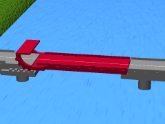
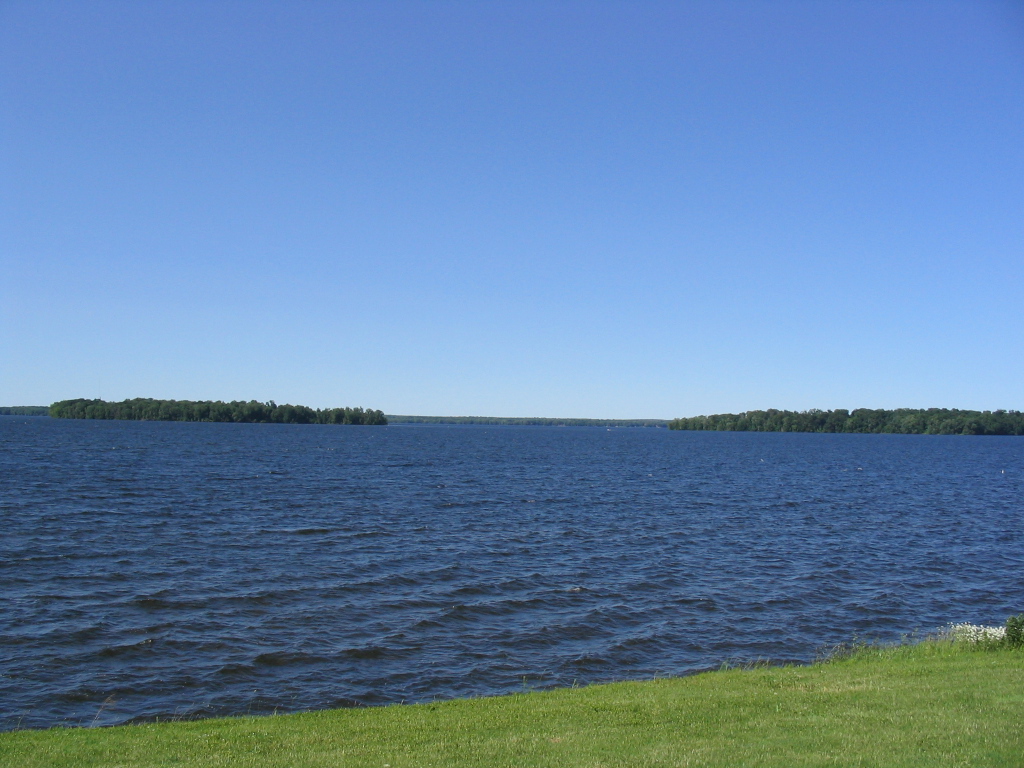