|
Reflections 2017
Series 7
May 15
Montréal-NYC R&S V: Troy – Hudson Valley – Kingston (Rondout)
| | Day 10 (later): We just spent our final half day on the Erie Canal, left the Waterford Flight of Locks, and passed through the Troy Federal Lock and Dam, which, quite remarkably this far inland, marks the head of tide on the Hudson River. Immediately afterward we'll now dock at Troy, where we'll visit, as promised, its architecturally charismatic historic downtown. It turned out to be an even greater high point of the trip than I'd expected.
http://reny.net/areas/images/Troy-map.jpg
| | | | Troy This political map (click) shows just where Troy NY is and how it sprawls along the east bank of the Hudson. Its northern reaches are directly opposite Waterford and Cohoes, and note again the several delta-like islands caused by the catastrophic draining of Glacial Like Iroquois (2017/3). Again, Van Schaick is pronounced as though written Van Skike. The Federal Dam & Lock would be located at about the C in "Central". The southern end of Troy is not too far from being opposite the northern reaches of Albany. As we know Schenectady is not too far to the west, and Troy has close ties to both Albany and Schenectady, forming a region popularly called the Capital District. | | | | Troy's downtown is in the lower half of the Central District, and we're going to dock at its Riverfront Park. That means we pass under the Collar City Bridge (explanation later) carrying NYS Route 7, and the Green Island Bridge—a former rail bridge--connecting both shores via Green Island. Today we won't go as far as the Congress Street Bridge a bit to the south, which carries NY 2 over the Hudson.
https://upload.wikimedia.org/wikipedia/commons/2/26/TroyWaterfrontPano.jpg
| | | | We've been so precise as to the bridges in order to explain this excellent picture of the Hudson waterfront of Troy. Click on the left to inspect Green Island. In the distance is the Collar City Bridge. Closer is the Green Island bridge, with its iconic blue towers. We're docking at Riverfront Park on the waterfront roughly where that boat is, though we'll face downstream. The online photographer misidentified this view as being from the Collar City Bridge, which is impossible. It has to be from the Congress Street Bridge, the southernmost one. | | | | History Through much of the 19C and into the early 20C, Troy was not only one of the most prosperous cities in New York State, but in the entire US. At the turn of the 20C, Troy was supposedly the fourth wealthiest city in the country, due largely to its geography. Obviously the confluence of the Hudson with the Erie and Champaign Canals and the Federal Dam being the head of tides, were both major factors in making Troy an industrial center. It was also a transshipment point for meat and vegetables from nearby Vermont. At one point Troy was also the second largest producer of iron in the US, surpassed only by Pittsburgh. Just to the east of downtown and on a low rise overlooking it is Rensselaer Polytechnic Institute (RPI), the oldest private engineering and technical university in the US, founded in 1824. | | | | | | There's also a bit of an off-beat history here, since Troy lays claim to the story of Uncle Sam. The image of Uncle Sam is purportedly based on Samuel Wilson, affectionately known as Uncle Sam, who resided in Troy from 1789 until his death in 1854. Wilson had a meat-packing business in Troy that supplied meat to a contractor for the federal government, Elbert Anderson. Wilson, who was also an Army inspector, stamped on every barrel of goods he approved the letters, "US/EA", meaning it was approved for delivery to the United States via Elbert Anderson. After Wilson's death, workers joked that the "US" part of the "US/EA" on the barrels didn't stand for "United States" but for Wilson's nickname, "Uncle Sam". Some of these men became soldiers in the War of 1812 and continued to spread the joke. This is the grave of Samuel Wilson in Oakwood Cemetery in Troy (Photo by David Bell). Click to read the inscription.
Now while the story is highly plausible, there is an element of legend in it as well. Nevertheless, in 1961 the US House and Senate unanimously passed a resolution, signed by President Kennedy, declaring Samuel Wilson of Troy to be the progenitor of the personification of the United States, Uncle Sam. That may make it very official sounding, but doesn't prove it to be accurate. But then maybe it is.
In 2012/5, we talked about the 19C cartoonist Thomas Nast and the many images he's responsible for. This is an 1877 image by Nast in Harper's Weekly of Uncle Sam riding a snail labeled "45th Congress". In that posting we said that Nast’s Civil War era lanky version added the iconic goatee, and was loosely based on Abraham Lincoln’s lanky appearance. However, the cartoonist-illustrator James Montgomery Flagg is responsible for further modification of the image in the 20C. He conceived his iconic 1917 poster of Uncle Sam, used for recruiting in both WWI and WWII, by basing the image on a modified version of his own face with a veteran named Walter Botts providing the pose. Exactly 40 years separate the Nast and Flagg images.
|
| | | | Names Once again we refer to the period when neoclassicism held sway, affecting the arts and architecture, but also names in the US. We've talked in the past about American cities being named after places in classical antiquity, such as Memphis TN and Cairo IL, also Athens GA. In NY alone we just recently passed Rome and Syracuse—the original Greek Siracusa is in Sicily. So it falls right into the spirit of the times when the town previously known as Ashley's Ferry was renamed Troy in 1789 after the Troy of Homer's Iliad. And, believe it or not, many people living in Troy do actually refer to themselves as Trojans. | | | | | | Since learning about the Iliad in high school English, I never understood the title, which is obviously something I always like to know. What connection could the name of the epic have to Troy and the Trojan war, during which the epic was set? Off to online research.
The Greek name of the city was Τροία (Troia), and the Latin name Trōia. That's simple enough. But the alternate name in Greek was Ἴλιον (Ilion), which in Latin was Īlium. Of the two, English usually uses the Latin form, Ilium. One source describes Ilium as being a poetic form of Troy, which explains the name of the epic poem as the Iliad. However, may I be so bold as to attempt suggesting as an alternative name, the Troiad?
This double name is not lost on the people of Troy NY. For instance, a landmarked 1904 building in the historic district is the Ilium Building, and there's a restaurant called the Illium Café, which chooses a double-L spelling. Of course, he who knoweth not his history, understandeth not the basis for these names.
|
| | | | We came across the name of the Collar City Bridge, which is based on Troy's nickname, the Collar City. And, of course, therefrom hangs a tale, one about antique clothing, specifically detachable collars. Clerical collars are detachable, as are some women's lace collars, and I always thought men's dress collars used to be as well, then eventually became attached to the shirt. I was apparently only partly right, since the proper historical sequence for men's collars was (1) attached; (2) detached; (3) attached again. | | | | In 1825, local Troy resident Hannah Montague was tired of cleaning her husband's shirts, which of course had the collars attached. Since only the collars were severely soiled, and since only the collars were to be starched, often to a hard, cardboard-like consistency as was the fashion, she decided to cut them off, bind the edges, and after cleaning and starching, sew them back in place on the shirt. Her idea of detachable collars caught on, especially after a local businessman, Rev Ebenezar Brown, commercialized the idea, and it changed men's fashion for a century, although detachable collars were later held on to the shirt by studs. Manufacturing detachable collars as well as shirts became a significant industry in Troy, hence the nickname Collar City. For a while, both cuffs and shirtfronts were also made detachable so they could be starched. That's no longer the case, although a full dress shirt still uses a stiff shirtfront and cuffs, though they are attached. | | | | This is a (starched-stiff) detachable wing collar with a front stud (Photo by Charlie Huang 【遯卋山人】) and this is an 1890s ad for a collar from a Troy company. It cost 30 cents and is proudly advertised as the highest collar ever made at 3 ½ in (8.9 cm). How uncomfortable! | | | | In 1851 a collar manufacturer began operations on River Street in Troy. It changed owners and names several times, until a clerk, George Cluett, became a partner. Eventually it merged with another Troy collar company, bringing Frederick Peabody into the firm. In 1899 the firm was renamed Cluett, Peabody & Co, which became a longtime manufacturer of shirts, detachable collars, and detachable cuffs. One Sanford Cluett joined the firm in 1919 and invented and developed the Sanforization process of pre-shrinking fabric, named for him. | | | | Prior to 1919, the principal business of Cluett, Peabody was men's shirt collars, but starting in the 1920s comfort in clothing won out over the practice of wearing stiff collars and consumer demand for shirts with attached collars grew considerably, and so the demand for detached collars declined. In 1929, the company established itself nationally extending its Arrow brand, whose product line included men's and boys' shirts, collars, cravats, handkerchiefs, pajamas, and underwear. The sale of Arrow shirts increased exponentially, and internationally. This is a 1907 ad for Arrow Collars. It would seem to suggest that Arrow also made collars for women. This is the silent-screen matinee idol Francis X Bushman in an ad for Arrow Collars. Click to read that the "Contour" model, is a "form-fit" collar for 15 cents. But everything comes to an end, and in the late 20C, Cluett, Peabody was acquired by other companies and no longer even has a presence in Troy. | | | | | | In discussing antique clothing, I should mention shirtwaists, an item also manufactured in Troy back in the day, since the word always comes up in reference to the deadliest industrial disaster in New York City, and one of the deadliest in US history, the 1911 Triangle Shirtwaist Factory fire, causing the deaths of 146 garment workers. What was it these workers were sewing? A shirtwaist was a woman's blouse constructed like a man's shirt, that is, of shirting fabric with turnover collar and cuffs and a front-button closure. They were often highly ornamented with embroidery and lace in the later Victorian period and into the Edwardian period, which was the time of the fire. This is an ad for sewing patterns by "The Modern Priscilla", a needlework magazine, showing 16 different designs for shirtwaists, with details (click) about patterns and materials. How very typical these styles are of this historical period! |
| | | | It's difficult to imagine today the importance of these antique items of clothing such as stiff, detachable collars or shirtwaists. They were an integral part of the culture, recognized immediately by all, and today by no one at all. Also lost on today's culture is the extraordinary effect on the culture of the day of advertisements by Cluett, Peabody (and Arrow) using the Arrow Collar Man, which ran from 1905 to 1931, ending as one of the most successful advertising campaigns in history. It strikes me that he typified the imagery of his era just as the Marlboro Man did for his era, 1954-1999. As the Marlboro Man typified late-century ruggedness, the Arrow Collar Man typified early-century elegance and style. Various male models were used, but the elegance and style remained the same. The ads with this name ran through 1931, but with the decline of detachable collars, as a sign of the times, the name was shortened to the Arrow Man. | | | | Although fictional, the Arrow Collar Man became an icon (think "Betty Crocker"), and by 1920 started receiving fan mail. His fans would cut out his pictures and hang them on the wall. In 1923, he inspired a Broadway musical comedy called Helen of Troy. (!!) The only information I can find about it is that it takes place in Troy NY and in NYC. | | | | It might to be hard to imagine that Arrow Collars could make their way into popular songs by the notable composers of the era, but note the following. Cole Porter included in his 1934 musical "Anything Goes" the song "You're the Top". Among the "top" items cited was the stylish Arrow collar. There are seven similar verses, with the first probably being the best known. | | | | | | The first verse starts:
You're the top! You're the Colosseum.
You're the top! You're the Louvre Museum.
A later verse starts:
You're the top! You're an Arrow collar.
You're the top! You're a Coolidge dollar.
| Listen to a YouTube video (3:42) of the great, Tony-winning Sutton Foster, and friend, performing "You're the Top". The Colosseum is at 0:38 and the Arrow collar reference is at 2:14. |
| | | | Irving Berlin in 1927 wrote his song "Puttin' on the Ritz" about black Harlemites strutting down Lenox Avenue. But there was, as a sign of the times, a later racial shift. For the film "Blue Skies" in 1946, Berlin revised, published, and copyrighted updated lyrics to apply instead to affluent whites strutting "up and down Park Avenue". It was performed by Fred Astaire, with whom the song is now particularly associated. To help the revised verse ooze high elegance and style, along with high hats and white spats, what better could Berlin refer to than Arrow collars? | | | | | | Have you seen the well-to-do
Up and down Park Avenue
On that famous thoroughfare
With their noses in the air
High hats and Arrow collars
White spats and lots of dollars
Spending every dime
For a wonderful time
| Listen to a YouTube video (2:09) of Fred Astaire performing "Puttin' on the Ritz". It might be worth paying attention, in both the video and the included photo stills, to the collars he's wearing. |
| | | | Historic District I was looking forward to Troy primarily for its architecture and period urban charm. The street plan dates to 1787 and the most recent historic building in the Central Troy Historic District dates to 1940, so those are the years of significance. Troy had been a city of wood, but suffered two major fires which devastated those early houses, so large tracts were available for urban development just as the city was in its industrial heyday. It became a city of stone, with nearly 700 properties in the historic district, encompassing a rich variety of Victorian Romantic Period and Belle Époque architecture, including Colonial, Federal, Italianate, Second Empire, Greek Revival, Egyptian Revival, and Gothic Revival architecture in the immediate downtown. The wealthy could afford magnificent stained-glass windows, transoms, and other decorative objects by Lewis Comfort Tiffany and John La Farge. | | | | The District was described in 2006 by the New York Times as having "one of the most perfectly preserved 19C downtowns" in the US. Martin Scorsese used parts of downtown Troy, particularly the Paine Mansion, to stand in for 19C Manhattan in his 1993 film version of The Age of Innocence. Troy's downtown was also used for scenes from Scent of a Woman, The Bostonians, The Emperor's Club and others. While many buildings remain in a state of disrepair, community groups and investors are restoring many of them. RPI's role in the District has expanded recently, and it owns several notable buildings, including the above Paine Mansion, which is now an RPI fraternity house (!!). | | | | This is a map of the Central Troy Historic District (Map by ChrisDHDR). For those that would like to follow it more carefully, this is a link to the SAME map for keeping in another window:
https://upload.wikimedia.org/wikipedia/commons/thumb/5/56/Map_of_central_Troy_historic_district_2.svg/1000px-Map_of_central_Troy_historic_district_2.svg.png
| | | | It may at first look confusing, so let me explain. Troy realized piecemeal what its treasures were. The five green areas were earlier historic districts, which were finally incorporated into one large one, so everything, pink and green, is historic, with the green areas being a guide as to what was thought most historic early on (and may still be!). | | | | The predecessor districts, listed in my own order, were (1) the Second Street HD, with many unaltered homes dating to the 1820s, many owned by prominent people (this had obviously been the largest, and I had my eye on it from early on); (2) the River Street HD, the oldest neighborhood in Troy with its antique district and Troy's pre-industrial commercial center, mentioned above as to where that early collar company was founded; (3) the Washington Park HD to the south, which was the city's first planned neighborhood in 1839, using London's residential squares as a model, and the first large Greek Revival area in Troy; (4) the Fifth Street-Fulton Street HD to the north, where, after the 1862 fire, many prominent businessmen built townhouses near what is now the landmarked, 1862 Classical Revival Gurley Building (details below on both); and (5) the Grand Street HD, tiny and furthest north, where famed American architect Marcus Cummings built townhouses after that fire. He also built the aforementioned Ilium Building on the NE corner of Fulton & 4th, not in the original HDs but now included within the pink area. | | | | You've seen the extent of Troy's boundaries along the Hudson. The Central Troy HD encompasses a full 10% of the city's area, and obviously, most of its downtown. Look at the yellow lines on the map for orientation, since the HD is centered around the axes of north-south US 4, splitting into one-way 3rd & 4th Streets, and east-west NY 2, splitting into one-way Congress & Ferry Streets and connecting to the aforementioned Congress Street Bridge. Interestingly in the cause of historic preservation, NY 2 eastbound on Ferry Street enters a two-block tunnel under the campus of Russell Sage College, a school I was unfamiliar with until I came across it, fitting beautifully into the HD and whose older buildings are an essential part of it. | | | | While all the buildings in the HD contribute to it, some are especially noted individually, including two National Historic Landmarks, which I've marked [Landmark], and several on the National Register of Historic Places, marked [Register]. | | | | A Stroll Through Troy The Grande Mariner docked just before 3 PM at Riverfront Park, roughly where the above picture showed another ship docking, allowing the rest of the afternoon in town. I knew I was looking forward to seeing some of the charismatic downtown architecture, and had the green-and-pink map of the HD ready to go. Almost ready to step off the boat, I had an epiphany. | | | | The only tour I'd signed up for on the entire two-week trip was the "Historic Walking Tour of Troy" with a "local historian and guide" from 3-5 for $17. I knew already that it was the architecture and urban charm that was the thing to see. And at the last moment, I told the cruise director to unlist me from the walking tour. Even though I'd neglected to find a map showing an actual walking tour, I felt I could do my own walk based on the pink-and-green map, even not having ever been in Troy before. (Afterward, some who'd walked with the guide did do some grumbling about it, but I don't see that as an evaluation of the guide. Some people just don't like walking tours, or have enough interest in architecture—or history.) | | | | I was delighted with the walk I decided on—making it up as I went along, unusual for me--but that isn't the end of the story. There's a great deal of outstanding architecture to see in Troy if you're really interested, and it quickly became obvious that the couple of hours allotted off the boat before dinner were not enough. I'll describe the walk I took—and we'll all do it together, as always—but I think in maybe a year's time or so, I'll take Amtrak back to Albany-Rensselaer, rent a car for the 20-minute drive to Troy, and spend a few days extending the basic walk I put together ad-hoc on this visit. We'll see. | | | | Look at the pink-and-green HD map. To cut it down to bare-bones, for now we can disregard the pink areas, which were later additions, therefore afterthoughts, to the HDs. The largest, and most promising, original HD in green is 2nd Street, and that's the walk we'll take. That I'd earlier read in advance about a building or two on 2nd added to its allure.
http://images.travelpod.com/cache/accom_maps/Cannon_Suites-Troy.gif
| | | | If you like, keep this street map along with the HD map in the background to help guide us. Again, in yellow, the major NS and major EW traffic routes, each running on two one-way streets, help define the area. We will start at the icon in Monument Square and go down 2nd Street. We'll then complete a loop via Ferry Street, 4th Street, and Broadway, but they will be less significant.
http://www.canals.ny.gov/maps/
| | | | Those maps will be helpful, but our old canal map from earlier postings will make this walk as realistic as possible, possibly the best on this trip. We last used it for the Troy Lock & Dam, so you'll have to go back to that, then move down the Hudson a bit to Troy until you see its three bridges. Just below the Green Island Bridge you'll find Riverfront Park in green, where we're docked. Click on Satellite View if you're not already there, and zoom in to the maximum, crazy-close, until it flips into isometric projection, which allows you to see the sides of many buildings. We're docked at the larger parking lot, slightly further north from the other one. Let's disembark and cut through the space between the historic buildings to reach River Street, where we turn right to reach triangular Monument Square, at Broadway and 2nd Street. River accessibility to the heart of Troy rivals that of Baltimore (2017/2). | | | | Compare where we are to the HD map, and you'll find the Broadway/River/2nd intersection in pink (click) is right at the head of the green 2nd Street HD. We're perfectly located here. Back on the satellite view, inspect Monument Square. It became primarily commercial, and developed as a focal point in the late 19C after downtown became less fashionable for residences, as it had been on 2nd Street in the mid-19C.
https://upload.wikimedia.org/wikipedia/commons/2/26/McCarthyBuildingTroy2.jpeg
| | | | On the satellite view, when you look at the row of historic buildings on the River Street side, you cannot miss the McCarthy Building [Register], that screams for attention. Built five stories tall and three bays wide in 1904 (click to see the date at its top), its magnificent terra-cotta façade, with details in iron an glass, is noted for its most distinctive feature, the large front arch window across the lower two stories that imitates a theater proscenium. The grand opening was attended by thousands, yet, during urban renewal efforts in the late 1960s it was almost demolished. Only local protest—an its listing on the Register—helped to save it.
https://upload.wikimedia.org/wikipedia/commons/2/24/TroyMonumentSquare.jpg
| | | | This panorama of Monument Square looks up River Street to the left and Broadway straight ahead. 2nd Street, our goal, crosses both on the far side. Monument Square was created in 1891 when the granite column of the Soldiers' and Sailors' Monument (click) was erected with a bronze statue of the goddess Columbia on top. It honors locals who served in the American Revolutionary War, War of 1812, and American Civil War. While bronze relief panels at the base represent soldiers' land battles, sailors' sea battles are represented by the clash between the ironclads, the Monitor and the Merrimack (2016/19). There is a local connection for that. Remember, Troy at one point was second only to Pittsburgh in the US in the production of iron, and the iron plates that covered the USS Monitor were forged in Troy. | | | | Note the contrasting styles of two buildings on the square: to the right is the Cannon Building and straight ahead is the former Hendrick Hudson Hotel, both of which actually have Broadway addresses. The Cannon Building (Photo by English Wikipedia User Daniel Case) [Register], in the Greek Revival style typical of that era, is the oldest building on the square and represents the early 19C. It was built in 1835, a spectacular 22 bays wide and five deep. It was four stories tall, but after two post-Civil war fires, it got a fifth story with a mansard roof in 1870, typical of that era's Second empire style, creating an unusual combination.
https://upload.wikimedia.org/wikipedia/commons/b/b9/HendrickHudsonHotelTroy.jpg
| | | | We saw the Monument Square side of the former Hendrick Hudson Hotel, and this is its Broadway façade. How different from the Cannon Building! This seven-story Colonial Revival building was built in 1932, a century later, and so it represents the early 20C. It's the largest building on the square. | | | | Finally, click to inspect this high-level view of Monument Square (Photo by ravedelay, color-corrected by Daniel Case). Next to the Cannon Building is our entrance to 2nd Street, and here one cannot miss the HUGE red-roofed next stop on our walk. Look closely to get a preview. | | | | On the satellite view, let's leave the square and walk one block down 2nd to the corner of State Street, the location of the unusually-named, strikingly red-roofed Troy Savings Bank Music Hall [Landmark]. The name, of course, indicates its origin, although it sounds a bit frivolous—it's more accurate to call it a concert hall or recital hall. The Troy Savings Bank was founded in 1823, but moved to this location in 1870. In appreciation of the community's support, while the bank was located on the lower level, a music hall was built on the upper floors right from the start in 1875, as shown in this 1876 engraving. This illustration has the advantage of showing a horse-drawn carriage of the day, so typical of the era, but for us oozing atmosphere. The building is in the Second Empire and Italianate styles with a leaning towards Beaux-Arts, and the concert hall/recital hall upstairs has excellent acoustics. In the 20C performers here included Paderewski, Rachmaninoff, Horowitz, Menuhin, and Rubinstein.
https://upload.wikimedia.org/wikipedia/commons/1/1d/TroySavingsBankMusicHallPanorama.jpg
https://upload.wikimedia.org/wikipedia/commons/3/3d/TroySavingsBankMusicHallRoof.JPG
| | | | As we saw earlier, the building towers over its neighbors and dominates the neighborhood; its iconic red roof is visible only in the second picture. Visualize a horse carriage as it would have been back in the day. But after WWII, Troy's wealth declined, as did the bank's. The music hall remains in use and is now operated by a not-for-profit organization. | | | | Walk into the next block of 2nd and note on the west side a mansion partly hidden by trees that is now a fraternity house (alas! But I understand the 25 members of the fraternity maintain it well) and also the Hart-Cluett Mansion, our next two stops. First we offer this picture to see 2nd Street at street level (Photo by English Wikipedia user Daniel Case). Mentally erase the blue pick-up truck and other modern cars to get your mindset where it should be, in the 19C. Behind the trees (click) is what students call the Castle (the building is one of those saved by RPI, which owns it), but what is in actuality the Paine Mansion.
https://1.bp.blogspot.com/-Jk-rq3O4lCQ/VGK51kwrk6I/AAAAAAAAKwM/kmqXc9V6xig/s1600/113%2B(400x500).jpg
| | | | It was built for one John Paine in 1896 for what was then a whopping $800,000, making it the most expensive, and grandest, house in Troy in its day. It's strikingly in the Richardson Romanesque style (see Dallas, 2016/3), known for its large and bold Romanesque arches. Note in particular the arcaded entrance loggia, corner tower, and bay windows surmounted by a balcony. Although we don't get to see the interior, I understand it has a large oak spiral staircase, 19 stained-glass Tiffany windows, a bell tower, 17 working fireplaces, and a dining room paneled in Italian marble and with gold leaf on the ceiling. | | | | But actually, we do get an inkling of the interior because of a unique feature of the Paine Mansion. We said earlier that Martin Scorsese used parts of downtown Troy, particularly the Paine Mansion, to stand in for 19C Manhattan in his 1993 film version of The Age of Innocence, and the result was magnificent, in all its Victorian glory. This is the actual dining room in the Paine Mansion. You see the Tiffany stained-glass window, built in buffet, cherry inlaid floors and the choir loft. But for cinematic purposes, rooms had to be restaged, so this is the dining room restaged as a period bedroom. On the other hand, this is the Moorish Room staged as a dining room. And this seems to be another view of the staged dining room (All four photos by Vivosims).
https://upload.wikimedia.org/wikipedia/commons/2/21/RensCoHistSoc.jpg
| | | | It's only three houses further south to the above Hart-Cluett Mansion [Register],an 1827 Federal-style mansion. It was built by a wealthy New York City merchant and banker as a wedding gift to his only child and her husband, Richard Hart, and was done in a style similar to contemporary mansions in NYC. Those houses have since been demolished, making Troy the only place today visitors can experience an early 19C NYC mansion of this style. Furthermore, no similar marble house exists elsewhere in Troy or its vicinity. Hart made much of his money from commerce on the Erie and Champlain canals, and later was mayor of Troy. After the deaths of the Harts, the house was sold in 1892 to George Cluett of Cluett Peabody and Arrow shirts. It then came down through that family, and was eventually donated to the Rensselaer County Historic Society for its headquarters. | | | | The front façade faces east and its four-bay marble-and-limestone width is dominated by its off-center entrance. The recessed door is set in a portico, with an elliptical fanlight above supported by small columns and sidelights. The southern façade to the left has nine bays overlooking a narrow alley; all other façades are brick. It's considered one of the best surviving buildings from this era and one of the most intact houses in its style in Troy. | | | | As we walk to the end of this second block of 2nd Street, we're at Congress Street, and the satellite map shows we have a pleasant-looking park to our left. We see that it's called Sage Park, and learn later it's one of the few private urban parks extant. But then we see that behind it is Russell Sage College, a name I'd heard of, but knew little about, including its location. It turns out it's located not only in Troy, but within the HD.
https://www.sage.edu/wp-content/uploads/2016/04/sage-colleges-troy-campus-map.pdf
| | | | Zoom in on this PDF map of the main campus in troy of Russell Sage College (RSC). You see how petite it is, running two blocks from 2nd over to 1st Street and a little beyond. While it overlaps to the north side of Congress Street, most of it lies south of Congress and Sage Park for two blocks down to Division Street. It's also of interest that all the bridge traffic on Ferry Street slides quietly under the campus through that tunnel we mentioned. | | | | Research shows that RSC is a women's college with approximately 750 undergraduates, plus 150 graduate and doctoral students. It was founded in 1916 by suffragist and philanthropist Margaret Olivia Slocum Sage, known as Olivia Sage. She was the second wife of Gilded Age robber Baron Russell Sage, who was in turn a frequent partner of Gilded Age robber baron Jay Gould (see Lyndhurst, below). When he died in 1906 (he's buried in a Greek mausoleum in Troy that is intentionally unnamed), he left his fortune to Olivia who used it for educational philanthropic purposes. In 1916 she founded RSC and named it after her husband (she died two years later at age 90). In keeping with her sufferagist philosophy, RSC is meant to offer women the means of independence through the combination of broad education in the liberal arts with preparation for specific professional careers. | | | | The self-contained campus apparently contains 19C brownstone residences, Victorian gates, formal courtyards, and walled gardens, but there's no time to fully explore the campus. What was easily visible though were two architecturally interesting, yet very contrasting, buildings at the south end of Sage Park. On the campus map, find buildings 26 and 28.
https://upload.wikimedia.org/wikipedia/commons/1/16/BushCenterRussellSageCollege.jpg
https://upload.wikimedia.org/wikipedia/commons/7/7f/Russell_Sage_Sage_Hall.jpg
https://upload.wikimedia.org/wikipedia/commons/c/c8/Russell_Sage_Campus.jpg
| | | | Building 26 is Bush Hall, in the spectacular style of a Doric Greek temple, and was once Troy's First Presbyterian Church. I understand it has two signed Tiffany stained-glass windows. Its immediate neighbor, Building 28, is Sage Hall, which is about as Victorian in style as you could imagine. The third picture shows them side by side at the edge of Sage Park. | | | | We are short on time, so we turn east on Ferry Street just as the tunnel emerges, and note a building on the NE corner. It's not named on the campus map, so return to the satellite view, where you'll see the south façade of our next stop.
http://www.december.com/places/nycd/images/troypl.jpg
| | | | The building is the Troy Public Library [Register], facing 2nd Street on the left. While the first library began in 1799, the current building was completed in 1897 and is called the Hart Memorial Building, a reference to the same family as the earlier house. The library is an example of the American Renaissance style, which had evolved with the success of the 1893 World’s Columbian Exposition in Chicago. The west and south walls are of white Vermont marble. Note how down below they're rusticated (highly textured and in deep relief), surfaces that contrast with the dressed ashlar stones above, which are smoothly finished and in squared-off blocks.
https://upload.wikimedia.org/wikipedia/commons/0/0a/TroyPublicLibrary.jpg
| | | | Both earlier views show us the five-bay loggia upstairs on the Ferry Street side of the building, while this view shows the highly detailed ornament surrounding the three windows on the 2nd Street side. All three views show us the stone parapet topping the building. The library has been described as "one of the finest examples of Italian Renaissance style in this country".
https://upload.wikimedia.org/wikipedia/commons/0/0a/TroyPostOffice2.jpg
| | | | After Ferry Street, we swing up 4th Street (see map) to return to the boat. At Broadway note the building on our left. It's the US Post Office [Register]. The Great Depression almost halted new construction here, so there are few buildings in the HD from that period. Built in 1936, it's one of the most modern of the contributing properties in the HD, in a stark, Classical Revival style. Its smooth, finished surfaces show the influence of Art Deco. It's a two-story steel-frame granite building. Its two façades, 4th on the left, Broadway on the right, frame their entrances with two-story pilasters (click), topped by a simple frieze. On the corners, the frieze is decorated with abstract stars and stripes, plus winged shields at the corners. From here, we return to the boat. | | | | Fifth Street-Fulton Street HD Of the five original HDs, the other one that has come to intrigue me is the Fifth Street-Fulton Street HD to the north. We reported above that "after the 1862 fire, many prominent businessmen built townhouses near what is now the landmarked, 1862 Classical Revival Gurley Building". We also mentioned the Ilium Building. While we do not have time to visit this area, perhaps I'll put it on my bucket list in case I revisit Troy in the near future. There are three pictured items of interest. First we have the townhouses on Fifth Street (Photo by English Wikipedia user Daniel Case). They date to the 1860s, seem to be brownstones, similar to many in Manhattan and Brooklyn, but these seem to have magnificent bay windows. While this is an attractive picture, for the properly original, historic mindset you again have to exchange the two modern cars for horse-drawn carriages. How does it look now?
https://c1.staticflickr.com/5/4085/5194887999_5a2b66d67d_b.jpg
| | | | This is the Gurley Building [Landmark] on the NE corner of Fulton (right) and 5th. Again, it's Classical Revival and dates from 1862. It's a four-story red brick building, with cast-iron interior columns aiding the brick-bearing walls. The exterior includes numerous arched doors and windows, all arches being of matching brick, semicircular and hooded, so that the windows and doors are set in to the façade. The entrances are asymmetrical with the main entrance located on Fulton Street. The building is currently rented by RPI for its use.
https://www.emporis.com/images/show/600813-Large-fullheightview-view-from-the-southwest.jpg
| | | | Nearby on Fulton (to the right) & 4th, and again on the NE corner is the Ilium Building [Register], whose detailed exterior stonework I find particularly striking. It was built in 1904 in the Beaux-Arts style, is five stories high, and was one of Troy's first tall buildings, with one of the oldest elevators in town. | | | | If you still have the satellite view set on the post office, glide north one block on Broadway to Fulton for a good view of the Ilium Building, then east on Fulton to 5th for a decent view of the Gurley Building. Then continue on Fulton to 6th to leave the HD and see (albeit at the edge of the viewing area)—absolutely nothing at all, mostly parking lots. There is method to this madness. Straddling 6th between Fulton and Broadway was once the location of Troy Union Station.
https://img1.etsystatic.com/004/0/6006374/il_570xN.366221767_2pcx.jpg
| | | | Troy's Rail History We said that Albany, Schenectady, and Troy, in that order of population, together form the Capital District. But while the first two cities still have somewhat decent long-distance rail service, Troy has nothing. Click on the above map showing the Troy business district in the 1950s to learn a bit about the unusual situation. Find the two colleges, and re-orient yourself to where we've been. Also find to the north the location of Cluett, Peabody, makers of Arrow collars and shirts. But then Find Troy Union Station and the tracks leading to it. | | | | We start again with the Green Island bridge. The present road bridge is the fourth, dating from 1981. The first two were wooden rail bridges, the first of which caught fire in 1862 from sparks from a passing locomotive, causing one of the two major fires devastating Troy, to the tune of 500 buildings, which is why the Gurley Building and 5th Street townhouses date from that year. The above map shows the third bridge, built of steel in 1884 and in use up to 1977. It was really two parallel bridges owned by the Delaware & Hudson RR, the northern span for rail and the southern span a toll bridge for cars, trolleys, and pedestrians. When rail service ended in Troy in 1963, the entire bridge was converted to automobile traffic. | | | | To show connections, this is an 1886 map of the Delaware & Hudson Railroad, an outgrowth of the Delaware & Hudson Canal Company, discussed below. (Two other railroads served Troy, which we'll mention momentarily.) Look at all the rail activity (click) around Troy and the Capital Area connecting locally and long-distance, and note particularly the lines arriving in Troy from the west over the bridge, plus from the north and from the south. Now compare this with the 1950s map. Bridge traffic merged with traffic from the north and south on 6th Street, which was then straddled by the facilities of Troy Union Station, with the station building, I believe, on the west side. While an earlier station had been located on River Street, to avoid riverside congestion, the tracks had been moved inland and a new station built. But this proved to be a poor location, which is why, in addition to the general postwar decline in rail traffic, it was this location that killed the station, which was torn down in 1958, with rail service ending shortly thereafter, in 1963.
http://gino.cdfw.net/TandS/TroyStation2.jpg
| | | | Above is a postcard of the exterior, and following is the interior, of Troy Union Station. It was built in 1900 with a colonial revival design with Beaux-Arts columns and decorated by Grecian castings. My guess is that the exterior view faces west, hence the name on the map Union Street, meaning that's Broadway to the right.
http://gino.cdfw.net/TandS/TroyStation4.jpg
| | | | This postcard view, called the North [Rail] Entrance, means we're looking south, perhaps from Fulton Street, so the station building is on the right, and seems to have a duplicate of the main façade. We already see the problem. The growth of Troy overwhelmed the neighborhood, with all available land near the tracks and station taken by row houses, stores, and factories. The station was only 400 ft (122 m) long, and the platforms not much longer, so most trains blocked grade crossings at each end of the station, and in 1910, there were 130 passenger trains a day. Beyond the station at both ends, where the tracks ran down 6th Street, locomotives inched their way past parked cars, and numerous streets required guards to flag the crossing and drop the gates. It looked like industrial, and not passenger, trackage. In other major cities, there had been grade-crossing elimination programs since the early 1900s, with right-of-ways being rebuilt above or below street level. While similar plans had been drawn up for Troy, they were never executed.
http://gino.cdfw.net/TandS/ShaughnTroy1955.jpg
| | | | The station got its name because it was the union of three railroads, the Delaware & Hudson, Boston & Maine, and New York Central (by way of the NYC having acquired the former Troy & Schenectady RR). Let's conclude this section with this postcard view looking south of a D&H train arriving from Montréal in 1955. You can see how close buildings and cars crowd up to the tracks, and how the train overruns the station considerably, blocking the cross street, which I expect is Fulton Street.
http://troyny.gov/Files/Downloads/recreation/walkingmap.gif
| | | | Walking Tour Map Only during post-trip research did I discover this map of suggested walking tours in Troy (note that north is at eight o'clock), and I was pleased to discover having done a rather decent job just making it up as we went along with the HD map. Perhaps this would be good for a future visit, but as for the two blue walks, we did rather well around Monument Square, and we did much of the gold and black walks. Given the limited time, it was a good job. | | | | Back at the boat, the sunshade had already been re-erected, and tables and chairs returned under it. Passengers were sitting around watching the workers laboriously raise the pilot house from next to the lounge back to the top deck with ropes and cables.
https://www.nywea.org/clearwaters/pre02fall/gif/321040a.gif
| | | | Hudson River At Troy, as mentioned earlier, the location of the Federal Lock and Dam immediately north of Troy is a major dividing line in the river, as the above map shows (the red line should actually appear above Troy). North of the dam is the narrower, Upper Hudson, and we discussed the Champlain Canal here going through Fort Edward. The dam is the head of tide, and south of it is the Lower Hudson, which widens perceptibly south of the dam. It's incredible that the river is fully tidal as far north as here, indicating that we're actually dealing with the Hudson River Estuary. It's 246 km (153 mi) from here to the Battery, near where I live, and we'll traverse that entire stretch. But also note on the map that salt water doesn't reach all the way to the head of tide here. It only makes it as far as Poughkeepsie, perhaps half way, so we're in fresh water in Troy. | | | | The widening river flowing south enters the Hudson Valley. Its rugged, natural appearance inspired the art movement known as the Hudson River School and has earned the Valley the nickname "America's Rhineland", a comparison to the famous 65 km (40 mi) stretch of the Rhine in Germany between Bingen and Koblenz (Map by Ulamm). Click to see it shown in yellow as part of the Mittelrhein/Middle Rhine. It's a stone's throw from where Beverly and I studied in Mainz for a year and over time, we visited it often. A similar 48 km (30 mi) stretch of the east bank of the Hudson has been designated a National Historic Landmark (discussed below), which is an indication of an odd fact we noticed years ago. While both banks of the Rhine strike me as having locations of interest equally, on the Hudson, while the west bank has a great deal to offer, it's the east bank that seems to win out as to the number of locations of interest. This is reflected in the fact that even the Landmark district is solely on the east bank.
http://nysparks.com/historic-sites/attachments/StaatsburghNationalHeritageArea-HudsonRiverValleyMap.pdf
| | | | We'll be using this very complete brochure map of the Hudson Valley and its sights. Scroll down to the map at the lower left and hit the plus sign 5-6 times, or to your comfort level. See if you also find more locations of interest on the east bank. Then note the green border broadly defining the heritage area. It runs within New York State from the VT-MA-CT state line in the east to the Catskill Mountains in the west. In the south it ends at the NJ state line and the northern border of New York City, which, although still on the Hudson, is a story unto itself. Move up to the northern edge, which runs along the Erie Canal to Waterford, south of Saratoga Springs and the Saratoga National Historical Park, site of the first significant American victory in the Revolutionary War, in 1777. | | | | We'll only barely touch on the fascinating stories of the Hudson Valley—the Hudson River School artists, the lengthy Dutch history and Dutch names and the Revolutionary War history. There are however 90 heritage sites that the map mentions, and we'll only discuss some, on this basis: over the years living in NYC, Beverly and I had even more time for repeat visits to the Hudson Valley than we did the Rheinland, and we've visited quite a few of these heritage sites. If you recall our route map, after Troy we stop only in Kingston, West Point, and NYC. As we move along, even though we don't necessarily see many of these sights from the boat, I'll mention in passing the places I can personally attest to in order to represent what is available in the fabulous Hudson Valley. | | | | Day 11: Hudson Valley, Kingston (Rondout) The next morning we leave Troy before breakfast at 6 AM and continue downstream into the Hudson Valley. We promptly pass Albany, which we earlier passed by rail, this time by water. That means, as we pass under that rail bridge, we accomplish, after ten days, the third and final rail 'n' sail crossovers (after St Lambert and Schenectady). | | | | | | While we already mentioned the NY State Capitol building, of interest is also the brick Schuyler Mansion, shown here in an 1818 watercolor. It was built between 1761 and 1765 for Philip Schuyler (SKY.ler), who became a general in the Revolutionary War. |
| | | | While I've been on both shores of the Hudson Valley, there is definitely a difference seeing it from mid-river, perhaps even better than it was on the St Lawrence. It's spectacular. While we do not see the village of Kinderhook, we pass along an historic bit of shoreline on the east bank. We refer again to our discussion some time ago of the Dutch word hoek. It's an almost-rhyme with "hoop" or "hoot", and does NOT rhyme with English "book, look, hook", although it's almost always mispronounced as English "hook" and mistranslated that way (compare with locations in and near NYC called Sandy Hook, Red Hook, Paulus Hook). The word corresponds to a "bend" in the shoreline, which makes much more sense, though the angular nature of a bend means the word can also refer to a "corner". | | | | In 1609, Henry Hudson sailed up the river and landed at a bend near the present village of Kinderhook. He supposedly was greeted by Native Americans on the bluffs observing this strange vessel, the "Half Moon". They had a lot of children with them, and so he called this bend in the river Kinderhoek, which would be "Children's Bend". English speakers eventually—and inevitably—altered it to Kinderhook; most references you see insist on translating the name "Children's Corner", which makes no sense at all. | | | | | | Eighth President Martin Van Buren was born in Kinderhook. His birth home no longer exists, but his retirement home, Lindenwald, just south of the village, has become the Martin Van Buren Historic Site. He purchased the estate and 36-room mansion in 1839, which he remodeled in the popular Italianate Revival style, and named in German Lindenwald (Photo by Rolf Müller), or "Linden Forest", based on the linden trees lining the Albany-to-New York Post Road in front of the house. I remember REALLY enjoying our visit to this house and developing a greater respect for Van Buren because of it.
Around 1839, there was a slang fad to use deliberate, jocular misspellings of common phrases, by which "all correct" became "oll korrect", and which then developed into OK, now also spelled "okay". Then a happy coincidence occurred. Because of his home town, Van Buren got the nickname "Old Kinderhook", also abbreviated OK. New York boosters of Van Buren during his reelection bid in 1840 used the term OK and called themselves the OK Club, which further popularized the term. As pure speculation, they may have said things like "OK is OK". Though he lost the reelection, the term stuck, filling the need for a quick way to signify approval. OK?
|
| | | | The boat then comes between two attractive towns, Hudson on the east bank and Catskill on the west, in an area associated with two painters of the Hudson River School. I've seen the Thomas Cole House in Catskill from the outside, and described in 2015/16 one of two visits to Olana, the home near Hudson of Cole's student Frederick Edwin Church, as well as his paintings of Ecuador.
http://static.panoramio.com/photos/original/88646370.jpg
| | | | Olana IS visible from the river—see above—although this view (click) is from Catskill. It also includes the quaintly named Rip Van Winkle Bridge connecting the two towns. But during our visit, do picture these browned-out off-season trees in a lush green. | | | | | | We pass Germantown, near which is Clermont, the former estate of the Livingston family, seven generations of which lived here over more than two centuries, and one of which was one of five authors of the Declaration of Independence. In 2015/8, discussing steamboating on the Mississippi, we reported: In 1807, Robert Fulton . . . established, jointly with his wealthy sponsor, Robert Livingston, the first commercially successful steamboat service anywhere, which was on the Hudson between New York and Albany. The ship was . . . renamed the "Clermont" . . . after Livingston's Hudson estate, Clermont Manor. And so we now come full circle. Clermont (Photo by Dmadeo) looks out over the Hudson to the Catskills (Photo by English Wikipedia user Daniel Case), showing the accuracy of its French-derived name, meaning "clear mountain".
We then come to Annandale-on-Hudson, home of Bard College, a major cultural institution. Nearby is Montgomery Place. When we visited it, it was a property of Historic Hudson Valley, of which we were members, and you could go apple-picking in its extensive orchards, but now it's a campus of Bard College. The word "Place" in the name has always intrigued me, and I think I've finally figured it out. General Richard Montgomery was killed in the failed invasion of Québec in 1775, and shortly afterward, his widow, Janet Livingston (!!) Montgomery purchased this property. She had a Federal style mansion built on the riverfront, and moved in in 1805, naming the house Château de Montgomery after her late husband. The Federal style of the mansion (Photo by English Wikipedia user Daniel Case) reflects the tastes of a younger, post-Revolutionary generation of Livingstons, and is the only Hudson Valley estate house from that era of neoclassical country houses that survives intact.
After her death in 1828, her brother Edward Livingston (!!) inherited the property, who reportedly is the one who renamed it Montgomery Place. But how do we understand the transition of "Château" to "Place"? I think I found the answer on this 1867 map of Annandale-on-Hudson. Look at the bottom where "Montgomery Palace" is listed as being owned by Mrs CL Barton. Edward left the mansion to his wife Louise, who left it to their daughter Cora (Louise?) Barton in 1860. The only remaining mystery is just when did "Château" get (mis)translated as "Palace" [a château is a (fortified) castle; a palais is a (residential) palace] and then, quite curiously, get shortened to "Place"? Did Edward do it, as sources indicate? Did Louise? While the map might be using an outdated name, it seems to show that it was still called Palace at least at the beginning of Cora's ownership. But whoever may have altered it to "Place", was it by accident--which I doubt, since these were educated people--or did they feel "Palace" was too pretentious? My guess is the latter.
|
| | | | Kingston (Rondout) At 1 PM we dock in a mild drizzle in Rondout near the end of Rondout Creek, opposite Rhinecliff on the east bank (see map; also note for later the length of Rondout Creek, plus High Falls and its museum). We need to explain just where it is that we are. We're technically in the city of Kingston NY (not to be confused with the earlier Kingston ON), but no one will be visiting Kingston's interesting central area at this time (except us, virtually), which, significantly, is NOT on the water. As the map shows, we're actually in the southern part of Kingston, in what was once the independent town of Rondout, which was mercilessly absorbed in the 19C by Kingston to serve as its river port. You see where my loyalties lie. I love Kingston, but I love Rondout as well, and think it got a raw deal back in the day.
| | | | It's an odd stop. It was posted as a Kingston stop, but no tours of central Kingston were offered. For those that stayed on the boat (me) there was free entry to a museum next to the dock (which turned out to be interesting), and a pamphlet with a walking tour of adjacent Rondout, which as far as I could tell, I was the only one with any interest, especially given the mild drizzle. The tour that WAS offered I suppose was understandable. From arrival at 1:00 to 5:30, close to dinnertime, a $69 bus tour was offered, over a nearby bridge to the east bank, to tour FDR's home in Hyde Park. Given that most passengers had little to no knowledge of the Hudson Valley, I suppose that that destination was preferable to all others. | | | | Kingston But we're within the borders of Kingston, which Beverly and I drove up to from home years ago at least twice for both visiting and dining, and a few times beyond that just for dining, so I think I know my way around. Historically, suffice it to say that Kingston was the first capital of New York in 1777 and still has the Senate House to prove it. Kingston was burned by the British that same year after the American victory in the battles of Saratoga (above). We'll mention two historic districts, the Stockade District to the north, in what locals call uptown, and the Rondout-West Strand HD to the south, which locals call downtown. What is now called the Midtown Neighborhood Broadway Corridor connects them, but this is obviously the old country road connecting Kingston and Rondout before they merged. While in port here, we'll use this map.
http://24timezones.com/mapa/usa/ny_ulster/kingston.htm
| | | | On the map, move a bit to the right so as to see the Hudson, with Rhinecliff opposite, and to get a feeling for Rondout Creek. We're docked on the north side, in Rondout, just east of that bridge. Then come back and work your way up Broadway to Main & Front Streets. Moving closer one click will identify this as the Stockade District, but then move in two clicks closer still. | | | | Within the past year, we've discussed former walls around Charleston SC and Trois Rivières QC, as well as the still-extant walls around Québec City. In Kingston, it's a step simpler, a mere wooden stockade that used to exist around the original settlement, so here we go again. | | | | The Kingston Stockade District is an eight-block area which is the original site of the mid 17C Dutch settlement of Wiltwyck, renamed Kingston when the British took over. The original enclosure, from 1658, was built by order of Dutch Governor Pieter Stuyvesant. It's the only one of three original Dutch stockaded settlements in New York where the outline of the wooden stockade is still evident due to the raised ground. Another stockade was located in Schenectady. Its founding is considered to be when a group of Dutch merchants and fur traders settled on the banks of the Mohawk in 1661 and built 12 houses surrounded by a wooden stockade. So where was the third stockade? | | | | Why Nieuw Amsterdam-cum-New York City, of course. In 1653, a wooden stockade on a bank of earth was laid along the north side of what is now Wall Street. It was ordered built by Pieter Stuyvesant to protect the land side of the city to the north; the water side was protected by Fort Amsterdam at the south end and a battery of guns along the Hudson, hence Battery Park today.
http://static1.squarespace.com/static/561dc79de4b0e829585612da/t/5637bae7e4b0514b41705fdd/1448400711420/?format=750w
| | | | This is a plan of the Kingston Stockade District in 1695. It's simple and compact, a square trying to become a parallelogram. Between Main and Front Streets there's just John Street. Between Green Street and Clinton Avenue are just Crown, Wall (!), and Fair Streets. Crown Street is the only street that doesn't extend beyond the district, which is split between residential use in the western half, and commercial use (Photo by Alexisrael) in the eastern (street not identified). | | | | Two structures of particular note are in the Stockade District, and with many others, are contributing properties to the HD. This is the Kingston Senate House (Photo by Dmadeo). A century after this stone house was built in 1676, the State of New York was founded in it. And this is the Old Dutch Church (Photo by Daniel Case at the English language Wikipedia). The original church was founded in 1659, but the present church, in Renaissance Revival style (click) was built in 1852. Its 69 m (225 ft) white spire dominates the local skyline. | | | | Now go back to our map and click on Satellite View. Wander about these eight blocks at will, but I'll direct your attention to the Senate House on the east side of Fair north of John; then swing over to the Old Dutch Church on the east side of Wall north of Main, which will pop up particularly nicely in Isometric View.
http://ulstermagazine.com/images/ecorners.jpg
| | | | There's one more thing that I remember enjoying in particular, known as Kingston Four Corners. Move over to the intersection of John and Crown and move in crazy-close. The four buildings you see there are more impressive on the ground than in this view, and are identified in the above sketch. This is the last intersection remaining in the US where all four corners contain 18C stone houses—or even earlier, since one actually dates from the mid 17C. | | | | Rondout Now rise up and wend your way back down Broadway to Rondout on Rondout Creek. I was there once before. On one of our visits, not knowing Rondout's background, we drove here down Broadway from the Stockade District, saw the results of unsatisfactory urban renewal, were duly unimpressed, and left. Now I know a lot more, and am much more interested. | | | | Prior to 1825, Rondout (RON.dout; rhymes with "bout") was an independent small maritime village serving Kingston further inland. It was transformed by the building of the Delaware & Hudson Canal in 1828. We noted above where Rondout Creek originates, though this map of the Rondout/Wallkill watershed (Map by Kmusser) is clearer, showing the Delaware River forming the New York border with Pennsylvania further to the southwest. This map shows how by 1865 the D&H Canal (Map by JimIrwin) breached the gap (click). | | | | As we saw earlier with the O&W railroad to Oswego building a branch line to Scranton PA, it was the northern Pennsylvania anthracite coal fields that were the great attraction. Follow the route of the primitive gravity railroads at the mines connecting to the D&H Canal, whose barges then led to the Delaware River for a short stretch, but which then left that river overland to connect to Rondout Creek, passing through many towns, including High Falls, to reach Rondout, shown here as a twin village with Kingston. This made Rondout, as the northern terminus, an important coal terminal and river port. The eventual destination of the coal was New York City. (We'll look at this map again later to discuss the Morris Canal in NJ.) | | | | The D&H Canal was in operation from 1828 to 1899, but over that period, the company saw the handwriting on the wall and, to replace the canal, began developing its railroad operation, also called the D&H (we saw the D&H rail map above in Troy). Once the D&H Canal was abandoned, it was mostly drained and filled, though a few fragments remain as parks and historic sites, notably in High Falls. | | | | | | I remember our visit to very rural High Falls, on a different trip than going to Kingston. These are three 19C buildings contributing to the HD.
http://www.canalmuseum.org/files/Five%20Lock%20Walk%20map%20web.pdf
We took the D&H Canal Five-Lock Walking Tour as shown above. Locks 16-20 (16 not numbered here), originally built in 1847 as an upgrade to accommodate increased traffic and larger boats, were cleared and refurbished. This is Lock 16, and this is the D&H Canal Museum (All three photos by Daniel Case at the English language Wikipedia).
In the name D&H, while everyone knows what "Hudson" refers to, the word "Delaware" could be confused with the State of Delaware and Delaware Bay instead of with the Delaware River. That it's the river becomes clearer when understanding the D&H Canal, but since much of the D&H Railroad had little or nothing to do with that river, the railroad's name can be more confusing.
|
| | | | In 1849, Rondout incorporated as a village, and by 1855, it grew commercially and surpassed Kingston in population. It was at its peak in 1870, and so in 1871 it petitioned Albany to become a city. But Kingston didn't want to be upstaged, and it maneuvered instead to propose a merger of the two villages as the City of Kingston, which happened in 1872. The die was cast, and Rondout has been a plus-one ever since. | | | | But with the closing of the canal in 1899, Rondout's heyday was over, and it saw the beginning of a slow decline, both in business and in building activity. Then in the 1960s, real disaster struck. It wasn't a natural disaster, but man-made. In the name of urban renewal, half the fabric of 19C Rondout was destroyed, with virtually everything east of Broadway being cleared away, but then barely replaced. Fortunately, Rondout west of Broadway retains a rich legacy of architecture reflecting the character of the thriving 19C maritime village that ALL of Rondout originally was. | | | | | | This is reminiscent of Saint Louis, most of whose 19C architecture was swept away in 1939-1940 (2016/3). A few important buildings were left downtown, but in order to see the historic and architectural urban fabric that was, one has to go just north of Eads Bridge to Laclède's Landing, where a remnant remains that is being burnished. Rondout is obviously much smaller than Saint Louis, and while Saint Louis lost most of what it had, Rondout lost perhaps half. |
| | | | This view of Rondout (click) is the north shore of Rondout Creek near its mouth. It's taken from the 9W bridge looking eastward, out toward the Hudson. The street that runs along north shore here has always been called "The Strand", a colorful and appropriate word, since a strand is a more poetic word for a beach, although in English today, it mostly appears when speaking of being stranded somewhere. In Rondout more recently, though, the Strand has been referred to less poetically as Strand Street, and, beyond that, West Strand Street and East Strand Street, though the central part, right where we're docked, is called Rondout Landing, which I like. | | | | But Rondout Landing and East Strand are both in the devastated area, so it's not surprising that what we'll be visiting on the west side is of necessity called the Rondout-West Strand HD. It constitutes the major portion of the remaining 19C village and covers 259 buildings, most from that century, that are contributing properties to the HD. It still displays its period character, the streetscapes generally retain their original integrity, and the HD illustrates what was a booming trading and industrial community. | | | | While the previous view east of the bridge would be bordered by East Strand, this view west of the bridge (Both Rondout photos by Daniel Case at the English language Wikipedia) even shows a bit of West Strand (click) bordered by a waterfront park with a pergola on the near side and a row of delightful, colorful, 19C buildings that we'll be visiting shortly on the other. | | | | Visiting Rondout We left our satellite map here in Rondout. We'll use that high-level bridge carrying route 9W overhead as our dividing line. For now, take a look at the blank, tear-down area to its right, and compare it to the living fabric to its left. It brings to mind the mask from Phantom of the Opera, where one side was a genuine living face and the other a blank nothingness. At the shore in this area, you'll find Rondout Landing and East Strand. There are also a few waterfront restaurants. | | | | Move immediately downstream from the bridge and zoom in crazy-close. The Grande Mariner was docked there along that grassy strip, which has some outdoor exhibits for the Hudson River Maritime Museum immediately in front of our bow. The bus left taking interested passengers to the FDR home, leaving the rest of us in Rondout. The entrance fee to the museum (Photo by Daniel Case at the English language Wikipedia) was included in our cruise fare, and a dozen or so of us took advantage of that.
https://media-cdn.tripadvisor.com/media/photo-s/07/58/98/ee/hudson-river-maritime.jpg
| | | | The museum was even better than I expected. I'd been curious about iceboating (see above), and the museum had an ice boat on display that I'd heard about at historic homes along the river. There were exhibits of steamboating on the Hudson, and some of the steamships were really elegant. It showed ferry connections across the river, with numerous artifacts.
http://www.hrmm.org/history-blog/the-hudson-river-day-line-1863-1971
| | | | But most interesting for me was finding out a great deal more about the Hudson River Day Line, which existed from 1863 to 1971. Pictures and information about it from the museum are above. I'd heard about it from my parents, who rarely traveled, but spoke about day trips up the Hudson to Bear Mountain, a state park. It was the premier steamboat line on the Hudson, connecting New York City and Albany with stops in between. Kingston Point, at the end of East Strand Street, was a popular picnic destination. The peak year was 1925, when two million passengers plied the river on seven steamers. It seems like it was as easy as taking a bus—miss a steamer, and you can take the next one. | | | | I particularly am interested in learning about this since on this trip, sailing down the middle of the river way surpasses driving along either bank or taking the train, as pleasant as that is. This is maritime infrastructure we have lost, as well as much of the rail travel that existed. The museum had a Day Line poster from 1940 showing that a round-trip excursion between Kingston and NYC cost all of $1.00. There were dining facilities on board, with lunch or dinner coming to a princely $0.75. The schedule showed daily service available for more than a 15-hour period, between 7:30 and 22:45, during which time about 4.5 hours could be spent in NYC. Presumably the reverse was available for those coming up to Kingston, Bear Mountain, or elsewhere. Another poster from 1960 showed the round-trip fare having risen--to $4.00!
https://crotoncalendar.files.wordpress.com/2014/01/map-hudson-river-line-1883-e1390307534918.jpg
| | | | In conjunction with the Day Line museum pictures above, study this 1883 map of the Day Line route (click) between New York and Albany, with stops. Note the still-existing mighty railroad infrastructure, including both sides of the Hudson. West Point cadets and their families could arrive either by boat or by rail (both gone today, as we'll see shortly). It's amusing how RONDOUT is listed in capitals, rebuffing Kingston, most likely because of the picnic facilities at Kingston Point. I'm surprised that Bear Mountain, which is opposite Peekskill, is not shown. Anyway, I think afterwards the other passengers in the museum went back to the boat, and I ventured off alone into the mist over to the enticing West Strand HD. | | | | On our satellite view, rise up two clicks to get the big picture again, then let's walk together under the roadway leading to the bridge just a single block up to the foot of Broadway. This is the real dividing line in town. You've noticed a few contemporary tract houses in the blank area. Now walk up the east side of Broadway and zoom in close. What do you see along the building line here, facing the historic area across the street? Two-story contemporary shops. An additional giveaway that they're relatively new is something that you can't see from the sidewalk, but we can see here—the extensive parking lots of a 20C-21C city, usually lacking in a 19C street grid. These are pleasant and nice enough, but a moment's thought makes one realize they're really a Potemkin village, hiding the barrenness of the east side of the village. | | | | I did not take the full walking tour of the West Side in my brochure, which was extensive, but I did walk some of the residential streets north of West Strand. But for our purposes, let's concentrate three main sights near the water, so we'll walk back to the foot of Broadway, located right at West Strand. On the NW corner is an attached building, Mansion House. On the SW corner is a free-standing building, the Sampson Opera House. These are the two largest commercial buildings in the HD. Attached to Mansion House is the string of colorful buildings we saw earlier from the bridge, West Strand Row, opposite that waterfront park with the pergola. Now let's get back down on the ground.
https://c1.staticflickr.com/3/2499/3793006791_c54737daa0_b.jpg
| | | | We're at the corner of West Strand on the left, and Broadway on the right, and this is Mansion House (try to disregard the political ad). It was built in 1854, just as Rondout began to really grow: its 1840 population of 1,500 quadrupled in 15 years to 6,000 in 1855. The hope was to capitalize on Rondout's location as a stopping-off place for steamboat and stagecoach passengers, but Mansion House also offered semi-permanent residences for the performers in local opera houses, including the one right across the street. It originally had a cupola on top:
https://www.nps.gov/nr/travel/kingston/buildings/mansion2.jpg
| | | | For several decades, it remained Rondout's luxury hotel, featuring a hundred elegantly furnished, gas-lit rooms. Steamboat passengers disembarking steps away could connect with stagecoaches that left right from the hotel door for Kingston and the Catskill Mountains. Note on the blowup picture of the stagecoach below that it connects Rondout and Kingston.
http://i1.wp.com/blog.ncmaps.org/wp-content/uploads/2014/07/Rondout-and-Kingston-Stagecoach_Mansion-House-NY.jpg?w=584
| | | | But with the general decline in local fortunes, the Mansion House was forced to close in the 1960s. Then in 1986, when Rondout experienced a rebirth, with waterfront businesses reviving, the building was rehabilitated and recycled. Today three stores occupy the ground floor, with apartments on the upper floors.
http://image.dailyfreeman.com/storyimage/DF/20110413/NEWS/304139995/AR/0/AR-304139995.jpg&maxh=400&maxw=667
https://farm4.staticflickr.com/3423/3793008301_34d36ce39b_z.jpg
| | | | Across West Strand (first picture) is the Sampson Opera House, which, like Mansion House, is Italianate in style, as this was a fundamental style for 19C American commercial architecture. The second picture, showing just the Broadway façade, illustrates the style better. You may wonder, as I did, how a three-story commercial building like this could house a theater. Well, therein lies a tale. | | | | In 1851, a German-born Jewish businessman, Israel Sampson, put up this building for his clothing business on the ground floor, but the building burned in 1874. In 1875, the refurbished building was reopened for commercial tenants, but a new, wooden fourth floor was added to house an opera house, which then gave its name to the entire building. (This may remind of the concert hall over the bank in Troy.) But in 1885, another fire gutted the building, destroying the opera house, which was never rebuilt when the rest of the building was. While the fires destroyed many of the building's original architectural features, some remain intact, like the cast-iron pillars at the ground level (see second picture). In the 1980s, with the town's rebirth, the Sampson Opera House (the "opera house" without an opera house) was fully restored, with two restaurants on the ground level and apartments on the upper floors.
http://static.panoramio.com/photos/original/19648722.jpg
| | | | Now let's look between these two buildings (mercifully, the political poster is now gone), to the west down West Strand to West Strand Row, that string of colorful buildings we saw before. Let's walk up to the pergola to look back at West Strand Row (Photo by Juliancolton), which total seven buildings reflecting the peak of Rondout's prosperity in the 1870s (don't get discouraged by the view across Broadway of the grassy "empty area"). The buildings are all in—what else—the Italianate style (click) with arched windows and heavily bracketed cornices. The storefronts have cast-iron columns manufactured by Rondout Iron Works, whose name can be seen molded in the base (I checked—it is). Seeing what we still have today on the west side of Rondout compounds the loss of the east side. | | | | Day 12 (early): Hudson Valley, West Point We leave Rondout (Kingston) at 4 AM, well before dawn, since we have to allow for a stop in West Point this morning, and also will be arriving in New York City late this afternoon (next posting). We have an absolutely perfect day today, and it's more enjoyable than ever, once we pull out of Rondout Creek, sailing down the middle of the Hudson Valley. | | | | | | As you consult the brochure map again, you see we're near the historic village of Rhinebeck, where Wilderstein is located. A 19C Victorian country house, the unique-looking Wilderstein (Photo by Rolf Müller) mansion was remodeled from the Italianate villa style to the Queen Anne style in the 1880s. It was built by one Thomas Suckley, related to the wealthy Livingston (what else?) and Beeckman families. He named it Wilderstein, "Wild Stone" in German, because of some local Native American petroglyphs. The last generation of the family was represented by Daisy Suckley, a distant cousin of FDR--his mansion, Springwood, is just south of here--and whose lifelong confidante and intimate friend she was. She was one of several women in FDR's life besides Eleanor (look it up), but there's no evidence in this case of any affair.
Not far further south in Staatsburgh is the Mills Mansion. It was built by Ogden Mills, who married Ruth Livingston (see a pattern here?). The Mills Mansion (Photo by Elisa.rolle) is in Beaux-Arts style, was designed by none other than McKim, Meade, & White, and is considered a good example of a Gilded Age mansion.
As we approach the town of Hyde Park, we reach the Vanderbilt Mansion, which was the Gilded Age home of Frederick William Vanderbilt from 1895 to 1938. Somewhat confusingly, the name of the 54-room Vanderbilt Mansion is also "Hyde Park" (Photo by Daderot). Again, it's an example of Beaux-Arts architecture designed by McKim, Meade, & White.
But of course, the name Hyde Park is synonymous with FD Roosevelt. Both he and Eleanor are buried near the mansion that is called the FDR National Historic Site, but the name of FDR's house is Springwood. And I have particularly long association with the site.
As I said, my parents were not frequent travelers, but I've also explained that the long-distance overland trip the five of us took at Eastertime 1953 to visit relatives in Chattanooga, when I was 13, was epochal for me as my first long-distance (domestic) trip. But as I think of it, there was also the first day-trip sightseeing experience I had. My parents were great admirers of FDR, and I remember when the five of us drove up to Hyde Park to visit his grave, and the house that was his birthplace and lifelong home. I just read that the site opened to the public in April 1946 (I was 6), so perhaps we visited a couple of years later when I was 8-9. I remember we didn't see everything we wanted to, and came back a second time within a year or so. (This is roughly the same period as the Steamboat Island story in 2017/5.) Years later, Beverly and I visited Springwood (Photo by Crunch), which is in the Georgian Colonial style. We took a recorded audio tour of Eleanor Roosevelt leading you through the house. This was the destination the other passengers took out of Rondout.
http://newyorkhistoryblog.org/wp-content/uploads/2014/05/ValKillCottage.jpg
Some years later right after Val-Kill, the Eleanor Roosevelt National Historic Site, opened, Beverly and I rushed over to visit it. It's a charming Dutch fieldstone colonial cottage (above), built for her in 1926 a few minutes inland from Springwood, and was the only home she ever personally owned. The interior, here, the living room (Photo by Crunch), is very homey and very 1920s-1930s—note the radio console by the window.
Hyde Park is also the home and main campus of the "other CIA", the Culinary Institute of America, and Beverly and I once dined in one of their student-run restaurants there.
|
| | | | Our map now shows us approaching Poughkeepsie (pu.KIP.si), the location of the former rail bridge, now a pedestrian bridge known as theWalkway over the Hudson. A group of five of us took the walk in 2011 and it's all discussed in 2011/8. This is the Walkway over the Hudson (click) looking northwest from Poughkeepsie (Photo by Mfwills), and this is the view from the bridge, again looking north (Photo by Juliancolton). Now picture how this view of the Hudson Valley looks from that boat below, 'cause that's the view we're having as we sail under the bridge. | | | | | | Recently, in 2017/2 in Baltimore, we discussed Samuel FB Morse and his telegraph. In 1847, three years after his discovery, he bought property in Poughkeepsie and had a Georgian villa converted into Locust Grove for him in 1851, named for some locust trees on the property. The now Italianate villa (Photo by Daniel Case) overlooks the Hudson from a bluff, which is common for many of the mansions already mentioned. He not only invented the telegraph and Morse Code, he was an accomplished painter, particularly of portraits.
On our brochure map, turn for a change to the west bank. A bit inland is the town of New Paltz, which has a rich Huguenot settlement history. After fleeing France due to religious persecution of Protestants, a group went to Germany and settled in Mannheim, at the time, a Protestant center. Mannheim is on the Rhine, not too far from France.
There is a modern Land in Germany abutting France, called Rheinland-Pfalz/Rhineland-Palatinate (Map by David Liuzzo); Mainz, where we studied, is the capital. But even during the year we lived in Mainz, I did not fully understand the background of the Pfalz, so let's move back another step into history for an explanation I've just learned. The southern third of this area is the historic Pfalz/Palatinate (Map by AjaxSmack). Curiously, it doesn't include Mainz, which is in that black bulge in the east central area. Nor does it include Mannheim, which was once the capital of the Pfalz, but which today is in Baden-Württemburg. So let's move back another step.
During the Holy Roman Empire, what is now Germany was in literally hundreds of bits and pieces. This is what was called the Kurpfalz/Electoral Palatinate (Map by Sir Iain and Lencer) in 1789, though it lasted from 1085 to 1803. Mannheim, city #2 in red, was for a time one of the capitals of the Kurpfalz. This is the Mannheim the Huguenots came to in the 1600s, definitely in the Pfalz (PFALTS). However, in the local dialect, the name never developed the High German PF, retaining the original P, and was known as the Palz (PALTS).
Now more to the point. Huguenots then emigrated to New York State and founded the town of New Paltz in 1678. However, records from 1683 show the town was not at first named in English, nor was it named in German. It was named in French, as the Nouveau Palatinat, which I think is delightful, given the multi-country history of the Huguenots. But apparently in time, Huguenot thoughts moved from France to Mannheim, and the German dialect form Palz won out—not High German Pfalz. English influence finally resulted in the name New Paltz, with the Z respelled as a here unhistoric TZ.
https://cdn.thinglink.me/api/image/417460965831868418/1024/10/scaletowidth
The Huguenots settled on what is now known as Huguenot Street, which is now the Huguenot Street Historic District, above. It's right on the Wallkill River, which, as we saw, flows north into the Rondout. The seven stone houses and accompanying structures are in their original village setting, and include a burying ground. Typical of the buildings is the Abraham Hasbrouck House, with the Freer house to its left.
In the hills to the immediate west of New Paltz is the Mohonk Mountain House, a large, famous, historic landmarked resort hotel begun in the 1870s (not on brochure map). Beverly and I did pay a pleasant evening visit the Mohonk Mountain House (Photo by Mwanner), though we did not stay there.
|
| | | | We continue splendidly down the Hudson, and seeing the Newburgh-Beacon Bridge tells us we have Beacon on our east side and Newburgh to our west (Photo by Daniel Case at the English language Wikipedia). Newburgh has a lot a Revolutionary War history, including a building that served as Washington's Headquarters at one point. But lying between Newburgh Bay and Haverstraw Bay (see map) are the Hudson Highlands, mountainous areas on both sides of the Hudson Valley. This view of the Hudson Highlands (Photo by Daniel Case at the English language Wikipedia) from Newburgh looks south, with West Point visible in the distance. | | | | | | Southwest of Newburgh, the map show Washingtonville, the home of the Brotherhood Winery, itself not noted, though on the National Register of Historic Places. It's considered to be the oldest operating winery in the US, having started in 1839, by—little surprise—a Huguenot. Some years ago, Beverly and I made a memorable visit there with friends Terry & Peggy.
https://s-media-cache-ak0.pinimg.com/originals/61/43/8a/61438a596372293d4e079a8a474fa062.jpg
Back on the east bank, between the pleasant towns of Cold Spring and Garrison is Boscobel (above), considered an outstanding example of the Federal style of American architecture. It was built in 1804 by a member of the Dyckman family and was originally located 24 km (15 mi) downriver, but moved here to preserve it. This is the river view from Boscobel, and indicates what a pleasant area we're traversing. Since Dyckman was an ardent Anglophile, he probably named the estate after Boscobel House in Shropshire, which in turn is a shortened form of the Italian phrase bosco bello, or "beautiful woodland".
|
| | | | West Point On our map you'll see we're now at West Point, our next docking place, for those visiting the Military Academy. Our early departure allowed us to be here between 9:00 and 11:00. There are two reasons I didn't participate in this tour. Most obviously, Beverly and I were already here, and very casually drove and walked all around campus, to the chapel, to the river views, to everything we wanted to see. The other point was, we did it when it was all very readily open to the public. Since Nine Eleven, the policy is very restrictive. You must be involved with a tour of some sort, and cannot visit on your own. But then, I was glad I didn't need to.
http://pics2.city-data.com/city/emap/em17896.png
| | | | It's easier to see in detail where we are on this map than on our brochure map. There is a definite bend, if not an S-curve, in the Hudson here around a promontory jutting out from the west shore, hence the name West Point. And this unusual geography was important militarily during the Revolutionary War as being very defensible, particularly because of the Great Hudson River Chain that was set up across the Hudson, especially the one in 1778, to prevent British vessels from sailing further upriver. Thirteen links of the chain (Photo by Timt1006), one for each original state, have been preserved in this display, high above the river; we look north upriver here, showing the height of the campus.
http://www.west-point.org/parent/wppc-greater-houston/photogallery/wpmap.jpg
| | | | This is the map of the campus—upstream is to the right. Click to see how the West Shore Rail Line, now only freight, enters a tunnel under the Point on the north side, and comes out again on the south side. We sailed around the point to the south side, and docked at what is labeled here as south dock. But that and everything else is much easier to see on this magnificent view (click) of the US Military Academy at West Point, looking north up the Hudson, where we just came from. You get an excellent idea of the Hudson Valley as well as of the Point. You see perfectly where we docked to let the tour leave, next to the former railroad station. Notice the road on one side of the station leading up top, while the tracks on the other side lead to that tunnel. | | | | The strangest thing happened when we first arrived at the dock. Another ship was in our spot letting off passengers, and the Captain joked about it being "one of our competitors". Then the ship left, we docked, and it didn't return for a couple of hours to get their people until our passengers had reboarded. The oddity was that the ship was the American Star that I'd debarked in Baltimore in May, just five months earlier.
http://images.fineartamerica.com/images-medium-large-5/1-the-ole-train-station-at-west-point-jerry-gammon.jpg
http://piercehaviland.com/rail/railimages/sowp3.jpg
| | | | It was a very relaxing two hours while docked, writing in the lounge. I couldn't help looking out at the charming, but forlorn, little West Point Station (first picture). To think of all the trains that brought cadets and visitors here back in the day, or, for that matter, how many Day Line steamships would have docked where we are now. It's all nice infrastructure with nothing to connect to. But then we did have a reasonable amount of freight traffic coming by, right out of the tunnel under the campus, as in the second picture. Freight trains are famous for their length, and I counted 100 cars on one, but then another with 145—they kept coming and coming out of that tunnel, like a clown car at a circus.
http://www.railpictures.net/images/d1/0/1/8/2018.1325823456.jpg
| | | | This picture is NOT at West Point, but serves to illustrate both the Hudson (looking upstream) and its rail situation once we left the dock. In the foreground is the east shore, which has passenger service, and shows a southbound MetroNorth train. On the other hand, the west shore has only freight service, and shows a lengthy freight train from one end of the view to the other. | | | | As we continue, we come to the Bear Mountain Bridge, which connects two mountains and which I mention for two reasons. For one, the aforementioned Bear Mountain on the west shore is one of the best-known peaks in the Hudson Highlands. For the mountain on the east shore, I refer back to 2016/19, where we were discussing the origin of the name Newport News. We suggested that "news" in this name could be an archaic word "ness", or actually "nose", both referring to a promontory. At that point I referred to Anthony's Nose in the Hudson Highlands, which is the mountain on the east shore of the bridge. I found several suggestions as to who Anthony was, none of which seeming valid enough to be worth repeating. This is the bridge, looking east at Anthony's Nose (Photo by Ahodges7); this is a panorama (click) taken FROM Anthony's Nose to the west, of the bridge and Bear Mountain (Photo by Lsaper). | | | | | | After we pass Peekskill, we come to Croton-on-Hudson and Van Cortlandt Manor, a historic site reflecting early settlers, granted in 1697. The stone manor house (Photo by Dmadeo), built sometime before 1732, is flanked by, most interestingly, a rebuilt tavern, where I remember learning a lot. Costumed guides give tours, and there are demonstrations of period activities such as cooking, spinning, weaving, and brickmaking.
http://c8.alamy.com/comp/B06G02/john-jay-homestead-near-katonah-new-york-is-known-as-the-bedford-house-B06G02.jpg
Just look inland for a moment at the John Jay Homestead in Katonah, also known as Bedford House (above). Jay was the first Chief Justice of the US. I mention this because I taught for 28 years in Katonah's John Jay School (friend Terry above also taught there), while Beverly taught in the Bedford schools, immediately to the south.
We pass Ossining, the home of Sing Sing Prison. This location is the origin of referring to convicted people going to jail as going "up the river". Sleepy Hollow follows, originally a fictitious place invented by Washington Irving for "The Legend of Sleepy Hollow". But he describes its location as "perhaps three miles from Tarrytown". A few years ago I was in the town of North Tarrytown when it was in the midst of voting to change its name officially to Sleepy Hollow, to comply with landmarks located there. Talk about life imitating art! Particularly well-known are the 19C stone Old Dutch Church of Sleepy Hollow (Photo by James Russiello), with its churchyard, and the adjacent Sleepy Hollow Cemetery, with numerous famous graves (Andrew Carnegie, Walter P Chrysler, Brooke Astor, Elizabeth Arden), including that of Washington Irving (Photo by JamesPFisherIII) himself.
We first talked about the 17C Philipsburg Manor in 2005/18 "December Time Travel" when I drove north for a holiday party there. We mentioned that the Anglo-Dutch Philipse family might have instead taken their boat from their main residence on Pearl Street at Wall. In 2011/17, discussing Loyalists losing their property, we mentioned the Philipse family again. In any case, the 18C manor house and water-driven grist mill are fun to visit (Photo by Daderot).
A bit inland from Sleepy Hollow is Kykuit, the estate of John D Rockefeller and family. A Georgian mansion is the center of the extensive Kykuit estate (Photo by Daderot) overlooking the Hudson. If one is familiar with Dutch, the startling-looking name is really quite pleasant and makes sense: kijk means "look" and sounds like "cake"--the older spelling is kyk; uit means "out", and is a bit more difficult to pronounce—[öüt], but if desperate, try "ate". So a kykuit is a lookout, very appropriate for the view of the river. However, the word locally is totally anglicized, hurting my ears, making Kykuit rhyme with "like it".
As we come to the Tappan Zee Bridge, we're in Tarrytown, which purportedly got its name from "the good housewives of the adjacent country" because their husbands would linger, or tarry, in the village tavern in town on market days. Immediately south of the bridge is Lyndhurst, the home of railroad tycoon Jay Gould, mentioned above with Russell Sage. Lyndhurst (Photo by Elisa.rolle) adds to the variety of Hudson Valley architectural styles because of its Gothic Revival style. The original house dates from 1838, but a second owner expanded it and named it Lyndenhurst because of the estates Linden trees. When Gould purchased the property in 1880, he shortened the name to Lyndhurst. (Think also of Van Buren's Lindenwald in Kinderhook.)
While castle-like Lyndhurst is magnificently imposing, a five-minute drive south to the next estate brings you to cozy and charming Sunnyside, the cottage-like estate and home of Washington Irving, who immortalized the Hudson Valley in his tales from Ichabod Crane and the Headless Horseman in Sleepy Hollow, up to Rip Van Winkle up in the Catskills—remember the Rip Van Winkle Bridge above. I find his home different from the others in the Valley, since Sunnyside (Photo by Beyond My Ken) is a homey cottage. It's in the Dutch Colonial Revival style, built around an existing cottage in 1835. While it evokes Dutch architecture of the Valley and of his native New York City, it has a fanciful touch, furthered by the wisteria around the entrance and extensive English Ivy, both planted by Irving himself, and the surrounding landscaping in the Romantic style. Walking to the left, one sees the west façade and porch facing the Hudson, with its iconic crow-stepped gable (Photo by Beyond My Ken), evocative of the Scottish Gothic style. Since the original cottage dated from the 1690s, it's unknown why Irving put "1656" on this façade.
In 1842, Irving became the US Ambassador to Spain. Traveling from Madrid to Granada, he was most impressed with both Granada and the Alhambra, to which he was given special access because of his celebrity status. After this visit he wrote his "Tales of the Alhambra". Located today in the Alhambra itself is this commemorative plaque (Photo by Javier Carro), which translates as "Washington Irving wrote in these rooms his Tales of the Alhambra in the year 1829". Shortly after his return to Sunnyside, in 1847 he added to the right of the cottage another iconic element, the Spanish Tower (Photo by Beyond My Ken), influenced by the architecture of the Alhambra. Further indicative of public interest in Irving and in Sunnyside is this beautiful c1860 print by Currier & Ives showing the cottage with its tower and gable, but also its view to the Hudson. I think I've adequately betrayed my predilection for Sunnyside.
|
| | | | Give a final look at our brochure map. We'll pause after we pass the Tappan Zee Bridge, with the Palisades about to lead us into the New York City area in the next posting. But in referencing the numerous points of interest along the Hudson Valley, we've purposely neglected to point out where that landmarked district is. I think it's obvious why it should be on the east shore, since by far there are more points of interest on that side. Why, I do not know. I doubt that better sunset views would be a valid reason. But for how long a stretch of the east shore would you expect a Hudson River Historic District would be located?
http://www.roblechman.com/Resources/Hudson-River-postcard-640.jpg
| | | | The HD was actually given the official lengthy name "Hudson River National Historic Landmark District" when designated in 1990 (click). Federal landmark status acknowledges a location of the highest national significance. It's the largest HD in the contiguous US, extending about 1.6 km (1 mi) and covering 83 sq km (32 sq mi). While it's amazing that it runs as far as it does, south from below Germantown to above Hyde Park—check out all the locations we've discussed within that area—what it does NOT cover may startle—compare this map with the brochure map to confirm. But let's just acknowledge that our cup runneth over and enjoy the sights. | | | | Tappan Zee Bridge We'll use as our dividing line between postings the Tappan Zee Bridge between Nyack and Tarrytown. The Tappan Zee itself is a natural widening (see map) of the Hudson, then renarrowing after about 16 km (10 mi); it's about 5 km (3 mi) across at its widest. The name is bilingual, combing the name of the Tappan Native Americans with the Dutch word for "sea", zee (rhymes with "say" in Dutch, altered in English to rhyme with "see"). The Tappan Zee appears as a natural lake in the river, much as Lake Pepin does in the Upper Mississippi (2016/4). In 1609 Henry Hudson sailed into the Tappan Zee and believed he'd found the Northwest Passage, but after reaching Kinderhook (see above) and Troy, he realized there was no such connection here. | | | | In 1955, the original Tappan Zee Bridge (Photo by Doug Kerr) was opened to traffic, and its length shown in the picture (click) indicates the wide expanse it crosses, but that's because of the two lengthy causeways on either side, which lead to the actual bridge in the center. Yet the bridge has become outdated, and will be demolished. It's being replaced by what looks like two bridges in one that will look like this artist's rendering:
http://www.gothamgazette.com/images/graphics/2014/03/Tappan_Zee_3.jpeg
| | | | You see the space between the separate roadways, four lanes each, with each roadway having its own towers. I suppose what ties it all together is that each set of towers comes together in the same foundation. I'm now learning that cable-stayed bridges are the choice of the future, and here, each roadway has its own set of cables. Particularly impressive is that this is as we speak the largest civil engineering project in the US. | | | | The new pair of roadways are being built slightly upstream from the old bridge, making it look like three river crossings at once. At the point where we sailed under everything it gave this impression of being very unfinished (Photo by Jim.henderson), with just tower stubs pointing to the sky, but I now see that's because we crossed under the bridge proper, in the center.
http://blogsdir.cms.rrcdn.com/91/files/2015/11/Tappan-Zee-5.jpg
http://www.newnybridge.com/wp-content/uploads/2016/07/05_TZC160624p0915lr.jpg
| | | | These two pictures show that the two causeways on either side are much more complete, the first one on the west shore near Nyack and the second on the east shore near Tarrytown. The second photo in particular shows how both the old and new spans are actually mid-river. Picture the Grande Mariner going right down that central channel.
https://www.gannett-cdn.com/-mm-/5fba3e34f78370baf5aca0ca484343f6b35cf64e/c=124-0-2784-2000&r=x404&c=534x401/local/-/media/2015/10/09/Westchester/Westchester/635799962936734264-SUP-2.jpg
http://www.hdrinc.com/sites/all/files/content/projects/images/5635-tappan-zee-hudson-river-crossing-design-build-the-new-ny-bridge-project-7855.jpg
| | | | These two artist's renderings show (top) the walking-bicycle path being built for the bridge and how the roadways will look. But from the very beginning, there has been controversy about including mass transit. The best progress we've had on that is that the bridge is being built strong enough so that it's mass-transit-ready, that is, capable of supporting either heavy or light rail and the roadway needed to support it. But that (alas!) has been put on the back burner. For now, new major bus routes have been planned, as indicated in the second picture.
https://i1.wp.com/www.streetsblog.org/wp-content/uploads/2014/03/Screen-Shot-2014-03-04-at-2.18.28-AM.png?w&crop=0%2C0px%2C100%2Cpx
| | | | These are the bus routes being discussed for the opening in 2018, which include making use of I-287 and I-87. They'll bring West Shore traffic to White Plains and connect as far east as Port Chester, but also include Tarrytown, Yonkers, and even the North Bronx at Bedford Park Boulevard. But buses cannot transport as many people as trains, so we continue to watch and wait.
http://www.enr.com/ext/resources/Issues/National_Issues/2016/March-2016/21-March/diagram.png
http://3.bp.blogspot.com/-8GAj5ZXuTrs/UN-SsVFs60I/AAAAAAAAMXg/8j5vCOs3m_s/s1600/Tappan_Zee_line.png
| | | | You'll recall that gap between the roadways. Once a lot more money is garnered, the thought is to fill in that space with a commuter rail line (top). I think the right side of the diagram is meant to indicate that both heavy rail (left) and light rail (right) could be accommodated. The map indicates wishful thinking of how a potential Tappan Zee rail line (in black) could connect five present MetroNorth routes on two sides of the Hudson, acting like segment of a wheel to the north of NYC attached to five spokes. To the west are the Port Jervis Line (orange) and Pascack Valley Line (purple) that also service NJ Transit reaching Hoboken Station, connecting at Secaucus to New York Penn. To the east are the Hudson Line (green)--we saw one of its trains earlier--Harlem Line (blue), and New Haven Line (red). Dotted lines show how the green and red lines could also reach New York Penn. Again, we watch and wait.
Now south of the Tappan Zee, we'll reach NYC in the next posting.
| | | |
| |
|
|
|


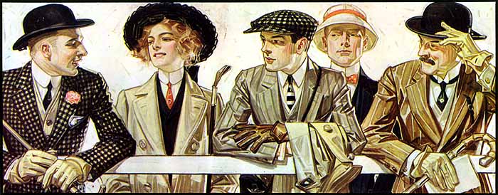
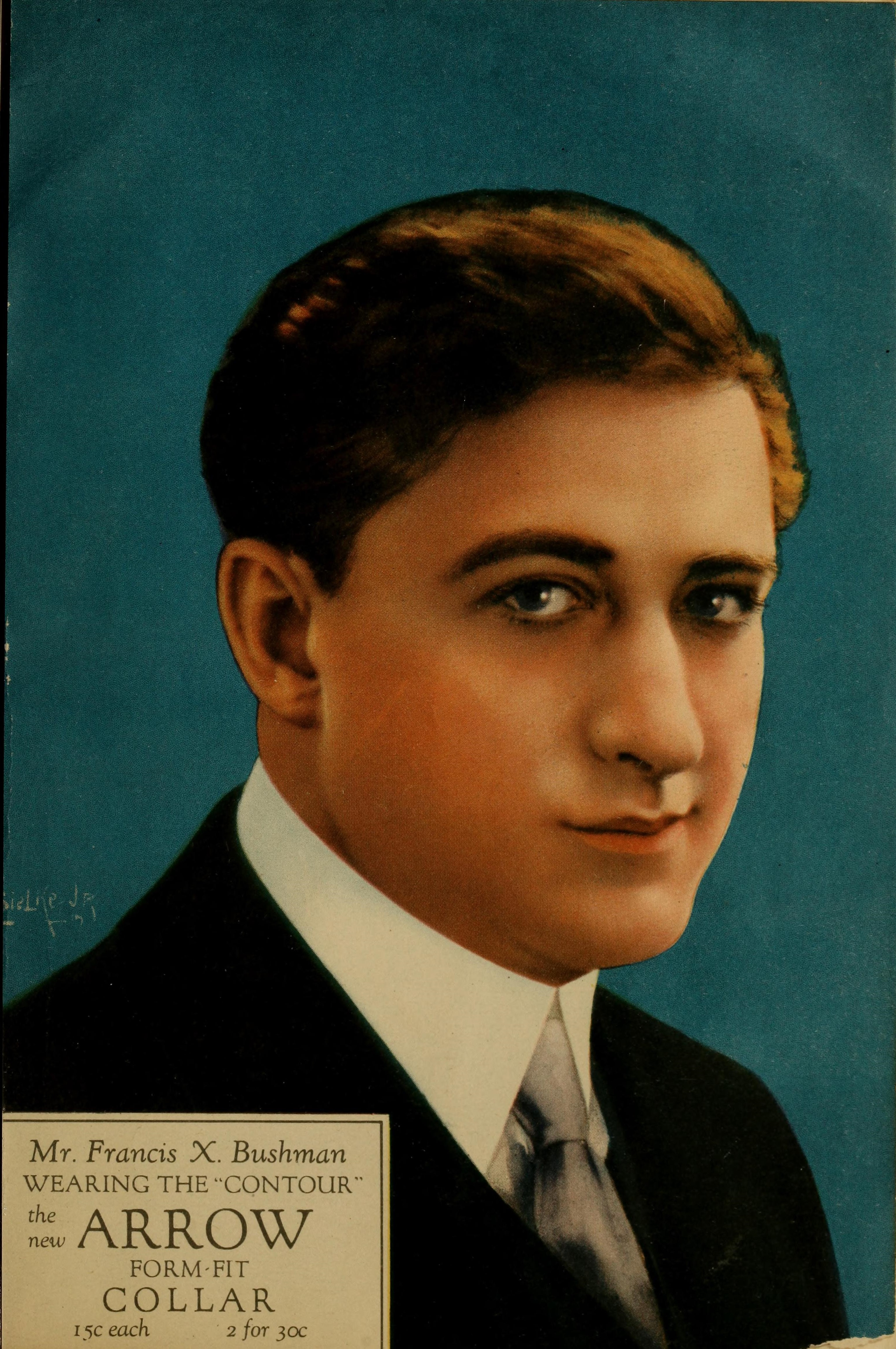
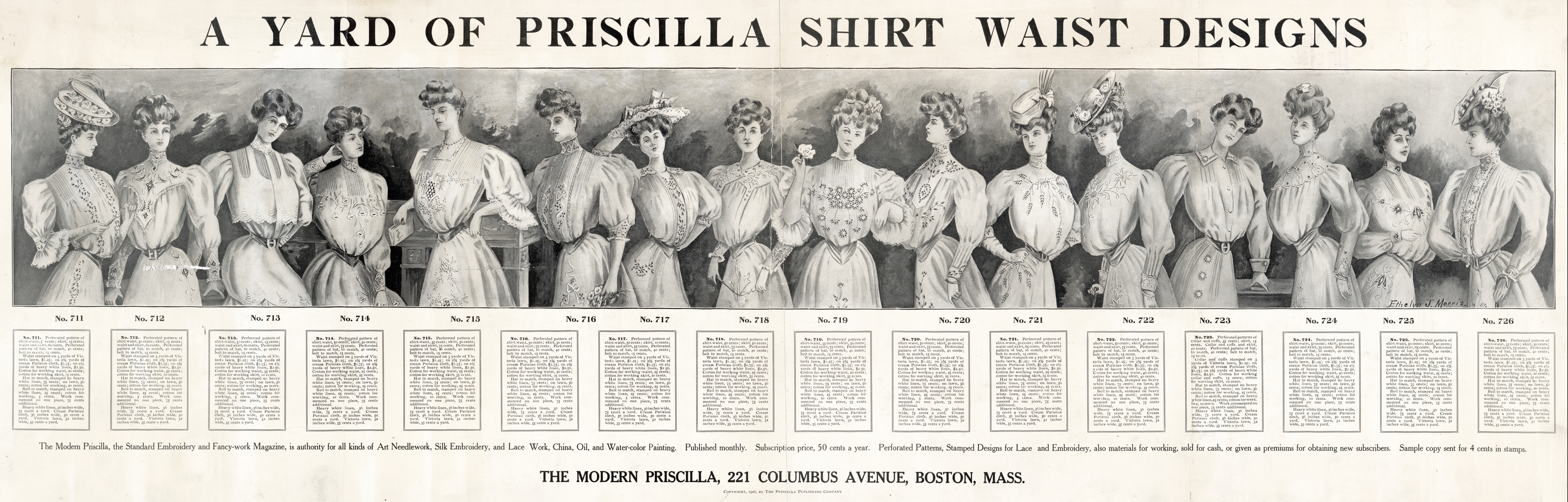
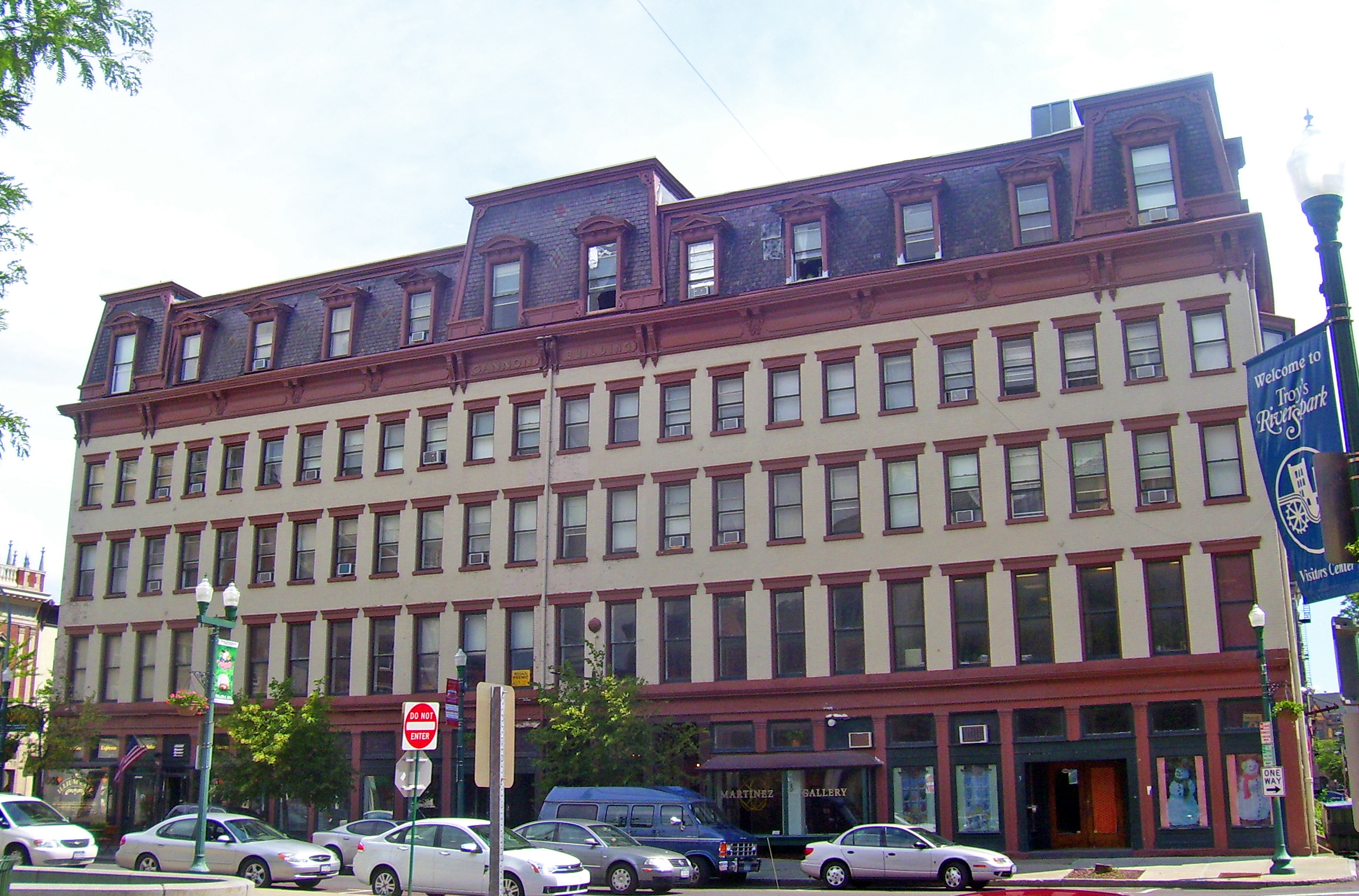
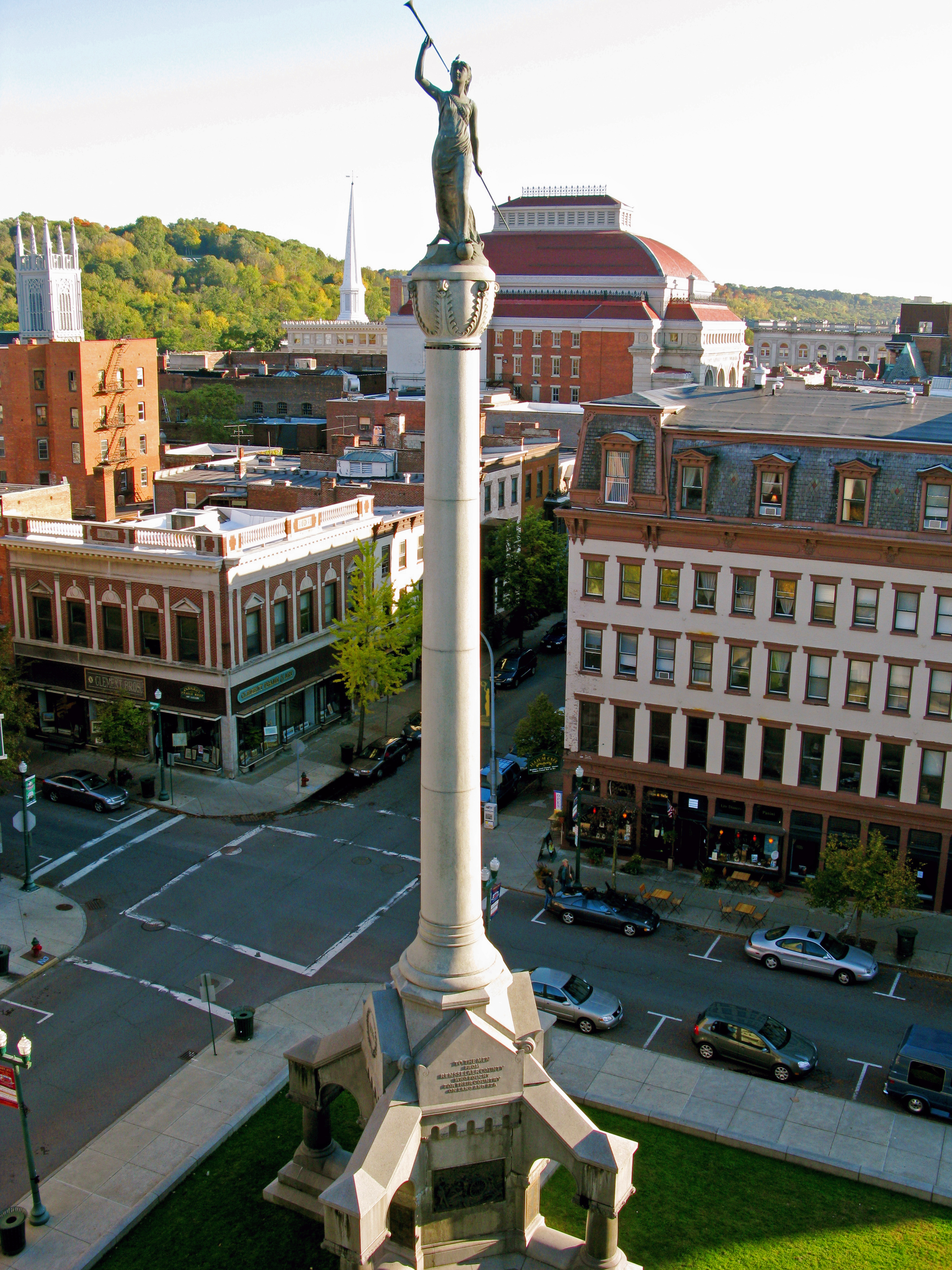
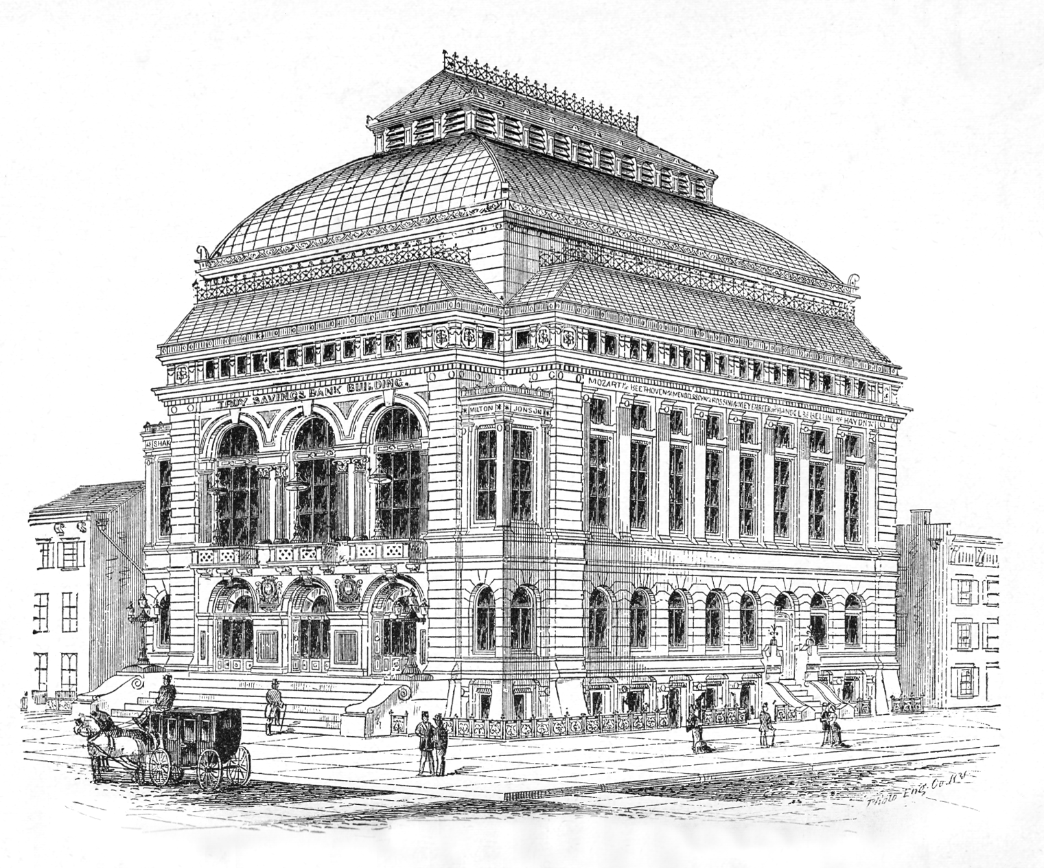
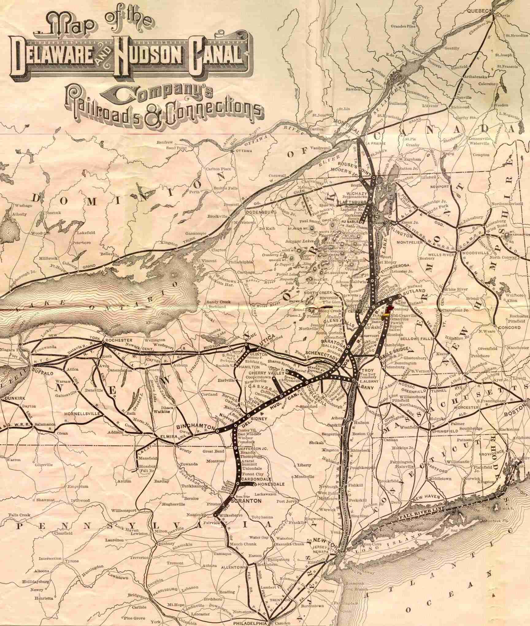
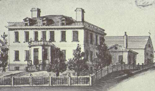
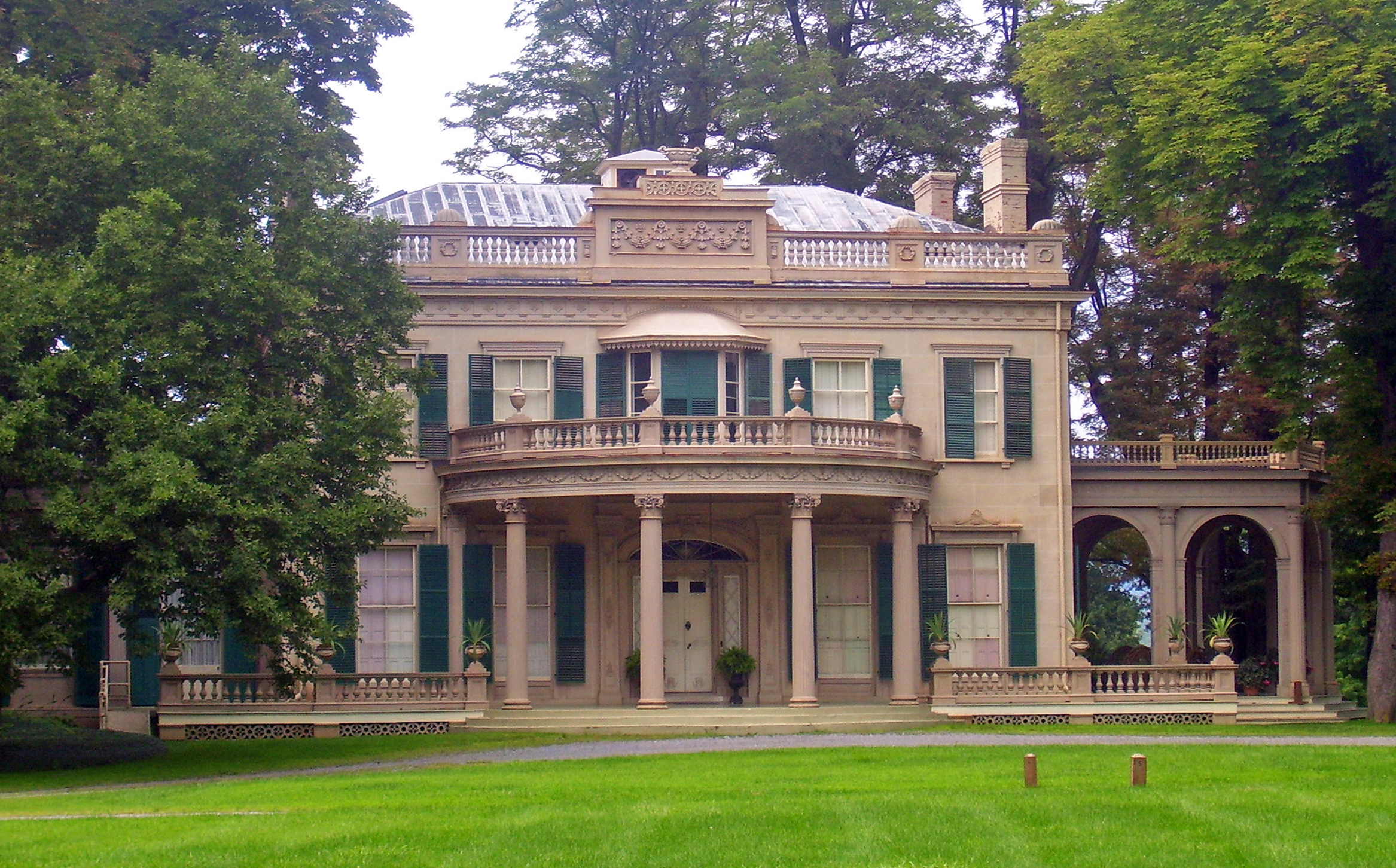
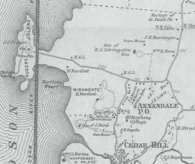
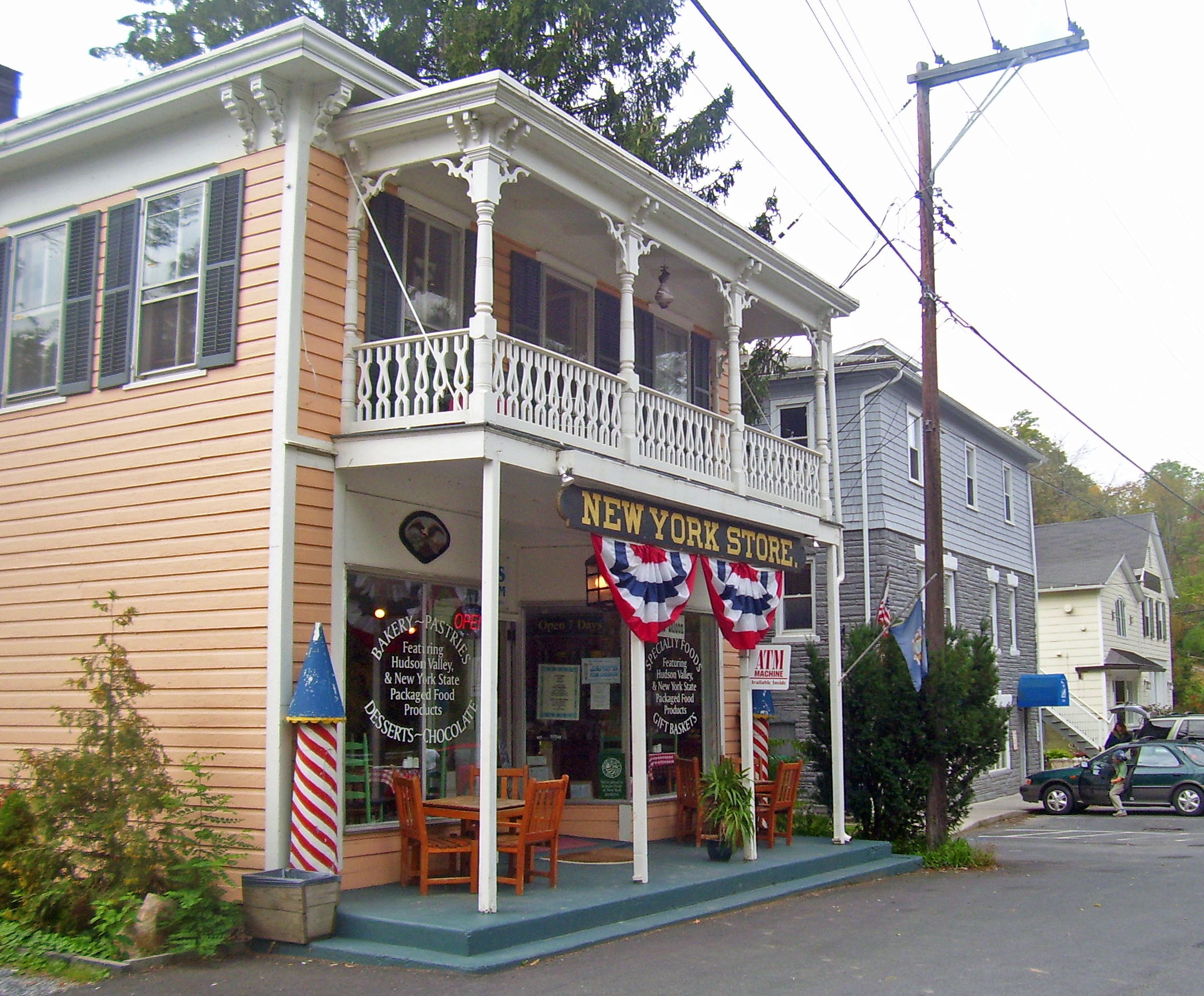
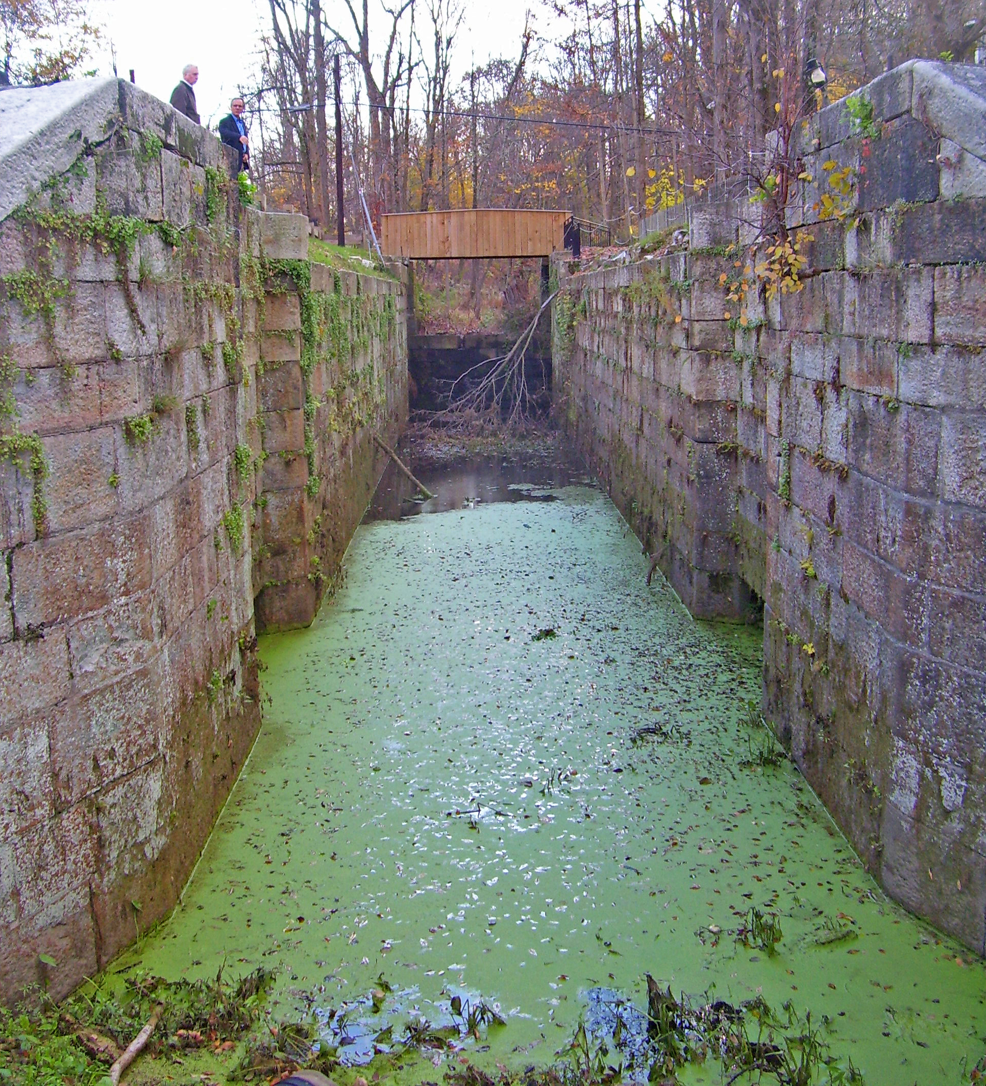
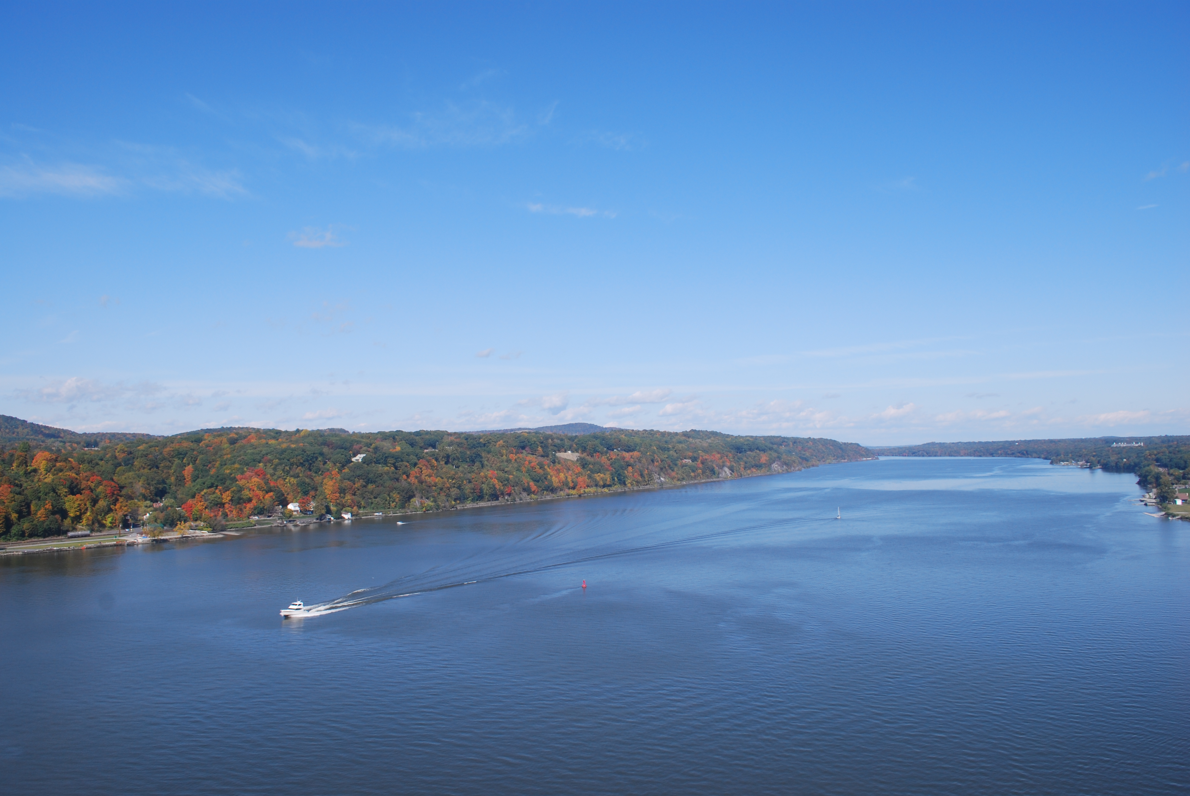
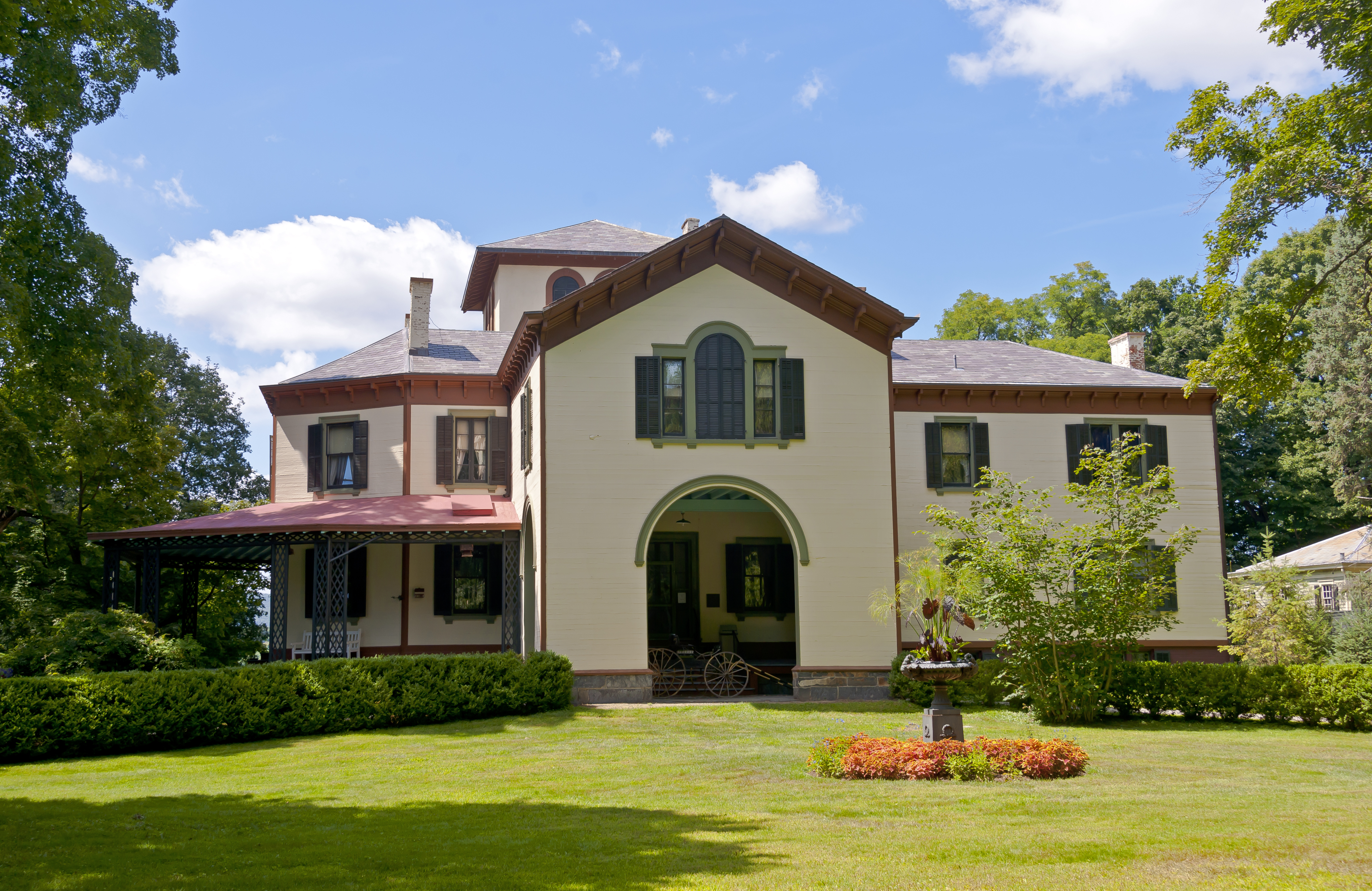
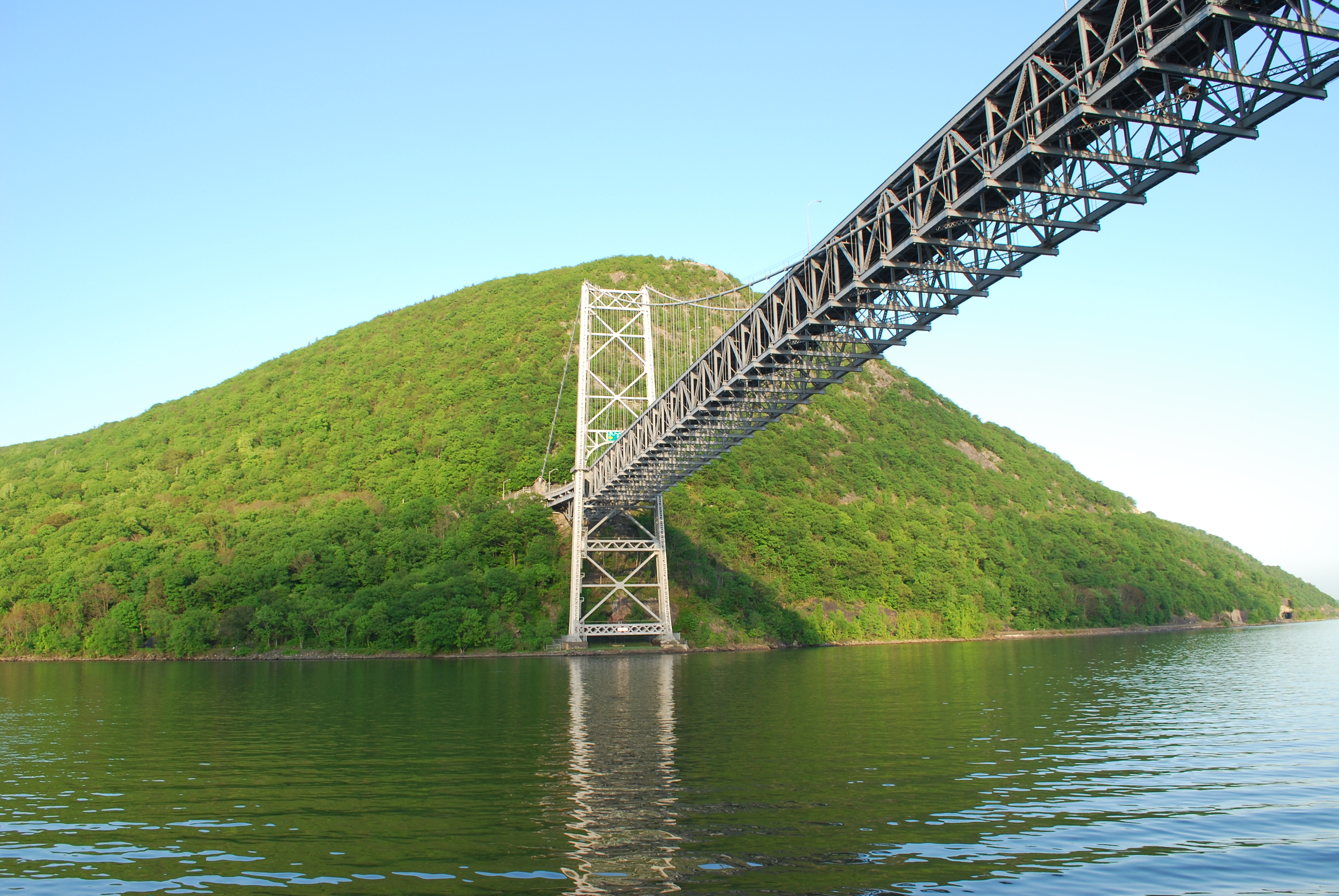
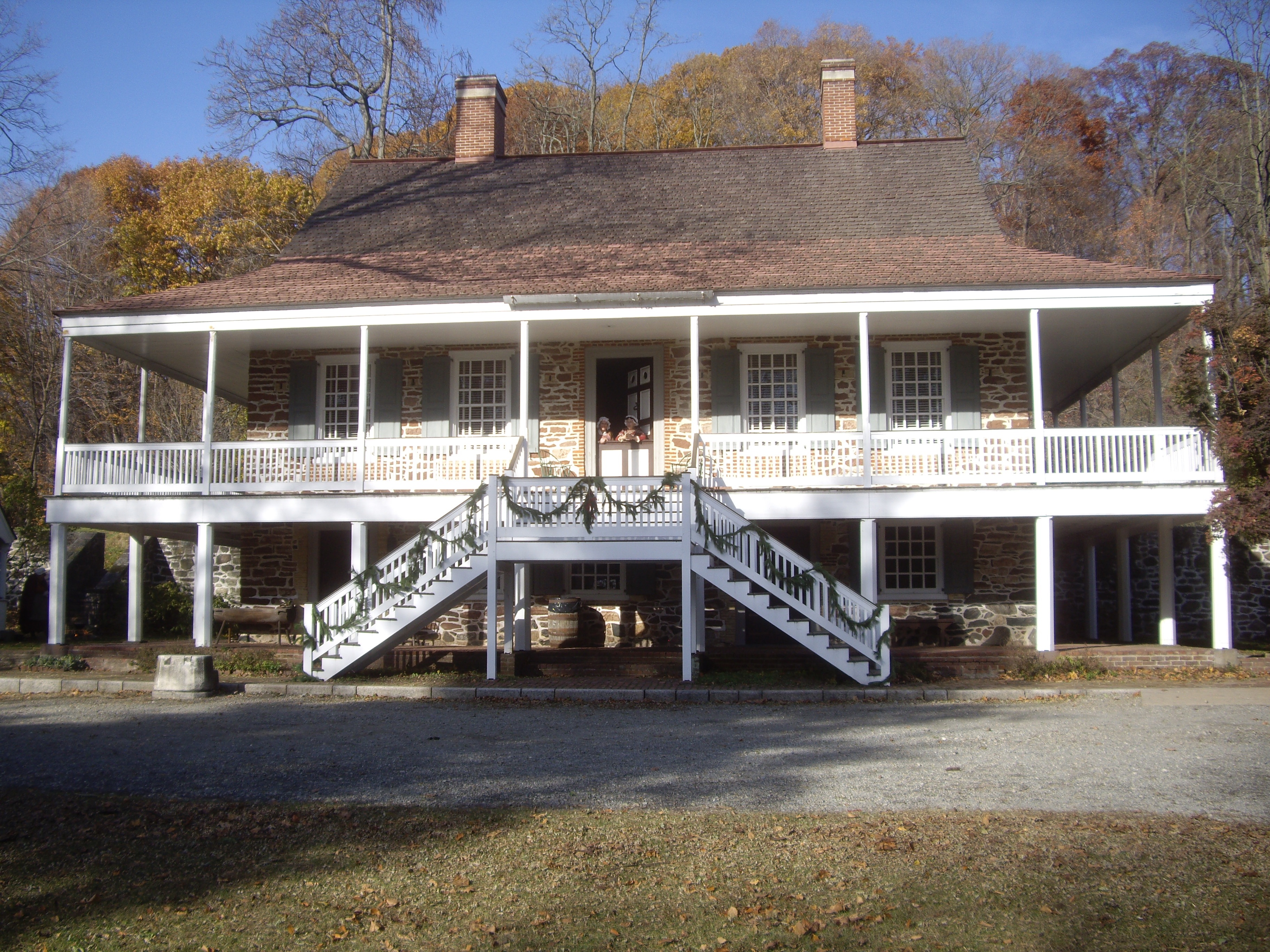
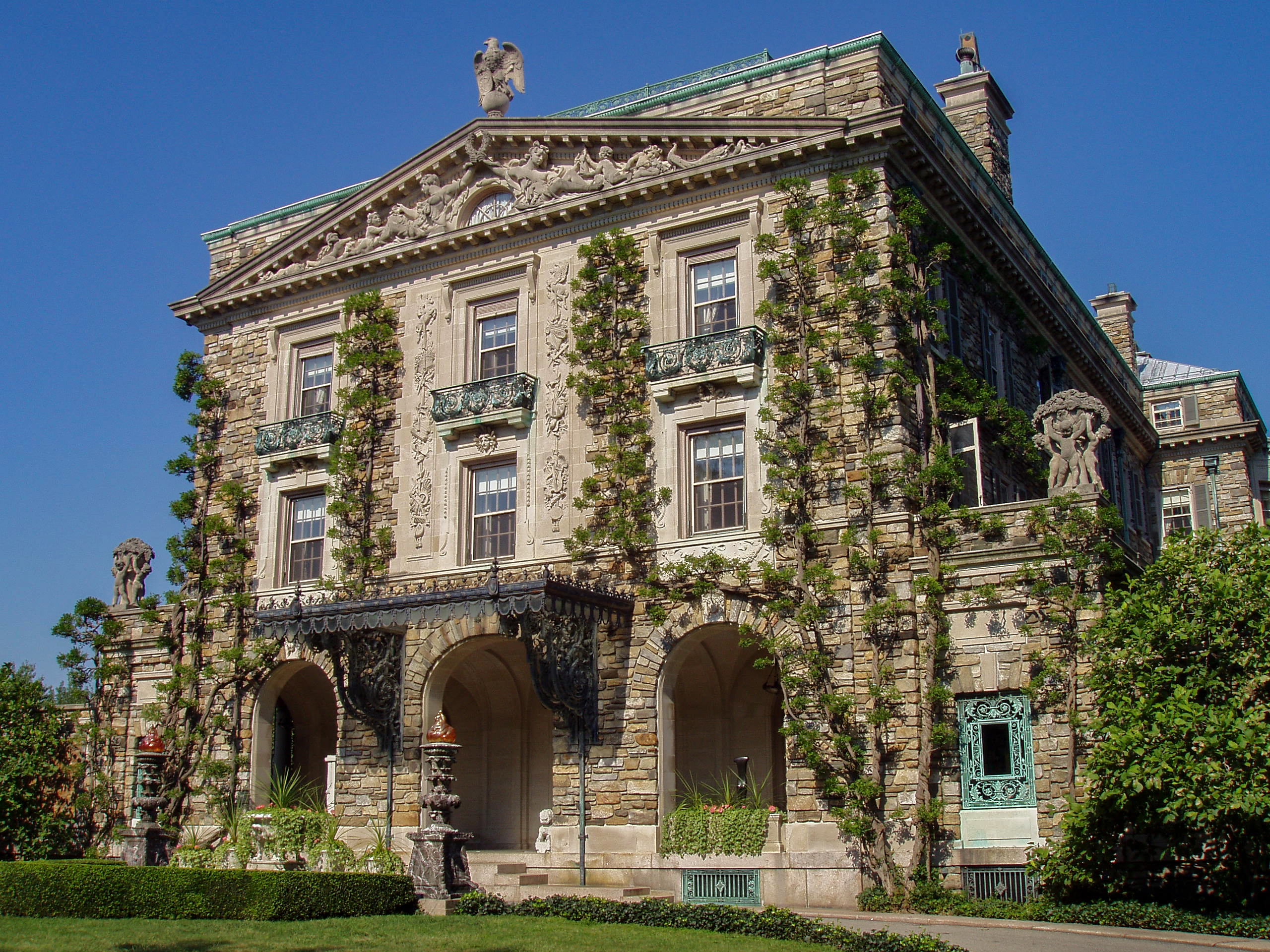
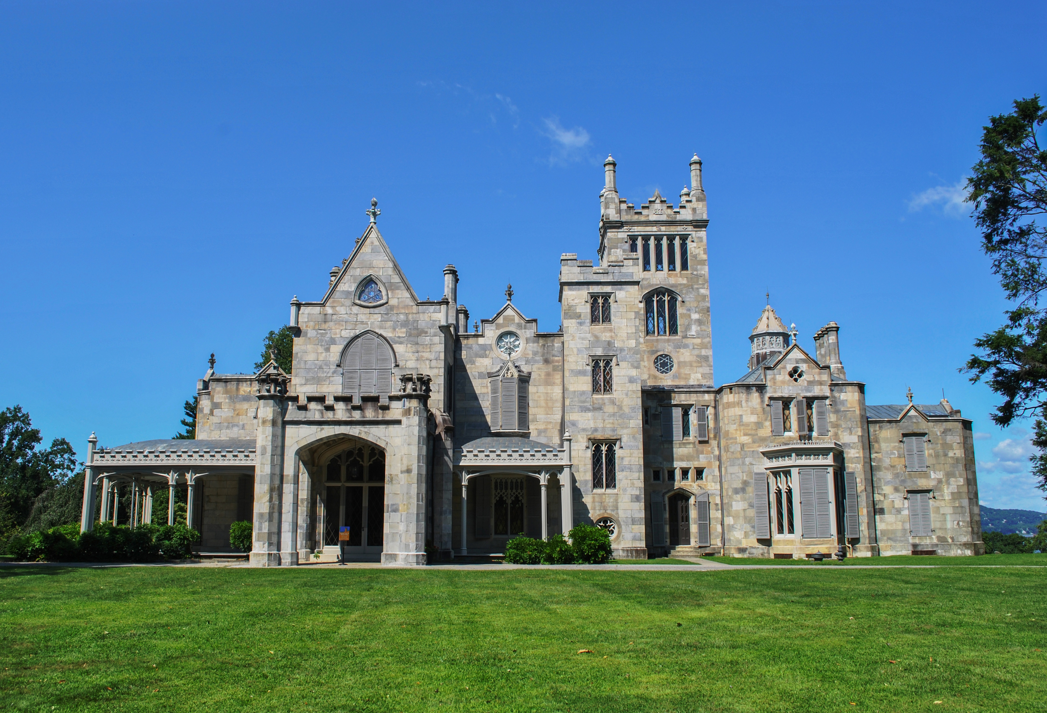
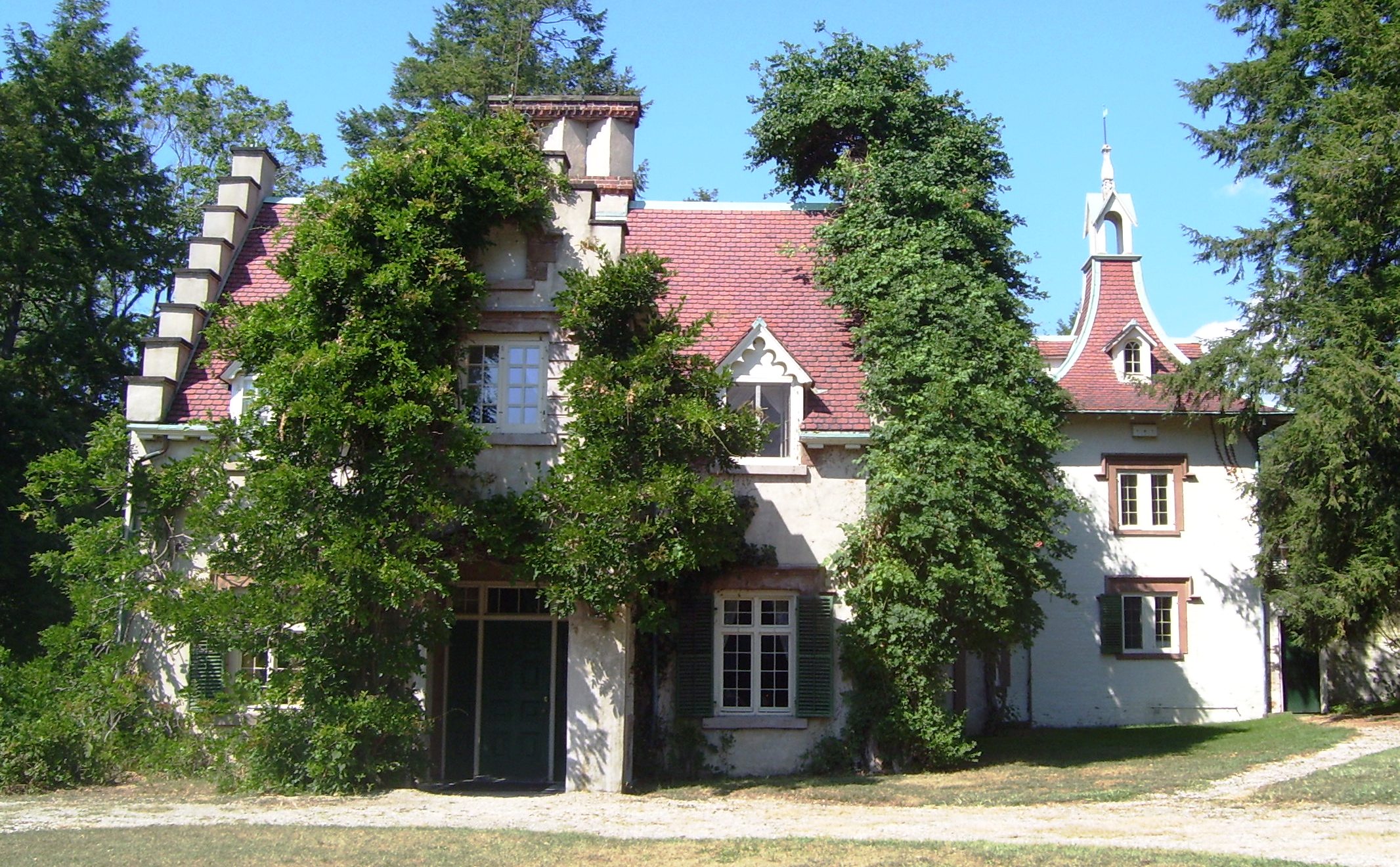
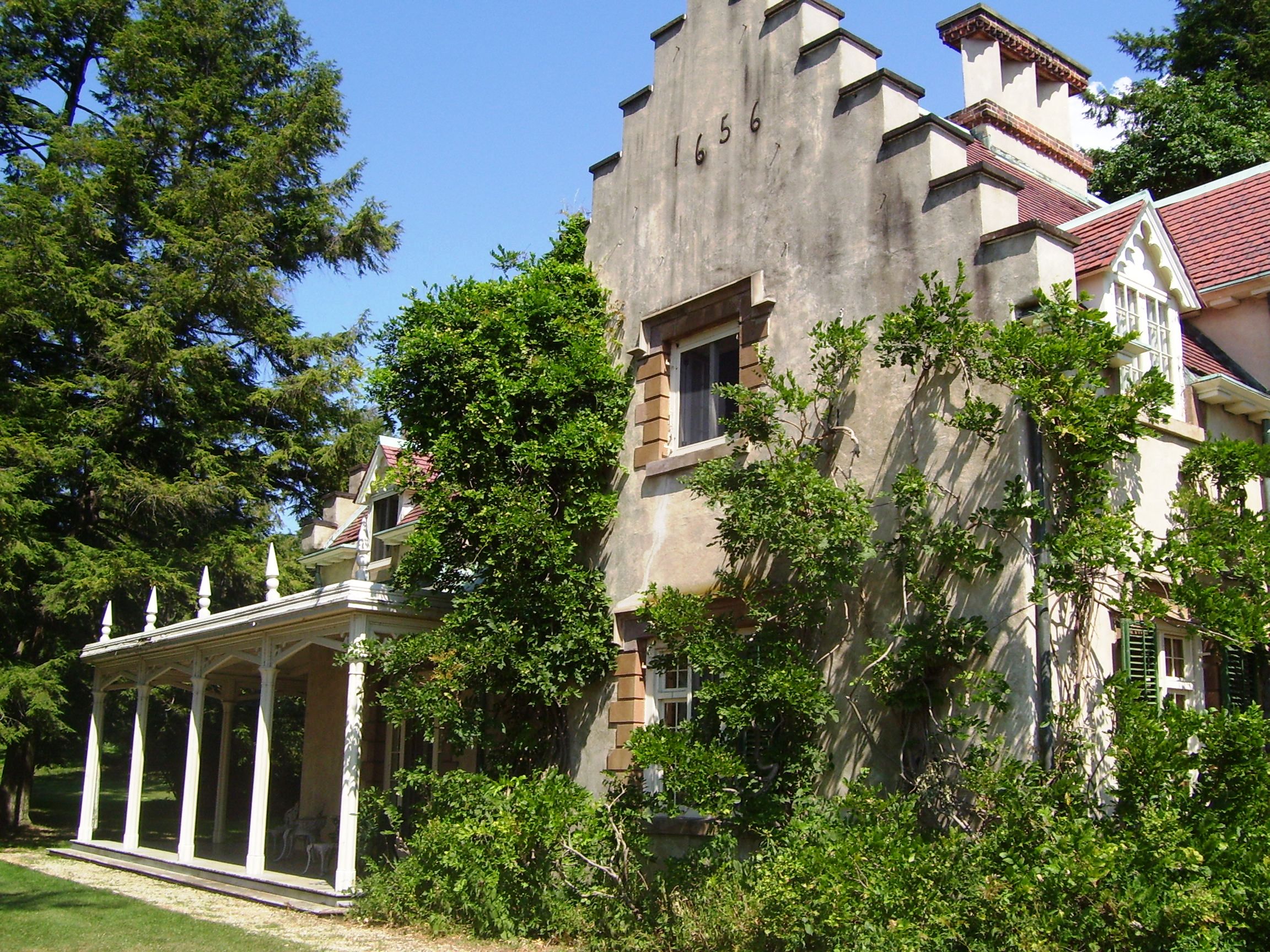