|
Reflections 2018
Series 2
April 2
Intermezzo IIa: NYC's Original Streets – NYC's Expansion Grid 1
| | Intermezzo II While we still need to get back to Paris and Burgundy, trying to add the story of New York's few teardown streets to the stories of Bucharest and Berlin was becoming overwhelmingly complex, so I did a lot of rewriting and broke all the additional stories down to two intermezzos. This Intermezzo II about New York, as I now find out, has become lengthy enough so that it will be in two parts, IIa and IIb, but hopefully will complete that topic. Toward the end, we'll have the street teardowns, and it will become clear why and where four avenues were broken through an urbanized area, mostly historic Greenwich Village. But it's become clear to me that we first need to fully understand the grid used to expand early New York up the length of Manhattan island, and the type of rural destruction it did on its own.
| | | | So before we look at teardown streets, we have to see the beautiful, bucolic Manhattan countryside lying outside the original City shredded to bits in order to lay out that huge waffle-iron grid in the first place. In doing this, I've learned much more than I'd known, and find that the destruction for the grid is a bigger story than the later street teardowns, much to my surprise. I've also found a lot of information I hadn't known before, nor had some local friends I discussed this all with, who do have an interest in local urban history. The result should be of interest to all, but particularly to those with a connection to Manhattan Island. With luck, the next posting, Series 3, will bring us back to Paris and Passy. | | | | Late 19C Merger To accomplish all that, we have to differentiate between two periods of expansion, proceeding backwards. One was the late 19C five-borough merger that we already discussed in the past. It involved how New York/Manhattan (NY-M) merged with Brooklyn in 1898 (or, as some of us feel, NY-M swallowed Brooklyn whole for lunch), plus including other areas in the merger, to form today's five boroughs (NY-5). For those aware of that event, one way to look at it is that that dual merger of the two, major established cities took with it, collaterally, small villages in Staten Island, Queens, and the Bronx to make five boroughs. That's true, but there's a fine point worth clarifying. NY-M had, in reality, already expanded in the early 19C so that it already existed in two parts, Manhattan and the Bronx, all New York County, all as one single, two-part city (NY-M/Bx). Therefore, a dismantling was necessary as part of the big merger. NY-M/Bx had to actually split in two, to NY-M and the Bronx, with the Bronx getting its own Borough Hall, in order to establish the five boroughs (NY-5). Still, the Bronx, though a separate Borough with the others as of 1898, remained part of New York County (five boroughs in four counties) until 1912, when Bronx County was finally established as the fifth county. | | | | | | (A) If you doubt that the Bronx was originally laid out to be an extension of Manhattan, (1) look at how Manhattan street numbers continue across the Harlem River into the Bronx, notably along the Hudson and the West Bronx, ending at 263rd Street at the city line in North Riverdale in the upper Bronx; (2) note that Third Avenue and Park (Fourth) Avenue run north into the Bronx, hopping the Harlem River, dating from when the Bronx was part of NY-M/Bx; (3) note that neither the New York Botanical Garden or the New York Zoological Society's Bronx Zoo are in Manhattan (NY-M), which they were named after, but in the Bronx, having gotten those names because they were founded when the Bronx was still part of NY-M/Bx.
(B) If you doubt the importance of Brooklyn being equal to NY-M among the five boroughs, the statistic you may have heard is correct: an independent Brooklyn today would be the fourth largest city in the US. As Brooklyn's population continues to increase, there's a good chance Brooklyn could eventually surpass Chicago as the third largest city in the US, with only Los Angeles in between.
|
| | | | Early 19C: New York Moves Uptown Now let's move back from the late 19C to the early 19C. Our concentration in this posting will deal just with Manhattan (NY-M). But before we can show early 20C cutting through of streets in historic neighborhoods, notably Greenwich Village, we need to show how, still in the early 19C, residences, farms, and estates were cut through as the city moved relentlessly uptown to establish its master grid plan in 1811, the one we recognize as all those "numbered streets". | | | | In that regard, I keep remembering a question I was asked recently that startled me. It was on the Grande Mariner in 2016. We were sailing down the Hudson and I was speaking to a woman who lived in the upper Hudson Valley. She had apparently been to NYC a few times, but was also apparently not too familiar with it. Of course, a little knowledge is a dangerous thing. When I told her I lived in Lower Manhattan, she blithely asked me what numbered cross street it was at so she could judge just how far south. I was nonplussed. She had apparently visited only Midtown Manhattan, which falls within the area where streets are numbered, and assumed that was the case everywhere. I had to point out that Lower Manhattan has streets with regular names, which explains names like Wall Street and Fulton Street. | | | | While I'm sure that New Yorkers, Manhattanites and others, are aware of the two naming patterns in Manhattan, few have given any thought to it as to why two street patterns exist to reflect these naming patterns, and just where the border between the two systems lies. I corroborated this recently with several Manhattan friends who knew a great deal about local history but who'd never been shown some of the fundamentals of Manhattan's growth. I therefore think many will benefit from this discussion.
https://legacy.lib.utexas.edu/maps/historical/new_york_1661.jpg
| | | | Two Manhattan Street Patterns Start by reviewing this illustrative map of Manhattan, which is really one map overlaid on an older one. Click to inspect at the bottom New Amsterdam in 1661 (it lasted to 1664, when the British took over and it became New York). It reaches Wall Street on the right, and snakes around Trinity Church on the left. Fort Amsterdam is at the bottom with Bowling Green and the beginning of Broadway above it. The southern point of land at the Battery is still rather V-shaped, before landfill was added on both sides to make it more of a bulging U-shape, as it remains today (obviously, Battery Park City on the Hudson was still three centuries in the future). | | | | But a later map has been overlaid in a ghostly manner onto this early map. The newer map shows two extensions. First come a number of additional mini-grids to the original settled area, as the original city continued to expand piecemeal. And then, like a flash, comes a sudden shift to extreme regularity. This latter part is a massive street grid, and we're seeing the lower part of the numbered-street expansion—as I count, up to today's 29th Street. While I don't know what map it is, it's probably late 19C, since it does show considerable expansion, but does NOT show the several teardown streets, all of which occurred in the early 20C. We can call this our "blank map", since its great advantage is that it shows virtually NO NAMES OR NUMBERS, just the street patterns. | | | | To get used to these patterns, look once again upwards a bit on the map from New Amsterdam at the bottom. You'll be first moving slowly into the early 19C and to the smallish City of New York, then located in the lower section of Manhattan, by this point well beyond New Amsterdam, but still covering perhaps only one-third of Manhattan. Yet the expectation was that it would still continue to spread north. In some ways, you might see parallels to Haussmann's expansion of Paris, but the expansion of Paris was circular, while Manhattan's was linear—relentlessly to the north, following the long narrow shape of the island, then jumping to the Bronx, the West Bronx on the Hudson to start with, since that lies due north of Manhattan. | | | | But the lack of writing on the map allows us to further inspect the different street patterns. Just north of New Amsterdam, some small mini-grids seem to be conflicting with one another. Then suddenly that area ends, and the pattern changes and becomes much more regular—indicating the year 1811, when a huge waffle-iron master grid takes over. These are the two main sections we'll be differentiating:
● Older is the original area of Manhattan, including New Amsterdam, the early mini-grid expansion, and the formerly independent Greenwich Village. This area has exclusively named streets (though weird changes were made later when the system was tampered with), and that's to be taken literally. Other than unique names like "Trinity Place", They are all "streets" (Church Street) and not "avenues". The only exception I can think of is Greenwich Avenue IN Greenwich Village, which might have gotten that name to distinguish it from Greenwich Street, which leads INTO Greenwich Village.
I would also note that "street" is a Germanic word, basic to English (some relish using the term "Anglo-Saxon" instead, but not I, considering it euphemistic), while "avenue" is a Latinate word borrowed from French, and has long been used to add a degree of cachet to street names. It's interesting to watch the addition of multiple "avenues" as the new grid is added (below).
The area of names uses adjectives (Broad Street), common nouns (Stone Street, Wall Street, Water Street), and proper nouns (Washington Avenue, Fulton Street). It's absolutely typical of this sort of ad hoc mentality to name a street after its broad width; because it was the first to have been paved with stones; because it ran along a wall; or along the water. And it's not that much of a stretch to name streets after prominent people.
Keep in mind how the antique quality of many of these names is also charming, since there are now streets broader than Broad Street; Stone Street has long since been asphalted; the wall along Wall Street was removed long ago; and landfill along the East River put Water Street two blocks inland.
● Newer is the gridiron area of Manhattan, often shortened to just "grid", laid out after 1811, which has numbered streets running east-west and (mostly) numbered avenues running north-south (the Germanic "street" and Latinate "avenue" are kept perpendicular to each other!). However, the numeric area, including famous names such as 42nd Street and 5th Avenue, is actually somewhat alphanumeric, because it includes, as we shall see, Avenues A, B, C, and D, explaining why the area where lettered avenues prevail is called Alphabet City. Also, the entire grid has also been also tinkered with after the fact, allowing for new named avenues and some numbered avenues having been given names for part of their run (see below).
| | | | But perhaps the most interesting area is where the two areas come together. Find on the right side of the blank map the indication where Houston Street is, and above it, where 14th Street is. If you inspect this strip between these two streets, you'll see a bit of a yin-yang pattern (Image by Sarang), showing where the opposites are interconnected. You can see on the left of the map how the irregular, named pattern reaches north of Houston into Greenwich Village, and how the strictly rectilinear pattern on the right reaches south of 14th Street. We'll end up discussing this ● transitional strip as being just as interesting as the other two, if not more so. (This is also the area of several teardowns we'll discuss afterward.) Now hold onto this map as we interpolate, somewhat surprisingly, a discussion on garden landscaping, which is actually a related matter. | | | | French and English Landscape Gardens Urban planning comes down to the notion of either willingly embracing nature or strictly controlling it, something also very apparent in two European styles of garden, the formal French Landscape Garden of the 17C and the informal English Landscape Garden of the 18C, which largely supplanted the French one. But both still exist everywhere (as well as other styles, such as Japanese rock gardens).
https://atmedia.imgix.net/1c3250bba9aa4a123d74ae214d07939c9e71f782?w=800&fit=max
| | | | The French Garden (Jardin Français) was developed first, in the 17C. It remains a highly formal style, where man controls nature, with parallel and perpendicular straight-line paths and geometric flower beds (squares, triangles, circles), all having a mathematical precision rarely seen in nature. But their perfection was expensive to maintain (even the gardens at Versailles eventually became overgrown), and in the next century, another style developed, the English Garden (Jardin Anglais), which was just the opposite. It has curves, boulders, copses of trees, streams, ponds. It doesn't fight nature, it seemingly embraces it. However, the eye is fooled, since it's all actually highly landscaped to look even better, more perfect, than reality. | | | | The most prominent landscape architect in the French style, who designed the gardens of many estates and palaces, most notably the gardens at the Palace of Versailles, was André Le Nôtre (originally Nostre, with the same pronunciation; this 1680 portrait hangs at Versailles). His work represents the height of the French formal garden style. This is a panorama of the Gardens at Versailles (Photo by RyanMcK). The garden is quite attractive (click, and scan left and right), but oh, so geometric. Trees don't naturally grow in perfect cone shapes, beds of grass don't naturally form fleurs-de-lys, flower beds don't naturally grow with decorative borders, nor do they grow in urns, ponds do not form perfect circle. The result is very attractive, but exhibits man controlling nature. Have one more look at a lawn with trees (Photo by Miltoni123). Click to see details.
http://www.capabilitybrown.org/sites/default/files/styles/news-details-image/public/capability_brown_cosway_about_us.jpg?itok=L8H88Zzr
| | | | As the popularity of the 17C formal French style declined, the 18C informal English style developed and spread. The most prominent landscape architect in the English style was Capability Brown (above). His real name was Lancelot Brown, but he acquired the name he became famous by since he regularly would tell his clients that their property had capability for improvement. He designed over 170 gardens surrounding country houses, many of which remain today. One of them is the park surrounding Highclere Castle, which was used as the main filming location for Downton Abbey, so if you saw that series, you've seen Brown's work. He also designed the park around Blenheim Palace (BLEN.im, shown here in an 1880 print), where Winston Churchill was later born. His naturalistic style including large lawns running straight to the house, scatterings of trees, and winding lakes formed by damming small rivers. The style envelops nature, yet is still constructed to be an idealized form of nature. This is the Chatsworth House Garden (Photo by Alan Heardman) designed by Brown. He simplified a garden by eliminating geometric shapes and terraces near the house in favor of rolling lawns and extensive views to distant trees, making the landscape seem even larger. Still, that stream is very possibly artificial, and sheep don't really appear in nature out of nowhere—it's all landscaping to achieve an ideal image of nature. This is part of Sheffield Park Garden (Photo by Dave Catchpole), originally laid out in the 18C by Capability Brown. Absolutely beautiful, but those trees have to have been planted—it's unlikely such a palette, such a variety would appear like that in nature. | | | | Both styles have survived, and can still be seen today in France, in England, and around the world. A notable example is in München/Munich, whose largest park, located in the center city, is the famous Englischer Garten (Photo by Ludmiła Pilecka), shown here with the Munich skyline in the background, notably the twin-towered Frauenkirche. The Garten dates from 1789, and its name is a direct reference to the style promoted by Capability Brown. | | | | If you wish to explore this topic a bit further, this (slightly loopy, but good) YouTube video (4:38) discusses and further illustrates French & English Gardens. | | | | Informal Urban Planning vs Grids Knowledge of the two garden styles helps us explain two styles of urban planning, the informal, natural, organic, style reflecting the English Garden, and the geometric grid plan, reflecting the formal French Garden. The natural style involves little or no planning, and allows a town or city to develop according to the whims of nature and its inhabitants. The haphazard layout of streets is based on country lanes, animal trails, Native American trails (in the US), plus some local short streets. | | | | People walk out across an unbuilt area and the dirt path might become a new street. Another path might follow the edge of a brook, or surround a pond. This type of street development is particularly walkable, since it came about by people doing just that, walking. Usually this "minimal urban planning" does include some rectilinear patterns that are parallel and perpendicular ("P&P"), with this pattern perhaps even going on for some little distance, though never really developing into an extensive long-range, planned, waffle-iron grid. Nevertheless, this system is still based on minimal human control of the natural environment as streets develop in new areas. | | | | I was pleased to come across this illustration online of a European city whose layout is as described above, and lo and behold, it turned out to be Paris! (Sketch by Fgrammen) The medieval streets just grew and grew, although a few turned out inevitably to be parallel or perpendicular to others. There is certainly no grid, and so this illustration came up as an excellent example of a typical non-grid street plan. It's unnamed, but do you recognize it? As it turns out, it's an area we discussed extensively. The leaning T near the center is Capucines meeting Avenue de l'Opéra, the triangle of the Grand Hotel is adjacent, and the Boulevard Haussmann cuts across just above that. Even despite Haussmann's boulevards, the wonderfully chaotic pattern looks like cracked glass. There are some incidental P&P streets and so you have the occasional right angle, but also have numerous odd angles, and streets forking into two streets. It invites the casual stroll. Also, check (or reflect back on) the Berlin map in the previous posting to see a layout just like the one in Paris, with occasional P&P streets, but otherwise a very flexible layout. | | | | Let's move back to early New York—really early. This is a land grant map for the original village of New Amsterdam dated 1642. It's turned on its side, so that north is to the right (actually upper-right). Click to read the early names of streets combined with today's names for them. In front of the fort is Bowling Green (not named here), and Broadway leads uptown from there, as a country road. One fact I can attest to is that Lower Broadway was laid out along the top of a south-to-north ridge, so we're definitely following nature here. To this day it's easy, when walking, to tell how all the side streets slope down to the East River, including Wall Street at the right. Landfill was eventually added on both rivers, and today, there's a noticeable slope going down to the Hudson as well. | | | | Otherwise, it's obvious that the New Amsterdam streets appeared haphazardly, as needed. Note the street for the market, and the Road to the Ferry. While many of the streets are P&P, the Road to the Ferry curves to follow the natural East River shoreline one block away. A more substantial map is the magnificent Castello Plan we first discussed in 2009/24, explaining why the map has an Italian name, and then again in 2010/1, when I actually got to see the original map. Refer back to those postings for further details. Anyway, the Castello Plan (click) gives an even better view of how these land grants appeared as an actual village, with a natural street plan. | | | | | | That Stone Street was originally called Road to the Ferry is a revelation to me I didn't know of before now, since it brings immediately to mind the well-known Rue du Bac ("Ferry Street") on the Left Bank in Paris (Map by Mark Jaroski). On the right, find the Pont Royal (click, name partially obliterated) and follow the Rue du Bac south. The ferry was established around 1550 to transport stone blocks northward to build the former Palais des Tuileries, built in 1654. Only its Gardens are left (see map). The Pont Royal, the third oldest in Paris, came later. In any case, both ferry streets developed ad hoc leading to the local river. This is natural development. You cannot get much more opposite "grid mentality" than this. |
| | | | Look back at the "blank map", which shows, north of New Amsterdam, first the 18C/early-19C expansion of New York (before 1811), and afterward the expansion after 1811. Click to review again in the lower area a sea of mini-grids, and in some cases, pseudo-grids that peter out quickly. They are often P&P to the Hudson—or nearly so—and also P&P to the East River. Filling in the middle section are mini-grids that are more or less P&P to Broadway. This shows some attempt at urban planning, but then these mini-grids also merge with each other in their own charming way, sometimes at odd angles. Mini-grids are not grandiose master grids. | | | | Canal Street (click) is one of the few named on this map. It was originally laid out, partially along the route of a "sluggish stream" to drain fetid water from swampy areas. This pleasant picture, clearly of another era, shows Broadway crossing the canal, a location you should be able to judge on the blank map. But then the canal became fetid itself, and was covered over. But the point remains that this is another example of nature (the "sluggish stream", the swamps) dictating the eventual location of a street. Canal Street, which forms the border between some mini-grids, but slices through another, is an unusual diagonal in this area. | | | | I've had to rewrite this posting a number of times because of new information constantly coming up, and I'm happy to find out now more about how the original area expanded due to major landowners subdividing their property, not the municipal government doing so, although they did register the changes as official after-the-fact. | | | | The name Delancey (one word) is well-known in Manhattan primarily because of Delancey Street on the Lower East Side today known for earlier immigrants and present-day gentrification, but much less—if anything--is commonly spoken of about the De Lancey (two words) family in the 18C. The De Lancey Estate, adjacent to the growing former New Amsterdam, was the largest estate in Manhattan owned by a single family. In response to the pressure of a growing city on their south side, they started to subdivide their estate in the 1760s. But then came the American Revolution, after which the De Lanceys, being Loyalists, left the US and their estate was confiscated, along with the streets they had laid out. More on the following map.
https://upload.wikimedia.org/wikipedia/commons/b/bb/NYC1776_labelled.jpg
| | | | While the last map showed the area in 1642, we now move over a century later to this 1776 Ratzer Map that we've used in the past. Click to see what's still similar: Broad Street, [The] Broadway [Street], Water Street still on the water.
Note that "K" is Trinity Church, but Wall Street down which it looks wasn't even important enough at the time to have its name on the map.
Note the Common, which is now City Hall Park with City Hall at its north side. It's where Broadway goes straight, but the Bowery splits to the right (more later).
On the Hudson is the Road to Greenwich, which was at the time a separate municipality, now called Greenwich Village. The road is now called Greenwich Street, and again because of landfill, is two blocks inland.
Note the Collect Pond, here called Fresh Water, which was a major source of drinking water. It became polluted, was drained, and the site is today Foley Square with its park courthouses and the Civic Center. Leading out of the pond and out of neighboring swamps is the canal (above) that later became Canal Street.
| | | | But our purpose in showing this map is to walk back to the Common, and then up the Bowery, here referred to as the Road to Kingsbridge. It was also the Eastern Post Road or Boston Post Road (more later). In a few steps we're surrounded by the former De Lancey Estate, surrounded by open countryside, so you can tell this was really an early extension. The top E-W street was called, appropriate for the naming style, North Street, and is now part of Houston Street. Note how relatively even in size the blocks are, not like the numbered area coming 35 years later north of Houston. Quite attractive would have been De Lancey Square (here misspelled), but with the De Lanceys having fled, the square was never built. (Note that the streets shown on the estate do not always correspond with precision to current streets.)
https://i.pinimg.com/originals/bb/64/17/bb641723ea7204a36fdf66e0bc3f4a36.jpg
| | | | This is the same neighborhood today. The estate ran from today's Houston south to Division Street. The De Lancey streets are, going east from the Bowery: Chrystie, Forsyth, Eldridge, Allen, Orchard, and Ludlow Streets, at least. This grid then became the pattern for the Lower East Side and was continued east, and based on the 1776 map, perhaps beyond the Bowery somewhat to the west. Orchard Street was obviously named for the De Lancey orchard. We won't go into the cross streets, save one. Three blocks down from Houston ("North") is Delancey Street, which serves as an approach to the Williamsburg Bridge (1903). If De Lancey Square had ever been built, it would have reached from Eldridge to Essex, and from Broome to Hester Streets. | | | | I've come across some information on the subdividing of the Bayard Estate. Unlike the De Lanceys, the Bayard family, Huguenots related to the Stuyvesants, subdivided part of their estate west of Broadway after the Revolutionary war, in 1788, to form a privately developed mini-grid. (Their main property was east of Broadway to the Bowery, as far south as Bayard Street in Chinatown.) However, as typical of these older mini-grids, near the edges of the estate the grid broke down in order to connect up irregularly with existing streets and mini-grids. The area in question forms the core of Soho and the southern part of Greenwich Village.
https://moon.com/wp-content/uploads/2015/08/01_02_WVillage_Soho.jpg
| | | | I haven't found a historic map of the area, but this modern one should serve well. Find Broadway on the extreme right, then look south of Washington Square. The Bayards laid out eight N-S streets west of Broadway (NYU has subsumed some blocks): Mercer, Greene, Wooster, Laurens (now renamed West Broadway/LaGuardia Place), Thompson, Sullivan, MacDougal, and Hancock Streets. Hancock no longer exists, since the extension of 6th Avenue obliterated it, which will be part of our later teardown discussion. My information says seven E-W streets here also go back to the Bayards, but without specifics. My guess is that they run from Canal Street to, or almost to, Washington Square. | | | | I was about finished with this topic when I came across the next property to the west. It's worth including, because it's another example of subdividing an estate, albeit a smaller one. From the bottom of Macdougal, look across the invasive 6th Avenue to King, Charlton, and Vandam Streets, but just as far as Varick Street. I've long known this was the
Charlton-King-Vandam Historic District, but knew little about its background, but that background fits in well here.
| | | | These small streets were part of the larger, bucolic colonial estate known as Richmond Hill, which included a widely-praised Georgian mansion dating from 1767 perched on top of the hill. It had a rich history. During the Revolution, it was used by Washington for his headquarters, and later taken over by the occupying British as their headquarters. While New York was the national capital, it was the residence of the first British ambassador to the US, and was later John Adams' Vice-Presidential mansion. Abigail Adams described the estate's rural beauty with views of the City to the south, Long Island (Brooklyn) to the east, and the Hudson and New Jersey to the west. (The area is far too built-up today to see these views.) | | | | In the early 1790s, Aaron Burr acquired the estate as a country home. He also acquired a portion of the Bayard Farm adjoining the estate, which I believe is the small part of the historic district presently across the modern 6th Avenue up to MacDougal Street. In 1797, Burr mapped the property, divided it into lots, and laid out the grid for what would become Charlton, King, and Vandam Streets. | | | | Then fate intervened. On the morning of 11 July 1804, Burr left Richmond Hill and had himself ferried across the Hudson to Weehawken NJ for his fateful duel with Alexander Hamilton, who arrived separately. Dueling was illegal in both NY and NJ, but the NJ penalties were milder. | | | | | | After the duel, the fatally wounded Hamilton was carried to the Greenwich Village home of his close friend William Bayard Jr, located at what is today 80-82 Jane Street (find it on our map to the north, between Washington & Greenwich streets, mid-block, south side, which Google maps shows as part of a fine row of period townhouses on a cobblestone [Belgian block] street). Hamilton died there the next day. |
| | | | In 1807, Burr filed his plans for driving his three new streets of through Richmond Hill. Although his plan was approved, he was in debt, very possibly because of general disapproval of the duel, and his finances were too weak to complete the project. His creditors sold the estate to John Jacob Astor, who, after his fur-trading successes, had moved heavily into New York real estate (2008/20), even further extending his wealth. Astor knew a bargain when he saw it, and he was the one who continued to develop what became to be known as the Richmond Hill neighborhood. In 1820, he had the mansion suffer the indignity of being rolled on logs down from the top of the hill it was named for to what is today is the southeast corner of Charlton and Varick, so that the hill could be leveled. The extensive grounds were sold off and the streets laid through, which is why many of the modest brick Federal-style rowhouses in the historic district date from 1820. The former mansion became a resort, a theater, then a roadhouse, and was razed in 1849. Once the Richmond Hill mansion was gone, people stopped calling the neighborhood Richmond Hill as well. In my humble opinion, the name of the historic district should be altered from the awkward triple-street name to "Richmond Hill Historic District". Perhaps this has not been done because there's already a Richmond Hill neighborhood in Queens. On the other hand, Manhattan has a Murray Hill in the East 30s-40s, and no one sees a conflict there with the Murray Hill in Queens. | | | | Commissioners' Plan of 1811 We've discussed the older pattern with its mini-grids and named streets, and followed the street grid as it grew to the north up to the 1811 city limits at Houston Street (Greenwich Village was then still a separate municipality). So now let's go to the newer one, and we'll leave for later the transitional strip between the two. The new, numbered pattern in the form of a waffle-like grid was the result of the Commissioners' Plan of 1811, which perfectly illustrates the desire to control nature on a massive scale, in a similar manner to how the French Garden style does. | | | | New York wanted to provide for the orderly development of the lands outside the then city limits in Lower Manhattan, and it was obvious that, on the long narrow island, linear expansion to the north was the only choice. This was quite different from the circular development of Paris. But the city government couldn't easily plan the move north because of local politics and the objections of property owners in that open countryside, including estate owners and farmers. So they appealed instead to the state legislature in Albany, which appointed a three-man commission with sweeping powers in 1807, and their plan was presented in 1811. | | | | I think the parallel with Haussmann's getting sweeping powers from Louis-Napoléon and his government is quite obvious. While Haussmann both expanded Paris and cut through boulevards, much more destruction came from the latter. On the other hand, the three New York Commissioners worked exclusively outside the city limits of both New York and Greenwich Village, and their extensive destruction affected only rural properties, that is, farms and estates, though on a massive scale. So let's inspect what the Commissioners' Plan of 1810 looked like. The first map (click, as necessary) is complete, but a bit hard to read. The second map is a detail of the most important area, and is clearer. Consult each, as needed:
https://upload.wikimedia.org/wikipedia/commons/a/a6/NYC-GRID-1811.png
http://forgotten-ny.com/wp-content/gallery/union_square/parade.jpg
But do remember, this was only a plan, and a house isn't necessarily built following every single detail of an engineer's building plans. Modifications abound. Not everything came to pass and the map doesn't necessarily show the status today.
◊ The proposed new master grid appears in the north in gray, and runs from 1st to 155th Streets. The grid itself has never gone higher than that, although street numbering has.
◊ The dark black area shows the mini-grids of early (pre-1811) New York, but the gray grid on the Hudson shows Greenwich Village as a separate municipality, whose streets were to be kept just as they were, in a sense, an extension of New York itself as it then was. A sharp eye on either map will spot the angular Canal Street, and also Broadway and the Bowery, both labeled, splitting down below at the former Common (City Hall Park), then merging again at today's Union Square.
◊ The proposed Market Place, which seems to have been planned from about 6th to 11th Street between 1st Avenue and the East River, never appeared as such.
◊ In a sense, what is shown as "The Parade", does exist, but in vastly reduced form, as Madison Square Park. As shown, it was to run from 23rd to 34th, but it only really goes three blocks, from 23rd to 26th; as shown, it was to run from 7th to 3rd Avenues, but it only goes from 5th to Madison, which didn't exist then, but appeared in the "4 ½" Avenue position, only half-a-long block east of 5th. (The entertainment venue known as Madison Square Garden was originally located on Madison Square. It has since moved twice to its present location at Penn Station.)
◊ A few odd public squares are shown, almost none of which were built, and there is, at this early date, no provision for Central Park.
◊ You might be able to estimate the location of the divided-up estates we've discussed in black on the detailed map, De Lancey on the right, Bayard west of Broadway, and Burr/Astor just west of that.
| | | | Although the City had full power to create new streets, it rarely did so on its own, and instead allowed landowners to subdivide their properties with their own new streets, as we've seen, then approved the moves after the fact. But the 1811 plan was different in that it involved properties not in the established city but on the currently developing edge of the city and way out in the countryside, where owners didn't expect the city to come sidling up to them. And so it was vociferously contested from the start by these property owners, including powerful ones, such as John Jacob Astor who was famous for having numerous real estate holdings. Astor tried to keep the grid off his land by saying the city had exceeded its authority, but the city countered by pointing out that developing new streets was a basic responsibility of government. | | | | Their primary concern was what form a new regular grid should take. Grid plans for streets have existed since ancient Egypt, and some had already been adopted in the US. There were simple grids in Philadelphia, New Orleans, Savannah, and Charleston. On the other hand, there was the possibility of developing a more complex one, where diagonals, circles, and arcs were blended into the simple rectilinear grid, such as the very interesting one that Pierre Charles L'Enfant had used in 1791 for Washington, as below.
https://goo.gl/images/EMfJyw
| | | | From the beginning, the New York Commissioners' Plan has been criticized for its monotony and rigidity, in comparison with irregular street patterns of older cities, or even some patterns of Lower Manhattan. Personally, I think the Commissioners missed the boat when they rejected using diagonals and circles, which break up the monotony of the rectilinear grid so nicely. Could it have been some dour streak of puritanism that had them decide on a simple rectilinear grid? My understanding is that they felt a gridiron was the most practical and cost-effective, since "straight-sided and right-angled houses are the most cheap to build and the most convenient to live in." Really? I suppose the Victorian-era octagon houses (2015/6) were still in the future at the time. Also, the Commissioners didn't realize that, by allowing Broadway (and other older streets) to remain, oddly shaped blocks would still exist, allowing for the magnificent, triangular Flatiron Building to be erected years later (Photo by Imelenchon) where Broadway (left; click) crosses 5th Avenue (right) at 23rd Street (foreground). Ah, hindsight. | | | | As the grid was laid out, existing buildings (farmhouses, manor houses) were allowed to remain in situ if they weren't in the way of streets being cut through. If tearing them down was necessary, the owners would receive compensation from the city, although court appeals were possible. | | | | It has been estimated that 39% of all the buildings standing in 1811 north of Houston Street (721 out of 1,825) had to be moved. However, if the new streets improved accessibility to the property, which they usually did, the city could levy a special assessment on the property for the improvement. This had been used earlier when adding public amenities, such as wells. | | | | Beyond having decided on a grid, the Commissioners seemingly went out of their way to make it as boring as possible. Compare these three urban grids (Map by Fred the Oyster), which are all on the same scale. The one for Portland OR uses square blocks, which does have a pleasing symmetry. Savannah GA has a grid with enviable variety; public plazas with parks are introduced periodically, and the grid has larger and smaller blocks to complement them. On the other hand, the Commissioners in New York chose blocks that are huge (that was HUGE), outsized rectangles.
http://www.nymap.net/content/maps-of-new-york-city/detailed-road-map-of-Manhattan-with-street-names.jpg
| | | | Manhattan's Grid Hold on to this map in another window as the definitive modern street map of all of Manhattan to which we can refer back as needed to compare with historical maps. The huge rectangular blocks in the grid area are immediately obvious. One arguable thought is that the long but narrow shape of the island contrarily influenced the shape of the narrow but long blocks. As mentioned earlier, the streets, which all run crosstown from river to river, go from 1st to 155th on the actual grid, though the numbers continue to 200th Street in insular Manhattan, to 228th Street in Manhattan's exclave of Marble Hill (more later), and to 263rd Street in the Bronx to the city line with Westchester. | | | | Avenues run uptown the length of the island. Their numbers run west from 1st Avenue to 12th (though 12th is actually unique, as a shore road), but as we mentioned, they are actually alphanumeric, since east of 1st Avenue, and running further east still, are Avenues A, B, C, and D of Alphabet City on the Lower East Side. | | | | | | The Spanglish version of "Lower East Side" is "Loisaida". To reflect the Puerto Rican heritage of the area, in 1987, Avenue C was given the co-designation Loisaida Avenue (see map). |
| | | | Block Width These avenues and streets result in the long—very long—crosstown blocks that typify the grid. The width of the long crosstown blocks is irregular, as below (not counting Alphabet City or the added streets [Lexington/Madison] to be discussed later):
1st to 2nd Avenue: 200m (650 ft)
2nd to 3rd Avenue: 190 m (610 ft)
3rd to 6th Avenue, each: 280 m (920 ft)
6th to 12th Avenue, each: 240 m (800 ft)
| | | | Making the blocks near the waterfronts on the rivers somewhat shorter was done purposefully, since this was a period of frequent water transportation, and it was thought there would be more development near the waterfronts. More development meant higher land values there than in the interior of the island and it was felt it would be to the benefit of all to have avenues closer together there. Still, I regularly have occasion to walk along 23rd Street from mid-block west of 9th, to 9th, to 8th, to 7th. While it's a walk of nominally just 2 ½ blocks, it's a long haul in the cold weather, with few cross streets to break up the monotony. Instead of walking across the avenues, walking the same distance uptown across the streets would have afforded much more variety. While the width of the short uptown/downtown blocks varies considerably along the length of the island, it averages between roughly 55 m (182 ft) and 63 m (207 ft). | | | | Street & Avenue Width The main numbered avenues are 30 m (100 ft) wide, though on the upper West Side and in West Harlem they increase to 46 m (150 ft). The added streets of Lexington and Madison are only 23 m (76 ft) wide, though Madison increases in Harlem.
| | | | The lesser crosstown streets are all 18 m (60 ft) wide, as opposed to the 15 major crosstown streets, actually boulevards, which are all 30 m (100 ft) wide:
14th, 23rd, 34th, 42nd, 57th, 72nd, 79th, 86th, 96th, 106th, 116th, 125th, 135th, 145th, 155th
| | | | I never fully understood the reasoning for the uneven spacing of the latter. There are two spacings each as much as 15 blocks apart (42-57-72), immediately followed by two each as few as 7 blocks apart (72-79-86). One spacing is 8, two are 9, one is 11, and six are 10, the most frequent, particularly uptown. It begs the question why they weren't all decimalized in the first place, given that the layout was an attempt at mathematical precision. | | | | The wonder of the 1811 plan was that it was enforced and actually completed. It took about 60 years for the grid to be built up to 155th Street, during which the grid prevailed while mayors and administrations, interest groups, and esthetic values frequently changed. The assumption had been that it would take several centuries for urban growth to reach 155th Street, where they ended the grid. Yet by the 1860s development was approaching that street, requiring a new plan for the hilly north end of the island (see below), and by the end of the 19C, the grid was fully laid out and filled in. | | | | Grandfathered into the Grid: Broadway & the Bowery While diagonals were never built into the grid as in Washington, a few items of earlier history were indeed maintained and were grandfathered into the grid, providing a few de facto diagonals after all. Most obviously are Broadway and the Bowery, plus their very lengthy extensions, but also the former Manhattan Street (W 125th), and the Astor Place/Stuyvesant Street complex. We'll get to these smaller ones in due time, but first the major ones. We need to start by seeing which parts of the oldest roads running the length of the island survived when the grid was planned and laid out, and which parts were plowed over. [Some of the below was covered in a posting some years ago, but this now includes more information, is more accurate, is described more in terms of the grid, and is hopefully better stylistically.]
| | | | The very oldest road in Manhattan still exists in bits and pieces. Some bits are part of the Bowery (under various names) and some are part of Broadway (ditto). It all goes back to a Native American trail. Though many Americans can name some well-known Native American tribes (Mohawk, Navajo, Sioux), probably few, even New Yorkers, can name the tribe that inhabited New York. They were the Lenape, short for the Lenni Lenape (Map by Nikater), a Delaware People, part of the Delaware Nation. The map shows the Lenapehoking, the original Lenape territory, divided into three dialect areas, centering on the Hudson and Delaware valleys. Click to see that one of their historical settlements was the same spot where the Dutch established New Amsterdam at the foot of Manhattan. | | | | Wickquasgeck Trail The Lenape established a trail from their settlement-cum-New Amsterdam located way in the southern end of the island all the way to the very top of the island, then across to the mainland. It's name is the Wickquasgeck Trail, which is a mouthful, so I'll just call it the WTrail. When it comes to old roads, Europe can point to the Roman roads, such as Watling Street, which I saw in England in Canterbury (2007/11), or the Via Appia/Appian Way in Italy, which I by chance stumbled across, then drove along northward to Rome (2003/18). We don't have those in North America. Our ancient roads might be animal trails/traces, such as the one that became the Natchez Trace (2015/6) or any other Native American trails. I see no reason to revere them as any less of a heritage, and so it behooves New Yorkers to know where the substantial bits and pieces remaining of their own Native American trails are located. That such trails very possibly developed from still older animal trails/traces is also very likely. Also, that most of these trail bits and pieces are parts of two famous streets such as the Bowery and Broadway yields us a multiple boon: ▲ an ancient wildlife heritage, ▲ overlain by a Native American heritage many centuries old, ▲ further overlain by Dutch and English Colonial heritage a mere three centuries old, ▲ still exists as substantial bits and pieces of Broadway and the Bowery. It doesn't get any better than that in North America!
https://upload.wikimedia.org/wikipedia/commons/b/bb/NYC1776_labelled.jpg
| | | | This is the same Ratzer map ("R") from 1776 that we saw earlier (click). We're going to simultaneously follow, from the beginning to the end, the route of the Wickquasgeck Trail, and with it the Bowery and Broadway.
https://moon.com/wp-content/uploads/2015/08/01_01_LowerManhattan.jpg
| | | | This is a modern map (click) of Lower Manhattan ("LM") to compare it to. On R find Fort Amsterdam (#B) and Bowling Green (#C) in front of it. On LM find Bowling Green (Photo by © 2002 Matthew Trump), now further inland because of landfill. This view is north up the WTrail, this section of which is today called Broadway. One of the names the Dutch gave it is Brede Weg, which is Broad Way or Wide Road. When the English took over, not only was it a no-brainer translation into English, but easily recognizable, since Broadway is a common element in many English towns for a principal market street. Greater London alone has a Fulham Broadway and Ealing Broadway, among others. | | | | On R follow Broadway along its ridge to the Town Common, and note that at the time, it ended there, at most abutting a local street. We'll call this part of the WTrail overlain with the earliest bit of Broadway ur-Broadway-1 (the number will be explained shortly). On LM we see this is now City Hall Park (but note that Boston still calls its corresponding location the "Boston Common"). | | | | On R we see that the WTrail veered to the right, then bent to the left. The Lenape sought the best dry-land route, avoiding swamps, streams, and ponds. It would seem the bend is explained to avoid the Collect Pond (here called Fresh Water), the southern lobe of which is now Foley Square (Photo by Sterilgutassistentin) in the Civic Center, whose most impressive building is the NYS Supreme Court Building. Click to see the steps, the location of many dramatic TV moments at the end of courtroom dramas, such as Law & Order, Law & Order SVU, and the more recent Bull. | | | | Beyond the bend, the road is identified only as the Road to King's Bridge (plus a sly comment about the impending Revolution). The King's Bridge was at the northernmost tip of Manhattan (and is our current destination), so we see that the WTrail was effectively taken over by the Colonists as a route north. | | | | | | Parenthetically, we really have to mention that road to the right. It's located about where 1st Avenue is today, but I have no idea if 1st was overlain on it, or, more likely, if it was obliterated and 1st is just nearby. It's listed as the Road to Kips Bay (here in an alternate spelling). Consult the modern Manhattan map to see where 1st Avenue is close to the East River at 34th Street—that's where the now obliterated bay was, and the neighborhood is named after it. Kips Bay was the landing point for the British invasion of Manhattan in 1776, as the Ratzer map says. Go to 2011/18 and do a search, Ctrl-F "landing" to read about our visit there that year. |
| | | | Now the next surprise will be what that road is that took off to the left of the Common, following the route of the WTrail. Locals should rightly be incredulous when I say it's the Bowery, because "that isn't where the Bowery is". But that's because the original Bowery was hit with thieving name changes at BOTH ends. Go back to LM. You'll see that, what was originally the start of the Bowery, is now called Park Row, along City Hall Park (the Common). Follow it under the Brooklyn Bridge approach (of a much later date) and you'll find the bend, which is today called Chatham Square (not named here) in Chinatown. Only after the bend does the Bowery retain its name, so most people think it starts here "in the middle of nowhere". | | | | Now move to the modern Manhattan map to the same area. Note that the WTrail at this point--and the complete Bowery—have the form of a right-hand parenthesis. Again follow Park Row to the Bowery to where the more modern 3rd Avenue takes off, and the Bowery seems to end. Nonsense. The last section of the Bowery leading to Union Square has been renamed 4th Avenue! It's ridiculous, since the avenues were laid out straight and this segment is an obvious curve. In any case, do understand this is all the WTrail, but the poor Bowery now suffers the indignity of having its extremities in disguise, as Park Row and the stub of 4th Avenue. | | | | The Bowery: from Rural Road to Infamy to Redemption Few places have had their reputations zig-zag as much as the Bowery, which we discussed in the past (2004/2), after Beverly and I dined at an upscale restaurant there, but it's worth quickly bringing up the subject again. | | | | All of it is a Colonial overlay of the WTrail. I've described it in the past as coming about in order to lead to the bowery, that is, the country estate of Peter Stuyvesant, the Director-General of New Netherland, to which he retired in 1667, after the British takeover, and where he died in 1672. His mansion burned down just over a century later, in 1778. | | | | That's completely true, but I now find it's an incomplete statement. While the Ratzer map doesn't go as far as the Stuyvesant bowery, it does show that the road led to many boweries, or plantations / country estates / farms to the north of New Amsterdam. I've even seen an assertion that the De Lancey property (see map) had been assembled from several earlier boweries, long before they subdivided their land. | | | | If you don't recall our earlier discussion, you're likely to be confused by my above use of the term. Because common usage has shifted. "Bowery" originally referred to an estate, plantation, or farm. Up until 1807, the road to all these boweries was called the Bowery Lane, which so far makes sense. But with the early growth of the city and subsequent demise of the estates, "the Bowery Lane" was shortened to just "the Bowery", and so the meaning shifted. (This would also explain the use of the definite article in the name.) Use this similar hypothetical example: let's say you have a Ferry Road leading to a ferry. The ferry is cancelled and no longer exists, but people then call Ferry Road the Ferry! It would then be weird to say they've built a new building on "the Ferry", meaning the road, but in actuality, that's what you're saying when you say they're putting up a new building on "the Bowery", meaning the road. But that's how human language works. It's called "transfer of meaning". | | | | In any case, "Bowery" is an anglicization taken from the antiquated Dutch word bouwerij, from bouw[en] to build + -erij –ery. It's antiquated in that the modern equivalent in Dutch is boerderij, which is much more similar to the word for farmer, boer, as in the Boer War. | | | | Bowery is not only related to Boer ("farmer"), it's also related to boor ("an uncouth rustic"); bower ("garden shelter"), German Bauer ("farmer") & Bauernhof ("farm"). I'm going to go out on a limb here and make an educated guess. German bauen "build" and Bauer "farmer" are probably related in that a farmer "builds" raw land into producing fields. If so, that would extend to the corresponding Dutch words. | | | | The suffix is easy, since we use the English equivalent frequently to describe a place connected to the base word, such as: bakery, bindery, brewery, cannery, creamery, refinery, winery. Carrying that to its logical end, a bowery would be a "*farmery", if such a word existed! Since the original form of the word is antiquated, and anglicized anyway, it's safe to say that Bowery is a quintessential NYC word, used just locally, and notably for one very famous road. (However, there's also a Bowery Bay in Queens, just west of LaGuardia Airport.) | | | | After being a rustic, Dutch country road, the Bowery was overtaken by the expanding New York. Its second incarnation started out with rural road houses and by about 1860-1875, developed into a very popular entertainment district. But then, by the 1880s it declined into a sordid entertainment district, as immortalized in the 1891 show tune The Bowery (3:04), where a visitor to the city tells why "I'll never go there anymore". Listen for the fourth line of the verse at the beginning where he says he was advised: "Better by far that I took Broadway", which by then had extended to be parallel to the Bowery. The chorus starts at 0:42 and some pictures show the country road and also the years the 3rd Avenue el ran along the Bowery. At 2:41 is the Bowery Savings Bank, which for many years, reflected better times on the Bowery. | | | | Things got even much worse in the years that followed and the Bowery fell into squalor and vagrancy with roughs known as the Bowery Boys and vagrants known as "Bowery bums" sleeping in cheap hotels known as flophouses. But in the late 20C the Bowery turned around entirely into its third, and present, incarnation. Historic buildings are being renovated. This is the historic, landmarked Edward Mooney House (Photo by Beyond My Ken) at 18 Bowery at Pell Street in Chinatown (click to verify both those facts). It was built in 1785-1789 in combined Georgian and Federal styles and is the only remaining Early Federal townhouse in the city. This building at Bowery and Bleecker, built for a banker in 1868, now contains condos (Photo by Beyond My Ken). New condominiums are being built; this next view looks south toward Houston Street at Avalon Bowery Place, one of several new luxury developments, at Bowery and East 1st Street on the left--yes, 1st Street really does exist (Photo by Irontomflint). And there are now numerous hotels and restaurants on and near the Bowery; this is a contemporary Best Western Hotel at Bowery and Grand (Photo by Jim.henderson). Gentrification has priced out the SRO hotels (Single Room Occupancy, or more plainly, flophouses). | | | | When Beverly and I went to the Bowery in 2004, the landmarked, magnificent Bowery Savings Bank building (Photo by Beyond My Ken) had been turned into an event space and restaurant called Capitale (click to see name), although now it's just an event space. Take a look: http://capitaleny.com/ The bank, at Bowery and Grand Street, was built in 1893-1895 and was designed by Stanford White of McKim, Mead & White. Its interior is in the style of a Roman temple, and White's choosing such a classical style for a bank was unique, and set a national trend. | | | | Finally, here's a contemporary view from Houston Street looking north on the Bowery towards the Empire State Building (click) in Midtown (Photo by David Shankbone). This third incarnation is vastly different from when they sang "I'll never go there anymore!" But now do a mental reset, since our interest here is back in the first incarnation, when the Bowery was a country road. | | | | First Physical Extension of Broadway Look at the LM map at City Hall Park. While the WTrail and Bowery (Park Row) swing to the right, it was apparently decided at one point to extend ur-Broadway-1 straight ahead to have two routes leading north. Then continue on this map of the Lower East Side (LES):
https://moon.com/wp-content/uploads/2015/08/01_03_EVillage_LowerEastSi.jpg
| | | | Broadway continues straight north. But then, as it approaches the Bowery (4th Avenue), it wasn't laid out to join it immediately, but instead leans left almost parallel to it, finally joining it at a former junction right in the middle of what is now Union Square. Since these were country roads, I don't understand why they weren't made to intersect several modern blocks south of where they did. In any case, you can now understand the reference in the above song to take nearby Broadway instead of the Bowery. | | | | I have not been able to determine precisely the date of this first physical extension of Broadway, from the Common (City Hall Park) to Union Square (14th to 17th Streets), so some detective work was necessary to get close. The Ratzer map of 1776 showed ur-Broadway-1 ending at the Common. The map of Union Square we'll see in a moment is dated 1815 and shows Broadway already reaching the Square, so it had to have happened somewhere in those 39 years. Ur-Broadway-1, which overlays the first part of the WTrail, is therefore the oldest part of Broadway, dating to Dutch and British Colonial days. Therefore, we'll call this extension ur-Broadway-2, since it WAS a purpose-built physical road meant to extend Broadway, but dates from after the Revolution. Any part of Broadway north of Union Square, as we shall see, is "pseudo-Broadway", since it was never originally Broadway, but was merely a renaming of another, already-existing road. It was simply the name that traveled up Manhattan, gobbling up other names. Well, I suppose that's just like how "Park Row" and "4th Avenue" gobbled up pieces of the Bowery. If you're paranoid enough to thing someone's out there over your shoulder ready to trample on your good name--well, maybe you're right. | | | | Union Square Today, Union Square is a pleasant park with a farmer's market on its northwest side. Yet I never understood in what way it had been a junction, a union of roads, until now, because that junction has been totally obliterated by the 1811 grid. I still see it as a curiosity that two major roads, after splitting at the Common (City Hall Park) should come together again such a close distance to the north. (There is a notion among some that the Square is named after labor unions, since soap-box speechmaking was popular there at one point, but the reference is actually to the union of our two roads.)
| | | | Do not be disoriented by this 1828 painting of the now obliterated junction. The view faces south, so that would be the Bowery (and the WTrail) on the left—the northern section today called 4th Avenue--and ur-Broadway-2 in the center. It clearly illustrates how rural both roads were coming north from the built-up area of the city. While I can't identify the couple of local side roads, what you see on the lower right is Bloomingdale Road, the continuation after the junction. The oddity is that it's the continuation of the WTrail—at this point, the Bowery—but has since been renamed Broadway instead!
| | | | And so we have here Union Square today, from 14th to 17th. The original 4th Avenue has since been named Park Avenue further north, then Park Avenue South (shown), then Union Square East, so perhaps it was in some sort of misguided compensation that the upper end of the Bowery was renamed 4th Avenue, even though it so obviously lies diagonally from the rest of where it had been. Ur-Broadway-2 also enters the area, but they join in a non-junction. Bloomingdale Road (now pseudo-Broadway) then continues north, once again back along the route of the WTrail. | | | | Post Roads We're now at the point where we have to take into consideration the fact that overland communication between the colonies became more and more essential to supplement coastal communications by ship. Again, the shape of the island became the main factor. Crossing water was involved for communication west and southwest via New Jersey (see 2011/3, Ctrl-F "York Road" between York PA and Staten Island) or east to Long Island (see 2011/9, Ctrl-F "Fulton St", also Jamaica Av). But communication north up the Hudson Valley and northeast up the New England coast was possible overland, thanks to the King's Bridge at the northernmost tip of Manhattan. | | | | In 1669, New York Province designated a postal route between New York and Albany, its two main settlements. Stagecoaches headed north on ur-Broadway-1 starting at Cortlandt Street, three blocks south of the Common and four blocks north of Wall Street (see LM map). I don't have a date or starting point for the corresponding post road leading northeast to Boston (presumably similar), but the above King's Bridge was built in 1693 over the Harlem River to the mainland to carry the road to Boston and served the Albany road as well. These two post roads developed within Manhattan along the two routes we've been discussing. | | | | The Eastern Post Road, or Boston Post Road followed the Bowery, and thus the WTrail. It was the favored, more direct, less rugged road north to the King's Bridge, and so was also called Kingsbridge Road from 23rd Street (Madison Square) north as of 1708. The Western Post Road, or Albany Post Road continued up ur-Broadway-2. Once again, it's remarkable that everything came together so soon at Union Square.
http://forgotten-ny.com/wp-content/gallery/union_square/parade.jpg
| | | | This is the same detail map of the Plan we saw before. Note Broadway and the Bowery at their pre-Union Square junction, and then all the above routes continuing in one "bundled package" along Bloomingdale Road (now Broadway) to The Parade (now a much smaller Madison Square). This is the second location, after ur-Broadway-1, where everything is together, and it won't happen for a third time until just before the King's Bridge. Now comes the next major division. The Eastern/Boston/Kingsbridge Road (and the WTrail) peels away to the right, and Bloomingdale Road, with the Western/Albany Road, rather oddly veers away from the traditional WTrail over toward the Hudson, as Broadway still does. We can now point out the importance of both Union and Madison Squares, more historically important than other intersections, as being the hubs connecting all these historic routes for the second time, between roughly 17th Street at Union Square and 23rd Street at Madison Square. And since the routes now split, we'll look at them separately, starting on the east, which, though it may surprise, was the easier, more direct, and therefore principal route north. (Sorry, rooters for Broadway!) | | | | Eastern/Boston/Kingsbridge Road The following sketch shows the route of the Eastern Post Road (et al) (Sketch by SPUI) in Manhattan (note three sections) and the Bronx (at the time, part of Westchester). The pink line is the Harlem River border between the two. Once across the King's Bridge, the two post roads diverged and never met again. The green line shows a later, more direct routing to Boston, crossing the Harlem River from ur-Harlem itself. We first discussed this road in 2011/7, though our focus is a little clearer now, but we will repeat the map of the Boston Post Road showing its three different (and interesting) Southern New England alignments in CT, RI, and MA (click). At the New York end, it shows both the original King's Bridge route via Kingsbridge, Williamsbridge, and Eastchester in today's Bronx, as well as a later shortcut via Morrisania, West Farms, and Eastchester, places we'll mention below. As for heritage routes, the next best thing in North America after Native American trails are the Colonial post roads. | | | | But let us return to the three sections in Manhattan. In the south is what we've already discussed, the southern remaining section from the Wall Street area to Madison Square. Then comes the sadly missing central section from there to Harlem, and finally the northern remaining section from Harlem to King's Bridge. | | | | The huge gap we saw in the central section of the historic WTrail and Eastern/Boston/Kingsbridge Road is due to its abandonment between 1839 and 1844, when the new grid pummeled it out of existence, along with farms and estates. This is particularly odd, since it had been the preferred route north over Bloomingdale Road (Broadway). To get an overview of the whole gap you can visualize on the modern map where it had been. For a more local view, look at this map that includes Union and Madison Squares. Trace the direct route between the two, and see the second (after downtown) of three locations where everything is together, the WTrail, Eastern/Boston/Kingsbridge Road (which could have been a Bowery extension, but wasn't), Bloomingdale Road (now Broadway), Western/Albany Road. If the thought of using uptown the name of a Lower Manhattan street such as the Bowery strikes you as odd, picture just how odd it is to use the name of a Lower Manhattan street such as Broadway way uptown as well. | | | | This happy reunion is short, extending from about 16-17th to 23-24th Streets. Now (click) visualize the WTrail and Eastern/Boston/Kingsbridge Road taking off diagonally to the northeast before they plowed it under, cutting across avenues and streets, just as Broadway does on the West Side, running from the East 20s to the East 100s in Harlem, with no trace. Continue following on the Upper East Side (click)--how would winding or diagonal road look here?—and into Harlem (All three maps by PerryPlanet). But when we click here, we have a surprise. | | | | One thing I already knew, and reported on that earlier time, is that, once our route cut through the northeast part of Central Park, it suddenly reappears at 110th Street under the name of Saint Nicholas Avenue. I've referred to this as the start of the northern remaining section of our route. Well, yes and no, since I've now discovered more. Where Olmstead and Vaux in designing the Park built the artificial Harlem Meer (Harlem Lake—they wanted to sound Dutch) there had once been a swamp. To avoid the swamp, the Eastern/Boston/Kingsbridge Road detoured westwards into the future park site, descended through a small valley in the rocky landscape, then rose to cross McGown's Pass, which separated the swamp from the heights to the west. The Pass is approximately where 106th Street would be if it entered the Park. The surprising news I just learned is that most of the stretch of our route that now goes through the Park has been incorporated into the Park's East Drive. So I'd estimate that we can say that, very roughly, our road actually reappears somewhere near the 102nd Street entrance to the Park (see map) and approximately follows the very winding East Drive around what is now Harlem Meer to end up at the Park exit at 110th Street and Lenox (6th) Avenue, to then continue as St Nicholas Avenue in Harlem. I'm very pleased with this discovery, particularly as I have another friend at 96th and 5th whose home has to have been at least close to the historic road, and who has trod the route from 102nd and 5th through McGown's Pass. | | | | St Nicholas Avenue starts out at a sharp angle from the grid, then falls more into place with it. It was known as Harlem Lane through the 19C. It crosses avenues, just like Broadway does further south, but there are no famous intersections. It crosses 7th Avenue (Adam Clayton Powell Jr Blvd), and 8th Avenue (Frederick Douglass Blvd), exactly as Broadway does in Midtown, but these intersections are uncelebrated. It then swings north for quite a distance. While 9th (Columbus) Avenue doesn't reach this far north, St Nicholas Avenue does manage to cross 10th (Amsterdam) Avenue way up at 162nd Street (off this map), and then meets today's Broadway once again at 169th Street. (This wasn't always the case—it used to be at about 147th Street—see below.) We'll show these intersections when discussing Broadway. | | | | Harlem We've just whisked by Harlem with insufficient comment. The settlement of Nieuw Haarlem was the second founded in New Netherlands after Nieuw Amsterdam, both named after Dutch cities. It was formally incorporated in 1660 under the leadership of Peter Stuyvesant and annexed to New York by the British in 1666 after their takeover of the colony two years earlier. Because the grid plowed over any original streets remaining, it's always been unclear to me (and I think, to everyone else) just where the village of Harlem originally lay.
| | | | I've found that way back in 1639, a homestead was established along the Harlem River from about the present 127th to 140th Street, but have no further information. Still, it's reasonable to believe that Harlem was a riverside town in those days of frequent river transportation. By 1820, the Harlem area was still relatively inaccessible; the only two connections to New Amsterdam were the Eastern/Boston Post Road or a steamboat from the Harlem River down to the East River, a connection that was difficult to navigate through the swirling waters of Hell Gate. But that changed in the 1830s when service on the New York & Harlem Rail Road began, which is now part of Metro-North. To this day, the only other stop on the three lines coming out of Grand Central Terminal is the (click) Harlem-125th Street Station (Map by The Port of Authority [sic]), located at Park (4th) Avenue and 125th Street. Compare these facts on the above Harlem map. | | | | But then I was delighted to find backup in this map I found, the 1867 Mitchell Map. It's a wonderful treasure you'll want to look over, which I'll reprint periodically as needed. But for now, click on the lower right inset to find the uptown section, and you'll find the only indication I've ever seen at least indicating Harlem on the river, with the rail line nearby. | | | | But this is just the historic location. What is referred to as Harlem today (Map by MHz`as) spreads way beyond the location of that village of Harlem on the river. It's now the umbrella term for a group of neighborhoods stretching from the Harlem River to the Hudson, plus way north and south, as shown. The original village area obliterated by the grid is now called, roughly, East Harlem, also Spanish Harlem, and it includes what was once called Italian Harlem. The area from 5th Avenue to Morningside and St Nicholas Parks is now referred to as Central Harlem, and West Harlem wraps around Morningside Heights to include Manhattanville and Hamilton Heights, where Alexander Hamilton had his estate and lived for the last two years of his life, and also borders 155th Street in Washington Heights, where naturalist John James Audubon had his estate, and also died. | | | | Regarding umbrella terms, the fact that the name "Harlem" has spread westward from the Harlem River across the island to the Hudson is a curious parallel to the name "Greenwich Village", or "the Village" having spread eastward across the island from the Hudson to the East River. | | | | Bloomingdale District Before we get back to the Bloomingdale Road downtown where it splits from the Kingsbridge Road, we have to determine where the Bloomingdale is that it led to. There had been a Bloomingdale District with several towns in it, including Bloomingdale Village itself. The District was huge, and originally encompassed all of the West Side along the Hudson from about what is now Chelsea to Washington Heights. But over time, the District shrank in size to the point where the name continued to be used only for Bloomingdale Village (see below).
| | | | The name first appears in public records in 1688, but was probably in use starting much earlier in that century (and has NOTHING to do with the Bloomingdale Department Store in the East 50s). As were most things we've come across in Manhattan, the name was Dutch: Bloemendaal, so think "bloom+dale", or "flower dale" or "flower vale" or "flower valley". Not that the area was known for flowers or for having a valley. In the Netherlands, Bloemendaal lies northwest of Amsterdam and just beyond Haarlem, so all three place names were probably simply transferred to Manhattan. | | | | The shrunken District encompassed five villages we can mention on the modern Upper West Side, between Central Park and the Hudson, but extending north into Harlem (see modern map). But as we've seen with other places such as the original Harlem Village, everything was subsequently plowed under in order to lay down the grid, so there's hardly a trace of these villages, just a residual name here and there. | | | | (1) Harsenville ran between 68th and 81st. It began in 1701 with the Jacob Harsen farm, with a homestead built in 1763 at what is now 10th (Amsterdam Avenue) and 70th. The house was torn down in 1893, and by 1911, Harsenville was no more, being replaced by brownstones and grand apartment buildings. There is one remnant; the condo building at 120 W 70th, near Columbus, is named Harsen House. [I have two friends living on Broadway at 75th, two on 79th, and two on 81st, all within the former Harsenville.] | | | | (2) Strycker's Bay lay between 86th and 96th. It was named after Gerrit Striker, who had his farm at 97th and 9th (Columbus Avenue). As a remnant, there's the Strycker's Bay Neighborhood Council on Amsterdam at 93rd. [I have a friend on 93rd, in the former Strycker's Bay.] | | | | (3) Bloomingdale Village itself stretched between 96th and 110th. The local branch of the New York Public Library on 100th Street is known as the Bloomingdale branch. The Bloomingdale (or New York) Insane (or Lunatic) Asylum opened in 1821 near 117th Street between 10th & 11th, just outside the village. Because of it, after the Civil War, developers thought the name Bloomingdale would turn off prospective buyers. They worked to rename the area "the West End". That didn't happen, but in 1880 they got the city to change the name of 11th Avenue north of 59th Street to West End Avenue. But in 1894, the Asylum moved to White Plains, and its location was taken over by Columbia University, which still occupies the site. | | | | (4) Manhattanville ran from about 123rd to 135th Streets, between the Hudson and what is today City College. There is a ridge along the Hudson that rises more and more as you go uptown, to where it finally forms Washington Heights and Inwood, at Spuyten Duyvil (2017/8). But at 125th Street there's a valley that splits the ridge, apparently the result of some ancient stream. Today's 125th Street bends in order to access that valley (see modern map). The valley appears so abruptly, that the #1 subway train running within the ridge and stopping underground at 116th Street/Columbia University, pops out of a tunnel portal and, still running level, is elevated for one stop, at 125th Street, high above ground, then enters another portal and is underground for the next stop, 137th Street/City College. This is the highly elevated 125th Street station (Photo by Daniel Schwen), with one of the tunnel portals in the distance (click). It's a rather spectacular ride, to be underground, then suddenly above ground in the bright sun, then underground again, all while never rising or falling.
| | | | In any case, Manhattanville was incorporated as a village in 1806 along that bend of what is now 125th Street. It was very well situated as a destination and suburban retreat. It had a commercial waterfront, warehouses, factories, a ferry terminal, and was the first (and only) station in Manhattan on the Hudson River Railroad, just as Harlem had its own station on the East Side. Located on Bloomingdale Road (Broadway), it was a hub of daily stage coach lines, and years later, bus and streetcar lines. It and its port also thrived in the 19C because of its access across the island to Harlem, which added to Harlem's growth as the two thrived in tandem. But Manhattanville declined severely in the 20C. Its name lives on (see below), but uniquely, two of its streets also live on.
https://www.gettyimages.com/detail/news-photo/map-of-manhattanville-situated-on-york-island-surveyed-and-news-photo/529309201#map-of-manhattanville-situated-on-york-islandsurveyed-and-laid-out-picture-id529309201
| | | | This 1850 map shows the original layout of the town, something we don't have for other towns, such as Harlem. You can make out the bend in Bloomingdale Road, and see the east-west streets as being parallel to each other. The town's main street in the center is Manhattan Street, and the one north of it is Lawrence Street.
https://goo.gl/images/Xg9AKH
| | | | This map is dated 1867, and we can see that the grid has arrived. The two top streets on the grid are 130th and 129th, so you can try to count downward for the others. You can now see two bends in Bloomingdale Road, but I believe the darker line on the left is where the road's been straightened out to become modern Broadway. | | | | But we see the two remnants. Manhattan Street has been maintained and grandfathered into the grid, my view is, because it follows the natural valley path through the ridge. In 1849 it was officially connected to 125th Street under its original name, but in 1920 it lost its name and is today called 125th Street as well. But with a bend. And believe it or not, Lawrence Street was also grandfathered, but it became part of 126th Street, still at that angle. You can check these two "bent" streets on the modern Manhattan map. | | | | As for remnants of names of the village of Manhattanville, there are two, rather spectacular ones, but the story is so odd as to make you incredulous.
▲ A Catholic school formed in 1853 downtown on Canal Street later moved out to the countryside to the village of Manhattanville at what is now 131st and Broadway and dropped its religious name, renaming itself Manhattan College. However, it moved north to the Riverdale section of the Bronx in 1922, where it's still located. So Manhattan College is no longer in Manhattanville, nor even in Manhattan, but at least it's still within NYC.
▲ A Catholic school formed in 1841 downtown on Houston Street in 1847 moved out into the countryside to the village of Manhattanville, and dropped its religious name, eventually becoming Manhattanville College. In 1952 it moved north again, to Purchase, in Westchester, roughly across from where we built our house (we once went to a reception at the college). The campus had been between 130th and 135th Streets on Convent Avenue, and has since become the South Campus of City College. The name Convent Avenue reflects the college's former presence there. However, Manhattanville College is no longer in Manhattanville, nor even in Manhattan, nor even in NYC!
| | | | (5) Carmansville was the northernmost of these villages stretching from about 140th to 158th Streets, today’s Hamilton Heights (see above). A Richard Carman founded the area and lived on 153rd Street. He was friends with naturalist John James Audubon, mentioned earlier, who had his estate called Minniesland at 156th Street. | | | | It's time to look again at the 1867 Mitchell map. At this point, concentrate on Manhattanville in its heyday, with its two angled streets surviving, and how conveniently it compliments Harlem across the island. But also note that this is the only Manhattan map I've ever seen—and I've seen my share—that actually shows Carmansville. | | | | Bloomingdale Road We are finally able to make sense why there was such a thing as Bloomingdale Road splitting off the main Eastern/Boston/Kingsbridge Road at 23rd Street and NOT going to the mainland at King's Bridge, but instead traipsing off toward the Hudson to serve what today is the Upper West Side. It was a main thoroughfare, but wasn't a through street for many years, since it dead-ended in the Bloomingdale area, at least at the start, before finally being extended to rejoin Kingsbridge Road further uptown. I've seen it suggested that this route had also been a Native American trail before it became Bloomingdale Road. I think that's entirely possible, and espouse that notion strongly. But officially, Bloomingdale Road was built by the British colonial government in 1703. It started in modern Union Square, via Madison Square, and led diagonally to Bloomingdale. North of 23rd Street the full grid system was supposed to take over. Bloomingdale Road wasn’t to be included originally, but was found that it "could not be eliminated" (see modern Manhattan map). | | | | I continue to be surprised that the eastern route, which was the main highway, not only had its mid section plowed under, but was never even considered to be named after the Bowery, of which it was an extension. It was probably the sordid reputation that the Bowery had in those years. However, secondary Bloomingdale Road was then baptized as the extension of ur-Broadway, and that name was extended to it. Well, a caveat. The section from Union Square, via Madison Square, and up to 59th Street was renamed Broadway in 1868, but urban planners wanted to give the Upper West Side (UWS) section a little extra panache, especially since it had, and has, park-like traffic islands in that area, so the section from 59th to 108th Street was named "The Boulevard" in that year. But in 1899, the name "Broadway" was finally extended to the entire Broadway/Bloomingdale Road/Boulevard route. I see irony in the fact that original Broadway, the area of ticker-tape parades, today has a secondary fame, while pseudo-Broadway in the Theater District, is by far the most famous stretch, with its name being synonymous with the New York theater. | | | | Broadway, as we know it today, famously running diagonally (to the UWS!) starting adjacent to 4th Avenue (near 14th) and crosses every avenue lying to the west (some way, way uptown), at or near major cross streets (with the odd exception). It meets 5th at Madison Square (23rd), and I've said that, based on my newest research, I now consider Union and Madison Squares, both of which have parks, to be historically special hubs for both the east and west routes. | | | | It next crosses 6th at Herald Square (34th) and 7th at Times Square (near 42nd) on its way to Columbus Circle. Both are named after newspapers, the former NY Herald (think Horace Greeley) and the present NY Times. These two tend to be paired as Midtown centers, and are part of the Theater District (Map by PerryPlanet). Another reason to twin these two, is that they're both so-called "bowtie intersections" where Broadway (Bloomingdale Road?) crosses the avenue at a very steep angle—we can also use the analogy of a pair of scissors, or the letter X. This shape is iconic, particularly for Times Square. What would New Year's Eve be like without this X, if it were just a square park like some others? | | | | | | We need an aside here. Irving Berlin's "There's no Business Like Show Business" from "Annie Get Your Gun" (1946) reflects show business in general, with no specifics. But it's George M Cohan's "Give my Regards to Broadway" from "Little Johnny Jones" (1904), that has come to represent NYC's Theater District. Cohan himself played Jones when the show debuted on Broadway. The Johnny Jones character was a jockey (based on a real jockey) longing to return from England to New York, who sings the song to his friend, who is about to sail to America.
Give my regards to Broadway, remember me to Herald Square,
Tell all the gang at Forty-Second Street, that I will soon be there . . .
A musing: if Bloomingdale Road was renamed as the extension of Broadway in 1899, and this song was written in 1904, a mere five years later, how close might it have been that they lyrics could have been "Give my Regards to Bloomingdale Road"? I say this just as an indication that the facts of history are not necessarily written as deeply in bedrock as they may seem. Anyway, three other lines in the song are:
Say hello to dear old Coney Isle, if there you chance to be,
When you're at the Waldorf have a "smile" [drink] and charge it up to me;
Mention my name ev'ry place you go, as 'round the town you roam . . .
The block of 42nd Street roughly between 7th and 8th Avenues was for many years the principal theatrical center, with major theaters all along the route. Notably, the Ziegfeld Follies played in the New Amsterdam Theater from 1907 to 1936. But this stretch declined horribly in the mid-20C to a row of pornographic grind houses. Only in recent decades has it, and Times Square, been rehabilitated to a more seemly state. Times Square's name had been changed from Longacre Square in 1904, the year the song was written. By the early 1890s, Longacre/Times Square had changed from a sparsely settled stretch Bloomingdale Road/Broadway to an area ablaze with light and thronged with crowds in the expanding entertainment district. Yet oddly, Cohan/Jones says nothing of it.
The theatrical reference Cohan makes is to 42nd street (in its heyday) and Broadway. Otherwise he talks about Herald Square, Coney Island, the Waldorf-Astoria (but the latter isn't what you think. The original Waldorf-Astoria stood from the 1890s to 1929 where the Empire State Building is today, on 5th and 34th, while the present Park Avenue iteration of the hotel dates from 1931, so Cohan was referencing a different place, the original location). He then generalizes about "ev'ry place you go . . . 'round the town".
Now, consider this argument: why would a jockey be so very infatuated with the theater in particular? When looking deeper into the song, doesn't it seem to show a longing for New York in general, the Broadway theater being just one of many places he longs for? I think over time the meaning of this song has shifted from a paean to NYC to being a paean limited to just the theater. Great for the theater, but most likely a change from historical intent.
In any case, it was in Times Square that a statue to Cohan, and to the song was erected (Photo by Billy Hathorn at English Wikipedia). This view (click) is opposite the typical New Year's Eve view, and looks north, up Broadway on the left, and 7th Avenue on the right. And of course, we cannot leave the subject without listening to the YouTube video of George M Cohan himself, as Johnny Jones, singing "Give My Regards to Broadway" (2:38). If it sounds just slightly different from what you're familiar with—notice the pause before the chorus, then the slow start—it's because this recording uses original period orchestrations, played in an authentic style on vintage instruments. Listen for the references to "Coney Isle" and the Waldorf. The most rousing version of the chorus comes at 2:02.
|
| | | | From Times Square, Broadway continues to the UWS (Map by PerryPlanet), crossing 8th Avenue at Columbus Circle (near 57th), a traffic roundabout and entrance to Central Park. This is where the segment that was once The Boulevard began. It crosses Columbus (9th) Avenue at 66th, not a major cross street, at Lincoln Square, which only became well-known once Lincoln Center was built. In this area, it has only one more intersection, Amsterdam (10th) Avenue, at 72nd, at the nearly unknown Verdi Square. North of here, Broadway has been considerably straightened to fit parallel to the other Avenues. | | | | It isn't until 108th Street that Broadway veers to the left and subsumes the route of West End (11th) Avenue. If we assume that Broadway was there first, then it would seem that West End was laid out to run into Broadway and not vice versa. Though this extension of Bloomingdale Road was also straightened to be parallel to the grid, Broadway continues north, and suspiciously seems to be taking on the spirit of 11th Avenue. | | | | Let's move back to the Harlem Map (Map by PerryPlanet), which, arguably, shows Manhattanville as being included. At 136th Street something odd happens. We come across an old fork in the road that separates the old and the new. The original Bloomingdale/Western/Albany Road turned right at that point to meet Kingsbridge/Eastern/Boston Road at 147th Street. The upper part of this old road segment between Amsterdam (10th) and St Nicholas, as well as the old intersection, have been plowed over. The only remaining section is between Broadway (which, remember, is here equal to 11th Avenue) and Amsterdam (10th) Avenue, and takes the name Hamilton Place. This is to commemorate the adjacent estate of Alexander Hamilton, whose home, The Grange, in 2006 was relocated to the north end of St Nicholas Park at 141st Street near Hamilton Terrace (#3 on the map). Today, Hamilton Grange National Memorial is operated by the National Park Service. | | | | Broadway (now clearly 11th Avenue) goes straight. If Midtown Broadway (ex-Bloomingdale Road) was pseudo-Broadway, and Bloomingdale Road at this point is Hamilton Place, then Broadway from here on north is bypass-Broadway, since its route from here north along what was to have been 11th Avenue bypasses Kingsbridge Road from 147th to a delayed rendezvous at 169th Street, this newer alignment continuing in a straight line to Washington Heights. | | | | Let's update our newest findings again on the 1867 Mitchell Map.
The Hudson River Railroad still runs along the Hudson shore, and its Chambers Street terminus is shown downtown. It's remaining segment, the High Line (2017/8), starts at Gansevoort Street in the Village (near 14th) and runs up 10th Avenue to 34th Street, shifting to 11th where Penn Station would later be built. Otherwise, it used to continue along the shore (where today's Amtrak Empire Connection runs) to Spuyten Duyvil. On its passing through Manhattanville, that station is not indicated (but neither was Harlem's).
Bloomingdale Road (Broadway) is still very serpentine north of about 79th and hasn't been straightened out as it is today; neither is it called Broadway on the UWS but The Boulevard.
Before being straightened out, Broadway even crossed 11th (West End) Avenue at about 108th, right near the Asylum.
| | | | Upper Manhattan We said Manhattan streets were mainly divided into the named ones in Lower Manhattan and the numbered ones in Central Manhattan up to 155th Street. But that's not exactly the whole story. The population grew to the point that some decision had to be made about what to do with the very rocky area above 155th Street in Washington Heights and Inwood, up to Spuyten Duyvil. This narrow peninsula was not wide enough, especially with the rocky ridge, to extend the grid, so while plans were laid for some parallel and perpendicular streets, they were not as an extension of the grid, and included some at an angle to the grid. But to fool anyone who wasn't paying close attention, the grid's numbering system was continued into this area—and beyond into the Bronx. This is an 1870 planning map for Upper Manhattan. Like the original Commissioners' Plan, it was not necessarily followed to the letter (click). As we examine it, you may wish to compare it to the modern map of Upper Manhattan (Map by PerryPlanet). The links to both maps are given here to copy into two other windows, to make flip-flopping easier.
https://upload.wikimedia.org/wikipedia/commons/2/2a/1870_Knapp_Map_of_Northern_Manhattan_%28_New_York_City_%29%2C_Harlem%2C_Washington_Heights%2C_Inwood_-_Geographicus_-_NorthernManhattan-knapp-1870.jpg
https://upload.wikimedia.org/wikipedia/commons/0/00/Uppermanhattan_map.png
| | | | We'll first follow the older, 1870 map. The cross-streets are generally straightforward in Washington Heights, though—after a break—they run at an angle in Inwood; the hills shown explain why. These angular streets are even more extensive on the modern map. On the older map, it's the avenues that are interesting, 9th, 10th, and 11th. 9th (further south, Columbus) Avenue, which had ended way down at 110th Street, suddenly reappears in Inwood as 9th again (unnamed here, check two locations on the newer map). 10th was planned to go into Washington Heights and stop there (this part is now called Amsterdam Avenue), but then reappear in Inwood as 10th Avenue, which is the case today. 11th (further south, West End) Avenue was planned to go through, but just into Washington Heights. | | | | We see our old friend, St Nicholas Avenue/Kingsbridge Road (et al). As mentioned earlier, it does indeed manage to cross 10th (Amsterdam) Avenue at 162nd Street, which can be confirmed on the newer map. But then comes what can easily be seen as a point of confusion. St Nicholas was planned to cross 11th Avenue as it wended its way north. The trickery that was done with names here has to be checked out on the newer map. | | | | We do see 10th (Amsterdam) Avenue plunging north through Washington Heights, and ending there. Of all the numbered avenues (some renamed) that are contiguous (not 9th), it reaches furthest north. We see St Nicholas/Kingsbridge encounter it at 162nd, so all that is true. But on the route of 11th Avenue, we see bypass-Broadway come barreling up to the present rendezvous point at 169th Street. This is the third and final time that all our routes run together, from here to King's Bridge, after the starting point on ur-Broadway and the route between Union and Madison Squares. | | | | But the truth remains hidden by contemporary street names. Though all routes actually continue along what the older map shows as Kingsbridge Road, the trickery involved gives the impression that St Nicholas "kisses" bypass-Broadway, and then they go their separate ways, because 11th Avenue north of this intersection is now being called (pseudo)-Saint Nicholas Avenue! Not only that, but once again, Broadway is given full credit as the name of the route including the former Kingsbridge Road, WTrail, Western (Albany) Post Road, and Eastern (Boston) Post Road, et al. It seems to be a cult of Broadway. But in any case, all routes together actually shift from the St Nicholas name to the Broadway name at this 169th Street intersection, and continue north. | | | | The modern map shows Broadway (et al) crossing the Harlem River after 220th Street (plus 9th Avenue having its final say), no mention being made of separated Marble Hill (2011/7). In Inwood Hill Park we spot an odd peninsula sporting a flattop hairstyle, followed by the Spuyten Duyvil area, which we discussed coming back from the Erie Canal in 2017/8. I'd thought the discussion of Marble Hill being separated from insular Manhattan was therefore now a known topic, but speaking with various friends on two unrelated occasions, they expressed curiosity and interest as to the story, so I imagine it's less remembered or known than I thought. Of course, 2011 was seven years ago. But reviewing the writeup on 2017 about Spuyten Duyvil, I checked further and found a flood of additional interesting information. So I suppose it's time to discuss this again, and more thoroughly. The simplest thing for starters is for me to quote myself from when we discussed Marble Hill in 2011/7, which includes a charming, bucolic view of the King's Bridge. | | | | | | The unified roads left Manhattan at its northernmost point at the Kings Bridge, in this idealized view. . . . But understanding just where that was is problematic. The northernmost point was a small peninsula ending in what is called Marble Hill. And Marble Hill, very interestingly, is not located today exactly where it once was.
It was decided in 1895 that the Harlem River needed straightening to ease the passing of ships, and the Army Corps of Engineers cut a channel, the Harlem River Ship Channel, across the south of Marble Hill turning it into an island, as seen on this 1896 map, with the original course of the river on three sides and the channel on the south. While this seems somewhat reasonable, what followed does not to me. In 1914, the original course of the river around Marble Hill was filled in (Map by Iseeaboar), physically attaching it to the Bronx. There have been unsuccessful moves to legally change Marble Hill to be part of the Bronx, but it remains part of Manhattan, meaning that now, Manhattan has a land border. (!!!)
|
| | | | The Top of Manhattan That was what I now see to be a "quick and dirty" explanation, but I've found a lot more information on the subject. Look again at the older, 1870 map, and you'll see on the right the northernmost tip of Manhattan, in a way we haven't seen before. We talked about the hilly area around Spuyten Duyvil, particularly Inwood Hill Park, and we can now see the topography of the entire area. The Hudson River Railroad crosses Spuyten Duyvil, and this is the basis for the Amtrak crossing there today. Look further below, and you'll also clearly see the topography that gives us the name Marble Hill. We see Kingsbridge (et al) Road, now called Broadway. | | | | Just before Marble Hill we see something that I finally was able to identify. About 1816 Curtis and John Bolton connected two tidal creeks just south of Marble Hill at approximately 222nd Street and converted them into a narrow power canal to run the mill of their nearby marble (what else?) quarry. It was known as the Bolton Canal or the Dyckman Canal, since this area was known as the Dyckman Meadows. (With the Dyckman name coming up so frequently, it's easy to see on the modern map why a major street in Inwood is Dyckman Street.) Today this tiny canal almost seems symbolic, since eight decades later the Harlem Ship Canal would use the same route. | | | | Look at the white road here to the east (bottom) of Marble Hill, because that's Kingsbridge Road. It winds around to the north (right) of Marble Hill, and crosses over the King's Bridge. You can also see the immediate split in the roads then. The names Eastern and Western Post Road stopped here, since they were only used in Manhattan. From here on in, it was just the Boston Post Road that turned right, and the Albany Post Road that turned left. Going straight I the road that today is Kingsbridge Avenue in the in the Kingsbridge neighborhood in the Bronx. We'll see in a moment how the Broadway name followed the Albany Post Road. If I had to speculate, I'd also say a Native American trail did too, although probably no longer called the Wickquasgeck Trail ("WTrail"), which I believe was just limited to Manhattan. | | | | But note in Marble Hill how a later version of Kingsbridge Road (Broadway) was planned to go straight, narrowly avoiding the actual area of the King's Bridge. Modern Broadway does the very same thing, but after 4-5 blocks in the Bronx, Kingsbridge Avenue merges into Broadway, so together, the routes finally live happily ever after. Yet once again, for these 4-5 blocks, modern Broadway becomes bypass-Broadway. | | | | But for the complete story I've uncovered, there's more. Today, once this area was canalized, most people consider the Harlem River as merging with the Hudson, and rightly so, though there's still mention of the last bit being Spuyten Duyvil Creek. If you compare the 1870 map with the modern map above, you'll realize that talking about Spuyten Duyvil Creek today, though occasionally done, is a fantasy, since it was obliterated when it was subsumed by the Harlem River Ship Canal plus the filling in of land around Marble Hill. Look how very sinuous it was, to say nothing of being very shallow. The shallow water is what allowed the Lenape to cross here in the pre-bridge era, by wading or swimming, and what simplified the construction of the King's Bridge in the first place. | | | | And yet there's another surprise—another peninsula, making the area looking like interlocking pieces of a jigsaw puzzle. As Manhattan's Marble Hill jutted into the mainland (to be more clearly identified in a moment), the mainland also jutted into Manhattan on its own peninsula. The black buildings, which were actually important enough to be indicated on this map in what was then a remote, rural area are identified as Johnson's Foundry. Constructed in 1853, it was a key component of the American war machine, producing guns, shot, and shells for the US military. To my knowledge, this small peninsula never had a name, but that won't hold us back, since I'll identify it as the Foundry Peninsula.
https://goo.gl/images/FXcyVU
The colors on this map help recognizing the jigsaw puzzle nature of the area. It's also easier to identify the two potential Sherman Creek routes (see below). And note the railroads. As we discussed in the past, the route splits at Spuyten Duyvil, one leg staying along the river and the other turning inland to go down the Harlem River. The difference here is that, after the Spuyten Duyvil station (here unnamed) we discussed, it used to go inland on the mainland to totally circumnavigate Marble Hill, then stop at a Kingsbridge Station (also unnamed) on the now defunct Putnam Line, then going south along the Harlem River. Today, as you may recall, that stretch is gone, and the line goes straight across the south end of Marble Hill for a station there, and only then down the Harlem River.
| | | | | | To complete the bridge story in Marble Hill, there was another one that connected it to the mainland. The 1693 King's Bridge was a toll bridge, which frustrated the farmers on both sides that needed to cross, so in 1759, the toll-free Dyckman (that name again) or Farmers' Bridge was built. It can be seen here on the east (bottom) side of Marble Hill, but called the Fordham Bridge, since it accessed nearby Fordham, where today Fordham University is. After the Revolution, the King's Bridge toll was abolished. |
| | | | I'm delighted to have found two more historic maps of this area, both pre-canal:
https://goo.gl/images/qJZRNM
https://goo.gl/images/1GxZ4R
| | | | The first is a detail of the Johnson Foundry. Notice there's even a Johnson Avenue (still there today) on its north side. And we see the tiny Bolton Canal/Dyckman Canal, which ran at what would have been 222nd Street, assuming those streets were even laid out yet. The second shows the whole area, including the full length of the Bolton Canal. Kingsbridge Road (Broadway) is named, and the turnoff to the Farmers' Bridge is shown, but not the north of Marble Hill or the King's Bridge. Westchester and New York Counties are named, facing each other. | | | | Onto the Mainland Before we get into the subject of the Canal, we should clarify what the "mainland" was on the north side of Spuyten Duyvil Creek and Marble Hill, as well as all of Upper Manhattan. I've known for some time that the Bronx was originally the southern part of Westchester County, which itself was one of the original twelve counties of the Province of New York, created in 1683. Earlier than that, the first permanent European settlement in what is now The Bronx, the town of Westchester, had been established in 1654, and was the town seat of the Town of Westchester until 1895. A major street in the Bronx is to this day Westchester Avenue. It's ironic that the roots of Westchester County are no longer in that county, but in Bronx County (Map by Matthew Trump). | | | | I've also known that New York County (Manhattan) annexed pieces of Westchester piecemeal. It started with the area closest to Upper Manhattan across the Harlem River, which has a certain logic, since Manhattan narrows severely at its north end, and adding what is now the West Bronx logically extends north the broader part of Manhattan island (Map by PerryPlanet). But then the hunger for land continued, and it annexed what is now the East Bronx, all the way to Long Island Sound in 1895. That's the basis for stating that, as of consolidation in 1898, five boroughs were formed, but they were located in four counties, as the Bronx was still within New York County. Bronx County wasn't formed until 1912. | | | | | | Here are the details. We'll avoid earlier history and stick to the 19C, which we'll pick up as of 1846:
https://goo.gl/images/7FYoS1
There had been earlier changes, but as of 1846, there were two towns in the southernmost part of the original Westchester (now the Bronx): the above-mentioned Town of Westchester, and the town of West Farms, which had broken away from it that year. Note in the north, Pelham, Eastchester, and Yonkers, and how Yonkers came down to actually border Manhattan across Spuyten Duyvil Creek. That's so hard to imagine.
https://goo.gl/images/w5noMz
In 1873, Morrisania appeared, but more interestingly for our purposes, in 1872, when most of Yonkers became the City of Yonkers, that change didn't include the southern portion, that had been known as Lower Yonkers, so by the end of 1872, it decided to secede and become the Town of Kingsbridge, becoming official in 1873. It obviously pridefully took its name from the King's Bridge, as being the main gateway to New York.
https://goo.gl/images/m5Gghf
The next year, 1874, New York County (Manhattan) annexed all of the West Bronx that faced Upper Manhattan across the Harlem River: Morrisania, West Farms, and most interestingly for us, Kingsbridge. The takeover was anticipated—Morrisania had earlier started numbering its streets to match the streets on Manhattan's grid across the Harlem River. The town of Kingsbridge might well be the shortest-lived municipality in US history, since it hardly lasted a year. At this point, what is today the Bronx was half in New York County and half in Westchester County, the dividing line being the Bronx River. Notably, at this point, the Town of Westchester was still in Westchester County.
https://goo.gl/images/fLVDbE
In 1895, New York County dropped the other shoe, and extended its annexation to what is now the East Bronx. By doing so, it swallowed the Town of Westchester whole, but two other towns had to be cut in two, which was a first in all these annexations. In place of the Town of Eastchester today is the City of Mount Vernon, though further north, there IS still a Town of Eastchester, which includes Bronxville and Tuckahoe. However, there is also an Eastchester neighborhood in the Bronx facing Pelham Bay Park, and located, interestingly, on the Boston Post Road. I know Pelham well, since Pelham High School was Beverly's first teaching job after we returned from Mainz, and for many years, we had a large circle of friends there. At any rate, its size today, that little triangle, is miniscule compared to what it was before 1895. The earlier maps all show how the triangle today is a mere remnant of the lands it lost, which included all of Pelham Bay, today's Pelham Bay Park, and City Island, all today in the Bronx. For years, when Beverly said she taught in Pelham, relatives in NYC thought she meant the Bronx and not Westchester, so embedded is the name Pelham Bay in the conscience of New Yorkers as being in the Bronx.
https://goo.gl/images/okQbmm
Just look at this modern map of the Bronx, and note the huge size of the Park, plus City Island, in the Northeast Bronx. Pelham Bay proper is not named, but it's the area east of City Island where Orchard Beach is located. As you can see, west of City island is Eastchester Bay, and further inland is the Bronx neighborhood of Eastchester, all remnants of the above history. (In the middle are also Fordham and Fordham Road, where that Farmers' Bridge led to. You can also spot the Morrisania [one word] neighborhood in the south.)
https://goo.gl/images/gAAGrz
Finally, three years later, in 1898, came the grand consolidation forming five boroughs, but four counties, as Bronx County wasn't formed, as we said, until 1912.
|
| | | | Kingsbridge/Riverdale This all ties in to the fact that New York County had been extended beyond Manhattan island. Now that we know where Kingsbridge came from, what is it today? And where did Riverdale come from? Kingsbridge, from the above discussion, is the original area, in both the lowlands above the King's Bridge, and extending to the ridge along the Hudson. But after the Hudson River Railroad built the rail bridge across Spuyten Duyvil Creek, a stop was established along the Hudson called Riverdale-on-Hudson, now called Riverdale. The station gave rise to the Riverdale neighborhood, with a separate identity from the rest of Kingsbridge. This is an 1867 map of Yonkers. Click to see on the right Tuckahoe, Bronxville, and the Mount Vernon West Station, still existing, along with Mount Vernon East, on another line. On the Hudson, the part of the Town of Yonkers that became the City of Yonkers is in gray, but that would still be happening 5-6 years hence. So move down to what was still "Lower Yonkers" and you'll find Riverdale Station, then a misspelled Spuyten Duyvil, all still part of Yonkers. The name Kingsbridge appears within the Town of West Farms, not Yonkers. Since the Town of Kingsbridge was formed only after Yonkers was split, I can only assume it was a preexisting informal name that later became formalized.
https://archive.nytimes.com/www.nytimes.com/imagepages/2006/09/22/realestate/24livi_map_ready.html
| | | | This is a more recent New York Times map of the area. Note Manhattan College, that we discussed earlier regarding Manhattanville. Wealthier and better-known Riverdale has had the tendency to subsume working-class Kingsbridge, a case of the tail wagging the dog, historically speaking. Sometimes Kingsbridge is considered a subsection of Riverdale, and some even refer to it as Lower Riverdale in order to enjoy a little of the prestige. Actually, on this map, Kingsbridge really continues further to I-87 between Manhattan College and Marble Hill in Manhattan—where the bridge actually was (is?). | | | | Harlem River Ship Canal The only waterway around Manhattan island that had been difficult to navigate was Spuyten Duyvil Creek, as the 1870 map will again confirm. Maritime transit had always been difficult between the Harlem and Hudson rivers, and confined to small craft. With the excitement coming from the completion of the Erie Canal in 1825, as well as the development of large steamships through the 19C, it was proposed as early as 1829 that a short canal at the top of Manhattan would solve problems and increase commerce.
| | | | But first a route needed to be chosen. The US Army Corps of Engineers proposed to Congress four possible paths (see map):
● From Sherman’s Creek down Inwood Street (now Dyckman Street), right to the Hudson.
● From Sherman’s Creek to a bend of Spuyten Duyvil Creek near Johnson’s Foundry.
Either of these would have cut off much more of Manhattan island than just Marble Hill, but on the other hand, the cut-off section would have surely been much too big to have ended up attached to the Bronx.
● Channelizing the winding Spuyten Duyvil Creek itself.
To my mind, this would have been the least disruptive, and therefore ideal.
● Cutting through Dyckman’s Meadows.
This was the location of the tiny Bolton (or Dyckman) Canal. It was chosen as it was found to be the easiest and least expensive route.
| | | | Well, despite the deep bedrock to blast through, that would solve the Marble Hill situation, but the plan was incomplete. The Corps of Engineers wanted to continue straight to the Hudson, and blast right through the "Foundry Peninsula", creating a direct line that would have been significantly easier to navigate. But at the time, the foundry was still of great military significance and too important to contemn for a shipping canal, so it was built instead around that peninsula. | | | | As I see it, this was actually a combination of the last two suggestions. While the Creek around Marble Hill didn't need to be channelized because the canal cut across to the south, the rest of the Creek WAS channelized, including that steep bend. | | | | The cut at Marble Hill was completed in 1895 and opened on 17 June of that year. There were grand festivities and parades held in the area, since people were convinced this was a great commercial step forward. Investors, notably the Astor family, bought land along both sides of the Harlem River expecting it to rise greatly in value. I'm really quite amazed at all the fuss made at this point in light of how few people know anything about it today.
http://myinwood.wpengine.com/wp-content/uploads/2013/10/Harpers-Weekly-IFebruary-16-1895.jpg
https://goo.gl/images/tfEmKG
| | | | Some of the excitement of the day was captured in the two above illustrations showing the Harlem River Ship Canal. I like them both so I've included both. They each look west along the canal from the cut south of Marble Hill, which is to the right (north). The first one is from Harper’s Weekly of 16 February 1895, which would be four months before the canal opened, so it's apparently an artist's conception of the canal. In the foreground is an ancestor of today's Broadway Bridge carrying Broadway (and Kingsbridge Road et al) from insular Manhattan on the left to Marble Hill and beyond. We then see the route going around the Johnson Foundry on its peninsula. In the distance is Spuyten Duyvil, the Hudson, and New Jersey. The second illustration is an etching from the same year, 1895, from roughly the same point, but higher, allowing for a better distant view. It clearly shows the Hudson River Railroad crossing. | | | | But the story doesn't end in 1895, the year of the biggest celebrations. Over two decades later, in 1916, came the next change. The part of the creek bed of Spuyten Duyvil Creek that went around the west, north, and east sides of Marble Hill was filled in, making it part of the mainland. A curiosity is the fact that it was filled in with rock from the excavation for the foundation of Grand Central Terminal. I have found no good reason why this partial elimination of a waterway was done. Aside from the historic nature of the old creek, it would seem that people gravitate to residences with water views much more readily than land views. | | | | In the process, both the historic bridges, the King's Bridge and Farmers' Bridge were covered over with landfill, but I understand there are historical plaques at the sites of both bridges. Since they apparently still exist, albeit underground, they would be, respectively, the oldest and second oldest bridges in Manhattan. Furthermore, King's Bridge, the basis for Kingsbridge Avenue and the Kingsbridge neighborhood, is one of the few royal names that were retained after the Revolution. | | | | After WWI, the New York State Legislature decided it was finally time to straighten the canal, and the foundry closed in 1923 so that the buildings and the central part of the "Foundry Peninsula" could be blasted away. The direct cut was finally made in 1936 and the channel dredging was completed in 1937-1938. But that peninsula isn't completely gone. We said the new channel was cut through the central part of the peninsula, which means the southern tip became—an island! That was the bit of land I referred to earlier as having a flattop hairstyle.
https://goo.gl/images/JBc9W4
https://goo.gl/images/geB7x1
| | | | These two maps show the area today, the first in general and the second a detail of Marble Hill. You can see in the first map that that flattop island is now not only part of Inwood Hill Park, it's been partially connected to Manhattan island, making it now a flattop peninsula. Apparently there was no issue in this part of the Bronx becoming part of New York County as there is with Marble Hill not wanting to be part of the Bronx. Actually, it's the location of the Inwood Hill Nature Center, and the designated BBQ location for the park, so in the summer, smoke still rises just adjacent to where it did from the foundry. You'll also notice that Johnson Avenue is still well and alive on the Bronx side. | | | | Since 1921, Baker Field has been a sports complex for Columbia University. It lies between West 218th Street and Broadway (see both maps).
https://goo.gl/images/Z33LYU
| | | | The above picture is taken from the flattop peninsula looking back north at the Bronx. Just about where the foundry had been is the Columbia University "C" in its blue and white colors. The letter is about 18 x 18 m (60 x 60 ft) in size. It started when a Columbia student in 1952, who was also on the rowing team, got permission from the New York Central Railroad to have the C painted on the gneiss rock. The rowing team continues to maintain it. | | | | Both maps show how Broadway crosses Marble Hill to the right. The second map is better at showing that the contemporary Broadway lift bridge carries both road and elevated subway traffic across the river. It also shows the current Marble Hill Station and the historic Kingsbridge Station. You can also confirm what we said earlier, that street numbers continue to 220th Street in insular Manhattan; that roughly 221st to 224th Streets never existed in this area because of the canal; that Marble Hill streets run from 115th to 228th Street, though the numbering system continues in the Bronx, running to 263rd Street at the city line with Westchester. | | | | You can also see precisely where, in Marble Hill, Kingsbridge Road turned left (west) around the physical hill onto West 228th Street, then turned right (north) across the now filled-in Creek onto what was later called Kingsbridge Avenue. Modern Broadway goes straight, but in about 5-6 blocks, Kingsbridge Avenue blends into Broadway again, which continues as the historic route.
http://myinwood.wpengine.com/wp-content/uploads/2013/10/2013-satellite-image-of-the-Spuyten-Duyvil-from-Google-Maps.jpg
| | | | This is a satellite image showing that today, Spuyten Duyvil Creek, the Harlem River Ship Canal, and the Harlem River form a continuous, amorphous channel, referred to collectively as the Harlem River, an important point, since everyone but sticklers calls all of it the Harlem River anyway, and I suspect most people are confused with references to the Creek or even the Canal today. But to be precise, the Canal today runs relatively straight to the Hudson. It's 120 m (400 ft) wide and 4.6 – 5.5 m (15-18 ft) deep. It shaves 40 km (25 mi) off the distance ships would travel from the Hudson, around Manhattan the long way, to Long Island Sound. | | | | But there is ample irony in this escapade. There is little evidence that the building of the Canal enhanced commerce in the city to any meaningful extent. I know of no real estate booms along the Harlem River because of it. And just how commercially useful is it? Northbound ships entering New York Bay go either up the Hudson or up the East River to the Sound. And how many southbound ships on the Hudson have a huge need to get to Long Island Sound so that they use the Harlem River as a shortcut? The whole concept had a lot more potential than practicality. Its greatest advantage perhaps is that at least it allows pleasure boats, including the Circle Line, to completely circumnavigate Manhattan island. | | | | To Albany We're almost done. I've said in the past that tiny ur-Broadway in Lower Manhattan has been extended over the years to run to Albany, but that assertion has to be understood properly, since there are two ways to look at it. The one that I feel is favored in Europe is that, every time there's a name change, it's a new road, as continuous as the road may be. So when the Boulevard des Capucines runs into the Boulevard des Italians runs into the Boulevard Montmartre, and so on, they are called the Grands Boulevards, plural, because each section is viewed as a new street because of its different name. In New York, Park Avenue, Park Avenue South, and the remnant of Fourth Avenue at the Bowery—are they one or three streets? You can look at it either way, but common sense might tell you it's all one street, with changing names. Keep this in mind as we go up to Albany.
| | | | This is a map of Broadway/Albany Post Road as far as Sleepy Hollow NY (Map by Open Street Map). It runs from both sections of ur-Broadway in Lower Manhattan to the renamed part of Bloomingdale Road (pseudo-Broadway) to a couple of bypass-Broadways. Still, it all was renamed Broadway. Note how far the name has been extended into the Bronx, then into a substantial section of Westchester County, beyond the Tappan Zee Bridge.
http://www.hudsonrivervalley.org/about/images/hvnha1000.png
| | | | You can very roughly follow the modern version of this route to Albany on this map. It still continues more or less up the Hudson Valley, occasionally split apart, often under the name of US 9, NY 9A, NY 9D, NY 9G, NY 9H, or as Albany Post Road, Old Albany Post Road, Old Post Road, Broadway (!), and numerous other local names. The variety of route numbers attests to past realignments of the road. Shortly before Albany, as I understand it, it met the post road from Boston to Albany. I have not been able to verify anything about this road, but a good candidate for it would be an older version of US 20. If this third road did exist, it would complete the post road triangle between Boston, Albany, and New York. Somewhat beyond this intersection, the combined Albany Post Roads crossed the Hudson to Albany at what was then the ferry at Crawlier, later Fort Crailo, dating from 1637 (see map). | | | |
| |
|
|
|


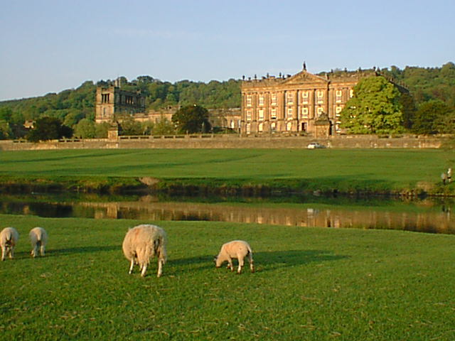
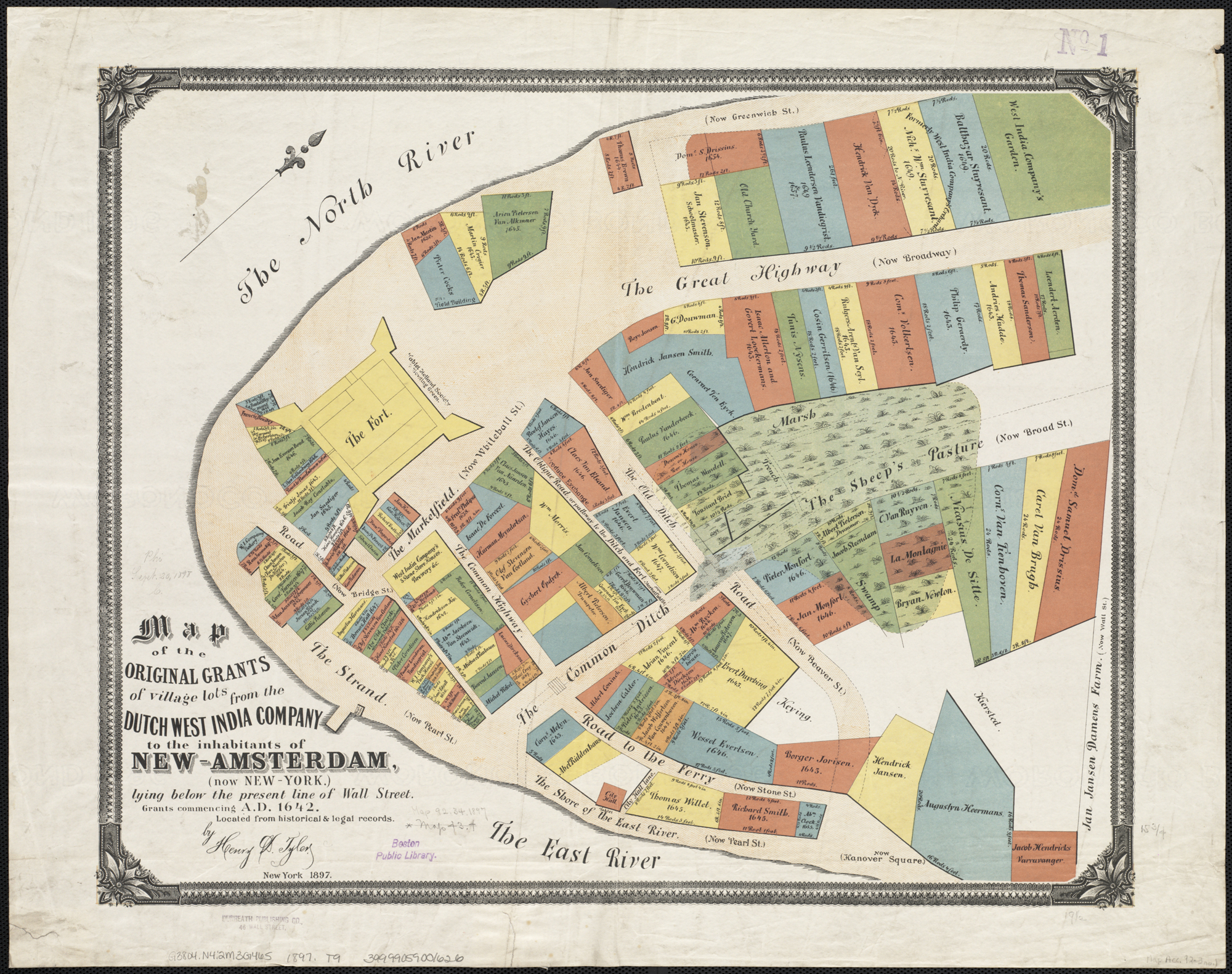
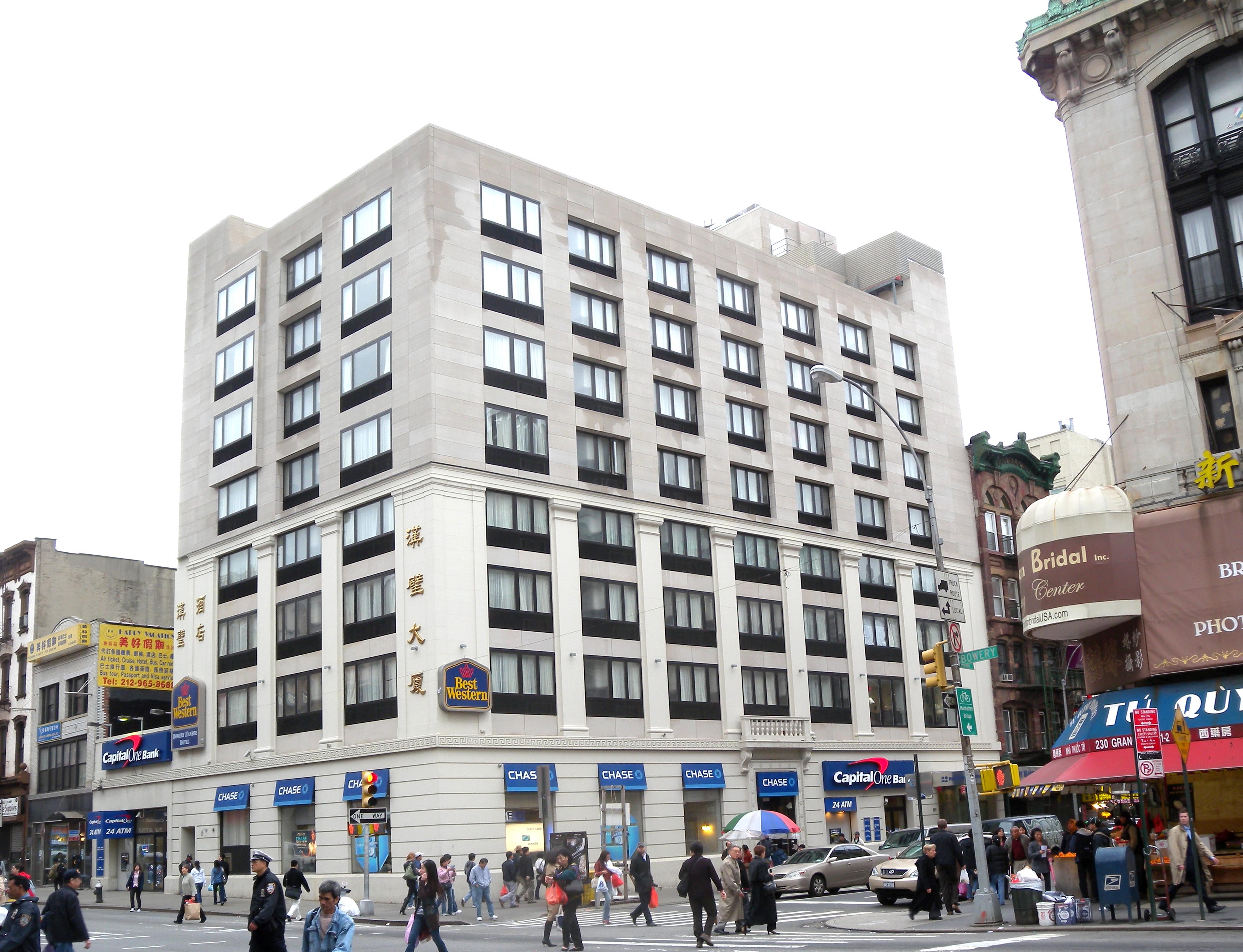
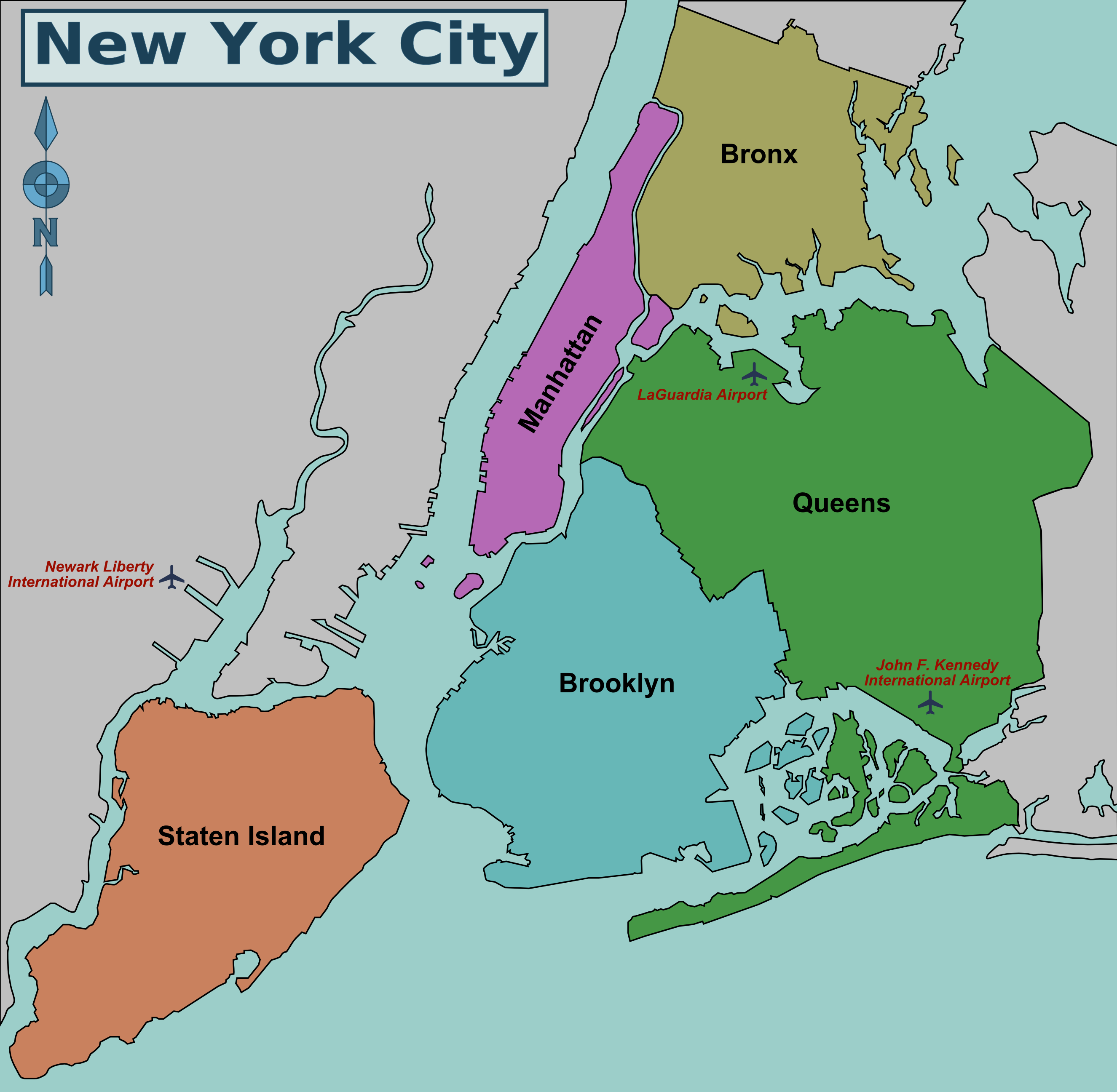