|
Reflections 2013
Series 24
December 30
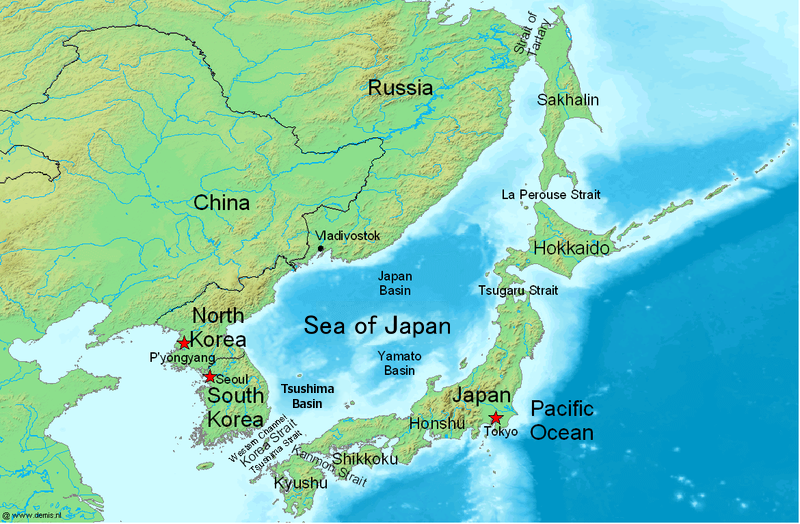
China VIII: Concessions in Manchuria - Concession Conflicts & WWII
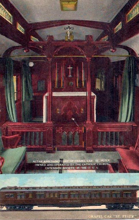
| | Where and when did WWII begin in Asia? Can you honestly answer that? I had trouble picturing that issue as I delved deeper and deeper into concessions, and the two concessions in Manchuria in particular. I do think the answer is concession-related. I found what I consider a reasonable answer, and find that others online do agree with that answer. Reaching back earlier still, I also found out that, in my opinion, the 20C in Asia "began early", in 1894-5. | | | | As all this information kept coming forth as additional interesting subject matter, I put the topic of Concessions of Manchuria into this posting of its own. The article started out fundamentally about a railroad construction concession given to Russia and a land concession associated with it. Then there was a Japanese element to the story, which led to localized war in and around Manchuria, which led into the Pacific theater of World War II, at least on the Asian continent. More accurately, the volatile area we're referring to is all of Manchuria (see following map), including way down south to its maritime area projecting into the Bohai Sea, Bohai Strait, and Korea Bay (Map by Kmusser), including those two peninsulas. | | | | I also thought I was familiar with the Transsiberian Railroad as it affected this area, but was a little confused about places called Dalian and Port Arthur—I remember wondering in high school why a Chinese city had such an English name. I really didn't know until recently where these places were. What was all that about the Russo-Japanese War, anyway? And you mean there were TWO Sino-Japanese Wars, the First and Second? What's that all about? | | | | Unequal Treaties & Manchuria Though we said this period starts in 1894-5, we have to again assess what had happened earlier with Manchuria, as we've discussed in the past. It was the Manchu people in Manchuria that militarily took Beijing from the Ming Dynasty to form the Qing Dynasty in the 17C, the last of the dynasties. Obviously, they brought their entire homeland with them becoming part of China. Their homeland was centered in the Amur River Drainage Basin (Map by Kmusser). Note the black line coming in from the left showing the modern border between Russia and Mongolia, then Russia and China. It follows the Argun tributary of the Amur, then the Amur, but not to the sea, as it once did. Just before Khabarovsk it turns south along the Ussuri tributary, then swings further west to meet (North) Korea, with which Russia has a 17 km (10.6 mi) common border. | | | | Russia had reached the Pacific coast in 1647, when it established the town of Okhotsk, well north of the mouth of the Amur, and of Manchuria. Now I had pictured that the area down to Vladivostok had "always" been part of Russia, and that is absolutely not so. In 1858 and 1860 what is known as the Amur Annexation took place by means of two "Unequal Treaties" (as did the later concessions in Manchuria). This is when Russia acquired Outer Manchuria, as we recently learned, first by an 1858 treaty declaring the Amur River all the way to the sea (visible on map) as the border. But they got greedier, and in 1860, the added the entire coastal stretch from the mouth of the Amur down to Korea. This second area includes today both Vladivostok and Khabarovsk. As Russia gained frontage on the Sea of Japan, China lost all the frontage there that it had had, so that now China's northernmost coastline was in the south of Manchuria, as we've been discussing. I find it hard to make myself realize that Russia's drive to bring rail across Siberia to Vladivostok was actually accessing ex-Chinese territory. | | | | The area we're discussing had three players and one silent partner. Expansionist Russia was nosing her way into the area; Japan, as the 20C approached was starting to feel its own expansionist oats; Qing China was a weak player, and Korea was the silent partner, about whose fate the first war was fought. | | | | First Sino-Japanese War (1894-5) The first war here was between China and Japan, and concerned Korea, although Russia stood eagerly on the sidelines to see what benefit it could get out of it. It occurred in the middle of the last decade of the 19C, but was a precursor of the 20C conflicts, which is why I say the 20C started early. The First Sino-Japanese War ("1st Sino") was fought for 8 ½ months in 1894-5, over Korea, and was an early Japanese expansionist move. Korea, though nominally independent, had always been under the sphere of influence of China, almost to the point where it was a vassal state. This continued during Qing China, whose officials exerted large influence over Korean officials that influenced the royal family. Japan's motives were threefold, yet all related. First, Japan wanted to remove China's influence from Korea. Second, it wanted to block any other power from dominating Korea. Third, it wanted to exert its own dominance over Korea, which it did, to the extent that 15 years later, Japan annexed Korea as a colony in 1910. | | | | From the beginning of the war, which was mostly fought in the Bohai Sea-two peninsulas area (see first map above), and in Taiwan, the Japanese army and navy had almost constant success, and the Chinese asked for peace talks in 1895. Two results were longer term, and two were short-term. | | | | Long term was China's recognition of the total independence of ▲ Korea, which left Korea open for Japan to annex in 1910. China also ceded ▲ Taiwan to Japan "in perpetuity". "Perpetuity" on a practical basis, lasted until the end of WWII in 1945. Japan had captured that Chinese port city of Weihai we discussed in the past (see first map above again), on the north side of the Shandong peninsula. One of the short-term results was that the Japanese evacuated ▲ Weihai in 1898. That same year, China leased it to Britain as the Weihaiwei Leased Territory (more later). The other short term one was quite unusual. China ceded the ▲ Liaodong Peninsula (next to Korea, with Dalian and Port Arthur) to Japan, also "in perpetuity". | | | | But it didn't last, to Japan's consternation, due to something called the Triple Intervention. Russia hadn't expected Japan to win the war (no one did) and it saw its own hopes in danger. Russia convinced Germany and France to pressure Japan diplomatically to surrender the peninsula it had won by treaty, in exchange for Japan receiving a financial indemnity in compensation, which is what happened. Of course, it was expansionist Russia, who was building railroads to and in the area, that had the most to gain from having its allies rein in expansionist Japan. In addition, Russia wanted its own warm-water port on the Pacific (Vladivostok gets iced in). And so, much to Japan's shock, Russia moved in and occupied the entire Liaodong Peninsula and fortified Port Arthur. (We'll detail Russia's rail and land concessions in Manchuria shortly.) This was one of the events that would lead to the Russo-Japanese War a decade later. | | | | Beyond these changes, the significance of the "1st Sino" was that regional dominance in East Asia (discounting Western powers), which had always been with China, now shifted to Japan. The Silk Road, for instance, had led to China, not to Japan. This 1894 political cartoon in Punch Magazine satirized the very unexpected victory of small Japan defeating large China, like David defeating Goliath. For the first time, Japan was a force to be dealt with, which became even more obvious in the first half of the 20C continued. China's prestige, at home and abroad, was devastated. Losing its influence in Korea, losing Taiwan, and the other results of the war raised a public outcry, which initiated a period of revolutions and political changes that eventually led to the downfall of the Qing Dynasty and the imperial state, in favor of the Republic in 1911. | | | | It was always unclear to me exactly what the unusually-named Boxer Rebellion of 1899-1901 was all about. I see now, that it fits in as a reaction to all the foreign concessions in China—war results probably included--since it was a violent grass-roots movement against the foreigners taking over the country. It was started by the Righteous Harmony Society, a secret society from Shandong province, and was spiritualist, idealistic, pro-nationalist, and opposed to the foreign imperialism (read: concessions) and Christian missions established in China. However, the foreign powers were successful in putting down the Boxer Rebellion, which was a further humiliation for China. | | | | The Chinese called it the Yihetuan Movement. So where did the (to me) lofty-sounding "Boxer" name come from used by Westerners? Was it somehow derived from a word in Mandarin? Not at all, and the answer has to cause a smile. The participants in the rebellion were well-trained athletic young men who practiced martial arts and calisthenics. English-speakers thought these muscular fighting men looked like boxers, so that's what they called them. To alter the name just to illustrate the original meaning, we could just as well call it the "Prizefighter Rebellion", or maybe the "Kickboxer Rebellion". Which makes one think: if Jackie Chan had lived a century ago, might he have helped train this group? What an odd name Boxer Rebellion is once you understand its literal meaning. | | | | Since the stories in and around Manchuria are intertwined, we've had to get ahead of ourselves while describing the war by referring to Russian railroads and the two Russian concessions in Manchuria without having discussed any of that yet. There is overlap in this with the war(s), so follow the dates carefully, since we may do a bit of jumping back-and-forth. It all starts with trains departing Moscow. | | | | Transsiberian Railway I refer first to my round-the-world by rail via Siberia trip in 2005, when I rode a private train from GW Travel from Vladivostok to Moscow (and beyond). In the writeup of 2005/8 I talked about the regular train, and even visited it before it departed. But in earlier years I didn't include pictures or even maps. For the sake of completeness, I suggest you go back to 2005/8 and review just ¶s 4-7, as I want to first supplement what I said there, and then relate it all to Manchuria and the concessions. (I've put a forward cross-reference in that posting to this one.) | | | | In ¶ 5 I refer to the church cars that the Transsiberian Railway had. Since I didn't use pictures then, I mentioned I saw a picture of a church car—or chapel car--on a siding in Siberia with a priest standing in the doorway, but wished I could have seen an interior. Life is so strange. I've searched all over the web, and couldn't find that original exterior photo, but I did find this drawing of a church car interior.
| | | | Surprisingly, I also found a drawing of the outside of a "cathedral car" originally published in the Boston Globe in 1896. It's on a copyrighted Orthodox Church website, so I can't link to it. Go and look at it for yourself. Copy and paste this web address in another window:
http://orthodoxhistory.org/wp-content/uploads/2012/05/1896-12-29-Russian-railroad-mobile-church-Boston-Globe.jpg
| | | | And I'm even more surprised that this isn't a thing of the past. The same website had a cross-reference to a report by NBC about a medical train in Russia that includes a carriage with a chapel. I don't know for how much longer this article may be available, but copy and paste this:
http://photoblog.nbcnews.com/_news/2012/04/27/11434337-russian-train-brings-medical-care-to-remote-areas-of-siberia
| | | | I refer particularly to three pictures, each better than the last: the first picture of the side of the train with a priest; the sixth picture showing a resplendent chapel interior scene of a baptism; and, best of all, the seventh picture with the priest ringing church bells at the end of the train. Fabulous. | | | | And silly me. Unique in Russia? Not at all, although they were the first ones to have done it. I now discover that later, the British did the same in India, and in the US, there were several Baptist, Episcopal, and Roman Catholic chapel cars used from the 1890s—the time of the Siberian ones—to the 1930s. This is the "Glad Tidings" Baptist chapel car in 1905. It dates from 1894 and was in use as such until 1926, when the wheels were removed and it was placed on a foundation in Flagstaff, Arizona to be a regular church. This is an undated postcard of the RC Chapel Car "Saint Peter", with views of both the altar and the exterior. It was in use from 1912 to the 1930s. | | | | As to ¶ 7, involving my visiting the station before our private train left the next day, I'll add this. I had some free time, and in the evening I walked over from our hotel to the beautifully restored 1912 Vladivistok Station (Photo by Marc Heiden). The rest of the description, very memorable to me, still holds, except now I can offer a picture of the train, called the Россия/Rossiya (Russia) (Photo by Marc Heiden). Below the second version of that word it says Москва-владивосток, or Moskvá (Moscow)-Vladivostok, the two end stations. The train is in the national colors. You may mistakenly think that those are red, white, and blue, but you must be thinking of 2-3 other countries. Russia's colors are white, blue, and red, in the order seen on the train, and on the Триколор/Tricolor (Photo by Vexillus), dating from the 18C-19C and readopted in 1993. | | | | But it's ¶ 6 that we have to expand on with some maps and updates. First the name. What in English is called the Transsiberian Railway is called in Russian the Транссибирская магистраль, which is Transsibirskaya magistral' (ma.ghi.STRAL'). I checked that last word, and it exists very obscurely in English as well, meaning "principal, main". So while we refer to it as a railway, in Russian it's the Mainline or Trunk Line. Actually, it's usually shortened to the Транссиб / Transsib, and that's what I'll call it from here on in. | | | | In 1890, when Tsar Nicholas was still Tsarevich, he visited Vladivostok and personally inaugurated construction from that end. Actual construction ran from 1891 to 1916, and it's been constantly upgraded ever since. But you already see the overlapping of dates I mentioned, around the "1st Sino" in 1894-5. | | | | Let's look at a current map of the Transsib. Since a number of these maps are on copyrighted websites, copy and paste this web address in another window, and click to enlarge:
http://www.transsib.ru/Map/transsib-passenger-eng.gif
| | | | The red routes out of Moscow are current. Other routes come in from the west. In blue, the Turksib takes off to Central Asia, its name using the reference to Turkestan to refer to those Turkic peoples. After Lake Baikal, the Transmongolian takes off for Ulaan Baatar and Beijing. The history of the following is what we'll be talking about in a moment. After Chita (Чита; chi.TÁ), the Transmanchurian takes off to Harbin (Харбин) and Beijing, but the main line then swings north to go AROUND the former Inner Manchuria, presently China's Northeast (Dongbei). At Khabarovsk (Хабаровск; kha.BAR.ovsk), where Russian territory turns south, so does the Transsib, making a dogleg to the right, down to Vladivostok. From there there are connections both back into Manchuria, and into Korea. | | | | | | And also to the port city of Nakhodka (Находка). Its ice-free and relatively calm bay was discovered (the name means "discovery") mid-19C. In the 1950's the Soviets—bless their dark little hearts—decided to close Vladivostok to foreigners for military use, and so Nakhodka became the only Russian open port in the area, and also the eastern terminus of the Transsib. Obviously, this is no longer the case for either rail or sail. |
| | | | But back on our map, there's a very interesting later development, the BAM (БАМ), which stands for the Байкало-Амурская магистраль / Baikalo-Amurskaya magistral' or Baikal-Amur Mainline, and this time, English, too, uses that last word. It leaves the Transsib before Lake Baikal, and swings north of it, into the area of the Amur River, but judiciously avoiding much of that river where it forms the border with China. As a matter of fact, the BAM was built over decades and completed in 1991 as an alternative to the Transsib. It strikes me as odd that, with all the fuss about the destination being Vladivostok or Dalian in China, this route should have been built, especially to the inadequate facilities of the town of Sovyetskaya Gavan' (Сове́тская Га́вань; GA.van') or Soviet Harbor, until 1922, Emperor's Harbor. The name is informally shortened to Sovgavan' (Совгавань). As isolated as the BAM is, there is now a rail ferry to Sakhalin Island (shown in red), with discussion of building a rail tunnel under the Strait of Tartary to the island. Beyond that, there's additional talk of building a connection to Japan via the proposed Sakhalin-Hokkaido Tunnel (or possibly Bridge) (Map by Chris 73 & Phoenix7777) across La Perouse Strait. Hokkaido is already connected with the rest of Japan via the Seikan Tunnel, which I've ridden through (2009/34). | | | | Transsiberian Railway Egg I know we're taking a lot of deviations here away from China, but before we get back to that history, we need something more lighthearted. How about an egg? A Transsiberian Railway Egg? Now who on earth in tsarist Russia was involved with eggs? Easter eggs? Why Fabergé, of course, Peter Carl Fabergé. | | | | The railway was so important to Russia, and to Tsar Nicholas in particular, at the turn of the new century that Fabergé made one of his fabulous jeweled eggs for the Tsar to present to his wife, the Tsarina Alexandra, at Easter, 1900, and it's known as the Transsiberian Railway Egg (Photo by greenacre8). Today the egg is kept at the Kremlin Armory Museum in Moscow. | | | | It's large, 27.5 cm (10.8 in) tall. The outside is made of silver, gold, and quartz, on an onyx base. It opens to a velvet-lined interior, and the hinged lid is decorated with green, blue, and orange enamel and acanthus leaves, topped by a golden three-headed eagle with the Imperial Crown. On the exterior below the lid is a route map of the Magistral', and the areas not yet completed in 1900 are also marked. Major stations are indicated by precious stones. Above the triangular, stepped white onyx base are three griffins in gold-plated silver, with swords and shields. | | | | Fabergé eggs always have a surprise, something mechanical that "does something". The surprise here, which presumably had been located inside the egg, is a tiny replica of a train with a gold-and-platinum steam locomotive with tender, and five coaches. The coaches have rock crystal windows, and are labeled "mail", "ladies only", "smoking", "non-smoking", and—you'd better believe it—"chapel". The locomotive has a rose-cut diamond headlight and ruby marker lights, and the whole train is 39.8 cm (15.7 in) long. There is also a gold key that winds the clockwork and makes the train actually run. | | | | This is a closer picture of the egg and train (Photo by shakko). The focus isn't as good, but you can click this one to enlarge it so closely inspect the lid, map (with 1900 date), fighting griffins, and, of course, the train. You can tell that the chapel is the last car. Finally, if you're interested, this is the 1895 Fabergé logo. It says: FABERGÉ / S. Peter[s]burg / Moskvá (Moscow), Odessa / Kiev, London. | | | | Russia & Manchuria But let's put aside eggs and the newest rail route to Sovgavan' and get back into our history, when Russia was interested in reaching Vladivostok—and also Dalian, in the era of concessions. Copy and paste this map: http://www.transsib.ru/Map/russia.gif | | | | This map shows the countries more clearly, and simplifies the rail routes. Although the map is in Cyrillic, I gave you the Cyrillic versions of names above in case there are names you don't recognize. Out of Moscow, the red is the modern route of the Transsib, and the yellow the historic route. After Chitá, note even more clearly here that, to avoid Manchuria (that is, the part not already annexed by Russia), the rail route has to go up, over, and down, like three sides of a rectangle. Then note the direct route from Chitá via Harbin to Vladivostok, and you'll understand why so much fuss was made about Manchuria. And beyond that, note the additional route southbound, forming a T out of Harbin, to Dalian and Port Arthur, and you'll begin to see the roots of the upcoming Russo-Japanese War. | | | | Russia's Two Concessions in Manchuria All the concessions in China were in urban areas, with one exception. Since it was obvious to Russia that it would be in its best interests by having a rail shortcut through Manchuria, following the turmoil of China having lost the "1st Sino" of 1894-5, Russia got from China in 1896 a construction concession to build a rail connection from Chitá via Harbin in Manchuria to Vladivostok. The part of the line physically in Manchuria was organized as the Chinese Eastern Railway. English speakers have also called it the Transmanchurian Railway. I am going to refer to this first route—I haven't seen anyone else do this—as the Main Line. The treaty granting the concession included the right to establish an administrative zone on either side of the tracks. I haven't been able to find a specific width, but I believe it could have been 62 meters (yards) on either side, a number which I'll explain later. Within the zone, headquartered in Harbin, Russia was allowed to maintain a police force, have customs facilities, run courts, and build and own railway-related industries, so de facto, the railway WAS a land concession, albeit it a long and very narrow one crossing Manchuria. | | | | We now see how everything here ties together. The war was just over, and a year after rail construction began in 1897 was when Russia arranged the Triple Intervention, got Japan off the Liaodong Peninsula, and took it over, all in 1898. This was Russia's second concession in Manchuria, and this one did involve a chunk of land, and not just a rail zone. The official name of the concession, based on an old local name, was the Kwantung Leased Territory, but it comprised the end of the Liaodong Peninsula, including the city whose modern Chinese name is Dalian with its adjacent magnificent port of Lüshun (Port Arthur), which was and is of great military and economic significance. Like all the other concessions, this one existed until the end of WWII. It will be easier for me to refer to this concession simply as Dalian, with the understanding that Lüshun is included. | | | | We have a wonderful satellite image of the end of the Liaodong Peninsula. [Alternatively, you may wish to copy and paste it into a separate window to make it easier to follow the text: 'http://upload.wikimedia.org/wikipedia/commons/0/09/Dalian%2C_China%2C_satellite_image%2C_LandSat-5%2C_2010-08-03.jpg.] This is simply magnificent. Both locations of interest are on the south side, facing out to sea. The light-gray urban area around the huge bay is the city of Dalian. Still within the Dalian limits (since 1950), but 64 km (40 mi) out near the south end of the peninsula, is Lüshun. Click to zoom in on its sheltered port area and you'll see why its natural harbor was so prized. Both Dalian Bay and Lüshun Harbor are ice-free year-round, while the bays on the north side of the peninsula are choked with ice for four months each winter. | | | | I'm bursting to talk about the names of these two locations, as each one has had three names. Lüshun is many centuries older, and it was given its present Chinese name in the Ming Dynasty. I'm told that the meaning of Lüshun is an expression of "plain sailing and a favorable voyage". But then, during the Second Opium War in 1860, a certain Royal Navy Lieutenant named William C. Arthur had his crippled frigate towed into Lüshun harbor for repairs; Lüshun was then an unfortified fishing village. At that point, the Western powers adopted the British name Port Arthur, which included the Russians, as Порт-Артур / Port-Artur. Under later Japanese administration it became Ryojun, and now it's back to Lüshun. | | | | As for Dalian, it also originated from a small fishing village, called Qingniwa (watch that Demon Q—it's CH), but the city the Russians established overtook it. I like the imagery of the Russian name, since it's one of two names on the Pacific that use the same word, the word for "far". While outsiders call everything east of the Urals Siberia ("Siberia faces Alaska"), the Russians consider only the first two-thirds of that as Siberia. The third of that area located on the Pacific is called the Russian Far East / Дальний Восток России (Dal'niy Vostok Rosiyi), literally the "Far East of Russia", which is the area that Russians consider to be facing Alaska. You'll recognize Vostok as being part of Vladivostok ("Lord [of the] East"), but it's Dal'niy that I'm referring to, meaning "far" or "far away", and Dal'niy (it has other transliterations) is what the Russians named Dalian. I love the imagery of distance in that name, Dal'niy / Far Away. During the Japanese occupation, the city was called Dairen, now it's Dalian. | | | | Russia's next step was to connect its two Manchurian concessions with a branch rail line. In 1898, the same year it got the lease on Dalian, Russia got approval to build the South Manchuria Branch Line running 880 km (550 mi) from Harbin to Dalian, with additional spurs, and the construction that had started on the main line the year before speeded up. Russia also started fortifying and developing Port Arthur into a first-class naval base for its navy and merchant marine. | | | | We now move back to that local map of Manchuria and its region, meant to show the routes of the China Eastern Railway (Map by Voland77 & Vmenkov). [For continuing reference, you can copy & paste it as well:]
http://upload.wikimedia.org/wikipedia/commons/thumb/d/d7/Chinese_Eastern_Railway-en.svg/1000px-Chinese_Eastern_Railway-en.svg.png
But there are later additions here. From the top, we see the BAM, which came a half-century after our time period. In addition, the Transsib around China wasn't yet complete. But crossing Manchuria through Harbin was the Main Line to Vladivostok, and leading south out of Harbin was the South Manchuria Branch Line to Dalian and Lüshun (Port Arthur) also centered in its zone. You'll also note the spurs off this branch line running into Korea and into Tianjin and Beijing. Perhaps you remember the postcard of the Russian Concession in Tianjin showing the Russian rail station there.
| | | | Traffic on the Chinese Eastern Railway began in late 1901 and it was essentially completed in 1902. Through passenger traffic from Saint Petersburg to Vladivostok started in July 1903. The northern route around China was only completed about a decade after the Manchurian shortcut on the Main Line. | | | | As this last map shows, Russia now had a choice of two destinations on the Pacific, Vladivostok on the Sea of Japan to the east of Korea, where the harbor would freeze in winter, and Dal'niy (Dalian) on the Yellow Sea west of Korea that remained ice-free all year. The result is this surprising map I found, never expecting it, showing a Transsib Express to Dal'niy in 1903 directly from Moscow. [Or, to copy and paste it:]
http://upload.wikimedia.org/wikipedia/commons/9/9b/Transsib-express-1903.jpg.
On reaching Harbin, the route hangs a right-hand dog-leg south to Dal'niy, and, almost as an afterthought, shows the Harbin-Vladivostok connection as well (with a connection NORTH to Khabarovsk). It shows the round trip, the upper route eastbound and the lower westbound. The area above is (exotically) labeled Russian Empire and below Chinese Empire. Two trains a week run the route in each direction. Look at Moscow, where train # 1 leaves on Wednesday and # 2 on Saturday. It then shows you where you'll be each subsequent day. You arrive on the 15th day, also a Wednesday or Saturday. Returning train # 3 leaves on a Saturday, # 4 on Tuesday.
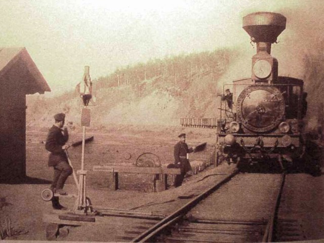
| | | | Of course, Transsib trains at the turn of the 20C didn't look like the contemporary pictures we've seen. This is a Transsib train in 1903, the very period we're discussing, at a tiny station between Lake Baikal and Chitá. The view faces west, so the train is on its way to Manchuria, behind us. | | | | With two destination cities now on the Pacific for their premier railroad, things were going so well for Russia. What could possibly go wrong? | | | | Russo-Japanese War (1904-5) There continued to be a problem between the two expansionist powers, Russia and Japan, and specifically about the fate of Korea and Manchuria, thereby affecting China. Japan continued to be peeved about the loss of the Liaodong Peninsula due to Russian negotiated diplomacy. Russia maintained a large army and occupied northern Manchuria, which concerned the Japanese. Russia pressed China for more exclusive rights in Manchuria, and China's reply was an alliance with Japan and the US against Russia. | | | | With Manchuria and Korea in the balance, Japan offered to recognize Russian dominance in Manchuria if Russia would recognize Japan's right to dominate Korea. Japan apparently saw this as a balance in expansionism, but Russia refused, not wanting to see Japan have a foothold on the continent. With that, Japan had its navy attack the Russian eastern fleet at Port Arthur in 1904, which was the start of the Russo-Japanese War ("Russo"), which ran for 19 months in 1904 and 1905, just a decade after the "1st Sino" in 1894 and 1895. It was fought in southern half of Manchuria, including the Liaodong Peninsula, and in the Sea of Japan and the Yellow Sea, since Russia attempted, but failed, to invade Japan. This is the area where the war was fought (click). | | | | After a series of land and sea battles, Japan defeated Russia, to everyone's amazement. American President Theodore Roosevelt mediated and negotiations were held in New Hampshire, in the Portsmouth Naval Shipyard. The Treaty of Portsmouth was signed in September 1905, and Theodore Roosevelt won the Nobel Peace Prize. | | | | This was the first victory in the modern era of an Asian power over a European power. Domestically, Russian confidence was shaken, and uprisings against escalation of the war broke out, which developed into the Russian Revolution of 1905. The military defeats were an embarrassment, and the war was extremely unpopular with the Russian people. They were also not particularly concerned about the remoteness of the area fought over, an irony which brings to mind the meaning of the name Dal'niy—far away. | | | | As for that distance, here's more irony. The Transib turned out to be a military liability to Russia. It was single-tracked, allowing travel in one direction, causing Russia strategic and supply problems for the front. Trains coming from one direction would have to pull over to a siding when a train in the other direction had to get through, which delayed supplies, troops, and materiél in one direction and returning troops and the injured in the other. These slowdowns allowed the Japanese to advance on the front. | | | | Another political cartoon from Punch in 1905 shows Russia's loss of prestige after the loss of the war, as indicated by the hourglass. It may also be symbolic of the Tsar's time running out as well, although perhaps I'm reading more into it, knowing what the future will bring a decade later. | | | | Internationally, world nations were shocked by Russia's defeat, while Japan's prestige rose. Russia virtually lost its entire Pacific and Baltic fleets, and its esteem plunged. Such consequences affected the future WWI, since Russia was an ally of France (see above political cartoon) and of Serbia. Germany, with France in mind, noted Russia's weakness, and Austria-Hungary, with Serbia in mind, did the same. Thus Japan's win and Russia's loss in the "Russo" had a distant effect on WWI, just as the upcoming Second Sino-Japanese War would blend directly into WWII. I had never realized that this Manchuria-Korea region was the 20C hotspot that it is, not forgetting the later Korean War, either. | | | | Keep the "1st Sino" and the "Russo" together in your mind as the two instances where a small Japan defeated first a large China and then a large Russia, both times shocking world opinion. These two wars mark the emergence of Japan as a military force dominating the first half of the 20C. These two wars also humiliated first China, and now Russia, and they eventually led to uprisings in China that overthrew the Emperor in 1911 and to uprisings in Russia in 1905 that led to the overthrow of the Tsar in 1917. Heady stuff. The similar affects of these two wars is why I say the 20C began de facto with the "1st Sino" in 1895. | | | | So what were the results of the "Russo"? From south to north: Russia recognized that ● Korea was part of the Japanese sphere of influence. Within five years, Japan would annex Korea in 1910 with minimal international protest. Japan would then be a continental power as well as an insular one. Russia turned over to Japan ● Dalian and Lüshun, with its naval base, and the rest of Russia's leased territory on the peninsula. Thus Japan had an even earlier toehold on the continent, before Korea. Russia turned over to Japan almost all of the ● South Manchuria Branch Line of the China Eastern Railway, a point that will be expanded shortly. Russia turned over to Japan the ● southern half of Sakhalin Island (mentioned above), although the Soviets took that back after WWII. | | | | This is what the coastal area (Map by Brionies) looked like by 1921. [Or, copy and paste: http://upload.wikimedia.org/wikipedia/commons/7/70/Kwantung_territory_China_1921.jpg.] Korea was annexed to Japan, since 1910. The Kwantung Leased Territory, with Dalian and Lüshun, were Japanese, with a neutral zone covering the Liaodong Peninsula. Over on the south side of the Shandong Peninsula opposite, the former German Kiautschou Bay Leased Territory in red (including Qingdao), with neutral territory, had been turned over to Japan in 1914 at the start of WWI, and Japan would remain there one more year, until 1922. | | | | Finally, we get back to the third concession involving Manchuria, but the one not located in Manchuria, the Weihaiwei (Weihai Garrison) Leased Territory in Weihai, plus neutral territory, on the north side of the Shantung Peninsula. Britain had leased it in 1898 when the Liaodong Peninsula had gone to Russia. Britain called the city of Weihai Port Edward at the time; it's located 130 km (81 mi) from Lüshun. Although it was Britain's intention to remain there as long as Port Arthur was occupied by either Russia or Japan, Britain left Weihai in 1930, although Japan held on to the other peninsula until 1945, and then the Soviets held it until 1955, when it finally went back to China. While we're again looking at the peninsulas, I'll remind about the tunnel being built to connect them (2013/23). | | | | So the two Manchurian concessions Japan got were the peninsula and a rail branch. Let's look at the two urban areas on the peninsula. Copy and paste this web address into a separate window to inspect from a period French travel guide the very end of the rail line in Port Arthur in 1912, when it was under Japanese administration and using the name Ryojun:
http://www.lib.utexas.edu/maps/historical/port_arthur_town_1912.jpg
| | | | Note the fine harbor. I would suspect the Old City is Chinese and the New City is Western. Then copy and paste this link from the same 1912 guide for Darien/Dal'niy, known then under Japanese administration as Dairen:
http://www.lib.utexas.edu/maps/historical/dairen_dalny_1912.jpg
| | | | Careful! The map is "upside down", with North at the bottom. This time the old town is called the "Chinese City" as was the case in Tianjin in the last posting. The street names in the Western town are in Japanese here, and they seem to have a special wharf for Chinese junks. | | | | South Manchuria Railway We noted the distinction on the Chinese Eastern Railway between the Main line running east-west and the South Manchuria Branch Line running south out of Harbin. And we also have seen that the Russians had to cut their baby in two and surrender (most of) the South Manchuria Branch Line to become reorganized as a new Japanese company founded in 1906, the South Manchuria Railway (Map by Voland77 & Vmenkov). All spurs in the south were taken over (it operated Korean railways until 1925) and most of the branch line, but for reasons not fully clear to me, it was not taken over all the way to Harbin, only to Changchun (on the map). Thus, Russia's Main Line now had a branch that only went to Kuancheng, a suburb of Changchun. With all spurs, and as far north as Changchun, the new railway had a total length of 1100 km (684 mi). | | | | As had been the case with Russia, Japan obtained extraterritorial rights to a South Manchuria Railway Zone, which I know for a fact ran 62 meters (yards) on either side of the tracks, which is why I made that same estimate earlier for the width of the Russian zone. Within the zone were 25 municipalities, and each one included warehouses, repair shops, coal mines, and electrical facilities needed for train maintenance. | | | | Let's take one more look at the Big Picture of the rail situation. Copy and paste the following in another window:
http://www.transsib.ru/Map/hismap-vsput1907.jpg
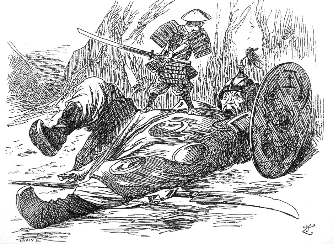
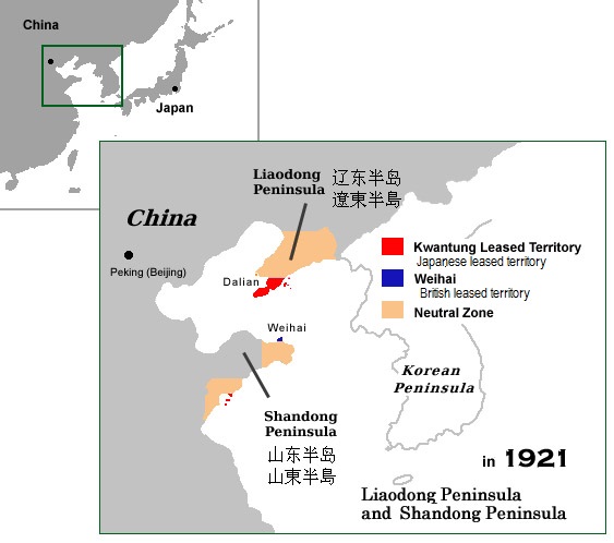
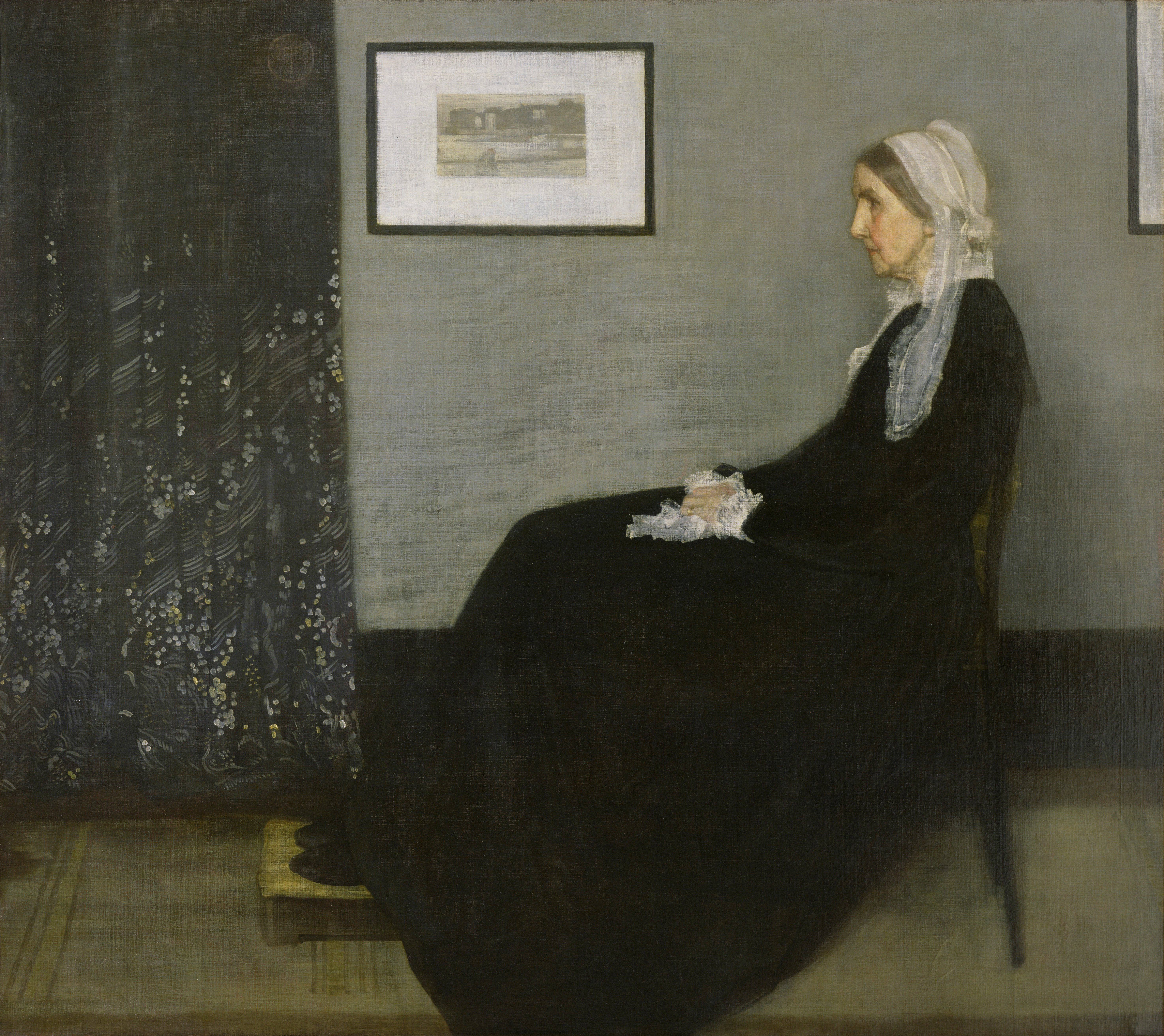
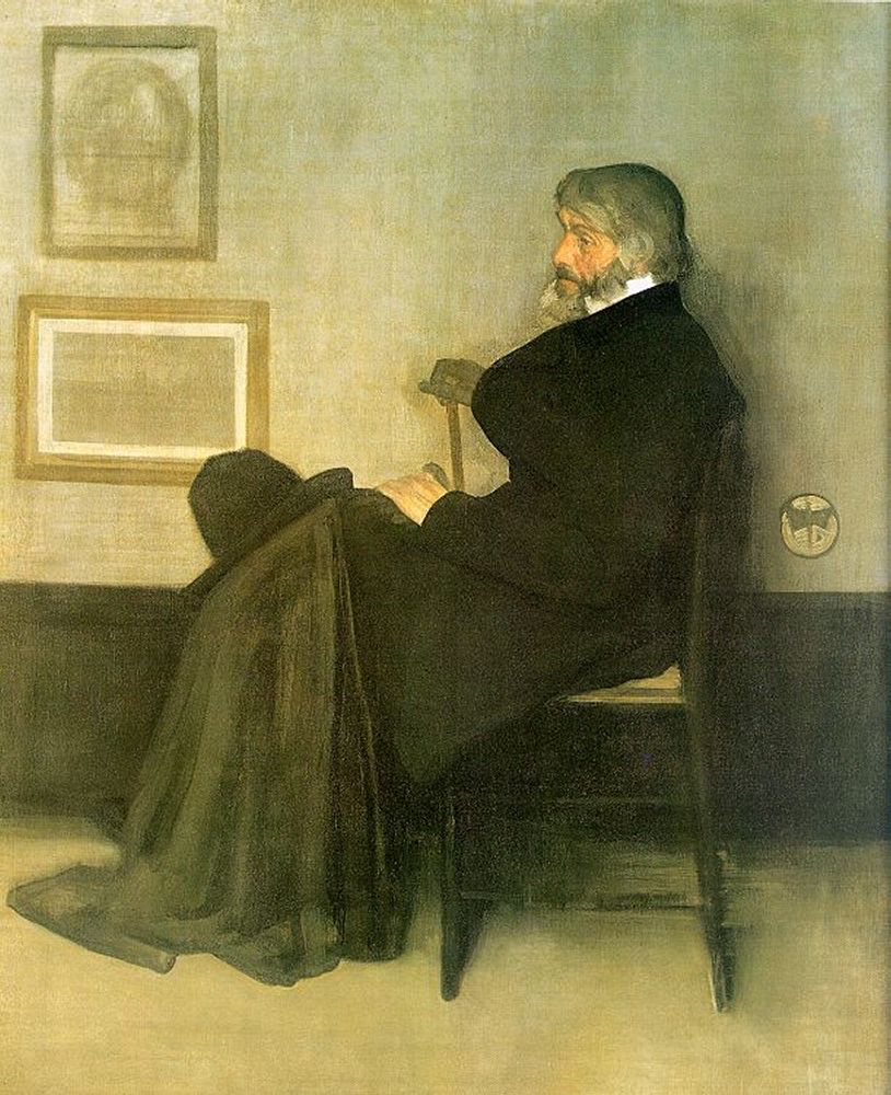
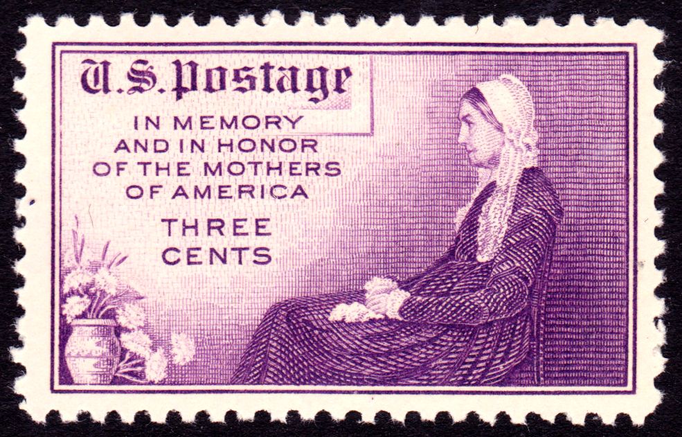
| | | | It's a 1907 postcard using that more romantic name for the Transsib I first mentioned in 2005, the Большой Сибирский Путь / Bol’shoy Sibirskiy Put’, or the Great Siberian Way. Remember, we're discussing a period when there were few good roads, and none leading through Siberia, and certainly no paving. On the left you can see the route of the Turksib we mentioned, going down into Kazakhstan, but we're concentrating on Manchuria. We can see that the China Eastern Railway in 1907, shortly after the war, still was the only route to Vladivostok. The modern route north of Manchuria was still not completed, but interestingly, you could still get to Khabarovsk by going to Vladivostok first, then continuing north, which today would be counterintuitive. South of Harbin, the route, in red, now stops abruptly at Changchun, with the balance in gray showing what is now Japan's South Manchuria Railway reaching Dalian, Beijing, and Korea. It has to have been a great comedown for the Russians. Not only was it a slap in the face, but now Japan had a growing foothold on mainland Asia. As we now know in hindsight, this does not bode well for 20C history. | | | | That Gauge Problem Again With all the military and cultural issues at hand here, we come down again to the purely mechanical matter of rail gauge. We've discussed in the past, notably regarding Australia, how standard gauge, broad gauge, and narrow gauge track is all incompatible without special modifications. Of the countries using broad gauge, Russia stands out because of its geographic size and location as well as the size of its network. Russian tracks are theoretically 5 ft (1524 mm) apart, although in practice, that size has gradually been reduced slightly by a miniscule 4 mm (5/32 in) to 1520 mm. This is the second most common gauge in the world, after standard gauge at 1435 mm (4 ft 8.5 in). China uses standard gauge. Japan, except for its high-speed trains on standard gauge, uses a narrow gauge at 1067 mm (3 ft 6 in). Whoops. | | | | We already mentioned that, if the tunnels are built, Russian broad and Japanese narrow gauges would meet on the island of Sakhalin, an issue that would need to be dealt with at the time. But the three-gauge issue already came up a century ago in Manchuria. Russia had built the entire Chinese Eastern Railway in its broad gauge. During the war, the advancing Japanese had commandeered the rail facilities behind its lines and had regauged the track to its own narrow gauge to be able to use its own rolling stock, but afterwards, realizing that would be incompatible with Chinese standard gauge, regauged it again to standard gauge. Because of this, there was now a break of gauge where the lines met in Changchun, with Russian broad gauge starting in suburban Kuancheng to the north of Changchun. As of 1907, dual gauge tracks connected these two stations. | | | | We have to take another aside, since this is too good to pass up. The traditional answer to why the Russians chose broad gauge has been because they were convinced the break of gauge with standard-gauge western Europe would prevent invasions. That's apparently only partially true. The individual who is actually credited with making the decision for broad gauge was a prominent American railroad engineer, George Washington Whistler. He had been hired as a consultant to build the first major Russian railroad between Moscow and Saint Petersburg. European engineers had recommended a broad gauge, and Whistler was familiar with, and a proponent of, the five-foot broad gauge which was apparently common in the US South at the time. He lobbied for the broad gauge, and probably used the invasion argument as a back-up to convince the Russian military to support the idea. | | | | It's true that Nazi Germany's advance into Russia in WWII was made more difficult because the break of gauge helped slow down supply lines. But a broader gauge inherently gives a smoother, more comfortable ride. Judge the solidity of your stance with your feet closer together as opposed to further apart and you'll see that a wide stance afford more solid support. (Incidentally, the last time I was on broad gauge was recently, since, quite surprisingly, the Peak Tram in Hong Kong is built to the same broad gauge as Russian trains. Look again at the video of the Peak Tram in 2013/18 and you can judge how far apart the tracks are and judge the solidity of the ride.) | | | | Whistler came down with cholera in Saint Petersburg and died at the age of 49 in 1849. He left his second wife, Anna McNeill Whistler, with whom he had had five sons. She was to become wildly famous 22 years later, in 1871, when their eldest son, James McNeill Whistler, painted her portrait, the painting commonly known as "Whistler's Mother". | | | | Fame is hard to explain. There are people just as talented as famous people, who just didn't become famous. It's the same with art or anything else. We've discussed three iconic paintings in the past, to which we now add a fourth, that are so famous that everybody knows them, including people who have no interest in art whatsoever. They have all become part of pop culture. These paintings are not necessarily any better than others, including paintings by the same artists, but they just become famous to the point of being iconic. We talked in 2006/4 about Edvard Munch's Skrik, actually The Shriek, but usually translated as The Scream. Then in 2011/18 we discussed Grant Wood's "American Gothic", and supplemented that by talking about Leonardo Da Vinci's "Mona Lisa", best translated as "Milady Lisa". And so the fourth one that "everybody knows" is James McNeill Whistler's "Whistler's Mother". I have seen all four of these pictures, the latter one being at the Musée d'Orsay in Paris. | | | | Whistler was American-born, but lived in Britain and is considered a British painter. When I saw the painting, I was startled to see that its actual name was "Arrangement in Grey and Black No 1". Whistler always insisted it was not meant to be a portrait, but an artistic study. There are rumors that can't be proven that, when the model hired for the painting didn't show up, his mother, living with him in London, substituted for her. Another rumor was that the figure was meant to be standing, but his mother was older and would get too tired while posing, so the painting became one of a seated figure. It is also believed that a young neighbor would substitute for the mother when she got too tired sitting. These are all good stories, but may or may not be true. | | | | When the painting was shown, it was decided that the title of what obviously was a portrait was inadequate, so an official subtitle was added, "Portrait of the Artist's Mother". It was from this subtitle that the colloquial name "Whistler's Mother" developed. Once Scottish essayist Thomas Carlyle saw the seated portrait, he agreed to sit for a similar one in 1873, which then was named "Arrangement in Grey and Black No 2". It was at this point that the number 1 was added to the first picture. | | | | Whistler continued to be bothered about why people would care about the identity of the model of what he continued to consider an art study. Beyond that, especially in the US, the picture has become an icon of motherhood, as shown in this 1934 postage stamp, which surely would have irked the artist. | | | | But the bottom line here, as we return from our little artistic detour, is that, when considering Russian rail gauge, consider not Whistler's Mother but instead Whistler's Father. | | | | Manchukuo So the status in Manchuria in the 20C prior to WWI is a standoff. Since the Manchu people were the source of the Qing Dynasty, China continues to have a historical claim to the entirety of historical Manchuria as Russia and Japan close in on it. Outer Manchuria, the Amur region including Khabarovsk and Vladivostok, is long lost to Russia, and remains so to this day. The northern part of Inner Manchuria, because of Russian ownership of the Chinese Eastern Railway and its zone cutting across as the shortcut route to Vladivostok, is heavily under the Russian sphere of influence. The southern part of Inner Manchuria is heavily under the Japanese sphere of influence because of Japanese ownership of the South Manchuria Railway and its zone plus Japan now holding the lease of the Kwantung Leased territory, that is, the Liaodong Peninsula (Dalian, Port Arthur). By 1910, Japan has also annexed Korea.
| | | | After WWI the chaotic political and military situation in Manchuria between Japanese, Russian, and Chinese interests continued. Following the additional chaos of the Russian Revolution of 1917, Japan crossed the border and moved into Outer Manchuria, but this was only temporary, since military and political pressure forced Japan to return the area to Soviet control by 1925. In 1921, Harbin had a population of 300,000, a third of which were Russians. After 1924, China joined the USSR in administering the Chinese Eastern Railway jointly, and Japan continued administering the South Manchuria Railway. | | | | But it was on the peninsula of the Kwantung Leased Territory where developments came that would lead to huge changes for the area, and indeed, to WWII. In 1906, Japan established the Kwantung Garrison there in Port Arthur to defend the territory. The garrison was reorganized in 1919 and renamed the Kwantung Army, which became the largest and most prestigious command of the Imperial Japanese Army. Many of its personnel moved up to high positions in the military and in the civil government of Japan, most notably General Hideki Tojo, who became Prime Minister of Japan, and Minister of War, during most of WWII. | | | | It was rogue military personnel of the Kwantung Army who, believing it was in the best interests of Japan, staged a false terrorist event by planting and setting off a small, relatively ineffective dynamite bomb near the South Manchuria Railway and claiming it was done by Chinese dissidents. This became a pretext for the Kwantung Army to invade Manchuria the next day, on 19 September 1931. This rogue event surprised the military command in Port Arthur as it did the civil government in Japan, but they felt they had to go along with it, even though it led to Japan's withdrawal from the League of Nations in 1933. | | | | The invasion led to the Japanese takeover of Inner Manchuria, after which Japan established a Japanese-aligned puppet state called Manchukuo (literally, "State of Manchuria") to separate the region from Chinese control. It was ostensibly a return of the territory to the Manchus, although they formed a minority there, the largest ethnic group being Han Chinese. Officials of Manchukuo were figureheads, each backed by Japanese counterparts, who really called the shots. The city of Changchun became the capital and was renamed Hsinking (pinyin: Xinjing) or "New Capital". It remained the break of gauge until 1935, when the Soviets had to sell their rights to the Chinese Eastern Railway to the Manchukuo government, after which even that was finally converted to standard gauge. This finally eliminated the Transib's shortcut across Manchuria to Vladivostok, and remains the case to this day, when the Transib continues to skirt the Chinese border on its way to Vladivostok. | | | | This is Manchukuo in the 1930's (Map by PANONIAN). I believe the correct dates are 1932-45. Notice the capital at Changchun/Xinjing, but also notice Japan's toehold on the Asian continent, where a colonized and annexed Korea and the Kwantung Leased Territory are, de facto, "Japan", and Manchukuo is a "virtual Japan". It's from these bases that Japan invaded China in the Second Sino-Japanese War of 1937, leading in to WWII, both of which we'll discuss in a moment. | | | | But before we get to that, let's jump ahead in time and complete the story of Manchukuo. Its government was abolished in 1945 after Japan's defeat in WWII. Its territory was seized by the Soviets at that time, but then formally transferred to China the next year. Also in 1945, the Chinese Eastern Railway, including its southern branch, the ex-South Manchuria railway, once again came under the joint control of the USSR and China, bringing Russia back full circle to having at least partial control of the railway it built in the first place. Finally, in 1952, the Soviets transferred all their rights to the railway to China. Thus, Russia's dream shortcut route, plus its branch to "far away" Dal'niy, lasted only from 1896 to 1952. | | | | Second Sino-Japanese War (1937-1945) At this point, the situation in Manchuria (Manchukuo) blows up to worldwide proportions, a situation that reflects the heritage of the Unequal Treaties and the foreign Concessions in China, particularly to Russia and Japan in Manchuria. | | | | The incident considered the start of the Second Sino-Japanese War ("2nd Sino") took place on 7 July 1937 when Chinese and Japanese troops exchanged fire near a bridge that was a crucial access route to Beijing. It became a full-scale battle in which both Beijing and nearby Tianjin (think of the Japanese concessions there) fell to Japanese forces. | | | | Japanese expansionism had already spread beyond Korea to Manchuria, which Japan saw as an extensive source of raw materials. It's been suggested that without Manchurian raw materials, Japan probably couldn't have continued to move across China and Southeast Asia and probably couldn't have taken the risk of attacking Pearl Harbor. | | | | China wasn't strong enough militarily to hold off against Japan and appealed to the League of Nations for help. The League condemned Japan for its actions, and Japan withdrew from the League. But the late 1930's was the period of appeasement—think of Chamberlain appeasing Hitler at Munich—and no country was willing to do anything to help China beyond censuring Japan's actions. | | | | China did get help from three sources. There was economic help from Germany, odd, considering Germany would be Japan's ally in WWII. The Soviets helped by having pilots and technicians flying planes in to China. Help came from the US, where, under presidential authority, pilots from the US Army Air Force, Navy, and Marines were recruited to form the 1st American Volunteer Group of the Chinese Air Force during 1941-2, the group nicknamed the Flying Tigers. Ground crew and other staff was also recruited from the US military. This map shows in red the extent of Japanese occupation of China in 1940. | | | | This is the point where Japan attacked Pearl Harbor on 7 December 1941 and the US entered the conflict, first against Japan and then against the European Axis Powers, Germany and Italy. But just how to consider what happened with the "2nd Sino" is problematic. There are those that say that it "merged into" WWII after Pearl Harbor, and thereby give it abbreviated dates of 1937-1941. I don't see the sense of that, and agree with those that give the "2nd Sino" the dates of 1937-1945, continuing to the end of WWII on 2 September 1945. This leads us to investigate the parameters of WWII. | | | | WWII The traditional, conventional framework for defining WWII is that it consisted of a European Theater of War and a Pacific Theater. It began when Nazi Germany invaded Poland on 1 September 1939 (my 0 birthday). With multiple alliances, Axis Powers and Allied Powers (except the US) declared war on each other right afterward. When Japan attacked Pearl Harbor in Hawaii on 7 December 1941 the US declared war, first on Japan, then on the European Axis Powers. The war in Europe ended when Germany surrendered (Italy already had, earlier) on V-E (Victory in Europe) Day on 7-8 May 1945, the date depending on time zone differences. The Pacific War ended on V-J (Victory over Japan) Day, which was either 14-15 August 1945 (time zones again) when victory was announced, or on 2 September 1945, when the surrender documents were signed. This latter date is the generally accepted one, meaning the war lasted six years and one day. | | | | Do you see something lacking in this conventional view? When did WWII start in Asia? Is there any basis for using the 1939 date there? Allied and Axis alliances aside, not at all. Some use 1941 as a starting date for WWII in Asia based on Pearl Harbor, but the "2nd Sino" war had been raging there since 1937. Some say the 2nd Sino somehow "blended in" to WWII so that its dates are 1937 to 1941, which is the basis for saying WWII in Asia started in 1941. Finally, there's the interpretation that WWII actually started worldwide on 7 July 1937 in China and not in 1939 in Poland. That 1939 is conventionally considered the starting date can also be attributed to the eurocentric nature of Western thinking, so that European tragedy is fundamental and tragedy having started two years earlier in Asia is glossed over. | | | | We're stuck with the conventional interpretation, as confusing as the Asian factor may be, but that doesn't mean that we can't try to reinterpret the facts in our own minds so that they make more sense. The first adjustment has to be the term "Pacific War" or "Pacific Theater", a term that emphasizes island warfare and seems to disregard the war in Asia from Manchuria to Singapore/Thailand/Burma, including the region of the River Kwai. The accurate designations should be "Asia-Pacific War" or "Asia-Pacific Theater". This map shows Japanese expansion into the Asia-Pacific region (Map by Emok) at the point where war broke out in Europe on 1 September 1939. It shows Manchukuo and other puppet states in China. Note in particular Beijing (Peking), Shanghai, Hong Kong, and Guangzhou (Canton). Dates shown indicate the approximate year that Japan gained control of the possession. | | | | I see two reasonable views of the data, a one-war interpretation and a two-war interpretation. Both views preclude that there was any such thing as a Second Sino-Japanese War at all (the 1st Sino would thus lose its number), since it was WWII that was being initiated then in Manchuria. | | | | The ● one-war interpretation of World War II has the advantage of being similar to the conventional one. But it would state that WWII had two starting dates. It started in Asia on 7 July 1937 and—secondarily--in Europe on 1 September 1939. This view would also assume that Hitler took into consideration that his invasion of Poland was, in a sense, a second front, and that Allies would then have to spread out their forces as they retaliated. V-E Day and V-J Day would remain as presently interpreted. | | | | But I prefer the ● two-war interpretation. The principal issue that ties the wars on opposite ends of Eurasia together is that there were alliances, so that becoming involved at one end involved a country at the other end. Other than that, it's not unusual to have two separate wars going on at the same time, such as presently in Iraq and in Afghanistan. | | | | Both wars were subsequent to WWI and each can use the "II" designation in the form WWII-Asia/Pacific, or WWII-AP and WWII-Europe, or WWII-E, two separate events taking place close to simultaneously. Just as in the one-war interpretation, events in Asia would continue to take primacy. WWII-AP was the longer of the two, starting earlier, on 7 July 1937, and ending later, on 2 September 1945. Here, too, V-J day marked the end of WWII-AP, and of just this war. WWII-E was shorter, starting on 1 September 1939 and ending on 7-8 May 1945. This would still remain V-E Day, but with the understanding that that means the end of the WWII-E war, independently of the other. The difference in length of the two wars would be much more obvious, as WWII-AP would have lasted 8 years and 2 months (less 5 days) and WWII-E would have lasted 5 years, 8 months and a week. | | | | Rail Today around and in Manchuria There's no doubt that railroads were an important factor in Manchurian history, but what's the situation there today? It's the break-in-gauge that still defines the differences. We need to look at our rail map again (Map by Voland77 & Vmenkov). | | | | The Transsib still operates on the Russian side (as does the BAM), in Russian broad gauge, in three routes, which are the three longest routes in the world. The traditional Transsib between Moscow and Vladivostok is actually the third longest single continuous service in the world at 9,259 km (5,753 mi). But since there is also a service beyond Vladivostok into (North) Korea, the Moscow-Pyongyang direct service is the second longest in the world, at 10,267 km (6,380 mi). Finally, there is service earlier than Moscow, from Ukraine, and so the Kiev-Vladivostok service is the longest direct service in the world, at 11,085 km (6,888 mi). But between Moscow and Vladivostok, all three of these use the same track. | | | | | | Look at our rail map to locate the fact that Russia does indeed have a border with (North) Korea. It runs a mere 17 km (10.6 mi) along the Tumen River, and was established in 1860 as part of one of the Unequal Treaties, where Russia not only obtained Outer Mongolia from China, but also made sure to include seacoast down to Korea to prevent China from having an outlet on the Sea of Japan. The rail link crosses the border on a bridge over the Tumen river. Direct Pyongyang-Moscow service is provided by a Korean coach taken across the border, where the bogies are changed to the Russian gauge. It's then attached to the Vladivostok-Moscow train, creating through Pyongyang-Moscow service. |
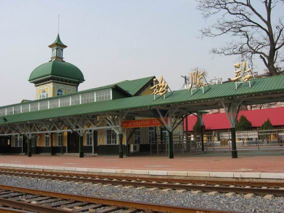
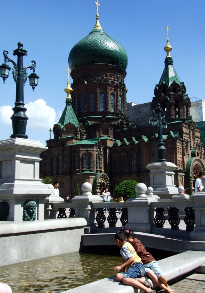
| | | | On the Chinese side, the operations are nothing like what the original Russian builders had planned, without break-of-gauge, to Vladivostok and later to Dal'niy/Dalian. All rail in Dongbei/the Northeast (ex-Manchuria) has been standard gauge since the Japanese converted it. However, the area is now one of the two main rail routes to Beijing. (The other is the Trans-Mongolian Railway, which cuts off earlier from the Transsib into Mongolia; after the break-of-gauge at the Chinese border, this route approaches Beijing from the west.) | | | | What can still be called the Transmanchurian route from Moscow still branches off at Chitá (see map), and reaches the Russian border crossing station at Zabaikalsk, the break-of-gauge. It continues on the Chinese side from Manzhouli to Harbin. The Moscow-Beijing through trains continue here south to Beijing. From Harbin there's the option to continue east to another break-of-gauge between Suifenhe and Ussurisk, which is back on the main route to Vladivostok. Some southbound service out of Harbin splits at Shenyang to provide service to Pyongyang. | | | | There is today no direct (emphasis on "direct") passenger service across the original route in Manchuria from Moscow via Chita and Harbin to Vladivostok because of the two breaks of gauge and two border crossings, with both Russia and China requiring visas. Yet it's possible to do it with enough will and enough patience, and remains as a challenge to history buffs and rail history buffs (I'm both, but decline the challenge). One has to understand that service is only twice weekly and involves changing trains, one has to be ready to be delayed at the two breaks of gauge along with two border crossings, and has to have one's visas ready. But it IS possible. | | | | The High-Speed Surprise Looking back at the high-speed rail map (Map by Alancrh) that we saw earlier, we have a surprise. In the tic-tac-toe of HSR routes, we look to the Northeast (click) and find that one of the new routes is the Beijing-Harbin HS Railway, which also connects Harbin with Dalian, and so we come full circle in the early 21C, but using HSR, with what the Russians were working at at the turn of the 20C. | | | | The Beijing-Harbin HS Railway is presently under construction and will run parallel to the regular-speed, original Beijing-Harbin Railway. The new route actually consists of two parts, the Beijing Shenyang HS Railway connecting to the Harbin-Dalian HS Railway. This latter one, the northernmost HSR line in China, is the world's first alpine HSR, operating at high latitudes and low winter temperatures. The trains can operate with snow on the line—there are heavy snowfalls in winter--and the tracks are fitted with de-icing technology. Still, trains will run slower in winter. The scheduled Harbin-Dalian time in the summer is 3h30, but 5h18 will be allowed in the schedule in the winter to make the 921 km (572 mi) run. | | | | Temperatures in the Northeast are extreme, varying from 40°C (104°F) in the summer to winter temperatures of -40°C (which, oddly enough, is -40°F), requiring specially-designed track. These extremes also cause frost heave, when ice expands the ground, then melts, causing shrinkage and distortion of the ground surface. For that reason, 70% of the new line is constructed on raised viaducts. But this was learned the hard way, after about 20% of the already-laid track built directly on the ground had become distorted and had to be rebuilt on viaducts, delaying opening the line by a year. | | | | Manchuria Today I am intrigued with the history of the former Manchuria, particularly the Russian connection. I remember when I was in Hakodate in northern Japan (2009/39) and visited the Russian Cathedral and was intrigued at having to leave one's shoes at the door, just as is done in a Japanese temple. I love that blend of East and West. Although Harbin is well off the beaten path, it and the rest or the region of former Russian influence apparently still has a lot to admire, especially architecturally. | | | | I've found a couple of examples of things I did not see, but wish to present. This is a view of the Lüshun Train Station (Photo by Manchurian Tiger), which the Russians knew as Port Artur/Port Arthur. It obviously dates from the Russian era, and I like the large Chinese characters in gold contrasting with the Russian architectural style. This is the entrance to the wooden building (Photo by kamakura), which is at the end of the branch line from Dalian and receives two trains a day from there. | | | | I've heard there's a lot of Russian influence in Harbin, largely the European architecture, but also the food. But I've become entranced with the saga of what is reportedly one of the most magnificent buildings in Harbin—and, from the pictures, I have to agree--the former Софийский собор (Sofiyskiy Sobor), or the Russian Orthodox
Saint Sophia Cathedral (Photo by Charlie Fong 冯成).
| | | | After the railway was completed in 1903, the cathedral was built in 1907, in traditional Neo-Byzantine style. As is typical, it was laid out in the form of a cross, and was topped by a huge green onion dome. But it was closed in the late 1950's, and its decline began. It was supposed to be destroyed during the Cultural Revolution, but it survived as an empty shell. Its windows were bricked up, and it was used as a warehouse for a nearby state-run department store, with shrubbery growing from its roof. | | | | Then it suddenly disappeared from sight and could neither be reached nor seen, when prefabricated concrete buildings were built on all four sides of it, coming almost right up to its walls. And thus it remained hidden for decades, right in the middle of Harbin. The surrounding buildings eventually included an auto body shop, a pen factory, and apartments for employees of the municipal government. | | | | Finally, in 1996, as part of a nationwide preservation campaign, it was named a national cultural heritage site. As people became aware of the "hidden" cathedral, donations rolled in from local businesses, corporations, and individuals to both restore the cathedral and to renovate the square around it. In 1997, the surrounding buildings were torn down, revealing both the cathedral and the square. | | | | The renovation of the European-looking square included adding a huge new fountain and renaming it "Harbin Architecture Square". At the same time, the former cathedral was turned into the Municipal Architecture and Art Museum. And this is the former cathedral today (Photo by Lin Yang). | | | | Personal Family History It was while writing this posting that I had an epiphany regarding the Russo-Japanese War, which allowed me to speculate, with some reasonable basis, about personal family history on my mother's side of the family. A lot of family history is unknown, perhaps unknowable, and "intelligent guessing" has to be a factor in formulating a picture. | | | | I've talked about my mother's parents before. I won't repeat that, but will include cross references to past discussions. My maternal grandfather was Антон Костеневич / Anton Kostenyevich (aka Kastonowitz) 1881-1954. My grandmother was София / Sofiya 1882-1952. In ● 2011/1 I made a passing reference to ROVA Farms (Ctrl-F: ROVA) in New Jersey, adjacent to which is the cemetery where they are buried. I elaborated further a few postings later, in ● 2011/5, where there is a whole section on the Russian background of my mother's side of the family. I pointed out that in actuality, the family was Byelorusian, even though we continue to generalize and call ourselves Russian, which is less complex to explain. The name we all used in place of "Grandpa", Dzyedka (Anglicized to Jetka) is typically Byelorusian and not Russian. We even discuss and illustrate Belorusian cabbage rolls. The family was from Minsk, the capital of Belarus. I just found out that, as in New Yorker, Londoner, and Berliner, the demonym for Minsk is Minsker. I also speculate on a possible explanation for the name variation of Kostenyevich to Kastonowitz, based on immigration information obtained from Bill Miller, the noted maritime historian, who I met and heard speak on several voyages, including about European emigration. He also was a docent at the South Street Seaport in New York, where I'm a member. In ● 2012/11, based on guidance from Georg Witschel, the former German Ambassador to Canada (now posted to Indonesia), who I met on the train returning from Churchill, I visited the reconstructed Ballinstadt in Hamburg (Ctrl-F: Ballinstadt), which included emigrant dormitories which I speculate Dzyedka might have used in preparation to sail in 1905 (my cousin Gary reports he understood it was 1907) from Hamburg to New York. I thought I'd seen 1905 on a now lost document, that also had the name of the German ship, which I do not recall. Some four years later he sent for his wife and daughter Manka, who we knew as Mary, the eldest of five daughters and the only one born in Europe. My mother was second youngest. | | | | Through "educated" speculation, I've been able to put together a semblance of route and time of emigration. I assume the reason for emigration was economic, and the usual hope for a better life. What I haven't been able to ascertain is why he chose 1905 (or 1907) to emigrate, and not a few years earlier or later. It was in writing about the Russo-Japanese war that I had the epiphany, by assimilating another family story into the equation, that I had thought was a mere curiosity, and never had thought to be of particular importance. | | | | The story my mother told me on several occasions is a bit bizarre. It always seemed to be an isolated incident not applicable to any other information. The story is this. Dzyedka served in the Russo-Japanese war. (Gary reports he may have been a prisoner of war.) He was awarded some "medals". Once in America, and especially after he'd had a couple of drinks, he would go on and on bragging about his "medals". Finally, my grandmother, otherwise the quietest, most unassuming woman I may ever have met, had had enough, and, according to my mother, "threw the medals in the garbage". | | | | Let's peel back the layers of this story in reverse order. Might the medals ever have been retrieved from the garbage before it was too late? I don't know, but probably not. Baba apparently wanted to make a point, and certainly did, although I have no idea to what extent it might have helped. Secondly, I have to be a bit dubious about these "medals". I've looked up online and have found pictures of Russian medals awarded for the Russo-Japanese war. However, Russia apparently seems very liberal in awarding ribbons and medals. If you've ever seen pictures of old Russian soldiers at Russian military parades, most of them have an impossibly large chestful of ribbons and medals. Might Dzyedka have only gotten some service ribbons, or did he perform a heroic act of some sort? We'll never know, but I feel the importance of these medals can probably be considered relatively low-key. But the value of this story of throwing away "medals" is in the fact that because of the story, I know Dzyedka served in the Russo-Japanese War! I suspect that without this unusual story, I never would have heard that fact. It's amazing how much information does NOT get handed down between generations if there isn't a special reason to do so, such as this story. So what does his military service tell me? | | | | The Russo-Japanese War ran from February 1904 to September 1905. Dzyedka would have been a young man of 23-24. I think it's reasonable to speculate that he'd never been away from Minsk until he was called into military service, and also that he probably traveled eastward, then back home, on troop trains on the Transsib, since there would have been no other way to get there and back. I thought of that when I posted the 1903 picture above of a Transsib train—he could have almost been on it. Where could he have served? Harbin? Dal'niy/Dalian? Probably not Vladivostok, but who knows? | | | | We also don't know when he was sent back home from the front, but we do know that there was turmoil in Russia due to displeasure with the war, which is referred to as the Revolution of 1905, a prelude to 1917. It's a reasonable assumption then, that he decided to emigrate in 1905 (or shortly afterward, in 1907), having just been uprooted from home for military service and having traveled a long distance away, and then finding political unrest at home. My writing about the Russo-Japanese War brought this story to the fore, and has allowed me to speculate on something I'd been wondering about. | | | | It's fitting that I give equal time to my father's side of the family, although the only parallel I have is that they emigrated from Italy at about the same time as Dzyedka did from Minsk. I never had had more than a bit of information on details, although I've just been gathering a lot more from my cousin Joe, on the other side of the family. The emigrating generation was proud of the town they came from, but I only recall my father telling me it was near the provincial capital of Benevento. It was only when I asked my father's sister, my aunt Vicky, Joe's mother, that I found out they had come from Paduli. I made it a point when in southern Italy to drive into Paduli—read the short writeup in 2003/7—and I know that my cousin Joe, Vicky's son, also visited Paduli a decade earlier in 1993 (with return visits, and more planned), so that must be some sort of a generational record for the family. It was a small, dusty town, but easy to picture and remember. When we were in Minsk, it was too large a city to bond to. | | | | Paduli's Wikipedia listing—yes, it has a short one—reminds me that it's about 60 km (37 mi) northeast of Naples and about 9 km (5.6 mi) northeast of Benevento. The listing also indicates that http://www.comunepaduli.gov.it/ is the website for the comune (municipality) of Paduli—if you're interested (it's in Italian). | | | | Much more interesting, and a personal gold mine, is the Wikipedia indication of the website called "Paduli in America", which you can copy and paste in another window if you like:
http://www.paduli-in-america.net/home.html
It's primarily in English, and I suggest you take a look. The subheading on the home page says "IN ONORE DELLA PRIMA GENERAZIONE", or "IN HONOR OF THE FIRST GENERATION", which is a nice touch. The site is for maintaining contact among Padulesi abroad (the Padulese diaspora?) and between them and the town. At least I now know the demonym for Paduli is Padulese (pa.du.LÉ.zé), making me simultaneously a Minsker and Padulese, at least by heritage.
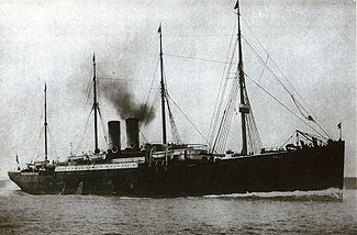
| | | | Look at the home page and read about the fact that many who came thought they'd return. While some did, most didn't, settling in locations in New York State and in Pennsylvania. Read also about the pride among the emigrants who in 1949 donated a bronze plaque with many of the emigrants' names to a church in Paduli, along with an organ. | | | | Click on Home again, then Plaque, and you'll see a photo of this plaque. In the third column, fourth name, you'll see the name of my grandfather, Vincenzo DiNapoli, after whom I'm named (My middle name is Anthony, after Dzyedka Anton). In the fourth column, 23rd name, you'll see Giuseppina DiNapoli, my grandmother. My cousin Joe helped me find the names of my Grandmother's three brothers and one sister, and my Grandfather's brother and cousin. | | | | Click on "Paduli in Australia" and find out about the Padulese club in Campbelltown, northeast of Adelaide. Click on "Paduli Assoc" and find the World Padulesi Association, established by the town to maintain contacts. You needn't click on "List", since it gives pages and pages of records of arrivals, which I've already checked out for family names. | | | | Because of this list, I now know that both my Italian grandparents sailed to New York from Naples on German ships. (!!!) More specifically, they both sailed on Norddeutscher Lloyd / North German Lloyd ships, separately, since they met and married in America. My Grandfather, Vincenzo DiNapoli, who had been a carabiniere (member of the military police) in Italy, was 28 when he sailed in 1904 on the SS Prinzessin (Princess) Irene. He arrived in New York with $9 in his pocket (I always wondered how people knew that, but I see now that it was recorded in the immigration records at the time). He sailed on 23 September and arrived on 5 October, making it a 12-day crossing. He first joined his brother Angelo on Mulberry Street in Little Italy in Manhattan (I never knew of any family connection to Little Italy), before establishing himself in Brooklyn, eventually on the Atlantic Avenue location I knew as a child. | | | | The SS Prinzessin Irene was a Barbarossa-class ocean liner built for NGL in 1899. In 1903, she started regular service on the Genoa-Naples-New York run, where she primarily remained. When the US entered WWI in 1917, she found herself in New York, where was seized by the US for conversion into a troop transport for the Navy and renamed the USS Pocahontas. She saw service in WWI carrying troops to Europe and back; the picture shows her taking troops home in 1919. When decommissioned, she was sold back to NGL for mercantile service and renamed the Bremen. She was broken up in 1932. | | | | My Grandmother, Giuseppina Fantozzi, came over the previous year, 1903, on the SS Lahn, at age 25, arriving some nine months before her future husband. This crossing also took 12 days, from 25 November to 7 December, a rough time of year to be on the North Atlantic. I know, because in 1971, we sailed from Genoa to Boston, a very similar run, on the Yugoslavian Freighter Tuhobić, which took 13 days from 5-18 November, with rough weather. | | | | The SS Lahn was one of eleven NGL ocean liners named after German rivers, so the group was named the Rivers class. The first, and the only one I have a picture for (scanned from a postcard), was the SS Elbe (1881). They were improved over the years, the 6th, 7th, and 8th ones being made out of steel and known for their speed. The 9th of the eleven was the SS Lahn, which entered service in 1888. She was larger and faster still, and was the last single-screw steamer to hold the speed record for the English Channel. The Lahn, like the others, had four decks, the lowest two for cargo, the third for steerage passengers, including my Grandmother, and the top deck with cabins. When Mark Twain sailed on the 11th and last ship in the Rivers class in 1892, he declared it delightful, and published an essay comparing German steamships favorably to others. Still, even if she were aware of his essay when she sailed 11 years later, I doubt it would have impressed my grandmother down in steerage on the Lahn. | | | |
| |
|
|
|

