|
Reflections 2018
Series 7
August 4
Paris V: Canal Saint-Martin – Axe Historique de Paris – 8 October 1961
| | Canal Saint-Martin As recently mentioned, today we'll travel on the Canal Saint-Martin through the heart of Paris. It's ironic that we should be finally doing this Paris canal cruise right now, since right after our stay in Paris we'll be traveling in Burgundy along the Canal du Nivernais on the hotel barge Luciole. Both will prove to be very enjoyable experiences, but are very different from each other.
| | | | We got a preview of this cruise in the last posting when the tramway traveled through the area of the junction of those three canals. The bothersome thing for me is the lack of complete information I'd been given all along. The cruise line basically did a good job, but emphasized what it was selling, the Canal Saint-Martin. At no time did they explain we'd also be sailing on the Canal de l'Ourcq. Perhaps they thought that would "confuse" the tourists. Well I'm no tourist, I'm an interested visitor, so let me start from scratch, based on some pre-trip, but mostly post-trip online research. Needless to say, I find my presentation more complete and more intellectually satisfying than the cruise company presents to their tourists.
https://www.french-waterways.com/waterpress/wp-content/imagez/Paris.jpg
| | | | It's all about the Ourcq. I find Ourcq a pretty word, despite its weird spelling. (Say "TOUR", drop the T-, add a –K, to get OURK.) The Ourcq River (see above map) is an 87-km-(54 mi)-long tributary of the Marne, not of the Seine, though the Marne does flow into the Seine later. The above map shows that the Ourcq flows (used to flow?) into the Marne after Lisy-sur-Ourcq, but that's the point where the canal was built to divert the river and bring fresh water to Paris. I believe the river itself was also canalized above that. It was Napoléon I who, from 1802 to 1825, had the Ourcq Canal and its sub-canals built to use the river to supply water to Paris, and it continued doing so until Haussmann restructured Paris. It was also used to supply grain, building materials, and other goods. Two ports were created at the Paris end to unload the boats, the Port de l'Arsenal near the Seine and the Bassin de la Villette further inland. But by the 1960s traffic had dwindled and the Canal Saint-Martin was almost filled in and paved over for a highway. | | | | This map makes it clear that it's the Ourcq up to the Bassin de la Villette, with the other two sub-canals being mere branches, and secondary to it. The Canal Saint-Denis takes off just before the Bassin de la Villette and the Canal Saint-Martin takes off from the far end of that basin, something not made clear during the trip. Now things should be clearer when we see this detail of the junction of the three canals (Map by David-waterways). You can also see it's the job of the two smaller canals with numerous locks to lower the water level coming in from the Ourcq to the level of the Seine, at two different locations. So again, it's really all about the Ourcq.
https://uk.tourisme93.com/Local/tourisme93/dir_img_uk/Canal/canal_saintmartin/canal_saint_martin.gif
| | | | The Canal Saint-Martin (above) is 4.6 km (2.86 mi) long and 27 m (88.6 ft) wide. The delightful thing about it is that for close to half its length (2.069 km/1.29 mi) it's in a tunnel! The tunnel was built in 1860 by Haussmann—who else—and there's parkland above. The 8 m-(26 ft)-wide tunnel has the same, graceful vaulted ceiling we've seen in the Métro stations. The tunnel ceilings are pierced periodically by oculi for lighting and ventilation. An oculus is a skylight, as is famously found in the Pantheon in Rome. The above map shows the actual length of the canal, though the cruise, as said, goes further into the Ourcq itself. For a preview, you see the Port de l'Arsenal where we enter, then go UNDER place de la Bastille (!) into the Voûte (Vault) de la Bastille, followed by the Voûte Richard-Lenoir and the Voûte du Temple. After exiting the tunnel there's a charming area of scenery and locks, then we pass the Rotonde de la Villette and we spoke about in the past as we enter the Bassin de la Villette, after which we're actually in the Canal de l'Ourcq up to the Parc de la Villette. There are four double locks and one single one (at the Seine), and two ponts tournants (swing bridges). From the Seine, the Canal Saint-Martin rises 24.5 m (80.4 ft) up to the Ourcq.
http://www.canauxrama.com/images/plans/plan_situation_canal.jpg
| | | | To visualize best just where in Paris the Canal Saint-Martin is located, we have this map from the canal company I didn't use Canauxrama. (I have to correct their misspellings: Chaumon is Chaumont; Luxemburg [Germanic spelling] is Luxembourg [Latinate spelling].) Canauxrama only tours within the canal. I chose Paris Canal, whose tour starts earlier, at the Musée d'Orsay (see map), not only offering a substantial ride on the Seine, but also the chance to actually enter the canal from the Seine. This map also gives a preview of the Axe (Axis) Historique de Paris, our stop later today—follow the line of symbolic trees from the Louvre to La Défense. | | | | Day 4 Th7 (First Part) Canal St-Martin Since I wanted a specific morning tour on a specific day, and wondered how busy they'd be so close to the end of the summer tourist season (they weren't), I bought my ticket online before leaving home. Instructions were to arrive at the Musée d'Orsay, then go down to the Seine opposite the museum at the Quai Anatole France, to rendez-vous (this was in French) by 9:30 for a 9:45 departure (lasting 2h30 to 12:15). The Métro map (link reissued below) shows this location perfectly, as well as the route to get there: RER C once again from Boulainvilliers to Musée d'Orsay. We'll also reissue our attractions map for your reference, as it shows the route as well.
https://parisbytrain.com/wp-content/uploads/2014/01/paris-metro-geo-2014.pdf
https://parismap360.com/carte/image/en/paris-attractions-map.jpg
| | | | This would be the only time I'd be leaving Passy from a station other than La Muette, and I was concerned about it. Firstly, I'd been keeping an early morning schedule since arrival, unusual for me, but I also knew the RER trains came less frequently than the Métro, maybe every 15-20 minutes. So I allowed a lot of "fat" in the morning schedule, and found myself arriving at the Musée d'Orsay over an hour early. Still, I went down from the beautiful museum building to the very broad quay (Photo by LPLT/Wikimedia Commons), actually an esplanade along the Seine, walked a bit west to where I saw the name of the company, and sat down on a bollard (they're so handy) to pass the time. | | | | | | While the boat in the picture (click) is not ours—it seems to be a dinner cruise—ours was located about here. Writing this, I got curious. I learn SO much more after-the-fact. I remember what our boat looked like, but didn't note the name, so I just went to the Paris Canal website and find they have three boats, all of which can be outfitted as large party boats. I found my boat--it's a petite 25 m (82 ft) long. It's their smallest, and I see that the name was the Martin-Pêcheur. My first thought was that they named it after the canal, but if you know any French, you know that the other word has two WILDLY different meanings. A pêcheur is either a sinner (!), or a fisherman. The latter sounded more likely, but things still didn't seem quite right so I looked up the entire word online. To my amazement, a martin-pêcheur is a kingfisher! I had no idea while I was on the boat! The things you learn, especially after-the-fact! (As it turns out, in English, too, a martin is a sort of a swallow, possibly named after St Martin's day, when they depart for the season. So the French name martin-pêcheur is structured in the form of a "fishing martin".)
I even found a picture of the Martin-Pêcheur (Photo by patrick janicek), though as we see it, we have to momentarily jump ahead in time, since it's shown on the canal. Click for detail. You see the large main cabin where the guide made announcements in French and English. Behind was a little terrace, and it also had a an open upper deck. While everyone scurried upstairs, it was September and the movement made it breezy, so most of the time the mid-sized group sat downstairs. But we went up for a bit when in the tunnel. And note the bollards, which always make good seats in a pinch.
|
| | | | Back to the quay. Actually, the time spent waiting for the crew to arrive and open up the boat was most pleasant. Morning joggers were hoofing it down the quay, the weather was pleasant, the view ideal. Where else would one want to sit and enjoy life? From the Métro map it's easy to see that the view across the river is of the Tuileries Garden and the Louvre. It was only a slight disadvantage that, from the river's edge, the view was so upward that you saw only the upper parts of the trees in the Garden and the Louvre, and that continued as we went along the river. | | | | Anyway, our boat turned out to be double parked, so we were led across the nearby boat to enter it. The guide sold tickets on the spot, and of the 25-30 people only four of us had pre-paid—but better safe than sorry. On the Métro map you can see our Seine route perfectly. We passed all the famous bridges, including the Pont des Arts and the Pont Neuf. We went along Cité, past the Quai des Orfèvres we spoke about, and got that sharply upward view of Notre-Dame, then saw the Île Saint-Louis with its many residential buildings. Just after that, we were ready to turn left into the canal when I noticed there were bridges over the canal entrance. I just assumed it was a road bridge along the river, but only later, when I wanted to do something special on Métro line 5, did I realize that there was also a rail bridge there. Thus, we're going to pass this actually quite unusual canal-Métro intersection now by water and on Day 6 by rail. So now, our boat turns into the canal just before the Quai de la Rapée Métro station. | | | | This is the river view at the canal entrance (Photo by David Monniaux). If you hadn't known the entrance was there, you might have missed it. The shore road, and another road, cross it on bridges, but on the right is the Métro station, and trains from there use a third bridge between the two road bridges across the canal entrance. Here we are just at the entrance (Photo by Mbzt), which has a lock immediately behind the road and rail bridges. From one of the road bridges, this is a view outward toward the Seine (Photo by Tangopaso) of a Métro line 5 train crossing the canal lock. Other than that you can see the Seine, it has to be outward because of the direction the gate is facing, always toward the pressure of the water flow.
http://www.boating-paris-marindeaudouce.com/wp-content/uploads/itinerary_canal_saint-martin.jpg
| | | | We'll use this map to start with. You see (click) the names of the two road bridges, and also that the single lock (with two pairs of gates) we just passed is lock 9, or Écluse 9 de l'Arsenal, since we're entering the first of two basins, the Port de l'Arsenal (Photo by Ed Ogle), named for an adjacent former arsenal. As you can see, the basin is used today as a marina for pleasure craft. | | | | But what a view ahead! You see ahead the entrance to the vaulted tunnel we're about to enter, the first part being called the Voûte [Vault] de la Bastille. But more spectacular is that we'll actually be under the Place de la Bastille, which we can see, with its column. We'll visit here on Day 5. | | | | | | You may think, as I did at first, that the column commemorates the fall of the Bastille in 1789 during the Revolution, but you'd be wrong. As you know, it's hard to keep track of all the changes in French history without a scorecard. Fortunately, we provided such a scorecard in 2017/18. If you consult that, you'll see there were three governments (including Napoléon I's) between that more famous revolution and what is called the French Revolution of 1830, the Second French Revolution, or the July Monarchy, a liberal government that lasted from 1830 to 1848. Therefore, the column we're seeing is called the Colonne de Juillet (July Column). Yes, it does commemorate a French Revolution, only it's the second one. If you look at the column very carefully, you can read "Juillet 1830". |
| | | | Before we duck into the darkness, there's one more thing to note. There are three Métro stops under the Place de la Bastille (see Métro map) and the openings you see straight ahead below street level are part of the open-air Bastille Métro station of line 1. Right above the tunnel entrance you can see people waiting for a train. This is roughly the reverse view (Photo by Coyau), from the platform towards the basin is to the right. Click to see the stone walls of the canal, which are visible where it says Port de Paris Arsenal. It's rare for line 1 to have an outdoor station, but here the line rises to cross the canal. With the Métro knowledge we now have, we can recognize the platform walls and doors, the rollways for the rubber wheels, and on the left (at least) the cables for driverless operation (perhaps that was just being installed at the time of the photo).
https://adamsonfamilydotnet.files.wordpress.com/2011/08/img_1486.jpg
https://files1.structurae.de/files/350high/3076/dscn4944.jpg
| | | | Connecting to the Voûte de la Bastille is first the Voûte Richard-Lenoir, then the Voûte du Temple (see canal map), Haussmann covering this part of the canal three different times, years after it was built. The first picture shows what it's like, and you can estimate where the oculi are by looking at the water ahead. The second picture shows an oculus directly. But even better is this YouTube video (0:43) of the tunnel ride with oculi. | | | | Though I've never been in the linear park above the tunnel, this is a section of the park along Boulevard Richard-Lenoir (Photo by Patrick Nouhailler's…) showing two oculi from the outside. Otherwise, Boulevard Richard-Lenoir itself (Photo by Clicsouris) straddles the park on two sides, this view being a few blocks north of Place de la Bastille. | | | | Boulevard Richard-Lenoir If it seems I'm talking a lot about this street it's because the name has been familiar to me for some time in connection with the Inspector Maigret detective novels of Georges Simenon. In 2017/18 I wrote, regarding the street and building on Cité: The other location in Paris that constantly comes up in the Maigret novels is the Boulevard Richard-Lenoir, where Maigret would stroll with Madame Maigret every evening after dinner. When we take the Canal Saint-Martin cruise later, on the Seine we'll pass the Quai des Orfèvres and on the Canal we'll pass the Boulevard, which is the closest I've ever come to visiting either. | | | | So here we are, under that road. If you look at our canal map, I can say that the Boulevard Richard-Lenoir (R-L) runs from the top of Place de la Bastille to Avenue de la République, meaning the Voûte R-L is by far the major one, and the other two just cover short distances. R-L, along with the tunnel, is the work of Haussmann. Simenon has Jules Maigret living at 132 Boulevard R-L, which is on the east side of the east lane of R-L in the last block before République. Remember, looking for Maigret sites in Paris is similar to looking for Sherlock Holmes sites in London (though surely not quite as popular). I find online that this is that building:
https://www.voyage-insolite.com/files/2014/07/132_boulevard_richard_lenoir.jpg
| | | | That Hyphen Yet I continued to be intrigued about that name, Richard-Lenoir, especially that hyphen. It seems to be named after an individual, but why hyphenate his first and last names? Well, there's a lot more to it than that, and I find the background story, which is available only from gleaning online French biographical information, highly interesting. Simply put, it superficially seems to be named after two people, but it's not. It's one person. First let's see the superficial story, then you can see if you see a subcontext, as I do. | | | | One is told that the boulevard is named after François Richard and Joseph Lenoir-Dufresne, so it seems to be named after two people. They were industrialists who brought the cotton industry to Paris in the late-18C and early 19C and manufactured textiles. I rarely give dates with people, but it's appropriate here: François 1765-1839; Joseph 1768-1806. | | | | They met in 1790 when they both found themselves bidding at an auction for the same goods. They decided to form a partnership and go into business together, starting with jointly purchasing the same goods they'd just been bidding on. Calculating from their dates, when they met in 1790 they would have been ages 25 and 22, respectively. | | | | Joseph died young, suddenly, from a fever, at age 38, when François was 41. Joseph was greatly admired by the workers in their factory, and his untimely death was taken very, very hard by all, with barely a dry eye at his funeral. He then would not live long enough to become as famous as François would. But in any case, as the story goes, Joseph had a deathbed wish. He asked his associate never to separate their two names. Faithful to his memory, François continued their joint enterprise, and published his memoirs, under the new name François Richard-Lenoir. He became the richest man in the 19C (I presume that's limited to France), living to age 74. Thus we see that, in actuality, the boulevard is named just after one person, François, with merely a hint of Joseph. | | | | That's the official version, and is a poignant story of friendship. But let's think about it. Who changes his last name for the rest of his life because a business partner asked him to? Who would do it even for a very close friend? Unless that friend were very, very close. It's again just speculation with no known basis in fact, but the story becomes even more poignant if, perhaps, it had been sanitized back in the day and the two were primarily life partners as well as business partners. Does that hyphen in Richard-Lenoir foretell couples hyphenating their surnames today? We'll never know. But I do know what I choose to believe. | | | | Back to the boat. The Martin-Pêcheur comes to the end of the tunnel and we exit its north portal. The canal map shows three pairs of lock gates, meaning we're at a double lock. Having just left the Voûte du Temple, we're at Écluses 7 & 8 du Temple (Photo by Boerkevitz), with the upper lock (7) in the foreground and the lower lock (8) hidden behind it as we look back at the tunnel portal. I also believe the trees along the canal are marronniers (chestnut trees). | | | | We pass several passerelles (footbridges), then come to the Pont Tournant de la Grange-aux-Belles (Photo by Jean-Marie Hullot), shown here looking back south from its adjacent passerelle. We said earlier there are two such ponts tournants on the canal. They are literally "turning bridges", though they're called swing bridges in English. We then switch the view to look north, and see the swing bridge again, but with the Passerelle de la Grange-aux-Belles now behind it (Photo by Patrick Nouhailler). As usual, both structures are named after the adjacent street, here the Rue de la Grange-aux-Belles, which in turn is named after a former farm. The name means "Barn of Beauties", but don't get too excited. My guess is, it probably refers to cows. | | | | You'll note from the map that right after these two structures come another pair of locks, Écluses 5 & 6 du Récollets, named after an order of monks, followed by the Passerelle Bichat. This is a composite view taken looking back downstream from Bichat (Photo by JLPC/Wikimedia Commons/CC BY-SA 3.0). It shows a boat in the upper lock (5), the lower lock (6), the previous swing bridge (click) and passerelle. | | | | You've noticed that each flat area of water between sets of locks is referred to as a bassin (basin), which are in addition to the two major ones. At one point or another, the canal levels out to appear just at street level, with pedestrians and cars only a short distance away on either side. We then arrive at a gruesomely-named pair, the Locks of the Dead, the Écluses 3 & 4 des Morts. This is apparently the lower one of the pair (4) (Photo by Jmpoirier1) as water is rushing in to fill it from the upper one upstream in the back. The macabre name is due to the former nearby location of the sinister but famous Gibbet of Montfaucon. | | | | | | I never got the gist or significance of this story on the cruise, not even from the English explanation. I assume you needed more background in the subject matter than I had at the time. I've since found out what I need to know.
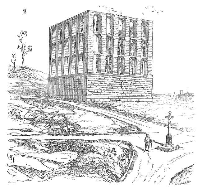
We know a gallows is where people were hanged. I now understand that a gibbet is where people were not only hanged, but put on public display as a warning to the population, sometimes brought over from elsewhere. They could have been left on display for varying periods of time, up to several years. The Gibbet of Montfaucon ("Mount Falcon") was the main gallows and gibbet of the Kings of France. It was first built in the late 13C and used until 1629, then finally dismantled in 1760. There are various renderings of it, but it apparently had three sides and 45 window-like openings for display. One rendering had it possibly looking like this.
Throughout the middle ages, its location was well outside the city walls (we've seen plenty of THEM!) and out in the countryside. It's been judged that the large structure was at the top of a small hill, the Butte de Montfaucon, near the modern Place du Colonel Fabien, but the hill is now covered by a housing development. On our canal map, the Place du Colonel Fabien is that oval just to the right of these locks. This view looks from one of the Locks of the Dead up toward what once was Montfaucon Hill (Photo by Traktorminze).
|
| | | | We can insert here a short (0:36) time-lapse YouTube video of a boat traversing one of the double locks (I don't know which one). Since gates always point upstream to better hold back the water, this boat is going downstream. Anyway, it's being lowered, which is the other clue. | | | | We then go through another short tunnel, the Voûte la Fayette, before reaching our last lock pair, Écluses 1 & 2 de la Villette (Photo by Stockholm), seen here looking back to the tunnel portal. We are not at the end of the cruise, but we are at the end of the Canal Saint-Martin, a point not made clear onboard (for fear of confusing us?).
http://canalsofparis.com/Resources/Villette-map.gif
| | | | Replace our canal map with this one, since we now enter the other big basin, actually the terminus of the Canal de l'Ourcq, the Bassin de la Villette (Photo by Traktorminze). As we do so, we look very, very sharp to the left (see new map), almost behind us, and see the Rotonde de la Villette (Photo by Coyau). We discussed this rotunda in 2017/7 as being a very well-preserved part of the Wall of the Ferme Générale, and the most imposing, used by tax agents to prepare taxes. Today it's a restaurant and modern art gallery. Again, the Métro is right behind it, and we'll pass by it again tomorrow on line 6.
| | | | Though this Bassin is spacious, it doesn't have the same sort of charm we've been seeing. From its center, we look back and see the rotunda (click), then look forward (click) and see something unique, the very last lift bridge remaining in Paris (Both photos by Traktorminze). We are approaching (see map) the Pont Levant de la Rue de Crimée (Photo by Emmanuel LEGRAND), or the Crimea Street Lift Bridge. This view is looking north with the bridge in the up position, just as we pass it, and its passerelle is visible behind it. We then turn around and look back, and see the graceful Passerelle de la Rue de Crimée (Photo by Pline), with the lift bridge in the down position. The bridge was put into service in 1885, and still has almost 9,000 maneuvers per year. When built, it was the third lift bridge erected in France, while today, it's the last one in Paris. The bridge and footbridge are registered historic monuments. | | | | As the map shows, we are now definitely on the Canal de l'Ourcq. We pass the junction with the Canal Saint-Denis and are in the Parc de la Villette, our last stop. While we still have something to do in this area, it will be of interest to now look at this YouTube video (5:53) of a cruise on the Canal Saint-Martin. Just be aware it's the reverse of what we did, going southbound from Bassin de la Villette to Port de l'Arsenal—and the music is very atmospheric.
0:15 lift bridge rising at the Rue de Crimée
0:48 Rotonde de la Villette with a Métro train passing behind it
0:57 the adjacent double lock at la Villette, with the same Métro line crossing
4:09 streets on the same level as the canal
4:55 under the graceful voûtes with the oculi
5:25 leaving the tunnel while still under the Place de la Bastille and its Métro station
5:29 entering the Arsenal marina, then turning around to see the July Column on Place de la Bastille
| | | | Unfortunately, the last stop on the cruise turned out to be a place where I didn't want to spend time. The Parc de la Villette (Map by Paris 16) was built in 1984-7 as an urban development project on the abandoned site of the huge Parisian slaughterhouses and wholesale meat market that Napoléon III had ordered built in 1867. The boat let us off at that first bridge over the Ourcq (see map) and I felt immediately I didn't like it. It's claimed to be one of the largest concentrations of cultural venues in Paris, including Europe's largest science museum and three major concert venues. It looked to me a little like a poorly-planned amusement park. It's not just me—there has been much criticism of its "innovative design". It's based on "architectural deconstructionism" which seems like a euphemism for "bad design". There's little concern with human scale and the open space seems to "challenge the expectation that visitors may have of an urban park." The designer has referred to it as a non-place (so you know you're already in trouble). I consider it a non-park, and was glad to get away from it. I crossed the bridge over the Ourcq and hastened down along the Saint-Denis to the exit. | | | | Go back to the Métro map and northeastern Paris, to the area around the Porte de la Villette, and southwest of it, where we are now. (This whole neighborhood, after which so much we've seen has been named, was one of the communes taken over in its entirety when Paris expanded in 1860. The name Villette is structured something like "Village-ette" or "Town-ette".) I knew my preplanned destination wasn't far. I crossed the Saint-Denis and zigzagged to Rue Gaston Tessier just before Rue de la Crimée. I was in front of the embankment that carried the RER E. I was looking for something that's so new that it isn't on the Métro map, or many other maps yet. As I faced the embankment at this point, I was looking at the new Gare Rosa Parks (Photo by Bmazerolles). | | | | This, the RER E, is the newest and shortest RER line. It comes in from the eastern suburbs, and is incomplete, only going to Haussmann-Saint-Lazare. It's to be extended to the western suburbs by 2020. We said the urban purpose of the RER is for more service within the city, and so it was decided another station was needed between the widely-spread-apart stations of Pantin and Magenta (see map). To build the station, they dug into and through the embankment in 2015, giving the Gare Rosa-Parks a north and south entrance. We just entered from the south, and to the north is the tramway stop Station Rosa Parks. We'd said it wasn't named after a street. It was named after the RER station, and the tram's route bends to come closer to the north entrance. As an example of the esteem Rosa Parks is held in in France (and elsewhere), there are 17 schools across France that bear her name, something extremely rare (rarissime) for a foreign personality. | | | | In the station, there are long escalators that bring us up to the platform level (Photo by Geralix). On a center platform like this, an RER train nevertheless still arrives on one's left. It's a little hard to tell, but RER E trains are also bilevel, so I struggle down below to find a seat. But RER stations are spread apart, so we cross the rest of Paris stopping only at Magenta before Haussmann-Saint-Lazare. At that big station with two hubs, we make our way in two minutes to the other hub, Saint-Lazare, where we can get a line 12 Métro train to go two stops to Concorde. We will not exit the station at Concorde, as our goal here is to celebrate the Axe Historique de Paris by using the ultra-modern Métro line 1. | | | | Axe Historique de Paris I have a feeling that a good number of people, including those that have visited Paris, remain unaware that so many of the major sights—the Champs-Élysées, the Louvre, Place de l'Étoile—are, somewhat surprisingly, all lined up in a row. This lineup is not an accident. We said that so many straight lines—the boulevards--are Haussmann's doing, but this one was already there, and he only added to it, like designing the Place de l'Étoile ("Star Square") and the star-like streets radiating from it. All these buildings, monuments, boulevards that line up create a Historical Axis in western Paris, the Axe Historique de Paris. The attractions map shows this very well, but so does the Métro map.
| | | | I've seen the claim that it was the laying out of the Champs-Élysées in the 17C to provide a western vista that was the start of the Axe Historique. I disagree. While that certainly added to the growing vista, I say it started with the Louvre, which was always oriented westward because of its location along the Seine, since the Louvre was at first meant to protect Paris from invasions coming upstream on the Seine from the west. | | | | I refer you back to 2017/17, where we discussed the circular walls around Paris. We showed a map of Paris circa 1180 . . . Note the clearly identified Château du Louvre to the west, well outside the older city walls. Its use as a fortress against invaders coming upstream is apparent. Click to find it, and note how from this early date, the Louvre, located well outside Paris, was a bastion oriented to the west. We then added that we move up several decades to 1223, and see that the . . . Louvre is now right outside this wall . . . But always oriented to the west. | | | | We've recently seen again this map of Paris in 1380 (Map by Cédric Roms). . . . the Louvre is now, for the first time, inside the walls and has lost its function as a fortress. Charles V transformed it, between 1360 and 1380, into yet another royal residence, and in later centuries, it would become the art museum it is today. . . . But do notice the original shape of the Louvre, a square, built around the Cour Carrée ("Square Courtyard"). All later extensions went westward from this original structure. | | | | The origin of the Louvre dates to 1190, when King Philippe Auguste had a fortress constructed to protect Paris from the west. The name first appeared as of 1204. There are a number of theories as to the origin of the word Louvre. The most compelling, in my opinion, center around the word loup (LU), or "wolf". I've known that word for some time, but I just now learned that the feminine form is louve (LUV), or "she-wolf". | | | | Now the theories go that there were many wolves in this area and that the first Louvre fortress was built on the site of a louverie, now an antiquated word. A source I found online wants to tell me the word refers to an engeance de loups ("brood of wolves"). Poppycock. Don't believe everything you read. If that IS a possible meaning, it makes no sense here. So I then found another definition, that it's a lieu abritant les équipages employés à chasser le loup, ("place housing crews used in wolf hunting"). Now that makes sense. You'll recall that the Château de la Muette in Passy was also built for hunting. | | | | Finally, let's make that outdated word a little more familiar. English words ending in the suffix "-ery" often indicate a place: cream/creamery, bake/bakery, bean/beanery, bind/bindery, brew/brewery, can/cannery. French words ending in –erie sometimes indicate a place: crême/crêmerie, fromage/fromagerie, concierge/conciergerie. Unfortunately, English and French don't always match. While a crêmerie matches "creamery" a fromagerie unfortunately doesn't have a corresponding *cheesery; we have to call it a cheese shop instead, and a conciergerie is not a *conciergery, but a "concierge's lodge". Bummer. | | | | But once we know the relationship, we can hypothesize to our hearts' content. Look at our word louverie, based on the word for "wolf", and see that we can call it a *wolfery. Even though that's not a real English word, we can understand that a *wolfery is the place out of which wolf hunters work, and keep their equipment. And from louverie developed "Louvre", so we understand better the origin of that name. | | | | | | Now that we understand this concept, we really have to take this one more step. We'll see in a moment that, adjacent to the Louvre used to be the former Tuileries Palace--and the Tuileries Garden, which still exists. It's the same concept. A tuile is a tile, and so a tuilerie we can now call a *tilery, that is, a place where tiles are made. In the 13C, the land where the Tuileries Palace was built had had tile-making factories on it, and so the palace took that name, in the plural, equal to *Tileries. So now when you picture the two adjacent buildings, the Tuileries and the Louvre, you historically have the *Tileries and the *Wolfery, both named for what used to be there. |
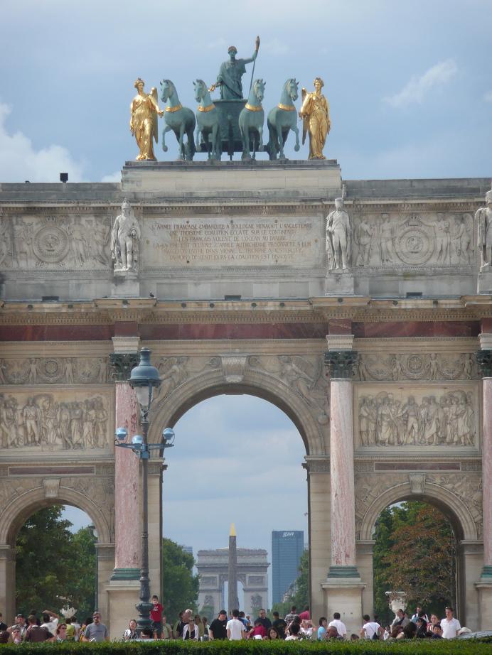
| | | | Our period maps of the Louvre all showed the original square building. Then in 1564, construction started on the now-gone Palais des Tuileries a good distance west of the Louvre (everything is oriented to the west!). Its Garden, the Jardin des Tuileries (still there) was laid out further west still. Then the oddest thing happened in this drive west. A long narrow connecting structure called the Galeries du Louvre was built along the Seine connecting the Louvre with the Tuileries! I wouldn't believe it either if I didn't see it, so let's look at this map of the Louvre area in 1739. | | | | Orient yourself, because the view is to the southeast, so the westward expansion is roughly coming toward us. Click in the upper left to see the square building, labeled Vieux Louvre, or Old Louvre. Closer to us are many intermediate buildings and streets, but along the river is that long gallery, connecting to the south end of the Palais des Tuileries. Closer still is the Garden. | | | | Now look at the Louvre at its greatest extent. This has north at the top. If you disregard the north wing and the blue pavilions, almost all the dates of construction are in the 1500s and 1600s. You can then tell that in the 1800s, all those houses and streets in between were cleared away, a north wing was added to complement the old south wing along the river, and the blue pavilions were added. | | | | We have this 1850 painting showing the eastward view from the Garden. Click to see the Tuileries Palace, the inner courtyard, the two "arms", and the Louvre proper in the back. Note in the courtyard for later reference the mid-sized Arc de Triomphe du Carrousel. Haussmann's Rue de Rivoli runs along the north (left) side. | | | | During the tumultuous period of the Paris Commune in 1871, many public buildings were destroyed. That includes the Tuileries Palace, and the unusual decision was taken, unfortunate to my mind, not to rebuild it. So we have the Tuileries Garden still existing without its namesake palace. From then on, the Louvre looked like this (Both sketches by Paris 16). It seems to me that, if you don't know the background, you accept this odd shape, but if you do, it's mildly amusing to see two long arms reaching out to encompass—nothing whatsoever. Those two arms had been a means to an end, the palace, and now they're just there for themselves. | | | | Finally, let's use this more complete, contemporary plan (Map by Greatpatton) to see what the Louvre area is like, along with the invisible Tuileries Palace that used to close off the courtyard. But now from the Arc de Triomphe du Carrousel the view is open to the west. Some would still like to see the palace rebuilt, for completeness, to give sense to the Tuileries Garden being there, and for more exhibition space for the Louvre. But don't hold your breath.
http://www.worldeasyguides.com/wp-content/uploads/2013/02/Map-of-Place-de-la-Concorde.jpg
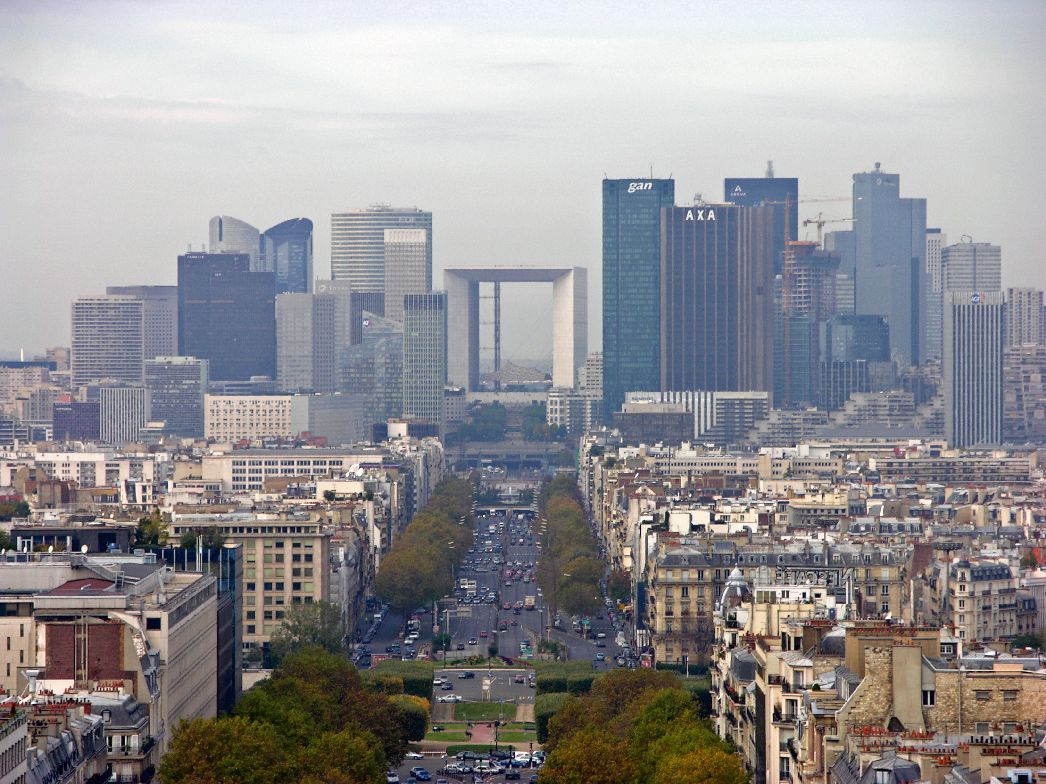
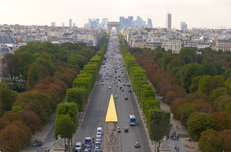
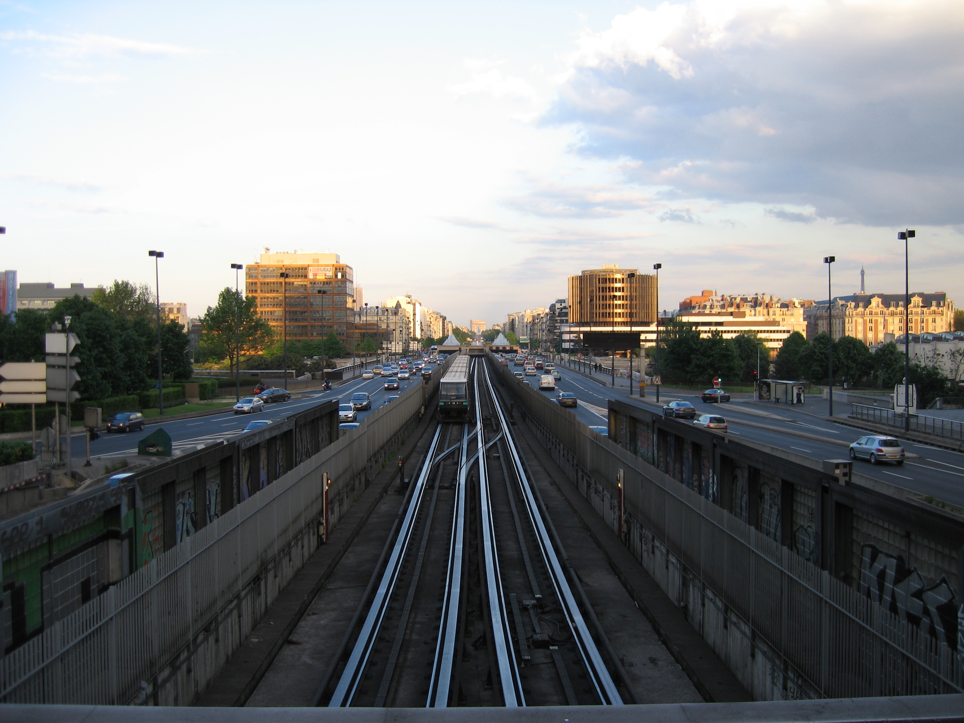
| | | | Moving further west, between the Tuileries Garden and the already-mentioned Champs-Élysées there were again a jumble of buildings. These were also removed to build what is today the largest square in Paris, the Place de la Concorde (see map above), with its famous gold-tipped Egyptian obelisk in the center, along with fountains. It was originally a royal square, the Place Louis XV, then became the Place de la Revolution, the site of numerous guillotinings, including that of Louis XVI and Marie Antoinette. It got its present name in 1795, the concord referred to being a gesture of reconciliation between the levels of society after the turmoil of the Revolution. | | | | This is a view of the Place de la Concorde (Photo by Cristian Bortes) as seen from the Eiffel Tower. Click to inspect the gold tip to the obelisk, and the topiaried trees in the Tuileries Garden. You will note a low retaining wall between these trees and the Place. There are benches in the Garden behind the upper part of that wall with a good view over the wall of the Place. And I have a story about it. | | | | It was, once again, during our 1961 trip. Only now do I notice how many stories emanate from that particular memorable trip. As I consult my oldest travel diary, it was Sunday, 8 October 1961 (more below), so at that time of the year, evening came early, especially with Paris being so far north. Beverly and I had been walking all day, including a visit to the Louvre. We then walked the length of the Tuileries Garden and were exhausted, so we sat down on one of those benches. It was a few minutes before 5:00, and it was beginning to get dark. The beautiful Place de la Concorde and the buildings around it looked quite gray in the growing twilight. We were discussing how nice it would be when the evening illumination came on, but we'd probably have to be on our way by the time that happened. Unthinkingly, I said how nice it would be if I just snapped my fingers and the illumination came on. As I said that, I snapped my fingers. And that's just what happened! I didn't even have a baguette magique with me as the obelisque, fountains, and surrounding buildings were suddenly brightly illuminated and looking their very best. A truly memorable event. | | | | Along the Axe Historique we now come to the Avenue des Champs-Élysées. We said above it was started in the 17C, but in my opinion, was not the initiator of the drive to the west, it was the Louvre. The land had been open fields, but the Avenue des Champs-Élysées and its gardens (the Jardins des Champs-Élysées are unnamed, west of Concorde on the map) were originally laid out in 1667 by André Le Nôtre as an extension of the Tuileries Garden, which Le Nôtre had rebuilt in his own formal style in 1664, that is, in the form of the French Landscape Garden (2018/2). Le Nôtre planned a wide promenade only up to the modern Rond Point (see the "Round Point", unnamed on the attractions map). The new boulevard originally had other names, and wasn't given its present one until 1709. (In Greek mythology, the final resting place of the souls of the heroic and the virtuous was called the Elysian Fields, or Elysium.) In 1710 the avenue was extended to Place de L'Étoile, where the Arc de Triomphe was completed in 1836. In 1774 it was extended along the Avenue de la Grande Armée (named by Napoléon III after Napoléon I's Grand Army that conducted his campaigns) to the modern Porte Maillot (see attractions map). | | | | Finally, the Axis was extended beyond the city limits beyond Porte Maillot, crossing the Seine to La Défense. This area was originally a large junction named for a statue commemorating the defense of Paris in the Franco-Prussian War. Starting in the mid-20C, plans were made to turn La Défense into a new business district with high-rise office buildings, which came to be in the 1980s. It includes a hollowed-out office building called the Grande Arche [de la Défense] (no attribution). This view is taken from the Arc de Triomphe at the Étoile. | | | | Because of the rail and road lines beneath the area, the pillars supporting the Grande Arche are slightly out of line with the Axis, bending it slightly should it ever be extended further. I have been to La Défense and do not like it. My feeling is, if I want to see Manhattan, I'll stay home. Paris has too many far more interesting things to see and do. This picture shows just how ghettoized La Défense is, compared to the buildings in the foreground. | | | | You might find of interest this sketch of the Axe Historique (Image by Pline) showing its full length from the Louvre to the Grande Arche, although the attractions map might show it even better. | | | | Most bits and pieces of the Axe are enjoyable in their own right, but it's their totality that's really the most impressive, including ensemble views down all or most of its length, of which we have several to show. We'll start with the view I remember best, from the courtyard of the Louvre (the part that was actually a courtyard to the Tuileries Palace). There's a Place du Carrousel there, and in it is the previously mentioned Arc de Triomphe du Carrousel (Photo by Simdaperce), through which the best distance view unfolds. You are looking the length of the Tuileries Gardens to the Obelisk of Luxor in the Place de la Concorde down the Champs-Élysées to the Arc de Triomphe de la Place de l'Étoile, with a hint of the skyscrapers at La Défense. | | | | Starting further west, here's a spectacular view starting in the Tuileries Garden (Photo by Pline). Click to inspect the topiary, the exit to the Concorde, the golden-topped Obelisk of Luxor, the full length of the Champs-Élysées, the Arc de Triomphe de l'Étoile, plus the length of the Avenue de la Grande Armée over the Seine to La Défense, looming in the distance like the éminance grise that it is. | | | | Finally we have a high view from the Concorde (Photo by Palagret). The golden tip of the obelisk looks somewhat out of place; then follow the actual Gardens of the Champs-Élysées with some squared-off trees in front of the natural ones, then the Avenue des Champs-Élysées, the Arc de Triomphe, with, again, La Défense hovering in the distance, its scale different from buildings closer in. There are other streets around the world with long-distance views, but it's hard to think of one with such a variety of intermediate sights. | | | | The development of the Axe Historique had its effect on later routes. When Haussmann decided to build his Grande Croisée de Paris (Grand Paris Crossing) centered on the Place du Châtelet (2017/18), it was a no-brainer that his western arm just followed along the Axe Historique. Later roads, including highways, followed suit. When the Métro was built in 1900, its line 1, today the busiest of all lines, was under the Axe Historique, then continued eastward along Haussmann's eastern arm. When RER A was built between 1969 and 1994 to relieve pressure on line 1, it followed it very closely (see Métro map) between La Défense and Étoile and then almost as close further east. That's how fundamental the Axe Historique is. | | | | Day 4 Th7 (Second Part) Axe Historique de Paris As we continue our tour today, we're aren't going to reinvent the wheel by seeing sights already visited in the past, nor again see the views from them to the west. Instead, we're going to turn the tables, go to the west, and see the views back east. To accomplish that, we're going to kill two birds with one stone by using Métro line 1. It's a visitor attraction in its own right, as well as being the oldest, and one of the most modernized lines to increase its efficiency, and we've been wanting to see it anyway. We'll take it west, take in the view, and then come back. | | | | This is a geographically accurate route map of line 1 (Map by Metropolitan). We'd ended up earlier at the Concorde station to go west. Still, perhaps it's best to follow on the Métro map. This shows that there are actually three adjoining stations at Concorde, all connected together as one. The one with the most interesting décor is where we got off line 12, as this station has tile work all along the walls an across its voûte consisting of blue letters on white repeating the text of the Declaration of the Rights of Man and of the Citizen of 1789. As this detail shows, the words run on without spaces (Both Photos by Clicsouris). | | | | We reach the line 1 platform and note the platform walls and doors, being sure to move to where the front of the train will stop. It enters quietly on its rubber wheels, and we manage to find one of the seats at the very front picture window. We can sit there, since there's no driver's cabin, as there's no driver on an automated train. The cars are also articulated one to another. We have a spectacular view of the tracks ahead and of each station as we pull in. Other than at the Bastille, the only place line 1 is outdoors is to cross the Seine between Pont de Neuilly and Esplanade de la Défense, where we get off. | | | | There's no reason to go to the last stop at La Défense, since it's underground with no view and anyway I don't particularly like the place. We get off instead at the stop before, the Esplanade de la Défense (Photo by Greenski). We exit our train at this center platform via the platform doors on the right, get our view from the open end of the platform behind the camera, then catch a return train via the platform doors on the left. | | | | We have two online views to show, not literally taken from this station, but from near it. This is an eastern view down the Axe Historique (Photo by Gonioul). We first notice the road and rail system all along it (notice the rollways for the Métro's rubber wheels and the cables for automatic operation). We then see (click) that all this is coming from the Arc de Triomphe at the Place de l'Étoile. Look left and right, and the stonework at the sides of the bridge, the Pont de Neuilly--can be made out—all this road and train traffic is crossing the Seine right here. This is a similar, but sunnier view (Photo by Pline). | | | | We then backtrack under the Champs-Élysées to the Franklin D. Roosevelt station (Photo by Fmjwiki), renamed for him right after WWII. Note the unique décor and platform walls and doors. We then switch to line 9 to La Muette. | | | | | | If you look at the route of line 9 really closely on the Métro map, you'll see that for part of the way, we'll be traveling under the Avenue du Président-Wilson, renamed for him toward the end of WWI, and a little further south than that, in Passy, you'll again see the Avenue du Président-Kennedy, renamed for him in 1964. |
| | | | 8 October 1961 Tomorrow we'll be going to Montmartre, and there's a lot to say about that. For that reason, I'd planned to tell about an old cabaret sing-along here, in advance. But once I started talking about snapping my fingers at Concorde, I decided to not solely rely on my memory, but to go to our oldest travel diary, all in Beverly's handwriting, to do some fact-checking. Memory is funny. I fully remember the finger snapping, the cabaret, and eating French onion soup in Les Halles, but was sure the three events happened at varying times during that time we were in Paris before going for a year to study in Mainz. I'm shocked—shocked!—to find out the three things all happened on the very same day, Sunday, 8 October 1961, until the wee hours of the morning—and beyond. | | | | Since we had gone to the Louvre first, which involves a lot of walking, then went through the Tuileries Garden, then finally sat down at the edge of Concorde just before 5 PM for the illumination story, I would have sworn we'd have ended the day there and would have gone back to the hotel. But apparently the night was young, and so were we (low 20s). It's possible we did go back to the hotel to rest, I don't know. Anyway, let me allow Beverly to introduce the next part of the day from the diary: In the evening, we went to Montmartre, where we first visited the Sacré-Coeur and then went to a café and sang French songs until the wee hours. | | | | I remember the venue of what was a simple cabaret show with sing-alongs being right on the north side (Rue Norvins) of the Place du Tertre (Map by Paris 16), the heart of old Montmartre village. (More on the Place du Tertre when we're there tomorrow.) Trying to reconstruct the past, I'd checked with Google street view and had settled on it probably being the second venue from the right corner. But referring back to a later entry in the diary, Beverly said: . . . we again went to the Auberge de la Bohème in Montmartre. I have NO recollection of having gone back, but at least I had the name of the venue. | | | | A lot can happen in 56 years, but I see that the corner venue at #2 (see map) has the name La Bohème du Tertre, or La Bohème for short, so I felt I was making progress—it's still there. I checked their website and got quite a bit of history, which I think is pertinent. In the early 20C there was a building here called the Hôtel du Tertre, named after the square. It was described in its day as the epicenter of Montmartre bohemian artistic life. It was sold in 1930 and demolished, and the present brick building with stone trim was completed in 1937.
https://media-cdn.tripadvisor.com/media/photo-s/02/6e/93/04/montmartre-place-du-tertre.jpg
| | | | This is the view to the northeast corner of the Place du Tertre. It wasn't the lower building to the left of the tree that I mistakenly recalled, but the taller one to the right where Beverly and I had enjoyed a fun evening. The building continues around to the side street, Rue du Mont-Cenis (see map). In 1938 it became a brasserie serving food and drink, and was called La Bohème (Photo by Olivier Bruchez) in memory of the spirit of the bohemian life connected to the site. This view is at and around the corner (click to read Rue du Mont-Cenis), but also note the Cabaret de La Bohème. | | | | Now my memory might be rusty, but I'm sure when we saw the show it was one flight up. I understand the venue was renovated in 2016, and they're announcing that the cabaret space is in the basement. So be it. It's being used for various reasons, including cabaret evenings, though probably very different from what I remember. But I'm pleased with what I found out to be the date the cabaret shows started: 1961. That means that when we were there on 8 October 1961 they had just inaugurated this cabaret tradition that year. I like that. | | | | I know we knew what we were doing, but all in all, it must have been pretty nervy of us. The whole show was in French, and there's a good chance that everyone else in the room was a native francophone. And here we were, "just off the boat"—the Liberté, that is. This was the language situation. Beverly and I were both German majors, but her minor was French and mine was Spanish. I had been teaching myself French, and she later learned Spanish working with me. In any case, at this point, both of us had a knowledge of French. While the vocabulary of some complex songs surely went over our heads, it was everyone having such a good time that allowed us to enjoy the parts of songs we didn't understand. Wine helped, too. | | | | There was a personable young man acting as conferencier and leading the sing-alongs, and there must have been a small band. Beverly knew French folk & drinking songs, and during my college years, I made sure I learned some of the principal ones. I'm sure we sang old standbys like Auprès de ma blonde and Chevaliers de la table ronde. To this day, I can give you several verses of each, especially of Chevaliers. | | | | I'm sure we'd considered we'd just stay a few hours, but we apparently ended up closing the place. The current cabaret hours end at 2 AM and I'm sure that's as long as we stayed. Of everything that went on in the show, we enjoyed two items we'd never heard of before so much that they've stayed with me for the last 56 years. They're both the type of thing that you find yourself singing as you leave the venue and walk down the street. But one thing I have to state. I never knew the complete details behind both these pieces until researching for this posting. | | | | Ya, Mustafa The first one is a whimsical bit of nonsense that seemed at the time to be a popular song in Europe from the early 60s, since everyone else seemed to know it. While the words are nonsense, the Arabic melody is positively infectious, and you can't help tapping your foot, strumming your fingers, or clapping along. Its Arabic name is simple to remember. I now have all the details, but first listen on YouTube (2:36) to Ya, Mustafa. The black-and-white period look is unmistakable. If you want to hear it again, this is (2:35) another version. | | | | Now stop tapping and strumming, and sit still. It seems the song was composed by a certain Egyptian musician, but only became popular in Europe when it was released in France in 1960 (the year before we heard it) by the Egyptian singer of Lebanese ancestry Bob Azzam. It was Azzam himself singing on the first recording, made in a Swiss TV studio. The lyrics are tri-lingual, in Arabic, French, and Italian, and the song has been covered numerous times, and remains particularly popular in the countries of the Eastern Mediterranean. The rather silly trilingual chorus is (Line 1 French; Line 2 Italian; Line 3 Arabic: | | | | | | Chéri je t'aime, chéri je t'adore,
como la salsa del pomodoro.
Ya Mustafa, ya Mustafa . . .
| My dear I love you, my dear I adore you,
just like tomato sauce.
Oh Mustapha, oh Mustapha . . .
|
| | | | You may want to go back and sing along with the chorus, as we couldn't help doing when leaving the cabaret that evening. | | | | Tout va très bien, madame la marquise Now the other piece (new to us) that we enjoyed that evening is a whole other kettle o' fish. It's a song that's also a comedy sketch. I now know a lot more about it than we did that Sunday night when we first heard it, but I'd like for you to experience it the same way we did, knowing little about it and struggling a bit with the French. Then we'll talk some, then watch a second, fuller version. | | | | It seems a Marquise (wife of a Marquis) has gone on vacation for a couple of weeks. She phones back to her château and speaks with four of her servants. Each one keeps on telling her that tout va très bien--"everything's fine". But is it? | | | | | | To further understand, we should talk about modes of address. In English we can combing honorifics and titles in very few circumstances. We can say Mister President, Madam Prime Minister, Mister/Madam Chairperson, and perhaps a few more. But English doesn't have the flexibility to do many other combinations, such as Herr Doktor in German, Signore Professore, in Italian, or Madame la Marquise (or Monsieur le Marquis) in French. To express these in English, the titles have to go, and English would just use appropriate honorifics, like Sir or Ma'am. Thus the title in English would be "Everything's Fine, Ma'am", although you probably could also get away with "Everything's Fine, Your Ladyship". |
| | | | Now listen to this first YouTube video (3:21) with minimum visuals, but with both French and English subtitles. You'll probably want to listen to it more than once, so that you know exactly what's going on, especially when the end speeds up a bit, because the next video version will be all in French. | | | | I think you'll have caught on that when this is performed, Madame la Marquise is always sung by a man in falsetto. I'm sure that at the performance we saw, it was the conferencier singing that role. And the four servants aren't professional singers, either, but four band members filling in. And that information brings us back to the research I've found out about the piece. | | | | As you saw at the opening of the video, it all started with a band called Ray Ventura et ses Collégiens [and his Collegians] in 1935. This type of humorous song is very old, though its style was revived by a popular comic duo in France in the '20s and '30s. In any case, the Ventura band was in trouble. It was appearing in the South of France that year, in Nîmes, and the opening night was a flop. The audience was sullen, and the band couldn't warm up the room. The musicians were desperate to find a way to revive the show. | | | | That night at the hotel Paul Misraki got to work on both the lyrics and music. He was the composer and pianist for the band, and over the years, wrote some quite successful pieces. He later did the music for over 180 full-length feature films, notably Et Dieu . . . créa la femme ("And God . . . Created Woman") in 1956 with Brigitte Bardot. On that fateful evening in Nîmes, Misraki worked through the night. He worked out the départ (opening) right away, but it wasn't until daybreak that the pont (bridge) came to him. It's the line un incident, une bêtise (an incident, a silly thing) that breaks up the entire rhythm of the song until that point. And a major factor in the humor was the antéchronologique style of relating the events in reverse chronological order. They performed it that very next evening, and it was a triumph. | | | | There's a lot more interesting news about this, but it's time to plunge into this 1967 version totally in French (3:46). See how well you can follow, using the earlier one as a guide. | | | | We now see two things. One is, that it's entirely likely that the man (band leader?) singing falsetto might also be dressed in drag. And consider the use of the phone. Telephones had been around for a long time in 1935, but were still not universally owned. The fact that the Marquise is using one, and calling long-distance at that, is an indication of her high social status. And that is in direct conflict with the news she gets. | | | | This sketch has been translated into a number of languages, but as far as I can tell, English is not among them. YouTube has a version entirely in Hebrew. It also has one entirely in German called Alles perfekt, Madame la Marquise. It has one in Italian called Tutto bene, Madama la Marchesa. However, none of these recordings are ideal, so I'm not linking to them. Oddest of all, YouTube has a version in Russian called simply Маркиза (Markiza or "The Marquise"), but it's all a cartoon! | | | | If you're really deeply into this, you can find on YouTube a version in French performed by the Dutch Symphonic Wind Orchestra, with some members dressing up as the characters in front of the formally dressed orchestra. As for subtitled versions, you can find one with Greek subtitles. For those people with a knowledge of Spanish, I will link to a French version with subtitles in Spanish (3:21), translated as Todo va muy bien, Señora Marquesa. | | | | But the oddest thing is how the phrase has evolved. This sketch, and particularly its title, has become part of the French language, a proverbial expression speaking against blindness facing a desperate situation. It's used as a standard riposte, a retaliatory retort, whenever someone says something made to sound better than it is. Dating from 1935, the phrase was first used that way in the prewar period up to 1939. Journalists picked it up immediately, using it against politician Édouard Heriot during a 1936 strike as Tout va très bien, Monsieur Heriot. It was used after the Munich agreement of 1938 to denounce the passivity of France with war on the horizon. It appeared as Tout va très bien, Monsieur Mussolini, apparently when he boasted that things were going too well for him. And when war broke out, and the Free French were broadcasting to France from Radio Londres (Radio London), just in case the occupying Nazis were feeling complacent, the phrase Tout va très bien, mon Führer was broadcast. | | | | Lest you've gotten the mistaken impression that this song might be dated, I found this contemporary YouTube political protest parody (3:26) made by "Daniel & Fred", who were glad to see the end of François Hollande. You'll recall that he was Président of France from 2012 to 2017. You needn't watch it all, just note the edited clips of Hollande speaking in chopped phrases, and then "Daniel", wearing a t-shirt labeled Ouvrier Qualifié (Qualified Worker), singing Tout va très bien, Monsieur le Président, in opposition to some things Hollande says. Much of the text he sings is altered to fit the present situation, but you'll hear some key lines. | | | | Les Halles Long before I ever went to Paris I'd heard people talking about Les Halles and eating onion soup there at dawn. And so that's just what we did next. Just as well that we did it then, because it's all gone now, and you can't do it any more. If you're not familiar with what I'm talking about, let me explain, all while adding online research to what I'd already known.
| | | | First, that beautifully odd name. I just now found out further details about it. It turns out that, in the singular, une halle (an almost-rhyme with the first syllable of Ol[iver]) is any structure that covers a traditional market (or wholesale market) and protects it from the weather; it's usually open at the sides to aerate and keep produce fresh. A synonym is marché couvert (covered market). But when used in the plural it refers to a few very specific places, most of which are either gone or no longer function as such, the huge central food markets in some major cities, most notably the famous Les Halles de Paris (lé.OL). | | | | King Philippe Auguste, who built Paris's Third Wall (and the original Louvre, above), in 1183 enlarged the preexisting marketplace of Paris and built a shelter for the merchants. In the 1700s it was expanded, and the 1850s was rebuilt as the famous glass and iron buildings, here in 1870, that would last until the 1970s. Émile Zola famously set his novel Le Ventre de Paris (The Belly of Paris) in Les Halles. This is a street scene at Les Halles at the turn of the 20C. | | | | But Les Halles, being located where it was in the city center, became too small to service the growing demand, and the buildings were in need of huge repairs. And so, in 1971, the buildings were disassembled, Les Halles disappeared, and the colorful street ambience was lost. Nevertheless, the quarter of the 1st Arrondissement that included the former market is to this day called the Quartier des Halles (Map by Starus). | | | | Where Les Halles de Paris had been, there was left a large open space for several years that was finally replaced by two things. In 1979 the Forum des Halles, a huge shopping center was built, partially underground, which has since been completely renovated. In addition, a major RER station was built underground, combined with the Châtelet station and now known as Châtelet-Les Halles (2017/18). | | | | The wholesale market was transferred to the suburb of Rungis (pronounce the –S), south of Paris near Orly Airport, a location that also had good road and rail connections. While it can be referred to as Les Halles de Rungis, it's technically called the Marché d'intérêt national de Rungis (Rungis International Market). It's still the principal market for Paris, mainly for food and flowers, and is the largest wholesale food market in the world. | | | | La soupe à l'oignon We now talk about onion soup, known best in English—not in French--as French onion soup. (Note that the word oignon is in dire need of spelling reform, since it's pronounced simply as ognon.) A form of this soup has been part of French cuisine going back to Roman times, and it's a specialty of onion-producing areas, though traditionally for those of modest means, since it's so simply and cheaply prepared. The modern version of this soup developed in France in the 17C, made of caramelized onions, beef bouillon, and dry bread or croutons.
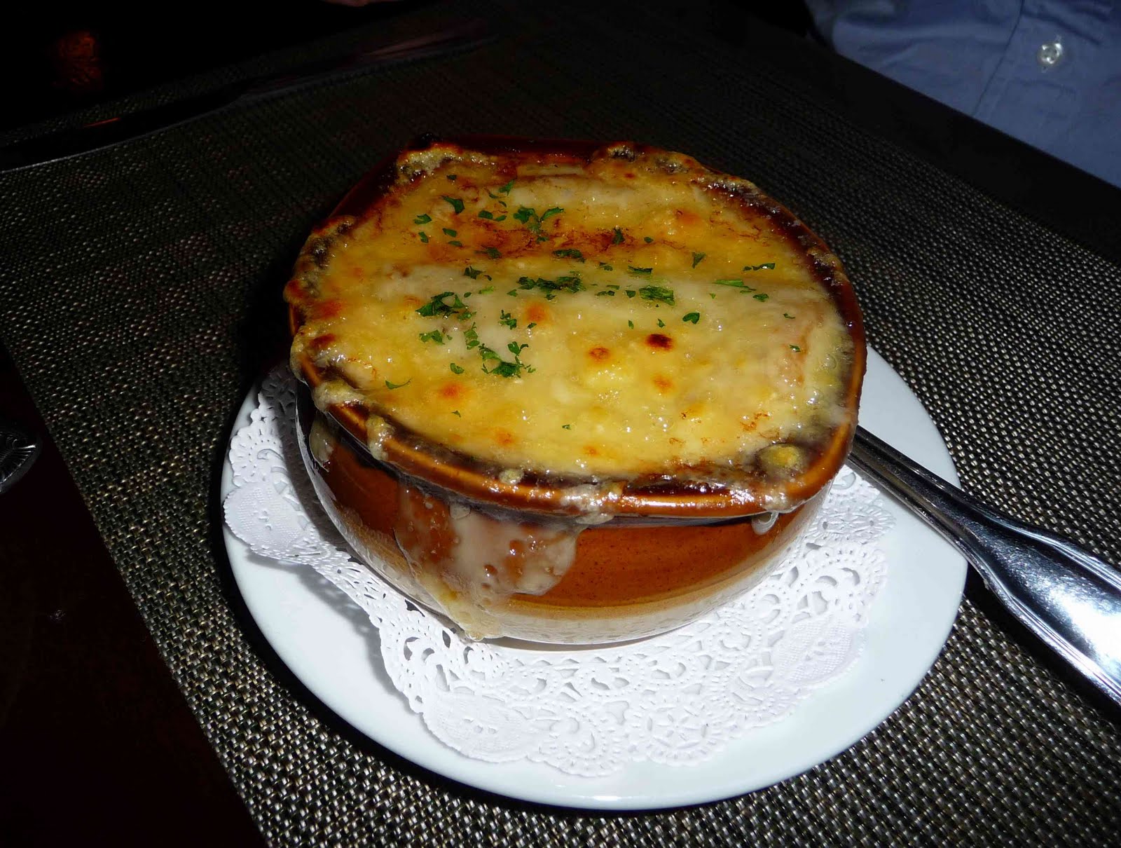
| | | | Given its origin as a poor people's soup, the association of onion soup with Les Halles de Paris seems quite logical. Even back in the 18C, onion soup was served in and around Les Halles as a snack for merchants, customers, even tourists. A number of restaurants developed at the site--the names I've found are La Poule au Pot, Chez Baratte, Au Pied de Cochon. And it was at these Les Halles restaurants that onion soup acquired its final key touch: gratinée. A large amount of grated cheese was added on top of the bread or croutons, and the bowl was then placed under a grill to melt the cheese. Thus, these restaurateurs created the classic Gratinée des Halles, also known as Soupe à l'oignon Gratinée. This version, which is just about the only version one comes across today, succeeded in transcending class distinctions. This soup became not only the petit-déjeuner/breakfast of the burly workers of Les Halles transporting merchandise, but also a hangover cure for partygoers leaving cabarets who wanted to visit the only truly nocturnal area of Paris. I found a quote from actor Vincent Price: After a late night in Paris we used to like to go to Les Halles, the large outdoor markets, where we could get steaming bowls of savory onion soup to revive us. Late or early, this hearty soup is one of my all-time favorites. | | | | My favorite way to have onion soup served is in an open bowl (Photo by Rainer Z ...) with the cheese gratinée limited to the bread or croutons. I prefer it because I find it a superior presentation--you have the visual pleasure of actually seeing the steaming soup. Yet I know onion soup is most often served in a ramekin (Photo by Joshua Sherurcij) with the melted, hardened cheese forming a lid over the soup and flowing down the sides (Photo by Mathhorse). The thick layer of cheese on top then serves as a barrier to reaching the soup, and tends to keep it scalding hot. But with an open bowl, you don't have the bother of having to break through the hard covering, which can result in a sloppy mess. It all tastes just the same, but I find the open bowl presentation visually more pleasing and also more convenient to eat. | | | | With Les Halles gone, the whole ambience of the area has changed. Those restaurants that had only opened at dusk and then closed at dawn began to serve meals during the day as well. The only one left of those mentioned earlier is Au Pied de Cochon ("The Pig's Foot"), located at the northwest corner of the former site. It's one of the rare restaurants in Paris open 24 hours a day. | | | | I've found an interview with José Dufour, the manager of the Pied de Cochon, where he reminisces about the past: At the time, there was this ambiance at the Halles. You had butchers working in their white aprons, covered in blood, and then you had people who had just from an evening out, women in evening gowns, gentlemen in tuxedos. So bit by bit, there was this mix of people from all walks of life. Reflecting on today, he says: You have the more festive clients, those who come as they’re leaving nightclubs, or even before they go out, but you also have people who work at night and who come here at the end of their shift. People who work in hospitals, police, people who work for the SNCF [rail company]. | | | | But despite the loss of that nighttime atmosphere, soupe à l'oignon gratinée has never left their menu and remains a best seller, where 150 to 200 bowls a day are sold to a great variety of clients. | | | | 1961 Back to that long day. Beverly wrote: Next we went to Les Halles and had a dish of onion soup while waiting for the market to open. I don't remember how we got there. We must have left Montmartre at about 2 AM. I know the Métro doesn't run that late, and I know we didn't get any other transportation. I'm quite sure we must have walked across a good swath of Paris from Montmartre to Les Halles, while singing about Mustafa and the Marquise. On the attractions map, Place du Tertre (unnamed) is just west of the Sacré-Coeur. We would have wended our way down western Montmartre and across the city to Les Halles to what on this map is labeled the Forum des Halles. I remember being at the market before daybreak and sitting in what I recall as a small café for our onion soup, watching the workers arriving. I wonder if we could have been at one of the restaurants named above, but I just don't know. As I reflect back now, I realize we had this Les Halles/onion soup experience just one decade before the end of Les Halles, 1961-1971.
| | | | Beverly ended the diary entry by saying: We walked home and arrived at the hotel at 5 am. That would put us walking across Cité (see map) and down to the upper part of Rue Monge (not named, but north of the Arènes de Lutèce). | | | | I am proud to be a night owl, and usually work online into the wee hours. On very rare occasions when working on a project, I've been known to pull an overnighter (like in college), and go to sleep at daybreak, though that's very, very unusual. But that Sunday (into Monday morning) is the only time I've ever been roaming all across a city until dawn. At least it happened in Paris. | | | |
| |
|
|
|

