|
Reflections 2018
Series 5
July 4
Paris III: Arrival - Passy
| | Picking up the Thread After a detour during recent postings, we pick up the thread about the trip to Paris and Burgundy early last September. The precise basis for doing this trip we'll discuss when we get to Burgundy, since it'll make more sense then. We've so far had two postings on Paris. Paris I dealt with "Its Historic Circles", the walls around the city and the spiraling expansion to today's arrondissements. Paris II dealt with "Its Historic Lines", mostly Haussmann's boulevards that sliced destructively straight through neighborhoods, which is what led us to the Intermezzos. We'll now continue with the trip itself. | | | | Day 1 M4 – Overnight Travel The day of departure in September was Monday, the 4th (M4 in the heading). It was a nonstop from New York to Paris. I have several points to make about it. First is that this was a medium-length long flight, nothing spectacular. My summary of the nine very long flights I've taken that were over the threshold I use of ten hours is in 2014/12, near the end. | | | | | | My record-length nonstop flight was also a world-record length flight. It was the famous, absolutely delightful, five-star Singapore Airlines Flight 21 from New York (Newark) to Singapore (2010/14), at the time the longest regularly-scheduled commercial flight in the world, a scheduled 18h50. It was all business class (100 bed-like lie-flat seats) and worth every penny of it. Flying is not my favorite way to travel, compared to rail 'n' sail or even pleasure driving, but this flight was exceptional—there's nothing like it. It was worth taking even if you weren't interested in visiting Singapore. But it apparently didn't prove financially viable and as of 2013 now makes a stop on the way in Tokyo, so it lost its nonstop record status.
BREAKING NEWS: Just as I was writing this on 30 May 2018 the New York Times reported that the flight is back! This news is literally right off the press! Singapore Airlines is replacing the older Airbus A-340-500s with Airbus A-350-900s, with extra fuel capacity, made of carbon fiber lighter than the traditional aluminum, and using less fuel because it has only two, not four, engines. These will have 161 seats, 67 in lie-flat business class and 94 in premium economy, without lie-flat seats, but larger than usual ones. The service restarts 11 October this year and becomes daily as of 18 October. The king seemed dead, but long live the king!
|
| | | | N-S versus E-W By that measure, an overnight flight of 7-8 hours, while substantial, isn't all that much, but that's a comparison I want to make now. 2017 was the only time I took both a north-south flight of that length and an east-west one as well. Since they were both in the same calendar year, it was particularly easy to compare the time-zone matter. In late May I flew New York (Newark) round-trip to Lima. Though both are in the same time zone, the US was on daylight savings time at that point, but that one-hour's change really made little to no difference. The flight south was a day flight, scheduled 7h55, early afternoon to mid-evening. The return was scheduled 8h00 overnight leaving at 22:30. While each was a long trip, tiring in its own right, there was no real time-zone shifting, and so no jet lag. | | | | It's a six-hour time difference between New York and Paris. In early September, the flight from JFK to Paris was scheduled overnight leaving at 6:40 PM, after which we had dinner and went to sleep. When it landed after a scheduled 7h25, we on board felt it was 2:05 AM, but it was actually 8:05 AM local time, since we had "lost" that six-hour time difference. Waking up at about two in the morning and being ready to start a new day on another continent is not the easiest thing to do (but not impossible—it worked out fine). | | | | The return flight two weeks later was a day flight leaving Paris at 10:40 AM. It was scheduled a little longer, 8h17, probably due to the headwinds moving against us. When we got in to New York, we felt it was already 6:57 PM, but no, it was only 12:57, roughly noontime, since we'd "gained" back those six hours, so we'd be having a long day ahead of us. Also doable, but not like flying north-south. | | | | Going Transatlantic Another point is surely one we've made before, but traveling transatlantic does not mean leaving North America to the due east. That's the optical illusion that Mercator projections leave us with, that the coasts of North America and Europe/Africa are parallel to each other. The truth is more like this (Map by Uwe Dedering). If you draw a mental line from Ireland to Portugal, then draw one along the upper east coast of North America (New England, Maritime Provinces), you'd find they were not parallel, but instead perpendicular to each other. It's the northeast coast of North America (Canada, from Newfoundland to Baffin Island) that's parallel to Europe, a fact that I'm sure few people visualize. That means that the shortest route from, say, New York to the English Channel area for both planes and ships is to follow the coasts of New England and the Maritimes. Only after Newfoundland would they find themselves in the open Atlantic until Ireland, the UK, and the Channel area. Again, this includes the shipping route, including the route the Titanic took up to the Grand Banks of Newfoundland.
https://airandspace.si.edu/webimages/highres/6325h.jpg
| | | | This leads us to Lindbergh, since that's exactly the route he took in May 1927, just 40 years and a few months before we followed the same route. While Roosevelt Field on Long Island, a military training field from WWI at the time, is now a shopping mall, Le Bourget, Paris's first airport, is now used for general aviation, including business jets, and for the Paris Air Show. And though Charles Lindbergh needed 33h30, our modern plane made it in 7h25. But we went, as he did, up the New England coast, then the Maritimes. Part of that for us was sleep time, as well as crossing the open ocean. We woke over the south coast of Ireland, then that of the UK, then the Channel Islands. We purposely overshot Paris to turn around and land from the east. | | | | | | For the 2017/17 posting, I sat down and figured out just when I'd visited Paris in the past, and found this would be my 8th visit (I've never counted out visits to Berlin or London). But as I said before, with one minor exception, I never flew to Paris, as all my arrivals were overland. I'd arrive by ship, then train, or by a flight elsewhere, then by car, or train. The exception I mentioned earlier where we did fly into Paris was not to see Paris but in transit. It was 1965, when we sailed from Haifa on the Bilu (2013/7, Voyage 5) to Nice, took the train to visit Marseille, then flew back to New York. I don't remember on what airline we flew back transatlantic afterward, but I do clearly remember the Marseille/Paris connecting flight. It was on a small airline called Air Inter, and we must have connected at Orly, which is in the six o'clock position south of Paris. This is an Air Inter plane at Orly in 1973 (Photo by RuthAS). I just looked it up. It was a semi-public French domestic airline officially called Lignes Aériennes Intérieures that started up in 1960, but which was absorbed into Air France in 1997. I don't know why this little internal flight sticks in my mind, but making this connection to New York was the only time I was ever in Paris airspace before the current trip. |
| | | | Since it was my first flight directly to France, I wanted to fly Air France, which I don't think I ever flew before. I follow the Skytrax rating system of one to five stars. By far, most airlines are 3-star, and it isn't suggested one fly on anything less than that. Even with 3-star airlines coach class is usually cattle class. Singapore Airlines mentioned above was one of the very few 5-star airlines I've flown on, and I loved it. But Air France is 4-star, which is a very good rating. The only quirk is that nowadays airlines do a lot of sharing, so the return flight, nominally also Air France, was "operated by Delta", a three-star airline. Delta wasn't bad, but neither was it Air France. | | | | It was the atmosphere and service that were so special, but let's not forget the food. A printed menu was given out, and I took this choice, with my translation: | | | | | | salade de quinoa, maïs, haricots noires
poulet, sauce au beurre et citron
fromage
| quinoa, corn, and black bean salad
chicken, lemon-butter sauce
cheese
|
| | | | It was delightful. Do you suppose they'd known I'd just been to Peru and have recently become "addicted" to quinoa? And when the drinks cart came by, there was another surprise, this being coach class. One choice was champagne, the good French stuff, of course. I asked to see the label on the bottle, and it was Monopole Heidsieck (Photo by decar66). It helped lull one to sleep over the Atlantic. | | | | Day 2 T5 (First Part) RER to Passy This would then be my first time at Charles de Gaulle Airport (CDG), which opened in 1974 northeast of Paris at the one o'clock position. I understand most locals refer to it by the name of the town it's near, Roissy (rwa.SI), just like with Orly, and, for that matter, Le Bourget. As a matter of fact, the express bus between Paris and here is called the Roissybus. It's the largest airport in France and on the Continent, but second after London's Heathrow. I was looking forward to being here, as it seems to have everything, all sorts of rail connections seemingly everywhere, hotels, other services. But I was disappointed to find it a source of more stress than necessary, and confusion. To be blunt, it was an overcrowded madhouse, both coming and going. I'm an experienced traveler, speak French, and had printed out a map of CDG in advance, but still I felt stressed and overwhelmed on arrival. And I was concerned about going back there at the end of the trip. Rightly so, because I came close to missing my return flight because of the overcrowding. But I got through it at both ends, and we all will now as well.
http://www.parisaeroport.fr/docs/default-source/passager-fichiers/acces/plan_masse_cdg.jpeg?sfvrsn=4
| | | | Click to see this maze more clearly. You can tell by the terminal numbers the sequence in which they were built. Terminal 1, the round one, apparently the oldest, and 3 is the newest, but neither affects us. We have to deal with Terminal 2, which is spread out over seven—seven!—subterminals, 2A to 2G. 2G is accessed by a shuttle bus for Schengen flights within Europe and also doesn't affect us. You would think that that leaves just 2A to 2F to overwhelm us. Wrong! 2E has two extensions, Hall L and Hall M, bringing us up to seven locations to run around in! I already knew that CDG was the biggest on the Continent, but it still didn't concern me too much when I saw that ses aérogares sont relativement éloignées les unes des autres, (its terminals are relatively spread out one from another). Ha! You'd better believe it! | | | | You see dark lines on the map. These are the free, driverless airport train shuttles called CDGVAL, shown here at Terminal 2 (Photo by ArséniureDeGallium). Including the initials of the airport, the name stands for CDG Véhicule Automatique Léger, or CDG Automatic Light[rail] Vehicle. You see the upper one that connects the three terminals with two intermediate parking garages. We can leave this one for the trip home, when we'll be staying at the Ibis Styles hotel (in green) the night before our morning flight (more later), at which point we'll have to manage to struggle back to Terminal 2. | | | | I'd also read about the other black line on the map, which is also a CDGVAL line, called LISA, which stands for Liaison Interne Satellite Aérogare, or Terminal Satellite Internal Connection. It's within the security-controlled area of Terminal 2E and links Halls L and M with a Hall K, part of 2E. But my ticket said I'd arrive at Terminal 2E, so I also put LISA out of my mind. Talk about "Innocents Abroad"! In 1869, Twain hadn't encountered CDG. | | | | Arrival As we always do, we'll all take the walk through CDG, then ride to Passy and do an extensive walking tour together. When we landed, it was 8:05 locally, but as mentioned, for those on the plane it felt like 2:05, since we'd lost those six hours. Still, I'd slept well, and was ready for a full and active day. I'd done my homework and knew we'd arrive at Terminal 2E. Right? Well, yes and no. In actuality, we landed in Hall M, off in Siberia, but that's technically part of 2E, isn't it? I just don't like being fooled. Bilingual signs told us we should take the next shuttle (I was taking LISA after all!) two stops to the main part of 2E. I found it very off-putting, having arrived in another country and taking a train first before having "legally" arrived yet. This is where the stress started. The train was crowded with people and luggage, standing room only, but we only needed to go two stops. | | | | I travel light, with my overhead rollerbag being sufficient for two weeks—more actually, when needed--so I was able to walk right by the baggage claim area as usual, thank goodness. But then came the logjam in the large hall for immigration. There was a line for immigration control snaking left and right around stanchions. As I looked ahead, I estimated it bent about 45 times. A countdown clock said it would take about 45 (boring) minutes, though it only took 30. | | | | Finally, I was out into the main oval of 2E. Fortunately, I spotted an ATM machine right away, and took out €20. Hotels and the cruise were prepaid, and restaurants take credit cards, so the cash was for a few incidentals. Very few. I still had over €8 left the last night to use up as part payment with dinner. | | | | As for transportation, again, I'd done my homework and knew exactly what I wanted and where to get it. Although the crowds partially obscured it, I found the counter marked "Île-de-France", and this worked out very nicely. I knew I needed ● an RER ticket into town right away. ● From several choices I'd read about online, I'd decided that, best for me would be the 5-day, 3-zone (central Paris) "Paris Visite" card. Then, after Burgundy, I'd need ● a return RER ticket to the airport for that last night. My only regret was that I didn't initiate speaking French with the agent, which I would have enjoyed doing, since I knew just what I wanted. When I walked up, she started speaking English, so we stuck to that. When I told her the three items I needed, she was slightly incredulous, and pointed to a list facing me on the counter to confirm that I knew what I was doing. Yes, I did, thank you very much. After the sale, she warned that I should be careful with the tickets and keep them away from things like credit cards, since the magnetic stripe could become demagnetized. Boy, was she ever right! Only the ticket I used immediately worked without having to be replaced! | | | | There are excellent rail connections at CDG, and they're located at the other end of 2E. But it was a huge walk the length of that oval, and even moving sidewalks didn't help all that much. I was headed for the first RER B station (see map) called CDG-2 because it's the furthest from Paris. Note that there's another RER B station adjacent near Terminal 3, called CDG-1, which we'll be using going home, to stop at Ibis Styles. But before I left, I wanted to get a feel for the high-speed rail TGV connections out of CDG, so I stopped at that station (see Gare TGV on the map we've been using).
http://www.exploringmonkey.com/wp-content/uploads/2008/01/tgv_route.jpg
| | | | It's rather amazing, but as this above map shows, air travelers don't have to go into Paris at all to get a high-speed TGV connection around all of France and into Brussels and beyond. These are all TGV stations with direct connections to CDG, as shown. Routes even bend around Paris to connect to the West. But, this TGV station is very close to the RER B station, and there was so much crowding, so many people standing on conflicting ticket machine lines, that I walked in circles until I found the down escalator to the platform I needed. And by then, I was more than ready to escape from CDG.
http://easycdg.com/wp-content/uploads/2017/02/Plan-CDGVAL-TGV-RER-Roissy-CDG.png
| | | | But first, this schematic diagram might help understand the complex rail connections at CDG. You see the CDGVAL connecting the three terminals. You see the TGV connection located only at Terminal 2, station CDG-2. You see the RER B we're about to take also leaving from there, but then stopping at Terminal 3, station CDG-1, which we'll use on our return. | | | | RER versus Métro We've never discussed the RER before because I've never ridden it before, and even if you know what it is, I'd like to explain from my point of view how it differs—and doesn't differ—from a subway. I picture it as it seems clearest to me, by using the German terminology U-Bahn and S-Bahn, terms we've used before, just recently when we discussed Berlin (2018/1). In doing so, I want to compare Berlin, New York, and Paris. | | | | A U-Bahn is your basic subway. It stands for Untergrundbahn, just as London calls its subway the Underground. As Berlin has its U-Bahn, New York has its Subway, and Paris has its Métro. Since the UK has always led in rail, the London Underground has its origins in the late 19C. Otherwise, picture the turn of the 20C as the general date for many subways: the Paris Métro began in 1900, the Berlin U-Bahn in 1902, and the NYC Subway in 1905, as we just discussed in the previous posting. While such systems tend to stay within city limits (as NYC's does) others, such as Berlin's and certainly Paris's do occasionally run beyond the city line. | | | | But we have to look a full half-century earlier, roughly to the mid-19C, for the start of rail, usually by private companies. It tended to divide itself into long-distance inter-city service, and local suburban service, nowadays often called commuter rail, since that's pretty much what suburban rail has evolved into. It's suburban rail that's known as the S-Bahn, which is short for Stadtbahn, or City Rail, in other words, a system that serves an urban area as opposed to inter-city rail. We are now getting to the heart of the matter: we can imagine to what extent any S-Bahn system serves the suburbs, but to what extent does it serve the city proper internally? Ideally, before an S-Bahn line crosses into the suburbs, it should have numerous stops across the city center proper, acting as an alternate subway system.
http://www.ogierelectronics.com/Downloads/BerlinTrans02.jpg
| | | | We saw that in Berlin (above). I particularly remember that the Olympiastadion/Olympic Stadium had both a U-Bahn and S-Bahn servicing it, but as the map shows (U-Bahn orange, S-Bahn green), while there are occasional common stations, for the most part, some neighborhoods are serviced by one, some by the other system, allowing for maximum coverage across the cityscape. (Even the intercity trains (red) have a number of stops in town.) Now, how well do New York and Paris compare to this dual system?
https://nycmap360.com/carte/image/en/nyc-train-map.png
| | | | As for rail in New York, things don't look so good. Aside from the fact that the aging U-Bahn/Subway system needs extensive overhaul (and expansion, too), the S-Bahn situation is almost ludicrous. The above map, which is limited to commuter rail, not the subway, shows how the NYC grid extends into New Jersey and Connecticut, which is decent enough, but disjointed. Because of past history, it's divided into three subdivisions that—it's almost a joke—do not connect with each other. But click on the center to see what internal service there is in the city—some, but not too much. | | | | In the West, New Jersey Transit has an extensive system, with Newark (and its airport) a notable hub, as is Secaucus Junction and Hoboken Terminal. But this system crosses the Hudson to end at Penn Station in Manhattan, with no local service whatsoever. One saving grace is the PATH system in orange. Not only does it have what can be considered S-Bahn stops on the NJ side, it enters Manhattan twice, both times to a dead end. But one of the routes does offer five stations of internal Manhattan S-Bahn service. (In the last posting, discussing the Hess Triangle, we mentioned its location between PATH's Christopher and 9th Street Stations.) | | | | | | What's called the Staten Island Railroad (in green) is visualized by many as a subway system (U-Bahn), but in actuality it's the only genuine S-Bahn system New York has. But it, too, connects to nothing, although at least one rail bridge to New Jersey exists. |
| | | | In the North, three lines merged historically to form the Metro North Railroad. Trains leaving Grand Central make that stop in Harlem, at 125th Street, which we've also discussed recently. The stop there is an unusual within-Manhattan service. Among their stops in the Bronx are Yankee Stadium, as well as Marble Hill, Spuyten Duyvil, and Riverdale, all discussed recently, then leave the city. On the other two branches, there are stops at Fordham, and the New York Botanical Garden, with Woodlawn being the last (S-Bahn) stop in the city on one line, and Wakefield on the other. However, several of these stations are also accessible by the Subway (U-Bahn), including Harlem, Yankee Stadium, and Marble Hill, similar to the situation in Berlin. | | | | In the East, the connections are via the Long Island Rail-Road. While the LIRR has no other stop in Manhattan (a connection to Grand Central has been under construction for years), it's really quite extensive within Queens, with the major hub in Jamaica, also connecting to JFK. The Brooklyn connection goes first to Jamaica as well; it leaves from what is now called Atlantic Terminal (Flatbush Avenue), but has only two stops in Brooklyn, Nostrand Avenue and East New York. All other S-Bahn service within city limits is in Queens, with the last in-town stations, N to S, being Little Neck, Queens Village, and Rosedale. | | | | When you add the suburban connections to the in-town connections, New York has three, rather decent S-Bahn systems, but they are disjointed and unconnected. The most glaring oddity is at Penn Station, which has NJT trains deadheading from the west and LIRR trains deadheading from the east, with absolutely no through service. Why shouldn't a train from Newark run via Penn Station to Jamaica? Why shouldn't either be able to connect via the Hell Gate Bridge to points north? I understand the NJT and LIRR signal systems are incompatible, but if Europe can connect its lines, why not here?
https://queenstransit.files.wordpress.com/2015/07/regional-rail-map-full.png
| | | | People interested in rail have many fantasies, and this is one I've found online. As a last stop before we get to the Paris RER, look at this fantasy map. While it doesn't connect Staten Island with anything, or add through service at Penn Station (a train change would be involved, as it is today), just look at some of the interesting suggestions superimposed on current service. The yellow route in NJ suggests two new tunnels be built under the Hudson for loop service to Manhattan connecting with Newark, Secaucus, and Hoboken. Look at the purple line in Queens. It extends the connection being built to Grand Central to Lower Manhattan, then a new East River tunnel continues the route to Atlantic Terminal and beyond, to include two additional stations in Brooklyn, and several more before Rosedale. Finally, from the North, the violet line restores the old Hudson River RR route, now used by Amtrak's Empire Connection, to S-Bahn service. It divides at Spuyten Duyvil, restores, of all things, the old Manhattanville station at 125th Street, adds another stop at 59th, then loops through Penn Station. First it goes to Queens, then does use the Hell Gate Bridge to the Bronx, for a string of new stops, plus additional stops on the Harlem Line in red. It's all a fantasy perhaps, but if Berlin and Paris have done it, why not New York? Keep this fantasy in mind as we look at Paris. | | | | Now that it's clear what we mean by an S-Bahn, let's get back to Paris and look at its version, the RER. It should now be obvious that, with the Métro being the U-Bahn, the RER system was devised, from regular suburban railroads, to be an S-Bahn overlay, a supplementary system, the "other Métro" with not only suburban routes, but substantial in-town stations and connections. It's full name is the Réseau Express Régional (Regional Express Network), and consists of five lettered lines, A, B, C, D, E. Letters are used to contrast with the 16 Métro lines, which are numbered. Without showing how far all RER routes run into the Île-de-France suburbs in five fare zones, we can for now just for purposes of illustration show the RER network in central Paris (Map by Metropolitain). You might want to make your own copy for now (link below), since we'll be referring back to it, though later on, we'll mostly be using a map that includes both the Métro and RER:
https://upload.wikimedia.org/wikipedia/commons/8/88/Central_RER_network.png
| | | | Line A (red) was meant to take the burden off Métro Line 1, the oldest and busiest in the system, but now has itself become one of the world's busiest lines, and the busiest in Europe, with over 1.2 million daily passengers. By itself, it accommodates a quarter of all suburban traffic. Line B (blue) is second busiest. It also serves CDG. The most convoluted Line C (yellow), since, as we'll see, it has a lot of sub-routes. I also find its history the most interesting (see below). Line D is in green; Line E, in purple, is the only one that doesn't yet cross completely across the city, but dead-heads at Gare Saint-Lazare. However, between 2020 and 2022, it's planned to be extended west in two phases. | | | | While the Métro charges a flat fare, the RER runs far greater distances into the suburbs, so has distance-based fees. However, that disparity is resolved in central Paris ("Zone 1", pretty much within the city limits, a beige circle on the above map), where all RER trips limited to that area use the same flat fare as the Métro. This is why I needed separate RER tickets to come into town from CDG (on RER B & C) and to leave (on RER D & B). While in town I needed to use C twice, and E once, and I went out of my way to take RER A, just to ride it, since it's the most important RER line. Thus, though I didn't plan it, I ended up riding all five RER lines, which is unusual, since I'd never had a need to ride the RER before this trip. | | | | Leaving CDG I escaped from CDG by taking the escalator at the bottom of this picture down to this platform of station CDG 2 (Photo by Remontees), where I'd be catching the RER B, and where I began to learn a lot more. While most Métro line trains come frequently, often every three minutes or so, I now learned that the RER, being a "regular" railroad, doesn't run so often. The sign indicated trains left about three times an hour, so I had close to a 20-minute wait. I'd read that some of these trains leaving the airport run as expresses, but it wasn't worth it to hang around longer just for that, so I took the next train, which was a local, and enjoyed the slower ride into town. Two points about the above picture. When the train finally pulled in, it was single-level. Nothing odd there. And it pulled in on the left (Paris is straight ahead). I paid no attention to that, since this was the first stop, where sometimes trains leave from alternate sides of the platforms. (But see below!) This is another view of a train at the same station in a different livery (Photo by trblnyx), but looking back toward the escalator.
| | | | Finally, off we went! Since this is one case where the suburbs are involved, we'll show the route of the RER B (Map by Benoit Mortgat). You see (click) it has another end point here besides the airport and both are located out in Zone 5 for fare calculation purposes. I'm probably the only one who paid attention to the fact that we stopped at the town of Le Bourget in Zone 3 (not at its historic airport), so I felt I was completing my version of Lindbergh's flight. | | | | As we arrive in Zone 1, central Paris within its city limits, let's switch back to the map of the RER network in central Paris, which is easier to follow. After seeing few people get on or off at the local stops out in the boondocks, we pulled into the RER station at the Gare du Nord and what a difference! A sea of people got off, and just as many got on. The next stop was Châtelet-les Halles and it happened again. I'd said in an earlier posting when we discussed this location that I only vaguely remembered walking around the actual Place du Châtelet, but have frequently passed under it on Métro lines, and now on the RER. We then crossed under both the Seine and the Île de la Cité and reached the Left Bank and our stop, Saint-Michel-Notre-Dame (this area faces the cathedral on Cité). | | | | We're transferring here to RER C. Take a quick look (click) at how complex the RER C is (Map by Benoit Mortgat). In the south, it has two legs in Zone 5 and a triangle (!) in Zone 4. Zone 4 also has two different stations in Versailles (names in yellow). Then note how Zone 1 is triple-legged. On another day we'll want the leg that brings us to the Pont du Garigliano (ex-Boulevard Victor), but today, we'll want the northern leg toward Pointoise. Now go back to the RER map of central Paris. | | | | I recall that by pure chance, we discussed the interesting origins of the RER C in the writeup on scripophily in 2014/14 in regard to the old bond certificate I'd purchased for the Chemin de Fer de Paris à Orléans (Paris-Orleans Railroad). Actually to my surprise, and totally unplanned, I saw that the route to Passy went via RER C, so I'd be traveling the route I'd earlier only been writing about. | | | | We'd discussed how long-distance trains from the Gare d'Austerlitz had years ago been extended to the then new Gare d'Orsay (see map), but how that was halted when the conversion of the route to RER C happened. That's the point when the station-to-museum conversion of the former Gare d'Orsay to the Musée d'Orsay also took place. In other words, with the beautiful, well-located, and well-stocked museum taking over upstairs, the museum basement remained a sort of "Gare d'Orsay" but now for RER C. Here's a quote from that posting as to how two dead-end railway stations were joined by a tunnel in 1979: From the museum basement a short tunnel of . . . [under a kilometer, just over a half-mile] was built to the west, which joined with the Gare des Invalides under the esplanade in front of the Invalides complex of buildings and monuments. . . . By 1979, with the startup of the RER suburban commuter traffic lines, the entire route from beyond Austerlitz via Orsay and Invalides to Versailles became Line C of the RER, with an RER station under the museum. We can add now that the basement of the Gare des Invalides has also become a Line C station, while the main building has become the Aérogare des Invalides, an air terminal that serves Orly Airport to the south of Paris. | | | | Arriving at the Line C part of the station, with two side platforms, a choice was necessary—we had to let trains pass until there was one going to Pointoise. This is where I noticed that this is one of the lines with bilevel seating, something I don't really care for. Two levels are fine on Amtrak Superliner coaches, with sleepers and coach seating on an upper level and storage, family rooms, and so on on the lower level. But here I'm talking about commuter trains. Coming home from Newark Airport I often get stuck on one of New Jersey Transit's bilevel trains, and when I go to Fire Island, the LIRR also uses them. This is what a typical bilevel train on the RER C (Photo by Tibidibtibo) looks like, in one of several liveries. The entries, here in color, are mid-level, but then there are stairs to climb up or down to the two seating levels, which I find awkward, particularly with luggage. Fortunately, most entry areas include a few seats, as in this small, mid-level entry on a Line A train (Photo by Poudou99). | | | | My next surprise was that the trains were coming from the "wrong" direction! Then I had to smile when I realized what was going on. I should have known better. We discussed Left-Hand Traffic (LHT) & Right-Hand Traffic (RHT) in 2013/15. In a location with RHT like New York or Berlin, if you're waiting at the curb for a bus (taxi, or friend's car) on a normal two-way street, it will arrive from the LEFT. In other words, arrivals are the reverse of traffic direction. If you're in London or Sydney with LHT, arrivals will come from the RIGHT. This extends to subways and railroads. | | | | But now I remember, France is the anomaly, despite being the country where RHT was invented. In the mid-19C, when railroads were being built everywhere, French companies wanted to get the best engineers, and they did so from the country with the greatest rail history, Britain. The only problem was, the Brits had the chutzpah to build railroads in France with what they were familiar with, LHT, disregarding that France used RHT. So we said at the time that today, French railroads operate on the left, and have to switch sides when crossing national borders, despite all road traffic operating on the right. It then strikes me that, once Eurostar service began through the Chunnel, a London-to-Paris train has no shifting to do. Neither does a London-to-Brussels train when it enters France, but then has to shift at the Belgian border. | | | | Since the RER is a child of French railroads, it, too, operates on the left, and arrives from the right. This is most obvious with side platforms, which are like bus stops. It's a little harder to see with center platforms, since then, people get on "on the wrong side of the train" as it were, as we saw in the first station on the B. | | | | But it gets better. By the time the Métro was first built, apparently the French had more confidence in local French engineers, so Métro trains run like road traffic, on the right, arriving from the left. Since this was the first time I'd ridden the RER, it was the first time I realized the difference in the two systems in Paris. Crazy. | | | | This is the RER station we're standing at on Line C (Photo by Clicsouris). We're on the platform across the way, facing Passy to the west, while this train is going east. But the point is made: it's on the left-hand track in its direction and pulling in from the right, and I find it a bit eerie. Let's now take a look at the view from our platform (Photo by Informaticienzero). We're waiting, peering west, but the train will come from behind us, from our right. | | | | One last thing I noticed was from the electric display board for Line C, with its multiple destinations. I was just waiting for the next train in the direction of Pointoise, cut and dry. But I noticed on the board that all the trains had four-letter nicknames. It was a bit cute, and a bit silly, and I didn't see the need for it. But trains to various destinations were nicknamed SARA, GOTA, LARA. The one to Versailles was VICK, and our train to Pontoise was NORA. It's just slightly daft. | | | | Friend Paul had pointed out to me in advance that RER trains were different. I found them OK, but I'm much more passionate about Métro trains (see below). When my train came in—NORA--I realized that, not only was it a double-decker, but the platforms at these stations on Line C were at ground level. That meant a struggle, especially with luggage, to step up even to the mid-level I chose to sit in. Elsewhere the RER had high-level platforms. | | | | The next stop (see map) was the Musée d'Orsay station (Photo by Pline) under the museum, and by the number of tracks, you could see that this was once more than just an RER station. (The bilevel windows in relation to the doors are particularly noticeable here.) As we continued, I'm sure I was the only one on the train who was visualizing that we were passing through that short, connecting tunnel to the Invalides station. We then stopped at the Champ-de-Mars-Tour-Eiffel station before crossing the Seine to Passy, where the second stop is Boulainvilliers, our destination. It's named after the street above it, and it's a mouthful to pronounce: bu.la(ng).vil.YÉ. | | | | But first, let's take a look at this (Spanish) map of the 7th Arrondissement (Map by Hmaglione10), which is where we just were before crossing the river to the 16th. We'd been coming along the Seine in sort of an open-sided tunnel, so there were large openings between columns where we got some nice views. But then notice how we went close to being underneath the Eiffel Tower, located on the former military parade ground called the Champ-de-Mars, and facing the Trocadéro (Palais de Chaillot) across the river. Only afterward is there that station actually called Champ-de-Mars-Tour-Eiffel. And from this area hangs a tale, explaining how this entire western side of the RER C route came about.
| | | | In the late 19C, Paris was mad about world's fairs, and had five (!) of them, the Expositions Universelles of 1855, 1867, 1878, 1889, and 1900, or one every 11-12 years. So where were the fair grounds? They were built on the Champ-de-Mars, sometimes including, at least visually, the Trocadéro across the river. The one in 1889, celebrating the centennial of the Revolution of 1789, was the one where Eiffel built his Tower as sort of an entryway to the fairgrounds, although we rarely think of it today as such. This 1889 fair was also the one where we discussed the Romanian pavilion in 2018/1. | | | | But it was the 1900 fair which brought many public improvements to Paris: the Grand Palais, the Petit Palais, the Gare de Lyon (also the Gare d'Orsay and Gare des Invalides). It was also that year that the first Métro line opened, Line 1, on 19 July after the fair had already started, but it couldn't be of much service to the fair, being located on the Right Bank with the fair on the Left. | | | | The solution was a new rail line. It started at the Gare Saint-Lazare (not way out in Pointoise as it does today), and formed a large arc (see RER map) in the form of the letter C (was that prophetic?) through Passy at Boulainvilliers, then across the river, so that it approached the fairgrounds from the southwest. It not only stopped there, at an enlarged Champ-de-Mars station, it also went on to Invalides, since the park area there around the monuments was also used as a branch of the fairgrounds, as shown in this sketch (click). In other words, the fairgrounds were in three, not two sections. Between April and November 1900, this line brought ten million passengers to the fair. I was glad to finally learn the western approach of RER C. | | | | As we crossed the river to Passy, you couldn't have wanted a better view (Photo by Lukke). This is an RER C train crossing the river on the way to Passy with a very close Eiffel Tower (click). Why not? We were just almost underneath it. This bridge is a section of the Pont Rouelle crossing over to a long, slender island we'll visit in a few hours, the Île aux Cygnes (trees on the left). That means that this is only half the Seine; when we zip over the narrow island, the bridge will cross the rest, to Passy. | | | | This is the Gare de Boulainvilliers (Photo by Smiley.toerist). It was originally an open air station, in an open cut below street level. With the development of the RER C line, the station was roofed over. The walls are still original. Though the view of the tracks is partially obscured, we arrived, of course, on the left track, not at the platform we're looking at. Because of the former importance of the station, it looks rather magnificent up at street level (Photo by Mbzt). But I didn't get this view until a few days later when I entered RER C this way. Today, on arriving, since the station connects with the Métro station La Muette, I wanted to connect underground and see what La Muette looks like, since it will be our home station. This is what we saw as we connected to La Muette (Photo by Jody McIntyre) on our way up to the exit. As a Métro station, the train is arriving on the right-hand track, and from the left. | | | | Passy The name is easy, but perhaps you've been mispronouncing it. Passy doesn't quite rhyme with sassy or brassy. "Passy" is pa.SI. I found myself coming to Passy by a lucky happenstance. I'll explain on the way to the cruise in Burgundy how that came about, but since they had a free pick-up and return shuttle service in Paris, I thought it would be good to visit Paris again in advance of the Burgundy cruise. Booking.com, a favorite, made some suggestions closer to the center of Paris, but they didn't appeal to me. Then they suggested the Hôtel Aéro in Passy, an area interestingly located in the west of Paris, but one that also had a few single rooms available—I'm a sucker for a petite, cozy room—and that's how I began my Passy adventure. | | | | I was immediately curious about the name of the hotel. What aeronautical connection could a 14-room boutique hotel like the Hôtel Aéro away from central Paris possibly have? So I emailed the hotel--in French, which was fun--about the origin of the name. They responded by sending me a link to the Société Historique d'Auteuil et de Passy. It was here that I first learned both of the aeronautical connection and of the local connection to an extremely significant major American 18C figure who'd lived for about a decade virtually across the street and down the block from my windows. We'll get to both those matters shortly. | | | | In the Middle Ages, the village of Passy was called Passiacum, meaning the land of Passius, evidently a proper name. Passiacum was mentioned for the first time in a Charter of 1250. Passy later became a commune ("township") on the outskirts of Paris. In 1658, hot springs were discovered and spa facilities were developed, attracting Parisian society and English visitors. The springs remained very popular until 1785. Some of these visitors made Passy their winter homes, since Passy offered some attractive countryside, including both modest homes and upscale residences, including several châteaus. Particularly the Château de la Muette, where the royal court came to spend time, was a benefit to Passy. Passy was absorbed into Paris with other surrounding areas in 1860. It has remained, since its spa and château days, home to many of Paris's wealthiest residents. | | | | Quite a number of famous names are associated with Passy, of which we'll mention just a few. Gioachino Rossini died at his country house in Passy in 1868. Camille Pissarro studied in Passy. Giuseppe Verdi spent the summers of 1848 and 1849 in Passy. Honoré de Balzac lived in Passy from 1840 to 1847, and we'll get into that story momentarily. Benjamin Franklin lived in Passy from 1776 to 1785. (So HE'S the famous time-travel neighbor!) | | | | During the academic year from September 1949 to June 1950, a student at the Sorbonne, one Jacqueline Bouvier, lived in Passy on Avenue Mozart (more below). She later became Jacqueline Bouvier Kennedy Onassis. She said later that that year in Passy had been the happiest and most carefree year of her life.
http://parismap360.com/carte/image/en/paris-attractions-map.jpg
| | | | Passy Geography We'll call this first map our "attractions map" of Paris. Whether you know Paris well, somewhat, or not at all, this will guide us. You can judge where we came down from the north, then along the Seine, past the Tower. A landmark showing where we crossed the river to Passy is (click) the north side of the Maison de Radio France. Today, we'll be visiting the area between there and the Palais de Chaillot, whose only redeeming factor, in my humble opinion, is how nicely it faces the you-know-what, since it, too, was once part of the fairgrounds. | | | | To best visualize the geographic layout of the area you must understand that, before later buildings appeared, the village of Passy consisted of the Passy plain above and inland from the river, and a rather sudden slope along the riverbank. While the slope was forested, the plain up above had numerous windmills functioning up until the 19C. | | | | As we know, each arrondissement is divided into four sections literally called quarters (quartiers). This is an outline of the 16th arrondissement that includes Passy (Map by Paris 16). Don't let it fool you. | | | | What we're interested in is the built-up, populated area down by the river along the lower right. A huge swath on the upper left is merely parkland, the Bois de Boulogne. Porte-Dauphine is a later neighborhood that doesn't concern us here. Auteuil (o.TÖY) is another older community, but that also doesn't concern us here. You'll note that traditional Passy is within the quartier called La Muette, and we'll also be walking up to Chaillot. So concentrate on the orange area near the river, and the blue area.
http://www.histoire-auteuil-passy.org/wp-content/uploads/2014/05/Plan_Auteuil_Passy_XVIIe.jpg
| | | | This is the historical map I liked best that I got from the website of the above-mentioned Société Historique d'Auteuil et de Passy—you may now understand their name better. Simple as it is, it's useful, and shows both villages in the 17C. The map is turned sideways, with north to the right and the Seine on the bottom. Unfortunately, street names have been changed over time, so you "can't tell the players without a scorecard". Fortunately, I have the scorecard, with names assembled from various sources. | | | | In the center, find the Chemin des Tombereaux. Reflecting the rural nature of the area at the time, it means Dumpcart Road. It now has a religious name, Rue de l'Assomption. In any case, back in the day, this road marked the dividing line between the villages of Auteuil and Passy, and today it still marks the dividing line between the quartiers of Auteuil and La Muette. | | | | Along this road we find the Château de Passy up top, and its "dependencies", primarily gardens, running down the slope to the river. Bordering the Château is Ruelle Saint-Pol (with that old spelling again), or Saint Paul Alley, now called Rue des Vignes (Vineyard Street; in 1789, about a quarter of the surface of Passy was in wine cultivation). This brings us to the Village de Passy itself, adjacent to the Château. It's bordered by two streets with absolutely charming names, keeping in mind the flat land and the slope. The Rue d'en Haut (Upper Street) is now the elegant Rue de Passy, running right in front of our hotel, though it was at one point called Grande Rue de Passy ("Passy Main Street" or British "Passy High Street"). | | | | The Rue d'en Bas--also Rue Basse--(Lower Street) is today Rue Raynouard. It led to the Château de Passy and to the village of Auteuil. We'll be walking along this street when we "visit" Balzac and Franklin. Note carefully the wishbone-shaped intersection. Again indicating the steep slope near the river, this bend was actually a switchback for traffic to descend closer to the river. The unnamed old street continuing the switchback is today Rue Berton, and that area within the very sharp bend is where Balzac's house is. At the bottom of the map, the Chemin du Bord de l'Eau (Water's Edge Road) connected Paris with Versailles. It was also called Route de la Reine (Queen's Highway), but today has a definite American tone: its northern part is the Avenue de New-York and its southern part is the Avenue du Président-Kennedy. | | | | I have the names of six other old Passy streets, but only one is of importance to us, and very much so: the Rue de l'Annonciation, probably the street I enjoyed the most. It ran under my hotel window and, on the other side and down a bit, was once the entrance to where my time-travel neighbor Ben lived. Although it was developed in 1856 over a road shown on a 1730 map, I agree with sources I've read that say the street appears to be much older. | | | | The Three Châteaus Back in the day, within Passy there were châteaus and numerous mansions established to be near the hot springs spa. Among these older properties, all of them gone today, we can cite three. | | | | First we have the already-mentioned Château de Passy, built in 1381. As we noted, it was north of Rue Raynouard. A picture will follow, but for now we have the floor plan of the Château de Passy. Note in the lower-right corner that it had a chapel, with a dome above. South of Rue Reynouard and down to the river it had an immense garden on the water, with refined flower beds and ponds. The garden was designed by Le Nôtre, who did the park at Versailles; see 2018/2. | | | | In 1746, the Château went to the Marquis de Boulainvilliers, and the building was renamed Château de Boulainvilliers. We now see why Passy has a boulevard by that name, and the station. But when you see those names, picture that they're located where the Château de Passy used to be. Anyway, in 1826, the property was resold, dismantled, and divided into building lots.
https://upload.wikimedia.org/wikipedia/commons/6/63/16e_Arrondissement%2C_Paris%2C_France_-_Open_Street_Map.png
| | | | Copy this map of Passy's 16th Arrondissement into another window to refer back to regularly throughout this posting (click). As for now, let's estimate where the Château was located. Orient yourself by starting with the round Maison de Radio France by the river and the Rue de l'Assomption coming out of it, forming the border between quartiers. Everything we'll be doing in Passy will between this line, the Palais de Chaillot, and the triangular park. The Château de Passy (de Boulainvilliers) ran roughly from Rue Raynouard up to Avenue Mozart between Rue de l'Assomption and Rue des Vignes. | | | | | | Now that we're talking about Avenue Mozart where Jackie Kennedy lived in 1949-1950, we can try to locate it more precisely. She lived at 78 Avenue Mozart, on the southwest corner of Assomption, though another source says it was 58 Avenue Mozart, one block further south. |
| | | | The second building, though not a château, was a mansion, the Hôtel de Valentinois, where Benjamin Franklin, born in 1706, spent the entire seventh decade of his life, from 1776 to 1785. The Hôtel de Valentinois was on Rue des Vignes opposite the Château de Passy, roughly between present-day Rue Raynouard and Rue Bois-le-Vent (see map). Its fourth side, and entrance, was at the present-day 9 Rue de l'Annonciation, roughly opposite the church, and down from the Hôtel Aéro up at the top end of the street. | | | | | | On the map you'll notice why I used Rue Bois-le-Vent when I later needed a handy shortcut from the hotel at Place de Passy, zigzagging to Boulainvilliers station. Once I used it, I looked up the name, which is a bit offbeat. It seems there was once a chantier de bois (lumber yard) located there, sous le vent ("under the wind", i.e. downwind) from the nearby Bois de Boulogne (remember all those windmills on that upper plain). If you twist my arm, I'd translate Rue Bois-le-Vent as Windwood Street, though it doesn't translate well. It also remains unclear to me if bois in the name is meant to refer to the wood (bois) in the lumber yard or if it's a reference to the Bois (Woods, Forest) de Boulogne.
I also learned more about the street and the whole adjacent area. It was mentioned in 1730 a being part of what is now our very own Rue de l'Annonciation, and they had been jointly paved in 1720. The construction in 1835 of what is now the Place de Passy split the longer street into the present two sections. Actually, space for the Place de Passy was taken from all the streets that bordered it, and in the times that Passy was its own commune, it was called Place de la Mairie (City Hall Square). It was only when Passy became part of Paris in 1867 that the name was changed to Place de Passy, based on the adjacent Rue de Passy.
|
| | | | The Hôtel de Valentinois was owned by Jacques-Donatien Le Ray de Chaumont, who bought it in 1776 and at first rented an apartment near its orangery to Benjamin Franklin. This rental to Franklin eventually expanded to the entire eastern pavilion of the building. This is the Hôtel de Valentinois as painted between 1775 and 1780 from across present-day Rue Raynouard. The eastern pavilion where Franklin lived is on the right. | | | | Franklin also worked in, among other places, the laboratory installed by Louis XV in the Château de la Muette (next entry). Following a bankruptcy, the Hôtel de Valentinois was divided in 1794 into three building lots. The main lot, including the building itself and some gardens, went to an owner who sold it to a school. It was demolished in 1909. | | | | It's now time to see the ensemble so far. This is a 1743 painting called Passy et Chaillot vus de Grenelle ("Passy and Chaillot seen from Grenelle"). Today the Pont de Grenelle crosses the river from Grenelle on the other side, about where this was painted, to Passy and we'll be on the bridge shortly. Down below along the river is the former route to Versailles. Most spectacular is the Château de Passy on the left, with its gardens sloping down towards the river. The domed chapel is on its right end. From this view, the two white pavilions of the Hôtel de Valentinois are a bit further to its right. In the right distance is the hill of Chaillot, later reduced in height by Haussmann. | | | | The third château is the just-mentioned Château de la Muette, which lay inland from the river, adjoining the Bois de Boulogne. It's the building that gave its name to the nearby Porte, to the whole quartier, to the Métro station, and to local businesses. Actually, three separate châteaus have been located on the same site since a hunting lodge (which is why it was near the Bois, for hunting) was transformed into the first château in the 16C. Louis XVI and Marie-Antoinette lived at the second château, which was demolished in the 1920s to make room for houses and a third château built by Henri James de Rothschild. This last one is now used for a governmental organization. The site of all three is (see map) between the northern point of the triangular park and where the roads converge at the Porte de la Muette between Passy and the Bois de Boulogne. | | | | This is the second Château de la Muette in the 18C when Louis XVI and Marie-Antoinette were living there. One curiosity about it is that the king granted a small area of sandy ground of the château's estate to demonstrate the growing of potatoes, which had previously not been considered to be safe for human consumption in Europe, other than in Ireland. Just think of how that developed into pommes frites / French fries. (See the potato discussion in Peru in 2017/13.) | | | | The word muet, muette (MÜÉ, MÜET) is "mute" in the masculine and feminine forms, so that a muette, is a mute woman. But this makes no sense. On the other hand, meute, pronounced MÖT, is a "pack" as in meute de chiens, or pack of dogs, most likely in this case deerhounds. Apparently this word varied historically, and the spelling muete appeared frequently up to the end of the 18C. It would not surprise me, given that spelling, that the pronunciation, too, was by pure chance, a homonym of muette. It's easy to see how the words became confused, and so Deerhound Castle became Mute Woman Castle, the Porte de la Muette became Mute Woman Gate, the Passy neighborhood of La Muette became The Mute Woman, and so did the Métro station. All languages have these aberrations, which are a reflection of human thought, error, and (il)logic, and which are a treasure trove to study. | | | | So we've seen how I found out about Franklin from the historical society, but what about this aeronautical business? What in Passy's history was the Hôtel Aéro's name referring to? It's balloon flight! Right at the Château de la Muette! With Franklin in attendance! The story gets better and better. | | | | The first successful manned flight was lighter-than-air and took place in the garden of the first Château de la Muette on 21 November 1783, when a hot-air balloon manufactured by the Montgolfier brothers lifted off, piloted by Jean-François Pilâtre de Rozier and the Marquis d'Arlandes. Watching in the crowd were the royal family and court, and Benjamin Franklin. (On our map, west of La Muette station, note the park where they took off from, and in it, the Allée Pilâtre de Rozier, although in an alternate spelling, Rosier.) | | | | They flew for 25 minutes, travelling almost 300 m (984 ft) above Paris and covering a distance of about 9 km (5.6 mi), before landing between the windmills on the Butte-aux-Cailles (Quail Hill) in southeastern Paris. We've seen this map in the past, and we need it again (Map by ThePromenader). Remember how we earlier saw Montmartre lying so far away from the walled city, and how it's an integral part of it now. Later, we'll also mention Mont-Sainte-Geneviève in the Latin Quarter. But for now, use Chaillot as a reference point, with Passy south of it, and judge the flight's distance to the Butte-aux-Cailles. | | | | They could have flown 4-5 times the distance, since they had enough fuel. But burning embers from the fire were rising up and scorching the fabric of the balloon, and had to be put out, so they decided to land as soon as they saw an open space. | | | | | | This was the first free manned flight. However, de Rozier had flown in a tethered balloon the month before, on 15 October 1783. Beverly and I once went up in a tethered balloon (tethered is the only way I'd ever do it!) when we were living at Paradise Lakes near Tampa FL. It was an arranged free event at the resort, and the balloon went up and down giving 2-3 people at a time short "rides" of a few moments, just to above tree-top level, to afford nice views. So that's long been checked off my bucket list. |
| | | | Then of course, we also discussed the Wright Brothers' first successful heavier-than-air flight at Kitty Hawk in 2016/18. In any case, we have a picture of a model of the Montgolfier brothers' balloon, located in the London Science Museum (Photo by Mike Young). And we have another illustration. In researching online images, I've been pleasantly surprised how helpful old postcards have been in illustrating the past. But this is the first time that an antique collecting card—this is from 1890-1900--has so nicely illustrated an event under discussion (click). | | | | Day 2 T5 (Second Part) Passy, Île aux Cygnes In our narrative so far, we reached Boulainvilliers, then connected underground to La Muette. Coming upstairs, we found ourselves at the intersection (see map) of Avenue Mozart and Rue de Passy, and needed to go east on the latter one, first for a very short bock, and then for a longer one to Place de Passy. We'd be using this short-and-long block route daily to and from the Métro. I had mistakenly thought that this section of the elegant Rue de Passy, plus the next section to the east, would be my favorite route in the area. It wasn't. Much more enjoyable was the Rue de l'Annonciation beneath my windows. Note on the map how its first block is darkened, meaning it's pedestrianized, thankfully. | | | | Remember that this trip took place in early September, with fresh, autumn weather. I say that because the next two pictures are the best ones I could find of the charming Place de Passy, and they both show exactly what I want, but they were both taken in the dead of winter, with bare trees and snow on the ground. Beware: don't get the wrong impression. | | | | This is the Place de Passy taken from the left. Rue de Passy is in the foreground, and we've just come from the Métro from the right, passing [sigh] McDonald's (click). In almost every picture to follow, there will be on the south side of the square two buildings: on the left that large white one, and on the right, the diminutive Hôtel Aéro. You see that even in winter, its café unfortunately usurps a large part of the Place--(Terrasse Chaufée is "Heated Terrace"). In front of that is our snow-covered Wallace Fountain (see below). At first I thought I wanted my room to face the Place, but I was much happier when I found it faced Rue de l'Annonciation on the right. | | | | This is the Place de Passy taken from the right (Both photos by Celette). You get a better view of the Aéro, and are clearly able to see the two red-and-white Do Not Enter signs, plus the blue ones showing Pedestrians Only at the start of Annonciation.
https://static4.pagesjaunes.fr/media/ugc/restaurant_aero_paris_passy_07505600_215245205
| | | | This view is much closer to the actual September weather we had. The Aéro is to the back, and Annonciation to the right. As nice as cafés are, I find they're best when along a sidewalk, in a single row, or maybe 2-3 rows. I'm not pleased seeing them take over most of a public square, limiting the space for someone wanting to enjoy the square as open space. Anyway, we now see our Wallace fountain on the Place de Passy in warm weather (from the left), and here it is by itself, from the right (Photo by BulletZ). | | | | Wallace fountains are public drinking fountains all over Paris in the form of small cast-iron sculptures, most frequently in the form with the four caryatids, each different from the other. The fountains are named after the English philanthropist Sir Richard Wallace, who financed their construction. During the Franco-Prussian War's siege of Paris and then the Commune, many aqueducts had been destroyed, and Wallace wanted people to have good access to water. These people are drinking at a Wallace fountain in 1911. He also felt the fountains would help to beautify Paris. They are dark green to blend in with parks and trees. Most of the fountains currently in the city do function, and distribute perfectly potable water to the relief of all, including the homeless. They function during the eight warmer months, are regularly maintained, and are repainted every two years. I was so pleased we had our own Wallace Fountain right up front.
https://media-cdn.tripadvisor.com/media/photo-o/0d/73/01/b6/aero-hotel.jpg
http://www.parishotelaero.com/images_hotel_aero_paris/facade.jpg
| | | | Let's walk from the Place around into Annonciation past the Aéro (first picture), with the hotel on two upper floors above the restaurant, where I ate just once. The building is three windows wide on the side street. Adjacent in what apparently once was a narrow separate building just two windows wide, is the actual hotel entrance, where we check in. It's a nice, cozy, boutique hotel, just as I like them. My room will be the pair of windows above the pair you see.
https://exp.cdn-hotels.com/hotels/17000000/16590000/16586800/16586758/ca80a1e3_y.jpg
https://media-cdn.tripadvisor.com/media/photo-s/09/00/27/5f/aero-hotel.jpg
| | | | I am very well aware that there are those who will recoil at the small size of the single room that I was delighted with (first picture). It was somewhat trapezoidal, and wider behind the camera. The single bed fit in just nicely; the entrance is to the left; behind the camera on the left is the wardrobe and on the right, a nice desk area. Between them is the entrance to the good-sized full bathroom. The room was just what I'd hoped for. | | | | And it got better. When you leaned out the window on the right (near the desk), you got the view down Rue de l'Annonciation in the second picture. We are plunging right into the local culture here, since this very old street is a local grocery-shopping street. My windows faced the Supermarché G20 (main entrance on the next block west). Supermarkets are more common now, but the traditional individual shops still thrive: the striped awning is Halles [market] Gosselin that sells primeurs (fruits & vegetables), and the red awning is at Boucheries [butcher shop] Roger.
https://www.gralon.net/plan-ville/cartes/planr-rue-de-l-annonciation-paris-5916.jpg
| | | | A Walk Through Passy Continue holding on to our map of the 16th, but for now, let's use this detailed map of our street. First note the naturally free-flowing, typical European street pattern that lends itself to a casual stroll, to wedge-shaped buildings (Mcdonald's and G20 face two streets), and to the odd open square (Place Chopin). No grids here! While Hôtel Aéro uses the address 3, Place de Passy (the large, white building is #1), it also faces Rue de l'Annonciation at #44 (the restaurant) and #42, the actual hotel entrance.
http://static.panoramio.com/photos/large/51444933.jpg
https://media-cdn.tripadvisor.com/media/photo-s/01/0c/c7/03/street-where-the-hotel.jpg
| | | | It was so easy to find multiple pictures of Annonciation online that it makes me think more than ever that it's a very popular street, being so full of local atmosphere. With Aéro still in the background (and M and G20), the first picture shows more of Boucheries Roger, with his refrigerated display case right out on the street. Moving still a bit further away (2nd picture), we come across another vendor of primeurs.
http://www.leshautsdepassy.com/uploads/2016/06/les-hauts-de-passy-homeslider2.jpg
https://traveltoeat.com/wp-content/uploads/2013/04/wpid-Photo-Mar-16-2013-754-AM1.jpg
| | | | Continuing to look back as we walk away (1st picture), we see a florist shop facing an outdoor café, and beyond the blue sign, another hotel. The 2nd picture reveals that the blue sign is on À la Ferme de Passy, a name best translated as Passy Farms, run by an Artisan Cheesemaker. Its address is #39 on the map, showing we're barely down have the pedestrian area of Annonciation and already have so much.
https://u.tfstatic.com/restaurant_photos/104/16104/169/612/family-cafe-devanture-3a8e5.jpg
http://menuonline.fr/familycafe/images/restaurant_Yi8bti_640_300.jpg
| | | | Just beyond that hotel (and after—ugh--a Triperie, or Tripe Shop) was a restaurant (1st picture) that caught my eye, and I dined there on two evenings. Since September was already getting chilly, I ate indoors. On the map, it's #35, the large unnumbered property. As it says on the awning (2nd picture) it's Le Family. English speakers will find the name a bit quirky, but as English-speaking restaurants might give themselves a French name for flair, this is the same thing, but in reverse. The first word is odd, given that in French, the phrase is La Famille. It also says it's a resto de quartier. Any ideas? | | | | English can clip some words so they end in -O, such as "steno" for "stenographer", "typo" for "typographical error", "info" for "information", "expo" for "exposition". In French, a pen is a stylo, short for stylographe, and a resto is short for restaurant (where AU is pronounced O in the first place). We also know each arrondissement is divided into four quartiers, so the sign is simply saying it's a "local restaurant", implying local charm and familiarity. It's so much fun reading signs in other languages. | | | | | | You probably know another clipped French word ending in -O without even realizing it. Think back to the terrorist attacks on the satirical weekly magazine Charlie Hebdo. While the first word is a reference to the cartoon character Charlie Brown (for which reason I know not), the second word is short for hebdomadaire, the word for "weekly". |
| | | | On both evenings the atmosphere inside was very cordial. To my recollection, the menu was only in French. I ordered a favorite, whose complete listing was Tartare de boeuf préparé en cuisine, Pommes grenailles, Gratin de courgettes. Beef tartare, as you probably know, is raw beef. It's often prepared table-side with onions, capers, Worcestershire sauce, and more, but the menu said they prepared it in the kitchen. It's best spread on bread. It was served with new potatoes and zucchini gratin. On the second visit, I had Entrecôte argentine, Béarnaise maison, Pommes grenailles, Gratin de courgettes, which is a steak (from Argentina) and homemade Béarnaise sauce; the veggies were the same. These are the types of French meals I thrive on. (I avoid things like tripe next door like the plague!)
https://www.justacote.com/photos_entreprises/aux-merveilleux-de-fred-paris-13796151430.jpg
http://because-gus.com/wp-content/uploads/2015/09/Merveilleux11.jpg
| | | | As we approach the side street (see map) and the end of the pedestrian zone, one more shop, at #29, is doing a land-office business, with long lines inside. It's a pâtisserie (confectionary) called Aux Merveilles de Fred ("Fred's Marvels") reflecting the work of Frédéric Vaucamps. Both pictures show large and small versions of his work. They are NOT cakes. They are meringues (the firm kind). According to their website, one type comes with whipped cream coated with shaved white chocolate, another with coffee whipped cream coated with crystallized coffee meringue, a third with chocolate whipped cream coated with shavings of dark chocolate. They come in sizes called mini, individual, or shared, from 4 to 24 pieces. For some reason, they list their Paris address as being just across the river from Passy, so maybe this is a branch store. There are branches everywhere, including Berlin, London, Brussels. I was surprised to discover that Aux Merveilleux New York is in Greenwich Village at 37 8th Avenue at Jane Street.
https://u.tfstatic.com/restaurant_photos/523/34523/169/612/le-agra-devanture-a7f0b.jpg
http://cdn.ou-dejeuner.com/establishment/menu/original/75016-paris-16/passy-le-agra_39954_a13.jpg
| | | | Although we're headed down Annonciation, let's take a look at the side street, Rue Lekain (see map), and peek in at #7. It's Le Agra, an Indian restaurant I first found online, and ate at one night. Just because you're in France, there's no reason you can't enjoy a dual French/Indian cultural experience. Reading a French menu describing Indian food is a cultural experience in itself. I had what was listed as Samosas viande : beignets en triangle fourrés à la viande (Meat samosas: triangular fritters filled with meat), then Seek kebab : gigot d'agneau haché en brochettes avec oignons, menthe, coriandre, herbes et épices, grillé au four (Shish kebab: pieces of leg of lamb on skewers with onions, mint, coriander, herbs, and spices, oven-grilled). The second picture says they deliver to home and office. I saw Service Traiteur all over Paris, and had to look it up. It's "catering service". | | | | Back on Annonciation, the street becomes less lively as it gains some mild traffic (see local map). This view looks back north behind us (Photo by Mbzt) from about halfway down its short length (click). Just right of center is the church the street is named after; on the right, you'll see the vertical, red Aéro sign, meaning we are also looking down the entire length of the pedestrianized area and that that sunlit building in the distance is on the Rue de Passy. You see a Pizza Hut—what can I say?—and two signs indicating an Auto-École (Driving School). The map shows that opposite this church is #9. In the earlier life of this street, located here was the entrance to the Hôtel de Valentinois, where Franklin lived. I can't say he used that very entrance, but I can imply that, using time travel, Ben was my neighbor down the street. Let's walk south to the end of the street and turn right. | | | | We move back to the main map of the 16th. Try to find Annonciation east of Boulainvilliers station. The street we've now turned into is Rue Raynouard, the former Rue d'en Bas or Rue Basse, Lower Street. That means lower than we'd been, but not yet down to the riverside. We pointed out earlier how that first block goes straight, but Rue Berton bends back to complete a switchback as the road descends lower and lower to the river. I point this out, because within that switchback is a very interesting house, the Maison de Balzac. | | | | You have to appreciate the difference in height. We are up on Rue Raynouard looking to the right (Photo by Guilhem Vellut). You remember the slope in Passy we saw in that earlier painting. You can see how the apartment buildings in the distance get lower down the slope. Rue Berton is to the left of those trees, and we see a bit of Balzac's house. We move down the fence and get this view back looking left (Photo by franek2). This is Balzac's house in the switchback with Rue Berton behind the trees. Of course, you won't have missed seeing the nearby Eiffel Tower, views of which pop up regularly and unexpectedly in Passy. That's not true just anywhere in Paris. | | | | We're pointing this all out in detail, since the story of Honoré de Balzac is really quite amusing. He apparently always owed a lot of money to "everybody". Fleeing his creditors, he rented the top floor of this house from 1840 to 1847 using the name of his housekeeper, Monsieur de Breugnol. In addition, he liked the fact that this house has two addresses: 47 Rue Raynouard up here and 24 Rue Berton down below. If the creditors came knocking at the front entrance on Berton, he'd flee up to Reynouard, and vice versa. This is the only one of Balzac's many residences still in existence. Here he wrote some of his major novels, but what I enjoy most is Balzac's sneaky, demi-monde character. | | | | We now move from the ridiculous to the sublime. We hardly more than turn from the fence overlooking the switchback and walk a few steps and we're at the northwest corner of Rue Singer and Rue Raynouard (see map), where we find this corner building (Photo by Mbzt). Looking up (click) we find a plaque showing a profile of Benjamin Franklin, so we know we've found what we came for. It's also interesting that what we read here shows a 1910 dedication to the same historical society we got our info from earlier, so it's been around for a while. Now remember, the Hôtel de Valentinois with the pavilion where Franklin lived is long gone. This is a 1910 apartment building on which they've put their commemoration. We have to stand back, as the inscription is very high off the ground (Photo by Celette). It reads, misspelling Valentinois with an A for the E: | | | | | | Ici s'élévait un pavillon depandant de l'Hôtel de Valantinois de 1777-1785. B. Franklin l'habita et y fit placer le premier paratonnerre construit en France. | Here there once was a pavilion attached to the Hôtel de Valentinois from 1777-1785. B. Franklin lived there and had the first lighting rod built in France set up there. |
| | | | It's enjoyable to see how they appreciated Franklin, and—wouldn't you know—he'd accomplish a first-ever scientific achievement while there! I enjoyed another HIC LOCUS EST moment—This is the Place. | | | | I believe I was always aware that Franklin was in France at the time of the American Revolution and did do some negotiating, but I was very unclear on just what happened, but now have the nitty-gritty on my neighbor Ben. In December 1776, Benjamin Franklin was dispatched to France as commissioner for the United States. He was very successful in conducting US affairs with France, including securing a critical military alliance in 1778 and then nothing short of actually negotiating the 1783 Treaty of Paris which legally established the United States of America. | | | | Benjamin Franklin lived in Passy for the decade from 1776 to 1785, after which he returned to Philadelphia, where he died five years later at age 84. He not only lived in a wing of the Hôtel de Valentinois (his hosts lived in the other wing), he also worked on his scientific projects in a laboratory (shared with others) in the Château de la Muette set up by Louis XV, where, as we know, he witnessed the balloon ascent. At Valentinois, he established a small printing press (what else?) to print pamphlets and other material to further French support for the American Revolution. He called it the Passy Press (priceless!). | | | | He became so associated with Passy that, upon his return to the US, the new American Ambassador to France, none other than Thomas Jefferson, wrote: "When he left Passy, it seemed as if the village had lost its patriarch." When Franklin died in 1790, the French National Assembly went into mourning for three days, making it the first political body in the world to pay homage to a simple citizen from another country. I find news like this quite overwhelming. | | | | This short stroll from the Aéro is the end of our first Passy walk. Let's backtrack to the hotel and do the circular loop I'd also long planned in advance to see a lot more of what Passy has to offer. And we start once again with the Place de Passy, but this time we look at its past. We know from above how and when it was formed, but let's look at some historic pictures. My favorite is this 1882 painting called A Coach Stop on the Place de Passy by Edmond Georges Grandjean. I've since read that Grandjean believed "in a meticulous observation of nature and its careful rendering with almost photographic realism". Click to look at some of the detail. Yet try as I may, I cannot identify any of the buildings. He submitted this painting to the Paris Salon that year, where it was accepted and featured in that exhibition’s catalogue. | | | | | | What goes around, comes around. I found this item by looking up "Place de Passy", liked it and planned to use it. Only then did I find a cross-reference to the topic "stagecoach" in Wikipedia. I went back to that page and found the picture again. When I wrote recently about stagecoaches (2017/2 "Stagecoaches to Train Coaches"), I didn't even realize what this picture was all about! |
| | | | While he may have used almost photographic realism, our other examples actually are actual photographs:
http://aeroparispassy.e-monsite.com/medias/album/images/paris-passy.jpg
| | | | I have no date for this photo, but looking left (eastward) we see a streetcar moving along Rue de Passy and several horsecars parked right on the Place (it was a parking lot?!). The horsecars are marked "Passy-Bourse", meaning they're connecting Passy with the Stock Exchange. We see that the large white building was there already, as was what seems to be a predecessor of the Aéro, though my guess is that the older building was remodeled into the Aéro. It's marked as an Hôtel Meublé, which in France is a hotel-like establishment serving as a principal residence for its guests, who are nevertheless considered transients; in other words, a rooming house offering furnished rooms.
http://parisavant.com/images/place%20de%20passy%201a.jpg
https://www.e-monsite.com/s/2009/12/18/aeroparispassy//56230032place-passy-jpg.jpg
| | | | The first of these photos looks westward down Rue de Passy and centers on the building now housing that McDonalds. Beyond the horses is Annonciation and the (pre-)Aéro. The second photo is similar, but at a later, more motorized date, and the Place is a bus parking lot this time. The (pre-)Aéro at this point has a restaurant called Café de la Place.
https://media-cdn.tripadvisor.com/media/photo-s/07/3a/d8/28/passy-eiffel-hotel.jpg
| | | | Check the map to see that we now walk up the Rue de Passy, which is attractive, but doesn't have the earthy ambiance of Annonciation. As from many points in Passy, the Tower is partially visible. Note those two black-domed buildings on either side of a side street, since we'll see them again. We shortly come to a circular hub, Place du Costa Rica, not named on the map, with quite a number of streets coming together, including Rue Raynouard. Actually, the two domes are right on this Place. We'll come back to this hub after we zip up to Chaillot. It's a shame this map doesn't name the street we're taking that leaves the hub in the one-o'clock position. It's nothing other than the Rue Benjamin Franklin! That's the degree of respect Passy and Paris gave him. | | | | We walk uphill up Rue Franklin, since we're climbing Chaillot hill a bit. After two blocks, there's a little park on the left, where we see Franklin himself in bronze (Photo by Remi Jouan). Click to read the inscription: | | | | | | Ce génie qui affranchit l'Amérique et versa sur l'Europe des torrents de lumière! Le sage que deux mondes réclament... | This genius who freed America and poured torrents of light over Europe! The sage claimed by two worlds... |
| | | | Franklin’s location is the Square de Yorktown (not named on this map). This commemorates the 1781 Virginia battle in which the combined forces of American general George Washington and French general Comte (Count) de Rochambeau defeated the English, prompting the Brits to begin negotiating an end to America’s war of independence. | | | | | | A little word study is in order. The French word square, borrowed from English, nevertheless is pronounced to rhyme with "far". But what about place? And carré, which also corresponds to "square" in a mathematical way? The first part is easier. A place is any open area at an intersection. But if it's park-like with grass, then it's a square, so that's the difference between the Place de Passy and the Square de Yorktown, since Ben is surrounded by grass.
For the rest, we need to dig deeper. Latin quattuor is "four" and a quadrus is a geometric square. English has related words, such as quadrant and quadrangle. With the prefix ex-, it became in Vulgar Latin (Vulgar or Vulgate means "everyday, popular", as opposed to Classical) *exquadra (the asterisk means it's assumed, but unproven). In Old French, that developed into esquarre. While that was borrowed into English as "square", in Modern French (typically, losing the S), it became équerre, which today refers to a T-square.
English "square", by the mid-13C, also took on the meaning "tool for measuring right angles". By the 1550s, it gained the mathematical senses "four-sided rectilinear figure" and "number multiplied by itself". The sense of "open space in a town" is from the 1680s; that of "area bounded by four streets in a city" is from c. 1700. It was then borrowed into French for its narrower meaning above.
Without that prefix ex-, Latin quadrus became quarré in Middle French and carré in Modern French. It's used for a geometric square: pierres carrées du pavage are square paving stones. It's also used for an algebraic square: Seize est le carré de quatre. Trois est la racine carrée de neuf. (Sixteen is the square of four. Three is the square root of nine.) English speakers come across this word only rarely: at the east end of the Louvre is the Cour Carrée (Square Courtyard); what is known in English as the French Quarter of New Orleans is called, both locally and elsewhere, the Vieux Carré (Old Square), a reference to the shape of the neighborhood on a map.
|
| | | | Another glance at our map will show how, by just crossing the street from the statue, we reach the Cimetière de Passy, about which I've found a bit of background. At the turn of the 19C, several new cemeteries were established to replace the old ones within Paris. These were all outside the old city limits of the Wall of the Ferme générale (the Sixth Wall—see 2017/17). To the east was established the most famous of all, Père Lachaise (2005/10), also Belleville; to the south, Montparnasse; to the north, Montmartre, which we'll visit later on in this trip; and in the west, Passy. Père Lachaise, Passy, and Montmartre will make a total of three cemeteries we will have visited in Paris. | | | | | | As in most cemeteries, it's hard to find your way around, even with a map. If you're really intent on finding certain locations, you have to allow a lot of time. I've visited Père Lachaise twice and only with great difficulty—and time--found what I wanted. Visiting Passy and Montmartre, though both are smaller, will be in-and-out, catch-as-catch-can affairs, even with maps, since the days are otherwise full. If we find one or two locations we want, we'll consider it a success. |
| | | | The Cimetière de Passy was opened in 1820. Since it was located just to the south of the expensive residential and commercial districts of the Right Bank near the Champs-Élysées (see map), by 1874 it had become the aristocratic necropolis of Paris.
http://files.thanatologie.webnode.cz/200000133-0081701797/2014-05-09%20-%20Cimetiere%20de%20Passy%20(Paris)%20(3).jpg
| | | | Click to find details on our map. The little purple squares (carrés!) show celebrities, and the stars indicate noteworthy monuments. You'll surely recognize some names, although some will be celebrities for the French only. My quick visit involved, after entering at the Entrée, making my way to the lower circle, where I discovered the Manet/Morisot site (Photo by Martin Ottmann). The situation here is a bit confusing, and I hope I have it right. This is the grave of the painter Édouard Manet (with his bust) and his wife. It is also (or is adjacent to) the grave of the painter Berthe Morisot and her husband, Eugène Manet. The two painters were colleagues, and the two men were brothers. Got it? The cemetery is also known for its bowers of chestnut trees, as below.
https://upload.wikimedia.org/wikipedia/de/4/41/Friedhof_Passy.jpg
| | | | On the map you'll notice that we've climbed uphill on the Colline de Chaillot (Chaillot Hill) that we mentioned earlier, though reduced somewhat in height by Haussmann. In addition to Franklin and the cemetery, we see mentioned Trocadéro, referring to the gardens, and we see the image of the Palais de Chaillot (pa.LÉD sha.YO) dominating the hill. You can also tell that it's positioned to line up perfectly across the Seine with the Champ-de-Mars that we passed under on the RER C a while ago. The two together have traditionally served as the grounds for Paris's world's fairs. | | | | For the Exposition Universelle of 1878, the hill was topped with the old Palais du Tracadéro, named after a battle in Spain the French won. It was in the form of a concert hall with two wings and two towers. It had extensive gardens, and the square behind it was the Place du Trocadéro. The building was unloved for a long time, and was never meant to last, but expense delayed its demolition for six decades. | | | | It took the Exposition Universelle of 1937 to replace it. At that time, the Palais de Chaillot was built in the late form of Art Deco called Streamline Moderne. I like Art Deco, but I don't think this building is successful. The new building has an open esplanade in the center with two independent, curved buildings to either side, serving as wings to—nothing. They seem to contain some insipid museums. However the Trocadéro gardens still surround the newer building, and the square has kept the name, so you go to the (Place du) Trocadéro Métro station to visit the Palais de Chaillot.
https://media-cdn.tripadvisor.com/media/photo-s/01/0e/4c/64/palais-de-chaillot.jpg
http://footage.framepool.com/shotimg/qf/265481867-highlights1513-palais-de-chaillot-trocadero-esplanade-city-view.jpg
| | | | The first picture shows a hard-to-get complete front view of the Palais de Chaillot, looking northwest, taken from the adjacent Eiffel Tower. You also see the Seine, the huge esplanade, the Place du Trocadéro, and the cemetery. The second picture is an aerial back view, of the Place, the cemetery, and Rue Benjamin Franklin adjoining the Palais on the right. It might even show the statue at the edge of the shade. Finally, I can link directly to this front view (Photo by Paige), also taken from the adjacent Eiffel Tower, which doesn't show Ben but which does give a good idea of the petite size of the Cimetière de Passy, and the high wall around it. Since the cemetery is actually up at the height of the wall with a staircase inside the entrance, my speculation is that the streets around it were cut through at a lower height. | | | | But the Palais de Chaillot has one big, big redeeming feature and is the reason Beverly and I had visited in the past, and why I went back this trip. It has a killer view of the Eiffel Tower, the best in Paris (Photo by Sergey Galyonkin). The view is unobstructed, face-on and is far away enough so you can view its huge size very nicely. Click to observe the details. The closer view right from the Champ-de-Mars is nice, but a starkly upward one. | | | | No real comments to make except about the name. It's unusual for a structure like the Eiffel Tower to be named after its designer and engineer, but it is possible. In 2011/1 we talked about the 1927 Holland Tunnel in NYC, named after its engineer Clifford Holland, and in 2016/3, we talked about the 1874 Eads Bridge in Saint Louis, named after its designer and engineer, James Eads. Later this year, we'll be talking about the beautiful Cincinnati-Covington Bridge designed by John (Johann) Roebling. It resembles the Brooklyn Bridge, which Roebling built a couple of decades later. The Cincinnati-Covington Bridge has now been renamed the Roebling Bridge, since they want to boast of the prize they have, but this happened only in recent decades.
https://assets.hipmunk.com/assets/hotel_image/v1/556f45decfcf1e10b744502d.jpg
| | | | Check our map again, since we now retrace our steps back to that (here unnamed) hub, the Place du Costa Rica to go down to the river. It's in the one o'clock position that we come down the (here unnamed) Rue Benjamin Franklin. In the two o'clock position is the Boulevard Delessert, shown in the above picture. As is typical all over Passy, the Tower we just saw face-to-face a few steps away still hovers over the rooftops of the typically Parisian apartment buildings. We also see those two black domed structures on a pair of apartment buildings we'd spotted earlier. In between them is the steeply sloped Rue de l'Alboni, which—oddly—seems to have some railroad tracks (click) suddenly popping out from its center with a roofed structure on either side. And why do the nearby cars seem so very much larger than the ones near the tracks? | | | | Go back to the map. In the five o'clock position out of the hub is the (again, here unnamed) Rue de l'Alboni. Its upper part, though sloped, is way above its lower part closer to the river. And what do we see "exploding out of the mountainside"? It's Métro line 6, which has its Passy station under those two roofs we saw beside the tracks. I know I'm being overdramatic by saying the Métro explodes out of the mountainside. Actually the train exits a portal in that steep slope we know Passy has along the river, and gently stops at the Passy station. But being overdramatic does make the point that this situation is highly unusual. | | | | Unusual, but not unique. We just discussed in 2018/2 how in Manhattan's Manhattanville neighborhood, a valley splits the ridge along the Hudson, and so just one station on the #1 train, at 125th Street is suddenly elevated, while all the others are underground. The train "explodes" out of the ridge at the South Portal, stops at the elevated station, then "plunges" back into the ridge at the North Portal. Or vice versa. Passy is different in that the station is right at the single portal, and once the train emerges from underground, it stays above ground on a viaduct across the Seine and across most of Paris. | | | | This view looks severely downhill on the slope traversed by Rue de l'Alboni (Photo by James Petts). Click to see people sitting on the top of the portal above the exit proper, then the station roofs and Lower Alboni with the tracks above and in between. This distance shot of Passy Station (Photo by Tangopaso) should also be quite clear. Click to look up the one block to the flowers in Place du Costa Rica, followed by the slope of upper Alboni. On the right is one of the two staircases leading to a platform on either side of the portal, one in each direction. Then look at the shiny steel strips, which are the rollways the trains run on—on rubber tires! There are actual tracks for back-up use. This is a train in Passy Station coming out of the portal (Photo by Pline). Click to see the rubber tires. More later on this technology. | | | | Our map shows us that both the Métro and street now cross a bridge to an island in the Seine and then to the Left Bank, but we're just headed to the island. I'd thought the bridge would just be a means to reach the island, but was quite mistaken, since I found it to be one of the more attractive and interesting bridges I've seen. This is the both the Métro and roadway bursting forth from the mountainside—there we go again with the dramatics—onto the bridge (Photo by Jerome Bon). Click to inspect how the viaduct for the Métro up above squeezes out between those closely-built apartment houses, and how the roadway gathers street traffic from the embankment. The lower level is also for pedestrians, on the outer sides of the roadways, but more spectacularly via a central colonnade, also used for bikes. But we begin to see the dual nature of this bridge. I find I even have to interpret exactly what this double structure is. When it was built between 1903 and 1905, replacing an earlier 1878 bridge, it was named the Pont de Passy, which I consider a very attractive, as well as appropriate, alliterative name. After WWII, that name was changed to Pont de Bir-Hakeim (bi.ra.ké.IM) for reasons of national pride that we'll explain below. But after looking the structure over closely, this is what I understand (or choose to understand). | | | | These are really two unconnected bridges, one, very unusually, carrying the other. On the lower level we have the ex-Pont de Passy, renamed Pont de Bir-Hakeim. But the structure on the upper level is to this day called the Viaduc de Passy, or Passy Viaduct (Photo by Gregory Deryckère), so Passy's name is, to my relief, not at all entirely lost here, as I've gradually learned. This stone tablet remains above the main central arch of the bridge, which we'll see better in a moment. | | | | As for the very unusual name, one has to remember how France had been invaded during WWII, but that it still maintained forces fighting for the allies. Bir Hakeim was an oasis in the Libyan desert south and west of Tobruk, where the Battle of Bir Hakeim was fought in 1942. The 1st Free French Brigade successfully defended the position from 26 May to 11 June against much larger forces of Rommel's Afrika Korps. The bridge was renamed in 1948 to pridefully commemorate the successful battle. While I never got to see the commemorative plaque on the bridge, I have found it online (Photo by Mu). It translates as: AT BIR HAKEIM, FROM THE 27 MAY TO THE 11 JUNE 1942, THE FIRST BRIGADE OF THE FREE FRENCH FORCES DROVE BACK THE FURIOUS ASSAULTS OF TWO ENEMY DIVISIONS, AND ASSURED THE WORLD THAT FRANCE HAD NEVER STOPPED FIGHTING. | | | | This is another view of the south side of the bridge (Photo by Mbzt), but from Passy, looking to the island and Left Bank beyond. You'll note that the bridge itself (down below) is an unusual arch bridge, where each arch has to rest on its own abutments in the middle of the river in order to span a longer distance. While it's attractive, today more economical structures are usually used. The railway viaduct above the actual bridge is supported by metal colonnades, except where it passes over the island, where it rests on that masonry arch with the stone tablet we mentioned. Click to inspect more closely the colonnades on the rail viaduct, then look at this closer picture of the columns and lanterns (Photo by AlfvanBeem). They are in the beautiful, graceful Art Nouveau style, which fits in with the 1903-1905 construction period. | | | | While there are pedestrian walkways on the outer sides of the traffic lanes, it's much more fun to walk down the central colonnade (Photo by Chabe01), being careful to avoid bikes (none were there on my visit). Click to find the green statue on the left that we're about to go see. Also, several pictures I've seen indicate that this colonnade is a popular place for wedding photography (Photo by Ismael zniber). And don't forget that, as long as you look north, whether you're on foot, the Métro, or by car or boat, you're bound to get great views of the adjacent you-know-what (Photo by DXR). Given that this is my eighth visit to Paris, I don't know how I missed this bridge and the island it leads to, but I'm afraid many people must do so also. | | | | The island we're coming two divides easily into a long center strip, and beyond a bridge at either end, the tip of the island has a statue, so we'll discuss statue-center strip-statue, as we come up to them. As for the statue we peeked at above at the north (upstream) end of the island, picture this dilemma. Someone gives you a well-intentioned house gift that you feel is the ugliest thing you've ever seen. What to do without hurting feelings? Probably the best is to hide that ugly vase in a closet, and take it out only when that person visits. But what can a city do with a gift it doesn't want? | | | | Once again, it was after WWII when the Danish community (presumably) persuaded the Danish government to present to Paris a statue made in 1930 by one Holger Wederkinch to be placed on the belvedere protruding upstream beyond the bridge at the island's north end. The statue was supposed to represent Joan of Arc, but the Municipal Council of Paris thought the figure looked too warlike and pompous, totally unlike the traditional way Joan of Arc was envisioned, and in 1956, sent an unfavorable report to the Central Commission of Commemorative Monuments. | | | | To avoid an international incident, it took the intervention of the Ambassador of Denmark, whereby it was decided that the statue wouldn't be representing Joan of Arc at all. Given that France had just revived itself after the war, the statue was quite appropriately renamed La France Renaissante, or France Reborn. This way, it was no longer a commemorative statue, but a decorative one. Since the Commission only had purview over commemorative works, it was no longer involved. Erecting the statue was authorized in later that same year, and it was finally erected in 1958 in the presence of the Ambassador of Denmark. | | | | This is a distance view of La France Renaissante (Photo by Moonik) on its belvedere pointing upstream (click), and this is a close-up (Photo by Oliver H), also showing the central arch proclaiming (click) that this is the Viaduc de Passy. We now go through that arch to see the rest of the island, and cautiously cross two traffic-filled roadways as well as the colonnade to do so. | | | | So what island is this, and just where are we on it? It's the Île aux Cygnes and we're about to walk down the Allée des Cygnes. Those beautiful (yet rather overinflated) names need a lot of fun explanation. But first let's look at this island map (Map by Paris 16). Passy is on top, and upstream on the Seine (and the Eiffel Tower) is to the right, so we'll be walking downstream. You see the bridge we just left, though the statue is not named here. Cutting a most graceful curve across our island is the Pont Rouelle. It's a rail bridge, and we've been there! That's the bridge that carried us on the RER C across the Seine to Passy just a couple of hours ago! Long time no see! If you like, go back and look at the picture of the RER C crossing the Seine and this island with the Tower in the background. | | | | On the back across from Passy, you'll see the Quai de Grenelle and the Port de Grenelle. We last heard the name Grenelle when we saw that 1743 painting of Passy and Chaillot and the châteaus on the slope. Now you see the (vehicular) Pont de Grenelle at the other end of the island, hiding a little secret at the downstream end. Finally, let's add a picture of the whole island from the top of the Eiffel Tower (Photo by Adrian Pingstone), looking downstream, with our three bridges. It shows the graceful arc of the rail bridge particularly nicely. | | | | Looking at the slender and very long shape, on either the map or photo, of this actually quite beautiful island, I'm sure you think there's something fishy going on here (no pun intended). And you'd be right. The island is as fake as a three-euro bill. (The more circumspect description is "artificial".) Nor was it built as an island. In 1825, Paris wanted to build up a river port in the area we saw called the Port de Grenelle. I still saw some activity there, but it seemed more recreational and probably much less industrial than it perhaps once was. Anyway, to separate the river port at Grenelle from the through traffic on the Passy side, they built what was at first called the digue de Grenelle. Now I understand digue as a dike or dam, but it doesn't mean that here, so a little dictionary flipping (online) brought out a better translation. This was the Grenelle Breakwater, a translation I'm rather proud of assembling. But over time, it apparently was thought of less as a breakwater and more of as an island, and so today it's a (rather elongated) park. (It's 850 m (2,789 ft) long and a mere 11 m (36 ft) wide, making it the third-largest island in Paris.) | | | | Now for those names: cygnes are swans, and there are absolutely no swans, nor has there ever been any swans, on this island. The rather fishy story (OK, this time the pun is intended) is that there once was an actual Île aux Cygnes further upstream near the Tower. That island was close to the Left Bank and was attached to it by landfill at the end of the 18C, and so is now blended into that shoreline. Still, its unclear why the first island was named after swans, or why the name was shifted here. Fishy, right? | | | | Either cygne or cygnes is pronounced SINY. If you have trouble blending an N with a Y offglide, particularly at the end of a word, then fake it by saying SIN.yuh. As for allée, it's always tree-lined, but is usually more of a broad, park-like boulevard in town. Yet apparently it can also be just a tree-lined path/walk/walkway in a park, as this one is. | | | | The last part of this word study is a subtle grammatical point in French, why the island uses aux and the walkway uses des. I see it this way: aux takes a dative connotation of "to, for" while des takes a genitive connotation of "of the". To translate the former one into English, it's always best to take the Latinate word order of Île aux Cygnes and flip it to English's Germanic word order of Swan Island. For the latter one, we can leave Allée des Cygnes in the Latinate word order "Pathway of the Swans", and it's valid, but that sounds to me too fussy a translation. I vote to abandon that fine point French enjoys and to flip it as well to Swan Walk. Works for me. | | | | Once we cut through the arch, we're above park level, so we have a few steps down (Photo by Mbzt) to access Swan Walk on Swan Island. This first bit the picture shows is a little misleading—it has the trees an allée is supposed to have, but gives the impression the whole thing is concrete, which it is not. The narrow width of the island is divided in thirds, the walkway in the center and two grassy areas, frequently with benches, on either side, seen here more in the distance. | | | | I really like this picture (Photo by Juanedc). While we're here in September, it seems to have been taken later in the fall, but is full of atmosphere. It's a thrill to walk down the path and have the river on each side, then sit down on a bench now and again to enjoy the river views, first on one side, then the other. And the Pont Rouelle, the rail bridge, has this charming stone passageway to accommodate the path. | | | | It's really not all that far to the Pont de Grenelle, and we walk under it to that little surprise we got a preview of earlier, the Statue of Liberty (Photo by Thesupermat). It's one of many replicas around the world, and there are even some others in Paris, where the original one was built. To clarify which one you mean, this one is called La statue de la Liberté du pont de Grenelle. And of course, it comes with a story. | | | | Before starting this major project, Auguste Bartholdi, who was French, first did a really small one 2.86 m (9.38 ft) high. Then he made a quarter-sized model in plaster in 1878 that was 11.50 m (37.73 ft) tall (I assume this was plaster of Paris, which we'll discuss in a later posting). He used this plaster model to quadruple the dimensions for the New York statue, which is 46.50 m (151 ft) high from the foot to the torch. The original plaster model is in a museum in Paris, and the museum later had a bronze one of the same size made for outdoor display at the museum. Going back to the original plaster model, a bronze figure was cast that is now at the Musée d'Orsay, with a copy in the Jardin du Luxembourg. Are you keeping count? | | | | Finally, in 1885 another replica was cast in bronze (our Grenelle lady). This replica was offered to France by the Comité des Américains de Paris to celebrate the centenary of the French Revolution. It was placed at the southernmost (downstream) tip of the Île aux Cygnes, raised up to the height of the Pont de Grenelle. It was inaugurated by President Carnot on the American holiday, 4 July 1889, three years after the New York one had been, and in the presence of its creator, Bartholdi. | | | | This is the point where this interesting story goes wildly off the tracks. The statue was purposely set up "backwards", facing the bridge and the Eiffel Tower. I've found two purported explanations for this. ● One was that it was made to turn its back toward the United States so as NOT to turn its back on Élysée Palace and the French government in central Paris. ● The other was that it was done in order to avoid having the French president inaugurate the statue from a boat, or, if he was on land on the other side, to avoid having him unveil it with its back facing him. Bartholdi was furious. He had specifically instructed that it be set up facing New York. | | | | The statue remained in this "backward" position for almost a half-century. Finally, it was during the Exposition Universelle in 1937 that the statue was turned around to face downstream toward her sister in New York. (This was also the point when the Tracadéro was replaced by the Palais du Chaillot.) | | | | So the Grenelle Statue of Liberty is exactly one-quarter the size of the New York one. It's almost a twin, except for the inscription on the tablet that Liberty holds. In New York, though Bartholdi greatly admired the US Constitution, he associated the date of the Declaration of Independence more with liberty, and that tablet reads "JULY IV MDCCLXXVI". On the other hand, the tablet on the Grenelle statue celebrates the July dates of both France and the US, and reads "IV JUILLET 1776 = XIV JUILLET 1789". | | | | We'll conclude with this downstream view, with Passy (Photo by Juanedc), and this upstream view, with two icons (Photo by Greudin). We then scramble up the steps to the Pont de Grenelle and zig-zag (see map) back to the hotel. It's late in the afternoon, fiveish. I simply collapse on top of the bed in my cozy room and zonk out for a couple of hours after the overnight flight, the time change, and the long urban walk in Passy today. I wake at about seven and go to dinner, then early to bed, ready for the next day of adventures. | | | |
| |
|
|
|


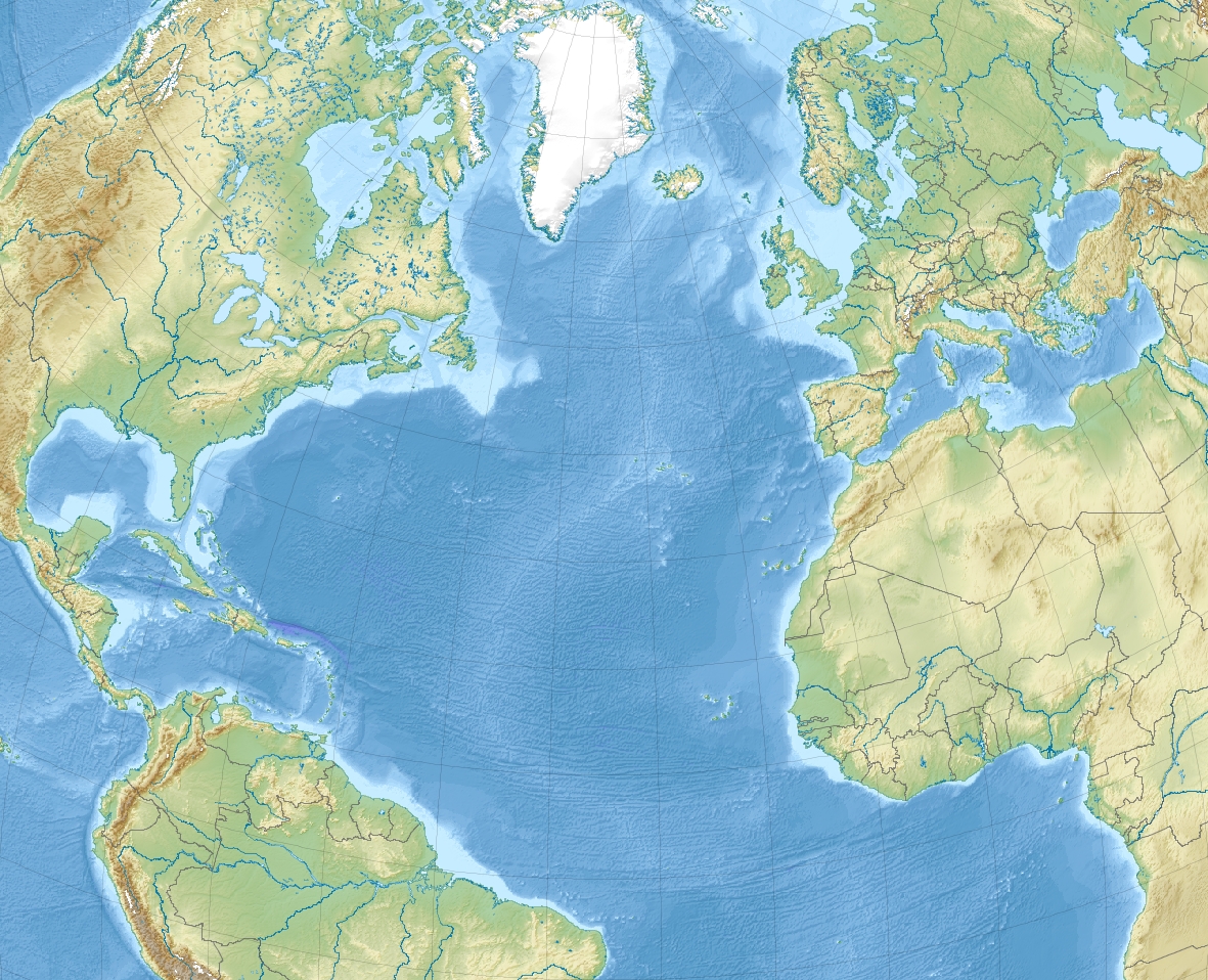
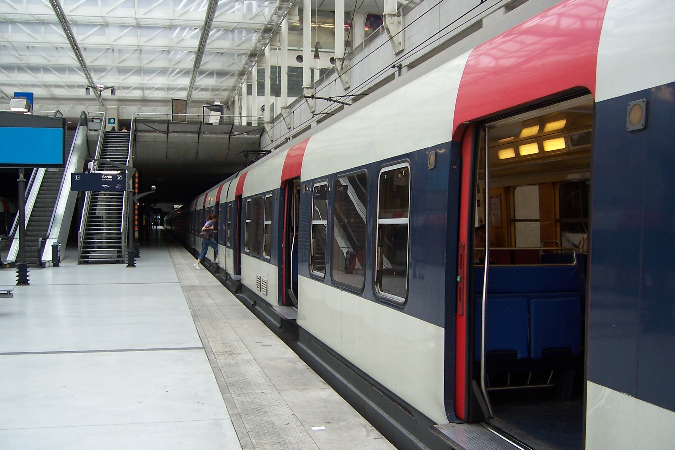
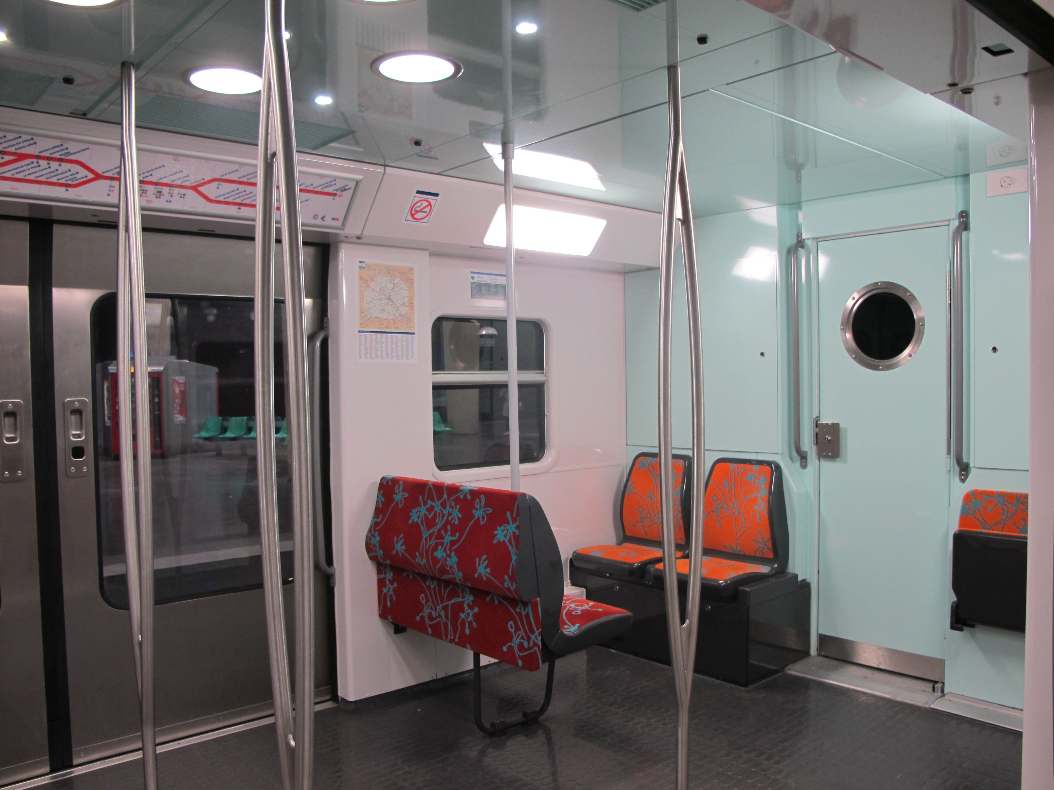
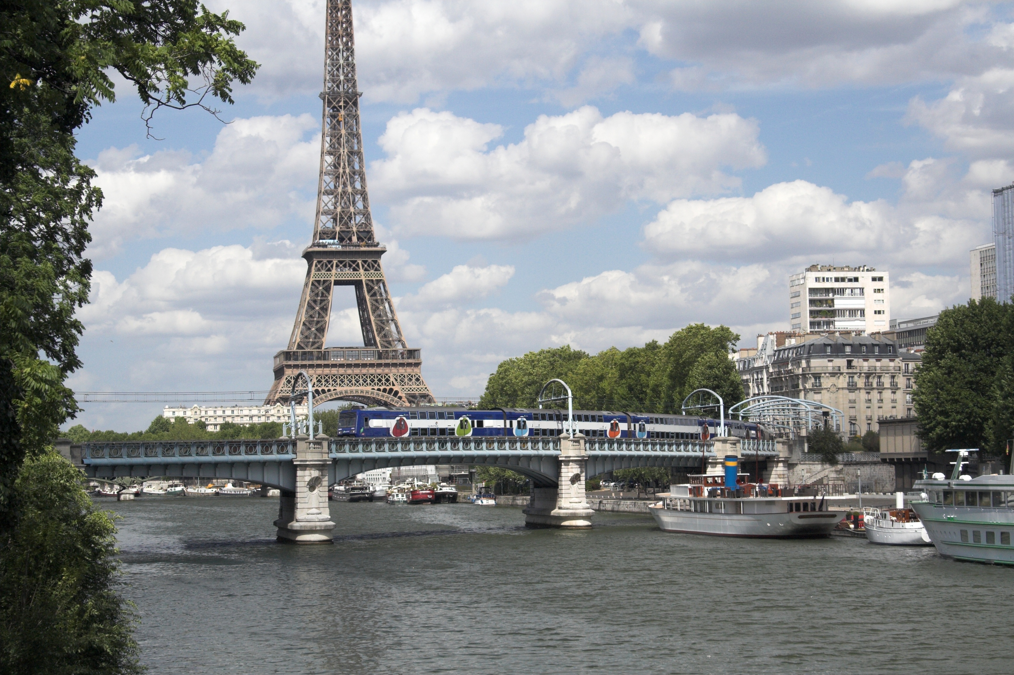
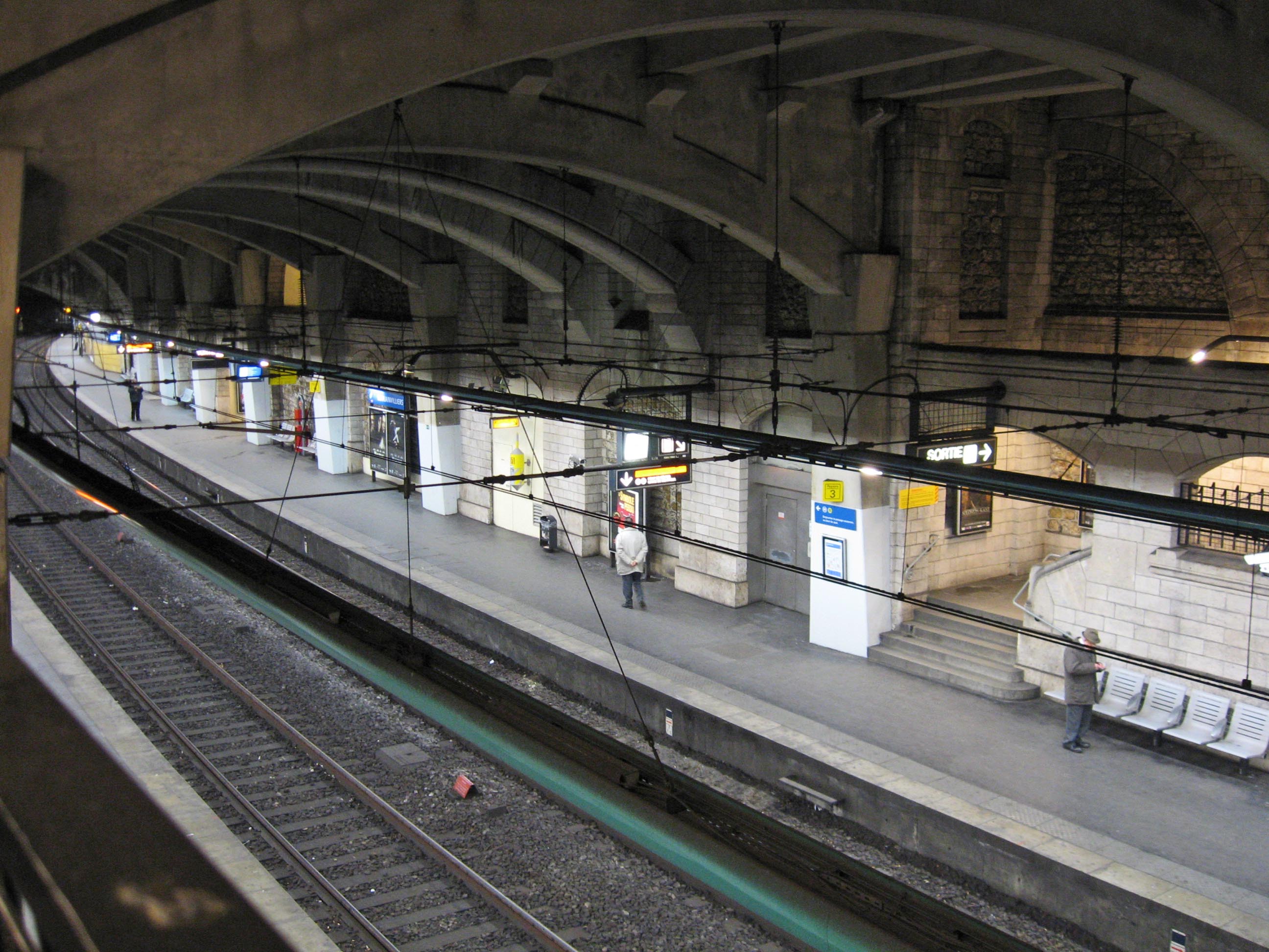
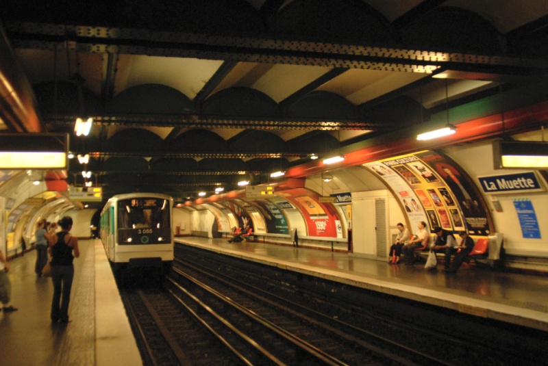
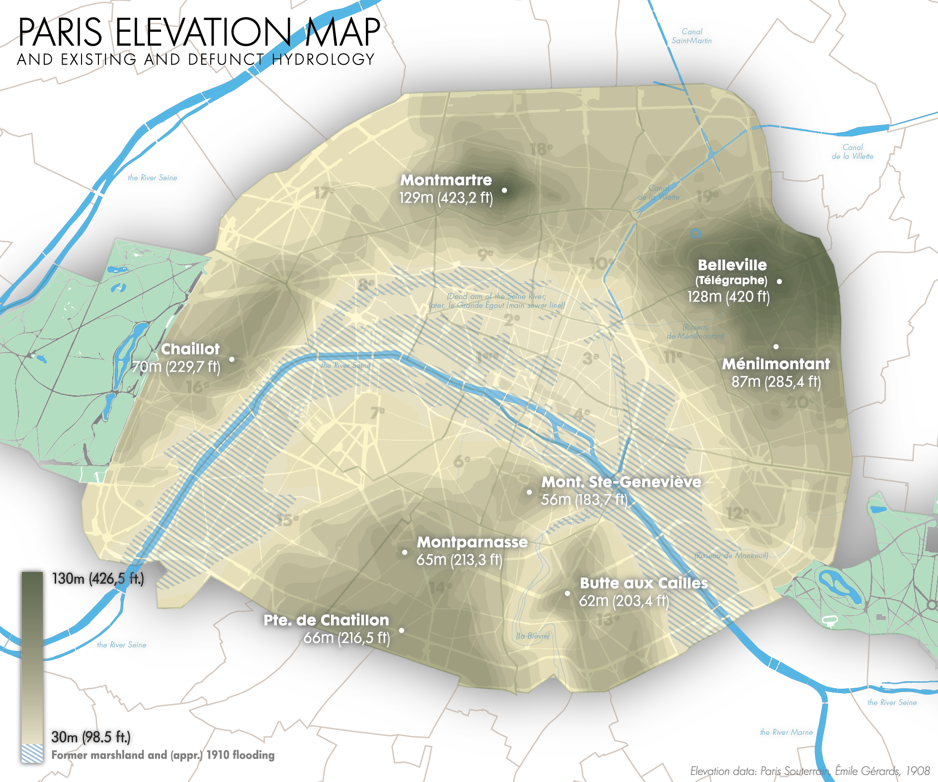
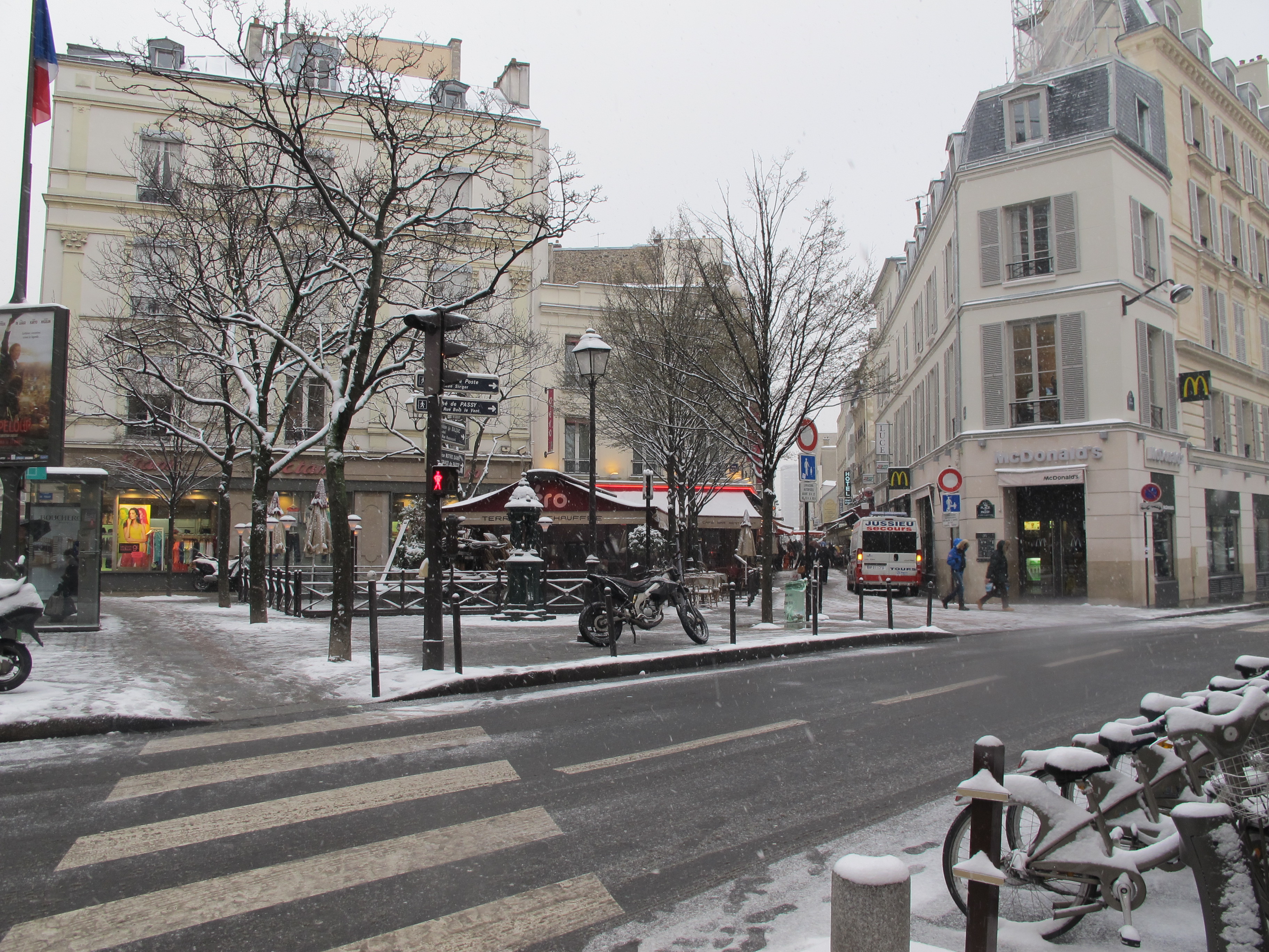
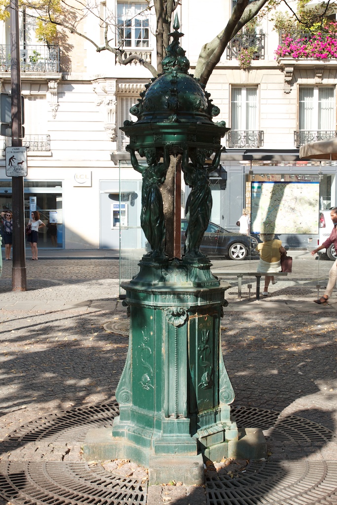
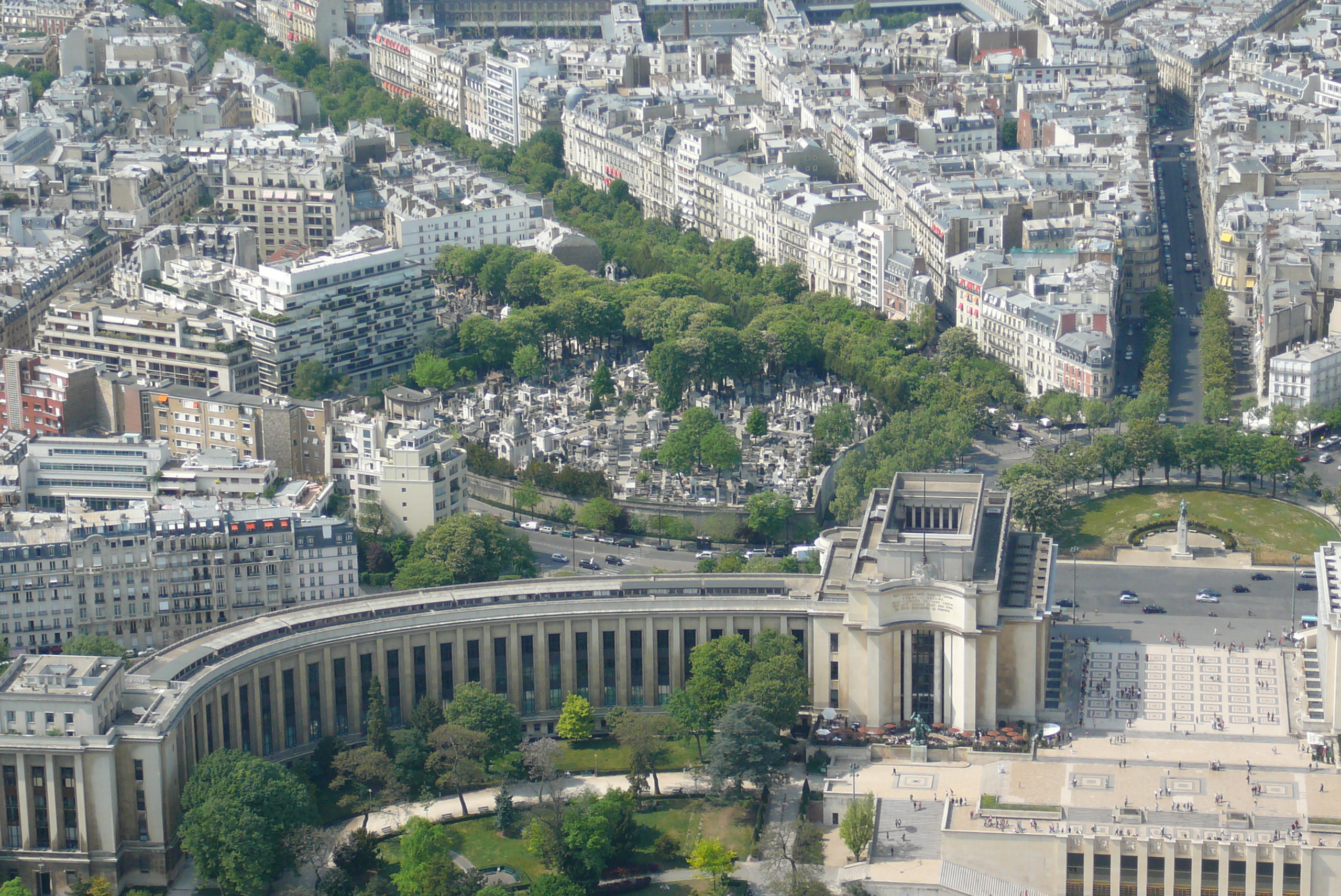
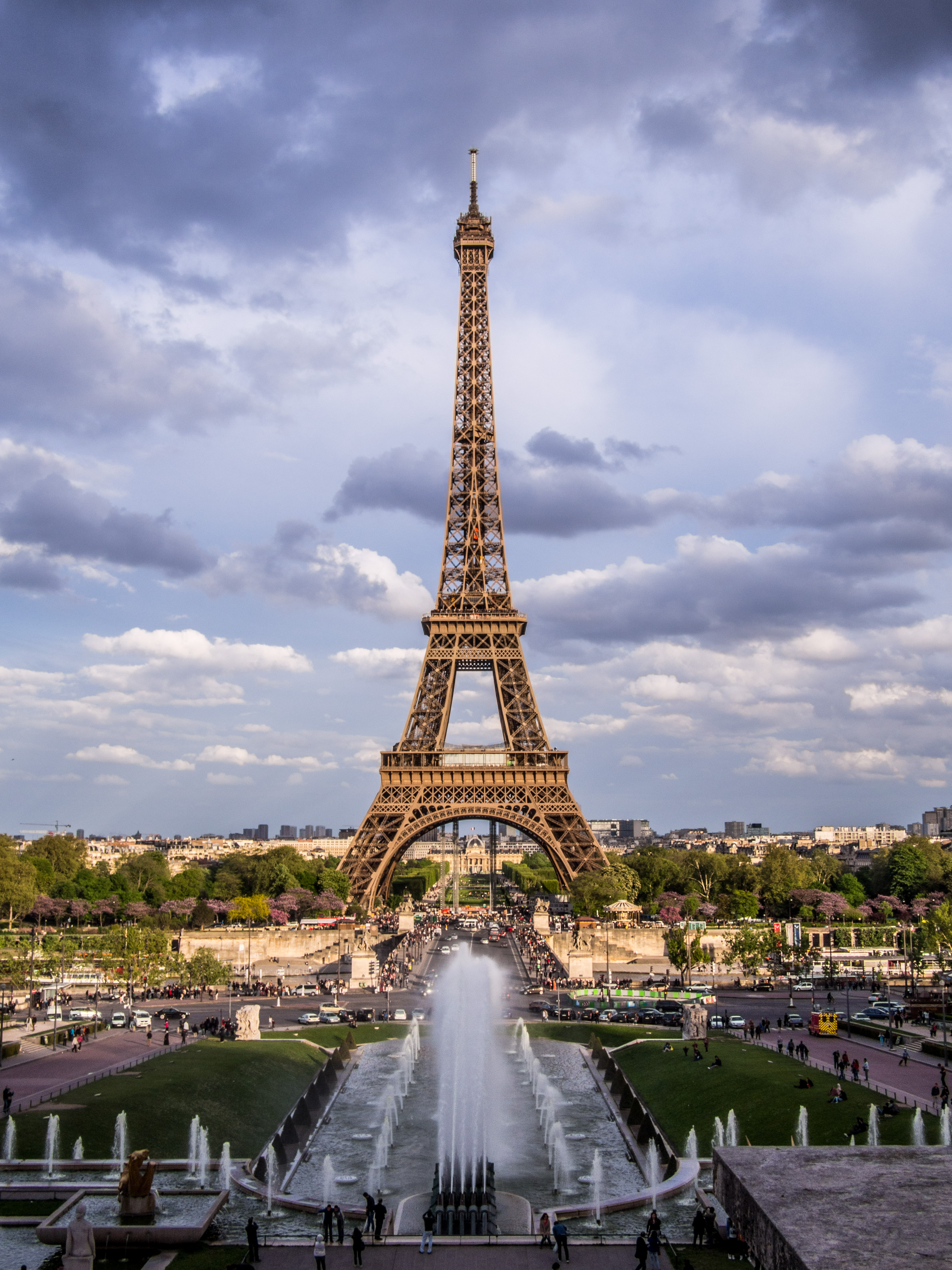
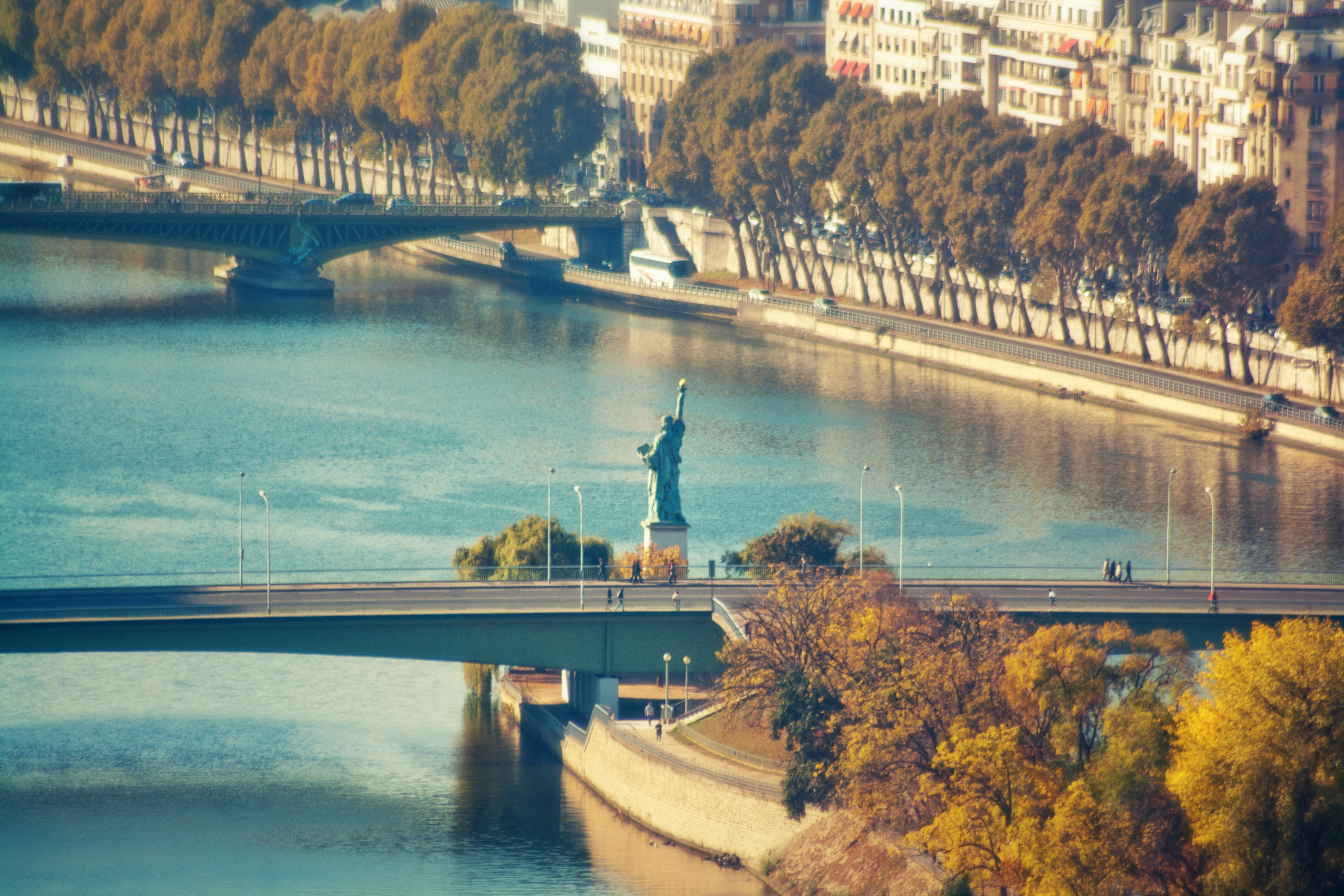
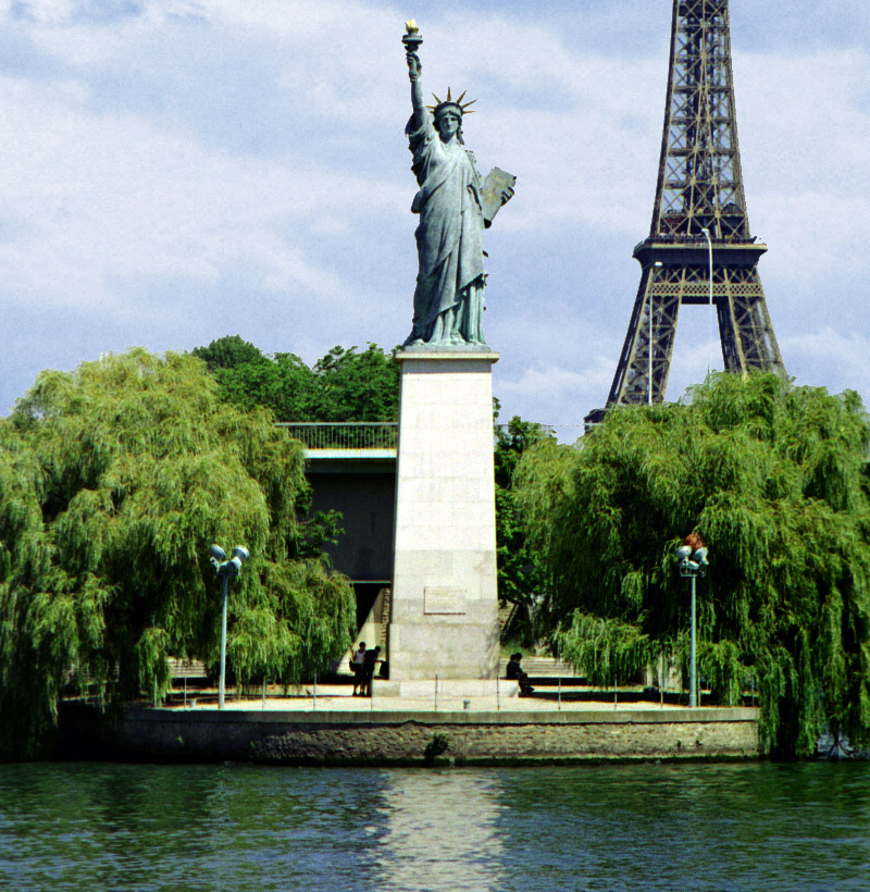